No. 255
Erected 1959
The Grist Mill
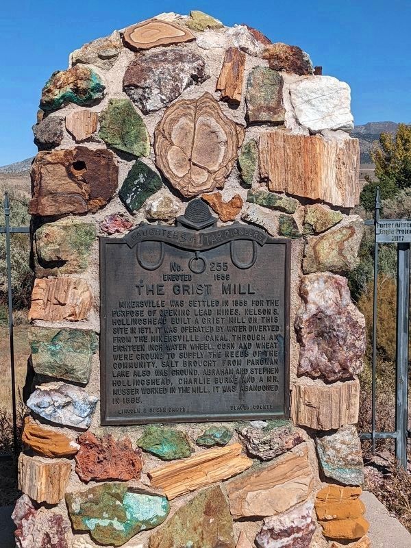
Minersville was settled in 1859 for the purpose of opening lead mines. Nelson S. Hollingshead built a grist hill on this site in 1871. It was operated by water diverted from the Minersville . . . — — Map (db m240540) HM
Philo Taylor Farnsworth was born August 19, 1906 in a log cabin near Beaver, Utah. At an early age, he became familiar with the various components of the telephone and the gramaphone. By age 12, he had a thorough understanding of electronics. In . . . — — Map (db m1421) HM
Dedicated to the memory of the valiant pioneers who erected the first woolen mills in Southern Utah in 1870. It was a busy mecca, with wagons coming and going from all over the State with their goods to trade. — — Map (db m75576) HM
On this site in 1870, in a three story building, 60 x 120 feet, the first Woolen Mills in Southern Utah operated. Machinery was brought here from New England by railroad and wagon. John Ashworth and others schooled in England in the art of wool . . . — — Map (db m75577) HM
A typical mining town at the foot of the San Francisco Mountain was fed by the fabulously rich Horn Silver Mine. By 1885 over $60,000,000 in zinc, copper, lead, silver, and gold were hauled away by mule train and the Utah Central Railroad. Water was . . . — — Map (db m78264) HM
The Milford stamp or A.G. Campbell mill was erected in the fall of 1873 at a cost of $45,000. It was designed to work the ores of the Old Hickory Mine. In 1873-74 the mill ran successfully for five months. They used a 60 horse power engine, two . . . — — Map (db m240533) HM
The Lincoln Mine
No. 17
Erected March 20, 1937
First lead mine in Utah
Five miles N.E. of here, discovered 1858, by Isaac Grundy, Jesse Smith, Tarlton Lewis and Wm. Barton. These men and Sidney Tanner,
John Blackburn, Edwin . . . — — Map (db m240538) HM
SITE NUMBER 74
Brigham City was the first important Mormon community to organize fistle for cooperative activity under a system later incorporated in the United Order of 1874. Approximately 30 or 40 industry branches were established with the . . . — — Map (db m240503) HM
Lorenzo Snow was born 3 April, 1814, in Mantua, Ohio, a son of Oliver and
Rosetta Snow. He joined the Church of Jesus Christ of Latter Day Saints in June of 1836 at the age of 22. He crossed the plains, captained his wagon company, and arrived . . . — — Map (db m240492) HM
Ancient Lake Bonneville once covered this area, including the flanks of Promontory Range. The waves washing against the ancient shore eroded fault-fractured rocks, creating the arch in the 300-million-year-old Oquirrh Formation.
More than . . . — — Map (db m171373) HM
Looking toward the immediate completion of the first Transcontinental Railroad, Corinne Townsite was laid out in the Spring of 1869.
Railroad Financiers, Real Estate Promoters, Businessmen & Gambling Sharks, launched a boom to make Corinne the . . . — — Map (db m117001) HM
Helping to Build a Nation Steel production increased rapidly in the United States after
the Civil War. Prior to the war, the United States had not
produced one single steel rail. By 1873, it had produced nearly
115,000 tons of steel . . . — — Map (db m172235) HM
Three Mile Creek, later named Perry, originated in 1853 with the arrival in the Three Mile Creek Valley of the William Plummer Tippetts family and Lorenzo and May Perry. They were soon joined by William Walker, Thomas C. Young, Alex Perry, and . . . — — Map (db m240481) HM
To commemorate an important episode in the early history of the west and to honor the scouts and explorers of earlier days, this monument was erected. In this vicinity in the winter of 1825-26 a cache containing 75 bales of furs, mostly beaver, . . . — — Map (db m149775) HM
This building, constructed in 1904, was first occupied by John H. Anderson who operated a general merchandise store. The store continued to function until the mid - 1960’s and sold shoes, dry goods, groceries, and clothing. The original owner, Louie . . . — — Map (db m44448) HM
This building was one of the earliest general merchandise stores built in Logan, and it continued as such until 1872. The owner sold the building and his merchandise and joined the historically significant ‘cooperative’ movement sponsored by the . . . — — Map (db m44481) HM
In 1860 two grist mills were built and operated in this valley. One at Wellsville by Daniel P. Hill and the other at Millville by Esias Edwards and Leroy Kent. The first burrstones obtained from Black Rock, Utah proved to be too soft for grinding so . . . — — Map (db m44471) HM
In the spring of 1860, Apostle Ezra T. Benson and Peter Maughan advised the people living at the Elkhorn Ranch to locate near a sawmill built by Esais Edwards and Roy Kent. This was done to provide better protection. In that same year, Apostle . . . — — Map (db m44456) HM
Rock asphalt was first mined at the top of Whitmore Canyon - 15 mi. NE of this location - in the early 1890's. The mine closed in 1898 & re-opened in 1903. It operated erratically until 1915 when it was forced to close due to the development of . . . — — Map (db m148003) HM
The Carbon Hotel was built in the early 1900's. It was first owned by C.A. Bartolino. The building was used as a hotel, bar, cafe and sporting house throughout the years. Due to the large number of single male immigrants into the local mines, the . . . — — Map (db m100991) HM
This monument is dedicated to the Carbon Plant, located SE of this site, the fourth coal-fired facility built by Utah Power. Construction on the $26 million plant began the summer of 1953, in cooperation with the International Brotherhood of . . . — — Map (db m148289) HM
Matt Warner was born Willard E. Christiansen in Ephraim, Utah. He left home at the age of 14 after a fight in which he thought he killed the town bully. He took the name Matt Warner, became a cattle rustler, bank robber and rode with Butch Cassidy . . . — — Map (db m101029) HM
Near this site stood the Pleasant Valley Coal Company office and store.
On April 21, 1897, in of of the most daring daylight robberies, Butch Cassidy, Elsa Lay, and Bob Meeks robbed paymaster E.L. Carpenter and made off with over $8000.00 in . . . — — Map (db m148293) HM
The Rainbow Inn is located at 305 N Mains St, Helper, Utah and was built in 1922. Originally owned by Lena Fodero, the building was used as a hotel, bar, and sporting house. It was known for the bordello on the upper floor. The railroad which . . . — — Map (db m106558) HM
The name Carbon County appropriately suggests the importance of carbon products to the economy and history of this area.
The first commercial development of coal occurred in this vicinity in the 1870's and soon out distanced production in other . . . — — Map (db m148292) HM
The Ashley National Forest, of which Flaming Gorge National Recreation area is a part, was named after William H. Ashley, an early fur trader and trapper. In 1825, Ashley and his party set out to join Jedediah Smith and other mountain men who were . . . — — Map (db m149084) HM
The Bountiful Lumber and Building Association, incorporated four years before Utah
statehood was granted, is one of the oldest retail businesses in continual operation since partners Levi S. Heywood and Heber A. Holbrook first opened their doors . . . — — Map (db m245963) HM
Brick making began early in Bountiful in several areas. The brickyard between 500 and 1500 South, and west of 200 West, was operated in turn by the Kirk Brick, Improved Brick, and Bountiful Brick companies, who made more bricks than any other Utah . . . — — Map (db m245925) HM
Daniel Davis was born on December 18, 1808, in Amesbury, Essex County, Massachusetts, the third child of Wells Davis and Mary Kelly Davis. As a young man Davis traveled to Nauvoo, Illinois, where he was converted to The Church of Jesus Christ of . . . — — Map (db m127586) HM
George Quinn McNeil was born to John McNeil and Mary Jane Quinn McNeil on January 4, 1865, in Bountiful, Utah. He married Adriane Marie Thomas on August 15, 1888. They lived on the family farm located on the southeast side of Bountiful City. Today . . . — — Map (db m127588) HM
Heber C. Kimball was born on June 14, 1801 to Solomon Farnham Kimball and Anna Spaulding Kimball in Sheldon, Franklin County, Vermont. He married Vilate Murray on November 7, 1822.
Kimball was converted to The Church of Jesus Christ of . . . — — Map (db m127584) HM
This site was surveyed August 1, 1852 and the mill (largest of it's time in Utah) was dedicated May 6, 1853.
Built on rock foundation with solid adobe walls trimmed with red sandstone, this Burr mill operated until 1892, when roller mills . . . — — Map (db m125132) HM
The Heber C. Kimball Gristmill, the foundation of which can be seen just east of this monument, was in operation from 1852 until 1892, using these burr-type gristmill stones. When the use of roller mills was introduced, mills of this type were no . . . — — Map (db m125133) HM
SIMON BAMBERGER conceived the idea of a local railroad between Salt Lake City and
Ogden. When the line came to Bountiful in 1892 it became an important factor in the
city's growth. For 10¢ residents of Bountiful could now ride to Salt Lake . . . — — Map (db m245969) HM
This frame store, built by Joel Parrish about 1903, faced Main Street on the northeast comer of Main and Center Streets. An addition on the north was used for storage. On the east side of the store was a two-story rock addition which housed . . . — — Map (db m246347) HM
In 1854 Anson Call of Bountiful erected a Grist Mill on the south side of Deuel Creek, just southeast of this marker. The mill was a three-story building made from Centerville Canyon rock, with the machinery on the top floor. The people brought . . . — — Map (db m246340) HM
The Richards Grist Mill, originally known as the
Rock Grist Mill, was owned and operated by S. W. Richards & Co. It was designed and built by Utah millwright Frederick Kesler at the direction of LDS Church President Brigham Young. James Leithead . . . — — Map (db m245980) HM
Originally built by Thomas and Electa Hunt in the 1860s, the VanFleet Hotel was probably first used as a residence. Located next to a Wells Fargo
stagecoach stop and county courthouse on what was once the highway
connecting Salt Lake City and . . . — — Map (db m246357) HM
Built in 1854 by John Weinel a native of Germany who came to Utah about 1853, the mill was the “overshot” water powered type & was erected on Webb’s Creek ¼ mile N.E. of this site. Native stones were used for the walls and pines for it’s . . . — — Map (db m123714) HM
Food for Thought
Brine shrimp are important to the ecology of the Great Salt Lake. The Great Salt Lake is hypersaline, which means that it is many times saltier than the ocean. While fish and frogs cannot tolerate the high . . . — — Map (db m172250) HM
The Walker Brothers, James T., Daniel, and Ephraim moved a building owned
by Isaac Barton across the street to this location and opened their store.
The home you see here now was remodeled from that original building. They opened the store in . . . — — Map (db m243428) HM
Hiawatha, about 13 miles NW of this location, was named from Longfellow's poem "Hiawatha." It was incorporated in Sept of 1911. In June of 1912, along with Blackhawk & Mohrland, it was purchased by the U.S. Fuel Company. Coal produced by Hiawatha . . . — — Map (db m101011) HM
Coal was first mined on Cedar Creek, about 9.4 miles N.W. of this location in 1906. Four men named Mays, Orem, Heiner and Rice bought the mines in 1908 and Castle Valley Fuel Co. was formed. In 1909 Castle Valley Fuel Co. became U.S. Fuel Co. and . . . — — Map (db m101010) HM
Wattis Coal Company was organized in 1917 by W.H. Wattis, E.O. Wattis & M.S. Brownin. A surface tramway and 2.5 miles of standard gauge track was built to connect to the Utah RR at Wattis Junction. Coal first went over the tramway in March 1918 . . . — — Map (db m240519) HM
In recognition of the labors of the early coal miners and their contributions to Emery County:
Black Diamond & Oliphant Coal Mines
These two mines, located nearby, are representative of early Utah coal mines.
Production at the two . . . — — Map (db m240513) HM
Dakota Formation’s Coal and Clay While the rock formations in this region often presented formidable travel obstacles for early settlers, they also supplied many useful natural resources. Locally, a rock layer known as the Dakota Formation (the . . . — — Map (db m146737) HM
Visitors to Panguitch, Utah will enjoy the opportunity to view many of the historic structures in this community which was settled by Mormon pioneers.
Famously creative survival skills are not the only heritage the early settlers left behind. . . . — — Map (db m146764) HM
Outlaw or Hero?
"My father, he carried the mail, and he always stopped and had dinner at a certain place [in Red Canyon]. While he was having dinner, old Butch Cassidy came to his camp. He told about these fellows following him. He got up . . . — — Map (db m40513) HM
Moab Mill
The Moab mill was constructed in 1956 by Uranium Reduction Company, which operated the mill until 1962 when the assets were sold to the Atlas Minerals Corporation (Atlas). Uranium concentrate, the milling product, was sold to the . . . — — Map (db m95083) HM
Imagine standing here on a Saturday night in the early 1920s. You might have heard music, laughter, people dancing, and folks talking about their day's work out on the mountain plateau. The music and voices would have come from a nearby inn known . . . — — Map (db m149126) HM
In February 1904, local businessmen became convinced that a strong financial institution was needed in Cedar City and the Bank of Southern Utah was created. By
1925, the bank had proven a valuable asset to the community and this building was . . . — — Map (db m240276) HM
Cedar City's Iron Heritage
Cedar City's rich deposits of iron ore were first recorded by Spanish explorers Dominguez & Escalante in 1776. In 1850, Mormon leader Brigham Young sent a group of colonists to mine these deposits to provide needed iron . . . — — Map (db m240279) HM
In 1866 Louis R. Chaffin, at the request of Apostle Erastus Snow, placed a gristmill in Cedar City. His son, Henry, ran it until 1868 when Louis returned from "The Muddy." Adjoining land was purchased in 1875. Excavation by Alva Matheson proved the . . . — — Map (db m59538) HM
This monument marks the spot where on Sept. 30, 1852 the first iron was manufactured west of the Mississippi River by the Mormon Iron Missionaries sent by Brigham Young.
This 5½ ton ore body was obtained from the iron deposits used by . . . — — Map (db m1288) HM
Shortly after WWI, the forward-looking citizens of Cedar City recognized that
tourism centered around the new national parks and monuments in the area, would be a powerful economic benefit to their rural community. Visitors certainly had . . . — — Map (db m240280) HM
Iron County exists because those who lived here developed the resources necessary for survival in this desert climate. The three legacies passed down by early settlers and their descendants — agriculture, mining, and railroads — are . . . — — Map (db m130593) HM
Established 1868 by Ebenezer Hanks and others who organized the Great Western Iron Manufacturing Co., a cooperative enterprise. Officers were E. Hanks, President, Homer Duncan, Vice President, Seth M. Blair, Secretary. 800 pounds of iron of good . . . — — Map (db m150259) HM
To satisfy an urgent need for manufactured iron products, a small group of English, Welch, Scotch, Irish and American pioneers answered a call from Brigham Young to become "Iron Missionaries" to settle Iron County and to make iron. They arrived in . . . — — Map (db m59545) HM
Born in England, Francis Webster traveled to Utah in 1856 and played an important role in the early development of Cedar City. A leader in the sheep industry, he was among the first to begin shipping sheep and wool to the Chicago markets. An early . . . — — Map (db m75620) HM
Born in Springshire, England, and an iron-molder by trade, Richard Harrison served as superintendent of the world’s largest iron foundry, located in Liverpool. He immigrated to Nauvoo, Illinois, in 1843 then on to Utah in 1849. He arrived in Cedar . . . — — Map (db m130595) HM
In 1904, this building replaced a smaller rooming house and became known as the Cedar's Hotel. The Cedar's had nine rooms on each floor all sharing a common bathroom.
It was in the lobby of the Cedar's that brothers Gronway and Chauncey . . . — — Map (db m240277) HM
In the 1930s, iron mining expanded in Iron County and massive shovels were needed to excavate the needed ore. According to company delivery records, two Bucyrus-Erie 120-B shovels were delivered to the Utah Construction Company in Cedar City in . . . — — Map (db m130598) HM
For nearly fifty years (1923-1972) the Utah Parks Company (UPC) brought visitors from around the world to the national parks and monuments of southwestern Utah and northern Arizona. Cedar City marketed itself as the "Gateway to the National . . . — — Map (db m240282) HM
In 1869, John P. Jones and sons moved from the fort at Johnson Springs and purchased land and springs on the east bench of the community. Jones, who was an iron worker, built a coke oven and blast furnace where scrap iron was melted and molded to . . . — — Map (db m59960) HM
The Old Spanish Trail originated as a series of ancient native american trade routes which were later connected by Mexican and American traders to provide a means for transporting commercial goods and slaves.
During the mid-1800's, Santa Fe . . . — — Map (db m240504) HM
During the last half of the 19th century, commercial endeavors developed along Parowan's main street. Into this community rode the freighters, commanding huge freight wagons pulled by draft animals, freighting their wares to our needful pioneer . . . — — Map (db m240477) HM
On this site, in 1862 the first Cotton Factory was erected in the west. Designed and operated by William Marsden and owned by Ebenezer Hanks. Here the first ball of Cotton Yarn was made west of the Mississippi River.
Girls That Worked in the . . . — — Map (db m59601) HM
At Parowan, a pioneer industrial center was settled in 1851. Water for manufacturing and industry was carried by wooden flume from the canyon to the fort. Along this water line industries were established known as the Public Works. Among these were . . . — — Map (db m59574) HM
This building was constructed in 1909 to serve as the new home of McCornick and Company bankers and has continued to the present to serve as a bank. McCornick and Company first came to Eureka in 1898, when they moved their bank, fixtures and all, . . . — — Map (db m75430) HM
This monument has two markersPlaque A: (Side of monument)
Bullion Beck and Champion Mining Company Headframe
This massive sixty-five foot Montana-type headframe is the only remnant of the Bullion Beck and Champion Mining . . . — — Map (db m75433) HM
In 1859, John Hoile established a flour gristmill at First South between First and Second East. The mill consisted of a small one-story frame building. On June 20, 1870, the mill was bought by John Hague who operated it until he died in 1900. The . . . — — Map (db m75269) HM
In the late 1800s, travelers who wanted to go to Kanab or Panguitch accompanied the mail carrier. In the early years, they traveled with him on horseback; in later years, they hitched a ride in his two-wheeled mailcart.
"No one who . . . — — Map (db m40467) HM
These millstones were used to grind wheat and corn into flour. Glendale oral histories tell us that in 1870 these burrs, as they were called, were brought here from Toquerville, Utah, 100 miles away.
Histories written about this area report that . . . — — Map (db m40475) HM
Built in the spring of 1882, the woolen factory was in operation until 1890. It was built under the direction of the United Order Board. Thomas Chamberlain, Bishop and President of the Board.
The machinery was run by waterpower. Yarn, batting and . . . — — Map (db m74675) HM
These charcoal ovens are evidence of a historic man using natural resources. Reminders, which once upon a time, formed the basis of a man’s industrial enterprise. In 1882 that man, George Morrison, hired Nicholas Paul to build four charcoal ovens. . . . — — Map (db m34859) HM
These charcoal ovens are evidence of a historic man using the natural resources. Reminders, which once upon a time formed the basis of a man's industrial enterprise. In 1882, that man, George Morrison hired Nicolas Paul to build four charcoal ovens. . . . — — Map (db m80117) HM
The Rocky Mountain Fur Company, headed by Milton G. Sublette, David E. Jackson and Jedediah S. Smith, conducted a fur trading rendezvous in this vicinity in June-July, 1827, taking 130 bales of beaver furs for shipment to St. Louis by pack train. . . . — — Map (db m66970) HM
This Chandler-Price platen, treadle press (circa 1885) is the last known piece of equipment once used in the printing business for the Randolph newspaper. The platen, or jobber, press was used to print business cards, envelopes, circulars, . . . — — Map (db m149641) HM
Randolph lies in the shadow of the Crawford Mountains against the western foothills of the Upper Bear River between two creeks, Big Creek on the south and Little Creek on the north. In answer to a call from the general authorities of The Church of . . . — — Map (db m149640) HM
Remnant of
Stamp Foundation
from the Rogers Mill
where
Daniel C. Jackling
in 1898-1899 conducted the original mill tests on ore from this deposit. On the results of these tests the Utah Copper enterprise was conceived and to January . . . — — Map (db m35015) HM
Bingham Canyon was named for Erastus Bingham and sons, Sanford and Thomas, Utah Pioneers of 1847, who in 1848 took up grazing land in this vicinity, first for private herds and later as a community enterprise. They built a small cabin at the mouth . . . — — Map (db m35228) HM
Ernest Green was the son of Alvin Washington Green and Alice Maria Jane White. His family lived on the hillside northwest of the “Old Mill.” His wife, Molly, was the daughter of Neri Bulter and Mary Elizabeth McGhie. During the early . . . — — Map (db m123712) HM
In the early 1860s, mining took off in the Salt Lake Valley. Many mining claims were filed in Little Cottonwood Canyon, and the town of Emmaville sprang up as a halfway camping ground for the miners and ore haulers. The town was located at the . . . — — Map (db m123707) HM
In the foothills above Wasatch Boulevard, north of the mouth of Big Cottonwood Canyon, is an area that was known as the “Silica Beds.” In 1910 the Utah Fireclay Company opened a mine at that location. Silica and clay were needed to make . . . — — Map (db m123710) HM
Can you smell bacon frying and the bread rising in
the cookhouse over yonder? This area was filled
with the smells and sounds of a growing, working,
city.
This rock-quarrying tent camp exploded into a
town of more than fifty buildings and . . . — — Map (db m171343) HM
The Stairs Project was built in 1894-96 as the first hydroelectric power plant to provide electricity to Salt Lake City. It was also one of the first plants in Utah to transmit power long distance, using alternating current rather than direct . . . — — Map (db m35307) HM
Cooperation between Utah State University in Logan and the Utah Poultry Producers led to development of a special breed of chicken, the White Leghorn, to produce a pure white egg that soon became preferred by consumers over the brown eggs of other . . . — — Map (db m224597) HM
As Draper's egg cooperative prospered, Draper farmers found markets all across America. To deliver the freshest eggs possible to cities as far away as New York City, special ice cooled railroad cars were developed, called "Reefers," which stands for . . . — — Map (db m224577) HM
During World War II, the U.S. Government purchased eggs, chickens and turkeys from the Utah Poultry Producers to be shipped to troops overseas.
At the cooperative's 1942 annual meeting, Utah Poultry Producers President, Clyde C. Edmonds . . . — — Map (db m224568) HM
Local Farms Produce National Results.
By the Great Depression, more than 5,000 families across Utah had chicken coops and relied on egg checks from The Utah Poultry Producers Cooperative Association to help with cash flow during hard economic . . . — — Map (db m224574) HM
National Popularity and Celebrities
With the success of "Milk White" eggs in large markets, celebrities endorsed the product in print, on the radio and at trade shows across the Nation.
Each year the current Miss America and other . . . — — Map (db m224557) HM
Heber A. Smith built this brick building circa 1890-1895 which served as one of the first three school houses in Draper, having one large room upstairs and two in the basement. Later is was used as a pool hall known as Poolies. In 1923 E. Miller . . . — — Map (db m224398) HM
This property deeded to Ebenezer Brown from the United States in 1872, was part of the old fort of Draper. Ownership changed several times. S.J. Mickelsen Lumber (circa 1818-1920) built this two-bedroom house as a "spec" home for returning World War . . . — — Map (db m224602) HM
445 feet west of this monument is the site of the pioneer flour mill erected in the spring of 1848 by John Neff, 1847 Pioneer, the burrs were bought by him at winter quarters from Brigham Young at whose request they were brought to Utah. The granite . . . — — Map (db m150269) HM
Thousands of miles of old mining tunnels surround the Bingham Canyon Mine. Unlike today's open pit, the old mines were a network of underground tunnels and shafts.
The Bingham Tunnel was completed in April 1951 to provide access to the Lark and . . . — — Map (db m238460) HM
Was erected by Robert Gardner and his sons, Archibald, Robert and William, on Warm Springs Stream, in Salt Lake City, October, 1847, where three boards were sawed. The Mill was moved to this site in 1848, producing the first commercial lumber in . . . — — Map (db m150254) HM
Gold, silver, copper, lead and zinc were found at Alta, Park City, and Tintic in the years 1864 to 1869. Since no smelting was done in the state or the surrounding area, smelters had to be built. Billy Morgan built the first smelter at 5189 South . . . — — Map (db m124034) HM
In 1824-26 the first black man came into Utah Territory. He was a trapper for the Rocky Mountain Fur Company. His name was James Beckworth. In succeeding years many black people would follow to contribute to the development of Utah, socially and . . . — — Map (db m1379) HM
Perhaps one of the longest living and prominent residents of the area, known as Parley’s Hollow, now officially Parley’s Historic Nature Park, was Joseph Dudler. About 1864, he settled in this location. Here he built his home. It was two stories, . . . — — Map (db m124023) HM
238 entries matched your criteria. The first 100 are listed above. Next 100 ⊳