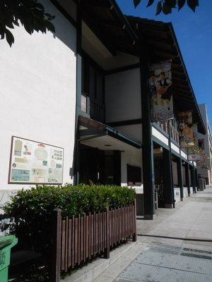
On Sutter Street near Webster Street, on the left when traveling east.
Americanization was difficult for the Issei. Prejudice, language barriers and discrimination often stymied their efforts, yet they persisted, often venturing into Western society with great zeal. With the Nisei generation, however, the Japanese . . . — — Map (db m192570) HM
On Alma Street south of East Creek Drive when traveling east.
As the largest local watercourse, San Francisquito Creek played a major role in the lives of native Americans, Spanish explorers and early Anglo settlers of the area.
For perhaps 7,000 years, the native peoples -- called Costanos by . . . — — Map (db m113017) HM
On Merrill Avenue, on the right when traveling north.
This building, constructed in 1867 by the San Francisco and San Jose Railroad Company, is the oldest railroad passenger station in California. The Victorian ornamentation was added in the 1890s when the station was remodeled to serve the . . . — — Map (db m2483) HM
On Alma Street at East Creek Drive on Alma Street.
Near "El Palo Alto", the tall tree, the Portola Expedition of 63 men and 200 horses and mules camped. They had traveled from San Diego in search of Monterey but discovered instead the Bay of San Francisco. Finding the bay too large to go around and . . . — — Map (db m25054) HM
After Stanford University opened in 1891, business increased in nearby Mayfield and Menlo Park, towns dating from the 1850s. Mayfield was a farming center, and Menlo Park a summer home to San Franciscans. Residents of both places rejected Senator . . . — — Map (db m41337) HM
By the time America entered World War II in 1941, the creek had been straightened at its outlet to the Bay near the Palo Alto Municipal Airport. The Army built Dipple General Hospital on land near the creek in Menlo Park. Later, Stanford Research . . . — — Map (db m41353) HM
On Sand Hill Road at Sand Hill Circle, on the left when traveling west on Sand Hill Road.
One half mile south of this site stood the first church in San Mateo County. Dedicated in 1853 by Catholic Archbishop Joseph S. Alemany. He named it after St. Denis to honor the founder, Dennis Martin, pioneer lumberman and farmer, who also . . . — — Map (db m292030) HM
On Arastradero Road at Arastradero, on the right when traveling east on Arastradero Road.
This structure, built by Felix Buelna in the 1850s, served as a gambling retreat and meeting place for Mexican-Californios. It was strategically located on the earliest trail used both by rancheros and American settlers crossing the peninsula to the . . . — — Map (db m11992) HM
On Portola Road, on the right when traveling south.
In 1894 Andrew Hallidie, inventor of San Francisco’s cable cars, built an aerial tramway on his hillside property, Eagle Home Farm. It served as a model for prospective customers. The tramway stretched 7,341 ft from this vicinity to a station near . . . — — Map (db m18467) HM
On Portola Road, on the right when traveling north.
Built in 1912 this country church was the first executed design of noted architect, Timothy L. Pflueger, who had just begun work for James Miller. An awareness of the Spanish California Missions inspired the style, which contrasts with the large . . . — — Map (db m18463) HM
On Portola Road, on the left when traveling north.
Portola Primary School was built in 1909. The bell was moved in 1893 from the abandoned Searsville School. The building served as the First town hall when the town of Portola Valley was incorporated in 1964. It was acquired by the town in 1976. . . . — — Map (db m25052) HM
In 1858, Simon M. Mezes donated land to the county so that a courthouse could be built. This is the third courthouse built on this exact site and the forth built in the property. In 1903, the architectural firm of Dodge and Dolliver designed a domed . . . — — Map (db m32621) HM
After the 1906 earthquake and its resulting fires destroyed much of San Francisco, public support surged for a reliable water supply. This allowed San Francisco to look beyond the Bay Area to resolve the region’s growing need for reliable, . . . — — Map (db m202491) HM
Near Brewster Avenue, on the right when traveling east.
Principal of Sequoia High School
Superintendent of Sequoia Union High School District
1921 – 1948
In the room at the foot of this tower Mr. Argo and his Board shaped policies of enduring importance to the Sequoia Union High School . . . — — Map (db m41619) HM
On Broadway near Warrington Avenue, on the right when traveling east.
Redwood City was an important center for early aviation and Stanford Redwood City is located on what was once an airfield. Silas Christofferson, a visionary young pilot and engineer, bought Michael Lynch’s flower field in early 1916 and built . . . — — Map (db m206589) HM
Al Terremere is a member of the Sequoia Sports Hall of Fame as both an athlete and a coach. Al was All-League in both football and baseball during his Sequoia playing career, and captured multiple championships in both baseball and football as a . . . — — Map (db m62605) HM
On Main Street south of Broadway Street, on the left when traveling south.
The finest playhouse between San Francisco and San Jose opened here January 20, 1896. In 1921, the building was purchased by Redwood City Masonic Lodge which was instituted August 28, 1863. — — Map (db m62625) HM
Spain claimed Alta California after its conquest of Mexico (1519-1521) When reports of British and Russian encroachment in Northern California began to circulate in the 1760s, Spain expanded its colonial settlements to defend the California . . . — — Map (db m206740) HM
On Broadway near Warrington Avenue, on the right when traveling east.
Alexander M. Poniatoff (1892-1980), a Russian immigrant to the United States, and his colleagues saw enormous commercial potential in the German recording technology they encountered during World War II. In 1944, he founded Ampex – Poniatoff’s . . . — — Map (db m206566) HM
On Marshall Street at Hamilton Street, on the left when traveling east on Marshall Street.
This was a public plaza in the Mezesville townsite, and was a park until 1959 when it was given to San Mateo County for a Hall of Justice and Records. — — Map (db m62577) HM
On Hamilton Street at Marshall Street on Hamilton Street. Reported unreadable.
California Square was a parcel of land located north of Marshall Street, between Hamilton and Winslow, diagonally located across the street from the Courthouse. The site was originally designated as a public park plaza in the Town of Mezesville . . . — — Map (db m202534) HM
Near Brewster Avenue, on the right when traveling east.
Otis M. Carrington is best remembered as one of the world’s foremost composers of operettas for children. In 1912, Mr. Carrington wrote “The Windmills of Holland”. It was the first of more than forty operettas to come from his hand, and . . . — — Map (db m41602) HM
(Four markers are mounted on this pedestal.)Original Marker:
Diller-Chamberlain General Store
(Quong Lee Laundry)
726 Main Street
J.V. Diller had this one-story brick building constructed in 1859 to house his general . . . — — Map (db m202732) HM
On Broadway east of Jefferson Avenue, on the right when traveling east.
You are standing over what was once Redwood City’s original waterfront, made up of creeks, tidal basins, and a fresh-water slough, providing the start of lumber, shipping and shipbuilding trades for the area. The tidal basins south of Bradford . . . — — Map (db m62622) HM
On Main Street near Broadway Street, on the right when traveling south.
A hotel on this site, owned by Harry N. Morse and Daniel W. Balch, was the site of the first town meeting in 1854. Residents rejected a Mezesville government. — — Map (db m25569) HM
On Middlefield Road 0.5 miles west of Woodside Road (California Route 84), on the left when traveling west.
The Redwood City Volunteer Fire Department started in 1861, and was the first non-profit organization in San Mateo County. It wasn’t until 1921 when this building at 1044 Middlefield Road was built that the firefighters finally received a salary. . . . — — Map (db m202543) HM
On Middlefield Road, on the right when traveling south.
The forerunner to today’s Redwood City Fire Department began in 1861 when citizens met to establish a volunteer fire company. Known as Redwood City Fire Company No. 1, it was the first non-profit organization in San Mateo County. The first fire . . . — — Map (db m202544) HM
On Broadway at Theater Way, on the right when traveling east on Broadway.
Sequoia High School started September 16, 1895 with 53 students attending classes held on the third floor of the Redwood City Grammar School (replaced by the building now housing the Fox Theatre one block down Broadway). At that time, the building . . . — — Map (db m62621) HM
On Broadway west of Middlefield Road, on the right when traveling east.
This property has been placed on the National Register of Historic Places by the United States Department of the Interior - 1928 — — Map (db m41621) HM
On Cañada Road 0.2 miles south of Edgewood Road, on the right when traveling south.
The Gaspar de Portolá expedition camped twice near this marker. During Spain’s initial colonial thrust into Alta California, the exploration party headed northward from San Diego searching for Monterey Bay. At first, they did not recognize the bay . . . — — Map (db m199135) HM
Near Woodside Road (California Route 84) north of Hess Road, on the right when traveling south.
The GRAND ARMY of the REPUBLIC was a fraternal organization composed of honorably discharged veterans of the Union Army, Navy, Marine Corps and Revenue Cutter Service who served in the American Civil War. Founded in 1866, it grew to include about . . . — — Map (db m202545) HM
(front):
To the memory of California's Patriotic dead who served during the war for the Union
Mustered out
(back):
Erected by the grateful people of San Mateo
All honor to the nations defenders — — Map (db m62672) WM
On Broadway near Warrington Avenue, on the right when traveling east.
The connection between Stanford University and the City of Redwood City goes back a long time. While the first students were admitted to the University on October 1, 1891 – with the mission to “qualify its students for personal success, and . . . — — Map (db m206511) HM
Nurseryman Michael Lynch bought the property that is now the Stanford Redwood City campus in 1898. Lynch was best known for growing violets and sweet peas for sale as cut flowers and in seed packets. In 1901, he was hired by Jane Stanford to . . . — — Map (db m206591) HM
1st Lieut. 15th U.S. Infty.
Born at Aurora, N.Y.
August 1, 1842
Died at San Francisco
May 15, 1887
At the age of 19 he enlisted in the 1st. Regt. Wis. Volunteer Infty. He fought in the Battles of Falling Water, Chattanoogo (sic), . . . — — Map (db m202538) HM WM
On Hamilton Street, on the right when traveling north.
A classic example of early "Steamboat Gothic" architecture erected in 1863 as the residence of San Mateo County's first Clerk, Recorder and Assessor, Benjamin G. Lathrop. Later the residence of General Patrick Edward Connor and Sheriff Joel . . . — — Map (db m202539) HM
On Marshall Street, on the right when traveling east.
This home housed three families of historical significance. B.G. Lathrop who had the house built in 1863 was San Mateo County’s first clerk-recorder and assessor, serving until 1864 when he became Chairman of the Board of Supervisors for San Mateo . . . — — Map (db m202540) HM
On Skyline Boulevard (California Route 35 at milepost 14), on the right when traveling north.
Age Estimated - 1,860 Years
Height:
Before Top Broke - 225 Ft
In 1954 - 137 Ft
Diameter at Base - 14 Ft
Access courtesy of California Water Service — — Map (db m202567) HM
On Warren Street near Standish Street, on the right when traveling north.
Mezes Park was donated to the public in 1854 by Simon Mezes, founder of the Town of Mezesville which became Redwood City in 1867. Originally named Park Square, the public space was bordered by B Street (now Warren Street) on the Southwest, C Street . . . — — Map (db m208147) HM
The discovery of gold at Sutter’s Fort in 1848 ushered in a period of rapid change in California as thousands of immigrants flooded into the state and the non-native population grew from 20,000 to 100,000 in one year. Mexico ceded California to . . . — — Map (db m206644) HM
On Broadway near Warrington Avenue, on the left when traveling west.
The San Francisco Bay Area was settled by Native Americans before the end of the last Ice Age flooded the river valley (rúmmey waayi) that became San Francisco Bay (about 5,000 years ago). The ancestors (muwékmakuš) of the Muwekma . . . — — Map (db m206786) HM
On Broadway Street west of Jefferson Avenue, on the right when traveling east.
This block of Broadway underwent a number of major changes during the first half of the twentieth century.
It started out as the Central Grammar School in 1895 (legally named “Redwood City Public School”) shown at the left above. Part of a third . . . — — Map (db m62580) HM
On Skyline Boulevard (California Route 35), on the right when traveling south.
In the early morning darkness on August 5, 1959, near the intersection of Skyline Blvd. and Bunker Hill Drive Hillsborough Officer Doran Stopped a 19 year old convicted felon who was on probation for burglary and interstate auto theft. The felon was . . . — — Map (db m202462) HM
On Broadway Street, on the right when traveling east.
Simon M. Mezes, owner of the land that now includes most of Downtown Redwood City, donated a block to the newly-formed San Mateo County in 1858 so that a courthouse could be built. There were eventually four courthouses built on this property. . . . — — Map (db m62598) HM
On Broadway near Warrington Avenue, on the left when traveling west.
Fossilized bones were discovered on this site in 2017 during earthwork grading operations for the Stanford Redwood City campus. The bones were found at substantial depth below the ground surface. They were determined to be from the Pleistocene . . . — — Map (db m206827) HM
On Broadway east of California Street, on the right when traveling east.
Redwood City
Climate Best by Government Test
This archway sign and slogan is based on the design of two earlier archway signs that once spanned the El Camino Real, designating the northern and southern entryways into Redwood City. A . . . — — Map (db m41623) HM
On Marshall Street, on the right when traveling west.
On the evening of September 11, 1861, a group of concerned citizens met at the San Mateo County Courthouse. Their mission was to organize the Redwood Hose Company for the purpose of providing fire protection to the small settlement of Mezesville and . . . — — Map (db m202493) HM
On Warren Street near Howland Street, on the right when traveling west.
Residents of this maritime-oriented village known as Embarcadero, Mezesville, Redwood Landing, and Redwood met 150 years ago in civic action to improve muddy, impassable streets that halted commerce during the winter. Twice before, residents had met . . . — — Map (db m207590) HM
World War 11
Corporal James Lindsay Wilson
V.F.W. Post No. 2310
In memoriam
to the following Redwood City men
who gave their lives in World War II
1941 – 1945
Raymond J. Barra • Russell V. Braca • Everett F. Bottena • Robert . . . — — Map (db m62846) WM
On Clinton Street north of Broadway, on the right when traveling north.
The Redwood City Woman's Club was the first independent
women's organization in Redwood City. The women of Redwood
City and the vicinity formed the club to provide social, service,
and educational opportunities for its members. One of . . . — — Map (db m186431) HM
Emblems of the California National Guard, United States Air Force, The United States Marine Corps, United States Army, United States Navy, United States Coast Guard, United States Merchant Marines are displayed across the top of the monument.
The . . . — — Map (db m26244) HM
Near Woodside Road, on the right when traveling west.
This windmill was built in the 1880’s on the Solari farm, located at Whipple Avenue and Old County Road in Redwood City.
It was move in the 1930’s to the new family farm located on Manzanita Street near Middlefield Road and the railroad tracks, . . . — — Map (db m62671) HM
This reconstructed windmill was originally built in the 1890's on the George Solari family farm which was located near Whipple Avenue and Old County Road in Redwood City. When the area was subdivided in the 1930's, the windmill was moved to the new . . . — — Map (db m93230) HM
Near Broadway Street, on the right when traveling east.
Left Side - English
She donated 59,000 acres of land for the benefit of all people.
Right Side - Spanish
Donadora de 59,000 acres par beneficio de la comunidad — — Map (db m62575) HM
In 1865, Simon L. Knights began service to Searsville, Woodside, and later the coastside. In 1906, the line converted to automobiles. — — Map (db m202495) HM
South Panel - 1 of 4
Welcome to historic Downtown Redwood City!
Step back in time, over 150 years, when much of Downtown Redwood City was made up of creeks and wharves. Discover that the town got its name, not from indigenous redwood . . . — — Map (db m202536) HM
Redwood City Historic Landmark No.2
National Register Historic District
This Brick Building was constructed in 1859 as a general store for J.V. Diller, who became Redwood City's first mayor in 1867. From 1875 until 1911, P.P. . . . — — Map (db m25528) HM
On Woodside Road (California Route 84) 0.5 miles west of El Camino Real ( Route 82), on the right when traveling west.
Union Cemetery's name reflects the controversy that erupted in the Civil War, three years after the cemetery's beginnings in 1859. Pro- and anti- slavery feelings ran high in California, and the founders of the cemetery strongly opposed the . . . — — Map (db m202537) HM
Near Cañada Road near Edgewood Road, on the right when traveling east.
Here on October 28, 1934, an eager audience celebrated the roar of Hetch Hetchy water as it rushed to the Peninsula for the first time. An adequate supply of high-quality drinking water was finally a reality for the Bay Area. — — Map (db m92635) HM
This country estate was begun in 1915 for Mr. and Mrs. William B. Bourn, II. Architect Willis J. Polk designed a modified Georgian Style country house. Subsequently the carriage house and garden pavilion were executed by Arthur Brown. The formal . . . — — Map (db m18450) HM
On Portola Road 0.2 miles east of Woodside Road (SR84), on the left when traveling east.
About three hundred feet south of this monument on the banks of Alambique Creek, stood San Mateo County's first saw mill. Built by Charles Brown in 1847. About the same time Dennis Martin was building a second mill on San Francisquito Creek. Both . . . — — Map (db m18478) HM
Near Woodside Road, on the right when traveling west.
Erected by coffee magnate James A Folger II, and designed by Arthur Brown Jr., who designed the San Francisco Opera House and City Hall, the stable is an example of the so-called "Victorian Gothic Style". Famed for it's decorative elements, it had . . . — — Map (db m56579) HM
The Australian company British Commonwealth Pacific Airlines DC-6B, VH-BPE, on a scheduled flight from Sydney to San Francisco with a final destination of Vancouver, Canada, crashed on Kings Mountain in San Mateo County during the morning hours of . . . — — Map (db m70332) HM
This property, Independence Hall, as been placed on the National Register of Historic Places by the United Stated Department of the Interior. — — Map (db m202566) HM
On Woodside Road (California Route 84), on the left when traveling west.
Welcome to GSV and the historic Pioneer Hotel Building.
GSV stands for “Global Silicon Valley” and reflects the entrepreneurial mindset that has long been part of the fabric of the West and has now spread globally.
When first built in . . . — — Map (db m202564) HM
Near Woodside Road, on the right when traveling south.
These stone walls are part of a network of trails and roads built by Chinese immigrants. In 1872 Simon L. Jones bought 1,500 acres of timberland in Woodside and developed them into farmlands, orchards and vineyards with the use of Chinese labor. . . . — — Map (db m63621) HM
On Sand Hill Road at Portola Road, on the left when traveling east on Sand Hill Road.
Here stood the lumberman’s village of Searsville whose first settler, John Sears, came in 1854. Across the road westerly from this monument stood a hotel. The school, store, blacksmith shop, and dwellings were to the southeast. Some on the site of . . . — — Map (db m10711) HM
On Cañada Road 0.2 miles south of Edgewood Road, on the right when traveling south.
The town of West Union stood between today’s Edgewood Road and Raymundo Drive in Woodside. The town was originally developed by the employees of two lumber mills on West Union Creek established by Willard Whipple. Farming supplemented the lumber . . . — — Map (db m199136) HM
Built in 1854 among sawmills and redwood groves by Dr. R.O. Tripp and M.A. Parkhurst. Operated by Dr. Tripp in person (who also served as dentist, librarian, postmaster and community leader) until his death in 1909. Purchased by the County of San . . . — — Map (db m202542) HM
∙∙∙Known as the El Embarcadero de Santa Clara in pre-American days. ∙∙∙Was the port of entry for San Jose prior to the coming of the railroad. ∙∙∙Surveyed and platted by C.S. Lyman in . . . — — Map (db m24342) HM
On Hope Street near Elizabeth Street, on the left when traveling north.
Established ca.1906, Bayside Canning Company expanded to become the third largest cannery in the United States by 1931. Under the leadership of Thomas Foon Chew, Bayside was the first cannery in the world to can green asparagus. The main building . . . — — Map (db m24364) HM
On Elizabeth Street at Hope Street, on the right when traveling west on Elizabeth Street.
This building served as lodging for many Bayside Cannery workers who normally lived in San Francisco or other distant cities. In addition to dorm rooms, the building also contained a kitchen and dining hall. During the cannery’s operation, this . . . — — Map (db m24367) HM
Alviso’s marina today starkly contrasts with its past as a bustling seaport. In the mid-19th century, Alviso was a transportation hub through which crops, goods and people circulated, fueling the economic growth of the South Bay. Port activity in . . . — — Map (db m24408) HM
On Catherine Street, on the right when traveling west.
Originally built as a private home, the house was remodeled in 1904 to serve as a boarding house for PG&E employees. It was later purchased by William Clampett and Jane Huxham in the 1920s. During the 1940s, boat restoration work for PG&E was . . . — — Map (db m24450) HM
Because of its location at the mouth of the Guadalupe River, Alviso was deemed the ideal location for a seaport. In the 1830s and 40s, it was the only port where raw materials and crops could be shipped from the Santa Clara Valley to San Francisco. . . . — — Map (db m24429) HM
Beginning with the Ohlone people, who harvested salt for local use and regional trade, small scale salt production on San Francisco Bay expanded into one of the largest industrial solar evaporation complexes in the world. Salt production transformed . . . — — Map (db m24444) HM
The Santa Clara County Parks and Recreation Department and the Santa Clara Valley Water District dedicated the Alviso Marina County Park on September 24, 2005.
First known to the Ohlone Indians, the lands of The Alviso Marina County Park . . . — — Map (db m24407) HM
Beginning in the 1840s, the dock at Alviso served as Santa Clara County’s access to the San Francisco Bay. From this port, passengers boarded steamboats loaded with goods and produce bound for San Francisco and points beyond. In the early days of . . . — — Map (db m64389) HM
On Hope Street near Elizabeth Street, on the left when traveling north.
During Alviso’s years as a major shipping port, this warehouse was used for the storage of goods prior to shipping. It was later incorporated into Bayside Cannery and used as a cold storage and refrigeration plant. Today it stands as one of the . . . — — Map (db m24345) HM
Water in Alviso is a complex issue that touches on the environment, economics, and life safety. Already susceptible to flooding, Alviso’s situation was worsened by regional development. Hard paving, which prevented water absorption into the ground, . . . — — Map (db m24414) HM
On Civic Center Drive at Civic Center Drive, on the right when traveling west on Civic Center Drive.
This California Colonial Cottage was built in 1900, by local craftsman George Whitney. The house was given to Lena Swope French, granddaughter of Benjamin and Mary Campbell. Benjamin, Campbell’s pioneer founder, traveled overland from Missouri to . . . — — Map (db m220637) HM
Near Civic Center Drive west of Harrison Avenue, on the right when traveling west.
The Ainsley House was built in 1925 by one of Santa Clara Valley’s first fruit canning pioneers, John Colpitts Ainsley and his wife, Alcinda. The Ainsley family and their home, with its original furnishings, are a tangible reminder of the past when . . . — — Map (db m220960) HM
The Agricultural Heritage Plaques located throughout Historic Downtown Campbell were installed in 1992 as part of the Downtown Streetscape Project. The fruits and blossoms commemorating Campbell’s agricultural heritage were selected as most . . . — — Map (db m24742) HM
This Property Has Been
Placed on the
National
Register of
Historic Places
By the United States
Department of the Interior
John Colpitts Ainsley, an Englishman, immigrated to California in 1886 and made his fortune in the canning of . . . — — Map (db m24136) HM
On East Campbell Avenue at Railway Avenue, on the left when traveling east on East Campbell Avenue.
This Califomia Mission Revival-style structure
was built by B. O. Curry in 1913 to house his
insurance and real estate businesses. Curry came
to Califomia in 1874 and made his fortune in
gold mines and timber in the Sierra Nevada.
Between . . . — — Map (db m154814) HM
On East Campbell Avenue at North Central Avenue, on the left when traveling west on East Campbell Avenue.
This Italian Renaissance-style building was constructed in 1911 to house the expanding business of the Bank of Campbell. The Bank of Campbell merged with the American Trust Company and remained here until 1938.
This building has since been home . . . — — Map (db m101519) HM
On East Campbell Avenue, on the right when traveling west.
Campbell’s first bank operated here from 1895 – 1911. Purchased by Guy Farley in 1923. Campbell Avenue’s oldest commercial building. — — Map (db m24245) HM
Black Walnut Trees planted about 1885 by William A. Swope, Son-In-Law of Benjamin Campbell, and daughters Alda Swope Blaine, Ethel Swope Davis, and Lena Swope French. — — Map (db m24234) HM
On Central Avenue at Orchard City Drive, on the right when traveling north on Central Avenue.
Built in 1912 as a fruit storage and packing plant for
the Campbell Farmer's Union Packing Company,
purchased by Sunsweet in 1919, this complex
formed the core of Santa Clara Valley's agricultural
trade. A neighboring building, demolished to . . . — — Map (db m154773) HM
Near Civic Center Drive near North Central Avenue.
The Campbell Volunteer Fire Department officially began in 1912. Keeping track of ladders was a problem and the need for a fire station became apparent. An ad placed in the newspaper urged "all parties to leave ladders belonging to fire dept. in . . . — — Map (db m24251) HM
On East Campbell Avenue at Winchester Boulevard, on the right when traveling west on East Campbell Avenue.
This beautiful Spanish Colonial Revival
building was designed by William Henry
Weeks and constructed in 1922. This was
the only grammar school in the district
until 1964. It was used as West Valley
College's first campus until 1976. Sold . . . — — Map (db m154798) HM
On West Campbell Avenue west of Winchester Boulevard.
Campbell Union High School, built 1936-38,
served as Campbel's only secondary school
until after World War II. The original facility
included Auditorium, Administration Building
and Classroom Building. These fine examples
of Spanish Colonial . . . — — Map (db m155003) HM