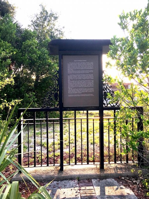
On Broad Street 0.2 miles east of Ocean Street, on the left when traveling east.
This is the site of the Historic Old Mayport Cemetery, on Navy, City of Jacksonville and nearby private properties, covered beneath considerable fill material, roadways and private development. The names of some who are interred here are known; . . . — — Map (db m137916) HM
On Plaza Drive at Seminole Road, on the right when traveling east on Plaza Drive.
Constructed by the U.S. Army in 1942, Combat Team Camp Atlantic Beach was the headquarters of the Harbor Defenses of Jacksonville during World War II. The camp was tasked with defending Florida’s Atlantic coast from Axis invasion following the . . . — — Map (db m106306) HM
On Ocean Boulevard at Atlantic Boulevard, on the right when traveling north on Ocean Boulevard.
Paul M. Patrick was Atlantic Beach’s first Town Marshal. Born on November 8, 1887, in Savannah, Georgia, he enlisted at age 21 in the U.S. Army and served for three years. After his discharge, Patrick worked for the Chatham County Police Department . . . — — Map (db m274634) HM
On Fort George Road, on the right when traveling north.
Ft. George Island presents a cross-section of the Florida story. Timucuan Indians inhabited this island when French explorer Jean Ribault landed nearby in 1562. A Spanish mission was established here before 1600 to serve the Timucuans. Known to the . . . — — Map (db m58377) HM
On Fort George Road, on the right when traveling north.
(Upper left plaque)
National Register Site
Ribault Club Inn
1928
Awarded By
Jacksonville Historic
Preservation Commission
(Lower left Plaque)
Ribault Club Inn
Has Been Placed On The
National . . . — — Map (db m58614) HM
On Ft. George Road, on the left when traveling north.
The establishment of missions chiefly for the purpose of Christianizing the Indian population was one of the methods used by Spain in attempting to colonize Florida in the sixteenth century. The Mission of San Juan del Puerto was founded in the . . . — — Map (db m21654) HM
On Fort George Road, on the left when traveling north.
St. George Episcopal Church, designed by Robert S. Schuyler and built in 1882, is a fine example of Carpenter Gothic, one of the most distinctive varieties of church architecture. Such churches were promoted by Florida's second bishop, John Freeman . . . — — Map (db m166854) HM
On Palmetto Avenue 2.1 miles north of Fort George Road, on the left when traveling north.
Historic references to the plantation house on Fort George Island are tantalizingly brief. The first detailed descriptions of the house and structural changes were recorded in the 20th century. From this vantage point, you can see the changes that . . . — — Map (db m40536) HM
Near Palmetto Avenue 2.1 miles north of Fort George Road, on the left when traveling north.
>br>The birthplace of African-American archaeology can be traced to Kingsley Plantation, where archaeologists in 1968 first began to search for artifacts that reflected African identity. Many of the slaves that lived here during Zephaniah Kingsley's . . . — — Map (db m40852) HM
On Palmetto Avenue 2.1 miles Fort George Road, on the left when traveling north.
Artifacts recovered by archaeologists provide clues as to who these enslaved African men, women and children were. This is most easily recognized within the realm of spirituality or religion, which is resistant to change. However, the physical . . . — — Map (db m41193) HM
Near Palmetto Avenue 2.1 miles north of Fort George Road when traveling north.
After the Civil War, slavery ended, but former slaves continued to live on the island. In this new era, former slaves and new landowners had to make difficult choices.
In 1869 the Rollins family settled at the former plantation and called it . . . — — Map (db m145390) HM
Near Palmetto Avenue 2.1 miles north of Fort George Road when traveling north.
The plantation era began in Florida in 1763 after Britain took control from Spain. Soon after, the first planter was given land here and brought his slaves and household.
Britain established a plantation economy and encouraged its growth by . . . — — Map (db m145387) HM
On Heckscher Drive (State Road 1A) south of Fort George Road, on the right when traveling south.
Jean Ribaut and a party of Huguenots landed the morning of May 1, 1562 on this island. Here they knelt in prayer, beseeching God's guidance and commending the natives to his care. This was the first Protestant prayer in North America. — — Map (db m40024) HM
On Palmetto Avenue 2.1 miles north of Fort George Road, on the right when traveling north.
The plantation house symbolizes the owners and their freedom. The cabin ruins stand behind you as a testament to the enslaved and their lives of forced labor.
Explore the plantation grounds and discover the stories of plantation owners and . . . — — Map (db m40007) HM
Near Palmetto Avenue 2.1 miles north of Fort George Road, on the right when traveling north.
In the spring of 1814, Zephaniah Kingsley relocated his family to this sea island plantation. Over the next two decades he developed his controversial views on race, society, and slavery.
Kingsley was a successful businessman who had strong . . . — — Map (db m40035) HM
Near Palmetto Avenue 2.1 miles north of Fort George Road.
The plantation era was a time in our history of opportunity, political contradictions and great cruelty.
For planters, like Zephaniah Kingsley, it was a time for amassing land and wealth. For enslaved Africans who produced the wealth it was a . . . — — Map (db m40085) HM
On Palmetto Avenue 2.1 miles north of Fort George Road, on the left when traveling north.
Imagine ... instead of the empty historic building and peaceful riverfront of today, a slave owner's family sits watching from the porch of their comfortable home as cargo-laden boats pass by on the river.
Breezes off the water cool the . . . — — Map (db m40043) HM
On Palmetto Avenue 2.1 miles north of Fort George Road.
Imagine...instead of a lush green landscape of today, a long dusty road stretches to the slave cabins and field beyond.
Bent over cotton plants, under the hot sun with dust-filled air, enslaved people toil day in and day out amidst the odor of . . . — — Map (db m40077) HM
On Heckscher Drive (State Road A1A) south of Fort George Road, on the left when traveling south.
(side 1)
Pilot Town
The St. Johns River provided trade access that supported the economy of the Fort George Island plantations. Cotton and sugar from the plantations were transported on the river to trading posts. Early Spanish . . . — — Map (db m106389) HM
Near Palmetto Avenue 2.1 miles north of Fort George Road.
Cash crops, like sea island cotton, indigo, and sugar cane, made a profit for the owner. Other crops, like potatoes, okra, and yams, fed the families of both owners and slaves.
Sea island cotton was highly prized because of its long, strong, . . . — — Map (db m40143) HM
Near Palmetto Avenue 2.1 miles north of Fort George Road when traveling north.
The House at the North end will be in the course of a month a very comfortable habitation, & in any other country a handsome situation. John McQueen, Jr., 1798
Planter John McQueen built the original portion of the house with the use of . . . — — Map (db m145389) HM
On Palmetto Avenue 2.1 miles north of Fort George Road, on the left when traveling north.
The exploitation of enslaved people differed throughout the Americas. However, the bottom line was profit for the owner, while for the slave it was loss of freedom.
Slaves were possessions. They were viewed as a valuable commodity to be bought . . . — — Map (db m83539) HM
On Palmetto Avenue north of Fort George Road, on the right when traveling north.
Constructed nearly 200 hundred years ago, these cabins were home to enslaved people. Following emancipation, former slaves lived here and worked the land. Slowly, individuals and families moved away, leaving the buildings to fall into ruin. . . . — — Map (db m40543) HM
On Palmetto Avenue 2.1 miles north of Fort George Road, on the right when traveling north.
Slaves actively resisted bondage by purposefully slowing down their work pace, faking illness, or even mutilating themselves in order to lessen their value as human property.
Resisting the inhumanity of their enslaved condition, slaves . . . — — Map (db m40657) HM
On Palmetto Avenue 2.1 miles north of Fort George Road, on the right when traveling north.
In front of you are the remains of 25 cabins, the homes of 60 to 80 men, women, and children. These people had the strength to survive the misery of slavery.
Before dawn, slaves left for their day's labor, or to use their specialized skills. . . . — — Map (db m40689) HM
On Palmetto Avenue 2.1 miles north of Fort George Road, on the left when traveling north.
The island's landscape has changed dramatically since the plantation era. Gone are the roofs, fruit trees, wells, and garden plots. Trees and grasses now replace fields once tilled by slaves.
To be a slave was to be a human being under . . . — — Map (db m40847) HM
On Palmetto Avenue 2.1 miles north of Fort George Road, on the right when traveling north.
The slave quarters were a place to find identity and strength through family, faith, and shared experiences.
Many American traditions originate from the daily activities and beliefs of enslaved people. Practices that survive today revolve . . . — — Map (db m41248) HM
On Palmetto Avenue 2.1 miles north of Fort George Road, on the right when traveling north.
From the earliest age, children were trained to do their parents' work. They were terrified of the punishment their parents endured. Parents taught their enslaved children strict obedience so they could survive. And yet, like children today, they . . . — — Map (db m41272) HM
Near Palmetto Avenue 2.2 miles north of Fort George Road when traveling north.
English:
Once the Portuguese made successful transatlantic trading voyages, other European nations quickly followed. In the eighteenth century, the port of Nantes became the busiest French port involved in the European slave trade . . . — — Map (db m145391) HM
Near Palmetto Avenue 2.2 miles north of Fort George Road when traveling north.
English:
Slavery has been a component of human history through time. Whether captured, purchased, or taken as spoils of war, enslaved people had wide-ranging experiences, but they all shared one thing in common: loss of freedom. . . . — — Map (db m145392) HM
On Palmetto Avenue 2.1 miles north of Fort George Road, on the right when traveling north.
You are standing at the edge of two worlds. You are leaving the world of the owner and entering the world of the slave.
The cabin ruins before you are a vivid testament to the generations of slaves who lived there. On them depended the . . . — — Map (db m40120) HM
On Palmetto Avenue 2.1 miles north of Fort George Road, on the left when traveling north.
Many crops were grown on the plantation, but sea island cotton produced the highest profit. Growing and processing it required a complex work structure.
The task system was used to manage the many specialized requirements of sea island cotton . . . — — Map (db m40499) HM
Near Palmetto Avenue 2.1 miles north of Fort George Road when traveling north.
Where there is now a tranquil river scene, a dock hustled and bustled with activity during the plantation era. Cotton bales were sent to market, and slaves and finished goods were brought here by boat.
Most plantations were located along . . . — — Map (db m145388) HM
Near Seminole Road 0.1 miles east of Campground Road.
Manhattan Beach was Florida’s first African American beach resort. In 1900, Henry Flagler reserved Manhattan Beach for black employees of his Florida East Coast Railway and Florida East Coast Hotel companies. African Americans, who comprised a . . . — — Map (db m173936) HM
On Sawpit Road 0.1 miles north of Flounder Road, on the left when traveling north.
Side 1
Sawpit Bluff Plantation, located on Black Hammock Island, was built in the 1750s by Edmund Gray. The plantation was named for the sawpit excavated to accommodate the up and down motion of a vertical saw blade. The plantation house . . . — — Map (db m92973) HM
On Huguenot Memorial Park Road 0.2 miles east of Heckscher Drive (State Road A1A), on the right when traveling east.
In 1562, when France was being torn by religious strife, Gaspard de Coligny, Admiral of France, sent two vessels to the New World in search of a refuge for the oppressed Huguenots. Leading the expedition was the Huguenot explorer, Jean Ribaut, who . . . — — Map (db m33486) HM
On New Berlin Road at Olympia Avenue, on the right when traveling east on New Berlin Road.
A Confederate earthworks designed and located by General Robert E. Lee as one of a series of forts for the defense of the Saint Johns River. This fort was occupied by both Confederate and Union forces during the course of the war and is today in its . . . — — Map (db m33458) HM
On Beach Boulevard east of 1st Street South, on the left when traveling east.
In 1912, following the drowning of a prominent citizen, Dr. Lyman Haskell and Clarence MacDonald established and trained Florida’s first U.S. Volunteer Life Saving Corps (VLSC) at this location to protect the lives of bathers on Jacksonville Beach . . . — — Map (db m93262) HM
The Beaches Museum Chapel, also known as the old St. Paul's Episcopal By-The-Sea, is one of the oldest remaining structures at the Beaches. It was built in 1887 two blocks south of this location and two blocks south from the ocean in what is now . . . — — Map (db m107836) HM
On Beach Boulevard at 4th Street South, on the right when traveling east on Beach Boulevard.
The Beaches Museum Chapel, also known as the old St. Paul's By-the-Sea Episcopal Church, is one of the oldest remaining structures at the Beaches. It was built in 1887 and was designed by Architect Robert Schuyler in the Carpenter Gothic Style. . . . — — Map (db m310977) HM
Near 1st Street South (Ocean Front Street) just south of 5th Avenue South, on the right when traveling north.
Has a hurricane ever hit Jacksonville Beach?
Records of Northeast Florida storms began in 1885. Since that time, Jacksonville Beach has had mild hurricane activity compared to many other coastal areas. Three relatively recent storms have come . . . — — Map (db m145378) HM
On Beach Boulevard (U.S. 90) near N 5th Street, on the right when traveling west.
Aviation pioneers were attracted to Northeast Florida's hard, wide beaches. Pablo Beach, as Jacksonville Beach was known until 1925, served as takeoff or terminal point for several early coast-to-coast flights. The first of these, in 1912, required . . . — — Map (db m57600) HM
On Beach Boulevard (U.S. 90) near N 4th Street, on the right when traveling west.
In 1883 construction of the Jacksonville and Atlantic Railroad was begun to serve this undeveloped area. The track was narrow-gauge, running 16.54 miles from the south bank of the St. Johns River to the beach. The first settlers were William Edward . . . — — Map (db m57599) HM
On Beach Boulevard at 4th Street South, on the right when traveling west on Beach Boulevard.
The Florida East Coast Railway, owned by Henry Flagler, constructed this 1½ story wood frame building in 1900 at Jacksonville Beach (then known as Pablo Beach) as a residence for their section foreman.
The house was originally located on the . . . — — Map (db m311467) HM
On Pablo Avenue at 4th Street South, on the right when traveling east on Pablo Avenue.
The Mayport Depot was built in 1900 and stood in Mayport as the northernmost terminus point for the Florida East Coast Railway. To enlarge his quickly growing FEC Railway.
Henry Flagler bought the Jacksonville and Atlantic Railway, expanded it to . . . — — Map (db m311456) HM
Near Beach Boulevard (U.S. 90) at 4th Street North, on the right when traveling west. Reported permanently removed.
The Mayport Depot was built in 1900 for the Florida East Coast Railway when Henry Flagler expanded the line running up to Mayport from a narrow gauge track to a standard gauge track. The new standard gauge line also provided transport for people . . . — — Map (db m311459) HM
On Pablo Avenue (U.S. 90) at North 5th Street, on the left when traveling west on Pablo Avenue. Reported permanently removed.
The Oesterreicher-McCormick Homestead was built in 1873, and is one of the oldest remaining homes in the Beaches area. The building is a rare example of cracker-style architecture that was used in Florida. One of the main features of this . . . — — Map (db m313141) HM
Near Beach Boulevard (U.S. 90) at 4th Street North, on the right when traveling west. Reported permanently removed.
The Pablo Beach FEC Foreman’s House was built in 1900 by the Florida East Coast Railway after it was bought by Henry Flagler. The house was built for the use of the local section foreman and his family, and represents a standard design used by . . . — — Map (db m311474) HM
The Pablo Beach Post Office was built in 1903, and used as the post office for the area until 1908. While this building was in use, the town was known as Pablo Beach until 1925 when it was renamed Jacksonville Beach. This building was the first . . . — — Map (db m108217) HM
On Beach Boulevard (U.S. 90), on the left when traveling east.
Porter wood burning locomotive
representing type of engine
employed during the 1880's on the
St. Johns Railway, St. Augustine's
first passenger line - chartered
in 1858 and in active operation
until 1894. Donated to City . . . — — Map (db m60201) HM
Near 1st Street South north of 5th Avenue South, on the right when traveling north.
On April 10, 1942, German submarine U-123 torpedoed the oil tanker SS Gulfamerica off the coast of Jacksonville Beach. The tanker exploded and eventually sank. Nineteen Americans lost their lives in the attack. This marker has been placed to . . . — — Map (db m181086) HM WM
On 4th Avenue N near Ocean Front N, on the right when traveling north.
This marker commemorates the attack on the USS Gulfamerica on April 10, 1942, during World War II (1941-1945) by a German U-boat just off the coast of Jacksonville Beach. The Gulfamerica, a merchant marine vessel, was on her maiden . . . — — Map (db m266556) HM WM
Near Beach Boulevard (U.S. 90) at 4th Street North, on the left when traveling east.
This locomotive was built in 1911 in Pittsburgh, Pennsylvania by the H.K. Porter Company. The 25 ton (50,000 lbs.) engine has a “2-6-0” design, which refers to the number of wheels that were used to actually move the locomotive rather than hold it . . . — — Map (db m181100) HM
On Beach Boulevard at 4th Street South, on the right when traveling west on Beach Boulevard.
The 25-ton steam locomotive was manufactured for the W.W. Cummer & Sons Lumber Company in Dade City, Florida. The locomotive was built in 1911 in Pittsburg, Pennsylvania by the H.K. Porter Company.
It was used to haul pine and cypress logs in Pasco . . . — — Map (db m311484) HM
Near 1st Street South 0.1 miles north of 5th Avenue South.
1941 - 1945
In Memoriam
Jacksonville Beach
Heroes Of World War II
Who Gave Their All
That The World
Might Have Peace
John J. Ahern, Jr. 2nd. LT. Army • Otis O. Box CPL. U.S.M.C. •George Henry Bruer S.SGT. Army • . . . — — Map (db m181094) WM
On Ocean Street (State Road A1A) just east of Broad Street, on the left when traveling east.
Side 1:
This marker commemorates the French Huguenot landing near this site on May 1, 1562, and their lives as colonists on the land until 1565. Hoping to escape religious persecution in Western Europe, the Huguenots set sail to this . . . — — Map (db m120345) HM
On Ocean Street (Florida Route A1A) at Broad Street, on the right when traveling north on Ocean Street.
(Side 1)
U.S. Merchant Marine
In Peace and War – 1775
Dedicated September 14, 1999
Mayport Florida
In memory of the men and women
of all nations who loyally served
aboard United States merchant
ships . . . — — Map (db m137894) WM
On Florida Boulevard 0.1 miles west of 3rd Street ( Route A1A), on the right when traveling west.
The Little House movement began in 1923 as part of the Better Homes in America Demonstration Week in Washington, D.C. With the intent of highlighting modestly-sized homes for the American family, a demonstration home was erected behind the White . . . — — Map (db m165846) HM
NaNa, the tallest dune in Florida, is a protected landmark due largely to the efforts of MaVynne Betsch (January 14, 1935-September 5, 2005), widely known as the "Beach Lady." Betsch, who once performed opera in London, Paris and Germany, returned . . . — — Map (db m59606) HM
On Ocean Blvd near Lewis Street, on the right when traveling south.
During the period of racial segregation, African Americans were barred from most
of the beaches in Florida. American Beach was founded in 1935 to provide African
Americans with beach access in a resort atmosphere. Nana, as the sand dune . . . — — Map (db m58907) HM
Burney Park at American Beach was named for Isadore Horace Burney II, a native of Athens, Georgia. After graduating from Atlanta University in the mid-1930s, Burney began his life-long career as an agent in Athens for the Afro-American Life . . . — — Map (db m219573) HM
On Gregg Street just south of Lewis Street, on the left when traveling south.
Evans' Rendezvous was renowned as a heartbeat of American Beach. Willie Brantley Evans was born in Orangeburg, South Carolina, on August 5, 1915. As a young man in the 1930s, he worked with the Civilian Conservation Corps for two years before . . . — — Map (db m205284) HM
On Lewis Street near 1st Coastal Highway (State Road A1A), on the right when traveling west.
The Franklintown community was first populated by ex-slaves from the Samuel Harrison plantation. Franklintown Chapel's congregation was organized in 1880 by Trinity M.E. Church, located in the City of Fernandina at the north end of Amelia Island. . . . — — Map (db m58542) HM
On Lewis Street at Waldron Street, on the right when traveling east on Lewis Street.
American Beach was established in 1935 under the leadership of Abraham Lincoln Lewis, one of seven co-founders of the Afro-American Life Insurance Company, and one of Florida’s first black millionaires. His vision was to create a beach resort as a . . . — — Map (db m58868) HM
On Ervin Street, on the right when traveling north.
American Beach, founded in 1935, was a renowned beach for Blacks during the segregation era when African Americans could not go to public beaches. In the early development of American Beach, a few private homes were built, including one hidden deep . . . — — Map (db m60434) HM
On Waldron Stret at Julia Street, on the left when traveling north on Waldron Stret.
Side 1
The Guzman house is a one-story masonry frame Vernacular style home. It has an irregular plan protected by a side facing gable roof with a front gable extension. The exterior walls are covered with wood shake shingles. The fenestration . . . — — Map (db m219579) HM
On Waldron Street at Julia Street, on the left when traveling north on Waldron Street.
The Stewarts' vacation cottage at 5449 Waldron St. was built in 1941 by Ralph and Marie Taylor Stewart. Waldron Street is one of the highest points on American Beach and was named after the Reverend J. Milton Waldron, one of the founders of what was . . . — — Map (db m227630) HM
On Estrada Street at White Street, on the right when traveling south on Estrada Street.
In 1811, the town of Fernandina was platted according to the Spanish Law of the Indies, which prescribed how the site for a Spanish settlement should be selected, and how the town should be laid out in classical grid form. This law also stated . . . — — Map (db m144882) HM
Standing at the highest point on the island, the Amelia Island Lighthouse was built from bricks re-used from the Cumberland Island Lighthouse in 1839 on land purchased from Mary Fernandez. The 67 foot tall lighthouse has walls four feet thick at the . . . — — Map (db m33367) HM
On Fort Clinch Street Park Drive 0.1 miles south of Fort Clinch State Park Museum, on the left when traveling north.
Developed under the New Deal Era of President Franklin D. Roosevelt, the Civilian Conservation Corps (CCC) was designed to provide jobs for young men and relief of families who had difficulty finding employment during the Great Depression . . . — — Map (db m311181) HM
On Alachua Street east of North 3rd Street, on the right when traveling west.
1810 · 1886
David L. Yulee
Lived Near This Location
— • —
He was U.S. Senator,
Statesman, Developer,
Florida's first Railroad
Builder. — — Map (db m33429) HM
On Atlantic Avenue (State Road A1A) at North Wolff Street, on the right when traveling west on Atlantic Avenue.
This site was part of an indigo plantation belonging to the estate of John Perceval, 2nd Earl of Egmont. After Lord Perceval’s death in 1770, his executors sent Stephen Egan to manage the East Florida estate. Under Egan’s supervision, Egmont became . . . — — Map (db m106652) HM
On Gregg Street at Julia Street, on the right when traveling north on Gregg Street.
Louis Dargan (L.D.) Ervin was born in Darlington, South Carolina, in 1873. He attended the Georgia State Industrial College for Colored Youth of Savannah, the oldest institution of higher education for African Americans in Georgia. Ervin . . . — — Map (db m144776) HM
On Gregg Street at Lewis Street, on the left when traveling south on Gregg Street.
In the early 1930’s, A.L. Lewis, president of the Afro American Insurance Company, bought 200 acres of beachfront so his employees could enjoy the Florida shore during the days of segregation. For the next 40 years, American Beach was a paradise . . . — — Map (db m144780) HM
On S 7th Street near Cedar Street, on the right when traveling south.
Built in 1885 by George Rainsford Fairbanks, lawyer, historian, and editor. Born in 1820 at Watertown, New York, Fairbanks moved to Florida in 1842 and became a major in the Confederate Army.
He edited the Fernandina Florida Mirror, presided . . . — — Map (db m59696) HM
During the Spanish and English periods of Florida history, many large tracts of land were granted primarily to induce settlement. All that remains of the Don Domingo Fernandez Spanish Grant is the family cemetery and this park. Royal title to . . . — — Map (db m33394) HM
On Gregg Street just north of Lewis Street, on the right when traveling north.
American Beach was established in January 1935 when the Afro-American Life Insurance Company purchased 33 acres of land with a 1000-foot shoreline. This Masonry Vernacular home was built that year for the president of the company, Abraham Lincoln . . . — — Map (db m92952) HM
On South 9th Sreet just south of Atlantic Avenue ( Route A1A), on the right when traveling north.
The First Missionary Baptist Church was founded by slaves in 1860 under the leadership of its first pastor. Elder William Rose of Savannah, Georgia. The congregation worshipped in multiple buildings until settling at its current location in 1873. . . . — — Map (db m174753) HM
On North 6th Street near Alachua Street, on the left when traveling north.
Organized in 1858, this congregation worships
in Fernandina's oldest church building, and
one of the oldest in Florida. This colonial
structure rests on land donated by David L.
Yulee, Florida's first Senator, and a former
member of the . . . — — Map (db m121847) HM
On Center Avenue east of Front Street, on the left when traveling west.
The Florida Railroad Company was incorporated January 8, 1853, with David L. Yulee as president. The line received both federal and state land grants. Despite early financial difficulties, construction was begun from Fernandina, where the main . . . — — Map (db m33411) HM
On Fort Clinch Road 3.1 miles north of Atlantic Avenue, on the right when traveling west.
Reconstruction and construction of roads, buildings and grounds was performed by Civilian Conservation Corps
Company 1420, 1937-1942. — — Map (db m33457) HM
On Fort Clinch Road 3.1 miles north of Atlantic Avenue, on the right when traveling east.
You are standing in the general location of the Fort Clinch Military Road. The photo represents what a typical military road looked like during the Civil War.
In 1847, with the start of the fort's construction, military engineers realized the . . . — — Map (db m33438) HM
On Estrada Street at White Street, on the right when traveling south on Estrada Street.
In 1847, with the start of the fort’s construction, military engineers realized the necessity to create a road that would connect Fort Clinch to Old Fernandina. The road would serve as a vital lifeline for the movement of soldiers, supplies and . . . — — Map (db m144854) HM
On Estrada Street at White Street, on the right when traveling south on Estrada Street.
On this bluff overlooking the Amelia River, Fort San Carlos was completed by the Spanish in 1816. The fort was made of wood and earthworks and was armed with eight or ten guns. As the Spanish Empire disintegrated, Fort San Carlos became increasingly . . . — — Map (db m33360) HM
On South 9th Street at Beech Street, on the right when traveling north on South 9th Street.
Side 1
In 1870, Samuel Irving came to Florida from Philadelphia, Pennsylvania, with a vision for an African Methodist Episcopal (AME) Church in Fernandina Beach. That year, Irving started a prayer meeting in the name of the AME Church. In . . . — — Map (db m251261) HM
Site of the Battle of Amelia, September 13, 1817. On this hill, Spaniards erected a battery of four brass cannon, with about 300 men, supported by two gunboats. They shelled Fernandina, held by Jared Irwin, adventurer and former Penna. congressman. . . . — — Map (db m33343) HM
On Sixth Street near Centre Street (State Road 1A / 20), on the right when traveling north.
Methodism first came to Amelia Island in 1822 when the South Carolina Conference of the Methodist Episcopal Church appointed the Reverend Elijah Sinclair as the first minister to East Florida. Sinclair arrived within months of Florida being ceded . . . — — Map (db m59687) HM
On Old Nassauville Road (County Road 107) just south of Dirt Road, on the left when traveling south.
(side 1)
Mount Olive Baptist Church in Nassauville, Florida was established in 1870 by the descendants of West African born, Sam Hooper, and his native American wife. Sam, (aka I. Hupue) who was over 100 years of age in 1864, was the . . . — — Map (db m92956) HM
On South 11th Street at Atlantic Avenue (State Road A1A/200), on the right when traveling north on South 11th Street.
In honor of
American Revolutionary War Patriots
who settled in Nassau County, Florida
Burroughs Higginbotham, Soldier
Amos Latham, Soldier
John Tolson Lowe, Lieutenant
James Pelot, Patriot
John Daniel Vaughan, Private
For freedom, . . . — — Map (db m93831) WM
On Centre Street near S 5th Street, on the right when traveling east.
The 1891 Nassau County Courthouse is one of only a few remaining courthouses in Florida built in the late 19th century. An excellent example of the Italianate style, it features a square domed tower with cupola, brick corbelling, bracketed cornice, . . . — — Map (db m58486) HM
On South Street near Atlantic Avenue (State Route 200) (State Road A1A), on the left when traveling south.
New Zion Baptist Church, the second oldest and largest black Baptist Church on Amelia Island, was founded on May 15, 1870 under the leadership of Reverend Lewis Cook (1834-1880). He and 69 parishioners held their first meeting in a stable on First . . . — — Map (db m58939) HM
On White Street at North 14th Streeet, on the right when traveling west on White Street.
Original site of
Fernandina
Last Spanish city platted
in the Western Hemisphere
Platted 1811
Listed on the
National Register Of Historic Places — — Map (db m144773) HM
On South 10th Street at Fir Street, on the right when traveling north on South 10th Street.
(Side 1)
The groundwork for Peck High School started in 1880, when a group led by Henry B. Delaney petitioned for an African American school in Fernandina. In 1885, a four-room building known as Colored School No. 1 opened at Atlantic . . . — — Map (db m93837) HM
On N 4th Street near Alachua Street, on the right when traveling north.
On February 5, 1875, Jean-Pierre Augustin Verot, Bishop of Saint Augustine, purchased this cottage from Sarah Phelan. The Sisters of Saint Joseph lived here in the year 1877, when a devastating epidemic of yellow fever swept over the Amelia Island . . . — — Map (db m59963) HM
On Estrada Street at Someruelus Street, on the right when traveling south on Estrada Street.
This land high above the Amelia River was a campsite for Indians in pre-historic times, as early as 2000-1000 B.C. In the early history of the state, it assumed military importance because of the fine protected harbor on the northern boundary of . . . — — Map (db m33349) HM
On Centre Street at North 4th Street, on the right when traveling west on Centre Street.
Cast iron lamp posts originally flanked the south and west entrances to the post office building. The lamp posts represent the first standardized type approved for Federal buildings. Removed in the early 1950s, only these two survived. They were . . . — — Map (db m144878) HM
Near 1st Coast Hwy (Florida Route A1A) 0.9 miles south of Sanctuary Lane, on the right when traveling south.
Rep. George Crady was born in Miami in 1931, the third of five children born to Syrian immigrants. He grew up in Jacksonville, graduated from Duke University, and served as a U.S. Marine helicopter pilot before relocating his family back to . . . — — Map (db m259695) HM
On Center Avenue east of Front Street, on the left when traveling west.
In May 1777, Colonel Samuel Elbert's Continentals landed on the North End of Amelia Island at Oldtown Bluff, approximately one mile north of Florida. A patrol engaged in a skirmish with British troops on the south end of the island. An officer, Lt. . . . — — Map (db m33414) HM
On Estrada Street at White Street, on the right when traveling south on Estrada Street.
A nearly two year ordeal for 100 enslaved Africans in Florida ended when they departed from Fernandina in 1829 and relocated to a settlement for freed slaves called New Georgia, in Liberia, Africa.
The Spanish slave ship Guerrero, . . . — — Map (db m144894) HM
745 entries matched your criteria. The first 100 are listed above. Next 100 ⊳