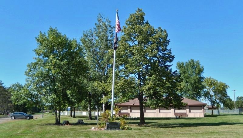
On 1st Street North just south of 3rd Avenue North, on the right when traveling north.
Minnesota Territory 1849-1858On March 3, 1849, during his last hours in office. President James K. Polk signed a bill adding a new name to the American political landscape — Minnesota Territory. A vast land, it stretched from the St. . . . — — Map (db m205213) HM
Near South Union Street at Ford Avenue, on the right when traveling south.
This is a replica of the Dalecarlian Horse, hand carved in Mora, Sweden since the 1840’s. It was built by the Mora Jaycees in 1971 and presented to this community as a reminder of their cultural heritage and as a tourist attraction. It weighs . . . — — Map (db m158912) HM
Near North Vine Street just south of East Maple Avenue, on the left when traveling south.
Kanabec County Courthouse built 1894 has been placed on the National Register of Historic Places by the United States Department of the Interior — — Map (db m158800) HM
On West Anderson Street west of Oric Avenue, on the right when traveling west.
Constructed entirely of reinforced poured-in-place concrete in 1918 by the Circular Concrete Company of Minneapolis. It is one of the first reinforced concrete water towers erected in Minnesota. The tower's construction accompanied installation of . . . — — Map (db m146893) HM
On County Highway 4 0.4 miles north of 60th Avenue Northeast (County Highway 26), on the right when traveling north.
At the start of the U.S.-Dakota War of 1862 settlers around Columbia (now Spencer) hastily formed an oxcart train and started for the stockade at Forest City. On the way to Diamond Lake, the refugees ran into other settlers fleeing from the Eagle . . . — — Map (db m77228) HM
On County Highway 4 0.4 miles north of 60th Avenue Northeast (County Highway 26), on the left when traveling north.
When Daniel Delaney and a man named McLeod camped on the shores of the lake in 1855, they became the first white men of record to visit the area. John Masters, a land developer who came in 1856, gave the body of water its name.
Diamond has . . . — — Map (db m76925) HM
On State Highway 4 0.1 miles north of 135th Street Northeast, on the right when traveling north.
The Red River Trail was the nineteenth-century answer to communication over the frontier between the early settlements on the Mississippi and Minnesota Rivers and Lord Selkirk's settlements (Winnipeg) in Canada. Trails, such as this, were not . . . — — Map (db m77016) HM
On 180th Street Northeast 1.5 miles north of 30th Avenue Northeast, on the left when traveling north.
After fighting a running battle with the Dakota on August 20, 1862 at Diamond Lake, two groups of refugees from Spicer and Eagle Lake camped here at Wheeler's Lake. The Dakota camped across the lake from them. There were no disturbances during . . . — — Map (db m77273) HM
On County Road 4 Northeast 0.3 miles south of Highway 12 Northeast (U.S. 12), on the right when traveling north.
On June 24, 1882, one of the most disastrous railroad wrecks in Kandiyohi County's history took place here. The train left Willmar to travel to Grove City gravel yards with 45-50 men on board. Two and a half miles west of Atwater the train's tender . . . — — Map (db m231744) HM
On 105th Avenue Northeast (County Highway 2) 0.1 miles west of 195th Street Northeast (County Highway 10), on the right when traveling west.
In 1872, February 2 began as a beautiful winter day with several inches of freshly fallen snow. The animals gave the first indication of the turn in the weather with the birds flying low and the cattle lowing restlessly. By that afternoon, the . . . — — Map (db m231746) HM
On 90th Avenue Southeast (County Highway 20) 0.4 miles east of 165th Street Southeast (County Route 136), on the left when traveling west.
Captain John S. Cady ambushed by Indians from this spot June 11, 1863.
Following the suppression of the Dakota (or Sioux) Uprising of 1862 the Eighth Minnesota Volunteer Regiment patrolled the frontier from Hutchinson to the Red River. Captain . . . — — Map (db m231708) HM
On 285th Avenue Northeast (County Highway 35) 1.8 miles west of County Road 9 Northeast (County Highway 9), on the right when traveling west.
Birthplace of Henrik Shipstead (1881-1966), the first native of Kandiyohi County to be elected to U.S. Senate. Henrik Shipstead was born on January 8, 1881 here in Burbank Township, Kandiyohi County, Minnesota, one of Norwegian immigrants Saave and . . . — — Map (db m231767) HM
On 165th Avenue Southwest (County Road 80) 0.2 miles west of U.S. 71, on the left when traveling west.
The morning of January 7, 1873, was mild and pleasant enough to encourage many farmers to make trips to town or to work in their woodlots. Shortly after 2 p.m. a howling blizzard of snow, driven by a 70-mph northwest wind broke the calm. The . . . — — Map (db m79353) HM
Near 45th Street Southeast (County Highway 44) 0.4 miles north of 150th Avenue Southeast, on the right when traveling north.
Immediately following the U.S.-Dakota Conflict of 1862, the United States Army established a chain of small military posts to stabilize the nearly abandoned frontier by keeping everyone—Dakota and settlers—out of the area. Temporarily mounted for . . . — — Map (db m231704) HM
On 160th Street Northeast at State Highway 23, on the right when traveling west on 160th Street Northeast. Reported missing.
What is believed to be one of the last pitched battles between the Ojibwe and Dakota ended near this marker about 1860. Some Dakota hunters found a party of Ojibwe encroaching on Dakota grounds. They attacked, killing several Ojibwe and driving the . . . — — Map (db m78413) HM
On 120th Street Southeast (County Road 134) 3.4 miles south of 15th Avenue Northeast (U.S. 12), on the right when traveling south.
Kandiyohi Town Site Corporation was organized in 1856, with John Swainson as president. By October of that year, the town site had been surveyed. David Charlton's plat indicates a large central area reserved for the State Capitol with a much . . . — — Map (db m78239) HM
On 120th Street Southeast (County Road 134) 3.9 miles south of 15th Avenue Northeast (U.S. 12), on the right when traveling south.
Mrs. Carrie (Pehrson) Johnson, the first white person buried in what is now Kandiyohi County, came here with her husband, John, and six month old son in the fall of 1857, from Sweden. She died in April 1858, and was buried near her new house. After . . . — — Map (db m78311) HM
On County Highway 8 0.5 miles south of 52nd Avenue Southeast, on the right when traveling south.
John Other Day, a Dakota who disagreed with the decision to go to war with the Whites, led a party of sixty-two white men, women and children out of danger when the Dakota attacked the Upper Sioux Agency near Granite Falls. The party left the Agency . . . — — Map (db m76656) HM
On 71st Avenue Southeast (County Highway 3) 1.1 miles west of County Highway 8, on the right when traveling west.
Wakanda is a spiritual place or "where the spirit dwells" in Dakota. The Dakota people named this area before the settlers came to Kandiyohi County. Prior to 1900 there was evidence of this being a place of burial grounds. Over time, erosion and . . . — — Map (db m231706) HM
On 195th Avenue Southeast (State Highway 7) east of 165th Street Southeast, on the right when traveling east.
A founding member of the Kandiyohi County PF (Pheasants Forever), Dalton worked tirelessly to keep the fledgling chapter going. He was committed to a cause he strongly believed in.....establishing quality habitat to help all . . . — — Map (db m77082) HM
On County Highway 8 north of 154th Avenue Southeast, on the right when traveling north.
On August 16, 1885 thirty people met at the home of Erik and Anette Larsen located in Section 26 of Fahlun Township and under the direction of Rev. A.N. Kleven, a new Lutheran congregation was organized by the name of "Tromso Lutheran Church," . . . — — Map (db m78263) HM
On County Highway 8 north of Big Kandi Drive (County Road 132), on the right when traveling north.
The United States Army responded to the U.S. - Dakota War of 1862 by carrying out federal government security policies of removing remaining noncombatant Dakota people and pursuing combatants while protecting settled areas. In August 1863, Jesse V. . . . — — Map (db m78292) HM
On County Road 4 Southeast 0.5 miles north of 90th Avenue Southeast (County Highway 20), on the right when traveling north.
The Farm Holiday Association, which at one time was reported to be the largest organization of farmers in the United States, began in Kandiyohi County in 1932. One particular incident led to the formation of this organization. A Kandiyohi County . . . — — Map (db m231711) HM
On Main Street South (State Highway 9) at 1st Avenue Southwest, on the right when traveling south on Main Street South.
1865 Louis Larson filed homestead rights and named the site New London.
1867 Merchants W.W. Pinney and Samuel Adams each built and opened stores. Postal service began.
1868 New London became county seat of Monongalia County.
. . . — — Map (db m79619) HM
On Main Street South (State Highway 9) at 1st Avenue Southwest, on the right when traveling south on Main Street South.
1938 A thorough study of a hundred acre location was carried out by the U.S. Commission of Surveys. Dam and mill site were purchased for $14,000. Land for fish ponds extended a mile downstream. Citizens contributed $1,300, and some easements . . . — — Map (db m79642) HM
On 180th Avenue Northwest (County Highway 40) 2 miles west of County Highway 5, on the right when traveling west.
During the Dakota Conflict of 1862, there were no casualties among the Norway Lake community settlers, although several from the nearby West Lake community were killed. On August 20, survivors from West Lake and other settlers from the Norway . . . — — Map (db m75746) HM
On 68th Street Northwest (County Road 101) 0.8 miles south of 180th Avenue Northwest (County Highway 40), on the right when traveling south.
In 1879 this village of Jericho was established in the historic Norway Lake settlement, 20 years after the first Norwegian immigrants arrived. A general store with a post office, a blacksmith shop, a creamery, and other businesses prospered in . . . — — Map (db m78215) HM
Near 3rd Avenue Southwest east of Oak Street South, on the right when traveling east.
This Monument is Erected by the
State of Minnesota,
in Memory of
Anders Petter Lundborg,
born Mar. 23, 1837.
Gustof Lundborg, born Apr. 30, 1839.
Lars Lundborg, born Dec. 22, . . . — — Map (db m78140) HM WM
On Main Street South (State Highway 9) at 1st Avenue Southwest, on the right when traveling south on Main Street South.
1858 A natural waterfall was discovered by pioneer Larson while on a hunting and trapping expedition three miles upriver from Nest Lake.
1859 Larson established a camp near the falls but had to abandon it when his tent and most of his . . . — — Map (db m79590) HM
On Main Street South (State Highway 9) at 1st Avenue Southwest, on the right when traveling south on Main Street South.
1946 Forty-two veterans met and signed the petition for a charter. The post was given its name in memory of Robert Ihlang who was killed in Italy during World War II. The charter was granted, and the officers were: commander, Victor Suneson; . . . — — Map (db m79634) HM
Near 3rd Avenue Southwest east of Oak Street South, on the right when traveling east.
Rev. Andrew Jackson had two services arranged in his Norway Lake Swedish Lutheran Parish for Wednesday, the 20th of August, 1862. In the forenoon a meeting was held at the Lundborg cabin at West Lake, now known as Monson Lake in Swift County. . . . — — Map (db m266388) HM
Near 3rd Avenue Southwest east of Oak Street South, on the right when traveling east.
This historical inclosure and all of its adornments constitute a memorial to Victor E. Lawson (1871–1960) the pioneer historian of Kandiyohi County. It has been provided by the Tribune Printing Company, Inc. publishers of the West Central . . . — — Map (db m79397) HM
On Main Street South (State Highway 9) at 1st Avenue Southwest, on the right when traveling south on Main Street South.
Department of the Air Force
United States of America
MCMXLVII
Department of the Navy
United States Marine Corps
National Guard
Department of the Navy
United States of America
Department of the Army
United . . . — — Map (db m79556) WM
On North Shore Drive (County Highway 30) 1.5 miles west of County Road 4 Northeast, on the right when traveling west.
American Indians lived in Kandiyohi County for thousands of years before settlers first arrived in the 1850s. Among the earliest Euro-Americans to visit this area were traders and missionaries as far back as the mid-1700s. The Missionaries came to . . . — — Map (db m231752) HM
On 190th Street Northeast (County Road 143) at 210th Avenue Northeast, on the right when traveling north on 190th Street Northeast.
The United States Army responded to the U.S.-Dakota War of 1862 by carrying out federal government security policies of removing remaining noncombatant Dakota people and pursuing combatants while protecting settled areas. In September 1862, . . . — — Map (db m231763) HM
On Roseville Road Northeast 0.3 miles south of Highway 23 Northeast (Minnesota Highway 23), on the right when traveling south.
The settlers of Roseville Township fled to Richmond when they heard of Dakota attacks in Kandiyohi County in 1862. When some time had passed without reports of Dakota in the Roseville area, a party consisting of John, Hugh and Robert Blakely, Hugh . . . — — Map (db m231764) HM
On 135th Street Southwest (County Highway 7) 0.2 miles north of 195th Avenue Southwest (State Highway 7), on the right when traveling north.
After the attack at the Lower Sioux Agency near Morton, twenty-five to thirty Dakota warriors camped here on August 18, 1862 en route to the lake settlements in Kandiyohi County. The Dakota in this party had frequently hunted in the lake region and . . . — — Map (db m231700) HM
On 165th Avenue Southwest (County Road 80) at 105th Street Southwest (County Highway 1), on the right when traveling east on 165th Avenue Southwest.
In 1877, William D. Washburn of Minneapolis purchased all of sections 3, 4, 5, 9, and part of section 6 in Holland Township to create one of Minnesota's first "bonanza" farms. Following the example of factories, bonanza farms were typically very . . . — — Map (db m231702) HM
On State Highway 4 south of 75th Avenue Northeast (County Highway 28), on the left when traveling south.
Joshua H. Gates arrived at Diamond Lake in 1857 where he claimed land in Sections 17 and 20 of Harrison Township. Gates may have been the first farmer in what is now Kandiyohi County. This is the site of the Joshua and Lucinda Gates family . . . — — Map (db m77102) HM
On 138th Avenue Northeast (County Road 98) at County Highway 4, on the right when traveling east on 138th Avenue Northeast.
During the Woodland period, about 1000 B. C. to A. D. 1650, Indian peoples began constructing earthworks or "mounds." Many if not most of these mounds functioned to visibly define and demarcate burial areas, much . . . — — Map (db m78079) HM
On County Highway 4 0.3 miles south of North Shore Drive (County Highway 30), on the right when traveling south.
The first settlers in Kandiyohi County arrived in 1856 eager to stake a real estate claim on the shores of Green Lake. Early pioneers were hopeful that this place would soon become home to a thriving new city.
Two men from . . . — — Map (db m77865) HM
On 132nd Avenue Northwest 0.4 miles west of County Highway 5.
On September 28, 1858, Johannes and Carin Iverson and family settled on section 32 of Lake Andrew Township near Crook Lake. Using supplies from the Eagle Lake Sawmill, Johannes Iverson built a log house here.
Almost four years later, on August . . . — — Map (db m79375) HM
On 150th Avenue Northwest (County Road 29) 0.5 miles east of County Highway 5, on the right when traveling west.
First Church in Minnesota Organized by Mission Friend Immigrants from Sweden
1870-Organized on J.A. Skoglund Farm
1873-Built 1910-Enlarged
1870-1955 Served this Rural Parish
1961-Perpetual Care Fund Raised . . . — — Map (db m77844) HM
On 140th Avenue Northeast 0.5 miles west of State Highway 23, on the right when traveling west.
The Dakota nation established campsites in Kandiyohi County to hunt and fish. Little Crow's campsite located here was used for that purpose. Little Crow was born Taoyateduta about 1810 in the Mdewakanton Dakota village of Kaposia. Little Crow later . . . — — Map (db m78384) HM
On County Highway 9 0.6 miles south of 113th Avenue Northeast (County Highway 10), on the right when traveling south.
In May 1859, Olof Olson Haugen, his wife Bergeret, and son Frederick homesteaded here in section 32, Dovre Township. Over the next three years, the Haugen family diligently worked to establish their new life; building shelter, raising crops and . . . — — Map (db m77770) HM
On Lake Avenue North (County Highway 30) north of Manitoba Street (County Highway 58), on the right when traveling north.
Green Lake has had three names. The Dakota who spent their summers here for hundreds of years, called it Mdeto.
The first whites called it Carnelian, for its red sandy beaches. Later settlers observed the green color, as the Indians had, and . . . — — Map (db m77792) HM
On Lake Avenue North (County Highway 30) north of Manitoba Street (County Highway 58), on the right when traveling north.
Dedicated to the
Veterans of All
Wars Who Served
Their Country to
Protect the
Freedom
of Humanity
Presented by Spicer
American Legion Post 545 — — Map (db m77050) WM
Near 113th Avenue Northeast (County Highway 10) at County Highway 9, on the left when traveling west.
Ojibwe and Dakota nations had a long history of conflict in what would become Minnesota. Both Dakota and Ojibwe people contended for the control of the abundant natural resources in the future Kandiyohi County area that played an economic role in . . . — — Map (db m78028) HM
Near North Shore Drive (County Highway 30) 0.4 miles west of County Road 4 NE, on the right when traveling east.
Native Americans camped in Kandiyohi County for thousands of years before white settlers arrived in the 1850s. One of the large Indian camp sites was here on the north shore of Green Lake. The Santee, or eastern bands of the Dakota Indians, were the . . . — — Map (db m231748) HM
On North Shore Drive (County Highway 30) 0.4 miles east of Highway 23 Northeast (State Highway 23), on the right when traveling east.
Several families settled near Green Lake's Crow River inlet in 1864. This became a trading center known as Green Lake Village, with a post office established in 1867. That same year the Green Lake lumber and grist mills were built. Lumber milling . . . — — Map (db m231754) HM
On 140th Street Northwest (County Highway 7) 1.6 miles south of 225th Avenue Northwest (County Road 112), on the right when traveling south.
On August 20, 1862, Andrew Jackson, a circuit-rider minister, was conducting services for members of the New Sweden Church (Lebanon Lutheran) at the Lundborg family cabin at this site. Young Peter Broberg interrupted to tell his parents that . . . — — Map (db m77823) HM
On 99th Street Northwest at 195th Avenue Northwest, on the right when traveling north on 99th Street Northwest.
Following the Civil War, immigrants flowed into the Norway Lake area with the majority from Norway and Sweden. On October 10, 1868, Norwegian Evangelical Lutheran Church of Norway Lake incorporated and built a log cabin worship facility at this . . . — — Map (db m76700) HM
Near 99th Street Northwest at 195th Avenue Northwest, on the right when traveling north.
Until 1868 the rapidly growing Norway Lake settlement had no regular place of worship. In the fall of that year a church of logs was hastily constructed. It would serve as the Norway Lake church until 1875 with Rev. L.J. Markhus as the pastor.
. . . — — Map (db m78357) HM
Near 180th Avenue Northwest (County Highway 40) 1.1 miles east of 80th Street Northwest (County Highway 1), on the left when traveling east.
A Response To Conflict
In 1865, a military post was established here in response to the U.S.-Dakota Conflict of 1862. During the conflict, twenty-five settlers and an unknown number of Dakota were killed in what is now Kandiyohi . . . — — Map (db m76774) HM
On Becker Avenue Southwest at 5th Street Southwest, on the left when traveling west on Becker Avenue Southwest.
This Indian image first became part of Willmar in 1915, when it appeared as the Kandiyohi County Bank symbol. That same year, artist Eben E. Lawson, commissioned by the bank, created "Kandiyohi," a smaller sculpture which was the basis for this . . . — — Map (db m76191) HM
On 7th Street Northwest (County Highway 41) 0.1 miles north of Park Avenue Northwest, on the left when traveling north.
Berger Thorson was the first resident of what is now the city of Willmar. Little is known of the man except that he raised cattle and sometimes herded cattle for other settlers. On August 20, 1862 a Dakota war party surprised him near his cabin . . . — — Map (db m231826) HM
Near Town Highway 71 Service Drive east of Porto Rice Street Northeast, on the right when traveling east.
Welcome to the original District 18 school house! Measuring a cozy 18' by 22', it was built in 1880 on a site in northeast Willmar Township across Foot Lake about a mile north of the radio station tower. Prior to that, school was held in private . . . — — Map (db m231823) HM
Near Town Highway 71 Service Drive east of Porto Rico Street Northeast, on the right when traveling east.
Engine 2523 is a P-2 class mountain type locomotive survivor of the steam engines acquired by the Great Northern Railway from Baldwin Works in Pennsylvania in 1923 to speed up mainline passenger service. A powerful and speedy locomotive of the P-2 . . . — — Map (db m231822) HM
On 26th Avenue Northeast (County Highway 24) 0.5 miles west of U.S. 71B, on the right when traveling west.
Solomon and Adaline (Stocking) Foot, with their four children, were the first settlers in Willmar Township, at this site in 1857. (Nearby Foot Lake was named after them.) Ground was broken in the spring. Vegetables, grain, and corn were planted. At . . . — — Map (db m231806) HM
Near Ella Avenue Northwest 0.1 miles west of Business U.S. 71, on the right when traveling west.
The agricultural land of the Willmar region has a history that dates back 60 million years, when an inland sea covered the Great Plains from the Gulf of Mexico to the Arctic Ocean. As the adjacent land eroded and life in the sea flourished, . . . — — Map (db m75844)
Near Business U.S. 71 at Puerto Rico Street Northeast, on the right when traveling north. Reported permanently removed.
This mountain type locomotive survivor of the steam engines acquired by the Great Northern Railway to speed up main-line passenger service was placed on permanent exhibition here on October 17, 1965.
A powerful and speedy . . . — — Map (db m76363) HM
On County Road 5 0.2 miles north of 60th Avenue Northwest (County Highway 25), on the left when traveling north.
This monument has been placed to honor Guri Endresen-Rosseland and other early settlers of the Solomon Lake community. The settlers were predominately immigrants from Hardanger, Norway. Among the special characteristics of these pioneers were . . . — — Map (db m272229) HM
On 30th Street Northwest (County Highway 5) 0.4 miles south of 37th Avenue Northwest (County Road 92), on the right when traveling south.
In May 1859, Olof Olson Haugen, his wife Bergeret, and son Frederick homesteaded here in section 32, Dovre Township. Over the next three years, the Haugen family diligently worked to establish their new life; building shelter, raising crops and . . . — — Map (db m77735) HM
Near Town Highway 71 Service Drive east of Porto Rice Street Northeast, on the right when traveling east.
Owned originally by Judge Gauthe Emil (GE) Qvale, this log cabin was part of the family estate on Eagle Lake. It was built as a children's playhouse and later converted to a guest house.
GE Qvale (1860-1951) was born in Norway and immigrated to . . . — — Map (db m231825) HM
On 5th Street Southwest at Becker Avenue Southwest, on the right when traveling south on 5th Street Southwest.
The first native Americans came to what is now Kandiyohi County about 10,000 years ago, to hunt mammoths and other huge prehistoric animals.
As the environment changed over the years, so did the Indians. They became less dependent on . . . — — Map (db m76235) HM
Near Business U.S. 71 near 10th Street Northeast, on the left when traveling north.
Robbins Island was formed about 25,000 years ago during the Wisconsin glaciation period. Early people used it as a refuge from prairie fires and their enemies. Artifacts, including a copper projectile point about 3 thousand years old, have been . . . — — Map (db m76867) HM
On Porto Rico Street Northeast north of High Avenue Northeast, on the right when traveling north.
The Sperry House was built in 1893 when this site was A. H. Sperry's farm. Featuring exterior brick, gables, wood molding, stained glass windows and carved interior oak woodwork, it was proclaimed by the Willmar Argus as "one of the finest . . . — — Map (db m231808) HM
On 15th Street Northeast at 60th Avenue Northeast (County Highway 25), on the right when traveling north on 15th Street Northeast.
Home to an Historic Battle
The Erickson Cabin was the site of a battle during the U.S.-Dakota Conflict in 1862. This outbreak of violence occurred at a time when tension between Dakota tribal members and the U. S. Government had reached . . . — — Map (db m231774) HM
Near Town Highway 71 Service Drive east of Porto Rice Street Northeast, on the right when traveling east.
Seems every town in the Midwest has a local summer celebration of some kind, and Willmar, Minnesota is no different. 1946 was the Kaffe Fest's first year, the chosen name being Swedish for coffee festival. The self-dubbed "Coffee Drinking Capital . . . — — Map (db m231820) HM
On 30th Street Northwest (County Highway 5) 0.1 miles south of 60th Avenue Northwest (County Highway 25), on the left when traveling south.
Turning Back Time
The wetland before you is only a small part of the Weber Waterfowl Production Area; this original 80 acre site was bought from Regina and Anthony Weber in 1965. Additional land was purchased between 1970-74. This 421 acre . . . — — Map (db m77714) HM
Near Business U.S. 71 at Hawaii Street Northeast, on the right when traveling north.
Sponsored and Erected
by Austin F. Hanscom Post 167
The American Legion
Willmar, Minnesota
In grateful remembrance of those who have died serving our country in war, and in honor of all others who have served in our armed forces. May their . . . — — Map (db m76412) WM
On 60th Avenue Southeast 0.1 miles east of U.S. 71, on the right when traveling east.
In the fall of 1856, a party of land speculators, organized by Edwin Whitefield, projected a town site on the west shore of Lake Wakanda. As a real estate agent and artist, Whitefield did much to impress the merits of the Minnesota frontier upon . . . — — Map (db m79336) HM
On US-71 Frontage Rd south of 24th Street Northeast, on the right when traveling north.
The first business firm in Kandiyohi County, a sawmill managed by W. H. Clark, was established at this site in 1858. The townsite of Fullerville was named after Randall Fuller, a partner in the sawmill venture who first came to the Eagle Lake area . . . — — Map (db m231769) HM
On 15th Street Northeast at 60th Avenue Northeast (County Highway 25), on the right when traveling north on 15th Street Northeast.
A Congregation & the Conflict
Kandiyohi County's first church once stood near here. Housed in an abandoned log cabin, the first congregation gathered in 1859 to hold its services. The congregation was called New Sweden and later became . . . — — Map (db m231773) HM
Near 67th Avenue Northwest 0.6 miles west of County Road 5 Northwest (County Highway 5), on the left when traveling west.
This log house is one of our state's Norwegian-American treasures. It was built about 1858 for the Endreson family, who had emigrated from Vikoy parish, Hardanger, Norway, in 1857.
Lars Endreson Rosseland, the builder of the house, had been a . . . — — Map (db m231777) HM
On 26th Avenue Northeast (County Highway 24) west of U.S. 71B, on the right when traveling west.
Swarms of grasshoppers invaded this county in July 1876, destroyed two-thirds of the crop, and laid millions of eggs. A grain farm at this site was owned by Paul Willmar (son of Leon Willmar, after whom the city was named). Willmar and other farmers . . . — — Map (db m231807) HM
On County Highway 23 at 550th Avenue, on the left when traveling east on County Highway 23.
During the U.S. – Dakota War, a battle between Dakota soldiers led by Taoyateduta or Little Crow and Tunkanhnamani (Walks Under A Sacred Stone) and Co. B, 9th Minn. Inf. Regt. made up of new recruits and civilians led by Capt. Richard Strout, . . . — — Map (db m70617) HM
On 1st Street at East Williams Street, on the right when traveling north on 1st Street.
Francis Johnson of Darwin (1904-1989) was an ingenious wood carver, known for carving a one-piece pliers as small as an inch long that opened and closed without pins or other fasteners.
On larger pliers, Francis would carve another pliers from . . . — — Map (db m266389) HM
On Parker Avenue East (U.S. 12) at Guy Street, on the left when traveling east on Parker Avenue East.
To Honor and Remember
All Veterans
who served in the
Armed Forces of the
United States of America
seals of the
Veterans of Foreign Wars
Disabled American Veterans
American Legion
Dedicated on . . . — — Map (db m70446) WM
On 4th Street at Atlantic Avenue West, on the right when traveling south on 4th Street.
Symbolic of agriculture, Dassel's lifeline, the West End Elevator is commonly known to its users as the Dassel Farmers' Elevator. Since its construction in 1885, the area's farmers have brought their corn, oats, wheat, beans, flax, rye, and . . . — — Map (db m76500) HM
On State Highway 24 at milepost 6 at County Highway 2, on the left when traveling north on State Highway 24.
In Grateful Memory of
Those Who Served in
World War II
•
1st Lt. Donald I. Booth Born Dec. 8, 1921 Died June 5, 1944
•
P.F.C. Robert Caswell Born Mar. 13, 1925 Died July 23, 1944
•
S/Sgt. Edward O. Johnson Born Nov. . . . — — Map (db m78680) WM
Near 309th Street 0.2 miles east of Minnesota Highway 24, on the left when traveling east.
On September 3, 1862 during the Sioux Uprising the citizens of Forest City erected upon this site a stockade for the defense against Indians. Early next morning, soon after some 240 people had taken refuge there, the stockade was attacked. The . . . — — Map (db m74620) HM
Near County Road 18 1.8 miles west of State Highway 22, on the right when traveling west.
This monument marks the site of St. Columban Church and Cemetery. Beginning in 1858, mass and sacraments were celebrated in the homes of the early settlers by Benedictine Monks from St. Cloud friory, who came periodically on horseback. . . . — — Map (db m70775) HM
On 248th Street 0.2 miles west of Minnesota Highway 4, on the right when traveling west.
This marks the spot where the first blood was shed in the Sioux Indian Outbreak Aug. 17, 1862
Victims: Robinson Jones • Ann Baker-Jones • Howard Baker • Viranus Webster • Clara D. Wilson
Bodies of these Victims are buried in Ness . . . — — Map (db m70373) HM WM
On 230th Street 0.2 miles west of Minnesota Highway 4, on the left when traveling west.
On November 26th, 1990 Arndahl Lutheran Church was destroyed by a fire. We are left with many memories of our church and its people.
We dedicate this monument to our church-going fore-fathers who did so much to build the kingdom of God in this . . . — — Map (db m70605) HM
On 248th Street 0.2 miles west of Minnesota Highway 4, on the right when traveling west.
On August 17, 1862, four young Dakota hunters, returning to their hungry families from an unsuccessful hunt, argued about stealing food from white settlers. Sungigidan, Kaomdeiyeyedan, Nagiwicakte, and Pazoiyopa dared each other this: who among . . . — — Map (db m70357) HM
On North Marshall Avenue north of East 3rd Street, on the right when traveling north.
The Grand Army of the Republic was an organization established in 1866 by Union veterans of the Civil War to preserve friendships, honor fallen comrades, and aid widows and the handicapped. It was wielded great political influence in the years . . . — — Map (db m70427) HM
On East 3rd Street at North Sibley Avenue (U.S. 12) on East 3rd Street.
Grand Army of the Republic Hall
This brick fortress style building across from Central Park was built in 1885 by Civil War Union soldiers to help promote veterans causes and to provide assistance to veterans and their families.
The . . . — — Map (db m70793) HM