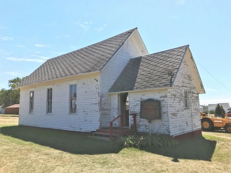
On Center Street south of North Street, on the left when traveling south.
Tread softly, for within the sacred precincts of this simple sanctuary the Holy Spirit moved many of its communicants to significantly serve their God and humanity.
With a membership rarely more than thirty, the core of whom were industrious . . . — — Map (db m205401) HM
On North Egan Avenue south of Northwest 5th Street, on the right when traveling south.
Charles B. Kennedy arrived at this location in March 1878. He said, upon his arrival, "There is not a tree in sight, nor sign of human habitation, only paths made by Indians and Buffalo leading to a flowing spring near by." This spring led to his . . . — — Map (db m237341) HM
On West Street at Main Street, on the right when traveling south on West Street.
Beginning in 1893, the "Emmanuel" served as a church on wheels throughout much of the western United States. Only thirteen total chapel cars were built and commissioned: seven Baptist, three Episcopalian, and three Catholic.
As communities were . . . — — Map (db m205394) HM
On Territorial Road 0.4 miles north of 234th Street (State Highway 236). Reported missing.
Here in April 1857, two Christian Indians, Seahota (Greyfoot) and Makpeyahahoton (Sounding Heavens) braved the wrath of Inkpaduta, a renegade Sioux. He and his band had killed 42 persons at Spirit Lake, Iowa in March and carried off four white women . . . — — Map (db m205240) HM
On State Park Drive 0.4 miles west of 234th Street (State Highway 236), on the left when traveling west.
This log structure was constructed in 1871 for the Herman Luce family. One of the three original homesteaders in this area, Herman Luce contributed to the establishment of Lake County. The log structure housed many families over the years, and . . . — — Map (db m205234) HM
On Territorial Road just south of U.S. 81, on the right when traveling south. Reported missing.
Lake Herman was the original stopping point on the Indian Trail that led from the pipestone quarries in Minnesota to the Three Rivers of the Sioux, a Sioux sanctuary near Fort Thompson on the Missouri. State Highway No. 34 closely follows this . . . — — Map (db m180136) HM
On Dakota Avenue at Grandview Drive, on the right when traveling east on Dakota Avenue.
The Lake Madison Chautauqua Association established 1890 was a corporation patterned after the original Chautauqua in New York. One of the first Chautauquas west of Chicago, it purchased 60 acres of the old Baker homestead from J. A. Trow, known . . . — — Map (db m258951) HM
On 228th Street (County Highway 26) east of 458th Avenue, on the right when traveling west.
"One generation shall praise the works to another and shall declare thy mighty acts." Psalm 145:4
Norwegian pioneer families came to South Dakota prairies near Madison making plans for ways to meet their spiritual needs.
In the sod house . . . — — Map (db m247710) HM
On State Park Drive 0.4 miles west of 234th Street (State Highway 236), on the left when traveling west.
In 2004, Lake Herman State Park received funding from the South Dakota State Historical Society through a Deadwood Fund Grant to restore this structure. Built in 1871, it was originally the home of the Herman Luce family. Through the years it housed . . . — — Map (db m205238) HM
Near South Egan Avenue west of Southwest 2nd Street, on the right when traveling south.
This property has been placed on the National Register of Historic Places by the United States Department of the Interior
This building was graciously donated by the Burlington Northern Railroad Company for the purpose of historical . . . — — Map (db m292611) HM
On Northwest 5th Street at North Egan Avenue, on the right when traveling east on Northwest 5th Street.
Lake County Civil War Memorial:
1861 – 1865
G.A.R.
In memory of these Civil War veterans who became pioneers of Lake County, South Dakota
Adams H. ·
Adkins L. D. ·
Aldrich E. A. ·
Bailey C. O. · . . . — — Map (db m238309) WM
The Great War Honor Roll
of
Madison State Normal School
Elmer Davis died in his Country's service
Earl Abbott
Leonora Anderson
Leonard Bargman
Wesley M. Beardsley
Vernon Beaumont
John Bell
Paul Brady
Joe Brorby
Clen . . . — — Map (db m169857) WM
On North Egan Avenue south of Northwest 5th Street, on the right when traveling south.
These stone creek walls are just a small part of the longest improvement Project built in Madison during the Great Depression. The Memorial Creek Walls stretch three-quarters of a mile along the creek between Northwest Fifth Street and East Center . . . — — Map (db m292560) HM
On State Highway 19 at 236th Street, on the right when traveling south on State Highway 19.
Lake County was started October, 1873 when Herman N. Luce and John T. Hare, the first qualified County Commissioners, met at the cabin of William Lee near the site of old Madison, to organize. William Van Eps platted the old town of Madison June . . . — — Map (db m177441) HM
On North Street east of Center Street, on the right when traveling east.
Lars O. and Sonnev Thormodsgaard built this cabin in 1872 near Fairview, SD.
Lars immigrated with brothers Ole and Nils from Hallingdal, Norway, in 1866. Sonnev arrived in 1857. Their nine children were Ingeborg, Emma, Ole, Sissalia, Guri, . . . — — Map (db m205410) HM
Soldier Statesman
Educator Conservationist
Through his leadership twenty million acres of school lands were saved for posterity in South Dakota, North Dakota, Montana, Idaho, Wyoming and Washington.
President of this school 1889 - . . . — — Map (db m177759) HM
On Main Street at Legion Avenue, on the left when traveling east on Main Street.
It is unknown what year this alarm bell made its way to the fire hall in Nunda, South Dakota from the C S Bell Company in Hillsboro, Ohio. Although the markings inside the bell would indicate that it was cast in 1915.
The bell served the . . . — — Map (db m276235) HM
On U.S. 81 at 223rd Street, on the right when traveling south on U.S. 81.
In 1877 a group of Swiss chose a point on the shore of Lake Badus for a colony. In 1878 Joseph Burkler, his family and some single men, arrived. In 1879 the colony was augmented by 11 other families who came by rail to Luverne, Minnesota and thence . . . — — Map (db m179686) HM
On West 2nd Street at North Baker Avenue, on the right when traveling west on West 2nd Street.
To Our Hero Dead in World War I
1917 – 1918
The city of Ramona pays homage to the memory of these valiants who gave the last full measure of devotion to their country
Earl Bannert · Raymond M. Schnell
Walter G. Freiburghaus . . . — — Map (db m238355) WM
On Route 81 at 220th Street, on the right when traveling south on Route 81.
So named because of its beautiful lakes. It had been the realm of the Dacotah (Sioux) Indians with few white intruders until ceded by the Yankton tribe in 1858. In 1857 the Nobles Trail was built across its NE corner and that year Mrs. Wm. Marble, a . . . — — Map (db m93576) HM
On 453rd Avenue 0.3 miles south of 223rd Street, on the left when traveling south.
Has been entered in the
National Register of Historic Places
By the Heritage Service of the
United States Department of the Interior
Built 1884 — — Map (db m93578) HM
On West 3rd Street east of Baker Avenue, on the right when traveling west.
has been listed in the National Register of Historic Places by the National Park Service of the United States Department of Interior
Built 1899
Date Listed: February 12, 1999 — — Map (db m247785) HM
On 233rd St. at 442nd Ave., on the right when traveling west on 233rd St..
Lake County So named because of its beautiful lakes. It had been the realm of the Dacotah (Sioux) Indians with few white intruders until ceded by the Yankton tribe in 1858. In 1857 the Noble's Trail was built across its NE corner and that year . . . — — Map (db m177453) HM
On 481st Avenue south of 296th Street, on the right when traveling south.
This is the site of the founding of the Nathanael Lutheran Church 16th day of May 1885.
A band of Swedish immigrants joined together to build a church on the prairies of Lincoln County, S.D. From this small beginning the prayers of these . . . — — Map (db m293368) HM
On U.S. 18 1 mile east of 482nd Avenue, on the right when traveling east.
Augustana was founded as Augustana Seminary in Chicago in 1860 by the Scandinavian Evangelical Lutheran Augustana Synod. The school's purpose was "to educate young men for the holy ministry in the Lutheran church … (and) to prepare men for the . . . — — Map (db m183483) HM
On North Lawler Street south of East 2nd Street, on the right when traveling north.
Augustana was founded as Augustana Seminary in Chicago in 1860 by the Scandinavian Evangelical Lutheran Augustana Synod. The school's purpose was "to educate young men for the holy ministry in the Lutheran church . . . (and) to prepare men for the . . . — — Map (db m183585) HM
On East 5th Street at North Main Street on East 5th Street.
First appeared on maps as Commerce City 1866. Its first postmaster was Benjamin Hill, appointed 14 May 1868. First settler here, L.P. Hyde, 1861. Cuppett, Hewit, & Rea built a blockhouse spring 1868 where Court House now stands. County organized 30 . . . — — Map (db m277989) HM
On North Main Street at West 4th Street, on the right when traveling north on North Main Street.
"Dedicated to all men and women
who served in the armed forces
of the United States of America"
Pause
You who pass beneath this flag, and remember the sacrifice of life and of treasure that has kept it aloft, unstained and beautiful . . . — — Map (db m227874) WM
On U.S. 18 1 mile east of 482nd Avenue, on the right when traveling east.
Receiving Congressional appropriations in 1899, the Hiawatha Asylum for Insane Indians was the second federal mental hospital and the first dedicated to American Indians. The first patient arrived in 1902, and through 1934, more than 370 . . . — — Map (db m183486) HM
On North Broadway Street at East 4th Street, on the right when traveling south on North Broadway Street.
Whereas, the Honorable John J. (Jack) Fox, Mayor of the City of Canton, South Dakota, has served the community of Canton in many ways, thus resulting long ago in Mayor Fox being designated citizen of the year in the City of Canton; and . . . — — Map (db m227911) HM
On 282nd Street (U.S. 18) 1 mile east of 482nd Avenue, on the right when traveling east.
A 60 foot ski jump tower stood on the river bluff directly south of this sign. Constructed in 1912 at the urging of Norwegian ski jumpers visiting Canton's Augustana College, it soon became widely popular for the tournaments held by the Sioux . . . — — Map (db m277992) HM
On Fourth Street at Hubbard Street, on the right when traveling south on Fourth Street.
I pledge allegiance to the Flag of the United States of America and to the Republic for which it stands one Nation under God, indivisible, with liberty and justice for all
* Killed in ActionVeteran's Prayer
Father of us . . . — — Map (db m293366) WM
On South Main Street south of West 3rd Avenue, on the right when traveling south.
In 1915, Elizabeth Harney, who trained as a practical nurse, built this hospital with the backing of Dr. Samuel Young. Elizabeth opened the hospital in 1916 and employed doctors Young, Volin, and Stevens. The Harney family lived in the upper . . . — — Map (db m227327) HM
On South Main Street north of West 2nd Avenue, on the right when traveling south.
Lennox
Brethorst-Burma
American Legion
Post 174
and Auxiliary
This memorial is dedicated to the men and women of the armed forces who performed their patriotic duty so we can enjoy the freedoms of America
Dedicated Memorial Day . . . — — Map (db m227871) WM
On 478th Avenue (South Dakota Route 11) 0.8 miles north of 271st Street (County Road 106), on the right when traveling north.
In 1886 the Cedar Rapids, Iowa Falls & Northwestern Railroad built a railway line from Larchwood, Iowa, through Springdale Township, Lincoln County, to Sioux Falls, Dakota Territory. The Springdale Station depot was established here; later it became . . . — — Map (db m183589) HM
Near 480th Avenue (County Highway 135) 0.2 miles south of 269th Street.
Deep into the distant years of prehistory, prairie grasses and flowers covered the rolling hills of this region where bison and elk roamed. Woodland animals and birds made their homes along the forested rivers and streams; eagles and hawks . . . — — Map (db m210635) HM
Near 480th Avenue (County Highway 135) 0.2 miles south of 269th Street.
The years 1500 to 1714 were the height of occupation by ancestors of the Omaha/Ponca and Ioway/Otoe. Their villages stretched down both sides of the Big Sioux River for nearly five miles. With 6,000 or more residents at its peak, Blood Run/Good . . . — — Map (db m210634) HM
Near 480th Avenue (County Highway 135) 0.2 miles south of 269th Street (County Highway 102).
By approximately 1714, archaeologists and tribal historians believe that Blood Run was abandoned. Using guns and horses, the Sioux had expanded their influence in the region and gained control of the pipestone quarries 60 miles to the north. . . . — — Map (db m210633) HM
Near 480th Avenue (County Highway 135) 0.2 miles south of 269th Street (County Highway 102).
In 1858, most of the Yankton Sioux were pushed west of the Missouri River. This move opened their former homeland to Euro-American settlement. While the onset of the Civil War slowed settlement in the region, Euro-American settlers began . . . — — Map (db m210632) HM
Near 480th Avenue (County Highway 135) 0.2 miles south of 269th Street (County Highway 102).
For approximately 150 years, this region has been intensively farmed. By clearing rocks from fields and plowing over the mounds, some destruction and erosion of cultural assets occurred. Yet, many farming families also played a role in site . . . — — Map (db m210630) HM
Near 480th Avenue (County Highway 135) north of 270th Street, on the right when traveling north.
In 1888, the Burlington, Cedar Rapids and Northern Railroad Company completed their route between Rock Rapids, Iowa, and Sioux Falls, South Dakota. Regional residents viewed the railroad's arrival as a sign of progress, but portions of the site . . . — — Map (db m195077) HM
Near 480th Avenue (County Highway 135) 0.2 miles south of 269th Street (County Highway 102).
During the 1980s, suburban expansion from Sioux Falls and gravel quarrying in Iowa became two significant threats to Blood Run National Historic Landmark. Concern that the landmark was endangered sparked efforts to preserve the site. Both states . . . — — Map (db m210628) HM
Near 480th Avenue (County Highway 135) 0.2 miles south of 269th Street (County Highway 102), on the left when traveling south.
With abundant bison herds and control over the
valuable pipestone quarries 52 miles to the north,
Blood Run/Good Earth was well positioned to
become a trading center. Hides and scapula hoes from
bison were two important products for trade. . . . — — Map (db m204025) HM
Near 480th Avenue (County Highway 135) 0.2 miles south of 269th Street (County Highway 102).
Did you know that Good Earth State Park has a limited archery season for deer and turkey hunting? Today's bow hunters are literally walking in the footsteps of Blood Run/Good Earth's earliest residents.
Of course there are some differences . . . — — Map (db m211278) HM
Near 480th Avenue (County Highway 135) 0.2 miles south of 269th Street (County Highway 102), on the right when traveling north.
As you look across the Big Sioux River and onto the landscape beyond, imagine clusters of hide-covered lodges and grass-covered mounds atop the terraces above the river. The smoke from village fires curls into the air and carries the scent of . . . — — Map (db m210637) HM
Near 480th Avenue (County Highway 135) 0.2 miles south of 269th Street (County Highway 102).
Crowded, cold, and damp would probably describe Even Lommen's birthplace. His parents, Peder and Marit Lommen, came to Lincoln County with three children in the spring of 1870. Even's birth occurred that first winter while the family shared a . . . — — Map (db m211363) HM
Near 480th Avenue (County Highway 135) south of Trading Post Road.
Eureka! In 2014, an exciting discovery occurred in the
initial spot identified for the visitor center. Enormous
"images" of mythic beings, called geoglyphs, sit beneath
the upper layer of sod. Ancient peoples left these
mysterious images . . . — — Map (db m204028) HM
Near 480th Avenue (County Highway 135) 0.2 miles south of 269th Street (County Highway 102).
If you could step back in time to the year 1700 A.D., one of the most striking changes you'd see would be the immense herds of bison that lived in this area. Between 30 and 60 million bison roamed North America until the mid 1800s. Where did . . . — — Map (db m211280) HM
Near 480th Avenue (County Road 135) north of 270th Street, on the right when traveling north.
Naming the first South Dakota state park created in over 40 years was an
important task. Names and titles matter. They hold meanings and stories more significant than the words alone. The park's name would need to define this place while . . . — — Map (db m195078) HM
Near 480th Avenue (County Highway 135) 0.2 miles south of 269th Street (County Highway 102).
Brrrrrr! It would have been a chilly day 14,000 years ago. South Dakota was nearing the end of the last Ice Age and most of Lincoln County was covered by the eastern edge of a glacier, a massive sheet of ice that bulldozed across the landscape. . . . — — Map (db m244198) HM
On North Main Avenue at State Route 262, on the left when traveling north on North Main Avenue.
The Milwaukee, building from Marion to the Missouri, in 1880 soon reached Nation, platted in 1879 by Robert and J. B. Nation, with Orlan K. Bullard its postmaster on 5 January 1880 and when changed to Bridgewater on November 20th he continued to . . . — — Map (db m180129) HM
On Main Street at 5th Avenue, on the right when traveling east on Main Street.
Canistota Veterans Memorial
Dedicated 2006
All Gave Some, Some Gave All
Robert Davidson KIA ·
Donald Slemmons KIA ·
Norman E Bergen KIA ·
Arthur Kruse KIA ·
Allen Watson KIA ·
Grant Bowen ·
Donald Wingert ·
David . . . — — Map (db m242215) WM
Near Adventure Drive east of North Drive, on the left when traveling east.
The dam was constructed and completed in 1958. Water flowed over the spillway for the first time on March 29, 1960, creating the lake. During this same time frame the Department of Game Fish and Parks purchased 1,540 acres of land to create the . . . — — Map (db m242213) HM
On 451st Street 0.4 miles south of 262nd Street, on the right when traveling south.
Farmer’s Union Local No. 253 was organized Dec. 15, 1917. Charter Members were J.C. Heinrich, John Noordsy, Henry Preshun, Robert Kaster, Elmer Goodyear, John Reecy, Leo Wingert, Henry Dykstra, Alfred Waechter, John Witkop, and G. H.Kirchner. The . . . — — Map (db m179883) HM
Near Adventure Drive east of North Drive, on the right when traveling east.
The Vermillion River was once known as Otter Stream. In 1801, a French trapper was the first person to reference the river on a map, referring to it as Otter Stream, presumably because of the abundance of otters. Lake Vermillion as we now know it . . . — — Map (db m242214) HM
On West Essex Avenue at Nebraska Street (U.S. 81), on the right when traveling west on West Essex Avenue.
To honor the men and women of
McCook County, South Dakota
for their faithful service in
the Armed Forces of the
United States of America
Dedicated July 4, 1991 — — Map (db m211524) WM
On Interstate 90 at milepost 363, 1.5 miles west of U.S. 81.
On May 24, 2012, the South Dakota DOT's Transportation Commission officially declared Interstate 90 from the Minnesota border to the Wyoming border as South Dakota's segment of the National Purple Heart Trail. The Purple Heart Trail was . . . — — Map (db m113430) HM
On Interstate 90 1.8 miles west of 441st Avenue (U.S. 81), on the right when traveling east.
South Dakota's rich western heritage has been remembered along the Interstate highway system at safety rest areas and tourist information centers.
The eight pillars which thrust skyward here merge in the framework of a tipi, the Plains . . . — — Map (db m179882) HM
On Vermont Avenue at Idaho Street, on the right when traveling west on Vermont Avenue.
St. Mary's Catholic Church in Salem was designated a historical site in its centennial year 1985. It is listed in the National Register of Historical Places. Blessed by Bishop Paul V. Dudley at the Centennial Mass on July 7, 1985. — — Map (db m293192) HM
On Main Street north of 3rd Street, on the right when traveling north.
At 8:44 PM on May 30, 1998 a tornado swept through the town of Spencer and surrounding area. Six people lost their lives as a result of the tornado:
Beverly Bintliff
Irene Yost
Elizabeth "Betty" Burnham
Gloria Satterlee
Ronald Selken . . . — — Map (db m255845) HM
On 254th Street (County Road 122) at Scandia Drive, on the left when traveling east on 254th Street.
John Thompson, Pioneer
(1841-1913)
John Thompson arrived in America in 1854. He was a 13-year-old orphan who had lost his parents and sister to cholera during the long journey from Meraker, Norway. He was raised by an aunt in . . . — — Map (db m181288) HM
In 1881 Frank and Justin Pettigrew began construction of the power dam and flour mill at this site where portions of the foundation remain. The mill and the railroad were the nucleus of the town which was first called St. Olaf, later called Keyes, . . . — — Map (db m222277) HM
On 470th Avenue (County Highway 137) at 248th Street (County Highway 110), on the right when traveling south on 470th Avenue.
Incoming Norwegian pioneers homesteaded in this area in the early 1870s, and many of these newcomers built homes on the high ground overlooking Willow Creek. Some lived in dugout homes carved into hillsides, while others used the tough, thick . . . — — Map (db m205269) HM
On East Elm Street at South 2nd Avenue, on the left when traveling east on East Elm Street.
The First Schoolhouse
After the Brandon Township organized in 1880, this two-room wood frame schoolhouse was built in 1885. Alma Langhout taught these students during the 1914-1915 school year. The school was moved south across Elm Street . . . — — Map (db m230814) HM
Near 264th Street 0.5 miles west of 484th Avenue (County Road 109).
Pioneers named the creek for the numerous beaver they found along the winding spring-fed stream. The stream flows year-round, supplying the numerous plants and animals with water, and in turn, supplying pioneers with opportunities to hunt and gather . . . — — Map (db m267172) HM
On Aspen Boulevard near South Splitrock Boulevard (State Route 11), on the right when traveling west.
Brandon Veteran's Memorial
United States of America
Funding for Brandon Veterans Memorial was provided by the Mary Chilton Chapter National Society Daughters of the American Revolution
Through the Mary Chilton DAR Foundation Sioux . . . — — Map (db m181915) WM
Near South McHardy Road 0.1 miles south of East Aspen Boulevard, on the right when traveling south.
The first Europeans to enter Minnehaha County in search of animal pelts to satisfy the demand abroad for furs may have been French trappers. Some historians believe that trader Charles Pierre Le Sueur, or his men, visited this area as early as 1683. . . . — — Map (db m198826) HM
Near South McHardy Road 0.1 miles south of East Aspen Boulevard, on the right when traveling south.
In 1870, Thorsten Lee homesteaded what is now part of McHardy Park. In 1972, owners Dr. Bryson and Hazel McHardy donated 35.85 acres of that land to Brandon Lions Club for park development. In 1973, lacking funds, the Lion's turned the property over . . . — — Map (db m198825) HM
Near East Custer Parkway east of East Sylvan Circle, on the left when traveling east.
After acquiring a quarter section of land in 1870 through the Homestead Act of 1862, Nels Nelson (N.N.) Graff and his wife Elise, Scandinavian immigrants, built a dugout where they lived the first three years. In 1873, Nels built the first permanent . . . — — Map (db m242346) HM
Near South McHardy Road 0.1 miles south of East Aspen Boulevard, on the right when traveling south.
Split Rock Creek is an unpretentious waterway that rises northeast of Ihlen, MN, and wanders through rich farmlands and quartzite walls until it joins the Big Sioux River approximately two miles southwest of this spot. In July 1879, this . . . — — Map (db m198824) HM
On 479th Avenue 0.5 miles south of 258th Street (County Highway 130), on the right when traveling south.
A group of emigrants from Sweden gathered in Lockport, Illinois, in the mid-1870s and dispatched N.J. Ronlund to inspect potential farmland near the Swedona settlement in Minnehaha County, Dakota Territory. Upon receiving his favorable report, 33 . . . — — Map (db m205270) HM
On Aspen Boulevard west of South Splitrock Boulevard (State Route 11), on the right when traveling west.
For hundreds of years, the land on which Brandon is situated was the home and hunting grounds of Native Americans. A prehistoric village site and numerous burial mounds are located nearby. Many early Brandon area settlers were of Norwegian descent; . . . — — Map (db m181916) HM
On South Splitrock Boulevard (State Highway 11) 0.4 miles south of South Sioux Boulevard, on the right when traveling south.
The Eminija Mounds, the largest and most numerous burial mound group in South Dakota, were built by Native Americans of the Late Woodland Period and may date from 500 to 1000 A.D. The original group consisted of at least 38 dome-shaped burial . . . — — Map (db m198936) HM
The house was built around 1869 by Ole and Soren Bergeson, two
brothers who had immigrated to America from Norway with their
parents in 1851. Ole was one of the first settlers to homestead in Split
Rock Township where he and his wife, Bergitta, . . . — — Map (db m183964) HM
On South Splitrock Boulevard (State Highway 11) 0.4 miles south of South Sioux Boulevard, on the right when traveling south.
In May of 1857, land speculators from the Dakota Land Company, of St. Paul, Minnesota Territory, surveyed and located the town site of Eminija in this immediate area. Eminija was the Santee Sioux Indian name for the Split Rock River . . . — — Map (db m198935) HM
On South Splitrock Boulevard (State Highway 11) 0.4 miles south of South Sioux Boulevard, on the right when traveling south.
In 1922 pioneer archeologist Dr. W. H. Over recorded the Brandon Village site, the only documented prehistoric fortified village in Minnehaha County. It is located one-half mile west of this spot, on top of a narrow ridge 85 feet above the flood . . . — — Map (db m198934) HM
Near 264th Street 0.5 miles west of 484th Avenue (County Road 109), on the left when traveling west.
The Samuelson Family
Dakota Pioneers
John A. Samuelson was born in Sweden in 1837. He immigrated to the United States in 1868 and lived for one year in Iowa. In 1869, he came to Dakota Territory and filed on a homestead of 160 acres, . . . — — Map (db m222435) HM
Near 264th Street 0.5 miles west of 484th Avenue (County Road 109), on the left when traveling west.
The 160-acre tract in this Nature Area was homesteaded by John A. Samuelson, (top left) originally from Sweden, who settled here in 1869. His first home was a dugout in the hillside where he and his wife Anna (bottom left) lived for three years and . . . — — Map (db m222432) HM
On 462nd Avenue 0.8 miles south of 245th Street, on the right when traveling north.
From 1906 to 1928 this was the site of Bethania Lutheran Church which is now a part of First Lutheran of Colton
Bethania Charter Members:
Mikkel Aker ·
Peder L. Aker ·
Peter P. Aker ·
Jens M. Berdahl ·
Mrs. Kristi Berge ·
Ole . . . — — Map (db m238357) HM
On East 3rd Street at South Sherman Avenue, on the right when traveling west on East 3rd Street.
Town founder John E. Colton is generally recognized as the driving force behind the establishment of a school district and three of a series of four public schools which met the educational needs of local children for 87 years. Colton was an . . . — — Map (db m205268) HM
On 464th Avenue at 245th Street, on the right when traveling north on 464th Avenue.
Charles B. Huntimer and his wife Ellen Sweeney, born to German and Irish immigrants, and their infant daughter, settled near this site in 1878. They traveled from Wisconsin to Dakota Territory in an oxen-drawn covered wagon. Some years later they . . . — — Map (db m222269) HM
On South Main Avenue at West 1st Street (County Road 110), on the right when traveling south on South Main Avenue.
John Edmund Colton
John E. Colton was born in Wisconsin in 1857. In April 1878 he moved to Minnehaha County, Dakota Territory, where he filed a preemption homestead claim to 160 acres of land. He remained on the land for 90 days, as required by . . . — — Map (db m186912) HM
On East 4th Street at South Charles Avenue, on the right when traveling west on East 4th Street.
Following the establishment of the 1897 Taopi Creamery at the future townsite of Colton, discussions began about the need for a farm-to-market railroad. Paul F. Sherman of Sioux Falls and John E. Colton, village founder, spearheaded a movement to . . . — — Map (db m186914) HM
On 248th Street (County Road 110) at 461st Avenue (County Road 155), on the right when traveling west on 248th Street.
In 1878 John B. Goddard and his family left their home near Taopi, Minn., and traveled by horse-drawn wagons to this site. They settled here in Dakota Territory, a sparsely populated area three miles beyond the end of the trail.
With his son . . . — — Map (db m186910) HM
On 257th Street 0.2 miles west of 468th Avenue (County Road 141), on the right when traveling west.
Unfavorable economic conditions in Sweden in the mid-1800s led many young people to search for a better life in America. In 1873 brothers Ben and Carl Johnson, Halmstad, Sweden, became the first Swedish immigrants to homestead in Benton Township. As . . . — — Map (db m187010) HM
On 471st Avenue north of 254th Street (County Road 122), on the left when traveling south.
The Little Nidaros Church is a replica of the Old Nidaros Church that was built in 1878 and is now located in Renner. Art Moe was inspired to build a replica as he daily drove past the Old Church on his way to work. Following retirement, Moe worked . . . — — Map (db m187027) HM
On 471st Avenue south of 254th Street (County Road 122), on the left when traveling south.
During the winter of 1880-1881, Iver Oyen made a number of ten-mile round trips between his homestead claim and a stand of timber along the Big Sioux River. After he felled, dressed, and debarked large cottonwood and maple trees, his team of horses . . . — — Map (db m187021) HM
464 entries matched your criteria. The first 100 are listed above. Next 100 ⊳