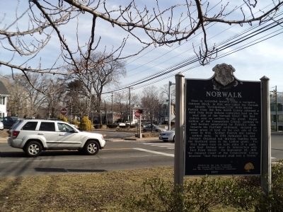
On E Wall Street at Park Street, on the right when traveling east on E Wall Street.
First in recorded history came a navigator, Adriaen Block, in 1614 who called the Norwalk Islands “Archipelago.” In 1640 Daniel Patrick from the New Haven Colony obtained a deed from local Indians conveying land on the west side of the . . . — — Map (db m53449) HM
On East Avenue, on the right when traveling north.
From the summit of this hill Maj. Gen. William Tryon witnessed the Burning of Norwalk by the British troops under his command during the engagement of July 11 & 12, 1779. --------------- Erected by Norwalk Chapter Daughters of the American . . . — — Map (db m53434) HM
On East Avenue at Park Street, on the right when traveling south on East Avenue.
This monument is erected as a tribute of honor to the Citizens of Norwalk, Conn. who devoted themselves to the cause of freedom in the service of our country during the Great World War, 1917 – 1919 and as a memorial to the men who made the . . . — — Map (db m53763) HM
On Pioneer Boulevard at Rosecrans Avenue, on the right when traveling south on Pioneer Boulevard.
Erected 1951-1954
by
Pacific Mutual Life Insurance Company
Logo showing a famous Giant Redwood view with a cutout for the road to go through.
"Giant of the Pacific"
1866
Undertaken in behalf of the company's half-million . . . — — Map (db m65827) HM
On Ponus Avenue at Nursery Street, on the right when traveling south on Ponus Avenue.
Like many small 18th and 19th century burial grounds, the Kellogg-Comstock Cemetery likely served the needs of a single family. The oldest marked grave dates to 1813 and most of the identified interments are related to Enos and Lydia Kellogg, . . . — — Map (db m226765) HM
On France Street at Adams Avenue, on the left when traveling north on France Street.
On this historic ground the American Patriots bravely sustained the cause of Liberty against the British Invaders July 12, 1779 ---------- Erected by the D.A.R. of Norwalk 1894. — — Map (db m53435) HM
Site of the Preston-Wickham Home, where pioneer Norwalk newspaper was published, 1836-65. Restored building, new Firelands Museum with historic collection, now on Case Avenue adjoining library. — — Map (db m147107) HM
Near White Street at Balmforth Avenue, on the right when traveling east.
Located opposite from where you’re standing stood the roundhouse and adjoining machine shop facility for the Danbury Yard. Built in circa 1914 the structure had 9 stalls for storage, servicing and performing light repairs to the many locomotives . . . — — Map (db m89546) HM
On Sunset Hill Avenue near East Avenue, on the right when traveling east.
This American Liberty Elm was named after “The Liberty Tree: Our Country’s first Symbol of Freedom.” On the morning of August 14, 1765, the people of Boston awakened to discover two effigies suspended from an elm tree in protest of the . . . — — Map (db m53918) HM
On West Main Street (Route 61) at Church Street, on the left when traveling west on West Main Street.
Paul Eugene Brown was born September 7, 1908, to Lester and Ida Belle Brown at their Norwalk home on 7 West Elm Street. He attended Benedict Elementary until his family moved to Massillon, where his football career began. Although small, Brown . . . — — Map (db m309256) HM
On Calf Pasture Beach Road, on the right when traveling north.
Norwalk’s first European settlers grazed their cattle on this property – hence the name “Calf Pasture.” Among these earliest arrivals was Matthew Marvin, who moved to Norwalk in 1651 (the year the town was founded). His son, Matthew Jr., bought a . . . — — Map (db m53465) HM
On Richardson Avenue at Roulette Farm Lane, on the left when traveling east on Richardson Avenue.
(Front): Ohio
8th Regiment Ohio Volunteer Infantry Lieut. Col. Franklin Sawyer 1st Brigade Gen. Nathan Kimball
3rd Division Gen. W. H. French 2nd Corps, Gen. Edwin V. Sumner Army of the Potomac On this field Ohio's sons sacrificed life . . . — — Map (db m5493) HM
On Calf Pasture Beach Road, on the right when traveling north.
Marvin Elementary School stands on the site of the former homestead of the Marvin-Taylor family, who lived in the 19-room farmhouse for more than 130 years. William Marvin, an ancestor of one of Norwalk’s earliest settlers, built the house in 1836 . . . — — Map (db m53468) HM
On Calf Pasture Beach Road, on the left when traveling east.
By the late 1800s, swimming (or “bathing” as it was known as then) had become an extremely popular recreational activity in America. In the 1910s, the American Red Cross and Young Men’s Christian Association (YMCA) responded to the alarming number . . . — — Map (db m53471) HM
On Calf Pasture Beach Road, on the right when traveling east.
In early July 1779, British General William Tryon led 2,600 British and Hessian soldiers on raids down the Connecticut shoreline to punish residents for their “ungenerous and wanton insurrection” against the Crown. They destroyed homes, provisions . . . — — Map (db m53442) HM
Near Sherwood Island Connector 1 mile south of Connecticut Turnpike (Interstate 95), on the right when traveling south.
Sanctuary
September 2011
by David Boyajian and Matt Rink
This sculpture was commissioned by the State of Connecticut in honor of the innocent lives lost during the September . . . — — Map (db m227354) WM
On Seaview Avenue at East Avenue, on the left when traveling south on Seaview Avenue.
The Mill Pond was created, probably in the 1700s, by diking a natural coastal inlet, save for a narrow channel that would power a mill wheel. Seaview Avenue and Veterans Park were later built on more landfill. Other businesses, most notably hat . . . — — Map (db m53482) HM
On Ceylon Road (Ohio Route 61) 0.5 miles south of Deehr Road, on the right when traveling north.
The gravel was carried out of Edison Woods to the Lake Shore Electric Trolley Line on Route 61. It was used to construct a trolley line from Ceylon to Norwalk.
From the 1890s to the 1930s electric-powered interurban trains or trolleys connected . . . — — Map (db m262295) HM
Near Mission Road (Provincial Highway 101) just east of Trans-Canada Highway (Provincial Highway 17), on the left when traveling north.
Joe Ball is one of Wawa's more colourful pioneers. Born in Michigan in 1864, Joe was one of many prospectors who found himself attracted to the lure of gold in the rugged hills around Wawa at the end of the 19th century. Joe worked as a caretaker . . . — — Map (db m218192) HM
On Main Street (Connecticut Route 35) at Branchville Road ( Route 102), on the right when traveling north on Main Street.
The First Recorded Plan for settlement was in 1697 when a group of Congregationalists primarily from Norwalk petitioned "to purchase of the Indians a certain tract of land lying about 14 miles northward of the town of Norwalk to settle a . . . — — Map (db m32048) HM
On Seaview Avenue at East Avenue, on the left when traveling south on Seaview Avenue.
In the past, the shallow and stagnant Mill Pond was not a good place for marine life. In 1996-97, the City of Norwalk undertook a $500,000 project to improve the aquatic habitat. Funds for the work came from the Connecticut Department of . . . — — Map (db m53485) HM
On Canfield Avenue, on the left when traveling east.
This 30-acre open space is what remains of the former Marvin-Taylor farm property, a spread that once was called “one of the fairest domains in Southern New England.” Descendants of one of Norwalk’s earliest residents, Matthew Marvin, first bought . . . — — Map (db m53466) HM
Near Florence Avenue 0.4 miles west of Norwalk Boulevard, on the right when traveling west.
Jesse & Lola Hathaway started to farm here in 1905. Lola was raised by her grandparents Martin & Mary Ann Koontz (near Telegraph Road & Norwalk Blvd.) They came to Fulton Wells (now Santa Fe Springs) in the 1860’s via the Oregon Trail in a covered . . . — — Map (db m125326) HM
On St. Paul’s Place, on the right when traveling west.
This Parish of St. Paul’s was founded in 1737 by a missionary priest sent to the colonies from London. The present church building is the fifth erected on this site. The second structure was destroyed by the British on July 11, 1779, when General . . . — — Map (db m53460) HM
On Gregory Boulevard at Marvin Street, in the median on Gregory Boulevard.
This stone, erected December, 1895, commemorates the purchase from the aboriginal inhabitants, made February 26, 1640-1, by Roger Ludlow, Deputy-Governor of the Colony of Connecticut, framer of its first Code of Laws, and Founder of Norwalk, of . . . — — Map (db m53440) HM
On Whittlesey Avenue (U.S. 250) just north of East Main Street (Ohio Route 61), on the right when traveling north.
First parking meters 1942 •
Citizens Banking Company 1884 •
Main Street Paved 1877 •
First Traffic Signals 1925 •
First Public Library 1905 •
Schine Movie Theatre 1941 •
First City Airport 1935 •
Platt Benedict, first settler 1817 • . . . — — Map (db m204631) HM
Near Kenya Avenue 0.3 miles east of Wisconsin Route 71.
Boom! Dynamite blasts echoed throughout this valley as workers excavated the tunnels. They used hand tools, horses, mules and oxen to remove the freed rock. All tunnels were dug from both ends, but this tunnel was so long that workers also dug . . . — — Map (db m203017) HM
Near Preston Avenue 0.1 miles north of Clearfield Drive, on the right when traveling north.
[ inscribed on the obelisk in the center of the pavilion ]
Dedicated To Those
Who Have Made
The Supreme
Sacrifice
Off. Milton Hodder Hamden 04/22/1943
Tpr./Trn. Stanley C. Heilberg C.S.P. 06/01/1929
Lt. Paul J. . . . — — Map (db m26504) HM
On St. Paul’s Place, on the right when traveling west.
This historic graveyard is one of the oldest in Norwalk. It predates the Revolutionary War and is the resting place of several patriots of the American Revolution. It is situated on the original grant of land given to the professors of the Church . . . — — Map (db m53461) HM
On Whittlesey Avenue (U.S. 250) just north of East Main Street (Ohio Route 61), on the right when traveling north.
First telephone installed 1877 •
First electric lighting 1887 •
Firelands Historical Society 1857 •
National City Bank 1881 •
Fair Publishing House 1880 •
Berry's Restaurant 1946 •
Norwalk Village incorporated 1828 •
Norwalk virus . . . — — Map (db m204630) HM
On Whittlesley Avenue (U.S. 250) just north of East Main Street (Ohio Route 61), on the right when traveling north.
Huron County Courthouse 1913 •
First train service 1853 •
First bank opens 1833 •
First motorized fire engine 1912 •
Fisher Titus Hospital 1957 •
Norwalk County seat 1818 •
Norwalk became a city 1881 •
Coach Paul Brown born 1908 — — Map (db m204629) HM
On West Main Street (Ohio Route 61) west of North Hester Street, on the right when traveling west.
Site of the Preston-Wickham Home where pioneer Norwalk Newspaper was published 1836-1865. Moved and restored 1956, the building is now the Firelands Museum with historical collection located on Case Avenue adjoining library. — — Map (db m309123) HM
On East McPherson Highway (U.S. 20) at East Maple Street ( Route 101), on the right when traveling east on East McPherson Highway.
James Birdseye McPherson was born in Hamer's Corners (now Clyde) on November 14, 1828. He left this house at age 13 to work in nearby Green Springs. He attended Norwalk Academy and West Point, where he graduated first in the class of 1853. Early in . . . — — Map (db m31737) HM
On Steinwehr Avenue (Business U.S. 15) at South Washington Street (Pennsylvania Route 134), on the right when traveling north on Steinwehr Avenue.
(Front):55th Ohio Infantry 2d Brig. 2d Div. 11th Corps. Erected by the State of Ohio. (Left):55th Ohio Infantry Arrived at 2:20 pm. July 1, in this position, which it held throughout the battle. With severe loss, its skirmishers . . . — — Map (db m12191) HM
On Main Street (State Highway 71) 0.5 miles west of Academy Street (State Highway 80/82), on the right when traveling west.
This 32 mile state trail was formerly the mainline of the Chicago and North Western Railway. The conversion from “rail to trail” represented a new concept in recreational development. Utilizing the abandoned railbed, it was the first . . . — — Map (db m18708) HM
Near White Street (County Highway P) north of South Railroad Street (State Highway 71), on the left when traveling north.
This 32 mile state trail was formerly the mainline of the Chicago and North Western Railway. The conversion from “rail to trail” represented a new concept in recreational development. Utilizing the abandoned railbed, it was the first trail of its . . . — — Map (db m18710) HM
On Danbury Road (U.S. 7) at Cricket Lane, on the left when traveling south on Danbury Road.
[ front ]
Wilton
Although this region was settled in 1651 as part of Norwalk, the first dwelling house here was built in 1706. The village of Wilton with parish privileges was granted by the general Assembly on May 12, 1726. The Town of . . . — — Map (db m32256) HM
Near Baker Street just south of Fulton Street, on the right when traveling south.
On September 25, 1886, the Order of the Native Daughters of the Golden West was organized
by Lily O. Reichling-Dyer in Jackson, California. The purpose of the Order is to perpetuate the
principles of love of home, devotion to the flag, . . . — — Map (db m231968) HM
On 10th Mountain Division Memorial Highway (U.S. 24) at Tennessee Pass Road, on the right when traveling north on 10th Mountain Division Memorial Highway.
After its stunning success in breaking through the Germans' Apennine defenses, the 10th was selected to spearhead the U.S. Fifth Army's huge 1945 spring offensive northward into the Po Valley, where it suffered its heaviest casualties of the war. . . . — — Map (db m289995) HM
On Main Street (Connecticut Route 124) 0 miles north of East Avenue ( Route 106), on the left when traveling north.
This region was established in 1731 as Canaan Parish, a separate ecclesiastical society of the Congregational Churches of Norwalk and Stamford. Incorporated as a town in 1801. New Canaan encompassed the area of Canaan Parish with additional land . . . — — Map (db m46878) HM
On Catoonah Street at Main Street ( Route 35), on the right when traveling east on Catoonah Street.
The Fire District in Ridgefield was organized in 1896 following the devastating fire of 1895. Ex-Governor Phineas Lounsbury was an early benefactor of the Department and the new engine company took his name. The firehouse is also the site of . . . — — Map (db m32050) HM
On Main Street at Prospect Street, on the right when traveling north on Main Street.
This town was founded in 1708 by a group of families from Norwalk who purchased twenty thousand acres from the Ramapoo Indians for one hundred pounds sterling. They were aided by John Copp, a surveyor, who explored the land now lying between High . . . — — Map (db m23409) HM
On Ethan Allen Highway (U.S. 7) at Branchville Road ( Route 102), on the right when traveling north on Ethan Allen Highway.
A Small Village began to emerge in the area in 1852 with the opening of the Danbury-and-Norwalk Railroad line. Stores, a hotel, a post office, a school and small industries in the area were establishes. The building that housed the Branchville . . . — — Map (db m31967) HM
On Main Street (Maryland Route 36) at Union Street, on the right when traveling north on Main Street.
In 1929, Grove opened "Lefty's Place"—a duckpin and ten-pin bowling alley and pool hall located diagonally from Lefty Grove Memorial Park, on Union Street. He operated the establishment, with help during the baseball season, until 1961. . . . — — Map (db m139842) HM
On Evaline Street at Falcon Avenue, on the left when traveling east on Evaline Street.
When John and Horace Dodge expanded their Hamtramck automotive factory in 1914, thousands of workers migrated to this area, creating the need for a local hospital. In 1927 the city built this Georgian Revival structure and opened it as Hamtramck . . . — — Map (db m137540) HM
On West William Street (U.S. 36) at South Sandusky Street, on the left when traveling west on West William Street.
1817 • Rutherford and Sophia Hayes move to Delaware from Dummerston, Vermont
July 1822 • Rutherford Hayes dies from a fever
October 4, 1822 • Rutherford Birchard Hayes is born in the family home at 17 East William Street
1823 • The Hayes . . . — — Map (db m239852) HM
Nicknamed “The Vallejo Express,” Dick Bass was the first junior ever to lead the NCAA in rushing, total offense, and scoring. Following injuries that forced him to miss most of the 1956 season and all of the 1957 season, Bass led the country in . . . — — Map (db m201775) HM
On Depot Place at South Street, on the right when traveling south on Depot Place.
The above photo depicts Bethel’s second train station that was completed in 1899 and provided passenger service until 1996 when a new station was constructed further north along the line. Bethel’s original train station occupied this same spot from . . . — — Map (db m48431) HM
Near Carter Street west of Hickory Drive, on the left when traveling west.
Revolutionary War, Soldier and Patriot
Jeremiah Beard Eells,
Lieutenant and Ensign - CT
Prisoner of War
Born 1 Dec. 1732 Norwalk, Fairfield Co. CT
Died 12 Nov. 1815 New Canaan, Fairfield Co., CT — — Map (db m312215) WM
On N Salem Road (Connecticut Route 116) at New Street, on the right when traveling south on N Salem Road.
The first surveyors came north from Norwalk to determine the suitability of the land for settlement as a plantation. Tradition says that they spent their first night on top of Settler’s Rock and that fires were built at its base to protect . . . — — Map (db m23420) HM
Left Panel Fort Couch was built as part of the emergency fortifications erected to defend Harrisburg and nearby bridges across the Susquehanna River during the 1863 invasion of Pennsylvania by Confederate forces. Fort Couch was built as an . . . — — Map (db m216436) HM
Near Mission Road (Provincial Highway 101) just east of Trans-Canada Highway (Provincial Highway 17), on the left when traveling north.
Mountains of Minerals The town of Wawa is surrounded by some of the world's oldest rock. These ancient Precambrian mountains were formed some 2.7 billion years ago. Within these mountains is a melting pot of minerals that have . . . — — Map (db m218199) HM
Near Old Post Road at Beach Road, on the right when traveling north.
Fairfield's prominence brought many important visitors to town, including President George Washington, who recorded his October 16, 1789 visit in his journal. The newly inaugurated president of the United States likely spent the night at Samuel . . . — — Map (db m203404) HM
On Main Street at Wooster Street, on the left when traveling north on Main Street.
Eight families came from Norwalk in 1685 to settle this area which the Indians called Pahquioque. They built their first homes a half mile south of here and made this green their common. The General Court in October 1687 decreed the . . . — — Map (db m250607) HM
On Main Street near Library Place, on the right when traveling south.
On March 1, 1852, the first train on the tracks of the Danbury & Norwalk Railroad pulled into the Main Street depot, located on the site of the present Post Office. The venture consisted of three locomotives, six passenger cars, twenty-four . . . — — Map (db m71184) HM
Near Connecticut Turnpike (Interstate 95) north of Tokeneke Road, on the right when traveling north.
Munson Hoyt, a Connecticut Loyalist, served in the Prince of Wales' American Regiment. This was his "redcoat."
Hoyt (sometimes spelled "Hayt") was born in Norwalk, CT. He wore this officer-s coat, made of red wool broadcloth, while he . . . — — Map (db m311651) HM
On River Road 0.3 miles south of East Mason Road, on the left when traveling south.
Camp Avery
1811 One-fourth mile southwest from the site on the brow of the hill overlooking the eastern bank of the Huron River, Gen. Simon Perkins, commanding the Ohio Militia, built the fortifications and block house of Camp Avery for protection . . . — — Map (db m41909) HM
On Ohio Route 13 near U.S. 250, on the right when traveling north.
Golden Age Nursing Home Fire
Located one mile north of Fitchville, the Golden Age Nursing Home caught fire and burned to the ground at 4:45 a.m., November 23, 1963, killing 63 of 84 patients. Fire departments from New London, Greenwich, . . . — — Map (db m97310) HM
On Settlement Road (County Road 129) at State Route 61, on the right when traveling west on Settlement Road.
On hand - hewn planks taken from floor beams over basement of original log home.
Engraving: James Herner of Monroeville, Ohio
Stonework: Richard Zimmerman of Norwalk, Ohio
Wood milled: David and Jean Martin of Monroeville, Ohio
Sign . . . — — Map (db m285093) HM
On South Broad Street (U.S. 62) at Newton Square Drive, on the right when traveling south on South Broad Street.
Side A:
On this site stood the home of Elisha and Polly Mygatt Whittlesey and their ten children. Also here was his law office and a records office that was moved in 1965 to Pioneer Village at the Canfield Fairgrounds. Already an attorney in . . . — — Map (db m65433) HM
Paul E. Brown, born September 7, 1908 in Norwalk, Ohio, and raised in Massillon, is a member of the Professional Football Hall of Fame and was one of the greatest coaches in the history of football at all levels. From 1932 until 1940, he led . . . — — Map (db m80725) HM
Near Randolph Avenue at Bahama Road, on the right when traveling east.
Our caboose is now in its 5th life. Originally built for the Wheeling & Lake Erie Railroad in 1948-49 (1st life), in its Ironville, Ohio, shop, it is 34 feet + 3 inches long and weighs 22.7 tons. A bright red caboose, long a trademark of . . . — — Map (db m302128) HM
On Greenmanville Avenue (Connecticut Route 27) south of Rossie Pentway, on the left when traveling north.
On July 24, 1992, at 3:30 PM, Dwight Collins, then 34, of Darien, CT, stepped ashore at Plymouth, England, after 40 days at sea in this 24-foot human-powered pedal boat Tango. Collins had departed St. John's, Newfoundland, Canada, on June . . . — — Map (db m227172) HM
On Kennedy Avenue at Main Street, on the left when traveling east on Kennedy Avenue.
The intersection of Main Street with White and Elm Streets, known as Wooster Square became an increasingly important section of town with the completion of the Danbury and Norwalk Railroad depot on Main Street in 1851.
As the main route . . . — — Map (db m72855) HM
Near Myrtle Avenue 0.1 miles north of Avery Place, on the right when traveling north.
Indigenous people frequented this area for thousands of years before the arrival of Europeans in the 17th century. In 1637, native Paugussets were driven away after the Great Swamp Fight between the larger Pequot tribe and European colonizers. In . . . — — Map (db m226768) HM
On Paul E Brown Drive Southeast east of Hess Boulevard Southeast, on the left when traveling east.
Born in Norwalk, Ohio on September 7, 1908, Paul Brown became the Head Coach at Massillon in 1932 at the age of 24. Coach Brown compiled an astonishing 80-8-2 record with six state and three national championships over his nine year career. To . . . — — Map (db m275107) HM
On Bailey Avenue at Main Street ( Route 35), on the left when traveling east on Bailey Avenue.
Welcome to Ridgefield's History Trail!
Ridgefield, Connecticut – 1708
The Fundamental Orders adopted by Connecticut in 1639 directed would-be settlers, able to support a minister, to establish a settlement, build a Congregational Church . . . — — Map (db m32234) HM
On Ethan Allen Highway (U.S. 7) at Branchville Road ( Route 102), on the right when traveling north on Ethan Allen Highway.
Welcome to Ridgefield's History Trail!
Ridgefield, Connecticut – 1708
The Fundamental Orders adopted by Connecticut in 1639 directed would-be settlers, able to support a minister, to establish a settlement, build a Congregational Church . . . — — Map (db m31997) HM
On Jesup Road at Taylor Place, on the right when traveling east on Jesup Road.
Jennings Trail
Jesup Green
Here stood the William H. Jessup House
Later owned by William Taylor.
On the river the Jessups built wharves
and warehouses in the late 18th
century where grain was stored awaiting
export by sail. The . . . — — Map (db m30645) HM
The Sleeping Giant began forming about two hundred million years ago, when molten magma welling up from deep belowground became trapped in an underground chamber on its way to the surface. As the magma in this chamber cooled and solidified, it . . . — — Map (db m295791) HM
On Sijan Avenue north of 32nd Street, on the right when traveling north.
On Elmendorf AFB, September 22, 1995 at 0747 hours
a Boeing E-3B Sentry AWACS from the 962nd Airborne
Air Control Squadron crashed shortly after takeoff
for a routine surveillance training sortie.
This memorial is dedicated in memory of . . . — — Map (db m254409) HM
On West Street at Foster Street, on the right when traveling west on West Street.
• First recorded census taken in 1756, Danbury’s population: 1,527.
• Danbury’s first mayor, elected in 1888, was Lewis LeGrand Hopkins.
• The first train arrived on the tracks of the Danbury & Norwalk Railroad on March 1, 1851.
• . . . — — Map (db m152995) HM
On Old Kings Highway North south of Pine Brook Lane, on the right when traveling north.
Telling the Story of Darien
Originally founded as the Darien Historical Society in 1953, the Museum of Darien is dedicated to telling the town's story.
Whether it's a 17th-century blanket chest, a hand-sewn Civil War-era flag, or an . . . — — Map (db m230984) HM
On Old Kings Highway North just east of Brookside Road, on the right when traveling west.
Darien's Roots
The Creation of Middlesex Parish
The origins of Darien can be traced to the challenges of a very long walk. In the 1730s residents living in the rural outskirts of Stamford's east end joined forces with their neighbors . . . — — Map (db m230980) HM
Near University Drive at Rye Beach Road (County Route 122).
The history of the Firelands is linked to the American Revolutionary
War. During the British raids of 1777 and 1779 the Connecticut
towns of Danbury, East Haven, New Haven, Fairfield, Norwalk,
Greenwich, Groton, Ridgefield and New London were . . . — — Map (db m150043) HM
Near Hayes Avenue (Ohio Route 4) at Cooke Street, on the right when traveling north.
The history of the Firelands is linked to the American Revolutionary
War. During the British raids of 1777 and 1779 the Connecticut
towns of Danbury, East Haven, New Haven, Fairfield, Norwalk,
Greenwich, Groton, Ridgefield and New London were . . . — — Map (db m182694) HM
On West Main Street (Ohio Route 61) at Newton Street, on the left when traveling west on West Main Street.
First building on this site 1836 Present building 1908 First burial 1820 (marker still intact) Caroline Tice, age 9 mos. “I am the first come here to lie, children and youth prepare to die.” — — Map (db m311000) HM
Near West Erie Avenue (U.S. 6) at Parkview Avenue.
Quincy Adams Gillmore, considered one of the greatest
military engineers and artillerists of the Civil War,
was born to Quartus Gillmore and Elizabeth Reid
Gillmore at this location in l825. He attended Norwalk
Academy and taught high school in . . . — — Map (db m143353) HM
On W. Maple Street, on the right when traveling east.
Travel in Northwest Ohio was not always as easy as it is today.
Once known as the Great Black Swamp, this area was almost
impassable. Early routes were simply logs laid down side-by-side
in the thick mud to form bone-jarring "corduroy roads". . . . — — Map (db m199770) HM
On April 19, 1989, a powder explosion occurred in Turret 2 while IOWA was conducting peace-time gunnery drills off the island of Viesques, Puerto Rico. Preparing to fire, the center gun's powder bags exploded before the breech was closed. The . . . — — Map (db m70263) HM
On County Road 17 at County Road Q, on the left when traveling north on County Road 17.
First Bell and New Foundation
The original church remained much like it had been constructed the first
eighteen years. In 1886 the church got its first bell at a cost of $319.51. The same
year a new concrete foundation was also . . . — — Map (db m172721) HM
On Brookside Drive at Garfield Avenue, on the left when traveling north on Brookside Drive.
The Lakeshore and Michigan Southern Railroad built the Olmsted Falls
Depot in 1876 as a part of major improvements made along the line
between Cleveland and Toledo. The depot replaced a smaller flag stop
station in Olmsted Falls at the Columbia . . . — — Map (db m134198) HM
Near Cooper Foster Park Road just west of North Main Street, on the right when traveling south.
Jacob Shupe, Amherst’s founder, settled atop this hill in 1811, soon constructing the first sawmill, gristmill, house, and distillery in this vicinity. Participant in first funeral, father of first native-born pioneer child, and first farmer in . . . — — Map (db m266427) HM
Thin black lines indicate changes in relevance. Between each pair of lines entries are ordered geographically but all have the same relevance.
* Inflectional forms of words are their plurals, singulars, and possessives as well as gramatical tenses and similar variations.