Near Meeting House Rd east of Heritage Ln (Local Route 151).
The Dwelling House or "Bell House" contained a kitchen, large community dining rooms, and retiring rooms (bedrooms). At the height of this community, 100 Shakers lived in the main building and the 'T' shaped wing. On its roof in a cupola, hung a . . . — — Map (db m115659) HM
On South Pearl Street (New York State Route 32) 0.1 miles south of Kenwood Road, on the right when traveling north.
This trail is a 9-mile pathway which follows the old Albany and Susquehanna Railroad between Albany and Voorheesville. This pathway connects visitors with landscapes and communities, including the dramatic Normanskill Gorge in the City of Albany, . . . — — Map (db m185899) HM
On Montgomery Street (parking lot), on the right when traveling south.
The original Quackenbush pumping sta.
engines pumped water from
Hudson River to reservoirs until
Dec. 1932. In Charge of Construction:
I.C. Chesbrough. Engineer; J.H. Mars,
Engineer For Pump Engine Constr.
1874
Designated as an Albany . . . — — Map (db m4190) HM
On Broadway at Ferry Street, on the right when traveling east on Broadway.
Built as the Boardman & Gray Piano Factory in 1853, it later became the Regent Shirt Factory, then the offices of the Brandow Printing Co. — — Map (db m115701) HM
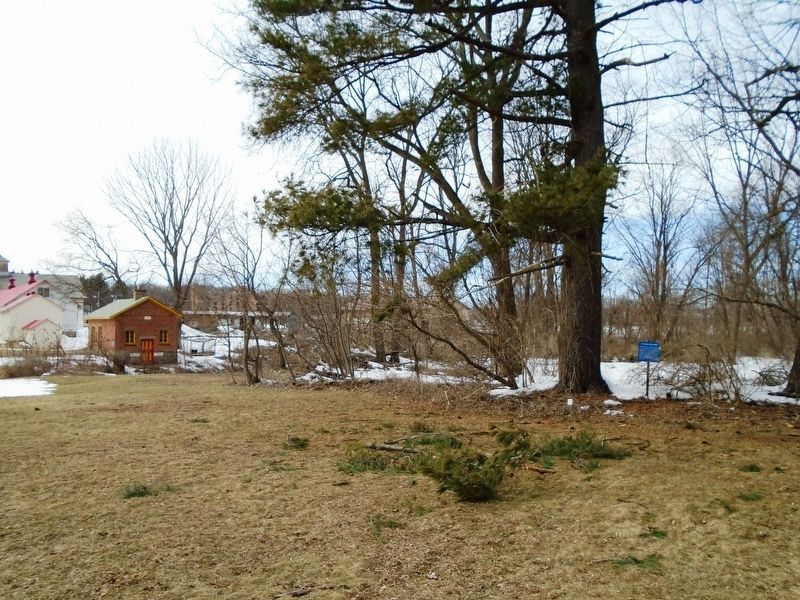
On Meeting House Road, on the left when traveling north.
The Brethren's Shop was used by the men and boys for various crafts including shoe making and tinsmithing. The porches and dormers were added in 1930 and the building is now used by Albany County as offices.
A date stone in the basement is . . . — — Map (db m115662) HM
The Shakers stored milk in the creamery to keep it cool. Milk was brought from the barn in large milk cans, which were then kept cool in troughs filled by water diverted from the creek. Later the building was used as a hen house; now it is used . . . — — Map (db m115688) HM
This brick building was used by the ministry elders. Each member of the ministry had to perform daily manual labor such as shoe making or tailoring. Elder Chauncey Copeley a cabinet maker, worked in a wing added to the building in 1850. . . . — — Map (db m115660) HM
Near New Karner Road (New York State Route 155) at Old State Road.
In 2014, the Albany Pine Bush was designated
a National Natural Landmark by the U.S.
Department of the Interior in recognition of
outstanding geological and biological features
including the largest area of inland sand dunes
in the eastern . . . — — Map (db m191105) HM
By 1920, automobiles had become both necessary and fashionable. The Shakers never hesitated to adopt new technology that would make life easier and more efficient. They built this concrete garage for their Packard automobilies [sic]. — — Map (db m115671) HM
The plants in this garden are some of the herbs used and sold by The Watervliet Shaker Community during the 1800's. The community grew large "Botanical/Physic" gardens and also gathered many wild herbs for use in their business of selling dried . . . — — Map (db m115658) HM
On Meeting House Road, on the right when traveling north.
This Meeting House, or Church, was built in 1848 to replace an earlier (1791) and much smaller Meeting House. It demonstrates many typical characteristics of Shaker architecture; double doors, one for men and one for women; a large meeting room . . . — — Map (db m115663) HM
On this location was a large 3 1/2 sto[r]y stone building. Here Shaker Sisters did spinning, weaving, and sewing. Journal entries indicate that Sister Polly wove 3350 Shaker bonnets in this building.
The building was the only stone building . . . — — Map (db m115656) HM
On Commerce Avenue, on the right when traveling west.
Site Of
The New York Central
Railroad erector shop where
Engine 999 was built in 1893.
'999' was the first creation
of man in the history of time
to Travel 100 Miles per Hour
— — Map (db m32251) HM
The Erie Canal.
This site marks the east
end of the canal, opened in
1825. It carried products
and people between the
Hudson River and Lake Erie
Albany Basin.
For nearly 100 years boats
entered the Erie Canal at
nearby Lock 1, . . . — — Map (db m5174) HM
On Meeting House Road, on the left when traveling east.
Shaker Creek provided water for both the canning and laundry operations. The first laundry, done on December 12, 1859, used a steam powered washing machine. Albany County used the building for laundry until the mid 1980s. Today it is a workshop. . . . — — Map (db m115674) HM
On Heritage Lane, 0.2 miles west of Airline Drive, on the right when traveling west.
This orchard was planted and tended by Shakers who now rest in the nearby cemetery. It shows up on an 1838 map of the Church Family, one of four Shaker villages established within a mile. Apples were an important food in the Shakers' diet. Apples . . . — — Map (db m248472) HM
On Heritage Lane at Airline Drive, on the right when traveling west on Heritage Lane.
The orderly arrangement and simple design of the stones in this cemetery reflect the communal lifestyle and egalitarian ideals of the Shakers buried here. What the stones don't reveal is the innovation, craftsmanship. and industriousness of the . . . — — Map (db m248457) HM
Near Ten Broeck Place north of Ten Broeck Street, on the left when traveling east.
Abraham Ten Broeck (1734-1810) built this grand mansion in the Federal style after the destruction of his family home on Broadway in the great fire of 1797.
Descended from one of Albany's founding New Netherland families, he was a businessman, . . . — — Map (db m139507) HM
"The face had an expression of absolute content, of relief, at throwing off a burden such as few men have been called upon to bear --- a burden which few men could have borne." - Recollections of New York Secretary of State Chauncey M. Depew. . . . — — Map (db m5192) HM
On Livingston Avenue, 0.1 miles east of Lark Street, on the right when traveling east.
Stephen Myers and his wife Harriet were the leaders of the Underground Railroad in Albany in the 1850s. Born enslaved in Rensselaer County, New York, in 1800, Stephen Myers was freed at age eighteen. By 1831 he and Harriet were assisting freedom . . . — — Map (db m144037) HM
On Livingston Avenue east of North Swan Street/Colonie Street, on the right when traveling east.
On this site, two generals of the Revolutionary War were interred. Major General Philip Schuyler and Brigadier General Abraham Ten Broeck, both natives of Albany.
General Philip Schuyler died in November of 1804 and was buried here following a . . . — — Map (db m139508) HM
George L. Fox, Methodist minister
Alexander D. Goode, Jewish Rabbi
Clark V. Poling, Dutch Reformed Minister
John P. Washington, Catholic Priest
During the early morning hours of February 3, 1943 the USAT Dorchester was part of a convoy of . . . — — Map (db m64989) HM WM
On Knox Street Mall/Henry Johnson Boulevard just south of Washington Park Road, in the median.
Soldiers and Sailors Memorial Commission of the City of Albany, New York Mayors Charles H. Gaus • Henry F. Snyder • James B. McEwan Commissioner of Public Works Wallace Greenalch Commissioners * John S. McEwan * John L. Newman • Peter Kinnear * . . . — — Map (db m144262) WM
On Knox Street Mall/Henry Johnson Boulevard just south of Washington Park Road, on the left when traveling south.
This straight path, sometimes known as the "Knox Street Mall", is the only portion of Washington Park that follows the pattern of the surrounding urban grid. It marks the west side of what was known as Middle or Washington Square.
This . . . — — Map (db m144256) HM
In commemoration of the three hundredth anniversary of the founding in 1624 of the first permanent settlement of Albany, then known as Fort Orange, near the site of Fort Nassau built in 1614 and abandoned in 1617. With the establishment of . . . — — Map (db m64993) HM
On Eagle Street at Corning Place, on the left when traveling south on Eagle Street.
Tablet commemorating the
Two Hundredth Anniversary
of
Albany
As a chartered city
Settled about 1624:
Charter Granted by Gov. Dongan:
July 22 1606:
State Legislature Held Here Permanently Since 1797:
Early Names Of The City: . . . — — Map (db m5560) HM
On South Swan Street, on the right when traveling east.
By his faith in God and man he built our nation
Erected in 1932 by the
New York State Commission
for the celebration of the
two hundredth anniversary of the birth of
George Washington
Hon. Franklin D. Roosevelt, Governor
Hon. . . . — — Map (db m8126) HM
On North Pearl Street (New York State Route 32) at State Street (New York State Route 5), on the right when traveling south on North Pearl Street.
The city of Albany is home to six National Historic Landmarks and more than 4,000 properties listed on the New York State and National Register of Historic Places.
In 2015, Albany was designated a Preserve America Community by President . . . — — Map (db m116698) HM
On Washington Avenue at Eagle Street on Washington Avenue.
Established in 1882, a hill on the site required the removal of 10,000 loads of sand and clay filling a gully on the north side of Elk Street where present houses were built.
Albany 300 - 1686-1986 - Still making History
Erected by Albany . . . — — Map (db m64997) HM
In Honor of the 200th Anniversary of the
1797 City of Albany 1997
Serving as the Capital City of the State of New York
For twenty years, after the establishment of the State of new . . . — — Map (db m5540) HM
After the English gained control of the Hudson Valley from the Dutch in 1674, they established a strong presence in the town they renamed Albany. Soldiers headquartered at Fort Frederick just above this intersection. They formed a masonic lodge in . . . — — Map (db m76382) HM
On State Street (New York State Route 5) at James Street, on the right when traveling west on State Street.
Upon this corner stood the house occupied by and wherein died Anneke Janse Bogardus 1663 The former owner of Trinity Church Property New York — — Map (db m147125) HM
Near North Pearl Street (New York State Route 32) south of Columbia Street, on the right when traveling north.
The City of Albany Salutes
B. Lodge & Co.
”Albany’s Oldest Store”
Established 1867
Presented by
Mayor Gerald D. Jennings
January 11, 1999
— — Map (db m116738) HM
On Washington Ave. (New York State Route 5) west of Eagle Street, on the right when traveling west.
Birthplace of
Modern Electricity
Here discovering magnetic
induction, Joseph Henry
pioneered the telegraph
and electric motor, 1829-31. — — Map (db m141459) HM
On Broadway just north of State Street (New York State Route 5), on the right when traveling north.
Early Albany, the Dutch village of Beverwijck, was filled with artisans — the people who built the community and made it livable and bustling with activity. By the late 1650s, among the thousand residents who called Beverwijck home, hard . . . — — Map (db m144029) HM
On Eagle Street at Corning Place, on the right when traveling east on Eagle Street.
Initiated by William Gorham Rice. Completed in 1927. Restored in 1986 celebrating Albany's Tricentennial of the Dongan Charter through the generous contributions of the citizens of Albany. — — Map (db m64992) HM
On Broadway (New York State Route 5) north of Hudson Avenue, on the right when traveling north.
The Declaration of Independence
Was first publicly read in
Albany by order of the
Committee of Safety
July 19, 1776 in front of this
City Hall, then on this site.
This memorial of the event
was placed here by the
citizens
. . . — — Map (db m116673) HM
Near Quay Street north of Broadway, on the right when traveling north.
While restoration progressed above the waterline, work below the waterline was delayed until such a time as the ship could be placed into drydock. The scope and cost of such a project meant that it would have to wait until the necessary funds were . . . — — Map (db m205900) HM
Albany's coomercial growth boomed after
the Erie Canal was completed
in 1825. From a small basin,
barges entered the river through a final lock.
Lining a mile of the canal above the basin was in
the Lumber District, where towering piles . . . — — Map (db m227414) HM
On State Street at Eagle Street, on the left when traveling east on State Street.
Fort Frederick Governor Edmund Andros Made an Inspection in Albany in 1676 and Found Fort Orange, Located Near the Foot of Madison Avenue in Poor Condition. He Ordered a New Fort Constructed at a Site in the Center of State Street Just West of Lodge . . . — — Map (db m5248) HM
On Eagle Street at Eagle Street and State Street, on the right on Eagle Street.
Facing The River On an Eminence in This Broad Street. Opposite St Peters Church Stood, Fort Frederick. Built About 1676. Removed 1789. Gallows Hill to the South. Fort Burial Ground, to the North. — — Map (db m5405) HM
On Broadway (New York State Route 5) at Frontage Road, on the left when traveling south on Broadway.
Mere yards ahead of you once stood Fort Orange, the first permanent Dutch settlement in North America.
The Dutch West India Company built Fort Orange at the most strategic crossroads in the region — at the head of the trail into Mohawk . . . — — Map (db m144034) HM
On Empire State Trail at Quay Street, on the right when traveling south on Empire State Trail.
Through this place passed
Gen. Henry Knox
in the winter of 1775-1776
to deliver to
Gen. George Washington
at Cambridge
the train of artillery
from Fort Ticonderoga
used to force the British
Army to evacuate Boston . . . — — Map (db m227122) HM
Philip Henry Sheridan, General United States Army. Born Albany NY. March 6th 1831, Died Nonquitt Mass. August 5th, 1888.
Erected by the citizens of Albany and the state of New York under chapter 100 of the laws of 1914. Commissioners: Governors . . . — — Map (db m95584) WM
On Empire State Trail at Quay Street, on the right when traveling south on Empire State Trail.
In charge of artillery for the Continental Army, Colonel Henry Knox was given the task to bring cannon captured from the forts in Crown Point and Ticonderoga to Boston. With ice barely able to support the weight of the sleds and cannons, Colonel . . . — — Map (db m227011) HM
On State Street (New York State Route 5) east of Eagle Street, on the right when traveling east.
This section of State Street is arguably the oldest continuously operating commercial avenue in the United States.
What began as a path in the woods cut by Native peoples and Dutch beaver trappers and traders became the main east-west . . . — — Map (db m116688) HM
Joseph Henry
Pathfinder in Science
Born in Albany
1797
Died in Washington
1878
[Left Panel]:
I arranged around one of the upper rooms in the Albany Academy a wire of more than a mile in length throvgh which I was enabled . . . — — Map (db m11749) HM
On Eagle Street at Corning Place, on the left when traveling north on Eagle Street.
Kilian Van Rensselaer the Progenitorof the Van Rensselaer family in America, a merchant of Amsterdam Holland, the original proprietor and first patroon of the Manor of Rensselaerwyck, under a grant from the Dutch government in 1629. In following . . . — — Map (db m116749) HM
Named in honor of the Marquis de LaFayette who commanded troops at Albany in 1778. Returned here in 1784 on his way to Fort Schuyler was entertained by the State of New York and the City of Albany during his visits in 1824-1825. — — Map (db m64999) HM
"I hold myself without mock modesty, the humblest of all individuals that have ever been elevated to the Presidency....You have generously tendered me the united support of the great Empire State." - Abraham Lincoln speaking to the New York . . . — — Map (db m5191) HM
On Empire State Trail at NY Bike Routes 9 & 5 on Empire State Trail.
In memory of Lou Rossi
1945-2020
NYSDOT Planner, lead founder of NYBC
Everyone in New York who loves bicycling
owes much to Lou Rossi. Smart and energetic,
he was the principal shaper of the state's
cycling infrastructure.
Two thousand . . . — — Map (db m227417) HM
On Eagle Street north of State Street (New York State Route 5), on the right when traveling north.
In 1885, American Architect and Building News named "The Best Ten Buildings in the United States."
Two of those selected were the New York State Capitol and Albany City Hall, before you and to your right. The Capitol was chosen . . . — — Map (db m116699) HM
When the USS Slater returned from Greece to dock at the Intrepid Sea, Air & Space Museum in New York City on August 27, 1993, the state of the ship was appalling.
The first goal was to survey the condition of the ship and develop a plan of action. . . . — — Map (db m49646) HM
In 1997, the management at the Intrepid Sea, Air & Space Museum made the decision to downsize and the SLATER was asked to find a new home. The ship was towed to Albany and arrived on October 27, 1997 to a crowd of well wishers. Here, a new . . . — — Map (db m49645) HM
The whole painstaking process of restoring the ship, acquiring the parts and installing the refurbished gear, has been driven by volunteers and would have never been possible without these dedicated individuals. The SLATER's wooden whale boat has . . . — — Map (db m49644) HM
On Broadway north of Steuben Street, on the left when traveling north.
In the dawn of American Railroads, the Mohawk and Hudson Line (1831), running between Albany and Schenectady, was one of the first built.
Juggling funding, inventions, public relations and sheer determination, this railroad evolved from a . . . — — Map (db m116703) HM
On Washington Avenue just north of Eagle Street, on the left when traveling south.
The New York State Organization National Society Daughters of the American Revolution honors the courage and valor of more than 41,000 patriot troops in the line. The levies and the militia from New York Colony and State who left their homes and . . . — — Map (db m64998) WM
On Broadway (New York State Route 5) north of Hudson Avenue, on the right when traveling north.
On the North-east Corner of Broadway then Court Street, and Hudson, then Spanish Street, stood the second City Hall, erected 1705, in which the famous Congress of 1754 “met and prepared a Union of the Several Colonies for Mutual Defense and . . . — — Map (db m116676) HM
On Broadway at Beaver Street, on the right when traveling south on Broadway.
On this site once stood the first Poor House in the United States.
Community care for the poor was an important feature of Dutch society, and it took root here in Albany as the city was settled in the first half of the 1600s.
. . . — — Map (db m116696) HM
Gen. Lafayette was received here 1824
The remains of President Lincoln and many other prominent men, lay in state here. The State Library was adjoining and with Capitol, demolished 1883. Fronting on this park stood Congress Hall, famous for its . . . — — Map (db m64990) HM
On State Street at South Pearl Street, on the right when traveling east on State Street.
Martin Van Buren
1782 - 1862
resided at 92 State Street
on this site
while serving as 9th Governor of
the State of New York 1828 - 1829
He is famed for his distinguished career as boy-lawyer, surrogate, judge, state senator, Attorney . . . — — Map (db m5439) HM
In the middle of State, formerly Yonkers Street, one block below, stood the First English Church, built A.D. 1715, upon ground granted by letters patent from King George the First. It bore the name of St. Peter's Church. The parish was incorporated . . . — — Map (db m76381) HM
On Broadway (New York State Route 5) north of Hudson Avenue, on the right when traveling north.
The grand building before you is home to the headquarters of The State University of New York (SUNY).
Founded in 1948, SUNY is the largest comprehensive system of public higher education in the United States. Among the system's 64 . . . — — Map (db m116667) HM
On Lodge Street at State Street (New York State Route 5), on the right when traveling north on Lodge Street.
Chartered
March 4, 1813
Held its first classes
in a frame building which
formerly stood upon this site
This tablet erected
June 3, 1938
during the Celebration of the
125th Anniversary of the
founding . . . — — Map (db m116745) HM
On Broadway at Maiden Lane, on the right when traveling north on Broadway.
Why is Albany Here?
Mohawk and Mahican peoples inhabited this region for thousands of years when the Dutch ship the Half Moon dropped anchor near this spot in 1609.
At that time, the world was in the midst of a "Little Ice . . . — — Map (db m116700) HM
On State Street (State Highway 5) just east of South Pearl Street (State Highway 32), on the right when traveling east.
Birth place of General Philip Schuyler and Elizabeth, his daughter, wife of Alexander Hamilton. Adjoining on the west was the famous “Lewis Tavern.” South Pearl St. formerly Washington St. was but twelve feet wide, having a gate at this . . . — — Map (db m147000) HM
Time: The Second World War, 1942
During the “dark days” of 1940, after the German conquest of France and prior to the U.S. involvement in World War II, England stood alone against the threat of Nazi world domination. An island nation, . . . — — Map (db m18188) HM
On Broadway just north of Steuben Street, on the right when traveling north.
Formerly Union Station Listed on The National Register of Historic Places Constructed 1898-1900 for New York Central & Hudson River Railroad Restored and renovated 1984-1986 by Norstar Bankcorp — — Map (db m149334) HM
Near Quay Street north of Broadway, on the right when traveling north.
USS Slater DE-766
Has been Designated a National Historic Landmark
This site possesses national significance in commemorating the history of the United States of America
Destroyer escorts defended vital - convoys during World War II. . . . — — Map (db m193737) HM
On Rapp Road at Stringsteen Road, on the left when traveling east on Rapp Road.
Rapp Road Community Historic District has been placed on the National Register of Historic Places in 2002 by the United States Department of the Interior. — — Map (db m152904) HM
On Eagle Street at Madison Avenue, on the right when traveling east on Eagle Street.
In 1835 the City appropriated $1,000 and citizens raised a fund to enclose it within an iron fence. A fountain, the first in the city, dedicated in 1863.
Albany 300
- 1686-1986 -
Still making History — — Map (db m65000) HM