By Jimmy Emerson, June 12, 2017
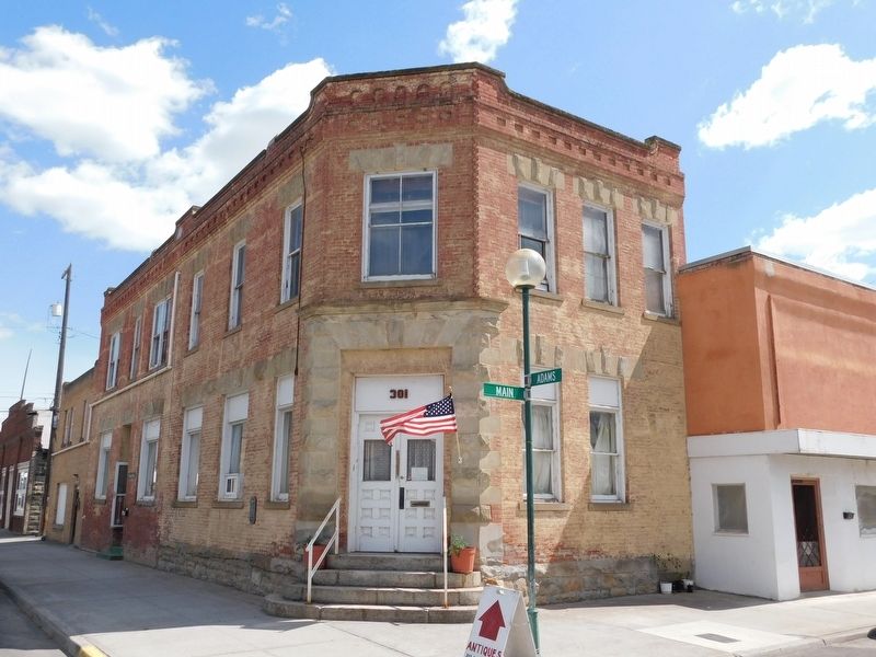
Adams County Bank
GEOGRAPHIC SORT Title Sort Marker Number Sort Marker Number Sort for Trails Publication Order Sort Publication Order Sort A Erected Year Sort Most Viewed Sort Most Recent-Interest Sort Most Recently Changed Sort SEE FAQ #33 FOR DESCRIPTIONS
On West Main Avenue at Adams Street on West Main Avenue.
On West Railroad Street at North Adams Street, on the right when traveling south on West Railroad Street.
On West Main Avenue at North Washington Street, on the right when traveling south on West Main Avenue.
On West Main Avenue at North Washington Street, on the left when traveling south on West Main Avenue.
On East Main Avenue at N Division Street, on the left when traveling east on East Main Avenue.
On West Main Avenue at North Adams Street, on the right when traveling south on West Main Avenue.
On East Main Avenue at North Division Street, on the left when traveling east on East Main Avenue.
On Washington Route 26 3.5 miles east of Route 261, on the left when traveling east.
On Main Street at N Tucannon Lane, on the left when traveling north on Main Street.
On 2nd Street east of Asotin Creek Road.
Near Silcott Road near U.S. 12.
Near Port Way at 9th Street, on the left when traveling east.
Near Port Way at 9th Street, on the left when traveling east.
On Port Way, on the left when traveling east.
Paid Advertisement
On Inland Empire Highway / Bridge Street (U.S. 12) 0.2 miles east of Elm Street, on the right when traveling east.
Near Silcott Road near U.S. 12.
Near Granite Lake Drive 0.2 miles east of 5th Street, on the left when traveling east.
Near Silcott Road near U.S. 12.
On U.S. 12 2.9 miles west of Westlake Drive, on the right when traveling east.
Near U.S. 12 0.1 miles east of Westlake Drive, on the right when traveling east. Reported missing.
Near 14th Street 0.1 miles south of Chris Avenue, on the left when traveling north.
Near State Highway 24 south of State Highway 243, on the right when traveling north.
On Cemetery Road 1 mile west of Travis Road, on the left when traveling west.
Near North Gum Street (Washington Route 397) 0.2 miles north of East Columbia Drive, on the right when traveling north.
On Thomas S. ‘Tom’ Foley Memorial Highway (U.S. 395) at West Hildebrand Boulevard, on the right when traveling west on Thomas S. ‘Tom’ Foley Memorial Highway.
On Columbia Park Trail 0.1 miles east of Route 240, on the right when traveling east.
On North Clover Island Drive 0.5 miles north of West Columbia Drive, on the left when traveling east.
On Paul Parish Drive at North Edison Street, on the right when traveling east on Paul Parish Drive.
On South Carmichael Drive at Vineyard Drive, in the median on South Carmichael Drive.
On Thomas S. ‘Tom’ Foley Memorial Highway (U.S. 395) at West Hildebrand Boulevard, on the right when traveling south on Thomas S. ‘Tom’ Foley Memorial Highway.
Paid Advertisement
On West Keewaydin Drive 0.1 miles South Auburn Street, on the left when traveling west.
On West Keewaydin Drive 0.1 miles west of South Auburn Street, on the left when traveling west.
Near South Olympia Street at W 14th Ave, on the right when traveling south.
On West Keewaydin Drive 0.1 miles west of South Auburn Street, on the left when traveling west.
Near West 10th Avenue at South Union Street, on the left when traveling west.
On South Union Street 0.1 miles north of West 24th Avenue, on the left when traveling north.
On Paul Parish Drive at Columbia River Way, on the left when traveling east on Paul Parish Drive.
On Columbia Park Trail 0.1 miles east of Route 240, on the right when traveling east.
Near North Clover Island Drive 0.4 miles north of West Columbia Drive, on the right when traveling east.
On North Gum Street (Washington Route 397) 0.2 miles north of East Columbia Drive.
On West Kennewick Avenue at South Auburn Street, on the left when traveling west on West Kennewick Avenue.
On West Kennewick Avenue at South Dayton Street, on the left when traveling west on West Kennewick Avenue.
On North Auburn Street at West Canal Drive, on the left when traveling north on North Auburn Street.
On McNary Road 1.8 miles east of Interstate I-82 when traveling east.
Near Plymouth Park Road near Christy Road. Reported unreadable.
Paid Advertisement
On Dudley Avenue east of Market Street, on the right when traveling east.
On 6th Street at Dudley Ave, on the left when traveling east on 6th Street.
On Meade Avenue 0.1 miles north of 6th Street, on the left when traveling north.
On 7th Street at Sheridan Avenue, on the left when traveling north on 7th Street.
On Grant Avenue at 10th Street, on the left when traveling north on Grant Avenue.
On Meade Avenue south of 6th Street, on the right when traveling north.
Near Crimson Way 0.2 miles south of University Drive, on the left when traveling south.
Near Columbia Park Trail 0.5 miles east of Columbia Center Boulevard, on the right when traveling east.
On Symons Street at Goethals Drive, on the right when traveling west on Symons Street.
On Harris Avenue 0.2 miles Newcomer Street, on the right when traveling north.
On Port of Benton Boulevard at Richardson Road, on the right when traveling north on Port of Benton Boulevard.
Near Columbia Park Trail 0.5 miles east of Columbia Center Boulevard, on the right when traveling east.
On Lee Boulevard at Amon Park Drive, on the right when traveling east on Lee Boulevard.
On Lee Boulevard 0.2 miles east of George Washington Way when traveling east.
Near Stevens Drive 0.3 miles north of Swift Boulevard, on the right when traveling north.
On Bradley Boulevard 0.3 miles north of Columbia Point Drive when traveling west.
Paid Advertisement
On Lee Boulevard 0.2 miles east of George Washington Way when traveling east.
On Lee Boulevard 0.2 miles east of George Washington Way when traveling east.
On Port of Benton Boulevard at 11th Street, on the left when traveling north on Port of Benton Boulevard.
Near Port of Benton Boulevard at Richardson Road, on the right when traveling north.
On Port of Benton Boulevard at Richardson Road, on the right when traveling north on Port of Benton Boulevard.
Near Bypass Highway (Washington Route 240) at Swift Boulevard, on the left when traveling north.
On West Van Giesen Street (Washington Route 224) 0.1 miles east of South 35th Avenue, on the right when traveling east.
Near Washington Route 225 1 mile west of Route 240, on the left when traveling south.
Near West Van Giesen Street (Washington Route 224) at Bombing Range Road, on the left when traveling west.
Near Crow Butte State Park Road 2 miles south of Route 14, on the right when traveling west.
Near Crow Butte State Park Road 2 miles south of Route 14, on the right when traveling west.
On Crow Butte State Park Road 2 miles south of Route 14, on the right when traveling west.
On Crow Butte State Park Road near Lewis & Clark Highway ( Route 14).
On Crow Butte State Park Road near Lewis & Clark Highway ( Highway 14).
On Eels Road near Mount Stuart Road, on the right when traveling east.
On East Woodin Avenue east of North Columbia Street, on the right when traveling east.
Paid Advertisement
On U.S. 97A 1 mile north of North Lakeshore Drive, on the left when traveling north.
On U.S. 2 at 9th Street, on the left when traveling west on U.S. 2.
Near U.S. 2 at Coulter Creek Road, on the right when traveling west.
On Golden West Drive south of Stehekin Valley Road, on the right when traveling south.
On South Wenatchee Avenue at Kittitas Street, on the right when traveling north on South Wenatchee Avenue.
On Orondo Avenue at Methow Street, on the left when traveling east on Orondo Avenue.
On South Mission Street (Washington Route 285) north of Yakima Street, on the right when traveling north.
On Marine Drive at Clark Road, on the right when traveling east on Marine Drive.
On North Forks Avenue (U.S. 101) at Tillicum Lane, on the right when traveling north on North Forks Avenue.
Near Upper Hoh Road 0.1 miles east of Linder Creek Lane, on the left when traveling east.
Near Upper Hoh Road 0.1 miles east of Linder Creek Lane, on the left when traveling east.
On North Forks Avenue (U.S. 101) south of Tillicum Lane, on the right when traveling north.
On North Forks Avenue (U.S. 101) south of Tillicum Lane, on the right when traveling north.
On North Forks Avenue (U.S. 101) just north of East Division Street, on the right when traveling north.
On Straight of Juan de Fuca Highway (State Highway 112) just east of Snow Creek Resort, on the right when traveling west.
On Upper Hoh Road 15.5 miles east of U.S. 101, on the right when traveling east.
Paid Advertisement
On Olympic Highway (U.S. 101) at Laird Road, on the right when traveling west on Olympic Highway.
On West Lauridsen Boulevard 0.2 miles east of S L Street, on the right when traveling west.
On South Lincoln Street at East 2nd Street, on the right when traveling north on South Lincoln Street.
On U.S. 101 just west of Deer Park Loop, on the right when traveling west.
On Lincoln Street (U.S. 101) at 4th Street, on the right when traveling north on Lincoln Street.
︽
1519 entries matched your criteria. The first 100 are listed above.
Next 100 ⊳