1852 entries match your criteria. Entries 201 through 300 are listed.⊲ Previous 100 — Next 100 ⊳
Entries Containing the Word «oregon»
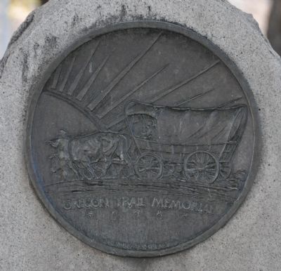
By Bryan R. Bauer, September 23, 2010
Oregon Trail Memorial Marker
RANKED BY RELEVANCE, THEN GEOGRAPHICALLY
| 201 ► Wyoming, Lincoln County, Kemmerer — Oregon Trail Memorial — |
| On J C Penney Drive at Pine Avenue (U.S. 189), on the right when traveling east on J C Penney Drive. | |||
| 202 ► Wyoming, Lincoln County, Smoot — Lander Cut-off of the Oregon Trail — |
| On U.S. 89. | |||
| 203 ► Wyoming, Lincoln County, Smoot — Lander Cut-off of the Oregon Trail — Stock Trail — |
| On U.S. 89 near Gomm's Pond Lane, on the right when traveling north. | |||
| 204 ► Wyoming, Natrona County, Alcova — Oregon Trail — |
| Near State Highway 220 at milepost 63 near Oregon Trail Road (County Route 319), on the right when traveling south. | |||
| 205 ► Wyoming, Natrona County, Alcova — The Oregon Trail — 1841 — |
| On Oregon Trail Road at Martin Cove Road, on the left when traveling west on Oregon Trail Road. | |||
| 206 ► Wyoming, Natrona County, Bessemer Bend — The Oregon Trail — 1841 — |
| On Jackson Canyon Road near Wyoming Route 220, on the left when traveling west. | |||
| 207 ► Wyoming, Natrona County, Casper — Oregon Trail — |
| On Fort Caspar Road, 0.1 miles west of South West Wyoming Boulevard (Wyoming Route 258), on the right when traveling west. | |||
| 208 ► Wyoming, Natrona County, Casper — Oregon/California/Mormon Trails — |
| Near Fort Caspar Road, 0.1 miles west of Wyoming Route 258, on the right when traveling west. | |||
| 209 ► Wyoming, Natrona County, Casper — Oregon-California Trail — C.H. King and Company — |
| On South Center Street at East 1st Steet, on the right when traveling north on South Center Street. | |||
| 210 ► Wyoming, Natrona County, Mills — Oregon Trail — |
| On Platte Avenue near 9th Street, on the right when traveling north. | |||
| 211 ► Wyoming, Platte County, Glendo — Oregon Trail — |
| On Esterbrook Ridge Road near Foy Road, on the right when traveling east. | |||
| 212 ► Wyoming, Platte County, Guernsey — Oregon Trail — |
| Near East Whalen Street (U.S. 26) near South Dakota Avenue, on the left when traveling west. | |||
| 213 ► Wyoming, Platte County, Guernsey — Oregon Trail — |
| On Wendover Road near Miller Road, on the right when traveling west. | |||
| 214 ► Wyoming, Platte County, Guernsey — Oregon Trail — |
| On Wendover Road at Cottonwood Road, on the right when traveling west on Wendover Road. | |||
| 215 ► Wyoming, Platte County, Guernsey — Oregon Trail Memorial — |
| Near S Guernsey Road, on the left when traveling south. | |||
| 216 ► Wyoming, Platte County, Guernsey — Oregon Trail Ruts — |
| Near Lucinda Rollins Road, on the right when traveling south. | |||
| 217 ► Wyoming, Platte County, Guernsey — Oregon Trail Ruts — Registered National Historic Landmark — |
| 218 ► Wyoming, Platte County, Guernsey — Oregon Trail Ruts State Historic Site — The Trail West — A Difficult Journey — |
| Near Lucinda Rollins Road near South Guernsey Road, on the left when traveling west. | |||
| 219 ► Wyoming, Platte County, Guernsey — The Oregon Trail — 1841 — |
| On U.S. 26, on the left when traveling east. | |||
| 220 ► Wyoming, Platte County, Guernsey — The United States Army and the Oregon Trail — |
| Near Lucinda Rollins Road near South Guernsey Road, on the left when traveling west. | |||
| 221 ► Wyoming, Platte County, Guernsey — The US Army’s Role in Protecting the Oregon Trail is Best Described by the Soldiers — |
| Near Lucinda Rollins Road near South Guernsey Road, on the left when traveling west. | |||
| 222 ► Wyoming, Sublette County, Boulder — Sand Springs - A Stop on the Oregon Trail — |
| On U.S. 191, 1.8 miles west of Wyoming Highway 351, on the right when traveling east. | |||
| 223 ► Wyoming, Sweetwater County, Green River — Oregon Trail Memorial — |
| On W. Flaming Gorge Way (State Highway 374) at Center Street, on the right when traveling west on W. Flaming Gorge Way. | |||
| 224 ► California, Modoc County, Davis Creek — Applegate Trail — Part of the Oregon Trail National Historic Trail System — |
| On FS 46N05A, on the right when traveling west. | |||
| 225 ► California, Modoc County, Davis Creek — Applegate Trail — A portion of the Oregon Trail National Historic Trail System — |
| On Crowder Flat Rd (Forest Road 73), on the right when traveling south. | |||
| 226 ► Idaho, Ada County, Boise — Bonneville Point — The Oregon Trail — |
| On State Highway 21 at East Lake Forest Drive, on the right when traveling east on State Highway 21. | |||
| 227 ► Idaho, Ada County, Boise — Ezra Meeker — The Oregon Trail — |
| On State Highway 21 at East Lake Forest Drive, on the right when traveling east on State Highway 21. | |||
| 228 ► Idaho, Ada County, Boise — Fort Boise — The Oregon Trail — |
| On State Highway 21 at East Lake Forest Drive, on the right when traveling east on State Highway 21. | |||
| 229 ► Idaho, Ada County, Boise — Idaho's Emigrant Trails — The Oregon Trail — |
| On State Highway 21 at East Lake Forest Drive, on the right when traveling east on State Highway 21. | |||
| 230 ► Idaho, Ada County, Boise — Kelton Road — The Oregon Trail — |
| On U.S. 21 at East Lake Forest Drive, on the right when traveling north on U.S. 21. | |||
| 231 ► Idaho, Caribou County, Soda Springs — General Patrick Edward Connor — Oregon Trail Memorial — 1863 — |
| On South Main Street at East 2nd South, on the left when traveling south on South Main Street. | |||
| 232 ► Idaho, Elmore County, Glenns Ferry — Over 500 Miles Step-by-Step — The Oregon Trail in Idaho — |
| Near Solobal Road near Rosevear Gulch Road. | |||
| 233 ► Idaho, Elmore County, Glenns Ferry — 1 — Site 1 ★ Two Island Crossing — Main Oregon Trail Back County Byway — |
| On West Madison Avenue near South Owyhee Street, on the left when traveling west. | |||
| 234 ► Idaho, Elmore County, Glenns Ferry — 3 — Site 3 ★ Hot Springs Creek — Main Oregon Trail Back County Byway — |
| On Hot Springs Road at Teapot Road/Ross Road, on the right when traveling west on Hot Springs Road. | |||
| 235 ► Idaho, Elmore County, Mountain Home — 4 — Site 4 ★ Hot Springs — Main Oregon Trail Back County Byway — |
| On Northeast Teapot Road near Worth Lee Road, on the right when traveling west. | |||
| 236 ► Idaho, Elmore County, Mountain Home — 5 — Site 5 ★ Rattlesnake Creek — Main Oregon Trail Back County Byway — |
| On U.S. 20 near Industrial Way. | |||
| 237 ► Idaho, Elmore County, Mountain Home — 6 — Site 6 ★ Kelton Road — Main Oregon Trail Back County Byway — |
| On Immigrant Road at Canyon Creek Road, on the right when traveling west on Immigrant Road. | |||
| 238 ► Idaho, Elmore County, Mountain Home — 7 — Site 7 ★ Canyon Creek — Main Oregon Trail Back County Byway — |
| On Canyon Creek/Mayfield Road near Memory Lane, on the right when traveling west. | |||
| 239 ► Illinois, Ogle County, Oregon — Lincoln Highway — City of Oregon — An Artist's Retreat — |
| On Washington Street (Illinois Route 64) just east of South 5th Street, on the left when traveling west. | |||
| 240 ► Kansas, Douglas County, Kanwaka — Coon Point — Oregon Trail — 1842 — |
| On U.S. 40 at E 600 Road (County Route 1029), on the right when traveling west on U.S. 40. | |||
| 241 ► Kansas, Johnson County, Gardner — A Look Back in Time — The Santa Fe, Oregon, and California trails once passed this way — |
| Near U.S. 56 at West 183rd Street, on the right when traveling west. | |||
| 242 ► Kansas, Johnson County, Gardner — A Look Back in Time — The Oregon and California trails were pathways for the greatest mass migration in American history — |
| Near U.S. 56 at West 183rd Street, on the right when traveling west. | |||
| 243 ► Maryland, Baltimore County, Cockeysville, Hunt Valley — Iron Ore Pit — The Oregon Mining Town, 1850 — |
| Near Kurtz Lane. | |||
| 244 ► Missouri, Jackson County, Independence — A Man of Means — Santa Fe, Oregon and California National Historic Trails — |
| On West College Street at North McCoy Street, on the right when traveling west on West College Street. | |||
| 245 ► Missouri, Jackson County, Independence — An Epicenter of International Commerce — Santa Fe, Oregon and California National Historic Trails — |
| On West College Street at North McCoy Street, on the right when traveling west on West College Street. | |||
| 246 ► Missouri, Jackson County, Independence — The Railroad Comes to Town! — Santa Fe, Oregon, and California National Historic Trails — |
| On West College Street at North McCoy Street, on the left when traveling east on West College Street. | |||
| 247 ► Missouri, Jackson County, Independence — Three Trails From Independence — Santa Fe, Oregon and California National Historic Trails — |
| On West College Street at North McCoy Street, on the left when traveling east on West College Street. | |||
| 248 ► Missouri, Jackson County, Independence — Trails to the East & West — Santa Fe, Oregon and California National Historic Trails — |
| On West College Street at North McCoy Street, on the right when traveling west on West College Street. | |||
| 249 ► Missouri, Jackson County, Kansas City, South Kansas City — People and the Trails — Santa Fe, Oregon and California National Historic Trails — |
| On East Red Bridge Road, on the right when traveling west. | |||
| 250 ► Missouri, Jackson County, Kansas City, South Kansas City — River Crossings and Red Bridges — Santa Fe, Oregon and California National Historic Trails — |
| On Red Bridge Road east of Minor Park North Entrance, on the right when traveling east. | |||
| 251 ► Missouri, Jackson County, Kansas City, South Kansas City — Trails Before Highways — Santa Fe, Oregon and California National Historic Trails — |
| On East Red Bridge Road east of East 110th Street, on the right when traveling east. | |||
| 252 ► Nebraska, Scotts Bluff County, Gering — Scotts Bluff — The Oregon Trail passed through here in the 1850’s |
| Near Old Oregon Trail, on the right when traveling west. Reported permanently removed. | |||
| 253 ► Nebraska, Scotts Bluff County, Gering — Scotts Bluff — Famous landmark on the Oregon Trail 1840-1860 |
| On Old Oregon Trail Road, on the right when traveling west. Reported permanently removed. | |||
| 254 ► Nebraska, Scotts Bluff County, Gering — The River Route — The Oregon and Mormon Trails paralleled the North Platte River — |
| Near Old Oregon Trail, on the right when traveling west. | |||
| 255 ► Nebraska, Scotts Bluff County, Gering — Traces of the Trail — The Oregon Trail passed here in the 1850’s |
| Near Old Oregon Trail, on the right when traveling west. Reported permanently removed. | |||
| 256 ► Oregon, Baker County, Baker City — Baker — Historic Oregon Trail — |
| Near Campbell Street near Sunridge Lane, on the right when traveling west. | |||
| 257 ► Oregon, Baker County, Baker City — J.C. Penney Building — Historic Oregon Trail — Established 1874 — |
| On Main Street near Valley Avenue, on the left when traveling north. | |||
| 258 ► Oregon, Baker County, Baker City — Old Post Office — Historic Oregon Trail — Established 1874 — |
| On Dewey Avenue (Oregon Route 7) near Auburn Avenue, on the right when traveling north. | |||
| 259 ► Oregon, Baker County, Durkee — Durkee — Historic Oregon Trail — |
| On Old U.S. 30 at Oxman Ranch Road, on the left when traveling west on Old U.S. 30. | |||
| 260 ► Oregon, Baker County, Huntington — Farewell Bend — Historic Oregon Trail — |
| Near Oregon Trail Boulevard (Business U.S. 30) near Frontage Road, on the right when traveling north. | |||
| 261 ► Oregon, Baker County, Sumpter — Site of Bank of Sumpter — Sumpter, Oregon — |
| On Mill Street (County Route 410) near Sumpter Street, on the right when traveling north. | |||
| 262 ► Oregon, Benton County, Corvallis — Alice E. Biddle — First Woman Graduate of Oregon State University — |
| 263 ► Oregon, Benton County, Corvallis — Avery Park Applegate Trail Kiosk — Southern Route to Oregon — |
| On SW Avery Park Drive, on the left when traveling east. | |||
| 264 ► Oregon, Benton County, Monroe — The Applegate Trail — Southern Route to Oregon — |
| On Pacific Hwy (U.S. 99) at Main Street, on the right when traveling south on Pacific Hwy. | |||
| 265 ► Oregon, Clackamas County, Government Camp — A Final Rest — For One Pioneer Woman, the Oregon Trail Ended Here — |
| Near Mt. Hood Highway (Oregon Route 35), on the right when traveling east. | |||
| 266 ► Oregon, Clackamas County, Oregon City — Clackamas Chinook — An Artist Encounter With the First Peoples of the Oregon City Area — |
| Near Washington Street near Abernethy Road, on the right when traveling north. | |||
| 267 ► Oregon, Clackamas County, Oregon City — Dr. John McLoughlin — Father of Oregon — |
| Near Washington Street near Abernethy Road, on the right when traveling north. | |||
| 268 ► Oregon, Clackamas County, Oregon City — Dr. John McLoughlin — "Father of Oregon" — |
| On McLoughlin Boulevard (Oregon Route 99) at S. 2nd Street, on the right when traveling south on McLoughlin Boulevard. | |||
| 269 ► Oregon, Clackamas County, Oregon City — Gardens — Living History of the Oregon Trail — |
| Near Washington Street near Abernethy Road, on the right when traveling north. | |||
| 270 ► Oregon, Clackamas County, Rhododendron — Laurel Hill — Historic Oregon Trail. — |
| On Mt. Hood Highway (U.S. 26), on the left when traveling west. | |||
| 271 ► Oregon, Clackamas County, West Linn — M16 — George Abernethy — Oregon History — |
| On Northbound Rest Area (Interstate 205), on the right when traveling north. | |||
| 272 ► Oregon, Clackamas County, West Linn — M14 — Willamette Falls — Oregon History — |
| On Northbound Rest Area (Interstate 205), on the right when traveling north. | |||
| 273 ► Oregon, Clackamas County, West Linn — M13 — Willamette Falls Locks — Oregon History — |
| On Northbound Rest Area (Interstate 205), on the right when traveling north. | |||
| 274 ► Oregon, Clackamas County, Wilsonville — Grove of the States — Oregon Heritage Tree Site — |
| 275 ► Oregon, Clatsop County, Astoria — Captain Flavel Trees — Oregon Heritage Tree Program — |
| On 7th Street south of Duane Street, on the left when traveling south. | |||
| 276 ► Oregon, Columbia County, Deer Island — M1 — Deer Island — Oregon History |
| On Columbia River Highway (U.S. 30) near North Buck Way, on the right when traveling north. Reported missing. | |||
| 277 ► Oregon, Columbia County, Scappoose — Thomas McKay — Oregon History — |
| On Columbia River Highway (U.S. 30) at SW Old Portland Road, on the left when traveling north on Columbia River Highway. | |||
| 278 ► Oregon, Deschutes County, Millican — Prehistoric River — Oregon Geology — |
| On Central Oregon Highway (U.S. 20) near Spencer Wells Road (County Route 23), on the left when traveling east. | |||
| 279 ► Oregon, Douglas County, Oakland — Applegate Trail - Oakland — Southern Route to Oregon — |
| On NE 1st Street at SE Maple Street, on the left when traveling north on NE 1st Street. | |||
| 280 ► Oregon, Douglas County, Reedsport — Brandy Bar — Oregon History — |
| On Umpqua Highway (Oregon Route 38) 4 miles west of Loon Lake Road, on the right when traveling west. | |||
| 281 ► Oregon, Douglas County, Scottsburg — Scottsburg — Oregon History — |
| On Umpqua Highway (Oregon Route 38) at Main Street, on the left when traveling west on Umpqua Highway. | |||
| 282 ► Oregon, Harney County, Burns — Fort Harney — Oregon History — |
| On U.S. 20 at South Harney Road on U.S. 20. | |||
| 283 ► Oregon, Harney County, Burns — The Terrible Trail — Oregon History — |
| On U.S. 20 at South Harney Road, on the right when traveling east on U.S. 20. | |||
| 284 ► Oregon, Jackson County, Ashland — Ashland, OR — California & Oregon Linked At Last — |
| Near 9th Street Alley. | |||
| 285 ► Oregon, Jackson County, Jacksonville — China Quarter — Jacksonville, Oregon 1865 — |
| On West Main Street. | |||
| 286 ► Oregon, Jackson County, Jacksonville — Methodist Episcopal Church — Jacksonville, Oregon — |
| On North 5th Street at East D Street, on the left when traveling north on North 5th Street. | |||
| 287 ► Oregon, Jefferson County, Terrebonne — Peter Skene Ogden — Oregon History — |
| Near U.S. 97, 0.4 miles south of SW Culver Highway, on the left when traveling north. | |||
| 288 ► Oregon, Jefferson County, Warm Springs — Indian Trails — Oregon History — |
| On Northwest North Springs Highway (U.S. 26). | |||
| 289 ► Oregon, Josephine County, Grants Pass — The 1846 Applegate Trail — Southern Route to Oregon — |
| Near Interstate 5 at milepost 62 near Merlin Road, on the right when traveling north. | |||
| 290 ► Oregon, Josephine County, Wolf Creek — Canyon Creek — Oregon History — |
| On I-5 Frontage Road at Ritchie Road, on the right when traveling north on I-5 Frontage Road. | |||
| 291 ► Oregon, Josephine County, Wolf Creek — The Applegate Trail — Southern Route to Oregon — |
| On Sunny Valley Loop north of Interstate 5, on the left when traveling north. | |||
| 292 ► Oregon, Josephine County, Wolf Creek — The Applegate Trail — Southern Route to Oregon — |
| On Old State Highway 99 South at Front Street, on the left when traveling north on Old State Highway 99 South. | |||
| 293 ► Oregon, Klamath County, Bly — Balloon Bomb — Oregon History — |
| On Klamath Falls-Lakeview Hwy (Oregon Route 140). | |||
| 294 ► Oregon, Klamath County, Keno — The Applegate Trail — Southern Route to Oregon — |
| 295 ► Oregon, Klamath County, Merrill — The Applegate Trail — Southern Route to Oregon — |
| On Malone Rd, on the right when traveling south. | |||
| 296 ► Oregon, Lake County, Fort Rock — Fort Rock — Oregon Geology and History — |
| On Oregon Route 31 south of Old Fort Rock Road, on the left when traveling south. | |||
| 297 ► Oregon, Lake County, Lakeview — Abert Rim — Oregon Geology — |
| On Fremont Hwy (U.S. 395), on the right when traveling south. | |||
| 298 ► Oregon, Lake County, New Pine Creek — The Applegate Trail — Southern Route to Oregon — Goose Lake Recreation Site — |
| On State Line Road, on the right when traveling west. | |||
| 299 ► Oregon, Lane County, Eugene — The Applegate Trail — Southern Route to Oregon — |
| On Cheshire Ave at N Lincoln St, on the right when traveling west on Cheshire Ave. | |||
| 300 ► Oregon, Lane County, Pleasant Hill — Bristow Monument — Oregon History — |
| On Oregon Route 58 south of Edenvale Road, on the left when traveling north. | |||
1852 entries matched your criteria. Entries 201 through 300 are listed above. ⊲ Previous 100 — Next 100 ⊳
* Inflectional forms of words are their plurals, singulars, and possessives as well as gramatical tenses and similar variations.