546 entries match your criteria. The first 100 are listed. ⊳
Historical Markers and War Memorials
in Silicon Valley Region
By Barry Swackhamer, March 18, 2015
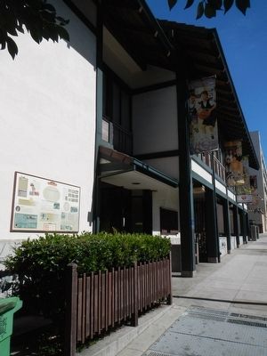
A New Ballgame Marker
1 ► California, San Francisco City and County, San Francisco, Japantown — 12 — A New Ballgame — San Francisco Japantown History Walk —  |
| On Sutter Street near Webster Street, on the left when traveling east. | |||
| 2 ► California, San Mateo County, Menlo Park — Early People of the Creek — |
| On Alma Street south of East Creek Drive when traveling east. | |||
| 3 ► California, San Mateo County, Menlo Park — 955 — Menlo Park Railroad Station — |
| On Merrill Avenue, on the right when traveling north. | |||
| 4 ► California, San Mateo County, Menlo Park — 2 — Portola Journey's End — November 6-10, 1769 — |
| On Alma Street at East Creek Drive on Alma Street. | |||
| 5 ► California, San Mateo County, Menlo Park — San Francisquito Creek Watershed — 1891 to World War II — |
| Near Alma Street near Palo Alto Avenue. | |||
| 6 ► California, San Mateo County, Menlo Park — San Francisquito Creek Watershed — World War II to Century 21 — |
| Near Alma Street near Palo Alto Avenue. | |||
| 7 ► California, San Mateo County, Menlo Park, Sharon Heights — St. Denis Church and Cemetery — |
| On Sand Hill Road at Sand Hill Circle, on the left when traveling west on Sand Hill Road. | |||
| 8 ► California, San Mateo County, Portola Valley — 825 — Casa de Tableta — |
| On Arastradero Road at Arastradero, on the right when traveling east on Arastradero Road. | |||
| 9 ► California, San Mateo County, Portola Valley — Hallidie Tramway — |
| On Portola Road, on the right when traveling south. | |||
| 10 ► California, San Mateo County, Portola Valley — 909 — Our Lady of the Wayside — |
| On Portola Road, on the right when traveling north. | |||
| 11 ► California, San Mateo County, Portola Valley — SMA-025 — Portola Primary School — |
| On Portola Road, on the left when traveling north. | |||
| 12 ► California, San Mateo County, Redwood City — 2 — "Old" San Mateo County Courthouse — |
| On Broadway Street near Hamilton Street. | |||
| 13 ► California, San Mateo County, Redwood City — A Feat of Gravity — The Hetch Hetchy Regional Water System — |
| Near California 35. | |||
| 14 ► California, San Mateo County, Redwood City — A. C. Argo — |
| Near Brewster Avenue, on the right when traveling east. | |||
| 15 ► California, San Mateo County, Redwood City — Airfield — 1916-1939 — Stanford | Redwood City — |
| On Broadway near Warrington Avenue, on the right when traveling east. | |||
| 16 ► California, San Mateo County, Redwood City — Al Terremere — 1930-1951 — |
| Near El Camino Real near Brewster Avenue. | |||
| 17 ► California, San Mateo County, Redwood City — Alhambra Theater — |
| On Main Street south of Broadway Street, on the left when traveling south. | |||
| 18 ► California, San Mateo County, Redwood City — Alta California — 1795-1848 — |
| Near Broadway near Warrington Avenue. | |||
| 19 ► California, San Mateo County, Redwood City — Ampex Years — 1954-2005 — Stanford | Redwood City — |
| On Broadway near Warrington Avenue, on the right when traveling east. | |||
| 20 ► California, San Mateo County, Redwood City — California Square — |
| On Marshall Street at Hamilton Street, on the left when traveling east on Marshall Street. | |||
| 21 ► California, San Mateo County, Redwood City — California Square — The Path of History |
| On Hamilton Street at Marshall Street on Hamilton Street. Reported unreadable. | |||
| 22 ► California, San Mateo County, Redwood City — Carrington Hall — Named in Honor of Otis M. Carrington — (1884 – 1964) — |
| Near Brewster Avenue, on the right when traveling east. | |||
| 23 ► California, San Mateo County, Redwood City — Diller-Chamberlain General Store / American Hotel/House / Sequoia Hotel / Bank of San Mateo County — (Quong Lee Laundry) / — Redwood City - Path of History — |
| On Broadway near Main Street. | |||
| 24 ► California, San Mateo County, Redwood City — Diller's Island — |
| On Middlefield Road 0.5 miles Woodside Road (California Route 84), on the left when traveling west. | |||
| 25 ► California, San Mateo County, Redwood City — Embarcadero Turning Basin Site — This is the site of the beginning of Redwood City! — The Path of History — |
| On Broadway east of Jefferson Avenue, on the right when traveling east. | |||
| 26 ► California, San Mateo County, Redwood City — Eureka Corner — |
| On Main Street near Broadway Street, on the right when traveling south. | |||
| 27 ► California, San Mateo County, Redwood City — Fire Station No. 1 — |
| On Middlefield Road 0.5 miles west of Woodside Road (California Route 84), on the left when traveling west. | |||
| 28 ► California, San Mateo County, Redwood City — GYP 136-07 — Fire Station No. 1 — |
| On Middlefield Road, on the right when traveling south. | |||
| 29 ► California, San Mateo County, Redwood City — First Fire House — 1862 - 1869 — |
| On Marshall Street near Main Street, on the right when traveling west. | |||
| 30 ► California, San Mateo County, Redwood City — Former Site of Sequoia High School — The Path of History — |
| On Broadway at Theater Way, on the right when traveling east on Broadway. | |||
| 31 ► California, San Mateo County, Redwood City — Fox Theater — |
| On Broadway west of Middlefield Road, on the right when traveling east. | |||
| 32 ► California, San Mateo County, Redwood City — 92 — Gaspar de Portolá Expedition Campsite — |
| On Cañada Road 0.2 miles south of Edgewood Road, on the right when traveling south. | |||
| 33 ► California, San Mateo County, Redwood City — Grand Army of the Republic — The Historic Union Cemetery — Redwood City, CA — |
| Near Woodside Road (California Route 84) north of Hess Road, on the right when traveling south. | |||
| 34 ► California, San Mateo County, Redwood City — Grand Army of the Republic Memorial — |
| Near Woodside Road. | |||
| 35 ► California, San Mateo County, Redwood City — Historic Connection — 1905 and on — Stanford | Redwood City — |
| On Broadway near Warrington Avenue, on the right when traveling east. | |||
| 36 ► California, San Mateo County, Redwood City — Horticultural Heritage — 1898-1916 — Stanford | Redwood City — |
| Near Broadway near Warrington Avenue. | |||
| 37 ► California, San Mateo County, Redwood City — In Memoriam George Edgar Filkins — |
| Near Woodside Road. | |||
| 38 ► California, San Mateo County, Redwood City — Lathrop House — |
| On Hamilton Street, on the right when traveling north. | |||
| 39 ► California, San Mateo County, Redwood City — Lathrop-Connor-Mansfield House — The Path of History — |
| On Marshall Street, on the right when traveling east. | |||
| 40 ► California, San Mateo County, Redwood City — Methusela — |
| On Skyline Boulevard (California Route 35 at milepost 14), on the right when traveling north. | |||
| 41 ► California, San Mateo County, Redwood City — Mezes Park — |
| On Warren Street near Standish Street, on the right when traveling north. | |||
| 42 ► California, San Mateo County, Redwood City — Mezesville — 1850-1900 — Stanford | Redwood City — |
| Near Broadway near Warrington Avenue. | |||
| 43 ► California, San Mateo County, Redwood City — Native Americans — Stanford | Redwood City — |
| On Broadway near Warrington Avenue, on the left when traveling west. | |||
| 44 ► California, San Mateo County, Redwood City — New Sequoia/Fox Theatre — Former site of the Central Grammar School — The Path of History — |
| On Broadway Street west of Jefferson Avenue, on the right when traveling east. | |||
| 45 ► California, San Mateo County, Redwood City — Officer Eugene A. Doran — August 8, 1922 - August 5, 1959 — |
| On Skyline Boulevard (California Route 35), on the right when traveling south. | |||
| 46 ► California, San Mateo County, Redwood City — Old San Mateo County Courthouse — The Path of History — |
| On Broadway Street, on the right when traveling east. | |||
| 47 ► California, San Mateo County, Redwood City — Pleistocene Period — 2.6 Million - 11,700 Years Ago — Stanford | Redwood City — |
| On Broadway near Warrington Avenue, on the left when traveling west. | |||
| 48 ► California, San Mateo County, Redwood City — Ralph D. Percival Memorial — Vista Point — |
| Near Junipero Serra Freeway (Interstate 280) 2 miles north of Edgewood Road. | |||
| 49 ► California, San Mateo County, Redwood City — Redwood City Arch — |
| On Broadway east of California Street, on the right when traveling east. | |||
| 50 ► California, San Mateo County, Redwood City — GPY 135-4 — Redwood City Fire Department — 150th Anniversary — |
| On Marshall Street, on the right when traveling west. | |||
| 51 ► California, San Mateo County, Redwood City — GPY 140-09 — Redwood City Sesquicentennial — |
| On Warren Street near Howland Street, on the right when traveling west. | |||
| 52 ► California, San Mateo County, Redwood City — Redwood City War Memorial — |
| Near Middlefield Road. | |||
| 53 ► California, San Mateo County, Redwood City — Redwood City Woman’s Club — Established 1909 — |
| On Clinton Street north of Broadway, on the right when traveling north. | |||
| 54 ► California, San Mateo County, Redwood City — S.M. Mezes — |
| On Allerton Street. | |||
| 55 ► California, San Mateo County, Redwood City — Sequoia Union High School — |
| On Broadway Street at Middlefield Road, on the right when traveling east on Broadway Street. | |||
| 56 ► California, San Mateo County, Redwood City — Sequoia Veterans Memorial — |
| Near Brewster Avenue at Broadway Street. | |||
| 57 ► California, San Mateo County, Redwood City — Solari Family Windmill — |
| Near Woodside Road, on the right when traveling west. | |||
| 58 ► California, San Mateo County, Redwood City — Solari Windmill — |
| On Woodside Road (California Route 84). | |||
| 59 ► California, San Mateo County, Redwood City — Soledad O. de Arguello — 1897 - 1874 — |
| Near Broadway Street, on the right when traveling east. | |||
| 60 ► California, San Mateo County, Redwood City — Stage Station — |
| On Main Street, on the left when traveling south. | |||
| 61 ► California, San Mateo County, Redwood City — The Path of History — Redwood City Walking Tour — |
| On Broadway, on the right when traveling west. | |||
| 62 ► California, San Mateo County, Redwood City — 3 — The Pioneer Store — Diller-Chamberlain Store — Historic Trail Site #3 — |
| On Main Street near Broadway Street. | |||
| 63 ► California, San Mateo County, Redwood City — 816 — Union Cemetery — |
| On Woodside Road (California Route 84) 0.5 miles west of El Camino Real ( Route 82), on the right when traveling west. | |||
| 64 ► California, San Mateo County, Woodside — A Monument to Water — |
| Near Cañada Road near Edgewood Road, on the right when traveling east. | |||
| 65 ► California, San Mateo County, Woodside — 907 — Filoli — Fight – Love – Live — |
| Near Canada Road. | |||
| 66 ► California, San Mateo County, Woodside — 478 — First Saw Mill — |
| On Portola Road 0.2 miles east of Woodside Road (SR84), on the left when traveling east. | |||
| 67 ► California, San Mateo County, Woodside — Folger Stable c.1905 — Folger Estate Stable Historic District — |
| Near Woodside Road, on the right when traveling west. | |||
| 68 ► California, San Mateo County, Woodside — In Memoriam The Aircraft "Resolution" — |
| Near Skyline Boulevard (California Route 35). | |||
| 69 ► California, San Mateo County, Woodside — Independence Hall — |
| Near Woodside Road. | |||
| 70 ► California, San Mateo County, Woodside — Pioneer Hotel — |
| On Woodside Road (California Route 84), on the left when traveling west. | |||
| 71 ► California, San Mateo County, Woodside — The Chinese Walls — at Folger Estate Stable — |
| Near Woodside Road, on the right when traveling south. | |||
| 72 ► California, San Mateo County, Woodside — 474 — Town of Searsville — |
| On Sand Hill Road at Portola Road, on the left when traveling east on Sand Hill Road. | |||
| 73 ► California, San Mateo County, Woodside — Town of West Union — 1853 ~ 1910 — |
| On Cañada Road 0.2 miles south of Edgewood Road, on the right when traveling south. | |||
| 74 ► California, San Mateo County, Woodside — 93 — Woodside Store — |
| On Tripp Road, on the left when traveling north. | |||
| 75 ► California, Santa Clara County, Alviso — Alviso — |
| Near Hope Street. | |||
| 76 ► California, Santa Clara County, Alviso — 69 — Bayside Cannery — ca. 1906 — City of San Jose – Capital of the Silicon Valley — |
| On Hope Street near Elizabeth Street, on the left when traveling north. | |||
| 77 ► California, Santa Clara County, Alviso — China Camp — ca. 1895 — City of San Jose – Capital of Silicon Valley — |
| On Elizabeth Street at Hope Street, on the right when traveling west on Elizabeth Street. | |||
| 78 ► California, Santa Clara County, Alviso — Discover Alviso’s Rich History — Alviso Marina County Park — |
| Near Hope Street. | |||
| 79 ► California, Santa Clara County, Alviso — La Montagne Boarding House — ca. 1890 — City of San Jose Capital of Silicon Valley — |
| On Catherine Street, on the right when traveling west. | |||
| 80 ► California, Santa Clara County, Alviso — Location, Location, Location — Once a Hub for the South Bay — |
| Near Hope Street. | |||
| 81 ► California, Santa Clara County, Alviso — Salt Ponds — Past, Present, Future — |
| Near Hope Street. | |||
| 82 ► California, Santa Clara County, Alviso — The Port and Town of Alviso — |
| Near Hope Street. | |||
| 83 ► California, Santa Clara County, Alviso — The Steamboat Jenny Lind Disaster — |
| On Hope Street, on the left when traveling north. | |||
| 84 ► California, Santa Clara County, Alviso — Union Warehouse and Docks — ca. 1850 — City of San Jose – Capital of the Silicon Valley — |
| On Hope Street near Elizabeth Street, on the left when traveling north. | |||
| 85 ► California, Santa Clara County, Alviso — Water Everywhere — Water Seeks Its Own Level — |
| On Hope Street. | |||
| 86 ► California, Santa Clara County, Campbell — Gilman House — |
| On Grant Street near Grant Street, on the right when traveling west. | |||
| 87 ► California, Santa Clara County, Campbell — Lena Swope French House — |
| On Civic Center Drive at Civic Center Drive, on the right when traveling west on Civic Center Drive. | |||
| 88 ► California, Santa Clara County, Campbell — The Ainsley House — |
| Near Civic Center Drive west of Harrison Avenue, on the right when traveling west. | |||
| 89 ► California, Santa Clara County, Campbell, Downtown — Agricultural Heritage Plaques — |
| Near East Campbell Avenue when traveling east. | |||
| 90 ► California, Santa Clara County, Campbell, Downtown — Ainsley House — |
| On Civic Center Drive near Harrison Avenue. | |||
| 91 ► California, Santa Clara County, Campbell, Downtown — B.O. Curry Building — |
| On East Campbell Avenue at Railway Avenue, on the left when traveling east on East Campbell Avenue. | |||
| 92 ► California, Santa Clara County, Campbell, Downtown — Bank of Campbell — |
| On East Campbell Avenue at North Central Avenue, on the left when traveling west on East Campbell Avenue. | |||
| 93 ► California, Santa Clara County, Campbell, Downtown — Bank of Campbell (Farley Building) — Campbell Historical Location — |
| On East Campbell Avenue, on the right when traveling west. | |||
| 94 ► California, Santa Clara County, Campbell, Downtown — Black Walnut Trees — Campbell Historical Location — |
| On East Campbell Avenue. | |||
| 95 ► California, Santa Clara County, Campbell, Downtown — Campbell Farmer's Union — |
| On Central Avenue at Orchard City Drive, on the right when traveling north on Central Avenue. | |||
| 96 ► California, Santa Clara County, Campbell, Downtown — Campbell Fire Station — |
| Near Civic Center Drive near North Central Avenue. | |||
| 97 ► California, Santa Clara County, Campbell, Downtown — Campbell Union Grammar School — |
| On East Campbell Avenue at Winchester Boulevard, on the right when traveling west on East Campbell Avenue. | |||
| 98 ► California, Santa Clara County, Campbell, Downtown — Campbell Union Grammar School, 1922-64 — Campbell Historical Location — |
| On East Campbell Avenue at Winchester Boulevard on East Campbell Avenue. | |||
| 99 ► California, Santa Clara County, Campbell, Downtown — Campbell Union High School — |
| On West Campbell Avenue west of Winchester Boulevard. | |||
| 100 ► California, Santa Clara County, Campbell, Downtown — Campbell Union High School — Campbell Historical Location — |
| On W Campbell Avenue near Winchester Boulevard. | |||
546 entries matched your criteria. The first 100 are listed above. Next 100 ⊳