By Marc Hayot, June 28, 2026
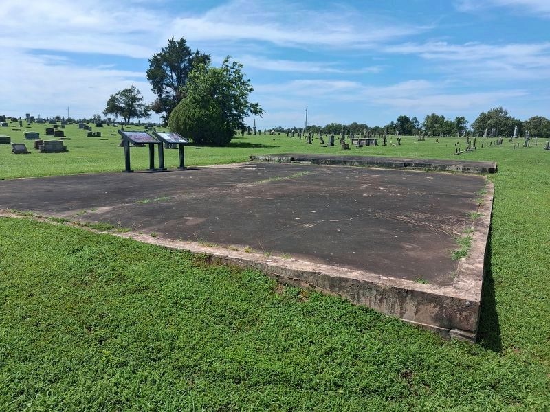
End of the Journey Marker
| On Cemetery Road north of West Doyle Avenue, on the left when traveling north. |
| On South Highway 59 (National Highway 1), on the right when traveling north. |
| On US 59 (Highway 1), on the right when traveling north. |
| On U.S. 59 at Main Street, on the right when traveling south on U.S. 59. |
| On Old Mission Mountain Road 0.7 miles south of Local Road 670, on the right when traveling south. |
| On Old Mission Mountain Road 0.7 miles south of Local Road 670, on the right when traveling north. |
| On Old Mission Mountain Road, on the right when traveling north. |
| On Old Mission Mountain Road north of Local Road 680, on the right when traveling north. |
| On Old Mission Mountain Road, on the right when traveling north. |
| On Chincapin Street (U.S. 62), on the left when traveling east. |
| On South Muskogee Avenue (U.S. 62) 0.1 miles north of Crestwood Drive, on the right when traveling north. |
| On South Muskogee Avenue (U.S. 62) 0.1 miles north of Crestwood Drive, on the right when traveling north. |
| On South Muskogee Avenue (U.S. 62) 0.1 miles north of Crestwood Drive, on the right when traveling north. |
| Near South Keeler Drive 0.3 miles south of East Willis Road (County Route D0790), on the left when traveling south. |
| On Cottonwood Street 0.1 miles south of Muskogee Avenue (U.S. 62), on the left when traveling south. |
| Near East Keetoowah Street just east of South Muskogee Avenue (Business U.S. 62), on the left when traveling east. |
| On South Muskogee Avenue (Business U.S. 62) just north of East Keetoowah Street, on the right when traveling north. |
| On Cottonwood Street 0.1 miles south of Muskogee Avenue (U.S. 62), on the left when traveling south. |
| On South Muskogee Avenue (Business U.S. 62) at East Delaware Street, on the right when traveling north on South Muskogee Avenue. |
| On South Muskogee Avenue (Business U.S. 62) at East Keetoowah Street, on the left when traveling south on South Muskogee Avenue. |
| On South Park Avenue at East Delaware Street, on the right when traveling north on South Park Avenue. |
| On Cottonwood Street 0.1 miles south of Muskogee Avenue (U.S. 62), on the left when traveling south. |
| On South Muskogee Avenue (Business U.S. 62) at East Delaware Street, on the right when traveling north on South Muskogee Avenue. |
| On Cottonwood Street 0.1 miles south of Muskogee Avenue (U.S. 62), on the left when traveling south. |
| Near East Keetoowah Street just east of South Muskogee Avenue (Business U.S. 62), on the left when traveling east. |
| Near East Keetoowah Street just east of South Muskogee Avenue (Business U.S. 62), on the left when traveling east. |
| Near North Grand Avenue just north of Spring Street, on the left when traveling north. |
| On South Muskogee Avenue (Business U.S. 62) at East Keetoowah Street, on the left when traveling south on South Muskogee Avenue. |
| On West Choctaw Street just east of South Morris Avenue, on the left when traveling west. |
| Near East Choctaw Street at South Water Avenue, on the left when traveling east. |
| On North Muskogee Avenue just south of Downing Street (Business U.S. 62), on the right when traveling south. |
| On South College Avenue at West Choctaw Street, on the left when traveling north on South College Avenue. |
| Near East Keetoowah Street just east of South Muskogee Avenue (Business U.S. 62), on the left when traveling east. |
| Near Battle Site Road (E0367 Road) 0.7 miles east of County Road 4200, on the left when traveling east. |
| On U.S. 69 at North 4440 Road, on the right when traveling west on U.S. 69. |
| On South 4th Street at Attucks Avenue, on the left when traveling south on South 4th Street. |
| Near U.S. 60 west of South 4380 Road, on the right when traveling west. |
| On East Illinois Avenue (U.S. 60) at South 2nd Street, on the right when traveling east on East Illinois Avenue. |
| On Dwain Willis Avenue (U.S. 60/69), on the right when traveling west. |
| On Canadian Avenue at Smith Street, on the right when traveling east on Canadian Avenue. |
| On U.S. 60 west of South 4380 Road, on the right when traveling west. |
| On West Canadian Avenue at South Smith Street, on the right when traveling west on West Canadian Avenue. |
| Near Veterans Memorial Drive. |
| Near Veterans Memorial Drive. |
| Near Veterans Memorial Drive. |
| On Seventh Street, on the left when traveling west. |
| Near East 7th Avenue west of North Walnut Street, on the left when traveling west. |
| On Main Street (State Highway 16/66), on the right when traveling north. Reported permanently removed. |
| Near Veterans Memorial Drive. |
| Near Veterans Memorial Drive. |
| On North Main Street (U.S. 66) north of East 9th Avenue, on the right when traveling north. |
| Near Veterans Memorial Drive. |
| On East 7th Avenue just east of Main Street (U.S. 66), on the right when traveling east. |
| Near Veterans Memorial Drive. |
| On West 6th Avenue just west of Main Street (Old U.S. 66), on the right when traveling west. |
| Near Veterans Memorial Drive. |
| On North Chestnut Street south of East 10th Avenue, on the right when traveling north. |
| On West 7th Avenue north of Country Club Drive, on the left when traveling north. |
| Near Veterans Memorial Drive. |
| Near Veterans Memorial Drive. |
| Near Veterans Memorial Drive. |
| Near Veterans Memorial Drive. |
| On Main Street near Malley Avenue, on the right when traveling west. |
| On East Broadway Street (Oklahoma Route 33) east of North Harley Avenue, on the right when traveling west. |
| On State Highway 33 east of Greenwood Road, on the right. |
| On State Highway 48 at West 11th Street (County Highway 600), on the right when traveling north on State Highway 48. |
| On Coonrod Drive (State Highway 51) at E Trower Blvd, on the right when traveling south on Coonrod Drive. |
| On Dewey Avenue (State Highway 66) near Main Street, on the right when traveling east. |
| On West Ozark Trail (Old U.S. 66) west of West Dewey Avenue (State Highway 66), on the left when traveling west. |
| On East Taft Avenue (State Highway 117) east of South Division Street, on the left when traveling west. |
| On State Highway 125 0.2 miles south of East 290th Road, on the left when traveling south. |
| On State Highway 20 0.1 miles east of N470 Road, on the right when traveling east. |
| On South 5th Street north of West Krause Street, on the left when traveling north. |
| On County Road E 340, on the right when traveling west. |
| On Alternate U.S. 412 west of Local Road 580, on the right when traveling west. |
| On U.S. 69 at East 360th Road, on the right when traveling north on U.S. 69. |
| On County Highway N4335 1.5 miles west of County Highway E6100, on the right when traveling south. |
| On County Highway N4330 1.5 miles east of County Highway E600, on the right when traveling south. |
| On West Ketchum Road (Oklahoma Route 85) 0.1 miles east of Route 82, on the right when traveling east. |
| On Scenic Route 412 (Scenic U.S. 412). |
| Near Battle Site Road (E0367 Road) 0.7 miles County Road 4200. |
| Near Battle Site Road (E0367 Road) 0.7 miles east of County Road 4420. |
| Near Battle Site Road (E0367 Road) 0.7 miles east of County Road 4200. |
| Near Battle Site Road (E0367 Road) 0.7 miles east of County Road 4200. |
| Near Battle Site Road (E0367 Road) 0.7 miles east of County Road 4200. |
| Near Battle Site Road (E0367 Road) (County Road 367) 0.7 miles east of County Route 4420. |
| On Adair Street at NE 1st Street, on the right when traveling north on Adair Street. |
| On Adair Street at NE 1st Street, on the right when traveling north on Adair Street. |
| On East Ferry Street (State Highway 20) at South Saltwell Street, on the right when traveling east on East Ferry Street. |
| On Broadway (Business U.S. 69) south of Gentry Avenue (U.S. 266), on the left when traveling south. |
| On Broadway (Business U.S. 69) at Spaulding Avenue, on the right when traveling north on Broadway. |
| On Oklahoma Route 150 0.1 miles south of East 1100 Road, on the right when traveling south. |
| On Broadway (Business U.S. 69) at North Avenue, on the right when traveling north on Broadway. |
| On Gentry Avenue (U.S. 266) at Broadway (Business U.S. 69), on the right when traveling east on Gentry Avenue. |
| On Gentry Avenue (U.S. 266) at 2nd Street, on the right when traveling west on Gentry Avenue. |
| On Paul Carr Drive 0.2 miles south of Gentry Avenue (U.S. 266), on the left when traveling south. |
| On Paul Carr Drive 0.2 miles south of Gentry Avenue (U.S. 266), on the left when traveling south. |
| On West Lafayette Avenue at Southwest 4th Street, on the left when traveling east on West Lafayette Avenue. |
| On Broadway (Business U.S. 69) at Gentry Avenue (U.S. 266), on the right when traveling north on Broadway. |
| On Broadway (Business U.S. 69) south of Gentry Avenue (U.S. 266), on the right when traveling south. |
582 entries matched your criteria. The first 100 are listed above.
Next 100 ⊳
