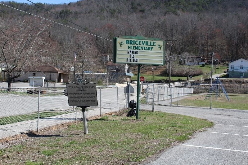
By Tom Bosse, March 4, 2017
"The Coal Creek War" Marker
GEOGRAPHIC SORT Title Sort Marker Number Sort Marker Number Sort for Trails Publication Order Sort Publication Order Sort A Erected Year Sort Most Viewed Sort Most Recent-Interest Sort Most Recently Changed Sort SEE FAQ #33 FOR DESCRIPTIONS
On Slatestone Road, on the left when traveling north.
On North Hicks Street at Leinart Street, on the left when traveling north on North Hicks Street.
On Edgemoor Road (Tennessee Route 170) at New Henderson Road, on the right when traveling east on Edgemoor Road.
On Market Place, on the right when traveling east.
On North Main Street (U.S. 25W) at Cedar Street, on the right when traveling north on North Main Street.
On Blockhouse Valley Road at Old Emory Road, on the right when traveling west on Blockhouse Valley Road.
On Oak Ridge Turnpike (Tennessee Route 95), on the right when traveling east.
On Oak Ridge Turnpike (U.S. 95) at Melton Lake Drive, on the right when traveling east on Oak Ridge Turnpike.
On Broadway Avenue just north of Kentucky Avenue.
On South Illinois Avenue (State Highway 62), on the right when traveling north.
On E. Madison Road, on the left when traveling north.
On Oak Ridge Turnpike (County Route 95) at Robertsville Road, on the right on Oak Ridge Turnpike.
On Kentucky Avenue at Broadway Avenue, on the left when traveling north on Kentucky Avenue.
On Robertsville Road, on the right when traveling east.
On Bethel Valley Road just east of Scarboro Road, on the right when traveling east.
Paid Advertisement
On Webb Road East (State Highway 82), on the right when traveling west.
On Wartrace Park (Tennessee Route 64), on the right when traveling east.
On Shelbyville Highway (Tennessee Route 231), on the left when traveling south.
On E. Lane St. near N. Brittain St, on the left when traveling south.
On Judge Mac Farrar Memorial Highway (State Highway 82) at South Brittain Street, on the right when traveling south on Judge Mac Farrar Memorial Highway.
On Lane Pkwy. (County Route 387), on the right when traveling south.
On North Main Street, on the left when traveling south. Reported missing.
On Public Square East at Holland Street, on the right when traveling north on Public Square East.
On Jessup Place, on the left when traveling north.
On Shelbyville Hwy (U.S. 41-A) near Carr Creek Rd, on the left when traveling north.
On Spring Street east of Bridgeview Street, on the right when traveling north.
On Tennessee Route 64 0.5 miles west of Fairfield Pike, on the right when traveling west.
On Cortner Road (County Route 269), on the right when traveling south.
On Blackman Boulevard West (State Highway 64) near Spring Street, on the right when traveling north.
On Blackman Boulevard (Tennessee Route 64), on the right when traveling south.
Paid Advertisement
On Main Street at Westview Avenue, on the right when traveling west on Main Street.
On North Church Avenue at East Lake Stret, on the left when traveling north on North Church Avenue.
On City Hall Street near Grove Street, on the left when traveling west.
On Spring Street at Grove Street, on the right when traveling west on Spring Street.
On Dayton Mountain Highway (State Highway 30) at Walker Road, on the right when traveling west on Dayton Mountain Highway.
On William Howard Taft Highway (U.S. 127) at College Station Cross Road (State Road 110), on the right when traveling south on William Howard Taft Highway.
On East Hunt Road (Tennessee Route 335) east of Russell Road, on the right when traveling east.
On West College Avenue close to North Farnum Street ( Highway 333), on the right when traveling west.
On Salem Road south of Lambert Road, on the right when traveling south.
On Alcoa highway (Tennessee Route 129) at Cusick Road, on the right when traveling north on Alcoa highway.
On Caldenwood Highway (U.S. 129) at 6 Mile Road ( Route 336), on the left when traveling south on Caldenwood Highway. Reported missing.
On Old Niles Ferry Road at Nine Mile Road, on the left when traveling west on Old Niles Ferry Road.
Paid Advertisement
On U.S. 129 0.5 miles east of Happy Valley Road, on the left when traveling east.
On South Cedar Street at West Broadway Avenue (U.S. 411), on the right when traveling north on South Cedar Street.
On Calderwood Highway (U.S. 129) 0.1 miles south of Hutton Ridge Road, on the left when traveling south.
On South Washington Street (State Highway 35) at Sevierville Road, on the right when traveling south on South Washington Street.
On East Broadway Avenue (U.S. 411) south of North Court Street, on the right when traveling south.
On E. Lamar Alexander Pkwy (Route 321), on the right when traveling east.
On Broadway Avenue (State Highway 33), on the right when traveling east.
On West Broadway Avenue at Cates Street, on the left when traveling west on West Broadway Avenue.
On Wildwood Springs Road at Wildwood Road, on the right when traveling east on Wildwood Springs Road.
On West Broadway Avenue (U.S. 411) at West Lamar Alexander Parkway (U.S. 321), on the right when traveling north on West Broadway Avenue.
On Broadway Avenue (State Highway 33), on the right when traveling east.
On East Broadway Avenue (Tennessee Route 33) at East Lincoln Road, on the left when traveling north on East Broadway Avenue. Reported missing.
On U.S. 411 0.5 miles north of Henry Lane, on the right when traveling north.
On Montvale Road (State Road 336) 0.3 miles south of Blockhouse Road, on the right when traveling south.
On Broadway Ave. at Cusick St., on the right when traveling west on Broadway Ave..
On West Broadway Avenue at Gary H. Hensley Drive, on the right when traveling east on West Broadway Avenue.
Paid Advertisement
On Old Knoxville Highway (Tennessee Route 33), on the right when traveling north.
On Old Knoxville Highway (Tennessee Route 33), on the right when traveling north.
On Highway 411 at Burnett Station Road, on the right when traveling south on Highway 411.
On Sevierville Road (Tennessee Route 411), on the left when traveling east.
On Wears Valley Road (U.S. 321) just north of Lamar Alexander Parkway (U.S. 321), on the right when traveling north.
On E. Lamar Alexander Pkwy (Route 321), on the left when traveling east.
On US Hwy 321 0.1 miles east of Old Tuckaleechee Road, on the right when traveling north.
On U.S. 321 0.4 miles north of Foothills Parkway, on the right when traveling north.
On Eureka Road NW (Tennessee Route 306) at Old Eureka Road NW, on the right when traveling north on Eureka Road NW.
On Keith Street Northwest (U.S. 11) at Stuart Road, on the right when traveling north on Keith Street Northwest.
On North Ocoee Street (State Highway 74) just north of 22nd Street Northwest, on the left when traveling south.
On Dalton Pike (Tennessee Route 60) 0.4 miles south of Old Weatherly Switch Road SE ( Route 317), on the left when traveling south.
On Berry Street Northeast just south of Central Avenue Northeast, on the right when traveling north.
Near Blythewood Road Southwest at Harris Creek Road Southwest, on the right when traveling north.
On Central Avenue NW at Oak Street NW, on the right when traveling east on Central Avenue NW.
On Dalton Pike (State Highway 60).
Paid Advertisement
On South Lee Highway (U.S. 64) at South McDonald Road, on the right when traveling east on South Lee Highway.
On Veterans Memorial Highway (US 25W) at Park Road on Veterans Memorial Highway (US 25W).
On U.S. 25 at 1st Street, on the right when traveling north on U.S. 25.
On U.S. 25 at State Street, on the left when traveling north on U.S. 25.
On McMinnville Highway (U.S. 70S) 0.2 miles east of Nave Lane, on the left when traveling east.
On McMinnville Highway (U.S. 70S), on the right when traveling east. Reported missing.
On West Main Street (U.S. 70S) at North Tatum Street, on the right when traveling west on West Main Street.
On North Cannon Street north of West Main Street (U.S. 70S), on the left when traveling north.
On McMinnville Highway (U.S. 70S) at Gassaway Road ( Route 53), on the right when traveling west on McMinnville Highway.
On McMinnville Highway (U.S. 70S) west of Gassaway Road.
On Atwood Highway (U.S. 79) at Cades Atwood Road, on the right when traveling south on Atwood Highway.
On Main Street, Atwood Highway (Tennessee Route 76 / 77) at Cades Atwood Road, on the left when traveling east on Main Street, Atwood Highway.
On Atwod Highway (U.S. 79) at Jax Road, on the right when traveling east on Atwod Highway.
On State Highway 22 at Roan Creek Church Road, on the right when traveling south on State Highway 22.
On Broad Street (U.S. 70) at Wall Street, on the right when traveling west on Broad Street.
On West Broad Street (U.S. 70) at Bayless Street, on the left when traveling east on West Broad Street.
Paid Advertisement
On Lexington Street (Business Tennessee Route 22) at Noles Lane, on the right when traveling south on Lexington Street.
On East Main Street (Business U.S. 70) at Buena Vista Road, on the right when traveling east on East Main Street.
On East Main Street (U.S. 70) at Oakhill Drive, on the right when traveling east on East Main Street.
On Tennessee Route 22 at Lexington Street (Business Route 22), on the right when traveling north on Tennessee Route 22.
On Cherry Avenue at College Drive, on the right when traveling west on Cherry Avenue.
︽
1484 entries matched your criteria. The first 100 are listed above.
Next 100 ⊳