437 entries match your criteria. The first 100 are listed. ⊳
Former U.S. Presidents: #07 Andrew Jackson Historical Markers
By Tim Carr, August 1, 2009
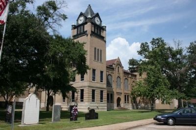
Autauga County Courthouse
1 ► Alabama, Autauga County, Prattville — A County Older Than the State, Autauga County —  |
| On East 4th Street west of North Court Street, on the right when traveling west. | |||
| 2 ► Alabama, Baldwin County, Daphne — 1814 - 1977 — General Andrew Jackson — |
| On Main Street south of Bayfront Park Drive, on the right when traveling south. | |||
| 3 ► Alabama, Baldwin County, Stockton — The Society War of 1812 in the State of Alabama — |
| Near Alabama Route 225, on the left when traveling north. | |||
| 4 ► Alabama, Blount County, Blountsville — Blountsville — |
| On Main Street (U.S. 231) at Lee Street West, on the left when traveling north on Main Street. | |||
| 5 ► Alabama, Blount County, Locust Fork — None — History of Locust Fork — |
| On Town Hall Road, on the left when traveling east. | |||
| 6 ► Alabama, Blount County, Oneonta — Blount County — A County Older Than the State — |
| On Second Avenue East (US Highway 231) at 4th Street North, on the right when traveling west on Second Avenue East (US Highway 231). | |||
| 7 ► Alabama, Bullock County, Union Springs — Indian Treaty Boundary Line — |
| On U.S. 29, on the right when traveling north. | |||
| 8 ► Alabama, Bullock County, Union Springs — Indian Treaty Boundary Line |
| On U.S. 82 near Greenwood Avenue, on the right when traveling west. Reported damaged. | |||
| 9 ► Alabama, Calhoun County, Alexandria — Lincoyer — and The Battle of Tallasehatchee — |
| On McCullars Lane west of County Road 73, on the left when traveling west. | |||
| 10 ► Alabama, Calhoun County, Alexandria — The Tallasahatchie Battle Field — |
| On McCullars Lane west of County Road 73, on the left when traveling west. | |||
| 11 ► Alabama, Calhoun County, Jacksonville — Chief Ladiga Trail - Jacksonville — |
| Near Mountain Street Northwest west of Woodward Avenue Northwest. | |||
| 12 ► Alabama, Calhoun County, Jacksonville — Jacksonville — First County Seat — Calhoun County, 1833-99 — |
| On Public Square East (State Highway 21) west of Ladiga Street Southeast, on the left when traveling north. | |||
| 13 ► Alabama, Calhoun County, Oxford — Creek Indian Campaign Memorial — |
| On Main Street south of East Oak Street, on the right when traveling north. | |||
| 14 ► Alabama, Calhoun County, Oxford — Muscogee (Creek) Nation — AD 1730 to AD 1832 — Choccolocco Park Interpretive Trail — |
| Near Leon Smith Parkway. | |||
| 15 ► Alabama, Cherokee County, Centre — Turkey Town Council Site |
| On West Main Street (Business U.S. 411) at College Street, on the left when traveling west on West Main Street. Reported missing. | |||
| 16 ► Alabama, Clarke County, Jackson — City of Jackson — |
| On Commerce Street (Alabama Route 177) at Magnolia Drive, on the right when traveling west on Commerce Street. | |||
| 17 ► Alabama, Clarke County, Jackson — Jackson — |
| On Commerce Street (Alabama Route 177) at Magnolia Drive, on the right when traveling west on Commerce Street. | |||
| 18 ► Alabama, Clarke County, Whatley — Old Indian Trail — |
| On Old Line Road (County Road 35) 2 miles north of U.S. 84, on the right when traveling north. | |||
| 19 ► Alabama, Clay County, Goodwater — Battle of Enitachopko — Creek Indian War 1813-14. — ← 4 mi. E. — |
| On Shady Grove Road (Alabama Route 9) at Route 63, on the right when traveling north on Shady Grove Road. | |||
| 20 ► Alabama, Colbert County, Cherokee — Colbert's Stand — |
| On Park Road 0.4 miles north of Natchez Trace Parkway, on the left when traveling east. | |||
| 21 ► Alabama, Colbert County, Cherokee — Safe Crossing — Natchez Trace Parkway — National Park Service, U.S. Department of the Interior — |
| Near Natchez Trace Parkway (at milepost 327.3), 1.6 miles east of N Pike (County Route 21), on the left when traveling east. | |||
| 22 ► Alabama, Colbert County, Tuscumbia — Jackson's Military Road — |
| On South Dickson Street at East 7th Street, on the right when traveling south on South Dickson Street. | |||
| 23 ► Alabama, Colbert County, Tuscumbia — Winston Cemetery — |
| On SW 14th Avenue near SW 7th Street, on the right when traveling east. | |||
| 24 ► Alabama, Covington County, Andalusia — Three Notch Road / Hank and Audrey Williams — |
| On Three Notch Street at Central Street, on the right when traveling east on Three Notch Street. | |||
| 25 ► Alabama, Covington County, Florala — Downtown Square and Veterans Memorial Park — |
| On 5th Street at 5th Avenue (U.S. 331) on 5th Street. | |||
| 26 ► Alabama, Covington County, Florala — Lake Jackson — |
| On 3rd Street (Alabama Route 55) north of 2nd Avenue, on the right when traveling north. | |||
| 27 ► Alabama, Elmore County, Wetumpka — Fort Jackson — |
| On West Fort Toulouse Road 0.3 miles south of Jackson Park Road, on the right when traveling south. | |||
| 28 ► Alabama, Escambia County, East Brewton — Site of Fort Crawford — |
| On Shoffner Street (County Road 22) at Weaver Street, on the right when traveling east on Shoffner Street. | |||
| 29 ► Alabama, Etowah County, Attalla — Camp Wills — |
| On 5th Avenue Northeast (U.S. 431) at Cleveland Avenue, on the right when traveling south on 5th Avenue Northeast. | |||
| 30 ► Alabama, Etowah County, Gadsden — Etowah County, Alabama — |
| On Forrest Avenue at South 8th Street, on the right when traveling east on Forrest Avenue. | |||
| 31 ► Alabama, Etowah County, Gadsden — Gadsden, Alabama — |
| On South 1st Street at Broad Street (U.S. 411), on the right when traveling north on South 1st Street. | |||
| 32 ► Alabama, Franklin County, Newburg — Newburg — |
| On County Route 87 south of Route 24, on the right when traveling south. | |||
| 33 ► Alabama, Franklin County, Russellville — Russellville — |
| On North Jackson Avenue at Lawrence Street West, on the right when traveling south on North Jackson Avenue. | |||
| 34 ► Alabama, Henry County, Screamer — Indian Treaty Boundary Line — |
| On Alabama Route 95 0.4 miles south of County Road 48, on the left when traveling south. | |||
| 35 ► Alabama, Henry County, Screamer — Indian Treaty Boundary Line — |
| On County Road 97 0.2 miles north of County Road 93, on the right when traveling north. | |||
| 36 ► Alabama, Jackson County, Scottsboro — Gen. Andrew Jackson — Soldier, Statesman, 7th President U.S.A. — |
| On East Laurel Street near South Broad Street (State Route 279), on the right when traveling east. | |||
| 37 ► Alabama, Jefferson County, Mountain Brook — None — The Early Mountain Brook Village Area — |
| On Cahaba Road, on the right when traveling north. | |||
| 38 ► Alabama, Jefferson County, Pinson — Pinson, Alabama — |
| On Main Street east of Center Point Road (State Highway 75), on the left when traveling east. | |||
| 39 ► Alabama, Lauderdale County, Florence — Andrew Jackson's Military Road — 1817 — |
| On County Route 47 at Cox Creek Parkway on County Route 47. | |||
| 40 ► Alabama, Lauderdale County, Florence — General John Coffee — City of Florence Walk of Honor — |
| Near Hightower Place south of Veterans Drive (Route 133), on the left when traveling south. | |||
| 41 ► Alabama, Lauderdale County, Florence — General John Coffee — Home Site and Grave — |
| On Cloverdale Road (Alabama Route 157) north of Cox Creek Parkway ( Route 133). | |||
| 42 ► Alabama, Lauderdale County, Florence — Jackson's Military Road — |
| On Military Road at Hermitage Drive on Military Road. | |||
| 43 ► Alabama, Lauderdale County, Florence — John Coffee: 1772-1833 — |
| On Surveyor Road 0.2 miles west of Cloverdale Road, on the left when traveling west. | |||
| 44 ► Alabama, Lauderdale County, Florence — Lauderdale County — |
| On West Alabama Street at South Court Street, on the right when traveling west on West Alabama Street. | |||
| 45 ► Alabama, Lauderdale County, Greenhill — Tabernacle Cemetery — Lauderdale County — |
| On County Road 47 at County Road 140, on the left when traveling north on County Road 47. | |||
| 46 ► Alabama, Lawrence County, Courtland — The Town of Courtland / Early Settlers — 1819 — |
| On Tennessee Street. | |||
| 47 ► Alabama, Lawrence County, Moulton — Anne Newport Royall — |
| On Market Street (Alabama Route 33) at Court Street (County Route 460), on the right when traveling south on Market Street. | |||
| 48 ► Alabama, Lawrence County, Town Creek — Trail of Tears — |
| Near Foster Mill Road (County Road 314) 0.5 miles west of Wheeler Dam Road. | |||
| 49 ► Alabama, Madison County, Huntsville — Andrew Jackson — |
| On Holmes Avenue at Lincoln St., NE on Holmes Avenue. | |||
| 50 ► Alabama, Madison County, Huntsville — Camp Beaty Brahan Spring Park — |
| On Ivy Avenue SW at SW 1st Street, on the right when traveling south on Ivy Avenue SW. | |||
| 51 ► Alabama, Madison County, Huntsville — Seminole Wars / Mexican War — |
| On Monroe Street Northwest at Washington Street Northwest, on the left when traveling east on Monroe Street Northwest. | |||
| 52 ► Alabama, Madison County, Huntsville — The Leroy Pope Mansion 1814 — |
| On Echols Street near Adams Street, on the right when traveling west. | |||
| 53 ► Alabama, Madison County, New Market — Buckhorn Tavern / Buckhorn Tavern Skirmish — |
| On Winchester Road at Maysville Road, on the left when traveling south on Winchester Road. | |||
| 54 ► Alabama, Marion County, Guin — Historical Pikeville — County Seat of Marion County — 1820-1882 — |
| On U.S. 278 at milepost 66, 0.2 miles north of Road 2, on the right when traveling north. | |||
| 55 ► Alabama, Marion County, Hamilton — General Jackson's Military Road — |
| On Berryhill Road 0.1 miles south of County Road 55, on the right when traveling north. | |||
| 56 ► Alabama, Marshall County, Guntersville — History of Guntersville — |
| On Florida Short Route/Gunter Avenue (U.S. 431) at Lurleen B Wallace Drive, on the right when traveling south on Florida Short Route/Gunter Avenue. | |||
| 57 ► Alabama, Mobile County, Mt. Vernon — Mt. Vernon Federal Highway — |
| On Old Highway 43 at Military Road (County Road 96), on the left when traveling south on Old Highway 43. | |||
| 58 ► Alabama, Monroe County, Uriah — Creek Indian Removal — |
| On Alabama Route 21 at milepost 19 at H-Kyle Road, on the right when traveling north on Alabama Route 21. | |||
| 59 ► Alabama, Montgomery County, Montgomery — Native Americans — |
| On Maxwell Boulevard east of North Holt Street, on the right when traveling west. | |||
| 60 ► Alabama, Russell County, Crawford — Crockettsville — Crawford, Alabama — |
| On U.S. 80 at Bleeker Road (County Road 79), on the right when traveling west on U.S. 80. | |||
| 61 ► Alabama, Russell County, Fort Mitchell — Fort Mitchell — |
| On Unnamed road 0.2 miles east of Route 165, on the right when traveling east. | |||
| 62 ► Alabama, Russell County, Fort Mitchell — United States Indian Trading Post |
| On Old Federal Road 0.2 miles east of Route 165, on the left when traveling east. Reported unreadable. | |||
| 63 ► Alabama, Shelby County, Chelsea — City Of Chelsea — Incorporated March 1, 1996 — Mayor S. Earl Niven — |
| Near Chelsea Road (County Road 47) near County Road 39. | |||
| 64 ► Alabama, Shelby County, Helena — Harmony Graveyard — Shelby County — |
| On Helena Road (Alabama Route 261) at 3rd Street, on the right when traveling north on Helena Road. | |||
| 65 ► Alabama, Shelby County, Montevallo — Welcome To Historic Montevallo — |
| On Main Street (State Highway 119) at Middle Street, on the right on Main Street. | |||
| 66 ► Alabama, St. Clair County, Ashville — John Looney House — Circa 1820 — |
| On Greensport Road (County Route 24), on the left when traveling east. | |||
| 67 ► Alabama, St. Clair County, Ohatchee — Fort Strother — |
| On State Highway 144 at Valley Drive, on the right when traveling north on State Highway 144. | |||
| 68 ► Alabama, St. Clair County, Pell City — None — A County Older Than The State — St. Clair County — |
| On Cogswell Avenue at 18th Street, on the right when traveling west on Cogswell Avenue. | |||
| 69 ► Alabama, Sumter County, Livingston — Livingston, Alabama / Livingston's Bored Well — |
| On Washington Street South at Franklin Street, on the right when traveling north on Washington Street South. | |||
| 70 ► Alabama, Talladega County, Fayetteville — Fayetteville — |
| On Old Fayetteville Road (County Route 34) at Caudies Lake Road, on the right when traveling east on Old Fayetteville Road. | |||
| 71 ► Alabama, Talladega County, Fayetteville — To The Memory of General Jackson — |
| On Gen. Jackson Memorial Dr south of Mallory Cir, on the right when traveling south. | |||
| 72 ► Alabama, Talladega County, Sylacauga — Fort Williams — 12 miles west — |
| On Fort Williams Street, on the right when traveling east. | |||
| 73 ► Alabama, Talladega County, Sylacauga — Sylacauga — |
| On South Broadway Avenue (State Highway 21) at Goodwater Highway (County Road 511), in the median on South Broadway Avenue. | |||
| 74 ► Alabama, Talladega County, Talladega — Battle Of Talladega — Nov. 9, 1813 — |
| On East Battle Street at Court Street North, on the right when traveling west on East Battle Street. | |||
| 75 ► Alabama, Tallapoosa County, Dadeville — Battle Of Horseshoe Bend — One hundredth anniversary — 1814 - 1914 — |
| On North Broadnax Street at West Cusseta Street, on the right when traveling south on North Broadnax Street. | |||
| 76 ► Alabama, Tallapoosa County, Dadeville — Horseshoe Bend Battle Ground — 12 Miles North — |
| On State Highway 49 north of U.S. 280, on the right when traveling north. | |||
| 77 ► Alabama, Tallapoosa County, Daviston — A Bloody Contest — Horseshoe Bend National Military Park — National Park Service, U.S. Department of the Interior — |
| Near Battlefield Park Tour Road, on the left. | |||
| 78 ► Alabama, Tallapoosa County, Daviston — Charge! — Horseshoe Bend National Military Park — National Park Service, U.S. Department of the Interior — |
| Near Battlefield Park Tour Road, on the left. | |||
| 79 ► Alabama, Tallapoosa County, Daviston — Designed for Defense — Horseshoe Bend National Military Park — National Park Service, U.S. Department of the Interior — |
| Near Battlefield Park Tour Road, on the left. | |||
| 80 ► Alabama, Tallapoosa County, Daviston — Futile Escape — Horseshoe Bend National Military Park — National Park Service, U.S. Department of the Interior — |
| On Battlefield Park Tour Road, on the right when traveling south. | |||
| 81 ► Alabama, Tallapoosa County, Daviston — Horseshoe Bend Battleground Monument — |
| Near Battlefield Park Tour Road. | |||
| 82 ► Alabama, Tallapoosa County, Daviston — Horseshoe Bend National Military Park — Who Were the Creek? — National Park Service, U.S. Department of the Interior — |
| On Battlefield Park Tour Road, on the left. | |||
| 83 ► Alabama, Tallapoosa County, Daviston — The High Ground — Horseshoe Bend National Military Park — National Park Service, U.S. Department of the Interior — |
| Near Battlefield Park Tour Road, on the left. | |||
| 84 ► Alabama, Tallapoosa County, Daviston — They Fought to the Last — Horseshoe Bend National Military Park — National Park Service, U.S. Department of the Interior — |
| On Battlefield Park Tour Road, on the right. | |||
| 85 ► Alabama, Tallapoosa County, Daviston — Tohopeka in Flames — Horseshoe Bend National Military Park — National Park Service, U.S. Department of the Interior — |
| On Battlefield Park Tour Road, on the left. | |||
| 86 ► Alabama, Tallapoosa County, Daviston — With Deer Tails in Their Hair — Horseshoe Bend National Military Park — National Park Service, U.S. Department of the Interior — |
| On Battlefield Park Tour Road, on the right. | |||
| 87 ► Arkansas, Benton County, Bella Vista — United States Commanders in Chief — |
| Near Veterans Way. | |||
| 88 ► Arkansas, Columbia County, Lamartine — C-27 — Columbia County Lamartine Pioneer Settlement — |
| On U.S. 371 at East Columbia Road (County Road 60), on the right when traveling north on U.S. 371. | |||
| 89 ► Arkansas, Cross County, Wynne — The Trail of Tears along the Memphis to Little Rock Road — 1824-1840 — |
| Near County Highway 754. | |||
| 90 ► Arkansas, Faulkner County, Conway — "Trail of Tears" — |
| Near State Highway 319 0.1 miles west of Cadron Settlement Lane. | |||
| 91 ► Arkansas, Lafayette County, Walnut Hill — James Sevier Conway — December 9, 1796 - March 3, 1855 — Surveyor • Politician • Planter — |
| Near County Road 9 0.5 miles south of State Highway 160, in the median. | |||
| 92 ► Arkansas, Washington County, Fayetteville — Reiff House — 1834 - 1951 — |
| On College Street west of Church Avenue, on the right when traveling west. | |||
| 93 ► California, Shasta County, Shasta — “Stage Drivers’ Plaque” — |
| On Highway 299 at Mackley Alley, on the right when traveling west on Highway 299. | |||
| 94 ► California, Shasta County, Shasta Lake — 148 — Pioneers Who “Held the Ribbons” — Bass Hill — |
| On Bridge Bay Road, on the left when traveling north. | |||
| 95 ► Delaware, New Castle County, New Castle, New Castle Hundred — NC-24 — Packet Alley — |
| On The Strand at Packet Alley on The Strand. | |||
| 96 ► District of Columbia, Washington, Northeast Washington, Arboretum — Capitol Columns — |
| Near Elipse Road Northeast at Beechwood Road Northeast, on the left when traveling north. | |||
| 97 ► District of Columbia, Washington, Northwest Washington, Cathedral Heights — The Nourse Farm — |
| On Wisconsin Avenue Northwest at Woodley Road Northwest on Wisconsin Avenue Northwest. | |||
| 98 ► District of Columbia, Washington, Northwest Washington, Downtown — Francis Preston Blair — |
| On Pennsylvania Avenue Northwest at Jackson Place Northwest, on the right when traveling west on Pennsylvania Avenue Northwest. | |||
| 99 ► District of Columbia, Washington, Northwest Washington, Downtown — W.2 — Franklin Square — Civil War to Civil Rights — Downtown Heritage Trail |
| On 13th Street Northwest at K Street Northwest, on the right when traveling north on 13th Street Northwest. Reported permanently removed. | |||
| 100 ► District of Columbia, Washington, Northwest Washington, Downtown — W.2 — Franklin Square — Civil War to Civil Rights — Downtown Heritage Trail — |
| On 13th Street Northwest at K Street Northwest (U.S. 29), on the right when traveling north on 13th Street Northwest. | |||
437 entries matched your criteria. The first 100 are listed above. Next 100 ⊳