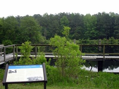
Before you is the Deep Creek Lock of the Great Dismal Swamp Canal. The canal was an important thoroughfare, connecting the North Carolina Sounds with Hampton Roads and the Chesapeake Bay. The Dismal Swamp Canal is the oldest operating artificial . . . — — Map (db m4773) HM
This is the Deep Creek Lock of the Dismal Swamp Canal, the northern end of the waterway linking the North Carolina sounds with Hampton Roads and the Chesapeake Bay. Deep Creek village evolved on the canal to serve workers, boatmen, and the . . . — — Map (db m165286) HM
The British erected a fort at Great Bridge early in November 1775. The first decisive land battle of the American Revolution in the south was fought here December 9, 1775. Virginia forces under Col. William Woodford united with the militia of South . . . — — Map (db m241916) HM
(front)
This stone
marks the Battlefield of
Great Bridge
Dec 9 1775
(rear)
This monument
was moved to this location
December 9, 1964
on the 189th anniversary of
the Battle of Great Bridge.
The site of . . . — — Map (db m281932) HM WM
Lower and upper Norfolk Counties were formed from the Elizabeth City County in 1637. Princess Anne County was carved out of the eastern portion of Norfolk Country in 1691.
The establishment of the Gosport Shipyard in 1767; The first marine . . . — — Map (db m221843) HM
Honoring the Public Safety Heroes of New York City
Never Forget
September 11, 2001 was the greatest loss of public safety personnel lives in the United States in a single day during a senseless terrorist attack on the World Trade . . . — — Map (db m191762) WM
During the colonial period, the established church cared for the poor as in Great Britain. Beginning in the late 18th century, local governments began to appoint overseers of the poor instead to support indigents with donated funds or house them in . . . — — Map (db m37940) HM
Site of
Southern Branch Chapel
A Chapel of ease of the Anglican Church
for the
Elizabeth River Parish 1701 - 1761
St. Brides Parish 1761 - 1845
Encampment area for American Patriots
Battle of Great Bridge
December 1775 . . . — — Map (db m48944) HM
Front:
Dedicated in remembrance of
SSG Jonathan Kilian Dozier, USA
Hammer Company, 3rd Squadron,
2D Stryker Calvary Regiment
Sinsil, Iraq 09 January 2008
and to all who have given the
“Last Full Measure”
in . . . — — Map (db m191539) WM
This memorial is the first and only memorial of its kind in the Commonwealth of Virginia dedicated to honor Afro-Union patriot heroes. It is located in the northeast section of the Sgt. March Corprew Family Memorial Cemetery.
Sgt. March . . . — — Map (db m211252) HM
In 1906, Norfolk County built a four room brick school house, “The Great Bridge School”, to educate elementary and high school students. Graduating its first class in 1911, the name was changed to Great Bridge High and Grammar School . . . — — Map (db m113684) HM
Day of Remembrance
In the years following the 9/11 attacks, the City of Chesapeake has hosted Day of Remembrance ceremonies at Chesapeake City Park to remember those who perished on September 11th, to honor those who protect and defend our . . . — — Map (db m191844) HM WM
Transporting the Artifacts
Following the September 11 attacks, crews of public safety officials and volunteers spent nine months clearing 1.8 million tons of debris at Ground Zero. Artifacts from the World Trade Center complex were . . . — — Map (db m191874) HM WM
New York City
The original One World Trade Center, also known as the North Tower, was completed in 1972 and stood at an impressive height of 1,730 feet. The design featured a telecommunications antenna on the roof of the structure, making . . . — — Map (db m191857) HM WM
In late October 1775, the Virginia Committee of Safety ordered Colonel William Woodford and his 2nd Virginia Regiment, along with five companies of Culpeper Minutemen, to march towards Norfolk and protect “…all friends to the American cause.” The . . . — — Map (db m211241) HM
(side 1)
This monument honors
Patriots who assembled
at this site in the Cause of
American Freedom in 1775
American Patriots
at the Battle
Second Virginia Regiment
Commanded by
Colonel William Woodford,
of . . . — — Map (db m211239) HM
His courage “amid a shower of bullets” helped achieve victory at the Battle of Great Bridge.
Private William (Billy) Flora was a free black from the Portsmouth area and a member of the Norfolk County Militia who served as a . . . — — Map (db m54952) HM
1600s: Woodlands, Marshes and the Great Bridge
The rich forests and fields south of the Elizabeth River and in northeastern North Carolina gave the early settlers in the late 1600s bountiful yields of shingles, naval stores, lumber, grain . . . — — Map (db m211244) HM
Some areas of the marsh were high enough to allow crossing on a corduroy road made of logs. Lower areas of the marsh required a stronger infrastructure, like the one seen here. This exhibit illustrates how five or six timbers, each ranging from 15 . . . — — Map (db m54950) HM
“There is great want of a bridge for horse and man over the swamp at the head of the Southern Branch of Elizabeth River…” Norfolk County Deed Book 5, part 2, Orders. page 4, 1686
In the mid-1600s, as the early settlers began to . . . — — Map (db m54948) HM
This 7,900-pound anchor was manufactured in 1861 by the Naval Yard Foundry in Washington, D.C., and most likely belonged to the USS Hartford, a Union warship immortalized at the Battle of Mobile Bay on August 5, 1864, when Admiral David Glasgow . . . — — Map (db m54957) HM
Marshall Parks, Sr.
1786-1840
The Dismal Swamp Canal, located about six miles west of here, officially opened in 1805. Dug completely by hand, its shallow depth limited navigation to flat boats and lighters manually poled or towed from . . . — — Map (db m54956) HM
At daybreak on the morning of December 9, 1775, the British rolled two four-pounder cannon field pieces across the bridge under the cover of smoke from burning buildings and piles of shingles located on the south island. The fires were set by . . . — — Map (db m54947) HM
By the summer of 1775, British control over the Colony of Virginia was in peril and Dunmore looked to Norfolk, the most heavily populated town in Virginia and the largest seaport between New York and Charleston. The occupation of Norfolk and Hampton . . . — — Map (db m54941) HM
Fauquier County, Virginia
Officers of the Culpeper Minute Battalion
At the Battle of Great Bridge
Major Thomas Marshall (1730-1802)
Member, 1st, 2nd, 3rd & 4th Virginia Conventions
Colonel, 3rd Virginia Regiment
Colonel, Virginia . . . — — Map (db m54953) HM
“…to reduce this colony to a proper sense of their duty…to His Majesty’s crown and dignity…”
On November 15, 1775, the day after his success in routing the rebels at Kemp’s Landing, Lord Dunmore issued a proclamation declaring . . . — — Map (db m54942) HM
The Canal Becomes a Federal Government Waterway
Competition from the railways and the re-structured Dismal Swamp Canal Company signaled the downfall of the Albemarle and Chesapeake Canal Company in 1910. By 1913, Congress, recognizing the . . . — — Map (db m48964) HM
A direct outgrowth of the New Mill Creek Society organized in 1772 by the Rev. Joseph Pilmoor, the first official Methodist missionary to America. Methodist meetings were held as early as 1770 in the Cutherell home, a regular preaching place for . . . — — Map (db m48923) HM
The Albemarle & Chesapeake Canal did not exist at the time of the Battle of Great Bridge…
...but plans for a canal at Great Bridge were in place more than three years before the battle. In 1772, the need for trade and commerce with North . . . — — Map (db m54955) HM
The Albemarle & Chesapeake Canal changed the landscape of this area.
Constructed between 1855 and 1859, the Albemarle & Chesapeake Canal cut through the causeway and marsh lying between the south island and the village of Great Bridge. The . . . — — Map (db m54949) HM
In the early morning of December 9, 1775, two opposing forces faced each other across the Great
Bridge, the British on the north end and the patriots to the south. The battle lasted about thirty minutes...but its outcome will last as long as . . . — — Map (db m211253) HM
I then saw the horrors of war in perfection, worse than can be imagined; 10 and 12 bullets thro’ many; limbs broke in 2 or 3 places…Good God, what a sight! Captain Richard Kidder Meade, Southampton District, 2nd Virginia Regiment . . . — — Map (db m54951) HM
The Albemarle and Chesapeake Canal Gains Steam
By 1850, larger steam driven commercial carriers needed a faster, deeper and wider passage to market than the hand dug Dismal Swamp Canal, a few miles west of here. Digging the Dismal Swamp . . . — — Map (db m211245) HM
The Thomas Marshall family lived in the backwoods of the Virginia frontier.
Thomas Marshall of Fauquier County served as a vestryman, High Sheriff, and member of the House of Burgesses. He was a close boyhood friend of George Washington, . . . — — Map (db m54954) HM
Both the Confederacy and the Union recognized the strategic importance of the Albemarle & Chesapeake Canal…and both sides fought for control.
The Albemarle & Chesapeake Canal (A&C) provided the Confederacy the means to avoid the coastal . . . — — Map (db m211943) HM
The village of Great Bridge was located at a strategic crossing of the Albemarle and Chesapeake Canal. This canal, along with the Dismal Swamp Canal, was recognized as being a strategically important corridor by both the Union and Confederate . . . — — Map (db m48919) HM
The Great Bridge village evolved to your left, where a bridge spanned the Elizabeth River. An early battle of the Revolution occurred around the bridge on December 9, 1775. The village grew with the completion of the Albemarle & Chesapeake Canal. . . . — — Map (db m211246) HM WM
The Battle of Great Bridge, in 1775, influenced everything you see today. Location, lives and legends are all here.
A. Great Bridge Lock Park
Enjoy a boat ramp, playground, picnic shelters and the many inviting vistas. Walk the . . . — — Map (db m48955) HM
Why doe the Canal Need a Lock?
The Great Bridge Lock is unique, because it is a guard lock—it guards water quality. Fresh water flows into the lock on your left from Currituck Sound in North Carolina. Salty water flows into the lock . . . — — Map (db m48960) HM
A Safer, Faster Route was Needed
Prior to the Revolutionary War, the most direct routes to transport goods to Norfolk and points north from North Carolina were, either the very slow overland route through the village of Great Bridge, or the . . . — — Map (db m48962) HM
At this point stood St. Bride's Church. The parish church of St. Bride's Parish which was established in 1761. The church, sometimes known as Northwest Church, was built in 1762 and survived until 1853. — — Map (db m46530) HM
Thirteen African American veterans of the Civil War are interred nearby at the Cuffeytown Historic Cemetery. They served in the 5th, 10th, and 36th United States Colored Troops infantry regiments organized in 1863 and 1864, after the Emancipation . . . — — Map (db m48917) HM
Before you is the Dismal Swamp Canal, a much sought after prize of war during the Civil War. The Confederates made good use of the canal facilities during the initial stages of the conflict. A large volume of supplies passed through in both . . . — — Map (db m282378) HM
(main legend, lower right corner) The Dismal Swamp Canal Trail, a former section of Virginia State Route 17, is now a multi-purpose, linear, nature trail and park traversing some of the most uniquely historic and ecologically significant . . . — — Map (db m114520) HM
The walking path you are standing on right now has quite a history.
In 1804, it was a tow road on the eastern bank of the canal, where laborers, using long wooden poles, ropes or mules, pushed loaded barges full of shingles, lumber, corn . . . — — Map (db m114518) HM
“Glencoe,” the plantation home of Capt. William Wallace of the Jackson Grays, was located approximately one-half mile northeast of this site.
William C. Wallace was born at Wallaceton, Norfolk County, Virginia, on March 23, 1842, and . . . — — Map (db m282377) HM
Across the canal lies the US Fish & Wildlife Service's Great Dismal Swamp National Wildlife Refuge.
The Great Dismal Swamp was once a vast ecosystem that covered as much as one million acres of southeastern Virginia and northeastern . . . — — Map (db m114525) HM
Herring Ditch was one of many ditches that connected with the Dismal Swamp Canal. Ditches were used to transport goods to the canal, allow access to swamp timber, and provide drainage. Walter Herron, a Dismal Swamp Canal Company stockholder, began . . . — — Map (db m114521) HM
Approved by the Virginia General Assembly in 1818, the North West Canal was constructed by the Dismal Swamp Canal Company between 1828 and 1830. The canal was intended for carrying timber and farm products between the Dismal Swamp Canal and the . . . — — Map (db m114524) HM
This is the former site of the Pleasant Grove Baptist Church. The monument to the "Jackson Greys" honors the regiment that was formed on the grounds of Pleasant Grove Baptist Church by Capt. (later Lieutenant Colonel) William H. Stewart who lived . . . — — Map (db m211238) HM
Nearby were the homes of three Afro-Virginians who served in the United States Colored Troops (USCT) during the Civil War. Sgt. March Corprew, Co. I, 2nd USCT Cavalry, and his brother Pvt. Daniel Corprew, Co. D, 1st USCT Cavalry, lived on a . . . — — Map (db m282379) HM
Haphazardly scattered on the ground and under the water along the east bank of the canal, huge monoliths of chiseled stone may be waiting to be discovered. Each one found so far weighs more than 1,000 lbs. and averages 4-6 feet long. Made of . . . — — Map (db m224495) HM
"All persons sending or carrying Boats, Goods, etc. through the Canal must not forget taking money with them to pay the toll." Norfolk Herald, January 22, 1819 The Superintendent's House, is the last standing vestige of . . . — — Map (db m224496) HM
Carl Moore Jordan
1880 - 1957
Born in Sussex County, Virginia, Jordan moved to Norfolk in 1900e in search of work. After several years working for Richmond Cedar Works, he and his brother Wallace developed their own lumber company . . . — — Map (db m247131) HM
1926 - 1927
With business booming for the Jordan Bros. Lumber Co., the company needed quick and easy access from their lumber in the Great Dismal Swamp to a sawmill in South Norfolk. In the
early 20th century, ferries were the most common . . . — — Map (db m247264) HM
Welcome! Replacing the original steel structure built in 1928, this soaring concrete bridge opened in late 2012 to reconnect the community across the Elizabeth River's Southern Branch. Its structural curves were incorporated in the bridge design to . . . — — Map (db m247088) HM
The South Norfolk
Historic District
has been registered as a
Virginia
Historic
Landmark
pursuant to the authority vested in the
Virginia Board of Historic Resources — — Map (db m191489) HM
This memorial is dedicated
to honor those veterans
who resided in South Norfolk
Norfolk County and the City
of Chesapeake, Virginia who
gave their lives in the
service of their country in
time of war.
Erected by . . . — — Map (db m191488) HM
Just north is the birthplace of Commodore Richard Dale (6 Nov 1756 - 26 Feb 1826). He served on the United States brigantine Lexington. The British captured and wounded him several times during the Revolutionary War. Captain John Paul Jones . . . — — Map (db m40678) HM
Historic Landmark
Site of the
Nansemond Indian Public School #9
1890’s-1928
Norfolk County School District #1
Dedicated July 28, 1985 — — Map (db m120128) HM
In 1908, the first long-term Polish settlement in Virginia was established in Norfolk County, now Chesapeake. The Piast colony, named for Poland’s first royal dynasty, was called Sunray after the Virginia Railway Company depot that opened here in . . . — — Map (db m76793) HM
Paul and James Camp started P.D. Camp and Company, a lumber business, in 1877. The brothers bought R.J. Neely's sawmill in 1886 and established Camp Manufacturing Company in 1887. The original Franklin mill was steam powered and lay on a . . . — — Map (db m51001) HM
The war seemed far from Franklin when Union forces captured Roanoke Island and the North Carolina Sounds in February 1862. In May, however, when they occupied Norfolk and Suffolk to control both coastal Virginia and North Carolina, suddenly the . . . — — Map (db m18135) HM
George Camp, Jr. (1793-1879) acquired this land in 1826. Several of his children incorporated the Camp
Manufacturing Company in 1887 to operate sawmills. The company expanded into a wood product
manufacturing company and later a paper mill. . . . — — Map (db m69463) HM
Before the Civil War erupted, Franklin became a regional transportation and commercial center for the Blackwater-Chowan River basin because the seaboard and Roanoke Railroad connected with steamship lines here. When the war began, the town . . . — — Map (db m18133) HM
Della I. Hayden, educator, was born into slavery in North Carolina and moved to Virginia with her mother after the Civil War. She attended a Freedmen's Bureau school and graduated from the Hampton Normal and Agricultural Institute (later Hampton . . . — — Map (db m224321) HM
Incorporated as a town in 1876, Franklin began as a Southampton County village in the 1830s. In October, 1862, during the Civil War, Union gunboats on the Blackwater River shelled the town and the railroad station. Several skirmishes occurred nearby . . . — — Map (db m18144) HM
Dedicated to those who gave their lives
in defense of our state and our nation
Originally a part of the James L. Camp homeplace,
the park was given to the town of Franklin in 1946
by the children of Mr. and Mrs. James L. Camp.
Rena . . . — — Map (db m125377) WM
This property has been
placed on the
National Register
of Historic Places
by the United States
Department of the Interior
circa 1937 — — Map (db m166008) HM
Pauline C. Morton, civic leader, graduated from what is now Virginia State University in 1933. She began working for the Virginia Department of Education in 1947, during the segregation era. Before retiring in 1974, she supervised home economics . . . — — Map (db m118319) HM
Franklin's location at the junction of a railroad and important water route offered opportunities that attracted new people, so the town rapidly recovered from the War. In 1866 the Albemarle steam Navigation Company was reorganized and the . . . — — Map (db m52133) HM
Between 1907 and 1930 Franklin witnessed a
revolution in transportation as gasoline-powered
vehicles replaced the horse and buggy and steam-
powered transportation. Even as Franklin
benefited from a boom in buggy making during
the first . . . — — Map (db m51062) HM
The conjunction of the Portsmouth &
Roanoke Railroad and the Blackwater River
in 1835 made this site, then a swampy
wilderness, a natural link between the
towns of the Chowan and Albemarle Sound
and points to the northeast. The . . . — — Map (db m51216) HM
In 1847 one of Franklin's most influential
couples, Richard and Mary Rebecca Murfee
Barrett, married and received a 260 acre farm
from Mary's father, Simon. The couple built a
house near the center of the new settlement
and began . . . — — Map (db m50456) HM
To protect Richmond from a Union attack from Suffolk, Confederate authorities fortified the Blackwater River in 1862. You are standing on the Blackwater Line. The intermittent earthworks stretched fifty miles from north of Zuni to the North . . . — — Map (db m18134) HM
What lies behind us and what lies before us are tiny matters compared to what lies within us.
In honor of the many individuals and organizations giving freely of their time, talents, and resources to assist in the response and recovery from . . . — — Map (db m166007) HM
During the first three years of the War Between the States, the Franklin railhead was the terminus of the Blackwater - Chowan corridor. The Confederate commissary used this route to deliver the millions of pounds of goods from eastern North . . . — — Map (db m18146) HM
During the War of 1812, British forces invaded the Chesapeake Bay and captured the town of Hampton. On June 22, 1813, American forces rebuffed Vice Admiral Sir John B. Warren's attack at Craney Island (located to your rear, across Hampton Roads to . . . — — Map (db m252823) WM
A-7E Corsair II
BuNo. 157606 • Navy • Attack
The A-7E Corsair II was first flown on November 25, 1969. It was powered by a naval version of the 15,000 lbs. thrust Allison/Rolls-Royce TF41-A-2 turbofan engine, . . . — — Map (db m248116) WM
One mile north, the Back River Lighthouse and keeper's dwelling stood for 127 years. The lighthouse was built for $4,250 in 1829, automated in 1915, and decommissioned in 1936. A guide for watermen and a meeting place for the community, the . . . — — Map (db m252908) HM
George Wythe (ca. 1726-1806), Revolutionary leader and signer of the Declaration of Independence, was very likely born at his family's Chesterville Plantation, about seven miles north. He later inherited the property. Wythe served in the House of . . . — — Map (db m247431) HM
A grisly sight met mariners navigating the Hampton River in the late 1710s. The severed head of the notorious pirate called Blackbeard hung from a pole to warn potential pirates of their likely fate. In May 1717, Blackbeard and other buccaneers . . . — — Map (db m283413) HM
189 ► Virginia, Hampton — Cemetery — Final resting place for many who passed through Hampton's doorways — Explore Hampton 2010 - From the Sea to the Stars —
This historic cemetery is the final resting place for many who passed through Hampton's doorways. Lying among them, his grave marked by volcanic rock from his birthplace in Hawaii, is Gen. Samuel Chapman Armstrong, the founder and first principal of . . . — — Map (db m283410) HM
In a marshy field miles north of here near space-age testing facilities lies the homesite of one of America's most respected founders. Chesterville was the birthplace and plantation of George Wythe, lawyer, teacher, and guiding light to men like . . . — — Map (db m251418) HM
Hampton University, whose campus includes the spot where President Lincoln's Emancipation Proclamation was first read to slaves on the Peninsula, played a major role in making those promises a reality nearly a century later. The civil rights . . . — — Map (db m252890) HM
People need to get to work. The advent in 1889 of Collis P. Huntington's huge shipyard on the James River in Newport News meant good jobs for many Hamptonians, but transportation was difficult. Lumber, hotel, and seafood entrepreneur James S. . . . — — Map (db m252694) HM
In January 1863, here under an oak tree, newly freed African American students listened as the Emancipation Proclamation was read aloud. Union Gen. Benjamin Butler's "contraband of war" decision at Fort Monroe in 1861 anticipated that day, enabling . . . — — Map (db m283408) HM
F-100D Super Sabre
No. 54-2145 • USAF • Fighter
The F-100 Super Sabre was the first USAF fighter jet with true supersonic performance. Designed as a successor to the F-86 Sabre, the first prototype flew on . . . — — Map (db m247815) HM
F-86L Sabre
No. 51-3064 • USAF • Fighter
The F-86L Sabre is an all-weather variant of the original F-86A, which gained fame in the skies over Korea in the early 1950s. The radar-equipped F-86L is substantially . . . — — Map (db m248079) WM
F-89D/J Scorpion
No. 52-2129 • USAF • Interceptor
Scorpion 52-2129 was delivered to the USA by Northrop Aircraft on January 5, 1955. Its last assignment was to the 4500th Air Base Wing at Langley AFB in Hampton, . . . — — Map (db m248588) HM
Fort Monroe
Has been designated a
Registered National Historic Landmark
Under the provisions of the
Historic Sites Act of August 21, 1935
this site possesses exceptional value
in commemorating and illustrating
the history . . . — — Map (db m302978) HM
New development dominates this area, but during the Civil War a house stood at this site that was one of many in the town destroyed by fire. The burning occurred when Confederate commander John Bankhead Magruder heard the rumor that Union Gen. . . . — — Map (db m283414) HM
In 1757, sea captain John Herbert built this house overlooking the Hampton River. Herbert's four sons served in Virginia's navy during the Revolution. A survivor of the two fires that ravaged Hampton, it is now the oldest brick dwelling in America's . . . — — Map (db m252836) HM
From its modest opening in 1950 as a dirt track with few amenities to today's paved showplace, Langley Speedway has offered an exciting pastime for stock car racing fans throughout the region.
In the late 1940s the property on North Armistead . . . — — Map (db m251140) HM
2617 entries matched your criteria. Entries 101 through 200 are listed above. ⊲ Previous 100 — Next 100 ⊳