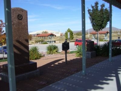
Largest U.S. city on the Mexican border. Named for the mountain pass. Historic gateway for Indians, priests, gold-seekers, traders, stages. Federal troops occupied this area longer than any other in Texas during the Civil War. Agricultural, . . . — — Map (db m38128) HM
Remembers that valor and devotion of her sons who served in the Arizona – New Mexico Campaign of 1861-62
Sibley's and Baylor's Texas troops followed this route in the expedition to occupy and hold the territory of New Mexico (present day . . . — — Map (db m38126) HM
This site commemorates the peaceful settlement of the Chamizal controversy, 1866 – 1963, and honors the men of goodwill, in the United States and Mexico, who made it possible.
Este sitio conmemora la resolucion amistosa de la disputa del . . . — — Map (db m118312) HM
Near Yandell Drive near Travis Street, on the right when traveling east.
Known as Concordia during the 1840s, this area was the home of Chihuahua trader Hugh Stephenson. In 1856 his wife, Juana (Ascarate), was buried in what is now part of Concordia Cemetery. The graveyard gained widespread use in the 1880s when El . . . — — Map (db m37947) HM
If you were standing here prior to the Chamizal Treaty of 1963, you would have been on a Mexican "island" looking into the United States. Referred to as Cordova Island because it was completely surrounded by the United States, this parcel of land . . . — — Map (db m38071) HM
On Wyoming Avenue at North Cebada Street, on the right when traveling west on Wyoming Avenue.
Dr. Lawrence Aaron Nixon was a pivotal figure in Texas civil rights. Born in Marshall, Harrison County, Texas, he attended Wiley College and Meharry Medical College and became a physician. He began his medical practice in Cameron, Milam County. . . . — — Map (db m60729) HM
Estela Portillo Trambley (1926-1998), an El Paso native, was an award-winning fiction writer, playwright and poet known for her vivid portrayals of strong and independent Mexican and Mexican American women in Texas and its borderlands. Recognized as . . . — — Map (db m118314) HM
Near North Stevens Street 0.1 miles south of East Yandell Drive.
History
In 1866, One year after the end of the Civil War and more than six months after the 13th Amendment abolishing slavery was enacted Congress had the need to reorganize the peacetime Regular Army. Recognizing the Military merits of Black . . . — — Map (db m38367) HM
On Wyoming Avenue at North Cebada Street, on the right when traveling west on Wyoming Avenue.
Henry Ossian Flipper (1856-1940) was the first African-American graduate of the United States Military Academy at West Point in 1877. Born into slavery in Thomasville, Georgia, he came from a family of achievers; his brothers were an African . . . — — Map (db m60727) HM
Virginia native James Harrison White came to El Paso in 1869 after serving with the Confederacy in the Civil War. In the 1870s he saw service in the Mexican army, the U. S. Army, and as U. S. Marshal of Las Cruces, New Mexico. As a civic leader and . . . — — Map (db m296363) HM
Born in Bonham, Texas, John Wesley Hardin was named for the founder of Methodism. "Wes" Hardin grew into a family man, cowboy, and outlaw who claimed to have killed more than 30 men. An unusual sort of gunslinger, Hardin considered himself a pillar . . . — — Map (db m38070) HM
"Lincoln commanded my nation to do all which may achieve a just and lasting peace. Juárez reminded us respect for the rights of others is peace. The goals of these men have guided us to this day."
President Lyndon Baines Johnson, . . . — — Map (db m252352) HM
On Magoffin Avenue, on the right when traveling east.
Joseph Magoffin (1837-1923), son of James Wiley Magoffin, one of the founders of the city, settled in El Paso in 1856. He held many offices: Collector of Customs, County Judge, and Mayor for four terms. In 1875, six years before railroads reached El . . . — — Map (db m38087) HM
On Magoffin Avenue, on the right when traveling east. Reported missing.
One of four population centers during the early period of American settlement of the present El Paso area, Magoffinsville was founded by Kentucky native James Wiley Magoffin (1799-1868). In 1849, he began acquiring land in this vicinity. The . . . — — Map (db m38086) HM
Honoring what each culture contributes to humanity.
Chamizal National Memorial is a park built on diplomacy. Established to commemorate the diplomatic settlement of a long-standing boundary dispute between the United States and Mexico, this . . . — — Map (db m252345) HM
He laid the foundation of the National Park Service defining and establishing the policies under which its areas shall be developed and conserved unimpaired for future generations. There will never come an end to the good that he has done. — — Map (db m37948) HM
The leaders of The Church of Jesus-Christ of Latter-Day Saints were looking to Mexico as a possible colonization site. By the spring of 1875, nearly 100 pages of selected passages from the Book of Mormon had been translated into Spanish for . . . — — Map (db m38069) HM
On South Santa Fe Street at Calleros Court on South Santa Fe Street.
Chihuahuita (Little Chihuahua) was settled by Ricardo Brusuelas, who received a land grant from Spanish authorities in 1818 and developed a prosperous ranch. After 1848, when the Rio Grande became part of the U.S.-Mexico border, new settlers arrived . . . — — Map (db m252368) HM
On South Santa Fe Street at Callaros Court on South Santa Fe Street.
Chihuahuita fue establecido por Ricardo Brusuelas quien en 1818 recibió una donación de tierras de las autoridades españolas y quien desarrollo un rancho exitoso. Después de 1848, cuando el Río Bravo (Río Grande) se convirtió en parte de la . . . — — Map (db m252369) HM
On South Santa Fe Street (State Highway 375) at Montestruc Court, on the right when traveling south on South Santa Fe Street.
El Paso Laundry and Cleaners CompanyThe El Paso Laundry and Cleaners Company was established in 1891 and moved to this site in 1897. Strategically located alongside the Rio Grande just a few hundred yards from the streets of Ciudad Juarez, the . . . — — Map (db m60743) HM
On South El Paso Street at East San Antonio Avenue, on the left when traveling north on South El Paso Street.
On this site, with Butterfield Stages rumbling by, stood a saloon operated by Ben S. Dowell, who became the first Mayor of El Paso on August 15, 1873; with Aldermen John F. Evans, John S. Gillette, Andrew Hornick, Thomas N. Massie, Joseph Schutz and . . . — — Map (db m37915) HM
On West San Francisco Avenue, on the left when traveling east.
With the arrival of the railroads to El Paso in 1881, the train tracks marked the northern boundary of the city. As El Paso grew, the tracks divided downtown and created a time-consuming barrier for pedestrians and motorists. In the early 20th . . . — — Map (db m37855) HM
On North Mesa Street at E San Antonio Ave, on the right when traveling north on North Mesa Street.
The Caples Building, a Romanesque style structure designed by Henry C. Trost, was built in 1909. Originally five stories tall, two additional floors were added to the building in 1915-1916. The fifth floor offices offered sweeping views of El Paso . . . — — Map (db m288144) HM
On North Oregon Street at Mills Avenue, on the right when traveling north on North Oregon Street.
The regal highway extending between his Catholic majesty's far flung kingdoms of New Spain, from Mexico City to the Kingdom of New Mexico, passed here. From 1581 onward it was the route followed by conqueror, padre, merchant, adventurer and settler. . . . — — Map (db m239454) HM
On West Mills Avenue at South El Paso Street, on the right when traveling west on West Mills Avenue.
Inhabited by various Indian tribes prior to the arrival of the Spaniards in the 16th century, El Paso has played an important role in the history of Mexico and the United States. Its four centuries of recorded history span periods of Spanish . . . — — Map (db m305425) HM
On West San Antonio Avenue east of West Paisano Drive (U.S. 85), on the right when traveling east.
One of the oldest survivors of America's steam railroading era, this locomotive was built 29 years after the steam engine was first developed for transportation. Breese, Kneeland & Company of Jersey City, New Jersey also operated as the New York . . . — — Map (db m37851) HM
On North Mesa Street (State Highway 20) at East Main Street, on the left on North Mesa Street.
Voted 871 to 2 for secession. At start of Civil War Minutemen were organized to provide frontier protection. The San Elizario Spy Company was mustered into Confederate service on July 11, 1861. El Paso was the springboard and supply point for 1861-2 . . . — — Map (db m48627) HM
Near West Paisano Drive (U.S. 85) at South Coldwell Street, on the right when traveling west.
This Union Station was built in 1904-05 as a center for El Paso's international railroad traffic. Constructed under the direction of Buchanan and Powers, general contractors, it was designed by the noted Chicago architectural firm of Daniel H. . . . — — Map (db m60718) HM
On West Mills Avenue, on the left when traveling west.
Chinese immigrants first arrived in El Paso shortly before the Southern Pacific Railroad completed its line here in 1881. The earliest immigrants opened a rooming house and a grocery store. Soon afterwards, the U.S. Government passed the Chinese . . . — — Map (db m37904) HM
On South El Paso Street at Pioneer Plaza, on the right when traveling north on South El Paso Street.
El Paso del Norte where the Centuries Meet
El Paso's First Newspaper
Near this spot in 1860, grew a cottonwood tree on whose broad breast were posted many public and private notices. In one of these on August 6th, 1860, Anson Mills . . . — — Map (db m37910) HM
On Texas Avenue at North Mesa Street, on the right when traveling west on Texas Avenue.
Elite Confectionary
The Elite Confectionary was located on the ground floor of the Buckler Building and was a popular soda fountain in the early years of the 20th century. It was noted for its chocolate covered ice cream baseballs along with . . . — — Map (db m37798) HM
On South El Paso Street at East San Antonio Avenue, on the left when traveling north on South El Paso Street.
In the early twentieth century, Felix Martinez was a prominent Hispanic businessman who worked closely with Anglo American leaders to transform El Paso into a major commercial, industrial and agricultural center of the American Southwest. Born in . . . — — Map (db m252424) HM
On East Main Street at East Mills Avenue on East Main Street.
The Consulate General of Mexico and the City of El Paso commemorate the historic meeting of William H. Taft, President of the United States and Porfirio Díaz, President of Mexico which took place in 1909.
The Presidents Taft and Díaz met on . . . — — Map (db m288203) HM
On South El Paso Street at Pioneer Plaza, on the right when traveling north on South El Paso Street.
English:
Fray García was born in Old Castile, Spain and traveled to Mexico in 1629 where he became a Franciscan priest serving in the Province of New Mexico. In 1659 he established the Manso Indian Mission of Our Lady of Guadalupe at the . . . — — Map (db m37913) HM
On North Oregon Avenue at Mills Avenue, on the right when traveling north on North Oregon Avenue.
Historic Sidewalk Clock
This sidewalk clock has marked time in downtown El Paso since 1911. Made by the E. Howard & company of Boston, Massachusetts it is a masterpiece of cast-iron workmanship featuring two large round faces and mounted on a . . . — — Map (db m37801) HM
On North Mesa Street south of East Main Street, on the right when traveling north.
Alzina DeGroff bought the Vendome Hotel at this site in 1899, renaming it Hotel Orndorff after her first husband. Noted architect Henry C. Trost designed a new building for her, which opened in 1926. Renamed Hotel Cortez in 1935, this brick . . . — — Map (db m37803) HM
On South El Paso Street at East San Antonio Avenue, on the left when traveling north on South El Paso Street.
This brick and terra cotta structure was the "dream hotel" of early El Paso businessman and promoter Zach White. White came to the town in 1881 and recognized El Paso's great potential as a gateway to Mexico. He worked hard to help the city . . . — — Map (db m290752) HM
The west's most feared
gunman, killer of at
least 26 men, was shot
dead in the Acme Saloon
on this site Aug. 19,
1895.
Hardin was shot in the
back of the head by El
Paso constable John
Selman.
At Selman's trial
witnesses . . . — — Map (db m24741) HM
On South El Paso Street north of East Paisono Drive (U.S. 85), on the left when traveling north.
317 South El Paso Street was the site of a leading pro-Villista Spanish language newspaper, La Patria, published by Silvestre Terrazas, a member of the oligarchic Chihuahuan Terrazas family. Terrazas wrote for La Revista Catolica and . . . — — Map (db m60744) HM
On South El Paso Street at Pioneer Plaza, on the right when traveling north on South El Paso Street.
The League of United Latin Citizens (LULAC) was founded in Corpus Christi, Texas in 1929, dedicated to the betterment of Americans of Mexican descent. The league soon expanded to El Paso with the establishment of LULAC Council 8 in 1933 and Council . . . — — Map (db m118077) HM
On South El Paso Street at East Overland Avenue, on the right when traveling north on South El Paso Street.
The Montgomery building is the last surviving false-front wood structure in the city of El Paso. It was built in 1881-1882 as El Paso underwent a great transformation from an adobe village to a thriving city following the arrival of the . . . — — Map (db m60745) HM
On North Stanton Street at Myrtle Avenue, on the right when traveling north on North Stanton Street.
To the memory of nine of primitive El Paso's patriotic heroes Emmett Mills
Aged 19
Freeman Thomas - Joe Poacher
M. Champion - John Pontel
Bob Avlin - John Wilson
Who in July 1861 were loyal citizens of El Paso, Texas and Loyal . . . — — Map (db m37902) HM
On West Missouri Avenue at North Coldwell Street, on the right when traveling south on West Missouri Avenue.
Composed primarily of early twentieth-century residential apartment buildings, this historic neighborhood was developed during a period of major growth in El Paso. Most of the structures were built of brick, stone, or wood between 1908 and 1923 and . . . — — Map (db m68168) HM
On South El Paso Street, on the right when traveling north.
Pioneer Plaza was the center of public activity in early El Paso. A United States military guard was posted here in the late 1870s to defend citizens from Apache Indian attacks, and military bands performed in the plaza.
An irrigation ditch . . . — — Map (db m37807) HM
On East San Antonio Avenue at South Campbell Street, on the right when traveling west on East San Antonio Avenue.
Robert Ewing Thomason was an El Paso attorney, state legislator, mayor, U.S. Congressman and Federal Judge who devoted more than fifty years of his life to public service. He earned a law degree from the University of Texas in 1900 and began his . . . — — Map (db m248990) HM
Near North Oregon Street south of East Main Street.
In 1857, W. T. Smith sold his property which he called "The Town of El Paso" for $6500.00. The buyers were J. S. and H. S. Gillette, J. F. Crosby, J. W. Morton and V. St. Vrain; they had it surveyed by Anson Mills. The map showed downtown El Paso . . . — — Map (db m37799) HM
On Texas Avenue (State Highway 20), on the right when traveling west.
Completed in 1928 for the Singer Company, this Spanish colonial revival style structure was designed by noted El Paso architect Henry Trost. For more than 50 years the ground floor served as Singer's Retail Store, while the second story was occupied . . . — — Map (db m37797) HM
On North Oregon Street, on the right when traveling north.
The United States Courthouse, which stood on this site from 1892 to 1936, was the scene of hundreds of arraignments, hearings and trials during the Mexican Revolution. Some of these legal proceedings involved Magónistas, or radical Liberal . . . — — Map (db m37916) HM
On South El Paso Street at East Overland Avenue, on the right when traveling north on South El Paso Street.
This block was the site of the stage station of the Southern Overland Mail line which connected St. Louis and San Francisco with a semi-weekly stage and mail service, 1858-1861. — — Map (db m60719) HM
On North Santa Fe Street at East Missouri Avenue on North Santa Fe Street.
“The Cavalryman" depicts a dismounted United States soldier, saddle in hand, serving on the Southwest frontier. "It should inspire all who view it with a determination to preserve the heritage which is theirs through the sacrifices of their . . . — — Map (db m249069) HM WM
On North Mesa Street at West Mills Avenue, on the left when traveling north on North Mesa Street.
By authority of War Department Orders of November 7, 1848
The First United States Soldiers
to be stationed at the Pass of the North
Camped in this Area
Regimental Headquarters and Six Companies
of the Third Infantry
Major . . . — — Map (db m37903) HM
On North Stanton Street, on the left when traveling north.
This seven-story commercial building was constructed in 1917 by businessmen M. D. Roberts and William Martin Banner, for whom it was named. Designed by the architectural firm of Brauhton and Leibert, it features Chicago style detailing in the use of . . . — — Map (db m37954) HM
On Leon Street south of West Overland Street, on the right when traveling south.
Mexican revolutionary Francisco (Pancho) Villa and his brother Hipólito stashed the currency, coins and jewelry they used to support themselves and their political activities in this house owned by George Benton during the Mexican Revolution . . . — — Map (db m248994) HM
On North Santa Fe Street at East Franklin Ave, on the left when traveling south on North Santa Fe Street.
Company E, 141st Regiment, 36th Infantry Division. The only WWII US Army Infantry Unit that enlisted Mexican American soldiers.
Company E began in 1941 when Mexican American National Guardsmen from El Paso, Texas were joined by Mexican . . . — — Map (db m250406) HM WM
On East San Antonio Avenue at South Campbell Street, on the left when traveling west on East San Antonio Avenue.
Maud Sampson Williams, black suffragist and civil rights leader, mobilized women to register and vote at county courthouse 1918-1919 — — Map (db m248993) HM
On Frutas Avenue at North San Marcial Street, on the right when traveling west on Frutas Avenue.
This Romanesque revival style building was constructed in 1908, soon after the church was founded by the Rev. Carlos M. Pinto, S.J. (1841-1919). A Jesuit priest who began several missions in the El Paso area, Pinto also drew plans and supervised the . . . — — Map (db m60726) HM
On North Martinez Street at Rosa Avenue, on the left when traveling north on North Martinez Street.
When the U.S. Army returned to this area after the Civil War, conditions proved undesirable at the prewar post, Fort Bliss at Magoffinsville. In 1868 the garrison moved to this location, then part of the Concordia Ranch. The new post was named Camp . . . — — Map (db m68278) HM
Near Cottonwoods Drive 0.8 miles north of Global Reach Drive.
The Butterfield Overland Mail was a mail and passenger stagecoach service that linked the Western and Eastern states. John Butterfield, president of the Overland Mail Company, won a federal government contact in 1857 to take and deliver mail twice . . . — — Map (db m68170) HM
On Robert E. Lee Road 0.1 miles west of Airport Road, on the right when traveling west.
In 1849, U.S. troops led by Maj. Jefferson Van Horne established a post in what is now downtown El Paso to secure territory gained in the U.S.-Mexico War, 1846-48. It moved several times: to Magoffinsville in 1854; to Camp Concordia in 1868; back . . . — — Map (db m85628) HM
On South Cotton Street at East 7th Avenue, on the left when traveling south on South Cotton Street.
Bowie High School is one of the oldest operating high schools in El Paso. Originally located in the Segundo Barrio neighborhood of South El Paso, the school would go on to primarily serve Mexican American students. The school was built in 1922 and . . . — — Map (db m252366) HM
On South Virginia Street at East Delta Drive, on the right when traveling south on South Virginia Street.
The Baptist Home Mission Board of New York established Second Baptist Church of El Paso in 1884 under the leadership of Reverend E.M. Griggs. Initially it had just five members - George Duvall, Thomas Gaines, Calvin Neal, and Mr. and Mrs. Joe . . . — — Map (db m252370) HM
On South Eucalyptus Street south of San Antonio Avenue, on the right when traveling south.
Douglass High School served El Paso's African-American community from 1920 to 1956 at this location, 101 South Eucalyptus Street. It initially offered instruction from kindergarten through grade 12. In 1947 an elementary school was built on the . . . — — Map (db m252353) HM
On Magoffin Avenue east of Willow Street, on the right when traveling east.
James Wiley Magoffin established a grand residence and trading post across from El Paso del Norte (Ciudad Juárez) in 1849. James, known by his friends as Don Santiago, was one of the most influential leaders in the area. Magoffinsville became an . . . — — Map (db m252363) HM
On North Eucalyptus Street at Magoffin Avenue, on the left when traveling south on North Eucalyptus Street.
Established September 14, 1849 by Brevet Major Jefferson Van Horne with 4 companies of the Third United States Infantry and known as post El Paso - vacated in 1851 - re-garrisoned in 1854 and named Fort Bliss in honor of Brevet Major William Wallace . . . — — Map (db m269137) HM
On Woodrow Bean Transmountain Road (State Highway 375) 2.5 miles west of Patriot Freeway (U.S. 54), on the right when traveling east.
Below is Fusselman Canyon, which follows the Fusselman Canyon Fault, a major natural cut into the Franklin Mountains. For centuries it has served as a natural corridor for the movement of people, goods and livestock between the river valley to the . . . — — Map (db m59163) HM
On North Cotton Street, on the left when traveling north.
In the late 1800s medical treatment of Tuberculosis called for isolation of the patient and complete rest. After the turn of the century research showed that bacteria responsible for the transmission of the communicable disease could be destroyed by . . . — — Map (db m37935) HM
On Ewald Kipp Way, on the right when traveling south.
In the spring of 1911 Pascual Orozco and Francisco "Pancho" Villa amassed their revolutionary forces on the outskirts of Ciudad Juárez and were soon joined by Francisco I. Madero. The Madero Camp, which stood across the river from this site, became . . . — — Map (db m38100) HM
On Ewald Kipp WayMarker, on the right when traveling south.
The Kansas City Consolidated Smelting and Refining Company came to El Paso in the late 19th century, creating a mining and smelting center for the Southwest. In 1899, the American Smelting and Refining Company (ASARCO) bought the operation and . . . — — Map (db m38098) HM
On Alameda Avenue west of Buena Vista, on the right when traveling east.
Established by Don Antonio de Otermín and Father Fray Francisco Ayeta, O.F.M. in 1682 • Maintained by Franciscan missionaries for the civilizing and christianizing of the Zuma Indians — — Map (db m269138) HM
Near Alameda Avenue (State Highway 20) north of North Washington Street.
Henry C. Trost was one of the most prolific architects of the American Southwest. His history is closely tied to that of his chosen base of operation, El Paso. Ohio native Trost was strongly influenced by Louis Sullivan and Frank Lloyd Wright, as . . . — — Map (db m68246) HM
On Alameda Avenue at Valdespino Street, on the right when traveling north on Alameda Avenue.
Approximate site of
the Mission and Pueblo of
San Antonio
de Senecú
Established by Don Antonio de Otermín and Father Fray Francisco Ayeta. O.F.M. in 1682 - Maintained by Franciscan missionaries for the civilizing and Christianizing of the . . . — — Map (db m37951) HM
Livestock shows and rodeos have a grand heritage in
Texas. Drawing from traditions of Hispanic vaqueros and western cattle drives, organized competitions in the state date from the 1880s, with the first documented El Paso
Rodeo occurring . . . — — Map (db m249030) HM
Near Alameda Avenue (State Highway 20) north of North Washington Street.
A master sculptor, Urbici Soler apprenticed under artists in his native Spain before studying and working in Germany, southern Europe, South America, and Mexico. In 1937 he came to El Paso to begin work on the statue "Cristo Rey," which stands on a . . . — — Map (db m68225) HM
Near Alameda Avenue (State Highway 20) north of North Washington Street.
Commander of federal forces during the Mexican Revolution, Victoriano Huerta (b. 1854) became President of Mexico in 1913, after the arrest and before the assassination of Francisco Madero. Huerta resigned a year later and went into exile. In 1915, . . . — — Map (db m68237) HM
On Alameda Avenue at Dorbandt Circle on Alameda Avenue.
Ysleta High School, built in 1929, is one of El Paso County’s oldest secondary schools and the first built by the Ysleta School District to serve the Lower Valley farming communities. Designed by the renowned architectural firm Trost & . . . — — Map (db m248866) HM
On South Old Pueblo Drive south of Alameda Avenue (Texas Highway 20), on the left when traveling north.
Although the exact building date for this adobe masonry structure is unknown, it appears to have been constructed during the 1870s for Benigno Alderete (1845-1916). Born in Ysleta (now part of El Paso), Alderete served at various times as a Texas . . . — — Map (db m37981) HM
Near South Zaragoza Road at Alameda Avenue (State Highway 20).
Originally founded in 1613 at Isleta Pueblo, in New Mexico, and dedicated in 1621 as San Antonio de Isleta. Removed to El Paso area, 1680 (during Pueblo Revolt), by Tigua Indians who brought along the Patron Saint as they accompanied fleeing . . . — — Map (db m118309) HM
On South Zaragoza Road at Texas Highway 20 on South Zaragoza Road. Reported missing.
Founded in 1682 By Don Antonio de Otermin and Padre
Fray Francisco Ayeta O.F.M.
for the civilizing and Christianizing of the Tigua Indians, Pueblo Revolt refugees, formally located at La Ysleta, New Mexico. Building damaged by floods of the Rio . . . — — Map (db m118313) HM
On Alameda Avenue at S Old Pueblo Drive on Alameda Avenue.
Ysleta Mission is the oldest continuously active parish in the State of Texas, and the community of Ysleta is the oldest town in Texas. The town was one of several agricultural communities started along the Rio Grande by Spaniards and Native . . . — — Map (db m288822) HM
On Alameda Avenue (State Highway 20) 0.1 miles east of Old Pueblo Drive, on the left when traveling east.
The present site of the Ysleta Neighborhood Health Clinic was part of the earliest Native American settlement associated with a Spanish Mission in the State of Texas, circa 1680 – 1750 A.D.
In 1989-1990, archaeologists conducted excavation and . . . — — Map (db m38088) HM
On West Old Paisano Drive 0.2 miles south of Ruhlen Court, on the right when traveling south.
Born in Kentucky. Trader in Mexico. Special U.S. Army agent in Mexican War, 1846-47. Established trading post at Magoffinville about 1850. Named state agent with Simeon Hart to receive U. S. property surrendered at Ft. Bliss, Mar, 1861 prior to . . . — — Map (db m38048) HM
Near West Paisano Drive, on the right when traveling south.
On May 4, 1598, Don Juan de Oñate, Adelantado and Capitain-General, Governor of New Mexico, first named El Paso del Rio del Norte.
Through this old pass, the lowest snow-free feasible route from the Atlantic to the Pacific through the Rocky . . . — — Map (db m24743) HM
On West Old Paisano Drive 0.2 miles south of Ruhlen Court, on the right when traveling south.
Born New York moved to El Paso 1861, founded Hart's Mill that ground out 100 barrels flour a day and sold to buyers from Arizona to San Antonio. When the Civil War came he was the main source for securing military supplies for the Arizona-New Mexico . . . — — Map (db m38043) HM
On West Old Paisano Drive 0.2 miles south of Ruhlen Court, on the right when traveling south.
For more than 200 years the Camino Real, or Royal Road, was the major route for transporting commercial goods from Mexico City and Chihuahua to Santa Fe and Taos. First traveled by Juan de Oñate during his 1598 expedition to New Mexico, the Camino . . . — — Map (db m118283) HM
On Scenic Drive, on the right when traveling east.
El Paso has always been a transportation, agricultural, industrial and international crossroads, with a well balanced economy. Built upon a strong spiritual, cultural, governmental and educational foundation. Sunny days, crystal clear nights and . . . — — Map (db m37933) HM
On West Yandell Drive at Corto Way, on the right when traveling west on West Yandell Drive.
Prominent El Paso attorney Richard Fenner Burges (1873-1945) had this house built in 1912 by local contractor J.E. Morgan. It was altered in 1927 according to plans of architect Otto H. Thorman, resulting in its current appearance featuring . . . — — Map (db m60720) HM
On Los Angeles Drive west of El Paso Street, on the right when traveling west.
El Pasoans initially obtained their domestic water from acequias, or open irrigation ditches, and later from the aguadores, water-carriers who delivered fresh water as depicted in the nearby mural. In 1882, Sylvester Watts built the first El Paso . . . — — Map (db m248986) HM
On Scenic Drive, on the right when traveling east.
El Paso International Airport. One of the nation's finest and busiest major airports and general aviation centers, dedicated in 1928. Elevation is 3,936 feet with a total area of 3,878 acres and tremendous runways measuring up to 12,000 feet. . . . — — Map (db m37882) HM
On Scenic Drive, on the right when traveling east.
El Paso Lower Valley Missions
Ysleta Mission -- 1681. Ysleta, the oldest community in Texas, claims the most steadily cultivated plot of land in the U.S.
Socorro Mission -- 1682. Regarded as the oldest active parish church in the . . . — — Map (db m37890) HM
On Montana Avenue north of North St Vrain Street, on the right when traveling west.
The first meeting of Baptists in El Paso was held on August 26, 1882, at the home of Maj. and Mrs. W.F. Fewel, under the leadership of the Rev. George Baines, Jr. One week later he directed the formation of this congregation, which was chartered . . . — — Map (db m60723) HM
In the early 1880s, Presbyterians worshiped with other El Paso denominations in a Union tent at the town's center. Their own congregation was organized on April 16, 1882, under the guidance of the Rev. John Alexander Merrill, who had traveled here . . . — — Map (db m252429) HM
On Scenic Drive, on the right when traveling east.
Mount Cristo Rey
High above the point where the states of Texas, New Mexico and Chihuahua intersect stands an impressive monument at the summit of Sierra de Cristo Rey, portraying Christ on the cross. The dream of the small parish of San Jose . . . — — Map (db m37930) HM
On North El Paso Street north of West Yandell Drive, on the right when traveling north.
Congregation B'Nai Zion was chartered in 1900, and the 35 members initially met in private homes or rented space. This building, the first Jewish synagogue in El Paso, was completed in 1912. The structure features an unusual combination of classical . . . — — Map (db m60722) HM
Completed in 1917, this building was the first structure on the new campus of the Texas State School of Mines and Metallurgy, now the University of Texas at El Paso. The Bhutanese style was suggested by Kathleen L. Worrell, wife of the school's . . . — — Map (db m252458) HM
On North Mesa Street at East River Ave, on the left when traveling south on North Mesa Street.
Olga Kohlberg was an El Paso civic leader who championed women's rights, public education and welfare for the poor. Born Olga Bernstein in Elberfeld, Westphalia (Germany) in 1864, she was raised in an upper-middle class German-Jewish family. She . . . — — Map (db m248984) HM
On Scenic Drive, on the right when traveling east.
As early as 1881, El Paso leaders promoted the idea of creating a place along the base of the Franklin Mountains to provide visitors a panoramic view of the area. The automobile brought new attention to the idea, and in 1920, the city council and . . . — — Map (db m37872) HM
On Prospect Street at Porfirio Diaz Street, on the right when traveling south on Prospect Street.
Originally platted as Satterthwaite's addition to the city of El Paso, Sunset Heights was one of the first planned residential subdivisions in the country. New York native J. Fisher Satterthwaite developed the area, which was named in a newspaper . . . — — Map (db m252433) HM
359 entries matched your criteria. Entries 101 through 200 are listed above. ⊲ Previous 100 — Next 100 ⊳