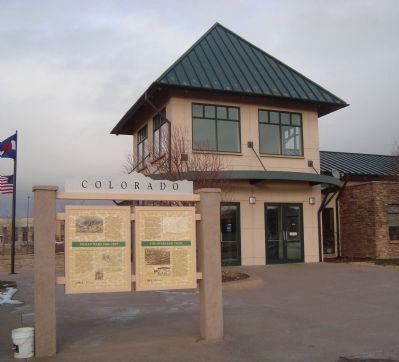
In November 1864, in southeastern Colorado, U.S. Volunteers troops attacked Black Kettle’s peaceful band of Cheyenne Indians at Sand Creek. In retaliation for the massacre and mutilation of 163 Cheyenne men, women, and children, Cheyenne warriors . . . — — Map (db m51217) HM
Near Overland Trail just east of U.S. 6, on the left when traveling east.
Sterling's beloved museum began as a joint venture between the Logan County Historical and Natural History Society and the local office of the Works Progress Administration (WPA). Built during the height of the Great Depression and initially called . . . — — Map (db m222403) HM
On South 4th Street at Main Street, on the right when traveling north on South 4th Street.
In Loving Memory of Orville S. Johnson (1911-1987) and H. Catherine Johnson (1914–2003) Orville and Catherine Johnson were lifetime residents of Northeast Colorado. Orville graduated from Sterling High School in 1930) and Catherine from Padroni . . . — — Map (db m289034) HM
On Main Street (Colorado Route 14) east of South 4th Street (U.S. 6), on the right when traveling east.
With the faith and courage of their forefathers who made possible the freedom of these United States The Boy Scouts of America dedicate this copy of the Statue of Liberty as a pledge of everlasting fidelity and loyalty 40th Anniversary . . . — — Map (db m177078) HM
On State Highway 138. Reported permanently removed.
This tablet commemorates the establishment of the first public school in the Sterling settlement, October, 1875. It was taught by Carrie G. Ayres, later Mrs. J. N. Hall of Denver. The sod schoolhouse stood 3160 feet east and the sod fort built by . . . — — Map (db m293883) HM
Call it the Pikes Peak Trail, the Denver Road, Overland Trail, or the South Platte River Trail – by any name, it dominated the movement of people and goods in Colorado between 1858 and 1867 and ranks with the great trails of American history. . . . — — Map (db m51215) HM
On N 4th Street at Main Street, on the right when traveling north on N 4th Street.
"This river, this valley, this giant furrow was the route of moving Indian tribes, of John C. Fremont on two occasions, of trappers, traders and gold seekers. It dictated the course of the Union Pacific tracks from Julesburg to Denver and the . . . — — Map (db m288862) HM
This tablet is the Property of the State of Colorado
3.8 miles north along county road is the site of Valley Station, built in 1859 as a stagecoach station of the Leavenworth and Pike Express. Station on the Overland Trail to California, . . . — — Map (db m51214) HM
On Grand Army of the Republic Highway (State Highway 6) at County Road 22 on Grand Army of the Republic Highway.
This tablet is erected in honor of
William Shaw Hadfield
The first white settler of Logan County, marking the site of his first sod house at Hadfield Island in 1871, three-fourths mile east.
Erected by the wife
Margaret Seibert . . . — — Map (db m61996) HM
On South Front Street close to Main Street, on the right when traveling north.
In the late 1800's the South Platte River Valley was a treeless wilderness covered in sagebrush, prairie grass and scrub willows. Great herds of antelope and buffalo roamed the windswept plains. Those continuing further west referred to this . . . — — Map (db m288864)
On State Highway 52 0.1 miles north of Interstate 76, on the right when traveling north.
Junction Station, the first settlement at this site, suffered numerous Indian attacks similar to those that raged all along the South Platte during the mid 1860s. To protect the crucial crossroads, which joined the South Platte River Trail with its . . . — — Map (db m47322) HM
On Main Street just south of East Railroad Avenue, on the left when traveling south.
Has been placed on the National Register of Historic Places by the United States Department of the Interior First City Superintendent: George Cox — — Map (db m289400) HM
Occupied from 1864 to 1868 and the divergence of the Denver Cut Off from the Overland Trail
This monument is erected by Fort Morgan Chapter, Daughters of the American Revolution
1912 — — Map (db m51213) HM
On State Highway 52 0.1 miles north of Interstate 76, on the right when traveling north.
Spanning the South Platte River, the Rainbow Arch Bridge carried vehicular traffic from its completion in 1923 until its closure in 1988. Engineer James B. Marsh of Des Moines, Iowa, designed the structure in 1922. Denver bridge contractor Charles . . . — — Map (db m47194) HM
On State Highway 52 0.1 miles north of Interstate 76, on the right when traveling north.
Sugar beets didn't become Colorado's first major cash crop by accident. Scientists, businessmen, and newspapers spent thirty years singing the praises of this starchy root, which as early as the 1860s was found to be perfectly suited to Colorado's . . . — — Map (db m47321) HM
On State Highway 52 0.1 miles north of Interstate 76, on the right when traveling north.
Take a few moments on this spot to explore the South Platte River and the riparian woodland that runs beside it. You'll discover that this ribbon of life is a great place for wildlife watching.Where the South Platte flows through prairie, farm, and . . . — — Map (db m47316) HM
A Visionary, An Uncle, and Scandinavians
Fowler
Jackie Moore: A scout for Kit Carson, ox team driver for freight between St Louis to Colorado, cattle herder, wood hauler. “Uncle” Jackie Moore’s life (1821-1927) spanned the . . . — — Map (db m313745) HM
Two Rivers and a Place to Land
Fowler
Two Rivers: It was the water in the Arkansas River and Apishapa River that attracted settlers who wanted to farm. They soon discovered that it took irrigation to raise good crops in this country. . . . — — Map (db m313750) HM
We have here a happy intermixture of nations and languages. French, Spanish, Indian and English salute your ears at one and the same time, and I am often at my wit's end to understand all the appeals made to me by such a Babel-tongued . . . — — Map (db m191922) HM
Near State Highway 194 0.1 miles east of County Road 35, on the right when traveling east.
John C. Fremont
His name appears on almost any roll of Western pathbreakers. Fremont’s expeditions were instrumental in opening the Southwest. He visited the fort on three of his first four expeditions to the West.
Susan . . . — — Map (db m180971) HM
The Arkansas River sustains a
tree-lined swath across the grasslands.
Making use of the trees and plants
available to them was key to the
survival of people on the Plains.
Groves of cottonwood trees offered shade for
people and . . . — — Map (db m180872) HM
Near Colorado Route 194 0.1 miles east of County Road 35, on the right when traveling east.
A Mud Castle Rises
In 1833, Bent, St. Vrain & Company built a trading post on the semi-arid reaches of the Arkansas River on the U.S. border with Mexico. Few if any buildings in the American West approached Bent’s Fort in size and . . . — — Map (db m71847) HM
From 1819 to 1847, the Arkansas River
formed the border between nations. Look across the river. When Bent's Old Fort was
active, you would be looking into a foreign country.
The land on the far side of the river was Mexican
territory . . . — — Map (db m181228) HM
Over the centuries, people living in and
traveling through the Arkansas River
Valley have used the natural resources
of the area to build their homes
and shelters.
Native peoples used bison skins to make tepees.
These cone-shaped . . . — — Map (db m180896) HM
On Colorado 194 0.1 miles east of County Road 35, on the right when traveling east.
Erected at the request of the Daughters of the American Revolution 1910 by A.E. Reynolds
Bent's Fort Santa Fe Trail as shown by ruins of walls in 1909
1822 The Santa Fe Trail 1875
This stone marks the point of the trail where the . . . — — Map (db m192004) HM
On Warren Avenue, on the left when traveling north.
Bent’s Old Fort along the Santa Fe Trail
At a distance, it presents a handsome appearance, being castle-like with towers at its angles…the design…answering all purposes of protection, defense, and as a residence. Second . . . — — Map (db m286236) HM
On Warren Avenue, on the right when traveling north.
City of La Junta
Enjoy the present, Explore the past, Gaze into the future;
The local tradition of studying Native American lore began in 1933 with a group of young boys who gathered to study archaeology and Southwest . . . — — Map (db m286133) HM
Near State Highway 194 0.1 miles east of County Road 35.
Edward Dorris
Died July 21, 1865
Aged 31 years
2 Ms. 28 Ds.
Edward Thou Hast Gone to Rest
In This Far Country of the West
Brothers and Friends Mourn and Weep
Thou in this Tomb Dost Sweetly Sleep
Edward Dorris, a . . . — — Map (db m71850) HM
On Warren Avenue, on the right when traveling north.
Explore the La Junta Region
A Cultural Overview of Southeastern Colorado
Historic Native American
A.D. 1550
Apachean groups arrive
Spanish
1590
Bonilla y Humana expedition (1593)
1680
Pueblo Revolt (1680) . . . — — Map (db m286244) HM
Near State Highway 194 0.1 miles east of County Road 35, on the right when traveling east.
I wish I was capable to do Bent and St. Vrain justice for the kindness received at their hands. I can only say their equals were never in the mountains.
- Christopher “Kit” Carson
Charles Bent
Charles Bent led . . . — — Map (db m71848) HM
Near State Highway 194 0.1 miles east of County Road 35, on the right when traveling east.
The land surrounding the Arkansas River teemed with wildlife. Most numerous were the bison or buffalo. They were the dominant species of the high plains, the emblem of the prairie. The fortunes of Bent's Fort and the neighboring tribes were tied . . . — — Map (db m192001) HM
On Warren Avenue, on the right when traveling north.
Railroads Built this Town!
Modern Rails Mimic the Santa Fe Trail
The town of La Junta was established as a temporary stop on two rail lines.
Atchison, Topeka & Santa Fe Railroad
The Atchison Topeka and Santa Fe Railroad arrived . . . — — Map (db m286240) HM
On Warren Avenue north of Belmont Avenue, on the right when traveling north.
Although some American Indian groups practiced farming and gardening about 2000 years ago, it was not until after the Mexican-American War of 1846-1848, the 1858 Colorado Gold Rush, and the Homestead Act of 1862 that immigrants moved into the . . . — — Map (db m286308) HM
On Warren Avenue, on the right when traveling north.
Recreation on the Comanche National Grassland
Get into the Canyons!
Vogel Canyon
Hike five trails that feature rock art and the remnants of the historic Barlow Sanderson Stage Road. Drive 13 miles south of La Junta on Hwy 109 to the . . . — — Map (db m286306) HM
When the Bents first traveled to this area they may have encountered elk, bighorn sheep, pronghorn, deer, grizzly bears, wolves, beaver, river otters, and the huge herds of bison that once lived here. Bison especially, provided the region's native . . . — — Map (db m180856) HM
The Purgatoire River Region
San Jose Plaza
The largest migration to the Purgatoire Valley of the nineteenth century occurred during the 1860s, as New Mexican frontiersmen and their families headed north in search of available land. . . . — — Map (db m313711) HM
Imagine traveling in the 1840s on the
Santa Fe Trail. You have just spent weeks
crossing hundreds of miles of lonely and
desolate prairie. There would have been
no help if you broke a wheel or an axle,
no help if you ran out of supplies. . . . — — Map (db m180968) HM
On State Highway 194 0.2 miles east of County Road 35, on the right when traveling east.
The Santa Fe Trail was an overland two-way trade road that connected Franklin, Missouri, with Santa Fe, New Mexico. After stopping at Bent's Old Fort for rest and resupply, traders heading east had about 180 miles to cover before reaching the point . . . — — Map (db m289485) HM
On State Highway 194 0.2 miles east of County Road 35, on the right when traveling east.
After a stay at Bent's Fort, traders heading west had a rough road ahead. The Sangre de Cristo Mountains loomed and the main route of the trail was through the rugged Raton Pass. The road was so rocky that in the 1840s a day's progress could be . . . — — Map (db m289395) HM
On State Highway 194 0.3 miles east of County Road 35, on the right when traveling east.
For centuries, the Arkansas River Valley has been an important travel corridor that has shaped our nation’s history.
Long before the fort was built, wildlife, native peoples, European explorers, trappers, and traders traveled through this river . . . — — Map (db m71851) HM
Near State Highway 194 0.1 miles east of County Road 35, on the right when traveling east.
In winters northers howled ... In summer temperatures climbed above the hundred-degree mark ... Spirits shriveled as respiratory organs dried; lips cracked and eyes burned ... it took a particular kind of spiritual iron to survive ... . . . — — Map (db m71846) HM
You are Standing on the Mountain Branch of the Santa Fe Trail
Susan Shelby Magoffin’s diary:
Down the Santa Fe Trail and into Mexico August 1846
Thursday 13th. “Purgatoire River” Camp No. 6. We are still lying at the Camp as of last . . . — — Map (db m313743) HM
On N. 9th Street north of Swink Avenue (U.S. 50), on the left when traveling north.
Born in Kentucky in 1836
Came to Colorado in 1871
Established a general merchandise store and (trading post) at a rocky ford on the Arkansas River.
Moved store and family to present site in 1876, when Santa Fe Railroad was extended . . . — — Map (db m70390) HM
On State Highway 71 north of U.S. 350, on the left when traveling north.
Travelers from Missouri would have crossed more than 600
miles of plains by the time they stood here. They picked this
more difficult Mountain Route of the Santa Fe Trail for its
reliable water. With less than a quarter of the trip . . . — — Map (db m180840) HM
On Grand Army of the Republic Highway (U.S. 6) at County Road 63, on the right when traveling west on Grand Army of the Republic Highway.
The last major Indian-white conflict on Colorado’s eastern plains took place on July 11, 1869, at Summit Springs Battlefield, south of Sterling. The U.S. Fifth Cavalry defeated Chief Tall Bull’s Cheyenne Dog Soldiers, killing Tall Bull and . . . — — Map (db m289498) HM
On East Kellogg Street 0.1 miles east of South Interocean Avenue (U.S. 385), on the right when traveling east.
This American Liberty Elm was named after "The Liberty Tree: Our Country's first Symbol of Freedom." On the morning of August 14, 1765, the people of Boston awakened to discover two effigies suspended from an elm tree in protest of the hated Stamp . . . — — Map (db m176792) HM WM
On Grand Army of the Republic Highway (U.S. 6) at County Road 63, on the right when traveling west on Grand Army of the Republic Highway.
Colorado's vast plains, rugged mountains, and grand plateaus, so magnificent in their beauty and variety, seem at time to overshadow the state's history and people. But look closely. The story of Colorado is every bit as dramatic as the physical . . . — — Map (db m289399) HM
Near County Road 235/10 south of West Amache Road.
Marker No. 1:
Amache
During the first months of World II, the United States Government ordered over 110,000 men, women, and children of Japanese descent to leave their homes, and incarcerated them in remote, military-style camps. . . . — — Map (db m62111) HM
Near County Road E 0.9 miles south of West Amache Road.
(Front)
Dedicated to the 31 patriotic Japanese Americans who volunteered from Amache and dutifully gave their lives in World War II, to the approximately 7000 persons who were relocated at Amache, and to the 120 who died there during . . . — — Map (db m82732) HM WM
Near Santa Fe Trail Scenic Byway (U.S. 50/400 at milepost 467.4), 0.5 miles west of the Colorado/Kansas state border, on the left when traveling west.
For centuries the Arkansas was a divided river. Indian nations waged ongoing battles over this life-sustaining resource, vying for access to its water and its fertile hunting grounds. Over time an uneasy balance emerged — the Kiowas, Comanches„ and . . . — — Map (db m289599) HM
Near Santa Fe Trail Scenic Byway (U.S. 50/400 at milepost 467.4), 0.5 miles west of the Colorado/Kansas state border, on the left when traveling west.
From cattle kings to cowboys and cow towns to hell on wheels railroad camps, this portion of the Santa Fe Trail encompasses all of the legends of America's Old West. Hiram S. Holly, town founder, arrived here in 1871 with 1,300 cattle. His 50,000 . . . — — Map (db m289600) HM
Near Santa Fe Trail Scenic Byway (U.S. 50/400 at milepost 467.4), 0.5 miles west of the Colorado/Kansas state border, on the left when traveling west.
The Heart of the Old West Colorado's portion of the Santa Fe Trail is a 184-mile section of the Santa Fe National Historic Trail. It is designated as one of America's Byways and a Colorado Scenic and Historic Byway. The trail begins in Missouri . . . — — Map (db m289642) HM
Near Santa Fe Trail Scenic Byway (U.S. 50/400 at milepost 467.4), 0.5 miles west of the Colorado/Kansas state border, on the left when traveling west.
At frontier towns where are centered many cattle… there are always to be found a number of bad characters, both male and female; of the very worst class in the universe, such as have fallen below the level of the lowest type of the brute . . . — — Map (db m289598) HM
Near Scenic U.S. 50/287 at State Highway 196, on the left when traveling north.
An area along the Arkansas River bottoms, 45 miles westward from a point 20 miles east of Lamar was known as “The Big Timbers” during the “Building of the West.” Big Timbers received its name from giant cottonwoods which flanked both banks of the . . . — — Map (db m213689) HM
On Scenic U.S. 50/287 at State Highway 196, on the right when traveling west on U.S. 50/287Scenic .
Indian Artifacts Our artifacts date from Paleo Indians to the last of the Cheyenne and Arapaho in the region. The Sand Creek collection includes bullets, arrowheads, cannonball fragments and campsite artifacts. It is the largest display . . . — — Map (db m213692) HM
Near Main Street (U.S. 50) at E. Beech Street, on the right when traveling north.
Location, Location, Location
Thousands of caravans used the Santa Fe Trail between 1821 and 1880. The trail clung close to the Arkansas River for hundreds of miles across the open plains. The Arkansas Valley offered gentle terrain . . . — — Map (db m106937) HM
On Scenic U.S. 50/287 at State Highway 196, on the right when traveling west on U.S. 50/287Scenic .
John Martin Reservoir The Southeast Colorado region, including the Big Timbers area, was once a great inland sea. The first transportation routes across the Santa Fe Trail were established by prehistoric migrating groups that . . . — — Map (db m213693) HM
On South Main Street (U.S. 287/385) just north of East Oak Street, on the right when traveling north.
So read the article's headlines in the Lamar Daily News, September 27,1935. The Holland windmill built in the early 1930's in the backyard of the home of businessman Floyd M. Wilson on East Parmenter Street, Lamar, was featured as the garden's . . . — — Map (db m213849) HM
Near State Highway 287 just north of Scenic U.S. 50/287, on the left when traveling north.
In honor to all soldiers alive and fallen for your devotion and sacrifices with Iraqi Freedom ———————————————— We Americans thank you God bless our heroes God bless America Frank Alonzo • Robert L. Pummill Sr. • Sgt. Andrew Alonzo USMC U.S. . . . — — Map (db m213755) WM
On Main Street (U.S. 50) at E. Beech Street, on the right when traveling north on Main Street.
(Front Panel)
N.S.D.A.R. Memorial
to the
Pioneer Mothers
of the
Covered Wagon Days
(Right Side Panel)
A place of historical lore noted for Indian lodges; shelter from storm and heat; food supply for beast; bivouac . . . — — Map (db m106897) HM
Near Scenic U.S. 50/287 at State Highway 196, on the right when traveling west.
The Story Begins… in 1922 when Mrs. John Trigg Moss representing the National Society of the Daughters of the American Revolution and Harry Truman joined forces to petition Congress to designate a "National Old Trails Road," . . . — — Map (db m213698) HM
On Rotary Way just north of Memorial Drive, on the left when traveling north.
Pike’s Tower is dedicated to the explorer, Brigadier General Zebulon Pike, for whom Pike’s Peak was named. He camped at this site on November 13, 1806 with his expedition group while heading west across Colorado. He was a U.S. Army officer who led . . . — — Map (db m289663) HM
On Main Street (U.S. 50) 0.3 miles south of Highway 196, on the right when traveling north. Reported permanently removed.
The Santa Fe Trail was the main trade route between Franklin MO and Santa Fe NM. The main part of the trail was 780 miles long. Thousands of freight wagons rumbled along the trail each year, except for the winter months. The trail passes several . . . — — Map (db m106939) HM
On Scenic U.S. 50/287 at State Highway 196, on the right when traveling west on U.S. 50/287Scenic .
The Heart of the Old West Santa Fe Trail Scenic and Historic Byway is an 188 mile portion of the Santa Fe National Historic Trail designated as one of America's Byways and a Colorado Scenic Byway. The entire Santa Fe Trail begins in . . . — — Map (db m213699) HM
On Scenic U.S. 50/287 at State Highway 196, on the right when traveling west on U.S. 50/287Scenic .
The Santa Fe Trail passed through present Lamar a quarter-mile south of this sign. In 1821 it became America's first international commercial highway, and for sixty years it was one of the nation's great routes of commerce and westward expansion. . . . — — Map (db m213700) HM
Near Main Street (U.S. 50) at East Beech Street, on the right when traveling north.
Welcome to Colorado
Colorado’s vast plains, rugged mountains, and grand plateaus, so magnificent in their beauty and variety, seem at times to overshadow the state’s history and people. But look closely. The story of Colorado is every bit . . . — — Map (db m106936) HM
Near County Highway 35.25 south of County Highway JJ.
Bent's New Fort links the continuous story of
southeastern Colorado-from the development of the
Santa Fe Trail, to the occupation of Bent's Old Fort, to
the construction of Fort Wise, to the disintegration of
human relationships following the . . . — — Map (db m181871) HM
Near County Highway 35.25 south of County Highway JJ.
The site of Bent’s New Fort built by William W. Bent in 1853 as an Indian trading post. Sold to the US Government, 1859. Buildings added one mile west and named Fort Wise in 1860. Re-named Fort Lyon in 1861. Fort moved . . . — — Map (db m180841) HM
On County Highway 35.25 south of County Highway JJ, on the right when traveling south.
Today the image of buffalo herds moving across the
plains is only a memory. For William Bent, buffalo
were a means to an end in which he traded with
Plains Indians and sustained his business. Bent relied
on Arapaho, Cheyenne, Kiowa, and Comanche . . . — — Map (db m180904) HM
Near County Highway 35.25 south of County Highway JJ.
In 1859 William Bent once again found the military
on his doorstep. This time the army was charged with
defending emigrants and gold seekers. Tens of thousands of people came to Colorado
seeking gold, then demanded protection along the
Santa . . . — — Map (db m180928) HM
On County Highway 35.25 south of County Highway JJ.
Bent Family Beginnings The entrepreneurial spirit of William
and Charles Bent and Ceran St.
Vrain brought them to the banks of
the Arkansas River where they built
Bent's Old Fort in 1833. Mutual
respect, intermarriage, and . . . — — Map (db m185030) HM
Near County Highway 35.25 south of County Highway JJ.
I saw the American flag waving and heard Black Kettle
tell the Indians to stand around the flag. I also saw a
white flag raised. These...were in such a conspicuous
position they could not have been missed.
-Robert Bent, son of William . . . — — Map (db m181015) HM
A Moving Experience
The town of Julesburg moved three times before settling in its present location. The first relocation was the result of an Indian raid. The second and third were prompted by the need to be close to the railroad. The . . . — — Map (db m253043) HM
On County Route 28 6 miles west of U.S. 385, on the right when traveling west.
When Jules Beni established his trading post here in the mid-1850's, he unknowingly set the stage for a series of four towns that would bear his name. Strategically located at the Upper California Crossing of the South Platte River, the first . . . — — Map (db m47346) HM
Gap-toothed and grumbling, the old windmill keeps vigil over the valley where a gravel road has replaced horse and wagon trails. The windmill is more than a machine - it symbolizes survival.The windmill grew up with the American West, supplying . . . — — Map (db m47343) HM
On East First Street (U.S. 385), on the left when traveling east.
Here on the Great Plains where the ramparts of the Rocky Mountains still lies some hours westward, the Mountain State welcomes you. This highway leads up the valley of the South Platte River to Denver. In 1859 and 1860 the gold rush carried . . . — — Map (db m100203) HM
On County Road 63.2 at County Road 36, on the right when traveling north on County Road 63.2.
The Organic Act creating the Territory of Colorado was signed by President Buchanan on February 26, 1861. The act carved from the territories of Kansas, Nebraska, Utah and New Mexico the 104,247 square miles that became the 38th state in 1876. . . . — — Map (db m119436) HM
On County Road 28 at Jenkins Street, on the left when traveling west on County Road 28. Reported permanently removed.
From the eastern prairie to the Rocky Mountains and the western plateau country beyond, Colorado enjoys a rich abundance of wildlife. Protecting this heritage has been a challenge, and Colorado's success is due to the efforts and cooperation of . . . — — Map (db m306451) HM
On County Route 28, on the left when traveling west.
Devil’s Dive
This deep, rugged wash presented problems for stagecoaches.
Drivers of wagons usually circled to the south rather than take the time to hitch up double teams needed for passage through the wash. Ruts made by thousands of . . . — — Map (db m79877) HM
On 1st Street at Walnut Street, on the right when traveling east on 1st Street.
In the 1880's, a fourth Julesburg developed at the junction of the Transcontinental Railroad and the Denver Branch of the Union Pacific. Originally known as Denver Junction, the town was soon renamed Julesburg, presumably the last of Jules Beni's . . . — — Map (db m47367) HM
On County Route 28 2.9 miles west of U.S. 385, on the right when traveling west.
Cheyenne, Arapaho and Sioux warriors burned the first Julesburg in early 1865. The second Julesburg was formed here, just outside the Fort Sedgwick Military Reservation. At its peak, the community included a store, blacksmith shop, billiards saloon, . . . — — Map (db m47340) HM
On County Route 28 6 miles west of U.S. 385, on the right when traveling west.
The senseless slaughter of peaceful Cheyenne on November 29, 1864, at Sand Creek in Southeastern Colorado united the Cheyenne, Sioux and Arapaho Indians.Near here on January 7, 1865, a small band of Cheyenne Dog Soldiers attacked a stagecoach and . . . — — Map (db m47344) HM
On Interstate 76 at U.S. 385, on the right when traveling north on Interstate 76. Reported permanently removed.
For thousands of years, these grasslands have supported tens of millions of buffalo, from the giant species of ancient times to the smaller version of today. As North America's largest land animal, buffalo dominated life on the Great Plains. In . . . — — Map (db m306452) HM
On 1st. Street at Walnut Street, on the right when traveling east on 1st. Street.
1. DePoorter Lakeis located off U.S. 385, just south of Julesburg. It offers fishing, picnic tables, restrooms and a wheelchair accessible pathway around the lake.2. Hippodrome Theatre is newly restored and a source of community pride. This . . . — — Map (db m47371) HM
On County Route 28 6 miles west of U.S. 385, on the right when traveling west.
The Pony Express mail service between St. Joseph, Missouri and Sacramento, California only lasted a short time in 1860-61, but its romantic image continues to captivate the hearts of the American public. In only 19 months, its riders covered over . . . — — Map (db m47347) HM
On County Road 28 6 miles west of U.S. 385, on the right when traveling west.
This Memorial is the
Property of the State of Colorado
Due North 1235 Feet is the Original Site of
Old Julesburg
named for Jules Beni, whose trading post was established at the "Upper Crossing" of the Platte prior to . . . — — Map (db m47348) HM