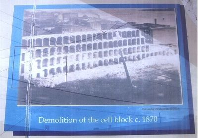
On William Street north of West Broadway (Route 100), on the left when traveling north.
Ruins of first state prison in Illinois. Built in 1830-31. Unsanitary conditions aroused persistent criticism from Dorothea Dix, pioneer in prison reform. All inmates were transferred to Joliet prior to 1860. During the Civil War many Confederate . . . — — Map (db m144762) HM
On Alby Street at East Broadway, on the right when traveling south on Alby Street.
Lincoln made frequent legal and political trips to Alton putting him in the heart of Alton history.
For nearly twenty-five years before becoming president, Lincoln was a general practice attorney, representing clients in a variety of . . . — — Map (db m133290) HM
On East 5th Street at Central Avenue, on the left when traveling east on East 5th Street.
Scott Bibb (1855-1909) was the plaintiff in the Alton School Case, a series of lawsuits that sought to retain Alton's desegregated schools, which had existed in Alton from 1872 to 1897, a short-lived outcome of the Reconstruction era. When Alton . . . — — Map (db m133294) HM
On State Street north of West Broadway (Illinois Route 100), on the right when traveling north.
The Franklin House hotel served as Lincoln's debate headquarters and reception area during the final debate.
In 1858, great debates were staged for the public with carnival-like appeal. People came from across Illinois and nearby states to . . . — — Map (db m164649) HM
"He had been in Alton scarcely a year when he began the building with his own funds, of a neat stone church on the corner of Third and Market Street and offered the building for use of all organized religious bodies in the town. From that time . . . — — Map (db m144835) HM
On William Street north of West Broadway Street, on the left when traveling north.
The Civil War began at Fort Sumpter on April 12, 1861 and Alton became a stopping off point for thousands of Union soldiers. Rail lines brought the soldiers to the river front and they boarded steamers for Southern battlefields.
By December, . . . — — Map (db m211069) HM WM
Near Pearl Street north of Joesting Avenue, on the left when traveling north.
More people died during the Civil War than during any other war in U.S. history. An estimated 200 Union soldiers are buried at the Alton Cemetery.
More than three million fought in the Civil War. Two percent of the population—more than . . . — — Map (db m133300) HM
On William Street north of West Broadway (State Road 100), on the right when traveling south.
The Illinois State Penitentiary at Alton was the first institution built with public funds in Illinois. Previously, prisoners sentenced in county courts were incarcerated in crude buildings, often constructed of logs that were inadequate for the . . . — — Map (db m211622) HM
On State Street at West 4th Street, on the right when traveling north on State Street.
The Hayner Public Library District (then known as the Alton Library Association) began in 1852 as a subscription library. "The association is designed to be …a permanent institution of our city, which will every year increase in means and . . . — — Map (db m304560) HM
On Illinois Route 100, on the right when traveling north.
In 1673 Jacques Marquette reported that he and fellow French explorer Louis Jolliet discovered a Painting of what was probably two "Water Monsters" on the bluffs of the Mississippi River near present day Alton. By 1700 those pictographic creatures . . . — — Map (db m89339) HM
On William Street north of Broadway Street, on the left when traveling north.
While the Alton Military Prison operated here during the Civil War, there were approximately 1,570 deaths among the soldiers and civilians and about 200 deaths among the Union soldiers who acted as their keepers. Burials occurred in three places, . . . — — Map (db m210695) HM
On William Street north of West Broadway Street, on the left when traveling north.
Units assigned to guard the Alton Federal Military Prison
13th U.S. Regular Infantry
Ordered to Alton February, 1862
77th Ohio Volunteer Infantry
Ordered to Alton August, 1862
37th Iowa Volunteer Infantry (The . . . — — Map (db m210701) HM
On North Alby Street just north of Industrial Drive, on the right when traveling north.
Plaque 1.
This memorial is erected to commemorate the patriotism and devotion of our citizens who answered our country's call and served in the World War.
Plaque 2.
Let us have faith in that right makes might, and in that . . . — — Map (db m55500) HM
On Tavernier Way 0.2 miles south of West MacArthur Drive ( Route 111/140), on the right when traveling north.
Point of Life
In dedication to these men who gave their lives in the pursuit of peace during the Vietnam Conflict. May these roots grow deep.
Harman R. Armstrong, Pfc USMC •
Norman L. Barton, Pfc USA •
James I. Burgoyne, WO USA • . . . — — Map (db m169579) HM WM
On Belle Street at West 5th Street, on the right when traveling north on Belle Street.
This building is named in recognition of United States District Judge William L. Beatty, who presided here from October 1979 through May 1991. He served as District Judge in the Southern District of Illinois from 1979 to 2001, presiding the last . . . — — Map (db m237240) HM
On College Avenue (Illinois Route 140) at Park Road ( Route 140), on the right when traveling west on College Avenue.
In remembrance of the pioneer days of this area and to the memory of the victims of the Wood River Massacre
who were killed by Indians near this site on July 10, 1814 - Rachel Reagan, Elizabeth 7, Timothy 3 wife and children of Reason Reagan - . . . — — Map (db m47661) HM
On Terminal Drive east of Civic Memorial Drive, on the right when traveling east.
Civic Memorial Airport
is gratefully dedicated
to all men and women from this area
who have made the supreme sacrifice
in the Armed Forces of our nation — — Map (db m220409) WM
Near Culp Lane 0.3 miles east of Stadium Drive, on the right when traveling east.
The following is a description of Culp Lane Park that the Village of Bethalto has undertaken. As you can see the village of Bethalto teamed with the state of Illinois with Illinois First Funds as well as Madison County, Illinois Community . . . — — Map (db m141361) HM
On Terminal Drive at Civic Memorial Drive, on the right when traveling north on Terminal Drive.
The McDonnell Douglas F-4C Phantom II was a long range supersonic, interceptor aircraft/fighter bomber jet that entered service in 1961. There were 5,195 built with 2,874 going to the USAF. It was built in St. Louis, MO.
The top speed was over . . . — — Map (db m220410) HM
On West Main Street east of North Oak Street, on the left when traveling east.
Erected about 1873 by Conrad H. Flick of Bethalto, and enlarged in 1885.
Long the center of government and community activity, it has housed the police, fire and water departments, and today contains the public library. Lodge No. 406 A.F. & . . . — — Map (db m242306) HM
On West Main Street east of North Combs Avenue, on the left when traveling east.
Collinsville, Illinois is home to the World's Largest Catsup Bottle, located at 800 South Morrison Avenue.
The giant bottle is 70 feet tall and 25 feet wide, perched atop 100-foot-tall steel legs.
The Brooks Catsup Bottle was built in . . . — — Map (db m305715) HM
Near Collins Lane 0.1 miles north of Collinsville Road.
Cahokia was the largest prehistoric Indian community in America north of Mexico. It covered an area of six square-miles, including at least 120 mounds of different size and function. Initial occupation during Late Woodland times (AD 700-800) . . . — — Map (db m151122) HM
On Vandalia Street (Illinois Route 159) just north of Tillotson Avenue, on the right when traveling north.
Modern Era - War on Terror
M4A1 Carbine
Curly
The kneeling soldier statue represents the homage given to fellow warriors and "Fallen Heroes," past and present, as he or she is "Called to Duty".
WWII - Korean . . . — — Map (db m169639) HM WM
On East Main Street 0.1 miles east of North Center Street, on the right when traveling east.
The Oatman House
501 East Main Street
This Carpenter Gothic Revival home warrants notice for the pointed arch windows and the "gingerbread" trim. The square nails used in its construction give a clue to its age. The patents on the . . . — — Map (db m169646) HM
On North Combs Avenue just north of West Main Street, on the left when traveling south.
Imagine Main Street in the early 1900s. Horses pull supply wagons stocked with fruits, vegetables, and dry goods to shops facing the thoroughfare. Trolleys bounce and clang as they trundle down rails at the street's center. Bicyclists weave between . . . — — Map (db m144068) HM
On Cemetery Street at South Center Street, on the right when traveling east on Cemetery Street.
This cemetery was the original burial place for the first settlers of the Collinsville community. It was donated by the first settler, William B. Collins. Since there were no city officials then, it was deeded to the care of the trustees of the . . . — — Map (db m169485) HM
On West Main Street east of North Combs Avenue, on the left when traveling east.
Collinsville, Illinois is proud to be the Horseradish Capital of the World, producing roughly 60% of the global supply.
Horseradish has been grown in Collinsville since the 1800s when German immigrants brought the farming practice to the . . . — — Map (db m305993) HM
On West Main Street just east of South Guernsey Street, on the right when traveling east.
Korean War
Eldon Doyle
Vietnam Conflict
Randall David Dalton •
David Kell Dematteis •
Leonard Monroe Gillespie •
Charles Bernard Lankford •
Albert Roy Lorenz •
David Paul Meyer •
Richard Lynn Moore •
Donald Louis . . . — — Map (db m169654) WM
On West Main Street close to South Guernsey Street, on the right when traveling east.
Howard H. Bailey •
Ben. M. Borgars •
James G. Dukes •
Michael Evanko •
Leighton Evatt •
George W. Ganninger •
Albert Hadfield •
Andrew Karvelat •
August Karvelat, Jr. •
Eugene Kohler •
Andrew Pinson •
Frank Quatto • . . . — — Map (db m169655) WM
On West Main Street just east of South Guernsey Street, on the right when traveling east.
Charles Anthony Ady, Jr. •
Charles John Ashmann •
Peter Paul Baudino •
Jesse James Beaver •
Carlisle Burnell Bowers •
Robert Brancaglione •
Leon Bryant •
Ray Vernon Castiaux •
Herbert Fendrick Chinn •
Arnold Harold Cline • . . . — — Map (db m169657) WM
Near Collins Ln 0.1 miles north of Collinsville Rd.
Monks Mound is the largest prehistoric earthwork in the Americas. Its base covers over 14 acres, and it rises to a height of 100 feet. It contains an estimated 22 million cubic feet of earth, all hand-carried in baskets from the many borrow pits . . . — — Map (db m62175) HM
On West Main Street east of South Guernsey Street, on the right when traveling east.
Carl Christian Mose (1903-1973), instructor of modeling at the School of Fine Arts at Washington University was commissioned to design and construct the center piece for the Dorris Fountain in March of 1938.
A youthful terra cotta figure of . . . — — Map (db m148774) HM
On St. Louis Road at National Terrace on St. Louis Road.
On April 5, 1918, German immigrant Robert Prager was hanged by a mob at this site. Prager's lynching was the high-water mark of the anti-immigrant and anti-German hysteria that gripped the nation during World War I. Persecution in the guise of . . . — — Map (db m151267) HM
Near South Center Street at West Church Street, on the right when traveling south.
Charles L. Carney, 4th TX Infantry •
Everett G. Drake, Hospital Corps •
Hiram J. Hood, 17th U.S. Infantry •
T.A. Riggin, 2nd U.S. Cavalry •
Ernest H. Isom, 9th IL Infantry •
John F. Tobnick, 3rd U.S. Artillery •
Henry Pausch, 5th MO . . . — — Map (db m169648) WM
Near Collins Lane 0.1 miles north of Collinsville Road, on the right when traveling north.
The central ceremonial precinct of Cahokia was enclosed by a defensive wall, the Stockade (or Palisade). It was built of upright logs placed in 4-5 foot deep trenches and probably stood 10-15 feet high above the ground. It would take an estimated . . . — — Map (db m74887) HM
On West Main Street just east of North Guernsey Street, on the right when traveling east.
In October 15, 1915 the President of the Collinsville Study Club (now the Woman's Club) appointed a library project committee. The library opened its doors on August 26, 1916 with a single bookcase of some three or four shelves. The City Council . . . — — Map (db m148710) HM
On West Main Street just east of South Guernsey Street, on the right when traveling east.
History of the 1962-63 wing
The East wing of the Collinsville Memorial Library was built in 1962-63. The addition was designed by Albert R. Goedde, assistant to J.W. Kennedy on the original design. The wing was built at a cost of $43,000 . . . — — Map (db m148776) HM
Near West Main Street just east of South Guernsey Street, on the right when traveling east.
History of the 1985-86 wing
In 1985-86 the four story 16,800 square foot south wing including a 3,479 square foot meeting room was added to the Collinsville Memorial Library. Robert Field was the architect.
In 1983 the City Council of . . . — — Map (db m148771) HM
On West Main Street just east of South Guernsey Street, on the right when traveling east.
Pre-1997
The Blum House located at 414 West Main Street in Collinsville is a home closely connected with one of the town's most well known industries. Two of the three generations of the Blum family who operated the internationally known . . . — — Map (db m142974) HM
Near West Main Street just east of South Guernsey Street, on the right when traveling east.
In 1975 as a bicentennial project, Irving Dilliard and Lucille Stehman founded the Friends of the Collinsville Historical Museum.
This organization formed around the artifacts of the Collins family trunk which had been acquired by Mr. . . . — — Map (db m148711) HM
On West Main Street just east of North Combs Avenue, on the left when traveling east.
Built circa 1845 by Daniel Dove Collins (1814-1892) for his bride Elizabeth M. Anderson (1826-1902), the Collins House is an example of Greek revival architecture. As the first president of the Collinsville village board, Collins held board meetings . . . — — Map (db m144010) HM
On West Main Street just east of South Guernsey Street, on the right when traveling east.
The fountain in front of the Main Entrance of the Collinsville Memorial Public Library was dedicated on May 25, 1938 in honor to Charles H. Dorris by the teachers and students of the Collinsville Unit 10 School District in which he served as the . . . — — Map (db m148773) HM
Near West Church Street at South Center Street, on the right when traveling west.
With the vision of Universal Freedom for all mankind this tree is dedicated to
Lt. Col. Donald L. Rissi
and all Prisoners of War and Missing in Action — — Map (db m169652) WM
On West Main Street just east of South Guernsey Street, on the right when traveling east.
In March 1966 the 76 year old Magnolia Tree planted by the late Theodore Ambrosius was moved from its original site on Clay Street to the front lawn of the Collinsville Memorial Library.
The tree was scheduled to be taken down from the . . . — — Map (db m148778) HM
On Vandalia Street (Illinois Route 159) 0.1 miles south of Union Avenue, on the right when traveling north.
World War I
Bailey, H. •
Borgars, B. •
Dukes, J. •
Evanko, J. •
Evatt, L. •
Ganniger, G. •
Hadfield, A. •
Karvelet, A. Sr. •
Karvelet, A. •
Kohler, F. •
Pinson, A. •
Quatto, F. •
Rissi, B. •
Snadden, J. • . . . — — Map (db m169637) WM
Joseph "Boss" Willoughby and his wife Hannah purchased this property around 1922 and ran a family-sustained farm for over 70 years. In its heyday, the farm included pigs, chickens, cattle, an orchard with fruit and nut trees, and a large flower . . . — — Map (db m202463) HM
On North Shamrock Street at East Main Street, on the left when traveling north on North Shamrock Street.
Our community will forever honor those who gave the ultimate sacrifice for our freedom
World War I
*Lee Arnold Berkheiser - Natl Guard - DNB • *Grant James Larrance - Natl Guard - DNB • Pvt Sam Mullins - Army - KIA
World War II . . . — — Map (db m211578) WM
On North Shamrock Street, on the right when traveling south.
The Wann Disaster of January 21, 1893, is Madison County’s most horrific railroad tragedy. It caused the greatest loss of life and cases of personal injury in a single incident. The accident occurred at the Wann Junction on the Big Four Railroad, . . . — — Map (db m139657) HM
On Washington Avenue south of 3rd Street, on the right when traveling north.
More than 250,000 horses were brought in from mid and western United States and shipped out of the East Alton stockyards during World War I. The horses of various breeds were shipped overseas to the British, French, and Belgian governments for the . . . — — Map (db m211576) HM
(first part shown as a timeline:)
1965 - First flying in September of 1965, the A-7 Corsair II replaced the A-4 Skyhawk as Naval Aviation's front line light attack aircraft. The multi-mission A-7E Corsair II was unparalleled in its . . . — — Map (db m168347) HM
On East Vandalia Street (Route 157) west of Buchanan Street, on the right when traveling east.
Virtually every older city in America was first populated by immigrants. In Edwardsville, the Czech Hall was built in 1906 by Czechoslovakian settlers as a gym and meeting hall. In 2002, it was named to the National Register of Historic Places. . . . — — Map (db m281138) HM
On South Kansas Street, on the right when traveling west.
Dedicated on June 3, 1982
In recognition of 50 years of outstanding service to the Edwardsville Municipal Band during which he served 25 years as its director
Edwardsville Rotary Club serving the community as the major contributor to . . . — — Map (db m54303) HM
On North Main Street (Illinois Route 143) 0.1 miles north of Hillsboro Avenue, on the right when traveling north.
First erected in 1923 at the corner of St. Louis Street and North Main Street
Through funds raised by public donations, the clock was relocated in this Clock Tower park and presented to the City of Edwardsville in gratitude for its . . . — — Map (db m52630) HM
On West Street (Illinois Route 157) at West Schwarz Street, on the right when traveling east on West Street.
Route 66, the Mother Road, is an American icon that symbolizes romance and freedom of the open road. Born in 1926, Route 66 was one of the first numbered U.S. highways, journeying 2,500 miles from Chicago to Los Angeles. Today, you can still "get . . . — — Map (db m144542) HM
On Randle Street at Scott Street, on the right when traveling west on Randle Street.
This tract of ground was the first cemetery in the City of Edwardsville. Buried here are the soldiers of our early wars and the pioneer settlers of this community. — — Map (db m144183) HM
Near Springfield Road north of Route 159. Reported missing.
One quarter-mile to the west stood Fort Russell, a wooden stockade which served as a base of supplies and operations for the Illinois Militia during the War of 1812. From here, for months at a time, Governor Ninian Edwards administered the affairs . . . — — Map (db m202080) HM
Known as the "Mother Road" and the "Main Street of America," Route 66 made its mark in history books, pop culture, and thousands of families' scrapbooks.
Route 66 was established in 1926 as one of the first roads in the United States . . . — — Map (db m287003) HM
The Goshen Road was one of the main arteries of travel in the early 1800's, when Illinois was frontier country. The road ran in a northwesterly direction from Shawneetown to Edwardsville -- a distance of more than 150 miles. Shawneetown and . . . — — Map (db m138859) HM
On South Main Street (Illinois Route 159) south of West Schwartz Street, on the right when traveling south.
Charles Samuel Deneen, Illinois' 23rd governor, was born in Edwardsville in 1863. Deneen was raised in nearby Lebanon, where he graduated from McKendree College (now McKendree University) in 1882. He later attended Union College of Law in Chicago . . . — — Map (db m182840) HM
On North Main Street (Illinois Route 143/159) at Liberty Street, on the right when traveling west on North Main Street.
Site of the courthouse where, in 1824, political enemies convicted Governor Edward Coles of illegally freeing his slaves. "To preserve to a continuous line of generations that liberty obtained by the valor of our forefathers, we must make . . . — — Map (db m143182) HM
On South Main Street (Illinois Route 159) south of West Schwartz Street, on the right when traveling south.
Edward Coles, the second governor of Illinois, was born into one of the wealthiest families in Virginia in 1786 and graduated from William & Mary. Although raised on a plantation, Coles was an anti-slavery advocate who persistently urged Presidents . . . — — Map (db m182845) HM
On South Main Street (Illinois Route 159) south of West Schwartz Street, on the right when traveling south.
John Reynolds, Illinois' fourth governor, was born in Pennsylvania in 1788 to Irish immigrants. His family moved from Pennsylvania to Tennessee to Kaskaskia, IL, and in 1807 to an area known as the Goshen Settlement near Edwardsville. Reynolds . . . — — Map (db m182842) HM
On South Main Street (Illinois Route 159) south of West Schwartz Street, on the right when traveling south.
Ninian Edwards, Illinois' third governor, was born in Maryland in 1775. Edwards attended college in Pennsylvania but left to study law in Kentucky, where he became chief justice of the Kentucky Court of Appeals in 1807. Edwards moved to Illinois in . . . — — Map (db m182844) HM
On South Main Street (Illinois Route 159) south of West Schwartz Street, on the right when traveling south.
Thomas Ford was Illinois' eighth governor. He was born in Pennsylvania in 1800, where his widowed mother struggled to raise the family amidst poverty. The family moved to Illinois in 1805. Ford studied law for one term at Transylvania University in . . . — — Map (db m182841) HM
On East Vandalia Street (Illinois Route 143) west of Buchanan Street, on the right when traveling east.
Route 66 winds through historic Edwardsville. This storied road inspired a wave of eager travelers who found cafes, shops and stops that served up local flavors, a place to rest, and fuel, tires and services. Many of these spots remain standing . . . — — Map (db m281135) HM
On Hale Avenue west of South Brown Avenue, on the right when traveling south.
"The Leclaire Athletic Base Ball Club, one of the strongest amateur clubs in Southern Illinois, winning 48 out of 58 games the last two seasons, and on account of not having an enclosed park are again soliciting support of the business houses and . . . — — Map (db m286983) HM
On South Buchanan Street (Illinois Route 157) south of East Vandalia Street ( Route 143/157), on the right when traveling south.
In grateful memory of the early settlers,
who by courage industry and endurance
transformed a wilderness into a
land of order peace and plenty. — — Map (db m145603) HM
On Longfellow Avenue south of Troy Road, on the right when traveling east.
"Do not go where the path may lead, go instead where there is no path and leave a trail."
-Ralph Waldo Emerson
The story of the Madison County Transit (MCT) Trails is really a story about the vision and tenacity of one man, Jerry J. Kane. . . . — — Map (db m281012) HM
On Jefferson Road at Holyoake Road, on the right when traveling west on Jefferson Road.
The exterior architecture of this home was design to fit within the overall aesthetic of the neighborhood. Its massive interior, high-end construction materials, and detailed interior design separated it from the rest of the homes in . . . — — Map (db m286830) HM
On Holyoake Road at Park Place, on the right when traveling north on Holyoake Road.
"Every brick and every board and every nail that is put into this building is for the benefit of humanity."
N.O. Nelson (remark to Mary Barnsback and Roland Van Hyning overlooking the future site of Leclaire Academy) . . . — — Map (db m286859) HM
On Troy Road at Longfellow Avenue, on the left when traveling north on Troy Road.
Social visionary N.O. Nelson founded the village of Leclaire in 1890, naming it after Edme Jean Leclaire, who inaugurated profit sharing in France. In contrast to unsanitary urban tenement districts, Leclaire was a model cooperative village . . . — — Map (db m143190) HM
On North Main Street (Illinois Route 143) at Liberty Street, on the right when traveling west on North Main Street.
In 1869, the abandoned Madison County Circuit Clerk's office at 1210 N. Main Street was designated as Edwardsville's "colored" school. It later became known as "Lincoln School." Though segregated, it was the first state-funded free public school . . . — — Map (db m173664) HM
On Randle Street at North Myrtle Street, on the right when traveling west on Randle Street.
Lusk Memorial Park is composed of the original "public burial ground," Edwardsville's oldest known cemetery, as well as a later expansion of the cemetery. Burials in the earlier cemetery, on the north side, began prior to 1812. The cemetery was . . . — — Map (db m263366) HM
"Mr. Nelson's life of seventy-eight years was so full of activity that he was known to many people in many lands. He was…a dreamer with visions carrying far into the future and yet with the ability to mold altruism into everyday life - a . . . — — Map (db m286982) HM
On Hale Avenue south of Jefferson Road, on the right when traveling south.
The architecture of this home is Federalist, a style that was popular during our country's founding. Examples of this style include The White House and Monticello - the home of Thomas Jefferson, for whom this street is named.
This home . . . — — Map (db m286969) HM
In 2020, the 135-year-old Nickel Plate Railroad Station was restored and reopened on the N.O. Nelson Campus of Lewis & Clark Community College in the Historic Leclaire neighborhood. The Edwardsville Children's Museum is proud to offer educational . . . — — Map (db m286968) HM
On East Vandalia Street (Illinois Route 157) at St Louis Street, on the left when traveling east on East Vandalia Street.
Territorial Governor 1809-1818
U.S. Senator from Illinois 1818-1824
Elected Third Governor of Illinois 1826-1831
City of Edwardsville was named in his honor in 1813 — — Map (db m54296) HM
On West Vandalia Street (Illinois Route 157) at St. Louis Street, on the right when traveling west on West Vandalia Street.
Early Political Career
Born in 1775 in Montgomery County, Maryland, Ninian Edwards moved to Kentucky in 1794 and was elected to the Kentucky legislature in 1795. He was appointed to serve as Chief Justice in the Kentucky Court of Appeals . . . — — Map (db m263411) HM
On Holiday Dam Road east of Holiday Drive, on the right when traveling east.
Artifacts recovered from the World Trade Center after September 11, 2001 courtesy of The Port Authority of NY & NJ and displayed in memory of the 2,752 victims, including:
343 NYC Firefighters
37 Port Authority Police Officers
23 New . . . — — Map (db m308355) HM
On Bohm School Road north of New Poag Road, on the right when traveling west.
Bohm Woods is a nature preserve complex comprised of four separately-owned land parcels. The largest of these parcels is Bohm Woods Nature Preserve; a 92-acre parcel at the core of the complex that is owned by the Illinois Department of Natural . . . — — Map (db m263427) HM
Near South Buchanan Street just south of East Vandalia Street ( Route 143/157), on the right when traveling south.
This monument was dedicated September 16, 1912, to commemorate the 100th anniversary of Madison County and rededicated on September 15, 2012, to commemorate its 200th anniversary.
Dedicated to early Madison County settlers by Governor Charles . . . — — Map (db m145602) HM
On West Schwartz Street west of South Main Street ( Route 159), on the right when traveling east.
In 1844, Madison County began a program of caring for the poor. Ten years later the county purchased this property and the first permanent buildings were constructed during the Civil War. The purpose of the facility was to provide care for the . . . — — Map (db m163349) HM
2765 entries matched your criteria. Entries 101 through 200 are listed above. ⊲ Previous 100 — Next 100 ⊳