Nevers Dam, 1898.
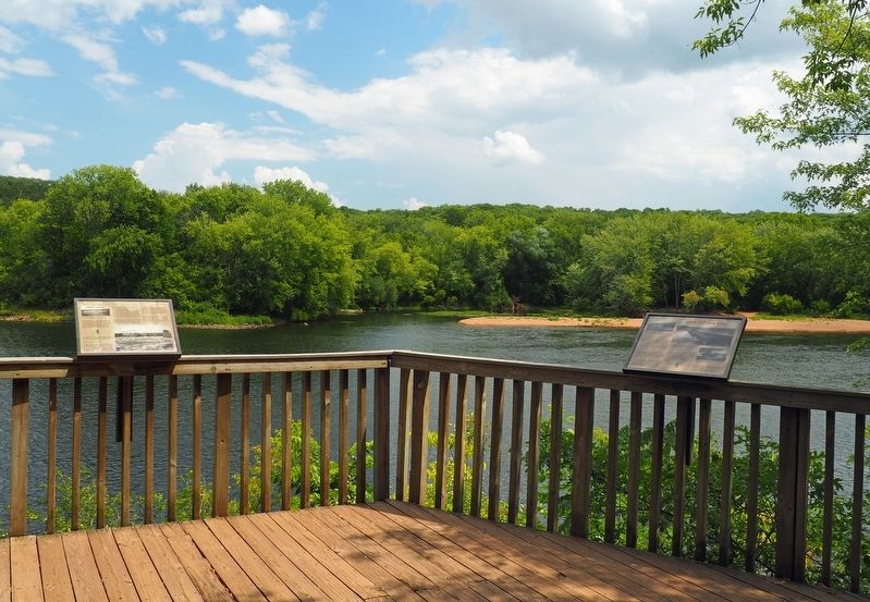
Nevers Dam once linked Minnesota and Wisconsin from the point of land directly across the river to the place where you are standing. The dam was named after Charles Nevers, a Wisconsin farmer whose land was bought . . . — — Map (db m234287) HM
In the 19th century, this part of Minnesota was covered by a mix of hardwood forests and open savannas. (A savanna is a grassland with scattered trees — often oaks.) When settler-colonists moved in, they turned most of the savannas into farm . . . — — Map (db m234229) HM
Look out at the top of the bluffs. Now look down to the river. That height difference represents the power of the St. Croix River. Over the past 15,000 years, the river has carved out this valley.
Nature isn't the only force making changes in . . . — — Map (db m234134) HM
Loggers cutting a large white pine.
From the St. Croix and its tributaries—the Kettle, Snake, Rum, Clam, Trade, and Yellow Rivers—thousands of pine logs were sent downstream. Nearly 100 logging camps upstream supplies logs for sawmills . . . — — Map (db m233538) HM
By 1890, 53 years after logging began in the forests that were predicted to last forever, enough trees were cut in one year along the St. Croix to build 50,000 houses. Hundreds of thousands of people across the Midwest lived in houses made from . . . — — Map (db m233412) HM
In the 1830's, logging companies from the eastern United States were running out of easily-harvested trees to supply the lumber for the growing population of this continent. Then they explored along the St. Croix River, and claimed the forests . . . — — Map (db m233405) HM
Before the arrival of the first French, English, or American explorers, people lived in the St. Croix River Valley. They were here before the Ojibwe came from the east, and before the Dakota and Mesquakie Indians guided and traded with the . . . — — Map (db m233179) HM
Wild River State Park gives visitors a sample of the beauty and variety of the landscape in the St. Croix River Valley. It is one of five Minnesota state parks located along the National Wild and Scenic Riverway. Wild River holds evidence of . . . — — Map (db m232715) HM
Chisago City and American Legion Post #272
Honor Women in the Military
We honor the spirit of patriotism inherent in all of the courageous women who volunteered to boldly defend, loyally uphold and valiantly preserve the . . . — — Map (db m247635) WM
Strength and Honor
This plaque is dedicated to the memory of the thirty-one Americans of Extortion 17 who were shot down while conducting a special operations mission in Afghanistan on
August 6, 2011
Naval Special Warfare . . . — — Map (db m247526) HM WM
SO2 Navy SEAL, Nicholas P. Spehar, was born in Minneapolis, Minnesota on October 19, 1986. Although his parents consider all of their children miracles, Nicholas became known as their "miracle child" because of his traumatic birth. Once Nick got . . . — — Map (db m247525) HM WM
Vilhelm Moberg was one of the foremost Swedish authors of the 20th century. His most famous characters, Karl Oskar and Kristina Nilsson, were representative of the over 1.2 million Swedish emigrants that landed on our shores between 1846 and . . . — — Map (db m247385) HM
Was dedicated to the memory and legacy of Vilhelm Moberg and the Swedish heritage of the Chisago Lakes Area during their visit to Chisago City on
September 13, 1996
By
Their Royal Majesties
King Carl XVI Gustaf and Queen Silvia of . . . — — Map (db m247718) HM
"The North Country is a siren Who can resist her song of intricate and rich counterpoint?"
(Grace Lee Nute, The Voyageur's Highway, 1941)
Lured by America's premier wilderness canoe region, Lake Superior's rugged shoreline and . . . — — Map (db m222163) HM
KIA
Supreme Sacrifice
Joseph M. Allen · Peter Jonas Carlson · Andrew J. Colby · Volora D. Eddy · Johan A. Gustafson · Ola Isaksson · Abraham Larson · John Magnus · William McLinn · Magnus Monson · Hakan Olson · Charles M. . . . — — Map (db m247889) WM
The Gustaf Anderson House is significant both for its locally notable Italianate style and for its association with a prominent Chisago County settler and successful speculator. The brick construction and local interpretation of the Italianate . . . — — Map (db m248168) HM
The Water Tower's Evolution
1848: Kichi Saga (Chisago) area is surveyed.
1880: Village of Lindström is platted on October 14.
1900: Voters approve a public waterworks system at a cost not to exceed $5,500. F.N. Benson to dig . . . — — Map (db m248011) HM
Marlene Carlson married Willard Smith, founder of Plastic Products Company (PPC), in 1973. Following Willard's untimely death in 1975, Marlene assumed control of Plastic Products. She diversified the client base and turned the struggling company . . . — — Map (db m248074) HM
Karl Oskar and Kristina are fictitious characters portrayed in The Emigrants, Unto a Good Land and The Last Letter Home, a trilogy written by the Swedish author, Vilhelm Moberg. They symbolize migration to America by Swedish peasants, who . . . — — Map (db m247887) HM
"...All of them left home hoping for a better life: enough land to raise food for their children, a country where there were no rigid classes – America...seeking new homes, good land, in a wide, strange, frightening, rich, wonderful . . . — — Map (db m247745) HM
Born January 26, 1861, just a mile southwest of here, Frank Lowden attended school at this site, until the age of 7. His Dad, Lorenzo, helped build the school at the beginning of the Civil War, his brother, Eugene, and sister, Caroline, are buried . . . — — Map (db m230058) HM
In the summer of 1914, Carl and Ethel Mae left Braham, MN to take clerk jobs at Elias Nordgrens mercantile store. It was here on December 26, at 12:26AM, Carl ran over to the neighboring house and announced to Harry Wolleat, they had a son named, . . . — — Map (db m230633) HM
Below: Map of the Arrow Line route as advertised.
Above: Portion of an Arrow Line stock certificate.
Construction by the Twin Cities & Lake Superior Railway Company took place in 1907-1909. Forty miles of . . . — — Map (db m229960) HM
The people who created this state park will never meet you but they gifted you with a cherished place. Protection allows this landscape to welcome visitors in much the same way it has for centuries. Did you travel hours or minutes to get here? . . . — — Map (db m216753) HM
The Treaty of 1837, made between Wisconsin Territorial Governor Henry Dodge and the Chippewa nation of Indians, ceded to the United States a large area of Chippewa territories, the St. Croix and its headwaters up to a line 30 miles south of Duluth. . . . — — Map (db m216748) HM
William Henry Carmen Folsom, St. Croix River Valley lumberman and land speculator, chose this imposing site for his home in 1854. He, his wife Mary Jane, and their two small sons lived in an open barn on this property to prove up the claim while . . . — — Map (db m44027) HM
About 1.1 billion years ago, a great rift valley formed across the North American continent from the Lake Superior region southwest to Kansas. As this rift valley opened, basaltic lavas erupted into it, accumulating to a thickness of up to 20 . . . — — Map (db m45814) HM
The potholes at the St. Croix Dalles have their origins in a tale of fire and ice. They are carved in a dark volcanic rock called basalt, which erupted as lava 1.1 billion years ago. This basalt is related to lava flows that line the North Shore of . . . — — Map (db m46434) HM
So read the local paper in 1904 as engineers surveyed the Saint Croix River in search of a suitable place to build a hydroelectric project. The falls had long fueled the local lumbering and milling industries, but the Minneapolis General Electric . . . — — Map (db m120099) HM
This is the oldest Methodist Church building in continuous use in Minnesota. Methodist circuit riders of the Sunrise Mission served the Taylors Falls area 1852-59. On March 27, 1859, the Rev. Sias Bolles organized the Taylors Falls Methodist . . . — — Map (db m44571) HM
The Eagan Town Hall has stood here at the corner of Pilot Knob and Wescott Road since 1914. Eagan's oldest surviving government building cost $1,047 to construct.
The site was chosen by the Town Board because it was as close as . . . — — Map (db m178001) HM
Dedicated to Those Who Have Made the
Ultimate Sacrifice for Their Country
World War I
United States Army
Pvt Lucking George J
Pvt Nelson William G E
1Lt Russell Thomas Lyle
World War II
United States . . . — — Map (db m78480) WM
As Hastings quickly grew and settlement in the area increased, this port city soon became the commercial center for Dakota County farmers.
Farmers brought wagons full of crops to the Hastings market, and then returned home driving wagons full . . . — — Map (db m47843) HM
A Small Area with a Big Impact
During the late 1800s, downtown Hastings offered a wide range of goods and services to the growing river city, resulting no just in a vibrant economy, but also a visually striking commercial district of fine . . . — — Map (db m198461) HM
This sculpture should not be viewed with realism, but as the artist’s expression of some of the images that helped form the community.
The wagon wheel represents commerce and the progress of life. It is placed in your line of sight so you look . . . — — Map (db m137312) HM
The Mississippi River has been a source of recreation for many generations. People have long enjoyed its beauty and marveled at its power.
This is more true than ever today. Boating, hiking, and bird watching all draw people to the river. In . . . — — Map (db m48510) HM
Hasting lies just south and East of the last glaciation. About 20,000 years ago a lobe of ice, called the Superior lobe, advanced from the Lake Superior basin and crossed the ancient bedrock valley of the Mississippi River between St. Paul and . . . — — Map (db m42199) HM
A dynamic force, the Mississippi River changes constantly. Humans have also changed the river, dramatically altering its flow and levels — sometimes with unintended results.
In its natural state, the river once flowed freely across a . . . — — Map (db m48570) HM
From 1856 to 1865, in its first decade of existence, the city of Hastings grew by 2,500 people, enjoying a boom of settlement also experienced by other cities along the Mississippi.
A steady flow of settlers, including many immigrants, . . . — — Map (db m48361) HM
Hastings Spiral Bridge Only One of Its Kind in America
April 27 1895 eight thousand people commemorated the opening of the new "High Wagon Bridge" across the Mississippi River.
It was built in seven months at a cost of $39,050 by the . . . — — Map (db m49690) HM
A natural harbor on the great Mississippi River highway led to the early development of Hastings. The river brought explorers, traders, soldiers, speculators, businessmen, and settlers. It carried from here the products of the prairies and forests. . . . — — Map (db m199536) HM
Just northwest of here, at the bottom of the hill, stood the home of Ignatius Donnelly, author, orator, politician, reformer, and prophet who was easily the best known Minnesotan of his time, both in the state and throughout the world.
. . . — — Map (db m65584) HM
The Mississippi River has provided a habitat for many species of fish and other aquatic creatures for millions of years. Human modifications of the river have had both positive and negative effects on fish populations here. Many types of fish thrive . . . — — Map (db m49277) HM
The Father of Waters
The Mighty Miss
The Great River
Source: Lake Itasca MN 552 River Miles
Mouth: Gulf of Mexico 1788 River Miles
This natural water highway made possible many of man's experiences on the North . . . — — Map (db m47809) HM
For more than 10,000 years, people have lived near the Mississippi River. The first cultures relied on hunting, fishing, and gathering for survival. As early as 1,000 years ago, however, Indian peoples were farming portions of the river valley near . . . — — Map (db m49801) HM
On this historic site, the SW corner of Block 67 of the Nininger City plat, was located a building that served the citizens for a century and a half. Construction began in March, 1858, when the Nininger Chapter of the Independent Order of Good . . . — — Map (db m65618) HM
What does a house say about its occupants?
The West 2nd Street Residential Historic District, just to the west between Eddy and Forest streets, vividly shows the diversity of house styles built between 1857 and 1890. A short walk to the . . . — — Map (db m198547) HM
The Mississippi River and its backwaters are home to a vast and diverse array of fish and wildlife. The river's natural fluctuations help create an environment rich in vegetation — providing food and habitat for nesting birds, fish, and . . . — — Map (db m50358) HM
In Honor and Memory
of All Men and Women
Who Served Our Country
During War and Peace in
the Armed Forces of the
United States of America
Duty · Honor · Country — — Map (db m42213) HM
The natural river above Hastings was treacherous for steamboats, with a depth that reached only three and one-half feet in some places. The first efforts of the federal government to improve navigation of the river were wing dams (piles of . . . — — Map (db m48475) HM
The Mississippi River has long been a major artery for trade and transportation.
For thousands of years, Indians traveled on the river by canoe. By the 1850s, rivertowns like Hastings boomed as steamboats brought settlers into the region. The . . . — — Map (db m48589) HM
was especially built for the retail, wholesale hardware business Henry Hudson Pringle established at Hastings in 1856. Originally, this building was a three-story stone structure with a rounded roof having two front entrances: one on Second . . . — — Map (db m211232) HM
This levee honors all who served in our nation's armed forces and is dedicated to the eternal memory of those who gave their lives.
Hastings, Minnesota
25 July 1981 — — Map (db m47790) HM
On this spot on September 16, 1958, a U.S. Air force B-52D bomber crashed while on a Cold War training mission originating from Loring Air Force Base, Limestone, Maine. Seven crewmen gave their lives for their country. They were:
Captain Wm. . . . — — Map (db m230711) HM
In memory of all the men and women who served in the Armed Forces of the United States of America
Veterans Memorial
Donated by American Legion Post 424
Inver Grove Heights Minnesota
Dedicated on September 20, 1997
World War I . . . — — Map (db m286418) WM
In 1930 Theodore Christian married Velva Moore and purchased 91 acres of land, 71 of which are now Rich Valley Park. The Christians farmed this land for 52 years and raised four children, two of whom built homes on the farm. The residence and . . . — — Map (db m306600) HM
The first congregation in Minnesota of the Evangelical Association of North America was organized here on March 2, 1857 by the Reverend Andrew Tarnutzer. The first small frame building was replaced in 1875 by a church measuring 20 by 32 feet and . . . — — Map (db m67319) HM
Ancient oceans, glaciers, and the powerful action of rivers carved the landscape of this region. Millions of years ago, Minnesota was covered by a shallow sea teeming with corals, sponges and shellfish. At the close of the Pleistocene, a time of . . . — — Map (db m228575) HM
The confluence of the Mississippi and Minnesota rivers has always been important to the peoples of this region. Native American cultures moving into Minnesota as early as 12,000 years ago lived along these major rivers. Dakotan groups living here . . . — — Map (db m228716) HM
Native Americans of varying cultural traditions lived in the Upper Mississippi River Valley for thousands of years before European Americans entered the region. During the early years of Native American contact with European Americans (1650-1837), . . . — — Map (db m228763) HM
Mendota occupies a strategic position in the transportation history of Minnesota. Located at the confluence of the Mississippi and Minnesota rivers, Mendota became a central meeting place for river boats traveling along these major waterways. With . . . — — Map (db m229037) HM
Called M'Dote or "the place where waters meet" by the Dakota, this area is central to many Dakota creation stories and is significant to Dakota people today. Just west of this site is Pilot Knob, which was used extensively for burials by the Dakota . . . — — Map (db m37659) HM
A National Scenic Byway
The Great River Road is the longest scenic byway in the nation, stretching nearly 3,000 miles through ten states from the Mississippi River's headwaters in Minnesota to the Gulf of Mexico. For thousands of years, the . . . — — Map (db m199537) HM
In front of you stands the Faribault House, built by long-time fur trader Jean-Baptiste in 1839. Faribault was originally from the Montreal area, and had been associated with the British and American fur traders since the late 1790s. He built . . . — — Map (db m37618) HM
Faribault House
Built by Jean Baptiste Faribault pioneer fur trader.
Presented to the Sibley House Association Minnesota D.A.R. by the State of Minnesota
January 5th 1935.
Dedicated May 5th 1937.
Restored by the Federal Government . . . — — Map (db m244960) HM
To the glory of God and in memory of General Henry Hastings Sibley. Born February 20, 1811, died February 18, 1891. A great patriot - soldier - statesman. This historic marker is built
of the only remaining stone from the pioneer . . . — — Map (db m37573) HM
The Sibley House was built in 1836 for Henry Hastings Sibley, regional manager for the American Fur Company. The first floor was designed for business operations, and the second floor was his bachelor's residence. Two additions were made to the . . . — — Map (db m242009) HM
[symbol of the Daughters of the American Revolution]
Mendota
In the language of the Sioux means the mouth of a river. Was the earliest
permanent white settlement in southern Minnesota. A pioneer center of the fur trade. . . . — — Map (db m37534) HM
Mendota
This wide valley intersection between the two rivers known today as the Minnesota and Mississippi has been a meeting place for people for thousands of years.
The Dakota people lived on these prairielands by the 1700s. . . . — — Map (db m229001) HM
The history of Minnesota is replete with stories of boomtowns becoming ghost towns. Sometimes their demise was caused by national or historical shifts in markets, such as the fading of the fur trade or the bottoming out of the wheat market. Other . . . — — Map (db m199637) HM
Welcome to the Sibley House Historic Site! This area had long been the center of travel and trade for the Dakota when it became the center for American Fur Company operations on the Upper Mississippi. It was also home to Minnesota's first governor, . . . — — Map (db m41238) HM
Here at Mendota (where the rivers meet) missionaries ministered to both Indians and settlers, enduring the hardships of a sprawling wilderness that was the Minnesota country. In 1842, Father Lucien Galtier built a small, log chapel with only two . . . — — Map (db m37714) HM
The first stone house erected in the State
of Minnesota by its first Governor,
Gen. Henry Hastings Sibley.
Secured in 1910 for the St. Paul Chapter, Daughters of the American Revolution
from St. Peter's Parish of Mendota
— by . . . — — Map (db m235093) HM
Until the late 1990s, people drove their cars into the overlook. They followed a curving route and went through an opening in the northern wall.
Works Progress Administration (WPA) workers quarried local Platteville limestone . . . — — Map (db m228924) HM
Works Progress Administration (WPA) workers built this overlook in 1938 from local limestone. The workers came from Mendota Camp #1, which was along the river bluff about a half mile (.8 km) away. Between here and there was a limestone quarry. . . . — — Map (db m225640) HM
The "New Deal"
During the Great Depression of the early 1930's, more than 25 percent of the nations' workforce was unemployed. One of President Franklin Roosevelt's New Deal programs was the Works Progress Administration (WPA). The WPA . . . — — Map (db m178002) HM
Ancient people lived in Minnesota as early as 12,000 years ago. These first inhabitants of the land left behind lasting clues about their cultures. They moved seasonally between camps while hunting and gathering. Often they chose camps near major . . . — — Map (db m229000) HM
1851 • 1922
[symbol of the D.A.R.]
To Commemorate The Treaty at Mendota
Negotiated on
Pilot Knob
Whereby the Sioux Indians ceded their lands
in the Territory of Minnesota and State of Iowa
to the . . . — — Map (db m37430) HM
You can see deep time in the overlook walls. Platteville limestone formed about 455 million years ago when a sea covered what we now call "Minnesota." As sea creatures died, their shells fell to the ocean floor. Building up over time, they . . . — — Map (db m229273) HM
Dedicated
to the memory of all
United States War Veterans
June 25, 1939
Dedicatory Committee
United Spanish War Veterans
Veterans of Foreign Wars
American Legion — — Map (db m37739) HM
Settler Mary Morrison’s home was built here on a stagecoach line one day’s journey from St. Paul. She rented rooms to travelers and named her business the Prairie House. Another hotel and store, the Rosemount House, opened in 1859. Today’s . . . — — Map (db m208534) HM
With the establishment of the stockyards, meat buyers were quick to congregate in South St. Paul. In 1897, Armour had buyers here. Cattle, hogs and sheep were purchased and then shipped to Chicago for processing. Nearby the Swift & Company plant was . . . — — Map (db m31247) HM
Here on the Mendota Trail from 1839 to 1852 stood the Sioux village of the Little Crow family. An attempted Chippewa attack in 1842 precipitated the Battle of Kaposia across the river. After the Treaty of Mendota in 1851 the band moved up the . . . — — Map (db m31186) HM
Kaposia was first located on the east bank of the Mississippi River on a low terrace below the bluff in present-day St. Paul. It was established after 1750 by a group of Mdewakanton Dakota whose succession of chiefs were each known as Little Crow. . . . — — Map (db m151038) HM
On this site stood Swift & Company’s slaughterhouse and meat packing plant. It eventually became the company’s largest plant in the United States. The area covered 28 acres, with 30.5 acres of floor space in multi-storied buildings.
Swift & . . . — — Map (db m40768) HM
The idea to create a livestock market and meat packing center at South St. Paul was conceived by Alpheus B. Stickney, a prominent railroad businessman. After meetings with western livestock ranchers and producers, the need to locally slaughter and . . . — — Map (db m31274) HM
Listed on the National Register of Historic Places.
Restoration funded through a $270,000 grant appropriated by the Legislative Commission on Minnesota Resources.
A project of the Minnesota State Historical Society and the City of . . . — — Map (db m117721) HM
In 1919, Hennepin County hired the Illinois Steel Bridge Company to replace a deteriorating timber trestle built across Long Meadow Lake in 1891. The new 860-foot bridge was the longest Camelback through-truss bridge in the state when it opened in . . . — — Map (db m180917) HM
1139 entries matched your criteria. Entries 101 through 200 are listed above. ⊲ Previous 100 — Next 100 ⊳