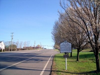
On North Franklin Street (Business U.S. 460) at Scattergood Drive NE, on the right when traveling north on North Franklin Street.
In 1866, Captain Charles S. Schaeffer, a Freedmen's Bureau agent, organized a school for blacks on the hill just to the southeast. Charles L. Marshall of Tuskeegee Institute became principal of the school in 1896. Under his guidance and with . . . — — Map (db m41424) HM
On West Main Street (U.S. 11) west of Hickok Street NW, on the right when traveling west.
This property has been
placed on the
National Register
of Historic Places
by the United States
Department of the Interior
Christiansburg
Presbyterian Church
has been registered as a
Virginia
Historic
Landmark . . . — — Map (db m209277) HM
On East Main Street (U.S. 11) at North Franklin Street, on the right when traveling west on East Main Street.
The African American Memory & Storyboard Project is a partnership of Christiansburg Institute Inc., Montgomery Museum of Art & History, and the community to memorialize the sometimes challenging, often joyful history of African Americans in . . . — — Map (db m209270) HM
On North Franklin Street (Business U.S. 460) at East Main Street (U.S. 11), on the right when traveling west on North Franklin Street.
Christiansburg, a town in turmoil during the war, supported the Confederacy. Its strategic location in the New River Valley made it a military objective, prompting President Abraham Lincoln to order Federal troops toward the area in 1861. . . . — — Map (db m193952) HM
On East Main Street (U.S. 11) at North Franklin Street, on the right when traveling west on East Main Street.
Recently emancipated African Americans yearned for education after the Civil War. They worked to build schools and educate themselves, often with assistance from the Freedmen's Bureau.
Freedmen's Bureau agent, Captain Charles Schaeffer, helped . . . — — Map (db m209264) HM
On West Main Street (U.S. 11) at South Franklin Street, on the right when traveling north on West Main Street.
In this town occurred the duel between Thomas Lewis and John McHenry in May, 1808. This was the first duel with rifles known to have taken place in Virginia. It resulted in the death of both men. Dr. John Floyd, later Governor of Virginia and . . . — — Map (db m41422) HM
On North Franklin Street (Business U.S. 460) at East Main Street (U.S. 11), on the left when traveling south on North Franklin Street.
To the memory
of Montgomery’s sons
who fell in the
Lost Cause
and to
all the Confederate dead
who lie beneath her soil.
This monument
is erected by her daughters
1861-1865
In this county
lie the remains of
300 . . . — — Map (db m41453) HM
On West Main Street (U.S. 11) at South Franklin Street, on the right when traveling north on West Main Street.
Dedicated to the
memory of these
citizens of Mont-
gomery County,
Virginia, who made
the supreme
sacrifice in the
service of our
country in the
world conflicts
Sponsored and erected by
the Montgomery County
American . . . — — Map (db m41445) WM
On East Main Street (U.S. 11) at North Franklin Street, on the right when traveling west on East Main Street.
Slavery is one of the defining stories of America, impacting political, economic, and cultural life. Enslaved men and women, denied the basic right of freedom, made important contributions in Montgomery County.
Almost from its earliest days, . . . — — Map (db m209259) HM
On Roanoke Road (U.S. 11/460) at Graham Street, on the left when traveling east on Roanoke Road.
Fotheringay was the home of George Hancock (1754-1820), a colonel in the Virginia Line during the Revolutionary War and aide-de-camp to Count Casimir Pulaski. He later served in both the Virginia House of Delegates and in the U.S. Congress, and was . . . — — Map (db m289048) HM
On Roanoke Road (U.S. 11), on the right when traveling south.
Montgomery County. Area 401 Square Miles. Formed in 1776 from Fincastle, and named for General Richard Montgomery, killed at Quebec, 1775. The Virginia Polytechnic Institute is here.
Roanoke County. Area 305 Square . . . — — Map (db m23827) HM
Near Interstate 81N at milepost 129, 0.9 miles north of North Fork Road (Virginia Route 603), on the right when traveling north.
This small bridge is the oldest metal truss bridge and the sole survivor of its type in Virginia. It was built in 1877-78 over Stony Run in nearby Bedford County and was subsequently moved to a site over Roaring Run, also in Bedford County, where it . . . — — Map (db m228044) HM
On Northbound Rest Area (Interstate 81 at milepost 129).
This structure was built in 1878 by King Iron and Bridge Co. in Bedford County. It remained in use until 1971. It is the oldest metal bridge in Virginia. — — Map (db m270423) HM
On Northbound Rest Area (Interstate 81 at milepost 129), on the right when traveling north.
Near here stood Montgomery White Sulphur Springs, popular resort area of 19th century America. During the Civil War the resort was converted into a military hospital staffed by Catholic nuns. Several hundred victims of smallpox including nurses and . . . — — Map (db m270424) HM
On Virginia Avenue (U.S. 460) at Forest Service Road (Road 269), in the median on Virginia Avenue.
Giles County. Area 369 Square Miles. Formed in 1806 from Montgomery, Tazewell, and Monroe, and named for William B. Giles, United States Senator and Governor of Virginia 1827-30. Mountain Lake is in this county.
Montgomery . . . — — Map (db m34758) HM
On Riner Road (County Route 8) just south of Homestead Road.
Floyd County. Floyd County was named for John Floyd, governor of Virginia from 1830 to 1834. The county was formed from Montgomery County in 1831, with a portion of Franklin County added later. The county seat is Floyd, formerly Jacksonville. . . . — — Map (db m104299) HM
On Alleghany Spring Road (Virginia Route 637) 0.5 miles south of Slusher Lane, on the right when traveling south.
Joseph and Jeanne de Vigné Crockett settled on this farm early in the 1760s. Three of their sons served as officers in the Revolutionary War. Col. Hugh Crockett, who lived here until his death in 1816, led militia during expeditions to North . . . — — Map (db m209254) HM
On Oldtown Road (Virginia Route 753) east of Basham Hollow Road, on the right when traveling west.
Ephraim Vause was appointed Captain of Horse in 1753 and was considered a man of considerable influence. For the protection of his family and his neighbors he built a simple palisaded fort nearby on his farm. In June 1756, during the French and . . . — — Map (db m42849) HM
On Wysor Highway (Virginia Route 100) at Stillwell Road, on the right when traveling north on Wysor Highway.
Pulaski County
Area 333 square miles
Formed in 1839 from Wythe and Montgomery, and named for Count Casimir Pulaski, killed at the siege of Savannah, 1779. New River flows through this county.
Wythe County
Area . . . — — Map (db m209757) HM
Near Ben H Bolen Drive 0.1 miles east of State Park Road ( Route 660). Reported missing.
This tablet commemorates the first white settlement west of New River, made in 1745 near here by "Dunkers". In 1756 they built a fort for protection against Indians. In 1771 Col. William Christian built a home on this site. The stones in this . . . — — Map (db m286314) HM
On Cleburne Boulevard (Virginia Route 100) 0.3 miles south of Cloyds Mountain Road, in the median.
In April 1864 Grant ordered Brig. Gen. George Crook to cut the Virginia & Tennessee RR in Southwest Virginia. Near Cloyd’s Mountain, five miles north of Dublin, on 9 May Crook battled Confederate defenders commanded by Brig. Gen. Albert G. Jenkins. . . . — — Map (db m41409) HM
On Cleburne Boulevard (Virginia Route 100) at International Boulevard (County Route 790), on the right when traveling south on Cleburne Boulevard.
Here on May 9, 1864, was fought the Battle of Cloyd's Farm in which more than 800 gallant men were killed.
Rutherford B. Hayes & William McKinley later presidents of the United States engaged in this battle as officers of the Union . . . — — Map (db m162942) HM
On Cleburne Boulevard (Virginia Route 100) at Laboratory Street ( Route 790), on the right when traveling south on Cleburne Boulevard.
Just to the west took place the Battle of Cloyd's Mountain, May 9, 1864. The Union General Crook, raiding to destroy the Virginia and Tennessee Railroad (N.&W.), met and repulsed General A. G. Jenkins, who was mortally wounded. — — Map (db m41410) HM
Near Ben H Bolen Drive 0.1 miles east of State Park Road ( Route 660).
This chimney, formerly to the home of William Christian, brother-in-law to Patrick Henry & frontier militia commander, was built about 1772 a mile down stream at a site now submerged by Claytor Lake. In 1808 it became the home of Thomas Cloyd from . . . — — Map (db m286317) HM
On Ben H Bolen Drive near State Park Road ( Route 660).
This chimney marks the site
of the home of
Colonel William Christian
Christiansburg, Va., was named for
this Revolutionary War leader and Virginia patriot
Chairman of the Fincastle Resolutions Committee
and brother-in-law of . . . — — Map (db m286316) HM
On Cleburne Boulevard (Virginia Route 100) at New Dublin Church Road (County Route 797), on the right when traveling north on Cleburne Boulevard.
This congregation, one of the oldest in Southwest Virginia, consisted of 45 families by 1769. Col. Joseph Cloyd, a Revolution army War officer, donated land for its first sanctuary, built 1/2 mile east of here ca. 1781. The present sanctuary (ca. . . . — — Map (db m138342) HM
On Bagging Plant Road (Virginia Route 617) at Dunlap Road, on the left when traveling north on Bagging Plant Road.
Just south of here stood the New River Ordnance Plant, or Dublin Bagging Plant, a World War II facility established primarily for the bagging of propellant used for firing artillery shells. Construction of the plant, designed and operated by the . . . — — Map (db m126020) HM
Near Cleburne Boulevard (Virginia Route 100) at International Boulevard, on the right when traveling south.
(preface)
Gen. Ulysses S. Grant, commander of all Union armies, ordered advances throughout the Confederacy in May 1864. In Virginia, Gen. George C. Meade led the Army of the Potomac across the Rappahannock River and south toward Richmond . . . — — Map (db m162941) HM
On Dublin Park Road east of Town Center Drive, on the left when traveling east.
The United States' mobilization for World War II
brought dramatic changes to this region. The Radford
Ordnance Works, nine miles northeast of here, and
the New River Ordnance Plant, near here, opened
in 1941. Construction employed more than . . . — — Map (db m228250) HM
On Belle Hampton Farm Road 0.1 miles north of Highland Road ( Route 627), on the right when traveling north.
While searching for his lost brother who fought in
the French-Indian War, James Mayo Hoge instead
found his true love and together they built a home
on land he called Hayfield (now Belle Hampton
Farm). Ownership of the property has . . . — — Map (db m228245) HM
On Lee Highway (U.S. 11) at Hickman Cemetery Road/New River Road (County Route 624), on the right when traveling south on Lee Highway. Reported permanently removed.
One mile to the north stood this Methodist Chapel, an early one in the New River area. It was built on land given in 1795 by Alexander Page. Bishop Francis Asbury preached in the chapel in 1802 and again in 1806. — — Map (db m288872) HM
On Lee Highway (U.S. 11) at Hickman Cemetery Road, on the right when traveling west on Lee Highway.
The first Methodist meetings west of the New River were reportedly held ca. 1773 on the farm of Alexander Page, a short distance north of here. Edward Morgan, a local preacher, organized the congregation and helped build a log meetinghouse. The Rev. . . . — — Map (db m288873) HM
On Peppers Ferry Road near the New River Bridge ( Route 114), on the right when traveling east.
During the 1770s, Samuel Pepper established a
ferry crossing nearby which opened a transportation, route during the late colonial and early
national periods linking the resources of the
West with the population centers in the East.
A century . . . — — Map (db m86261) HM
On Lead Mine Road (Virginia Route 693) west of Graysontown Road, on the right when traveling east.
August 14, 1940
On this day, the Georgia-South Carolina hurricane of 1940 caused water from the Little River to rise to this level at this location.
For more information, contact:
National Weather Service Blacksburg, VA . . . — — Map (db m209751) HM
On Newbern Road (County Route 611) near Towes Ferry Road (County Route 697).
Erected 1964
On this corner stood the first courthouse of Pulaski County 1839-1893
To the back still stands the old county jail — — Map (db m104646) HM
On Wilderness Road (Newbern Road) (Virginia Route 611) just south of Towes Ferry Road ( Route 697), on the left when traveling south.
The first court held in Pulaski County was in a building known as the James Tiffany House on May 9, 1839, at which term an order was entered adopting the house of Henry Hance (a great grandfather of K.B. Alexander present owner) as a place to hold . . . — — Map (db m197036) HM
On Newbern Road (County Route 611) east of Towes Ferry Road (County Route 697), on the right when traveling west.
The original reservoir of the first Newbern water works 1870 Restored in 1965 by the Newbern community improvement club Above is a sample of the 1000 feet of original pipe line, which is still in use. — — Map (db m104647) HM
On West Main Street west of Beaupel Place, on the right when traveling west.
Pulaski Graded School, later renamed Calfee Training School, was built in 1894. The building, which served Black students eventually through grade 11, burned in 1938. with help from Thurgood Marshall and the NAACP, faculty members Chauncey Harmon . . . — — Map (db m304959) HM
On Lee Highway (U.S. 11) 2.2 miles north of Interstate 81, on the right when traveling north.
John Draper's wife, Bettie Robertson Draper, was captured by Shawnee at Draper's Meadow (Blacksburg) in 1755. Mrs. Draper was carried into the Ohio country along with her sister-in-law Mary Draper Ingles and five others. Six years later John Draper . . . — — Map (db m216193) HM
Near West Main Street east of Jackson Avenue North, on the left when traveling east.
O Lord who guides the stars and yet dost stoop to heal the broken heart. Thou, for whom no distance lies of time or space, shield all thy sons and daughters whom men call missing but whose place and circumstance are wholly known to thee. If they be . . . — — Map (db m41482) WM
On Medal of Honor Way 0.1 miles east of Lee Highway (U.S. 11), on the right when traveling east.
Corporal Lewis Kenneth Brusell was born in Pulaski,
Virginia on April 17, 1924. He enlisted in the United States
Marine Corps at the age of 17 following the bombing of
Pearl Harbor. Corporal Bausell served with the 5th Marine
Regiment of the . . . — — Map (db m228247) HM WM
On North Washington Avenue (U.S. 11) at 1st Street NW, on the right when traveling south on North Washington Avenue.
The town sprang up at the coming of the railroad and was first known as Martin's Tank. Governor John Floyd lived near by. The county seat was moved here from Newbern in 1894. The town, like the county, was named for Count Casimir Pulaski, killed in . . . — — Map (db m23914) HM
On West Main Street east of Jefferson Avenue North, on the left when traveling east.
This native stone arch, built in 1907, was used as an entrance to the Pulaski County exhibit at the 1607-1907 Jamestown Exposition. When returned to Pulaski, it was erected here as a permanent entrance to the Pulaski County Courthouse, which was . . . — — Map (db m41480) HM
On Lee Highway (U.S. 11) at 1st Street NE, on the left when traveling north on Lee Highway.
September 28, 1925
The Norfolk and Western Railway Company gave permission to the town of Pulaski to use this parcel of land for a park. — — Map (db m162948) HM
On Jefferson Avenue North at Commerce Street, on the right when traveling north on Jefferson Avenue North.
Virginia Maid Hosiery Mills
Wallner Silk Hosiery Mills
Acme Hosiery Dye Works
"... He held his place
Held the long purpose like a growing tree
Held on through blame and faltered not at praise.
And when he fell in whirlwind, . . . — — Map (db m256749) HM
On 2nd Street NW (Virginia Route 99), on the right when traveling west.
Erected by the state bar association
of Virginia as a memorial of the legal
accomplishments, the fidelity to duty
and the courage unto death of
Thornton Lemmon Massie
judge of the twenty first Virginia circuit
who was assassinated while . . . — — Map (db m162946) HM
On N Washington Avenue (U.S. 11) at 1st Street NW, on the right when traveling south on N Washington Avenue.
[North and South Faces)]:
This memorial is dedicated to the honor and glory of all Pulaski County citizens who served our Country during World War I
[East Face]
Town of Pulaski
Founded 1886
Jackson Park — — Map (db m24132) HM
About five miles southwest is Dunkard Bottom, where Dr. Thomas Walker found a settlement in 1750. The fort there was built about 1756 and was the first fort in Virginia west of New River. The first store and first mill were also there. — — Map (db m23909) HM
On Riverhaven Drive (Virginia Route 114), on the right when traveling east on Riverhaven Drive.
Montgomery County. Area 401 Square Miles. Formed in 1776 from Fincastle, and named for General Richard Montgomery, killed at Quebec, 1775. The Virginia Polytechnic Institute is in this county.
Pulaski County. Area . . . — — Map (db m50619) HM
On Lee Highway (U.S. 11) at Hazel Hollow Road ( Route 626), on the right when traveling north on Lee Highway.
Montgomery County. Area 401 square miles. Formed in 1776 from Fincastle, and named for General Richard Montgomery, killed at Quebec, 1775. The Virginia Polytechnic Institute is in this county.
Pulaski County. Area . . . — — Map (db m41416) HM
On Lee Highway (U.S. 11) at Hazel Hollow Road ( Route 626), on the right when traveling north on Lee Highway.
Not “new” at all, the New River, the second oldest in the world, is more than 320 million years old. Only the Nile is older. The river received its original English name, Wood's River, perhaps from Colonel Abraham Wood who explored the . . . — — Map (db m41417) HM
Built, 1830, on the old James River and Kanawha Turnpike. Restored antebellum home of Colonel George W. Imboden, on General Lee's staff, C.S.A. Property and headquarters of the Fayette County Historical Society, organized in 1926. — — Map (db m50392) HM
On James River and Kanawha Turnpike East (County Road 60/33) at Tyree Street, on the right when traveling east on James River and Kanawha Turnpike East.
Regular stop on the James River and Kanawha Turnpike. The original building, dating from before the Revolution, was rebuilt by William Tyree, 1810. During the winter of 1861-62, it was headquarters for Chicago Gray Dragoons. — — Map (db m252549) HM
On West Main Street (U.S. 60) at 3rd Street, on the right when traveling south on West Main Street.
After the Civil War, George W. Imboden lived here with his wife, Mary Tyree, the daughter of William Tyree of Tyree Tavern. When the war began, Imboden enlisted in the Staunton Artillery in Augusta County, Virginia, where he then resided. He . . . — — Map (db m34371) HM
The Birdman of West Virginia
When thinking of the early aviation history of the United States, many times we think of Dayton or Kitty Hawk. However, the town of Ansted also holds a very special place in the story, as it was the birthplace of . . . — — Map (db m173335) HM
On U.S. 60 1.7 miles west of Fox Avenue, on the right when traveling east.
Once called Marshall’s Pillar for Chief Justice John Marshall, who came here, 1812. U.S. engineers declare the New River Canyon, 585 feet deep, surpasses the famed Royal Gorge. Tunnel for river makes vast water power here. — — Map (db m20675) HM
On Midland Trail (U.S. 60), on the left when traveling west.
Mouth of the great Hawk's Nest Tunnel, three miles long, which diverts water of New River from its five-mile long gorge. The tunnel, a mile of which is through solid rock, and a 50-foot dam give waterfall of 160 feet for electric power. — — Map (db m34421) HM
Like many other areas of West Virginia, coal mining has played an important role in the history of Ansted and the surrounding area. Soon after the 1873 completion of the Chesapeake and Ohio Railroad, coal mines began springing up in the New River . . . — — Map (db m173339) HM
In 1930 the Union Carbide and Carbon Corporation was in the process of building its new electrometallurgical plant in nearby Boncar (later known as Alloy). It was decided a hydroelectric power station would be constructed near Gauley Bridge with a . . . — — Map (db m173337) HM
Near Midland Trail (U.S. 60) 0.4 miles west of Short Street.
Construction of nearby tunnel, diverting waters of New R. through Gauley Mt. for hydroelectric power, resulted in state’s worst industrial disaster. Silica rock dust caused 109 admitted deaths in mostly black, migrant underground work force of . . . — — Map (db m34417) HM
Eight panels mounted to the inside of the town gazebo depict some historical and notable features of the town.
Panel 1 - Town of Ansted
The town of Ansted, West Virginia chartered in 1891, was created because of coal. The town's . . . — — Map (db m173340) HM
On East Main Street (U.S. 60) at Cemetery Street, on the left when traveling west on East Main Street.
In Westlake Cemetery is the grave of the mother of General Thomas J. "Stonewall" Jackson. The monument at the grave was placed by Captain Thomas Ranson, who had fought in Jackson's old brigade in the War between the States. — — Map (db m34376) HM
Near West Main Street (U.S. 60) near Orchard Street.
The sheer cliffs of Nuttall sandstones forming the walls of the New River Gorge are the "Salt Sands" of the driller. These sands produce oil and natural gas in West Virginia and commercial brines on the Kanawha and Ohio Rivers.
Sponsored . . . — — Map (db m34420) HM
On Holley Street at Midland Trail (U.S. 60), on the right when traveling north on Holley Street.
First mentioned by Captain Thomas Battes as he and others surveyed the area in 1671, the first settlers in what is now Ansted can be traced to 1790 when the families of James Lykens, James Taylor, Bailey Wood, and William Parrish arrived. The . . . — — Map (db m252552) HM
On James River and Kanawha Turnpike (County Route 60/33) at Tyree Street, on the right when traveling east on James River and Kanawha Turnpike.
During his and Gen. Henry Alexander Wise’s unsuccessful Kanawha Valley campaign, Confederate Gen. John B. Floyd made his headquarters here, August 17-18, 1861, while Wise camped on the top of Big Sewell Mountain. In 1862, according to an inscription . . . — — Map (db m59937) HM
On Cemetery Street at Clay Street on Cemetery Street.
This is one of the earliest identified cemeteries west of the Allegheny Mountains. William Tyree, owner of nearby Tyree Tavern, and Confederate Col. George W. Imboden, brother of Gen. John D. Imboden, are buried here. The cemetery is best known, . . . — — Map (db m253567) HM
William Nelson Page became one of the leading managers and developers of West Virginia's coalfields in the late 19th and early 20th centuries, with much of his time being spent here in Ansted. While president of the Gauley Mountain Coal Company, . . . — — Map (db m173338) HM
On Dixie Highway (West Virginia Route 16) just north of Twenty Mile Creek Road (Route 16/3), on the left when traveling south.
Nearby is grave of Seaberry Osborne (circa, 1815-66), daughter of Chief Running Bear. She married Solomon Osborne in Cherokee, N.C. and in 1838 fled to escape “Trail of Tears.” The Native American pioneers found sanctuary in the mountains and land . . . — — Map (db m138009) HM
On a ridge between Armstrong and Loop creeks across the river are extensive prehistoric stone ruins whose walls are several miles long, and enclose a large area. Many of these stones are from the valley below the old wall. — — Map (db m20820) HM
On July 26, 1942 the first African American 4-H camp in the United States was opened here in Fayette County. A 1929 report showed that 44 of the state’s 55 counties had 4-H camps for white children, hut none for black children. Fleming Adolphus . . . — — Map (db m138104) HM
On Camp Carver Road (Local Route 11/3) 1.2 miles west of Clifftop Road (County Route 11), on the right when traveling north.
Camp named for Booker T. Washington (1856-1915) and George Washington Carver (1864-1943). Land deeded for sum of $5.00 by Charles and Kathryn Midelburg. Constructed 1939-1942 by local WPA labor with materials found on site including stone and native . . . — — Map (db m138103) HM
Plaque One
Abraham Vandal
1758-1848
* Born in Dutchess, NY
* Soldier in the American Revolutionary War 1776-1781
* Married Mary Dillon 1780
* Father of Eight Children
* Early Fayetteville Settler
* In 1812 Abraham . . . — — Map (db m55816) HM
On County Route 8, on the right when traveling west.
This torch has been erected
by
American Legion Post 149
Fayetteville. West Virginia
as a tribute to
the veterans of all wars who
by their patriotism and loyalty
served God and Country — — Map (db m203948) WM
On North Court Street (State Highway 16) at East Maple Avenue, on the right when traveling north on North Court Street. Reported permanently removed.
During the Civil War, Fort Scammon stood in front of you on the hill behind the courthouse. There, on September 10, 1862, Union Col. Edward Siber and the 1,500 men of his 37th Ohio Infantry defended Fayetteville against Confederate Gen. William . . . — — Map (db m59214) HM
On North Court Street (Route 16) at Keller Avenue (County Route 82), on the right when traveling north on North Court Street.
Battle of Fayetteville (1862)
On September 10, 1862, soldiers under the command of Confederate Gen. W.W. Loring attacked Union forces in Fayetteville under Col. Edward Siber, driving them out of the town towards Charleston, where fighting . . . — — Map (db m120516) HM
On North Court Street (West Virginia Route 16) at East Maple Avenue, on the right when traveling north on North Court Street.
In early September 1862, Union Col. Edward Siber and about 1,500 men of the 34th and 37th Ohio Infantries garrisoned Fort Scammon, built on the hill behind the courthouse in front of you. From there, Siber prepared to defend Fayetteville as . . . — — Map (db m262680) HM
On Long Point Trail (County Road 9-8) north of Timber Ridge Trail, on the left when traveling north.
Early travelers here found a natural forest with huge trees that covered the landscape. The industrial coal and railroad boom that changed the gorge began in the 1870s and the area's big trees provided lumber during those prosperous times. This . . . — — Map (db m292754) HM
On Access road to Lower New River Take-Out parking near Fayette Station Road (County Route 82).
You are in the New River watershed, a place where streams and rainfall drain to a common outlet. Here that outlet is the New River. This 320 mile river is the main stem of a 7,000 square mile watershed that starts in the western mountains of North . . . — — Map (db m179414) HM
On Rotan Street (Local Road 19/15) at Austin Street and King Avenue, on the right when traveling south on Rotan Street.
At the top of the hill here a community came together to help Jewish soldiers
keep their faith in the midst of war. In early April 1862, Pvt. Joseph A. Joel
and 20 other Jewish soldiers in the 23rd Ohio Infantry asked Col.
Rutherford B. Hayes, . . . — — Map (db m297181) HM
Near North Court Street south of West Wiseman Avenue ( Route 16), on the left.
(Side A)
I have taken an oath
To serve and protect my fellow man
Guide me safely in my duties
To do the very best I can
Give me the ability
To stop those things that are wrong
To bring comfort and safety by restoring it to . . . — — Map (db m262710)
535 entries matched your criteria. Entries 101 through 200 are listed above. ⊲ Previous 100 — Next 100 ⊳