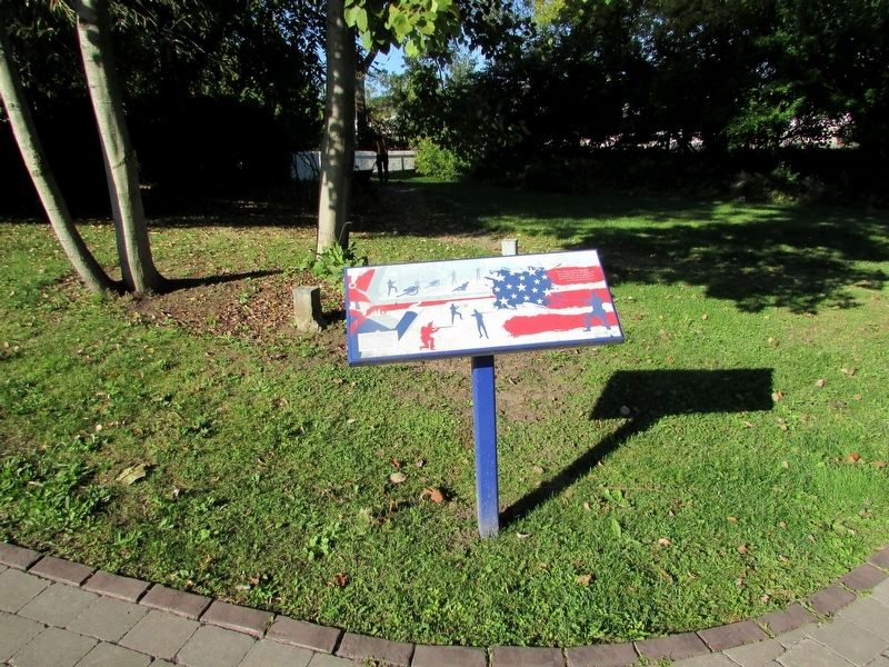
Following the capture of his artillery by the Americans, Lt. General Drummond and his troops retreated from their defensive position on the height of land in the cemetery to this area on the north side of the hill. Starting before 10 p.m. and . . . — — Map (db m283710) HM
In 1786 John Burch, a United Empire Loyalist, constructed a water-powered grist and sawmill on this site. He was the first to use the waters on the west bank of the Niagara River for industrial purposes. The mills were burned by the retreating . . . — — Map (db m274945) HM
The cut stone markers are the ends of a buried steel trestle that carried the tracks of the Niagara Falls Park and River Railway. It spanned the ravine created by Bowman’s Creek which eroded the soft glacial debris of the buried gorge of a . . . — — Map (db m283682) HM
Born into slavery in Logan County in what is now West Virginia U.S.A. Plato and several friends used the Underground Railroad to reach Canada in 1856, settling in Niagara Falls. He became a popular and respected businessman, as well as an active . . . — — Map (db m283725) HM
In memory of Lt. Col. Cecil Bishopp who died of wounds received during the raid on Black Rock, New York, July 11, 1813 during the War of 1812. He was buried in this cemetery on July 17, 1813. In 1846 Bishopp’s two sisters erected this memorial in . . . — — Map (db m283726) HM
“If the captain wants me, he may come himself and if he does I will shoot him.”
With these words, Charles Green refused induction into the N. Jersey rebel militia. Imprisoned, he escaped and joined the “King’s Rangers” a . . . — — Map (db m75879) HM
Church of St. John the Evangelist
One of the province's oldest Anglican churches, St. John's
was begun in 1825, during the pastorate of the Reverend
William Leeming, and consecrated three years later. It was
erected under the . . . — — Map (db m277922) HM
As early as 1795, a small log church, used by a number of denominations, was on top of this hill. Destroyed during the Battle of Lundy’s Lane on July 25, 1814, it was not replaced until 1819 when a combination church and schoolhouse was constructed . . . — — Map (db m283920) HM
English: Commemorating National Day For Truth and Reconciliation in 2022
On these grounds on September 30, 2022, Phyllis Webstad (Northern Secwepemc, Stswecem'c Xgat'tem First Nation), whose story inspired Orange . . . — — Map (db m308641) HM
The national hero of the Philippines visited the aweing magnificence of Niagara
Falls and paused near this spot on May 12, 1888. Born on June 19, 1861, Rizal was
a doctor, poet, writer, educator, linguist, and inventor. He authored the . . . — — Map (db m284603) HM
Dr. Jose Rizal
(1861 - 1896)
The national hero of the Philippines visited this magnificent falls and paused between the two rocks on May 12, 1888. — — Map (db m284607) HM
Established around 1795, Drummond Hill Cemetery is among
the oldest and most historic burial grounds in the Niagara
Peninsula. Here rest many of Niagara Falls' pioneer families
and early community builders, including United Empire Loyalists
and . . . — — Map (db m282295) HM
Drummond Hill Presbyterian Church Present during the Battle of Lundy’s Lane, a former church once sat at the north east end of the cemetery. Built in 1887 by A.J. Lowell, the current church was then modernized in 1961. Captain Abraham Hull & . . . — — Map (db m283921) HM
In 1852 this was the site of the Ebenezer religious community of 800 people. It had log houses, a wharf, store, blacksmith shop, sawmill, woolen mill, flour mill, tannery, cabinet shop and a communal dining hall. Their best known product was high . . . — — Map (db m282953) HM
Here rests, in the hope of a joyful resurrection, the mortal remains of Edgeworth Ussher, Esq., whose devotion to his sovereign and exertions in the cause of his country at a critical period of the history of Canada, marked him out as an object for . . . — — Map (db m75852) HM WM
English: Environmental Stewardship at Niagara Parks
As part of its mandate to protect the natural heritage along the Niagara River corridor, environmental stewardship has been a foundational and enduring priority . . . — — Map (db m308623) HM
“ In the centre the repeated and determined attacks of the enemy were met by the 89th Regiment, the detachments of the Royals and King’s and the Light Company of the 41st, with the most perfect steadiness and intrepid gallantry, and the enemy . . . — — Map (db m283715) HM
The Floral Clock at Queenston was built by Ontario Hydro in 1950. The idea to build the attraction came from Dr. Richard Lankaster Heam, Hydro’s General Manager and Chief Engineer at the time. While preparing for a business trip to England, Mr. . . . — — Map (db m279199) HM
Founded in 1904 in a basement room across the street,
Gay Brothers Bakery constructed this building three
years later. It was used until the bakery closed in 1958.
A widely known business for over half a century, Gay
Brothers also had a candy . . . — — Map (db m282275) HM
The Niagara Gorge provides a glimpse of over 400
million years of natural history. The layers of limestone,
sandstones, and shale were created over millions of
years when these lands were covered by a tropical sea.
The . . . — — Map (db m283745) HM
The haulage road trail is a former transportation route used by Ontario Power Generation (Ontario Hydro) for the construction of the Sir Adam Beck No. 2 power plant in the 1950's. A memorial cairn is located along this trail to commemorate the . . . — — Map (db m282318) HM
Early on the morning of July 26th, 1814, Lieutenant-General Sir Gordon Drummond awaited another attack on the Lundy's Lane hill near Niagara Falls. Throughout the previous night, this hill had been taken and retaken in the bloodiest, most hard . . . — — Map (db m279195) HM
On the evening of July 25, 1814, Col. James Miller, commander of the 21st US Infantry Regiment, was asked if his regiment could silence the seven British guns that had been holding the attacking American Army at bay for several hours. Miller replied . . . — — Map (db m283724) HM
200 yards north west of the highest point was situated the largest Indian Ossuary yet discovered in the Province. First discovered in 1828. Bones and sand removed in 1908. — — Map (db m75853) HM
200 y'ds N west on the highest point was situated the largest Indian Ossuary yet discovered in the province. First discovered about 1820. Bones and sand removed in 1908. — — Map (db m282809) HM
Within Indigenous cultures, the power of water has traditionally been revered and honoured for its ability to provide sustenance, healing, and transportation. Among the Haudenosaunee and Anishinaabek of this region, water is central to . . . — — Map (db m283730) HM
Indigenous History along the Niagara River
Archaeological evidence shows that Indigenous peoples have lived within the Niagara region for some 13,000 years. The first people who Europeans encountered here were the Neutral Nation. . . . — — Map (db m283732) HM
Niagara Falls Bridge Commission
1990-2020
International Construction Program
The adjacent stone monument commemorates the visit of their majesties King George VI and Queen Elizabeth to view the site of the Rainbow Bridge on June 7, . . . — — Map (db m283702) HM
Jack "JG" Walker started
working at Walker Brothers
in 1926 straight out of High
School. Three years later he
took over the business after
his twin brother, Norris,
was tragically killed in an
accident at the quarry and
caused his father to . . . — — Map (db m278596) HM
This structure was erected as a tribute to James N. Allan, who served as chairman of the Niagara Parks Commission from 1967 to 1986. Mr. Allan's dedication to the preservation and enhancement of the Niagara Parks Commission will always be remembered. — — Map (db m277615) HM
Cuban poet and patriot who sang to Niagara and, as José Martí said, awakened “an ever-burning passion for freedom” in the hearts of all Cubans.
Niagara
(fragments)
Thou . . . — — Map (db m283541) HM
K. Matt Broman, the first superintendent of the N.P.C. School Of Horticulture 1936 to 1943, laid out the basic design for the school campus with its various gardens and impressive vistas, including the Rose Garden where this fountain is located. He . . . — — Map (db m277612) HM
[Front Side of the Monument]:
To perpetuate
the name and fame of
Laura Secord
who walked alone nearly 20
miles by a circuitous difficult
and perilous route, through woods
and swamps and over miry . . . — — Map (db m49694) HM
This maple tree contributed by the Niagara Falls Branch United Nations Association In Canada in co-operation with the Niagara Parks Commission commemorates the life and work of
Lester Bowles Pearson
C.C., O.B.E., M.A., D.C.L.,
1897 - 1972 . . . — — Map (db m277621) HM
Lilac Garden
Gift of American Rotarians
New York State Rotary Clubs District 709
In commemoration of the 100th Anniversary
Founding of the Dominion of Canada
1867 - 1967 — — Map (db m277608) HM
{The west/city marker side, in English:}
Born and educated in Belgium, Hennepin was ordained a Recollet (Franciscan) friar in France. He was an adventurer at heart and undertook priestly duties in several European countries . . . — — Map (db m35487) HM
Lundy’s Lane Battlefield Gateway Commemorated on July 25th, 2014 on the 200th anniversary of the Battle of Lundy’s Lane (1814 – 2014) The City of Niagara Falls acknowledges the generous contribution made by the following partners Government of . . . — — Map (db m283723) HM
In celebration of the City of Niagara Falls Centennial, and the 190th Anniversary of the Battle of Lundy's Lane, fought on July 25, 1814. These limestone panels were created to pay tribute to those who lost their lives in the battle. Let us remember . . . — — Map (db m49739) HM
The City of
Niagara Falls
Canada
Lyon's Creek Cemetery
History
Original property of Captain Henry Buchner
First Known Burial Joanna, wife of Henry Buchner April 3, 1820 at 55 years of age
A Methodist Church was . . . — — Map (db m284562) HM
History
Captain Henry Buchner settled the area in 1778.
The adjacent building, formerly a Methodist Church,
was founded on the property in 1808 on land
donated by Peter Buchner.
The White Oak, which was approximately 58 years
old in . . . — — Map (db m284563) HM
This large block, built by Fred McClive, was one of
the City's first multiple use buildings. It housed
stores, offices, and apartments on separate floors
and had a bowling alley and billard parlour in the
basement. It was purchased by merchant . . . — — Map (db m282271) HM
Paisley Janvary-Pool Pathway
This section of the Millennium Recreational Trail is named in honour of Paisley
Janvary-Pool for her many years of dedicated service to the City of Niagara Falls,
September 2011.
Paisley Janvary-Pool, . . . — — Map (db m284619) HM
[ English ]
Niagara Falls Internment Camp
During Canada's first national internment operations of 1914-1920, thousands of Ukrainians and other
Europeans were imprisoned as "enemy aliens" in 24 camps across Canada. This . . . — — Map (db m277679) HM
The Niagara River Recreation Trail at this point is laid along the former double-track roadbed of the Niagara Falls Park and River Railway. From 1892 to 1932, before there was an auto route along the gorge, this electric railway carried millions of . . . — — Map (db m283679) HM
The Niagara Falls Park and River Railway Powerhouse, built on this site in 1892, was the first hydraulic powerhouse to use water from the Canadian side of the Niagara River. It generated 2100 hp of direct current electricity for the electric . . . — — Map (db m282983) HM
The Falls of Niagara were here about 7000 to 8000 years ago, three separate cataracts, about .8 kilometres (.5 miles) apart, fed by drainage from Lake Erie. Then suddenly, other lakes began to pour into Lake Erie, thereby increasing the outflow to . . . — — Map (db m277637) HM
These greenhouses were erected in the year 1946 as a part of the design of the Niagara Parks Commission to develop the natural magnificence of this historic district and to display its charms for the benefit not only of those who are residents of . . . — — Map (db m282991) HM
Established in 1885 by the Province of Ontario, The Niagara Parks Commission is tasked with the stewardship and protection of one of the world's greatest natural wonders.
In 1888, The Commission created Queen Victoria Park as a public asset, . . . — — Map (db m279178) HM
Established in 1936 on 40 hectares (100 acres) of land, the Niagara Parks School of Horticulture is the only known school of its kind in North America. Its graduate gardeners obtain positions in parks and in floriculture, horticulture, nursery and . . . — — Map (db m277611) HM
Following the cession of the east bank of the Niagara River to the United States in 1783, the British authorities felt compelled to transfer the portage road around Niagara Falls to the west bank of the river. Opened in 1789 by a . . . — — Map (db m283072) HM
This trail is provided and maintained through the earnings of The Niagara Parks Commission. The Commission is a self-funding agency of the Ontario Government dedicated to preserving and enhancing the beauty of the lands adjacent to the Niagara River . . . — — Map (db m283684) HM
Leonardo Torres Quevedo (1852–1936) was an ingenious Spanish engineer. Among his creations were algebraic machines, remote control devices, dirigibles and the world’s first computer.
The Niagara Spanish Aero Car was designed by Leonardo . . . — — Map (db m283677) HM
At this site, 40 metres below the surface of the Niagara River
lies the intake for the 10.2 km long Niagara Tunnel which conveys
water to the Sir Adam Beck hydro plants to generate electricity.
Dedicated to all the women and men in recognition of . . . — — Map (db m278280) HM
Nikola Tesla was born to a Serbian family in the village of Smiljan, Croatia.
He was a brilliant child who when only 12 years old, upon seeing a lithograph of Niagara Falls declared that one day he would put a wheel under it and “power the . . . — — Map (db m283694) HM
Speaking about this monument, Canadian sculptor Les Drysdale says:
“Tesla is as he would have appeared in 1896, age 39, about the time his inventions were being used to create hydroelectric power at Niagara Falls.
As the story goes, the . . . — — Map (db m283698) HM
The St. George Serbian Orthodox Church, Niagara Falls, in partnership with the Niagara Parks Commission, have erected this monument to Nikola Tesla. Physicist, inventor, electrical engineer. Tesla developed the world's first hydroelectric power . . . — — Map (db m283701) HM
The Olympic Torch Run Legacy Trail is an accessible multi-use recreational trail completed by the City of Niagara Falls in commemoration of the Olympic Flme Torch Relay (2010 Vancouver Winter Olympics) which traveled through Niagara Falls on . . . — — Map (db m282208) HM
On this site stood St. Andrew's Church
Erected 1856 - Demolished 1961
Originally Presbyterian
The congregation voted for Church Union in 1925
and became United Church of Canada
A new church was erected on Morrison St in 1961 and still . . . — — Map (db m282287) HM
From the 1890s to the 1950s a number of generating stations were
constructed along the Ontario side of the Niagara River. As a result,
the area around Niagara Falls and Queenston became the principal source of
hydroelectricity in the province. . . . — — Map (db m282325) HM
This art deco building replaced an earlier post office
at the corner of Zimmerman Avenue and Park Street.
It has had several expansions and remains one of the
most stately bulldings in the heart of Downtown.
The building is designated as a . . . — — Map (db m282280) HM
Queenston-Chippawa Hydro-Electric Development
This generating station, built between 1917 and 1922, was considered the world's first true hydroelectric megaproject. Its massive scale requires the use of construction equipment, . . . — — Map (db m277609) HM
R. Nathaniel Dett Chapel, British Methodist Episcopal Church
An important community icon, this chapel bears witness to
the early black settlement of the Niagara region and marks
the role of the church in assisting newly . . . — — Map (db m279181) HM
The dawn of railway history in Niagara Falls
began in 1841 following the completion of a
horse-drawn line between Chippawa and
Queenston. Using rails of wood with iron
straps fastened to the top of the rails, much
of this line's route was . . . — — Map (db m282266) HM
The Rainbow Bridge, owned and operated by the Niagara Falls Bridge Commission, was built in 1940-41 to replace the Upper Steel Arch Bridge. Its abutments are 15.1m (50 ft.) above the level of river ice jams. When it was built its 286m (950 ft.) arch . . . — — Map (db m64661) HM
Rededication of Centennial Square
and Dedication of the Peace Park
June 22, 1996
His Worship Mayor Wayne Thomson and
Members of the Municipal Council, City of Niagara Falls
Wayne Campbell
Kim Craitor
Patrick Cummings . . . — — Map (db m282253) HM
This park is named in commemoration of the Rosbergs Store that was located at this intersection and was a prominent cornerstone of the Downtown for many years.
The name of the Rosberg family is synonymous with Niagara Falls since their . . . — — Map (db m282272) HM
Ruth Redmond was a teacher at nearby Stamford Collegiate from 1926 to 1967.
In 1954, Miss Redmond began purchasing properties that were adjacent to her home here on the north side of Lundy's Lane. This valuable land was part of the Lundy's . . . — — Map (db m282945) HM
Considered to be one of the founding
fathers of Niagara Falls, Samuel
Zimmerman moved to Niagara from
Pennsylvania in 1842 as "a poor man with
a shovel on his shoulder," as he liked to
say. However, he had plenty of ambition
and some knowledge . . . — — Map (db m282222) HM
The theater opened in 1940 in grand style. Mayor George
Inglis performed the official ribbon cutting and the
opening movie was New Moon starring Jeanette
MacDonald and Nelson Eddy. The Seneca operated as a
movie theater until 1994. The Canadian . . . — — Map (db m282289) HM
The first Beck I unit was commissioned on Christmas Day, 1921. The vertical turbine generator combination is similar to the design used since in almost all hydraulic stations. Water provided by an open canal 20 km long from Chippawa above Niagara . . . — — Map (db m277607) HM
First chairman of the Niagara Parks Commission (1885-93) Gzowski was born in Russia of Polish parents. Forced to emigrate, following participation in the Polish Rising of 1830, he came to Canada in 1841. An exceptionally able engineer, he first . . . — — Map (db m283727) HM
[Front Side of Monument]:
Erected by the
Canadian Parliament
in honour of the victory
gained by the
British & Canadian Forces
on this field on the
25th day of July, 1814
and in grateful remembrance . . . — — Map (db m49790) WM
200 yards north east of this point stood
"Stamford Cottage" later known as
"Stamford Park" the home of
Sir Peregrine Maitland, Lieutenant Governor
of Upper Canada from 1818 to 1828.
The property was purchased in 1822 . . . — — Map (db m75856) HM
200 yds [N or S] east of this point stood Stamford Cottage, the home of Sir Peregrine Maitland
Lieut-Governor [of] Upper Canada. Property [was] purchased 182[2]. Gov. . . . — — Map (db m283045) HM
Established by the Presbyterian Church in 1784 and known as "God's Half Acre"
First known burial Janet Mulwain, 1784
mother of Thomas McMicking
Township of Stamford acquired ownership in 1943
Stamford and Niagara Falls amalgamated . . . — — Map (db m282313) HM
John Latshaw architect
Offices for Stamford Township
and
the City of Niagara Falls
1874-1970
and the
Lundy's Lane Historical Museum
since 1970
Commemorated by
the
Lundy's Lane Historical Society
on the
centenary of this . . . — — Map (db m284592) HM
On August 6, 1918, this dumping scow broke loose from its towing tug about 1.6 kilometres (1 mile) upriver, with Gustav F. Lofberg and James N. Harris aboard. The men opened the bottom dumping doors and the scow grounded in the shallow rapids. They . . . — — Map (db m283693) HM
This is the site of the historic landmark, Table Rock, a shelf of bare rock 61 metres (200 feet) long, 18.3 metres (60 feet) wide. Once part of the crest of the Horseshoe Falls it was left isolated when the Falls receded. Rock falls in 1818, 1828, . . . — — Map (db m64668) HM
The first Table Rock House stood 150 yards north of here. Erected in the year 1853, it occupied a site opposite the historical landmark of Table Rock, an overhanging limestone ledge which fell into the Niagara Gorge in the year 1850. — — Map (db m283542) HM
This plaque erected in fond memory
of a great Canadian
Terry Fox
who visited the City of Niagara Falls on July 12th, 1980, as part of his Marathon of Hope to raise funds for cancer research. Through dedication and a concern for others, he . . . — — Map (db m282263) HM
[ English ]
The Niagara Falls Peace Conference of 1914 was convened to resolve the international conflict between the United States and Mexico that arose when U.S. troops occupied the port of Veracruz to
change the course of the . . . — — Map (db m277650) HM
British and American forces suffered heavy losses at the Battle of Lundy’s Lane on July 25, 1814 and these were severe in proportion to the number of combatants. The casualty rates were nearly equal, as each side recorded around 800 casualties, . . . — — Map (db m283711) HM
Scott’s brigade approached from the south along the Portage Road. Shortly after 7pm on July 25, 1814, they emerged from the woods that covered the area south of this cemetery along present day Barker Street. Ahead, they saw the height of land at . . . — — Map (db m283716) HM
The Americans surged forward, attempting to take the British position. This and repeated attempts failed and they endured heavy losses. Later, under cover of darkness, the American 21st Infantry made its way up the southeast slope of the hill. In a . . . — — Map (db m283717) HM
The Battle of Lundy’s Lane was a turning point in the War of 1812-14. While British Reinforcements began arriving in North America following the defeat of Napoleon in Europe, the Americans were pushing to gain control of the Niagara Peninsula. In . . . — — Map (db m283707) HM
"It is further agreed that the waters herein defined as boundary waters and waters flowing across the boundary shall not be polluted on either side to the injury of health or property of the other."