
22691 entries match your criteria. Entries 201 through 300 are listed.⊲ Previous 100 — Next 100 ⊳
Entries Containing the Word «battle»
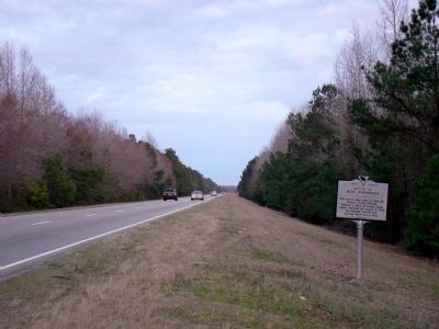
By J. J. Prats, February 26, 2009
Battle of Blue Savannah Marker
RANKED BY RELEVANCE
| 201 ► South Carolina, Marion County, Rains — 34-1 — Battle of Blue Savannah |
| On U.S. 501 at South Carolina Highway 41, on the right when traveling east on U.S. 501. Reported missing. | |||
202 ► Virginia, Fairfax County, Herndon — Battle of Dranesville — December 20, 1861 —  |
| On Leesburg Pike (Virginia Route 7) at Reston Avenue, on the right when traveling west on Leesburg Pike. | |||
| 203 ► Virginia, Hanover County, Ashland — M60 Main Battle Tank — Patton Series — |
| Near Cedar Lane (Virginia Route 623) west of Holly Berry Road ( Route 727), on the right when traveling west. | |||
| 204 ► Virginia, Hanover County, Mechanicsville — Beaver Dam Creek — 1862 Seven Days' Battles — |
| Near Cold Harbor Road (Virginia Route 156). | |||
| 205 ► Virginia, Petersburg — QA-25 — Battle of Petersburg — 25 April 1781 — Second Line Of Defense — |
| On North Madison Street 0.1 miles north of East Washington Street (U.S. 301), on the left when traveling north. | |||
| 206 ► Virginia, Petersburg — QA-23 — Battle of Petersburg — 25 April 1781 — First Line Of Defense — |
| On East Bank Street at East Street, on the right when traveling west on East Bank Street. | |||
| 207 ► Virginia, Petersburg — QA-20 — Battle of Petersburg — 25 April 1781 — Artillery Position — |
| On S Little Church Street at E Washington Street (U.S. 301), on the left when traveling north on S Little Church Street. | |||
| 208 ► Virginia, Petersburg — QA-24 — Battle of Petersburg, 25 April 1781 — Flanking Movement — |
| On Graham Road, on the right when traveling west. | |||
| 209 ► Virginia, Prince William County, Manassas — The Battle Begins — |
| On Lee Highway (County Route 705) 0.1 miles south of Lee Highway (U.S. 29), on the right when traveling north. | |||
| 210 ► Virginia, Williamsburg — W-43 — Battle of Williamsburg |
| On Pocahontas Trail (U.S. 60) at 5th Avenue, on the left when traveling east on Pocahontas Trail. Reported permanently removed. | |||
| 211 ► New York, Orange County, Fort Montgomery — The Battle Around the Redoubts — |
| Near U.S. 9W, on the right when traveling north. | |||
| 212 ► Virginia, Loudoun County, Leesburg — Battle of Ball’s Bluff, October 21, 1861 |
| Near Ball’s Bluff Road, on the left when traveling east. Reported permanently removed. | |||
| 213 ► Virginia, Louisa County, Louisa, Oakland — Bibb's Crossroads — First Shots — The Battle of Trevilian Station — |
| On Oakland Road (County Route 613), on the right when traveling north. | |||
| 214 ► Virginia, Louisa County, Louisa, Trevilians — W-209 — Battle of Trevilian Station — |
| On Louisa Road (U.S. 33) at Trevilians Square, on the right when traveling east on Louisa Road. | |||
| 215 ► Netherlands, Noord-Holland, Amsterdam, Bos en Lommer — Zeeslag bij de Doggersbank / Battle of Dogger Bank — |
| On Doggersbankstraat, on the left when traveling north. | |||
| 216 ► Netherlands, Noord-Holland, Amsterdam, Bos en Lommer — Zeeslag bij Solebay / Battle of Solebay — |
| On Solebaystraat, on the right when traveling north. | |||
| 217 ► United Kingdom, England, East Sussex, Battle — Battle town and the abbey’s estates — Battle of Hastings, 1066 — |
| Near High Street at Park Lane, on the right when traveling south. | |||
| 218 ► Kentucky, Madison County, Berea — 1300 — Richmond-Prelude/ Richmond Battle — |
| On Battlefield Memorial Highway (U.S. 421) north of Old Kingsto-Berea Raod, on the right when traveling north. | |||
| 219 ► New York, Saratoga County, Stillwater — The Battle of Freeman’s Farm |
| Near Park Tour Road, on the left when traveling south. Reported permanently removed. | |||
| 220 ► North Carolina, Cumberland County, Fayetteville, Cape Fear — II-1 — The Battle of Bentonville — March 19, 20, and 21, 1865 — |
| Near Interstate 95 at milepost 48, 1 mile south of Cedar Creek Rd (North Carolina Highway 53), on the right when traveling north. | |||
| 221 ► Virginia, Arlington County, Arlington, Fort Myer — Battle of the Bulge Monument — Triumph of Courage — December 16, 1944 - January 25, 1945 — |
| On Arlington Cemetery. | |||
| 222 ► Virginia, Louisa County, Louisa, Trevilians — W-210 — Trevilian Station Battle |
| On Louisa Road (U.S. 33) at Danne Road (Route 682), on the right when traveling west on Louisa Road. Reported missing. | |||
| 223 ► Virginia, Shenandoah County, Fishers Hill — Battle of Fisher's Hill — |
| On Old Valley Pike (U.S. 11), on the right when traveling south. | |||
| 224 ► Ontario, Niagara Region, Niagara Falls — Battle Stages — |
| Near Lundy's Lane, on the left when traveling west. | |||
| 225 ► Ontario, Niagara Region, Niagara Falls — The Battle of Lundy’s Lane — War of 1812 — |
| On Lundy's Lane, on the right when traveling west. | |||
| 226 ► Kansas, Linn County, Pleasanton — Battle of Mine Creek — |
| Near State Highway 52 0.5 miles west of U.S. 69. | |||
| 227 ► Kansas, Miami County, Osawatomie — Battle of Osawatomie — |
| Near Tenth Street 0.2 miles north of Main Street. | |||
| 228 ► Louisiana, Pointe Coupée Parish, Morganza — Battle of Bayou Fordoche — |
| On Bayou Fordouche Road (State Highway 10) 0.6 miles north of State Highway 77, on the right when traveling north. | |||
| 229 ► Michigan, Wayne County, Detroit, Elmwood Park — 70 — The Battle of Bloody Run — Michigan Registered Historic Site — |
| On East Jefferson Avenue 0 miles east of Adair Street, on the left when traveling east. | |||
| 230 ► Minnesota, Crow Wing County, Crow Wing, Crow Wing State Park — The Battle of Crow Wing — Chippewa Lookout — |
| Near State Park Road (County Road 27). | |||
| 231 ► Missouri, Jackson County, Independence — First Battle of Independence — A State Divided: The Civil War in Missouri — |
| On Lexington Avenue near Main Street, on the right when traveling west. | |||
| 232 ► New York, Kings County, Brooklyn, Greenwood Heights — Battle Hill — Revolutionary War Heritage Trail — |
| Near Battle Avenue, on the left when traveling north. | |||
| 233 ► New York, Sullivan County, Highland — Minisink Battle Monument — |
| Near Minisink Battle Ground Road, on the left when traveling east. | |||
| 234 ► New York, Washington County, Fort Anne — Battle Hill — |
| On U.S. 4 0.5 miles north of Charles Street, on the left when traveling north. | |||
| 235 ► Pennsylvania, Erie County, Girard — Charlotte Elizabeth Battles — (1864-1952) — |
| On Main Street (U.S. 20) at Mechanic Street, on the right when traveling west on Main Street. | |||
| 236 ► Texas, Williamson County, Taylor — 9037 — Battle of Brushy Creek — |
| On State Highway 95 south of County Road 452. | |||
| 237 ► Virginia, Fairfax County, Fairfax — B-11 — Battle of Chantilly — (Ox Hill) — |
| On Fairfax County Parkway (County Route 7100) at Monument Drive, on the right when traveling north on Fairfax County Parkway. | |||
| 238 ► Virginia, Fairfax County, Fairfax — The Battle of Ox Hill — The Death of Generals Stevens and Kearny — Second Manassas Campaign |
| On Monument Drive at Monument Court, on the left when traveling west on Monument Drive. Reported permanently removed. | |||
| 239 ► Virginia, Hampton, Fort Monroe — Veterans of the Battle of the Bulge — Ardennes — |
| On Ingalls Road (U.S. 258) at Main Gate, on the left when traveling south on Ingalls Road. | |||
| 240 ► Virginia, Henrico County, Richmond — PA-195 — Seven Days Battles — Malvern Hill — |
| On Willis Church Road (Virginia Route 156) at Carter Mills Road, on the right when traveling south on Willis Church Road. | |||
| 241 ► Virginia, Henrico County, Richmond — PA-235 — Seven Days Battles — Malvern Hill — |
| On Willis Church Road (Virginia Route 156) just north of Carters Mill Road (County Route 606), on the right when traveling south. | |||
| 242 ► Virginia, Louisa County, Louisa — Battle of Trevilians Memorial — |
| On West Street 0.1 miles east of West Main Street (U.S. 33), on the right when traveling east. | |||
| 243 ► Virginia, Shenandoah County, New Market — A-28 — Battle of New Market |
| On Old Valley Pike (U.S. 11) north of New Market, on the right when traveling south. Reported permanently removed. | |||
| 244 ► Virginia, Warren County, Front Royal — The Bridges — “Torch the Bridges!” — Battle of Front Royal - May 23, 1862 |
| Near North Royal Avenue 0.1 miles north of Depot Avenue when traveling north. Reported missing. | |||
| 245 ► Ontario, Essex County, Windsor — Battle of Lake Erie — |
| On Sandwich Street at Mill Street, on the right when traveling north on Sandwich Street. | |||
| 246 ► Florida, Bay County, Panama City, Carver Heights — Battle Memorial Funeral Home — c.1963 — Historic Glenwood — |
| On Martin Luther King Junior Boulevard (U.S. 98) 0.3 miles south of East 11th Street, on the right when traveling north. | |||
| 247 ► New York, Westchester County, White Plains — Battle of White Plains — |
| On Whitney Street at Battle Avenue, on the left when traveling south on Whitney Street. | |||
| 248 ► New York, Westchester County, White Plains — Battle Park — |
| On Battle Avenue, on the right when traveling east. | |||
| 249 ► Pennsylvania, Cumberland County, Carlisle, Middlesex Township — The Battle of the Ia Drang Valley — |
| Near Army Heritage Drive. | |||
| 250 ► Vermont, Bennington County, Bennington, Old Bennington — Before the Battle Monument — |
| On Monument Circle at Monument Avenue on Monument Circle. | |||
| 251 ► Virginia, Fauquier County, Auburn — CL-9 — Battle of Coffee Hill — (Second Battle of Auburn) — |
| On Rogues Road (Virginia Route 602) at Old Auburn Road ( Route 670), on the right when traveling west on Rogues Road. | |||
| 252 ► Virginia, Frederick County, Winchester — The Third Battle of Winchester — Thoburn's Attack |
| Near Redbud Road, on the right when traveling east. Reported permanently removed. | |||
| 253 ► Virginia, Frederick County, Winchester — The Third Battle of Winchester — The Middle Field - Bloodiest Encounter in the Shenandoah Valley |
| Near Redbud Road (County Route 661), on the right when traveling east. Reported permanently removed. | |||
| 254 ► California, San Francisco City and County, San Francisco, Lincoln Park — The Naval Battle of Guadalcanal — Twenty-Four Minutes of Thundering Hell On Iron Bottom Bay — |
| On El Camino del Mar north of Sea Rock Drive, on the left when traveling north. | |||
| 255 ► Florida, Hillsborough County, Tampa, Clair-Mel City — The Battle of Fort Brooke — Hillsborough County Veterans Memorial Park — |
| Near U.S. 301 0.2 miles south of East Martin Luther King Jr Boulevard, on the right when traveling south. | |||
| 256 ► Georgia, Wilkes County, Washington — 157-15 — Battle of Kettle Creek — |
| Near War Hill Road 1.5 miles south of Tyrone Road. | |||
| 257 ► Kansas, Miami County, Osawatomie — 1 — Battle of Osawatomie — |
| Near Main Street. | |||
| 258 ► Mississippi, Warren County, Vicksburg National Military Park — Battle of Champion's Hill, Mississippi, May 16. — Campaign, Siege, and Defense of Vicksburg; 1863. — |
| On Grant Circle west of Grant Avenue, on the left when traveling east. | |||
| 259 ► Mississippi, Warren County, Vicksburg National Military Park — Battle of Champion's Hill, Mississippi, May 16. — Campaign, Siege, and Defense of Vicksburg; 1863. — |
| On Pemberton Circle at Confederate Avenue, on the right when traveling south on Pemberton Circle. | |||
| 260 ► Missouri, Cooper County, Boonville — The Battle of Boonville — |
| On Morgan Street, on the right when traveling east. | |||
| 261 ► Missouri, Iron County, Arcadia — Fort Curtis — Battle of Pilot Knob — |
| Near Church Street at Spring Street. | |||
| 262 ► Missouri, Iron County, Arcadia — The Arcadia Valley — Battle of Pilot Knob — |
| On State Highway 72 at Thompson Road, on the left when traveling west on State Highway 72. | |||
| 263 ► Missouri, Iron County, Pilot Knob — Iron Furnace — Battle of Pilot Knob — September 27, 1864, 2:00 p.m. - 2:30 p.m. — |
| On State Highway 221 at Oak Street, on the left when traveling east on State Highway 221. | |||
| 264 ► Missouri, Iron County, Pilot Knob — Knob Creek — Battle of Pilot Knob — September 27, 1864, 2:00 p.m. - 5:30 p.m. — |
| On S. McCune Street 0.1 miles Missouri Highway 21, on the right when traveling north. | |||
| 265 ► Missouri, Iron County, Pilot Knob — St. Mary's Catholic Church — Battle of Pilot Knob — September 28, 1864, 1:00 a.m. - 3:30 a.m. — |
| Near N. McCune Street north of Maple Street (Missouri Highway 221), on the left when traveling north. | |||
| 266 ► Missouri, Iron County, Pilot Knob — The Arcadia Valley — Battle of Pilot Knob — |
| On N. McCune Street 0.2 miles north of Cedar Street, on the left when traveling north. | |||
| 267 ► New Jersey, Somerset County, South Bound Brook — Battle of Bound Brook — |
| On Main Street, on the right when traveling north. | |||
| 268 ► New York, New York County, Manhattan, Morningside Heights — Battle of Harlem Heights — |
| On Broadway north of 116th Street, on the right when traveling north. | |||
| 269 ► Ohio, Clark County, Springfield, Shawnee Springs — Battle of Piqua — August 8, 1780 — |
| On Tecumseh Road (Ohio Route 369) north of Lower Valley Pike. | |||
| 270 ► Ohio, Clark County, Springfield, Shawnee Springs — The Battle of Piqua — August 8th, 1780 — |
| On Tecumseh Road (Ohio Route 369) at Lower Valley Pike, on the right when traveling north on Tecumseh Road. | |||
| 271 ► Virginia, Augusta County, New Hope — Battle of Piedmont — Final Action at New Hope |
| On Battlefield Road (County Route 608), on the left when traveling south. Reported permanently removed. | |||
| 272 ► Virginia, Culpeper County, Brandy Station — The Battle of Brandy Station — The Race for Fleetwood Hill |
| On Fleetwood Heights Road (County Route 685), on the right when traveling east. Reported missing. | |||
| 273 ► Virginia, Winchester — The First Battle of Kernstown — An Unheralded Commander’s Unique Victory |
| Near Battle Park Drive, on the right when traveling west. Reported permanently removed. | |||
| 274 ► Virginia, Winchester — The Third Battle of Winchester — |
| On Mt Hebron Drive at Confederate Cemetery Drive, on the left when traveling east on Mt Hebron Drive. | |||
| 275 ► West Virginia, Berkeley County, Falling Waters — Battle of Falling Waters — Harper’s 5th Virginia Infantry — |
| On Williamsport Pike (U.S. 11) at Hammonds Mill Road (County Route 901), on the right when traveling south on Williamsport Pike. | |||
| 276 ► Wyoming, Natrona County, Casper — The Battle of Red Buttes — |
| Near Fort Caspar Road 0.1 miles west of South West Wyoming Boulevard (Wyoming Highway 258), on the left when traveling west. | |||
| 277 ► Massachusetts, Middlesex County, Westford — North Bridge Battle Drum — 1775 — |
| On Boston Road at Hildreth Street, on the right when traveling north on Boston Road. | |||
| 278 ► Mississippi, Hinds County, Edwards — The Coker House and the Battle of Champion Hill |
| On Adams Lane south of State Route 467, on the left when traveling south. Reported missing. | |||
| 279 ► Missouri, Adair County, Kirksville — Battle of Kirksville — August 6, 1862 — |
| On North Franklin Street at West Washington Street, on the left when traveling north on North Franklin Street. | |||
| 280 ► Missouri, Madison County, Fredericktown — Battle of Fredericktown — A State Divided: The Civil War in Missouri — |
| Near South Main Street (Business U.S. 67) 0.1 miles south of John Holt Drive, on the left when traveling south. | |||
| 281 ► New York, Orange County, Fort Montgomery — The Naval Battle of Fort Montgomery — |
| Near State Highway 9W. | |||
| 282 ► Ohio, Lucas County, Maumee — 46-48 — Battle of Fallen Timbers — |
| On North Jerome Road south of Monclova Road, on the left when traveling south. | |||
| 283 ► South Carolina, Lancaster County, Heath Springs — The Battle of the Hanging Rock — |
| Near Hanging Rock Road (State Highway 29-467) 0.8 miles east of Flat Rock Road, on the right when traveling east. | |||
| 284 ► Tennessee, Shelby County, Collierville — Battle of Collierville — |
| On North Rowlett Street. | |||
| 285 ► Tennessee, Williamson County, Franklin — The Battle of Franklin — |
| Near Eastern Flank Circle 0.4 miles south of Lewisburg Pike (Business U.S. 431), on the right when traveling west. | |||
| 286 ► Texas, Jefferson County, Sabine Pass — 10558 — Federal Fatalities at the Battle of Sabine Pass — |
| On 6100 Dick Dowling Road, on the right when traveling north. | |||
| 287 ► Virginia, Hanover County, Studley — Enon Church — The Battle of Haw's Shop — Lee vs. Grant – The 1864 Campaign — |
| On Studley Road (County Route 606) at Buckeye Road, on the left when traveling east on Studley Road. | |||
| 288 ► Virginia, Henrico County, Henrico — The Battle of Malvern Hill — Stonewall Jackson’s Men Threaten the Union Right — |
| Near Willis Church Road (Virginia Route 156), on the left when traveling south. | |||
| 289 ► Virginia, Virginia Beach, Fort Story — Battle of the Capes — U.S. Department of the Army — Fort Story, Virginia — |
| Near Antic Avenue west of New Guinea Road, on the right when traveling west. | |||
| 290 ► Newfoundland and Labrador, CensusDiv 1 - Avalon Peninsula-St. John's, St. John's — Battle of Signal Hill / La bataille de Signal Hill — |
| Near Signal Hill Road. | |||
| 291 ► Alabama, Baldwin County, Tensaw — The Battle of Fort Mims — Fort Mims Historical and Archaeological Site — |
| Near Fort Mims Road 0.4 miles Boatyard Road, on the right when traveling west. | |||
| 292 ► Kansas, Linn County, Pleasanton — After the Battle — |
| Near Kansas 52. | |||
| 293 ► New Jersey, Mercer County, Trenton, Downtown — The Second Battle of Trenton — |
| On S Broad Street at E Front Street, on the right when traveling north on S Broad Street. | |||
| 294 ► New York, Warren County, Lake George — The 1755 Battle of Lake George — Lake George Battlefield Park — |
| On Fort George Road, on the left when traveling south. | |||
| 295 ► Pennsylvania, Franklin County, Waynesboro, Washington Township — The Battle of Monterey Pass — |
| Near Charmian Road near Buchanan Trail East/Waynesboro Road, on the right when traveling west. | |||
| 296 ► South Carolina, Cherokee County, Gaffney — Form the Line of Battle — |
| On Chesnee Highway (Route 11). | |||
| 297 ► Virginia, Culpeper County, Brandy Station — Battle of Brandy Station — |
| On Fleetwood Heights Road (County Route 685), on the right when traveling east. | |||
| 298 ► Virginia, Culpeper County, Brandy Station — The Battle of Brandy Station — The Struggle for Fleetwood Hill |
| On Fleetwood Heights Road (County Route 685), on the right when traveling east. Reported missing. | |||
| 299 ► Virginia, Culpeper County, Culpeper — The Battle of Cedar Mountain — |
| On General Winder Road (County Route 657) at James Madison Highway (U.S. 15), on the right when traveling west on General Winder Road. | |||
| 300 ► Virginia, Hanover County, Mechanicsville — The Battle Ends |
| Near Watt House Road 0.7 miles south of Cold Harbor Road ( Route 156), on the right when traveling south. Reported permanently removed. | |||
22691 entries matched your criteria. Entries 201 through 300 are listed above. ⊲ Previous 100 — Next 100 ⊳
Thin black lines indicate changes in relevance. Between each pair of lines entries are ordered geographically but all have the same relevance.
* Inflectional forms of words are their plurals, singulars, and possessives as well as gramatical tenses and similar variations.
Nov. 22, 2026