By Christopher Light, July 17, 2007
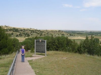
Ash Hollow Geology Marker
| On U.S. 26, on the right when traveling east. |
| On State Highway 27 at Road 54, on the right when traveling south on State Highway 27. |
| On South 8th Avenue just south of H Street, on the right when traveling north. |
| On Willow Springs Road 0.3 miles south of State Highway 91, on the left when traveling south. |
| On H Street 0.2 miles east of 13th Avenue (State Highway 96), on the left when traveling east. |
| Near Dam Road (State Highway 96) 7 miles north of State Highway 91, on the left when traveling north. |
| On State Highway 91/11 0.3 miles east of Windy Hill Road, on the right when traveling east. |
| Near Dam Road (State Highway 96) 7 miles north of State Highway 91, on the left when traveling north. |
| On Nebraska Route 91/11 0.3 miles east of Windy Hill Road, on the right when traveling east. |
| On State Highway 11 at milepost 58, on the right when traveling south. |
| On State Highway 2 5.6 miles west of State Highway 11, on the right when traveling west. |
| On Saint Paul Road 0.5 miles north of East White Cloud Road (County Road 41), on the right when traveling north. |
| Near Sky Park Road 0.6 miles north of East Airport Road, on the right when traveling north. |
| On Interstate 80 near the Grand Island Eastbound Rest Area, on the right when traveling east. |
| On Interstate 80 at milepost 316.5, on the right when traveling west. |
| Near West Capital Avenue just west of Taylor Avenue, on the right when traveling west. |
| On 1st Street (U.S. 30) at Locust Street, on the left when traveling west on 1st Street. |
| Near American Legion Memorial Highway (U.S. 281) at West Abbott Road (County Road 39), on the right when traveling south. |
| Near West Stolley Park Road. |
| On Tech Drive at U.S. 34 on Tech Drive. |
| On 1st Street (U.S. 30) at Walnut Street, on the right when traveling east on 1st Street. |
| On West 2nd Street at Cleburn St. on West 2nd Street. |
| On West 2nd Street near West 2nd Street and West Elm Street. |
| On Seedling Road, in the median. |
| On West Husker Highway 0.9 miles west of State Highway 11, on the left when traveling west. |
| On West Old Potash Highway 0.2 miles west of North 90th Road, on the right when traveling west. |
| On U.S. 30, on the right when traveling west on U.S. 30. |
| Near Q Street (US HWY 34) (Alternate Interstate 80) at 12th Street, on the right when traveling west. |
| On 12th Street north of L Street, on the right when traveling north. |
| On Taylor Avenue near Arizona Street. |
| On North Main Street (Nebraska Route 25A) north of East Carrigan Street, on the right when traveling north. |
| On Howard Street (U.S. 34) near Texas Avenue, on the left when traveling east. |
| On U.S. 34 near Old Highway 34, on the right when traveling east. |
| On U.S. 275 at South Spruce Street, on the right when traveling south on U.S. 275. |
| On U.S. 20 2.5 miles east of O’Neill, on the right when traveling east. |
| On North 4th Street at East Clay Street, on the right when traveling north on North 4th Street. |
| On American Legion Memorial Highway (U.S. 281) 8.6 miles south of U.S. 20, on the right when traveling south. |
| On 5th Street (State Highway 45A Spur) at Main Street, on the left when traveling south on 5th Street. |
| On Northwest 1st Street west of North Cleveland Avenue, on the left when traveling west. |
| On Southwest 1st Street (State Highway 2) 10 miles west of North Washington Avenue (State Highway 97), on the right when traveling west. |
| On Indian Street at 6th Street, on the left when traveling west on Indian Street. |
| On 12th Avenue 0.7 miles west of State Highway 11, on the left when traveling west. |
| On 4th Street, on the right when traveling west on 4th Street. |
| On River Road 4 miles north of U.S. 136, on the right when traveling north. |
| On 573rd Avenue at U.S. 136, on the right when traveling south on 573rd Avenue. |
| On 723rd Road (State Highway 4), on the right when traveling east on 723rd Road. |
| Near West Main Street (State Highway 49A Spur) just west of South Third Street, on the left when traveling west. |
| On Broadway at 4th Street, on the right when traveling east on Broadway. |
| On West 3rd Street at A Avenue when traveling west on West 3rd Street. |
| On 20 Road 1.2 miles south of U.S. 6/34, on the left when traveling south. |
| On State Highway 50A at 27th Road, on the left when traveling east on State Highway 50A. |
| Near V Road (State Highway 50A) at Road 29. |
| On 25th Road (Nebraska Route 44) 0.1 miles south of W Road, on the left when traveling south. |
| On Lowell Road at Carpenter Road on Lowell Road. |
| On Osco Road 0.6 miles west of 40th Road, on the right when traveling west. |
| On Harold Warp Memorial Drive (32nd Road) (State Highway 10) near State Highway 50A, on the right when traveling south. |
| On U.S. 30 at M, on the right when traveling west on U.S. 30. |
| On Interstate 80, on the right when traveling west. |
| On Parkhill Drive at West 10th Street on Parkhill Drive. |
| Near Interstate 80, on the right when traveling west. |
| On North Spruce Street (Scenic U.S. 26) at West 10th Street on North Spruce Street. |
| On Lincoln Highway (U.S. 30) 5.4 miles east of U.S. 26, on the left when traveling east. |
| Near Interstate 80, on the right when traveling west. |
| On Lincoln Highway (U.S. 30) 1.4 miles east of East County Road 15, on the left when traveling east. |
| On Norden Road 0.3 miles south of State Highway 12. |
| On Lincoln Highway (U.S. 30) just west of County Road 29, on the right when traveling east. |
| On Main Street 0.1 miles west of 539 Avenue, on the right when traveling west. |
| On State Highway 12 at 522 Avenue, on the right when traveling west on State Highway 12. |
| Near Walnut Street (Outlaw Trail Scenic Byway) (State Highway 12) at Spruce Avenue, on the right when traveling east. |
| On 100 Street 0.3 miles south of West Saltillo Road, on the right when traveling north. |
| On Sumner Street west of South 50th Street, on the right when traveling west. |
| Near NW 44th St at W. Cuming St. |
| On Vine Street at 14th Street, on the right when traveling west on Vine Street. |
| On North 16th Street at U Street, on the right when traveling north on North 16th Street. |
| On R. Street just west of 16th Street, on the right when traveling west. |
| Near R Street near North 12th Street. |
| On Q Street west of 10th Street (U.S. 34), on the left when traveling west. |
| On Lincoln Mall east of South 12th Street, on the right when traveling west. |
| On H Street just east of 16th Street. |
| On South 16th Street at H Street on South 16th Street. |
| On O Street (U.S. 34) west of 10th Street, on the right when traveling west. |
| Near West Branched Oak Road 0.5 miles east of North 126th Street, on the right when traveling east. |
| On Interstate 80 5.3 miles west of State Highway 560, on the right when traveling west. |
| Near Interstate 80 at milepost 194, 13.7 miles east of State Highway 56A, on the right when traveling east. |
| On U.S. 30 at South Jackson Road, on the left when traveling east on U.S. 30. |
| Near North Buffalo Bill Avenue 0.8 miles north of Lincoln Highway (U.S. 30), on the right when traveling north. |
| Near Scout's Rest Ranch Road, on the right when traveling west. |
| On East Third Street at North Dewey Street, on the right when traveling east on East Third Street. |
| On Interstate 80 at milepost 159, on the right when traveling east. |
| Near Interstate 80 at milepost 159, on the right when traveling east. |
| Near Interstate 80 at milepost 159. |
| Near State Highway 96 5.6 miles east of U.S. 183, on the right when traveling east. |
| On U.S. 183, on the right when traveling north. |
| On 546th Avenue (State Highway 121) 1.1 miles south of Front Street (U.S. 275), on the right when traveling south. |
| Near South 4th Street (State Highway 121) 0.1 miles south of West Park Street, on the left when traveling south. |
| Near West 9th Street 0.1 miles east of South Ingram Street. |
| On Main Avenue east of 4th Street, on the right when traveling east. |
477 entries matched your criteria. Entries 201 through 300 are listed above.
⊲ Previous 100 —
Next 100 ⊳
