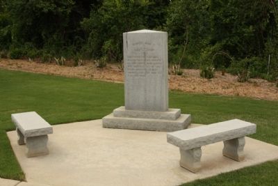
On Georgia Avenue (U.S. 25) near West Main Street, on the right when traveling south.
World War I
1914 — 1918
Dedicated to the men
and women who served
in the great war which
was believed to be the
final war of human
liberty and the "war to
end all wars". — — Map (db m31243) WM
On Georgia Avenue (U.S. 25) near West Main Street, on the right when traveling south.
World War II
1941 — 1945
Dedicated to the men and women
who battled globally to
secure a free world for
all mankind. The massive
production war effort caused
many women to enter industry
and changed the American . . . — — Map (db m31269) WM
On Buford's Bridge Highway (U.S. 321), on the left when traveling north.
(Barker's Mill side of marker):
Barker's Mill, which stood here on
Jackson Branch, was a grist mill
owned by William Ransome Barker
(1816-1869), a planter in what was
then Barnwell District. Barker moved
to this are in the . . . — — Map (db m7176) HM
On South Fant Street (State Highway 22) at East River Street (U.S. 76), on the right when traveling north on South Fant Street.
The location of the Anderson County Courthouse Annex on the corner of Fant and River Street has unique significance to Anderson's history. The site is the location of the 1865 federal encampment of the First Maine, 33rd Regiment, United States . . . — — Map (db m19838) HM
Sandy Springs Camp Ground: This Methodist camp ground named for the large spring nearby, dates to 1828, when a fifteen-acre site was purchased from Sampson Pope for $45. Early meetings were under a brush arbor until a central wooden shelter . . . — — Map (db m10785) HM
On Confederate Highway (State Highway 641) near State Park Road (County Route 5-8), on the right when traveling west.
Battle At Rivers Bridge
On February 2 ~ 3, 1865, as Gen. W.T. Sherman's
Federals advanced toward Columbia, units of
Gen. F.P. Blair's XVII Corps attempted to cross
the Salkehatchie River at Rivers Bridge. The
Confederate defenders . . . — — Map (db m7708) HM
On Burton Ferry Road (U.S. 301) at Carolina Highway (U.S. 321), on the right when traveling north on Burton Ferry Road.
(Front Text) Buford's Bridge, the earliest settlement in what is now Bamberg County, was established as early as 1792, when William Buford maintained a bridge and operated a ferry over the Salkehatchie River. It grew throughout the nineteenth . . . — — Map (db m7644) HM
On Craven Street at Church Street, on the right when traveling west on Craven Street.
Maxcy - Rhett House. This house was built circa 1810 for Milton Maxcy (1782-1817), who came here from Massachusetts in 1804. Maxcy and his brother Virgil, who founded a school for young men in Beaufort, later taught at Beaufort College. In . . . — — Map (db m218490) HM
On Old State Road (U.S. 176) north of Shrike Road, on the right when traveling north.
Burial place of Lt. Col. Olin M. Dantzler, C.S.A. Appointed Brigadier General 1 June 1864 Defender of Charleston, SC and Petersburg, VA His recorded notes to General P.G.T. Beauregard led to the location of the submarine H.L. Hunley in 1995 Killed . . . — — Map (db m134424) HM
[South side]:
At every board a vacant chair fills with quick tears some tender eye, and at our maddest sport appear those well loved forms that will not die; we lift the glass, our hand is stayed - we jest , a spectre rises up - and . . . — — Map (db m27484) HM
On River Road at Plow Ground Road (South Carolina Highway 10-1156), on the right when traveling south on River Road.
(Front text) Federal Expedition on John's Island The Battle of Burden’s Causeway was the climax of a Federal expedition against John’s Island, July 2-9, 1864. 5000 Federals under Brig. Gen. John P. Hatch crossed the Stono River and . . . — — Map (db m29585) HM
On North Limestone Street (State Highway 150) at East Frederick Street (State Highway 18), on the right when traveling north on North Limestone Street.
Married June 27th, 1874.
Came to Gaffney in August, 1876.
Merchant, Banker, President of Mills,
Business Leader, Builder of Homes and
Houses of Business, Philanthropist.
This building was erected by A.N. Wood
in 1881, being from the . . . — — Map (db m7330) HM
(Front face):To the Confederate soldiers of Colleton County, SC
To those who fought and lived
To those who fought and died
To those who gave much
And to those who gave all
(Rear face):
To the mothers, wives, sisters and . . . — — Map (db m7064) HM
On Wire Road (State Highway 18-19) near Cowtail Road (State Highway 18-71), on the right when traveling west.
(Front text) This church was organized shortly after the Revolution and this site was deeded to seven trustees in 1787. One of them, Jacob Barr, was the first minister to serve here. Appleby’s Methodist Church was named for a prominent local . . . — — Map (db m26275) HM
On U.S. 15 near Old Spell Road, on the left when traveling north.
(Front text)
This church was founded in the early 19th century as Murray's Church and served by ministers riding the Cypress Circuit.
It was originally named for the Murray family, which also gave this town its first name of Murray's . . . — — Map (db m22006) HM
On Wire Rd. (State Road 18-19) near Sandy Branch Road, on the left when traveling west.
(Front text) This house, an excellent example of early Federal era-architecture, was built about 1800 for Joseph Koger, Jr. (1779-1866), planter, state representative 1806-1812, Colleton District sheriff 1813-18, and state senator 1818-1838. . . . — — Map (db m26349) HM
On West Martintown Road (Route 230) south of South Carolina Highway 19-432, on the right when traveling north. Reported missing.
Born 1 mi. E. Cmdr. 1st Corps, Army of Northern VA Confederate States Army; Lee's "Old Warhorse"; West Point graduate; Mexican War veteran. — — Map (db m251958) HM
On South Dargan Street south of Cherokee Road (South Carolina Road S-21-13), on the left when traveling north.
Pee Dee Rifles - Camp #1419
Sons of Confederate Veterans
Florence, South Carolina
This sign is placed here in honor of the life and service of 64 unknown Confederate soldiers who died in Florence, South Carolina, and were buried here . . . — — Map (db m291943) HM
This house, built between 1878 and 1885, was the home of James Washington Moore (1837-1912), lawyer, Confederate officer, state legislator, and militia officer. Moore, a native of Gillisonville, was educated at the University of Ga. and returned . . . — — Map (db m26653) HM
On Fairview Road (U.S. 178) at Bagpipe Road, on the right when traveling south on Fairview Road.
Pinarea
Pinarea, the plantation owned by soldier, statesman, and manufacturer Paul Quattlebaum (1812-1890), was a mile E. Quattlebaum was a captain in the Seminole War and a brig. gen, in the S.C. militia by 1843. He was a state representative . . . — — Map (db m21869) HM
On New State Road at Old State Road (South Carolina Highway 32-66), in the median on New State Road.
On February 15, 1865, as Gen. W.T. Sherman's Federal army advanced to Columbia, Gen. O.O. Howard's Army of the Tennessee found its way blocked by Confederates entrenched behind Congaree Creek and defending the Old State Rd. bridge. Gen. George G. . . . — — Map (db m39818) HM
On Lewie Street (State Highway 32-737) at Waters Ferry Road (State Highway 32-37), on the right when traveling east on Lewie Street.
(Front) Lewie Chapel, a Methodist church founded on this site in the 1870s by Solomon R. Lewie (1835-1878) and others, was later known as Lewiedale Methodist Church and after 1910 as Gilbert Methodist Church. The original sanctuary, replaced . . . — — Map (db m30372) HM
On Nance Street, on the left when traveling south.
Front
Colonel Charles Trowbridge of the 33rd U.S. Colored Troops ordered the execution of Calvin Crozier, former private 3rd Kentucky Cavalry, on Sept. 8, 1865. Crozier, while en route to his Texas home, cut a troop member on the back of . . . — — Map (db m13305) HM
On John C. Calhoun Drive (U.S. 301) at Russell Street (State Route 33), in the median on John C. Calhoun Drive.
We fly this Confederate Flag to honor the Confederate Soldiers who gallantly fought and died defending the bridge crossing at the Edisto River against Gen. Sherman’s troops February 12, 1865. The following are the Confederate troops present at . . . — — Map (db m52267) HM WM
On Westminster Drive at Stratford Road, in the median on Westminster Drive.
Known as "Diamond Hill," which was burned by Union Troops during their invasion of Columbia, February 17, 1865, was located 125 feet due south of this spot.
The stones in this monument formed part of the foundation of that home. — — Map (db m46448) HM
On Main Street, on the right when traveling south.
The Jefferson Hotel, designed and built by Columbia entrepreneur and contractor John Jefferson Cain (1869-1929), stood here at the corner of Main and Laurel Streets from 1913 until 1968. The hotel (also sometimes called the Hotel Jefferson) was . . . — — Map (db m21895) HM
This Confederate camp of instruction was once located about 1 mi. NW at Lightwood Knot Springs, site of a popular resort prior to the War Between the States. — — Map (db m30192) HM
On Farrow Road (State Highway 555) near Killian Road, on the right when traveling south. Reported permanently removed.
On February 18, 1865, the day after Federals under Gen. W.T. Sherman occupied Columbia, Gen. Frank Blair ordered units of his XVII Corps to destroy railroad tracks north of the city. Portions of Gen. M.C. Butler’s Confederate cavalry division, . . . — — Map (db m228374) HM
Near Confederate Cemetery Road 0.1 miles south of Old U.S. 41.
(Front):General A.P. Stewart Stewart's Division 2nd Army Corps (Hardee) Army of Tennessee CSA Dedicated 24th Day of April 2010 By Benjamin F. Cheatham Camp 72 Sons of Confederate Veterans Manchester, Tennessee (Reverse):Battle of . . . — — Map (db m30698) HM
In Honor of the men of the Confederate 1st/3rd Kentucky
Calvalry (Consolidated) who first encountered the
onslaught of Wilder's Brigade, Thomas's Corps of the
Union Army, North of Hoover's Gap June 24, 1863 — — Map (db m166932) WM
On East Main Street at Mayland Road, on the right when traveling east on East Main Street.
Less than half a mile west of here, on the Lewis Whitaker farm, the only engagement of the war in Cumberland County between regular Union and Confederate troops took place on December 9, 1863. Several companies of Col. Thomas J. Jordan’s 9th . . . — — Map (db m69228) HM
Adelicia Hayes was the daughter of Oliver Bliss Hayes. At times Hayes was a lawyer, judge, Presbyterian minister and a land speculator. Adelicia married 50-year-old Isaac Franklin when she was 22. Franklin's home, Fairvue, still stands outside of . . . — — Map (db m166484) HM
Though Heiman was first buried in Mississippi, admirers brought Heiman's remains to Confederate Circle where they now rest beneath the monument. Confederate officers had recommended he be promoted to brigadier general, and this was confirmed four . . . — — Map (db m166483) HM
Caroline Meriwether was the first child of Charles and Caroline Meriwether. Their estate, “Woodstock”, overlapped the Tennessee-Kentucky border near Clarksville. Her father's chief occupation was raising thoroughbred horses, which led . . . — — Map (db m166494) HM
Maney's grave is located about 75 feet up the hill under a cedar tree.
The Maneys were French Huguenots. They lived in the seaport town of Meschers where they witnessed the migration of Huguenots escaping Catholic persecution. The Maneys first . . . — — Map (db m166475) HM
Hylan Rosser is but one of 1,492 Confederate soldiers buried here in Confederate Circle. Most of the dead do not have marked graves, and there are no known photographs of most. Rosser has been chosen as a representative of those soldiers who gave . . . — — Map (db m166488) HM
Rains is buried about 30 feet back, with a flat granite marker. Rains graduated from Yale Law School in 1854 and began a practice in Nashville. In 1858 he married Ida Yeatman, and they had one child, Laura. Rains also served as city attorney and as . . . — — Map (db m166490) HM
Though largely forgotten today, John Bell was one of the last great American statesmen. He was born in Davidson County in 1796, the year Tennessee became a state. Bell was elected to the U.S. Congress defeating Felix Grundy, Bell's service, . . . — — Map (db m166482) HM
Born in Washington County, Tennessee, Henry Melville Doak was an adventurous young man who tried twice, at age 4 and at 7, to run away from home and join the militia headed off to fight in the Mexican War. Several years older, he gave up the study . . . — — Map (db m166491) HM
Mary Bradford Johns and husband John Johns are buried about 75 feet ahead.
Mary Bradford was descended from several Virginia patriots of the Revolutionary War. Her grandfather, Captain John Bradford, came to Tennessee soon after the war, . . . — — Map (db m166489) HM
Mary Kate was the daughter of Dr. Hugh and Ellen T. Patterson. They lived along Nolensville Pike in the defunct community of Rashboro, now within Nashville. She was attending Elliott School when the U.S. capture of Nashville interrupted her . . . — — Map (db m166486) HM
Rachel Carter's diary is the source of her varied experiences in Nashville during the war. Her father, Daniel Carter, was a bank president. The Carter home was at the corner of High Street (now 6th Avenue) and Union. Rachel and her husband, Thomas . . . — — Map (db m166478) HM
Smith has a flat granite marker here in Confederate Circle. About 1,500 Confederate soldiers lie within the circle. Many were prisoners that died from wounds or illness. Others died in area battles. Smith lived until 1923 and was one of the last . . . — — Map (db m166487) HM
Bate's grave is easy to locate as his monument has a raised relief of his profile. He was born at Castalian Springs in Sumner County. In 2004 the Bate home is still occupied as a private residence and noted by a historical marker on Highway 25. . . . — — Map (db m166480) HM
Jackson's parents migrated from Virginia. He was born in Paris, Tennessee, but his parents moved to Jackson when he was five. He graduated from West Point in 1856 and served in the U.S, Army. His service was primarily in what is now New Mexico, . . . — — Map (db m166493) HM
Beall's grave is about 70 feet up the slope.
Beall was born in Bardstown, Kentucky, but his family moved to Arkansas. He graduated from West Point in 1848, and largely served on the western frontier. He resigned from the U.S. Army as Arkansas . . . — — Map (db m166476) HM
On West Main Street west of High Street (Tennessee Route 53), on the left when traveling west.
Side 1-Gen. John H. Morgan CSA
Side 2-Gen. Morgan left here Dec. 21, 1862, with 2,500 horsemen on his Kentucky Christmas Raid. The raid concluded in Smithville Jan. 5, 1863, after the raiders captured 1887 enemy soldiers and destroyed $2,000,000 in . . . — — Map (db m74323) WM
On South Public Square at South 3rd Street, on the left when traveling east on South Public Square.
(south face)
Atlanta • Chickamauga • Murfreesboro
This monument is dedicated to the memory of all DeKalb Countians who served the Confederacy. They sacrificed much for the cause of an independent South. Their courage and patriotism . . . — — Map (db m75792) WM
On West Court Street at South Main Avenue (Business U.S. 51) on West Court Street.
[Front]
Shiloh
To the memory of the faithful
Confederate soldiers of Dyer County
Number of battles fought by them
Confederate
[side] Perryville • Chickamauga • Missionary Ridge • Belmont • Richmond • Peach . . . — — Map (db m221760) WM
On West Court Street east of South Mill Avenue, on the right when traveling east.
[First plaque]
“For our tomorrow they gave their today”
Killed in Action
Bundy Alexander • Robert Edgar Austin • Robert Allen Brewer • Tipton J. Brewer • Robert T. Brown • Clarence P. Butler • Murrow Childress • Earl R. Cooper • . . . — — Map (db m255374) WM
Near East Court Street (Tennessee Route 104) at Liberty Avenue, on the right when traveling east.
To honor the
Confederate compatriots
who sleep eternally in
this hallowed ground
Erected and dedicated
November 30, 2004, the 140th
anniversary of the Battle of
Franklin and death of Brig. Gen.
Otho French Strahl, by the . . . — — Map (db m221785) WM
Near Ollie Pierce Lane west of Highway 211, on the right when traveling west.
Southern Battle Flag St. Andrews Cross emblazons blue Across a blood-red field, Adorned by stars of purest white; Our Southern battle shield. fly, dear flag, o'er heroes brave Both living and departed; Steadfast to the Southern Cause Our . . . — — Map (db m81520) WM
Near Essary Springs Road 1.1 miles south of Wolf Pen Road, on the left when traveling east.
Front In memory of the men who fought here October 5, 1862 BATTLE OF DAVIS BRIDGE Poor is the nation that has no heroes Shameful is the nation that has them and forgets. CONFEDERATE Back Duty is the . . . — — Map (db m62459) WM
On Main Street (U.S. 64) east of Adams Street, on the right when traveling east.
(West face)
This monument erected in honor of the gallant Confederate soldiers of Hardin County who
fought, died and suffered during the War Between the States 1861-1865. Sacred is the memory of the men and women of Hardin County for the . . . — — Map (db m168650) WM
On Corinth-Pittsburg Landing Road, on the right when traveling north.
Shiloh Church, biblically known as "place of peace," was built in 1851. Ironically this small log church gave name to the famous Battle of Shiloh and became the site of some of the fiercest fighting of the Civil War. On Sunday morning, April 6, . . . — — Map (db m22023) HM
Near Tennessee Route 22 0.6 miles north of Interstate 40, on the right when traveling north.
Front Dedicated to
Freeman's Battery
Forrest's Artillery
and
Samuel L. Freeman.
General Nathan Bedford
Forrest's First Artillery
Captain Freeman's Battery
fought near here
during the Battle of
Parker's Crossroads
Dec. . . . — — Map (db m72182) HM WM
Near Tennessee Route 22 0.6 miles north of Interstate 40, on the right when traveling north.
FrontDedicated to Morton's Battery Forrest's Artillery and Captain John W. Morton, Jr. The Confederacy's Youngest Captain of Artillery Morton's Battery fought near here December 31, 1862 in the Battle of Parker's Crossroads, TN. with Two . . . — — Map (db m72204) HM WM
On Public Square at West Locust Street, on the left when traveling east on Public Square.
This monument dedicated in memory of the men who served in the Confederate States Army from Macon County, Tennessee during the war between the states 1861-1865
These units were comprised of local men serving in the Army of Tennessee
2nd TN . . . — — Map (db m68526) WM
On Main Street (State Highway 56) at Hillcrest Drive, on the right when traveling south on Main Street.
Red Boiling Springs served as a station during the early part of the war between the states. The 30th TN. Infantry regiment was officially organized Oct. 22nd 1861 with the following companies enrolled here.
Co. A, Co. B were men from Robertson . . . — — Map (db m180016) HM
On Main Street (State Highway 56) at Hillcrest Drive, on the right when traveling south on Main Street.
This area was on a route used by Federal and Confederate troops as they made maneuvers between the Northern and Southern states. As they traveled thru, their sick and wounded were often left here for treatment. Dr. James Carson Weir, from . . . — — Map (db m39580) HM
Near Britton Lane 0.6 miles west of Steam Mill Ferry Road, on the left when traveling west.
Confederate States of America
This monument is dedicated to the memory of the gallant men of the 7th Tennessee Cavalry, C.S.A., commanded by Col. William H. Jackson, and to these men of the 7th who fell September 1, 1862, at the Battle of . . . — — Map (db m194038) WM
On West Court Square at 5th Avenue West ( Route 49), on the left when traveling south on West Court Square.
In Memorium
Pro Artis et Focis
(For hearth and home)
Not for fame or reward, not for place or for rank
Not lured by ambition or goaded by necessity
But in simple, obedience to duty
As they understood it, these men suffered all . . . — — Map (db m82329) WM
On Greenland Drive at North University Street, on the right when traveling west on Greenland Drive.
The Confederate Circle at historic Evergreen Cemetery was established in 1890. The reburial of Confederate dead from across the county here took place the following year.
Among those buried here is Robert James Campbell Gailbreath . . . — — Map (db m69176) HM
On Greenland Drive near North University Street, on the right when traveling west.
Within this circle lies the remains of over 2,000 gallant Confederate soldiers who gave their lives in the battles in and around Murfreesboro during The War Between The States 1861-1865. They were first buried on the battlefield where they died . . . — — Map (db m69177) HM
(Side one):
On Oct. 11, 1863, Gen. James R. Chalmers, with a force of about 3000 Confederate cavalrymen, consisting of the 7th TN, 13th TN, 18th MS, 2nd MO, 2nd AR, and 3rd MS, approached Collierville from the south along Mt. Pleasant Road. . . . — — Map (db m63137) HM
Near South Mount Pleasant Road south of Keough Road, on the right when traveling south.
To those who gave so much to their cause during the great conflict. Brave men lie beneath this ground; some in mass graves near the battlefields where they fell, some in lonely unmarked graves, and some in untended cemeteries across the south. The . . . — — Map (db m200769) WM
(side 1)
On April 15, 1861, eighty men from Collierville organized the Wigfall Grays to oppose President Lincoln’s call for volunteers to invade the South. The company was named in honor of Senator Louis T. Wigfall who was well known for . . . — — Map (db m82843) HM
On Union Avenue (U.S. 51) west of Dunlap Street, on the right when traveling west.
On June 28, 1900, a group of over 100 sons and grandsons of Confederate veterans met in Memphis to organize a local chapter, or "camp" of the United Sons of Confederate Veterans, later known as the Sons of Confederate Veterans (SCV). Following . . . — — Map (db m82854) HM
Confederate Soldiers Rest is located in the Fowler Section of Historic Elmwood Cemetery. Over 1000 Confederate Soldiers and Veterans are buried here. An article in The Memphis Daily Appeal on 27 June 1861 stated that this plot was dedicated to the . . . — — Map (db m51628) HM
Near Donelson Parkway (U.S. 79) at Moores Drive, on the left when traveling west. Reported permanently removed.
Union and Confederate forces clashed near here again on February 3, 1863, almost one year after the Battle of Fort Donelson. Confederate Gen. Joseph Wheeler attacked Dover’s 800-man Federal garrison after he failed to disrupt Union shipping on the . . . — — Map (db m173094) HM
On State Street east of Martin Luther King, Jr. Boulevard, on the right when traveling east.
On this site was formerly located the Bristol general Confederate Hospital. It was housed in the former Exchange Hotel erected in 1858 (later known as the Nickels House). The building was demolished in about 1898. Sick and wounded soldiers were . . . — — Map (db m157955) HM
Near Netherland Inn Road at Riverwoods Place, on the left when traveling west.
On December 13, 1864 approx. 300 Confederate cavalrymen from 2nd Ky. Cav. under Col. R. Morgan delayed the advancing 5,500 Union cavalry under Gen. Stoneman enroute to Saltville, Va.. This monument is dedicated to those brave Confederates and . . . — — Map (db m108203) HM
Near Cemetery Lane south of Route 141, on the left when traveling south.
Battle of Hartsville
December 7, 1862
The boldest and most successfully executed cavalry raid of the War Between the States
We salute the Confederate Veterans with affection, reverence, and undying devotion to the cause for which . . . — — Map (db m263518) HM
On South Main Street at Hollis Street, on the right when traveling south on South Main Street.
This Monument erected in honor of the gallant Confederate Soldiers of Wayne County who fought, died and suffered in the War for Southern Independence. 1861-1865
Confederate Units Formed in Wayne County
2nd (Biffle’s) Tenn. Cavalry BTN. . . . — — Map (db m53554) HM
On Liberty Road, on the right when traveling west.
Hudgins Cemetery
Established in 1876 by William J. Hudgins at the
burial of his son Felix and later deeded for a community burial ground in 1900. Hudgins Cemetery now encompasses 5.5 acres with additional donations of land from the Stinson, . . . — — Map (db m205507) HM
On Carnton Lane 0.3 miles south of Brandon Drive, on the left when traveling south.
After the Battle of Franklin, November 30, 1864, the Union Army withdrew into Nashville. Casualties of over 8,000 Union and Confederate soldiers lay upon the field. In pursuit of the withdrawing Union forces, Confederate General John Bell Hood . . . — — Map (db m69042) HM
On Carnton Lane 0.3 miles south of Brandon Drive, on the left when traveling south.
In the spring of 1866, the bodies of Confederate soldiers killed at the Battle of Franklin were exhumed from their temporary graves and reburied here, on this two-acre plot adjacent to Carnton, home of John and Carrie McGavock. Over about ten weeks, . . . — — Map (db m83183) HM
This cemetery is located within part of a 40-acre grant of land given to the city of San Antonio by the King of Spain. The property was later subdivided into twenty-nine separate cemeteries by city aldermen, and this area was designated as City . . . — — Map (db m30150) HM
Near Dickinson Road near Dickinson Road and Highway 35 Bypass, on the right when traveling east.
The John A. Wharton Camp of Confederate Veterans purchased cemetery land June 27, 1898 and more in 1903 and 1927. The total is about 15 acres. 37 Confederate veterans are buried here.
On Feb. 11, 1919 F. E. Acton, Y. M. Edwards, E. G. Ward, W. . . . — — Map (db m50164) HM
On Dickinson Road at Alvin Bypass (State Highway 35), on the left when traveling west on Dickinson Road.
Established in the 1890's by John A. Wharton Camp, U. C. V.; burial ground for Confederate veterans and families. After increase of acreage, use of cemetery was extended to public. Veterans of 4 wars; 1900 hurricane victims as well as prominent . . . — — Map (db m110259) HM
On Central Avenue (U.S. 67/377) at Austin Street, on the right when traveling west on Central Avenue.
Side A
Not for fame or reward, not for place or rank, not lured by ambition or goaded by necessity but in simple obedience to duty as they understood it. For four weary years these brave men suffered all, sacrificed all, dared all, and . . . — — Map (db m72290) WM
On Houston Street (State Highway 56) west of Travis Street, on the left when traveling west.
under the auspices of the Ex-Confederate Association of Grayson Co. Tex.
Organized July 21, 1888
Changed to
Mildred Lee Camp U.C.V. May 21, 1892.
Sacred to the memory of our Confederate Dead: true patriots. They fought for home and . . . — — Map (db m73252) HM
On West Mulberry Street (State Highway 243) 0.1 miles North Washington Street (State Highway 34), on the right when traveling west.
UCV Erected to the memory of the Confederate soldiers by the people of Kaufman County. 1861-1865 No soldiers ever fought more bravely on the field, nor suffered greater privations for their country. They went down into battle at the command of . . . — — Map (db m63755) WM
Near Farm to Market Road 61 south of Thompson Road.
Built with stones from the original fort, this monument was completed November 3, 1995 on the 144th birthday of Fort Belknap at its present location. Erected to the memory of the U.S., Texas and Confederate troops who served here. Dedicated by the . . . — — Map (db m93534) WM
On South Washington Street (Virginia Route 400) at Prince Street, on the right when traveling south on South Washington Street. Reported permanently removed.
The unarmed Confederate soldier standing in the intersection of Washington and Prince Streets marks the location where units from Alexandria left to join the Confederate Army on May 24, 1861. The soldier is facing the battlefields to the South where . . . — — Map (db m8605) HM
On King Street, on the right when traveling east. Reported permanently removed.
The Marshall House stood upon this site, and within the building on the early morning of May 24, 1861 James W. Jackson was killed by Federal soldiers while defending his property and personal rights as stated in the verdict of the coroners . . . — — Map (db m65490) HM
On North Court Street (State Highway 131) at Morton Lane, on the right when traveling north on North Court Street.
Appomattox Invincibles Company A, 20th Battalion Virginia Heavy Artillery Formerly Company A, 44th Virginia Infantry Appomattox Greys Company H 18th Virginia Infantry Appomattox Rangers Company H, 2nd Virginia Cavalry Liberty . . . — — Map (db m29997) WM
On East Main Street (Business U.S. 460) at Court Street, on the left when traveling east on East Main Street.
To the Confederate
Soldiers and Sailors of
Bedford County. 1861-1865
Bedford honors her heroes;
proudly rejoicing with the living;
sincerely mourning the dead.
Their history is it's brightest page,
exhibiting the highest qualities . . . — — Map (db m43042) HM
On Main Street at Walnut Street, on the left when traveling south on Main Street.
To the gallant Confederate
soldiers of Buchanan County
Virginia 1861–1865.
10th Kentucky Cavalry Co.'s F, G, H, & I
21st Virginia Cavalry – Co. E
21st Virginia Infantry Battalion – Co. E
22nd Virginia Cavalry – Co. B
34th Virginia . . . — — Map (db m228609) WM
Near Battery Dantzler Road 0.2 miles east of Old Stage Road.
First named Ft. Howlett, the battery was renamed after Col. Olin M. Dantzler, who was killed on June 2, 1864, in an attempt to capture Ft. Dutton. Leading the 22nd South Carolina Inf. the attack failed. Battery Dantzler played a major role in . . . — — Map (db m16066) HM
On West Hundred Road (Virginia Route 10) 0.1 miles east of Parker Lane, on the right when traveling east.
Here, on May 10, 1864, as part of Butler’s Bermuda Hundred Campaign, 3400 Federals and 2000 Confederates fought the Battle of Chester Station. This monument is erected in their memory by the Chester Station Camp #1503. Sons of Confederate . . . — — Map (db m17092) HM
Near Old Bermuda Hundred Road east of Ramblewood Drive, on the right when traveling east.
Construction of the Howlett Line
The earthworks here were constructed after the Battle of Ware Bottom Church. Prior to that, this area was the advanced picket line for the Army of the James and would have consisted of a series of rifle . . . — — Map (db m73982) HM