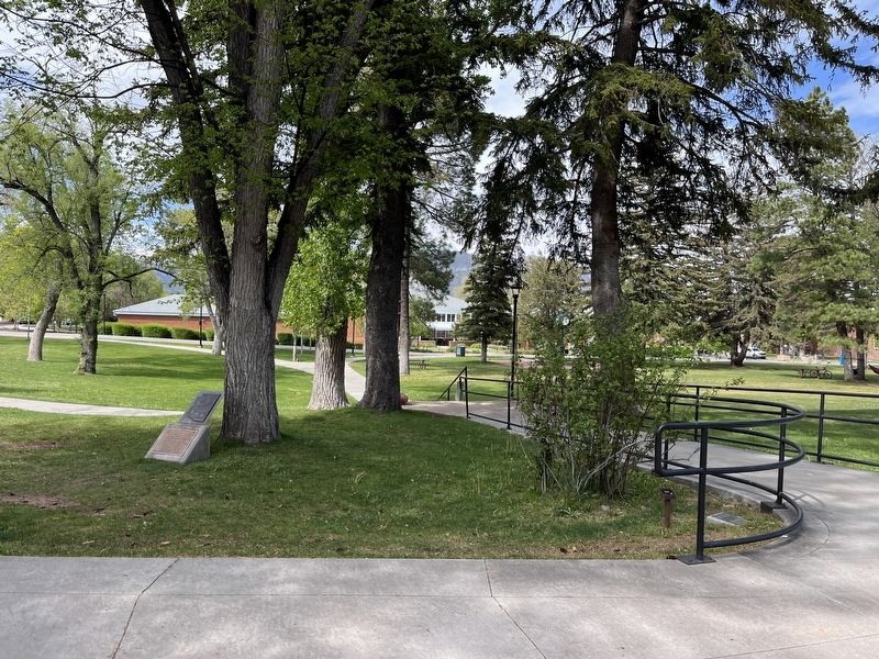
This rose is a clipping from a French Boursalt rose planted at the Arizona territorial governor's mansion at Prescott in 1865. The rose was brought from New York and planted by Margaret Hunt McCormick. She was the wife of Richard C. McCormick, the . . . — — Map (db m263431) HM
During the summer of 1947, the Arizona Highway Department constructed a 6.5 mile cut-off alignment of Route 66 through Flagstaff. This re-alignment shifted Route 66 away from the older Camp Townsend- Winona Road/U.S. Highway 89 alignment that . . . — — Map (db m263116) HM
Heading west, Route 66 helped determine Flagstaff's urban form by creating the long commercial corridor that provided travelers with motels, auto repair, gas, entertainment and food. The buildings along Route 66 that remain today are a living museum . . . — — Map (db m263117) HM
Built in 1931 by Dean Eldredge
Restored by Martin and Stacie Zanzucchi
Placed in the National Register of Historic Places
by the U.S. Department of the Interior on May 3, 1994
under the authority of Interior Secretary Bruce Babbitt
. . . — — Map (db m236440) HM
The original thirty-two Code Talkers were organized to develop codes based on their native language which were used extensively during World War II. These and many other Native Americans served bravely throughout the Pacific and other combat . . . — — Map (db m33344) HM
This 1945 Model H International Farmall, purchased by the Zanzucchi Family after World War II, was used to plow the "Fields" at the Flagstaff Dairy. The Flagstaff Dairy operated from 1904 thru 1979 and was located 3 miles west of Flagstaff on Old . . . — — Map (db m178779) HM
The mountain in the distance, known as the San Francisco Peaks, soars to an elevation of 12,633 feet. Mr. C. Hart Merriam, while leading a scientific expedition to the Peaks in 1889, developed the concept of life zones. These zones describe how . . . — — Map (db m263186) HM
Devices of this nature have been used for thousands of years to tell time, although only in a crude sense. Our division of the day into uniform hours occurred recently--in the 16th century-- while intervals of minutes and seconds were developed well . . . — — Map (db m263185) HM
In 1866 the Atlantic and Pacific Railroad was formed to construct a railroad from Springfield, Missouri to the Pacific Ocean, a distance of 2,000 miles.
In the summer and fall of 1882 the railroad was directly responsible for the founding and . . . — — Map (db m120891) HM
Arizona Lumber and Timber Company purchased this Baldwin steam engine in 1917 for lumbering operations in and around Flagstaff, where the engine spent its entire working life. The City of Flagstaff purchased No. 25 in 1995.
Canvas water bags . . . — — Map (db m41720) HM
(Japanese marker text not transcribed)
U.S. Astronomer Percival Lowell, Specialist of Mars, and Anamizu
Anmaizu Town And Its Friend City, Flagstaff, Arizona, U.S.A.
Dr. Percival Lowell (1855-1916_, the world famous . . . — — Map (db m263297) HM
John G. Verkamp came to Flagstaff in the 1890s. He first worked for the Babbitts (three of his sisters were married to Babbitt brothers), then succeeded in a number of businesses on his own, including lumber, livestock and merchandising. He is best . . . — — Map (db m59505) HM
Arizona Equal Suffrage Assn hosted speech by national suffragist Anna Howard Shaw here in 1912 to promote woman suffrage in Arizona — — Map (db m193161) HM
Flags have been important to the history of Flagstaff. It was a pine tree used as a flag staff that gave the town its name when Old Glory was flown at a spring (that later became the site of Flagstaff) on the occasion of the nation's . . . — — Map (db m33338) HM
John Weatherford, who was raised in Weatherford, Texas, came to Flagstaff in 1886. He decided to stay here because he fell in love with the San Francisco Peaks at first sight. He tried his hand in several occupations, everything from saloon keeper . . . — — Map (db m59507) HM
This park is named in honor of Rollin W. Wheeler who served as mayor from 1960 to 1968, councilman from 1952 to 1960, and teacher, coach and counselor at Flagstaff High School from 1929 to 1968.
He molded citizens by action and . . . — — Map (db m263081) HM
Farming then did not mean vast fields like we use today. Anasazi and Sinagua people modified these small terraces to grow hand-tended corn, cotton, beans, and squash. We know the climate was about what it is now, very dry for farming. The terraces . . . — — Map (db m41715) HM
Wukoki, a modern Hopi word for “Big House” was once home for two or three prehistoric Indian families. The inhabitants are believed to have been of the Kayenta Anasazi culture, judging from the types of artifacts found during excavation . . . — — Map (db m60078) HM
This trail follows the south side of historic Route 66 from downtown Flagstaff to the east side of town. In the mid 1990s the City removed a series of Billboards from the strip or land between Route 66 and the BNSF railroad tracks, and replaced it . . . — — Map (db m263109) HM
Fredonia Arizona 1885-1985
Settled in 1885 by few hardy Mormon pioneer families. Once the center of sheep and cattle grazing on the Arizona strip. The main industry is logging. Fredonia boasts one of the largest sawmills in Arizona. Other . . . — — Map (db m94922) HM
A worn and hungry band of Spanish explorers made camp at Johnson Wash, six miles to the east, on October 21, 1776. Fathers Dominguez and Escalante called it Santa Barbara. They found no water for horses or the men who were subsisting on meager . . . — — Map (db m94920) HM
In a parched and rugged land, Fredonia is a welcome oasis for residents and travelers. Mormon pioneers drawn to area springs settled here to begin farming and ranching in 1885. But water, like many resources on the Arizona Strip, was scarce. . . . — — Map (db m94923) HM
The Jacob Lake lookout tower has been used by lone fire lookouts for more than half a century. As in 1934, when the tower was built, vigilant lookouts still spot and plot fires from on high.
[Caption]: Spotting and Plotting
The 80-foot-high . . . — — Map (db m257806) HM
1956 Grand Canyon TWA-United Airlines Aviation Accident Site has been designated a National Historic Landmark.
This tragic accident site represents a watershed moment in the modernization of America's airways leading to the establishment of . . . — — Map (db m81861) HM
Directly behind you, looking down into Hermit Canyon, you can see part of Hermit Trail and the remains of Hermit Camp. In 1911-12 the Santa Fe Railroad built both trail and camp to serve a blossoming tourist trade. Why did Santa Fe build here at . . . — — Map (db m156999) HM
The Horace M. Albright Training Center is a National Park Service facility for employee development. Established in 1963 and named for the National Park Service's second director, the training center serves as an educational program center for . . . — — Map (db m39602) HM
In the early days of Grand Canyon Village, the blacksmith shop served as a focal point of activity. The blacksmith was a highly skilled craftsman who welded the machinery, sharpened the tools, built water tanks, repaired the wagon wheels and shod . . . — — Map (db m39582) HM
Bright Angel Hotel (below) was built around 1895 to serve stagecoach passengers. In 1905 the hotel became Bright Angel Camp, which eventually included cabins and an adjoining tent village.
In 1935 the Fred Harvey Company replaced the camp . . . — — Map (db m39510) HM
The Bright Angel Lodge, as it is known today, began as a cabin and several tents on this site in 1896. The central unit designed by Mary Jane Colter, was built in 1935. This lodge contains some of the oldest buildings in the Grand Canyon Village, . . . — — Map (db m39565) HM
Each year thousands of hikers enter Grand Canyon on the Bright Angel Trail. They follow a tradition - and a trail route - established by prehistoric people. For centuries humans have used this route for two key reasons: water and access. Water . . . — — Map (db m39563) HM
In the early 1890s (exact date unknown) Buckey O'Neill built a log cabin here on Grand Canyon's south rim. It stands in front of you; it is Grand Canyon's oldest surviving historic structure.
Grand Canyon's modern era began with people like . . . — — Map (db m39545) HM
Artist Thomas Moran was a storehouse of pictures. In 1873, geologist John Wesley Powell invited Moran to accompany his geologic survey of the Grand Canyon region. For Moran, the canyon was "by far the most awfully grand and impressive scene." As a . . . — — Map (db m250577) HM
Maybe those mountains are hard to climb. Those trees so hard to cut.
But the air is pure, the water fine. And we're climbing right out of the rut....
For besides helping ourselves, you see. We are helping Mother and Dad.
- Robert L. . . . — — Map (db m78836) HM
The first Chief Topographic Engineer of the U.S. Geological Survey 1919-1929 and the first President of the American Society of Photogrammetry 1934. He headed a Geological Survey expedition through the Grand Canyon in 1923 to acquire information . . . — — Map (db m157000) HM
One thousand years ago, wood smoke curled up from a farming village on the riverside delta below you, named Unkar Delta. Many such villages have dotted Grand Canyon's bottomlands since ancient times. Corn, beans, squash, and cotton grew between . . . — — Map (db m250578) HM
You are standing on a section of the original Hermit Road, constructed in 1911-1913. It was a road ahead of its time, offering sweeping vistas and gentle grades, at a cost of $250,000 — an unheard of sum for such a short road. It was built for . . . — — Map (db m157147) HM
This monument honors Major John Wesley Powell, the leader of the first documented expedition through Grand Canyon. Imagine entering the depths of Grand Canyon down a roaring, not-yet-charted river, not knowing whether you will emerge. Because . . . — — Map (db m108883) HM
Named for Don Pedro de Tovar, the first European to visit the Hopi Indian villages in 1540, the hotel was constructed by Hopi Indian craftsmen at a cost of $250,000 employing logs shipped by train from Oregon and native Kaibab Limestone. The El . . . — — Map (db m39477) HM
In 1901, the screech of train brakes and the blast of a train whistle signaled the arrival of a new era in Grand Canyon Village. The railroad provided the most comfortable means of transportation to the canyon for more than a quarter century. This . . . — — Map (db m102856) HM
Below you, the Colorado River makes a dramatic turn. Ever since the river entered Grand Canyon at Lees Ferry, it has been deepening its gorge east of the Kaibab Plateau. Here, the river turned west to cut straight through the plateau, opening a . . . — — Map (db m250582) HM
"No language can fully describe, no artist paint the beauty, grandeur, immensity and sublimity of this most wonderful production of Nature's great architect. [Grand Canyon] must be seen to be appreciated."
C.O. Hall, Grand . . . — — Map (db m39659) HM
It is hard to imagine the power of Hance Rapid from this distance, 3.8 miles (6.1 km) away. Closer to its roar, it is clearly one of Grand Canyon's most hazardous rapids, as the Colorado River falls the height of a three-story building. River . . . — — Map (db m250580) HM
On the inner plateau, Hermit Camp has been built.... A skilled Chef is in charge of the dining room, where excellent meals are provided. It is camping out ‘deluxe.’ —1916 Hermit Camp postcard Deep in the canyon are faint signs of . . . — — Map (db m156994) HM
Today, most visitors will travel the Hermit Road by shuttle, but in 1912 when the road first opened, you would have traveled by horse or buggy. The Santa Fe Railway and U.S. Forest Service built the buggy road so early visitors had a choice in . . . — — Map (db m157166) HM
Established in 1904 by the Kolb Brothers as a photographic studio and operated by Emery Kolb until his death in 1976. Kolb is now operated as a book store and information center by the Grand Canyon Association, a non-profit organization. Proceeds . . . — — Map (db m39546) HM
Hopi House opened on January 1, 1905, the first Grand Canyon work of architect Mary Colter. To complement El Tovar, their new hotel, the Fred Harvey Company commissioned Colter to design a building to display and sell Indian arts and crafts. Colter . . . — — Map (db m39478) HM
Designed as living quarters for Hopi artisans and as a place to sell Hopi crafts and souvenirs, this building represents the efforts of the Fred Harvey Company to revive Southwest Indian arts and crafts. Designed by Mary Jane Colter, the building . . . — — Map (db m39509) HM
Albright's contributions to the National Park Service can hardly be overstated. While working with the agency's first director, Stephen Mather, in the early years of the National Park Service, Horace Albright played a decisive role in guiding the . . . — — Map (db m39600) HM
On a clear day you can easily see Mount Trumbull just
above the western horizon, 62 miles (99 km) away.
Most days, haze makes spotting this distant landmark
difficult. Sadly, most of this haze is human-caused. It can
be a plume from a local . . . — — Map (db m196818) HM
Constructed in 1928, the Kaibab Trail Suspension Bridge was the only crossing of the Colorado River in a distance of 754 miles from Moab, Utah to Needles, California. Built in a remove location with incredibly difficult access through rugged . . . — — Map (db m173929) HM
The Kolb Brothers: daring, persistent, Grand Canyon legends. Their studio stands before you.
Ellsworth Kolb arrived here in 1901, Emery in 1902. First located in a tent, their photo business grew with Grand Canyon tourism. They eventually . . . — — Map (db m39549) HM
If a horseshoe can bring luck, why not a horseshoe-shaped mesa? Some 2,500 feet (760 m) below you sits Horseshoe Mesa. There, in 1890, Pete Berry and fellow miners discovered copper and began digging the Last Chance Mine. The ore was rich (15 to 30 . . . — — Map (db m250566) HM
Welcome to Grand Canyon and Desert View, where sun and sky, canyon and river gorge, tiered plateaus, and historic architecture blend into sweeping panoramas.
Constructed in 1932, the 70-foot tall Desert View Watchtower provides visitors from . . . — — Map (db m250584) HM
The Fred Harvey Company built Lookout Studio in 1914, in part to compete with the Kolb Brothers Studio located slightly west along the rim. Called "The Lookout," Fred Harvey's studio offered telescopic views, photographs, and books about the . . . — — Map (db m39544) HM
In 1890 prospector Pete Berry staked the Last Chance copper claim 3,000 feet below you on Horseshoe Mesa. The Last Chance Mine began a 17-year flurry of activity here at Grandview Point.
For a while the Last Chance Mine thrived. The ore was . . . — — Map (db m39662) HM
Responding to mounting political and public pressure, Congress authorized a ten-year program in 1955 to regenerate and modernize the national parks dubbed "Mission 66" for the target date of 1966, the National Park Service's 50th anniversary. The . . . — — Map (db m39587) HM
The mule barn and the nearby livery stable were two of the most important buildings in the original Grand Canyon Village. In the early 1900's, when all travel within the village was by horse-drawn carriage, these huge barns were the center of all . . . — — Map (db m39585) HM
Behind you is the Bright Angel mule corral, where each morning mules greet riders and another adventure begins. Mules have carried people into Grand Canyon since sightseeers first visited here in the 1890s. For many people - including those who . . . — — Map (db m205170) HM
Something unexpected once stood on the rim in front of you. A steel headframe towered over a mineshaft that dropped 1,500 feet (460 m) to one of the richest uranium mines in the United States. From 1956 to 1969, miners extracted ton after ton of . . . — — Map (db m108885) HM
Now known as Phantom Ranch, this area along the Bright
Angel delta first gained attention as a tourist camp under the
name Rust's Camp. In 1902, David Rust began the planting
of fruit trees and cottonwoods and the
building of a camp for . . . — — Map (db m310656) HM
"Won't you be one of the 25,000 visitors at the Grand Canyon of Arizona this summer? It is the world's scenic wonder - nothing like it."
Santa Fe Railroad brochure, 1914.
The Santa Fe train whistle that was heard here on September 17, . . . — — Map (db m39569) HM
Can you spot the Colorado River? It looks tiny, surrounded by the
vast Grand Canyon, but do not be deceived. Its racing, muddy waters
carved the one-mile (1.6 km) depth of Grand Canyon, Standing
on the canyon's edge you may feel distant and . . . — — Map (db m196819) HM
Build a structure that provides the widest possible view of Grand Canyon yet harmonizes with its setting: this was architect Mary Colter's goal when the Fred Harvey Company hired her in 1930 to design a gift shop and rest area here at Desert View. . . . — — Map (db m39616) HM
Trans-Canyon Telephone Line,
built in 1935 by CCC workers,
maintained by Mountain Bell,
has been placed on the
National Register of
Historic Places
by the United States
Department of the Interior. — — Map (db m78832) HM
From Navajo Point, your view includes Grand Canyon and extends across the surrounding plateaus into modern-day Indian Country. Several tribes still live in and around the canyon, honoring their ancient connection to this place. Grand Canyon is . . . — — Map (db m250581) HM
Cohonina and ancestral Pueblo (Kayenta Anasazi) people lived in this area in prehistoric time. The ancestral Puebloans built Tusayan about AD 1185. A visit to the museum and a short walk through the remains of the village will furnish a glimpse of . . . — — Map (db m39631) HM
Allow about 30 minutes to tour Tusayan Ruin. The 0.1 mile loop trail through the main ruin is paved and wheelchair-accessible; the side loop to a prehistoric farming site is not. Signs along the way explain the site's features. An interpretive . . . — — Map (db m39633) HM
John G. Verkamp rented a tent from the Bright Angel Hotel in 1898 and began selling curios and Indian crafts for Babbitt Brothers' Trading Company. After several slow weeks he closed and sold his stock to the hotel. But he sensed Grand Canyon's . . . — — Map (db m39571) HM
Mary Colter's Desert View Watchtower creates an illusion of age. Concealed within the tower is an entirely different reality. Workers built a concrete and steel reinforced superstructure and then applied a veneer of native stone. The weathered . . . — — Map (db m169439) HM
Originally this building stood at Red Horse, 25 miles south of the Grand Canyon, where it was possibly used as one of the stage stops between the Grand Canyon and Flagstaff. In 1902, Ralph Cameron had it moved to its present site, where, with the . . . — — Map (db m236357) HM
Completed in 1935, Bright Angel Lodge was designed and built under the direction of Mary Colter, Fred Harvey company's celebrated Southwest architect. Colter's penchant for rustic designs and her attention to detail led to the creation of this . . . — — Map (db m250419) HM
This cabin is the only remaining building from the early pioneer settlement era of Grand Canyon Village. Built on this site in 1895 by William Owen "Buckey" O'Neill, the two-room office and bunkhouse - complete with v-notched logs, rough mortar . . . — — Map (db m250421) HM
The Grand Canyon National Park Superintendent's Residence is a National Park Service Rustic style building. It was designed in 1921 by Daniel Ray Hull, Chief Landscape Engineer for the National Park Service Branch of Plans and Designs, as the park's . . . — — Map (db m250416) HM
California condors are the largest flying birds in North America. Their wingspans of nearly 10 feet (3.5 m) make condors easy to spot gliding above Grand Canyon today. Yet, in the 1920s, these birds disappeared from Grand Canyon skies. Condors were . . . — — Map (db m250417) HM
The Santa Fe is going to build the most expensive hotel … at the Grand Canyon … the idea of the architect is to bring the building into harmony with the wonderful scenery of the canyon rather than to put a blot upon its beauty by the . . . — — Map (db m195830) HM
A rich architectural history awaits as you explore Grand Canyon Village. Eclectic in nature, the village is a mix of early pioneer, Santa Fe Railroad, and National Park Service structures. Entrepreneurial-pioneers started building here in the early . . . — — Map (db m95934) HM
A rich architectural history awaits as you explore Grand Canyon Village. Eclectic in nature, the village is a mix of early pioneer, Santa Fe Railroad, and National Park Service structures. Entrepreneurial-pioneers started building here in the early . . . — — Map (db m250414) HM
This steel lookout tower, erected in 1936, is 80 feet
tall. It replaced an earlier wooden lookout tower and platform. The two-room bungalow style cabin, also built in
1908, serves as the lookout's residence.
As guardians of our . . . — — Map (db m310681) HM
Hopi House opened to the public in 1905. In an era when most architects were men, it was Mary Elizabeth Jane Colter's first building. The 36-year-old Colter enlisted the help of local Hopi craftsmen to build Hopi House, using locally quarried . . . — — Map (db m236334) HM
Hull Cabin Historic District, built circa 1890, has been placed on the
National Register
of Historic Places
by the United States
Department of the Interior. — — Map (db m310705) HM
This boat is an exact replica of the boat used by John Wesley Powell in his historic voyage through the Grand Canyon.
In 1869, Powell and his intrepid crew managed to survive the rapids in the Grand Canyon of the Colorado by lining and . . . — — Map (db m285526) HM
Your visit and rest here is part of a long tradition started in 1914 with the opening of Hermits Rest. After an 8-mile (13 km) buggy ride, you would be greeted by the resident caretaker and offered a refreshing drink to clear the dust from your . . . — — Map (db m108881) HM
Mary Colter's attention to detail is reflected in every element of the Desert View Watchtower.
Each rock and painted wall is intended to convey meaning. Colter used ornamental details, seemingly haphazardly, to create an added charm of the . . . — — Map (db m285542) HM
Near here in late summer of 1540, soldiers from the Spanish expedition of Francisco Vasquez de Coronado became the first Europeans to see Grand Canyon.
After journeying for six months, Coronado's army arrived at the Hopi mesas, east of . . . — — Map (db m125895) HM
He laid the foundation of the National Park Service, defining and establishing the policies under which its areas shall be developed and conserved unimpaired for future generations. There will never come an end to the good that he has done. — — Map (db m169438) HM
Constructed of locally quarried Kaibab limestone, Lookout Studio appears as if it grew out of the canyon wall. In 1914, Fred Harvey company took a bold step to compete against Kolb Studio (just west of here). They asked Mary Colter to design a . . . — — Map (db m250420) HM
Catastrophe can happen even in spectacular beauty. When technological achievements and human actions fail, disasters may happen.
On June 30, 1956, a United Airlines DC-7 and a TWA Super Constellation maneuvered around towering cumulus clouds on . . . — — Map (db m124533) HM
Throughout their longstanding friendship, Congressman Morris K. Udall and Senator John S. McCain set an example of bipartisan comity, collegiality, and leadership.
Though members of different political parties, these two great leaders and . . . — — Map (db m292135) HM
Inspired by Grand Canyon's burgeoning tourism trade, in 1898, John Verkamp established a small tent shop on the South Rim, selling American Indian arts and crafts. Profits proved meager, so John sold his inventory to the Bright Angel Hotel and . . . — — Map (db m250413) HM
Seven miles north of this point a band of Apache Indians were defeated by United States troops on July 17, 1882. A group of tribesmen from the San Carlos Apache reservation had attacked some ranches in the vicinity, killing several settlers. Cavalry . . . — — Map (db m67424) HM
Under the direction of General George Crook this trail was built in the early 1870's. Starting at Fort Whipple, it winds down to Fort Verde then eastward across the Mogollon Rim to Fort Apache covering 200 miles. It was used as a supply route by . . . — — Map (db m67419) HM
Under the direction of General George Crook this trail was built in the early 1870's. Starting at Fort Whipple, it winds down to Fort Verde then eastward across the Mogollon Rim to Fort Apache covering 200 miles. It was used as a supply route by . . . — — Map (db m67420) HM
This location has two markers
This steel lookout tower is 80 feet tall and has a 7 foot by 7 foot steel cab on top. It was erected in 1934.
As guardians of our nation's vast timber reserves, the U.S. Forest Service has always given fire . . . — — Map (db m94919) HM
1851 entries matched your criteria. Entries 301 through 400 are listed above. ⊲ Previous 100 — Next 100 ⊳