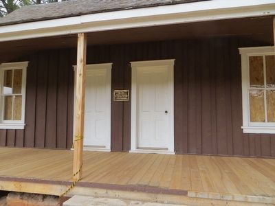
On Arizona Route 67 at U.S. 89A, on the right when traveling south on Arizona Route 67.
Kaibab Squirrel Area has been designated a National Natural Landmark.
This site possesses exceptional value as an illustration of the Nation's natural heritage and contributes to a better understanding of the environment. — — Map (db m94912)
On Arizona Route 389 at Cane Beds road, on the right when traveling north on Arizona Route 389.
Segments of centuries-old Indian trails between St. George and Long Valley were used by Mormon pioneers in 1864 to settle Long Valley and its resettlement in 1871 following Indian conflicts. The trail
divided at the area of this marker; the . . . — — Map (db m131299) HM
John D. Lee and wife Emma established this ranch to support their lives as river ferry operators. While living here, they shuttled wagon trains and travelers across
the Colorado River on makeshift ferry boats and skiffs.
The crossing became a . . . — — Map (db m289828) HM
Isolated from society, settlers here had to provide for themselves. Growing their own food proved to be a constant struggle as unreliable irrigation plagued the
desert fields. Lonely Dell families endured and grew lush gardens, orchards, and fields . . . — — Map (db m289827) HM
On U.S. 89A at milepost 557, on the left when traveling east. Reported missing.
Text from: Historical Markers with The Arizona Department of Transportation right of way. Prepared by: Roadside Development Section April 1, 1997
Fatigued by a thirty mile ride, the padres picked their way down the rocky north slope . . . — — Map (db m39917) HM
On U.S. 89A at milepost 538.3, on the right when traveling west.
In desperate search for a crossing of the Colorado River before the wild storms of winter might further weaken their starving bodies, Fathers Dominguez and Escalante led their expedition past this point on October 26, 1776.
Five days were spent . . . — — Map (db m94896) HM
Near U.S. 89A at milepost 537, on the right when traveling west.
John Deering (Bih Bitoodnii Nez) born 1870 of the Deer Water Clan, his wife Susie Deering, born in 1878, of the Maii Deeshgiizhinii Clan, and their nine children, pioneered the areas of the Gap, Copper Mine, Cedar Ridge, Bitter Spring, Page, Marble . . . — — Map (db m189730) HM
In memoriam to ironworker Lafe McDaniel
October 3, 1887 to June 12, 1928
The only individual to die during the construction of the Navajo Bridge, Lafe McDaniel, a well like and highly experienced Kansas City ironworker, fell from near . . . — — Map (db m206713) HM
On U.S. 89A at milepost 538, on the right when traveling west.
From 1872 to 1929
principal route of travel
across the Colorado River
to Utah Settlements
First crossing made at the mouth of Paria Creek in 1864 by Jacob Hamblin. Regular ferry established by John Doyle Lee in 1872. Purchased by . . . — — Map (db m41998) HM
Because of long, deep canyons, Lees Ferry was the best crossing point along 500 miles (800 km) of the Colorado River.
In 1873, Mormon Church members opened a wagon road from Kanab, Utah, and built a ferryboat here. John D. Lee was the first . . . — — Map (db m41999) HM
Northern gateway to Arizona for 54 years - from 1873 to 1927 - is located six miles upstream from this bridge.
This monument erected to the founder
John Doyle Lee
who, with superhuman effort and in the face of almost insurmountable . . . — — Map (db m94892) HM
John D. Lee settled here in Dec. 1872 and established ferry service thirteen months later. After her husband's death, Warren M. Johnson ran the oar-driven ferry for Emma Lee, 1875 to 1879, when the Church of Jesus Christ of Latter-Day Saints . . . — — Map (db m41997) HM
Near U.S. 89A at milepost 537, on the right when traveling west.
Lewis Nez, born 1900 of the To’di’chi’i’nii (Bitter Water) Clan. He married twice, first to Fannie and second to Bessie Betoney. He had ten children. He was employed by the Cedar Ridge Trading Post. He was responsible for hauling supplies, U.S. . . . — — Map (db m189731) HM
For more than 100 years, Lonely Dell Ranch has meant different
things to those who traveled here. To pioneers and missionaries, it was
an isolated settlement offering small comfort during a long journey
further south. To the families who lived . . . — — Map (db m289772) HM
A tourist lodge and trading post have operated near this site since 1929. Without them, travel through this isolated region would have been far more difficult. Marble Canyon Lodge was already in operation when the historic Navajo Bridge was . . . — — Map (db m94893) HM
Charles H. Spencer's second gold mining site
Spencer used an amalgamator reliant on mercury to pull gold
from clay. Tests recovered a little gold, but also some other metal,
exhausting the mercury supply. Years later the mystery . . . — — Map (db m291039) HM
Navajo Bridge
has been placed on the
National Register
of Historic Places
By the United States
Department of the Interior
August 31, 1981 — — Map (db m94885) HM
There are three markers on this end of the Navajo Bridge.(Marker on left:)
National Historical Civil
Engineering Landmark
American
Society of
Engineers
1852
Designated by the American Society of Civil Engineers . . . — — Map (db m94887) HM
This Erection Toggle Screw was used in the construction of the historic Navajo Bridge to maintain bridge vertical elevations and as a means of lowering bridge sections in place. — — Map (db m38469) HM
The Paria Canyon-Vermilion Cliff Wilderness was added to the National Wilderness Preservation System on August 28, 1984. This 112,000-acre jewel of the desert Southwest truly reperesents the meaning of wilderness. The majority of the wildreness area . . . — — Map (db m289824) HM
Welcome to Vermilion Cliffs National Monument, an isolated and spectacular landscape. Tucked away in north-central Arizona, this Monument is a wonderland of geologic formations and rugged terrain that supports a rich array of desert wildlife and . . . — — Map (db m94911) HM
On Center Street at South Main Street, on the right when traveling west on Center Street.
This #3 bell was manufactured by C.S. Bell Company of Hillsboro, Ohio in 1886. Jonathan Heaton brought the bell to Moccasin on 23 July 1902. On 24 July 1902, he mounted it on the shed west of the Big House.
The crystal metal alloy gave a . . . — — Map (db m255616) HM
On Center Street at South Main Street, on the right when traveling west on Center Street.
Pa had a big stockyard joining the barn where they shucked corn. He grew lots of corn and squash to feed the horses, cattle, and pigs in the winter. We raised turkeys and geese and would pick the geese for down, for pillows, twice during the summer. . . . — — Map (db m255617) HM
On Mormon Lake Road (Route 90 at milepost 4), 3.9 miles south of Lake Mary Road (Route 3), on the right when traveling south.
Between 1876 and 1886, Hyrum Judd, under the direction of Lot Smith, supervised a Mormon Dairy one
mile northeast near Dairy Spring.
Beginning with a herd of 115 cows, large quantities of butter and cheese were produced. During the 1880s the . . . — — Map (db m35187) HM
Near Grand Canyon Highway (Arizona Route 67) 43 miles south of U.S. 89A, on the left when traveling south.
Early in the twentieth century, wealthy ladies and gentlemen yearning for a peek at the fabled Grand Canyon found few urban comforts along its northern rim. While visitors on the South Rim relaxed in the luxurious accommodations of the cliff-hugging . . . — — Map (db m163551) HM
Near Grand Canyon Highway (Arizona Route 67) 43 miles south of U.S. 89A.
When Grand Canyon became a national park in 1919, the North Rim was scarcely developed. While the South Rim had grand hotels and many visitor programs and services, the hard-to-reach North Rim had only rustic tent cabins for 40 guests. The National . . . — — Map (db m163289) HM
Near Grand Canyon Highway (Arizona Route 67) 43 miles south of U.S. 89A, on the left when traveling south.
Under the supervision of the Utah Parks Company and architect Gilbert Stanley Underwood, work crews labored to build a lodge that harmonized with its surroundings. Advertisements for this "Hotel in the Wilderness" boasted that it "seems to have . . . — — Map (db m163552) HM
Near Grand Canyon Highway (Arizona Route 67) 43 miles south of U.S. 89A, on the left when traveling south.
A fire consumed the main lodge building at the height of the Great Depression. The September 1, 1932, fire claimed no lives but left only stones. For four years the ruins of the Grand Canyon Lodge stood undisturbed, silhouetted eerily against a . . . — — Map (db m163553) HM
On Cape Royal Road, on the right when traveling south.
Take a moment to stretch your legs on this 200-yard (200 m) one-way trail along the edge of Greenland Lake. The trail ends at a small log cabin built in the 1890s to store salt for cattle, which grazed nearby and drank from this rare waterhole. . . . — — Map (db m258215) HM
On Cape Royal Road, on the right when traveling south.
From the North Rim, the Colorado river and the Unkar Delta below seem distant, yet ancestral Puebloan farmers 1,00 to 800 years ago made the journey from river to rim on a routine basis, spending summers on the rim and most of the remainder of the . . . — — Map (db m258222) HM
On CC Hill Road (Arizona Route 67), on the right when traveling north.
[Caption]: In the spring of 1902....we began to seek a route across to the north side. But at that time there was no trail across from rim to rim, nor was there a bridge over the Colorado. - . . . — — Map (db m258224) HM
On Cape Royal Road, on the right when traveling east.
"This is one of the wonders of the world! People will come from all quarters of the globe and will pay great sums of money to gaze on what we behold." - Edwin Dilworth "Dee" Woolley
A visionary entrepreneur, "Uncle Dee" . . . — — Map (db m258210) HM
Near Grand Canyon Highway (Arizona Route 67) 43 miles south of U.S. 89A.
Built more than 900 years before the Grand Canyon Lodge, the foundations of this small, two-room dwelling provide a glimpse of the kinds of lodging used by ancestral Puebloan farmers of the North Rim. These native farmers built field houses like . . . — — Map (db m163577) HM
On Cape Royal Road, on the right when traveling east.
Forest seems to be on the march here, invading this meadow at a rate of one foot per year, but the Outlet Fire in spring 2000 may have slowed the forest's advance. Before the fire burned this area, forest was encroaching on better-drained, dryer . . . — — Map (db m258213) HM
Dwellings for ferry customers and operators
Only a ruin remains of the small stone cabin available to
travelers staying overnight. The ruin with two stone fireplaces
was home to Ferryman Frank Johnson, son of a previous
ferryman. . . . — — Map (db m291064) HM
Every Lonely Dell family struggled to water their fields through various dams, tunnels, and hand-dug ditches. The Paria River's muddy flows and unpredictable floods caused problems, but ferryman Warren Johnson worked tirelessly to grow crops and . . . — — Map (db m289944) HM
Flagstone walls and a roof made from earth, this partially dugout building was common on most pioneer farms and ranches. Before modern electric appliances, the cellar acted as a refrigerator to keep vegetables from freezing in the winter, butter and . . . — — Map (db m289948) HM
Warren Johnson, who took over operations after the Lees, built this cabin for his second wife Samantha and their young children. Samantha lived here only a year until the large family home was completed next door. When she moved out, farm hands . . . — — Map (db m289946) HM
Ferryman Warren Johnson built a two story house for his families using proceeds from the ferry. They tore down Emma Lee's cabin to make room for the new home, removing the last Lee Family structure at Lonely Dell.
In 1897, new lead ferryman . . . — — Map (db m289947) HM
Jerry Johnson, son of former ferryman Warren Johnson and wife Samantha, built this cabin as part of a polygamist haven. With the completion of Navajo Bridge in 1929, travelers bypassed Lees Ferry and the ranch grew quiet. Johnson and his family . . . — — Map (db m289945) HM
Leo and Hazel Weaver had big plans for their newly purchased ranch as they flipped old cabins into rentals for guests. They hired Hopi stonemason Poli Hugavi to build this house which acted as the main lodge. The rustic Paradise Canyon Ranch was . . . — — Map (db m289949) HM
Headquarters of Charles H. Spencer's gold mining company
Built 1911
First of Spencer's eight stone buildings
Failing to recover gold, Spencer abandoned his
mining outpost around 1912. Cowboys, miners, and
travelers occasionally camped . . . — — Map (db m289950) HM
This fountain is dedicated to the memory of our fellow employees who died October 8, 1997 in a plane crash near Montrose, Colorado.
Their names encircle the fountain just as the accomplishments of their careers and lives encircle us. . . . — — Map (db m40325) HM
Colorado River Storage Project
In recognition of the vision of the Colorado River Storage Project Act of 1956 and the significant contributions the act has made to the development of the Upper Colorado River Basin states, this plaque . . . — — Map (db m40350) HM
Concrete Bucket
This is one of several concrete buckets that poured the concrete in Glen Canyon Dam. Each bucket held 24 tons (22 metric tons) of concrete and it took over 400,000 buckets to complete the dam. The first pour of concrete . . . — — Map (db m40342) HM
On North Lake Powell Boulevard at Vista Avenue, on the right when traveling east on North Lake Powell Boulevard.
Work began in 1956. Four years were needed to prepare the site including the blasting of two river bypass tunnels and spillway tunnels, the erection of two huge cofferdams, the construction of a highway bridge just downstream from the dam site (a . . . — — Map (db m254684) HM
On Lake Powell Boulevard at Navajo Drive, on the right when traveling north on Lake Powell Boulevard.
Within sight of this place the Franciscan priests Dominguez and Escalante and their ten companions experienced two of the most difficult challenges among many along the 1,800 miles of their epic journey from the Spanish presidio at Santa Fe, New . . . — — Map (db m40324) HM
The imprints were made by a one ton, twenty foot long, meat-eating dinosaur. The slab of sandstone came from a nearby side canyon.
When Dilophosaurus tracked through the silt 170 million years ago, this was a different landscape. Shallow streams . . . — — Map (db m40326) HM
On Lake Powell Boulevard at Navajo Drive, on the right when traveling north on Lake Powell Boulevard.
A slightly larger, but reasonable replica of the 16 ft. pine rowboat in which Major John Wesley Powell first explored the canyons of the Colorado River in 1869. This craft was constructed by Walt Disney Productions and used in the river running . . . — — Map (db m40323) HM
Glen Canyon Bridge
Majestic Glen Canyon Bridge, 865 feet (264 meters) downriver from the dam, was the highest steel-arch bridge in the United States when completed.
The roadway is 700 feet (213 meters) above the surface of . . . — — Map (db m101903) HM
Glen Canyon Dam, Colorado River Storage Project, dedicated by the First Lady, Mrs. Lyndon B. Johnson, September 22, 1966.
United States Department of the Interior, Stewart L. Udall, Secretary.
Bureau of Reclamation, Floyd E. Dominy, . . . — — Map (db m40370) HM
On Spencer Trail, on the right when traveling north.
Throughout the 1800 and 1900s, Lees Ferry was backdrop to a mix of Westward expansion dreams and failed schemes. Because of its stragic location along the Colorado River, unlikely groups overlapped on these shores. Miners, traders, US government . . . — — Map (db m291037) HM
Glen Canyon Dam and other dams along the Colorado River provide critical water and power resources for millions of Americans in the Southwest. Recreation at the reservoirs is enjoyed by visitors from around the world.
Turbine Runner
This . . . — — Map (db m40344) HM
The eight small "buildings" on the upstream face of the dam contain equipment to operate the penstock gates. Each penstock is 15 feet (4.6 meters) in diameter and carries water to one of the turbine generators in the powerplant. — — Map (db m40349) HM
Major John Wesley Powell led scientific exploration parties down the Green and Colorado Rivers in 1869 and in 1871-72. Years later Powell became a leader in government science programs, headed the U.S. Geological Survey and the Bureau of American . . . — — Map (db m250651) HM
Rough, angled rock ledge on opposite river bank
Until 1899, many pioneers crossed the river near the
present-day boat dock, necessitating a harrowing
wagon ride either up or down the unforgiving rock ledge
known as "Lee's Backbone." . . . — — Map (db m291060) HM
On Lees Ferry Road 0.7 miles east of River Drive, on the left when traveling east.
The fort was never attacked, but welcomed travelers as a short-lived trading post. In 1911, miners expanded the building to use briefly as a crew mess hall. Through the 1930s, it mainly served as a home for various ferry families, USGS employees, . . . — — Map (db m289951) HM
Major John Wesley Powell 1834-1902 Explorer of the Colorado River 1869 and 1871-72 On August 3, 1869, Powell wrote in his journal: ”…we have a curious ensemble of wonderful features — carved walls, royal arches, glens, alcove . . . — — Map (db m155893) HM
On North Lake Powell Boulevard at Vista Avenue, on the right when traveling east on North Lake Powell Boulevard.
Humans first entered North America via the Bering Land Bridge sometime after 16,500 years ago as the last ice age lost its grip. Evidence of human populations in the Page area begins about 12,000 years ago. Since then a succession of Native . . . — — Map (db m254660) HM
On North Lake Powell Boulevard at Vista Ave, on the left when traveling west on North Lake Powell Boulevard.
Born out of a compromise, a vision constructed to provide power to the growing southwest. Construction began in April 1970, going commercial in 1974 (U1), 1975 (U2) and 1976 (U3).
A massive complex built on 1,786 acres leased from the Navajo . . . — — Map (db m250649) HM
On North Lake Powell Boulevard at Vista Avenue, on the right when traveling east on North Lake Powell Boulevard.
Although the official discovery of Rainbow Bridge did not occur until 1909, there is convincing evidence that prospectors stumbled upon the bridge in the late 1880s. (Certainly JW Powell did not know about the bridge as he floated down the Colorado . . . — — Map (db m254683) HM
Rock Bolts
Since Navajo sandstone tends to fracture vertically, rock bolts lock rock slabs together, thereby minimizing rock falls into the canyon. These bolts extend from 45 to 75 feet (14-23 meters) into the canyon wall. They are assembled . . . — — Map (db m40346) HM
On Lake Powell Boulevard at Navajo Drive, on the right when traveling north on Lake Powell Boulevard.
These tracks were made by a three-toed dinosaur known as a Saurischia therapod. It lived here about 170 million years ago during the Jurassic era when the environment was tropical. The footprints are raised natural sandstone castings of the . . . — — Map (db m40321) HM
Steam engine to pump water for Charles H. Spencer's mining experiments
Erected 1910
Boiler hauled from Flagstaff behind an ox-team
In his first attempt to extract gold, Spencer set up a pipe dredge across the
river. The boiler . . . — — Map (db m291040) HM
Steamboat Charles H. Spencer built for transporting coal from Warm Creek Canyon
Launched 1912
Hauled in pieces from San Francisco
and constructed at Warm Creek mine
Unaware of the difficulties in navigating the Colorado . . . — — Map (db m291061) HM
Rough mule trail for hauling Charles H. Spencer's gold mining supplies
Built 1910
Spencer's mining machinery needed fuel. As the rest of the miners hauled equipment to Lees Ferry, two men spent the fall of 1910 building a trail up this . . . — — Map (db m291041) HM
On North Lake Powell Boulevard at Vista Avenue, on the right when traveling east on North Lake Powell Boulevard.
One of Coronado's lieutenants, Captain Garcia Lopez de Cardenas, discovered the Grand Canyon in 1540. In the fall of 1776 an exploring group led by two Spanish priests, Dominguez and Escalante, were the first Europeans to see Glen Canyon. John . . . — — Map (db m254671) HM
This stainless steel turbine runner was removed in 1989 from the Bureau of Reclamation's Crystal Dam Powerplant in Montrose, Colorado. Weighing about 8½ metric tons, it is the rotating part of a Francis-type reaction turbine (named after its . . . — — Map (db m40371) HM
Safer and easier crossings made possible by moving the landing site here
Completed 1899
Improvements included a new ferry launch site, new ferry boat mounted on
permanent track cable, and new road.
James Emett took over as lead . . . — — Map (db m291062) HM
USGS Guesthouse
U.S. Geological Survey (USGS)
Built 1950
The USGS established a presence here as part of the
Colorado River Compact, a 1922 water rights agreement.
Using a cable car to measure the river's flow, they ensured
proper . . . — — Map (db m291038) HM
Pump system for all Lees Ferry water facilities, including Lonely Dell Ranch
Even today, life at Lees Ferry means being self-sufficient, as evidenced by
the area's self-contained water system. Wells proved infeasible here, so . . . — — Map (db m291066) HM
Hydroelectric power is produced when water under pressure flows through electrical generating equipment. Water entering the turbine flows through a series of louvers called wicket gates arranged in a ring around the turbine inlet. The amount of . . . — — Map (db m155898) HM
On Forest Service Road 100, on the right when traveling west.
In the summer of 1857 former Navy Lt. Edward F. Beale was chosen by the Buchanan Administration to develop a wagon road from Fort Defiance, New Mexico Territory (now Arizona) to the Colorado River along the 35th parallel. Secretary of War John B. . . . — — Map (db m48347) HM
On Grand Canyon Caverns Road 1.1 miles south of Route 66.
In 1927 Walter Peck, a cowboy and wood cutter, was walking through this area on his way to play poker when he nearly fell into a hole in the ground. The next morning Peck and his friends returned to the hole with lanterns and ropes. Peck was lowered . . . — — Map (db m288664) HM
Near Alternate Arizona Route 89 0.1 miles north of Jordan Road.
Carl Richards constructed this building in 1947 as his blacksmith shop. At the time, auto garage work was just a sideline. Richards is known as Sedona's first 'Fire Chief' because he kept the town's first fire truck in his garage. If there was a . . . — — Map (db m78744) HM
It took decades of searching for a perfect location before Marguerite Brunswig Staude's inspiring modern Catholic church could be built. The Chapel of the Holy Cross is an extraordinary architectural achievement, designed by architects Anshen & . . . — — Map (db m94811) HM
In 1946, Walter Jordan's orchard business had expanded. This building was constructed to house an apple grading machine and other fruit packing operations. Walter Jordan operated the orchards until 1973. — — Map (db m94848) HM
On Arizona Route 89A at milepost 378 south of Old Indian Road, on the right when traveling north.
In 1876 or 1877, Jim Thompson built a log cabin here and began cultivating the old Indian Gardens where the Indians had grown corn and squash long before Oak Creek was known to white men. Thompson remained here at his Indian Gardens Ranch until his . . . — — Map (db m33203) HM
This home of Walter and Ruth Jordan began as a one-room cabin in 1931. It grew by three rooms in 1937, and grew in 1947 to its present size. It was opened as the Sedona Heritage Museum in 1998. It exemplifies early Sedona red rock construction. — — Map (db m94846) HM
On State Highway 89A, on the right when traveling north.
Built circa 1938 by George Jordan as a co-op retail outlet for fruit produced and marketed by local orchard farmers, including George and his brother Walter. It was a key part in the early commercial development of Uptown Sedona and is a good . . . — — Map (db m40921) HM
On Jordan Road at Orchard Lane, on the right when traveling south on Jordan Road.
Fruit growing played a significant role in the early Sedona economy. Over time, settlers constructed ditches, flumes, pipelines, reservoirs, and water wheels to provide irrigation to their gardens and eventually to their larger orchards.
Apples . . . — — Map (db m54228) HM
Near Brewer Road at Cypress Lane, on the left when traveling south.
Harold and Christine Strohm built their Old-West style building and opened 'Museum, Et Cetera.' to showcase their collection of antiques. The Strohms named the building 'Pushmataha' after a Choctaw Chief. It means “He has won all the honors of . . . — — Map (db m94831) HM
Near Arizona Route 89A, on the right when traveling south.
This was originally Bob Bradshaw's photo shop and living quarters. Bradshaw's photos appeared often in Arizona Highways, and he published several books of Arizona images. Bob was involved in Sedona's film-making business for 50 years. He sold . . . — — Map (db m94834) HM
On Brewer Road at Ranger Road, on the left when traveling south on Brewer Road.
L.E. "Dad" Hart established Sedona's first real store in this building in 1926. The general store sold Oak Creek fruit and tourist supplies and was considered modern with gravity-drained gas pumps and the first commercial power in town. When the . . . — — Map (db m33202) HM
The earliest peoples arrived in the Verde Valley about 11,500 years ago. These early people practiced a hunting and gathering economy until approximately A.D. 1 when agriculture appeared. The Sinagua, whose Spanish name means "without water." . . . — — Map (db m132998) HM
This house was built in 1917 and was the home of the Sedona District Ranger, Jesse I. Bushnell. It continued to serve as living quarters until 1996, when the structure was converted to office space for the USFS Sedona Ranger District. — — Map (db m94829) HM
On Jordan Road at Navahopi Road, on the right when traveling south on Jordan Road.
Lee Van Deren, cattleman, arrived to put his children in the new Sedona school opened in 1910. Ranching was a major part of Sedona’s early economy. Round ups and cattle drives were a twice a year occurrence for ranchers when moving their herds from . . . — — Map (db m54229) HM
They dominate the horizon, rising 12,633 feet (3851 m) to Arizona's highest point. Visible for miles from all directions, they stand guard over a land which has long sustained people in spirit and natural resources. All of the region's Native . . . — — Map (db m41664) HM
Cinder cones erode easily and scars are slow to heal. In 1973, Sunset Crater was closed to climbing when 2-foot-wide trails eroded to 60-foot-wide swaths. Tons of cinder were shoveled back up the cone to fill hip-deep trenches. Notice the scars . . . — — Map (db m41676) HM
Buried under Sunset Crater's lava and cinders are perhaps dozens of pithouses. Those excavated revealed few artifacts; even building timbers had been removed. This suggests people had ample warning of the impending eruption.
The changed . . . — — Map (db m41693) HM
Erupting less than 1,000 years ago, Sunset Crater is the youngest in an impressive field of volcanoes all around you. The 1,000-foot-high (305m) cinder cone we see today formed when basalt magma rose directly to the surface through a primary vent. . . . — — Map (db m41665) HM
The landscape before you has existed on Earth for less than 1,000 years, less time than Romanesque architecture or paper money. Consequently, this environment has unique scientific value.
Geologists come here to study weathering processes and . . . — — Map (db m41691) HM
About 1,000 years ago, something spectacular happened in the lives of local Native peoples. Perhaps they first observed a change in animal behavior. Maybe they noticed the ground warming. Then the tremors increased in number and intensity. By the . . . — — Map (db m41689) HM
As a living ancestral homeland to the Hopi, Zuni, Yavapai, Havasupai, Navajo, Western Apache, and Southern Paiute, Sunset Crater is remembered, revered, and cared for.
People return often, bringing prayers and engaging in timeless traditions. . . . — — Map (db m41678) HM
On Arizona Route 264 at milepost 323, on the right when traveling east. Reported missing.
Near here in 1879
Mormon Colonists Built
Arizona's First Woolen Mill
Hoping to utilize Hopi and Navajo wool and labor, the Mormons intended to build a new industry to supply the early settlers. The 192-spindle mill operated only a . . . — — Map (db m94884) HM
1851 entries matched your criteria. Entries 401 through 500 are listed above. ⊲ Previous 100 — Next 100 ⊳