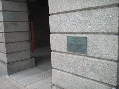
Through his leadership Pea Patch Island was returned to the State of Delaware by the Federal Government in 1948. He was the founder and first president of the Fort Delaware Society, January 1950 and was elected chairman of the board in 1956. — — Map (db m10207) HM
Fort DuPont State Park
Tucked beneath the northern foot of Reedy Point Bridge, Fort DuPont is one of the last open riverfront areas left in northern New Castle County. Once farmland, the site has been dedicated to defending the Delaware . . . — — Map (db m174456) HM
This bridge is named for local heroine Michelle Newton Smith, an Emergency Medical Technician with the Delaware City Fire Co. Smith, who dedicated her life to helping others, was aiding an injured motorcyclist along U.S. 13 when she was struck by an . . . — — Map (db m263577) HM
Officers Row was a home to commissioned officers and their families. The road was the originally the Henry farmhouse driveway leading from the canal (bottom left). The fountain replaced the “triangle” between Officers Row, Elm and Maple. The . . . — — Map (db m140434) WM
Delaware City was founded in 1826, in anticipation of the opening of the Chesapeake and Delaware Canal. The town was incorporated in 1851. The benefits of proximity to the canal resulted in a sustained period by prosperity and expansion of the . . . — — Map (db m94190) HM
This 18 acres of open space has been the focal point for most of the fort’s existence and has served many purposes over the years.
Geographically, the Parade Ground separated officers’ quarters from enlisted barracks and utilitarian . . . — — Map (db m140448) HM
Fort Delaware is located on Pea Patch Island in the Delaware River. The island is sometimes said to have gotten its name from a boat loaded with peas that ran aground on a mud shoal in the 1770s. The spilled peas sprouted, mud caught in the . . . — — Map (db m21589) HM
The African American community known today as Polktown is one of the earliest remaining free black settlements in Delaware and has been continuously occupied for nearly two centuries. It extended on both sides of the historic branch canal and . . . — — Map (db m244709) HM
The African Union Church once stood on this site adjacent to the cemetery. The church was a branch of the original "Spencer Churches," founded by Wilmington's Peter Spencer in 1813. In 1835, five trustees of the church - Perry Reynolds, Noah . . . — — Map (db m244731) HM
The Post Exchange (PX) was constructed in 1906. Later known as Burton Hall, the PX was a multi-purpose facility that over the years included a gymnasium, bowling alley, barber shop, pool tables, soda fountain, exchange and library. — — Map (db m188564) HM
This is the fort’s headquarters, also known as the administration building, constructed in 1901. The first floor of the building contained offices, the second floor was used for courts martial and records storage. The fort’s first official . . . — — Map (db m140447) WM
In the late 1890s, when the fort was being modernized, these generators were installed to provide back-up power for the lights, elevators, and the firing of the twelve-inch guns. An electrical service ran under the Delaware River to supply the . . . — — Map (db m174813) HM
The Chesapeake and Delaware Canal offered easy passage between Philadelphia and Baltimore for both freight and passengers. By reducing the miles traveled between the two cities, the canal improved access to Pennsylvania's Susquehanna Valley and . . . — — Map (db m174515) HM
In its original state, heavy iron-studded oak doors (like the one before you) stood at both ends of the sally port. Large granite blocks, quarried in Quincy, Massachusetts, line its walls. A sample of the fort’s fine brickwork can be seen on the . . . — — Map (db m21665) HM
They seem scary to many people, but a world without bats is scarier. Bats eat millions of flying pests each night, helping to control mosquitos and moths and saving farmers billions of dollars in pesticides.
White-Nose Syndrome [WNS] . . . — — Map (db m190540) HM
Made in Philadelphia 1839 for the Chesapeake and Delaware Canal Company, it was used as an air chamber for workmen to make underwater repairs on the lock gates. The canal was opened in 1829 and was operated until the sea level canal was opened at . . . — — Map (db m189476) HM
This earthbound rectangle of water before you was once the eastern gateway to the Chesapeake and Delaware Canal, one of four locks that regulated water depth along the canal to allow vessels to make the 14-mile journey between the Delaware River . . . — — Map (db m174502) HM
The Theatre was constructed by the U.S. Army's 1st Regiment and the Works Progress Administration in 1933 to provide entertainment for soldiers, their families, employees and civilians. Adult tickets were 20 cents and children's tickets were 10 . . . — — Map (db m174453) HM
This cemetery is the final resting place for five Civil War veterans. The United States War Department established the Bureau of Colored Troops on May 22, 1863 under General Order 143. These were free African American men who served in a segregated . . . — — Map (db m244717) HM
This monument is dedicated to those residents of Delaware City and Fort Dupont, past and present, who served in the United States Military and to honor those who gave the ultimate sacrifice. — — Map (db m215308) HM
This quiet waterfront promenade was once part of a busy, noisy commercial district that included coal wharves, a steamboat dock, sheds and stores, and broad staging areas for local produce destined for markets in Philadelphia and Baltimore. Piers . . . — — Map (db m174518) HM
Typical of a 19th century working class community, this burial ground likely contained a large number of wooden and fieldstone markers. Open unmarked areas indicate that was probably the case. Many of these handmade markers have disappeared over . . . — — Map (db m244729) HM
Shellfish call the muddy bottom their home
Among the many species of bottom-dwelling invertebrates
the most commercially important are oysters and blue
crabs. The estuary has been famous for high-quality
oysters for over a century. After . . . — — Map (db m191859) HM
1640
Native people welcomed the early explorers
Before the arrival of the first Europeans, this area was occupied by Lenape Indians, who depended on the forests, river valleys and waterways for their survival. When the early Dutch . . . — — Map (db m191668) HM
Completed in 1901, the New Castle County Workhouse at Greenbank was named the first penal institution in the United States to employ armed female guards. Nicknamed "Annie Oakleys" for their excellent shooting ability with the machine guns and rifles . . . — — Map (db m195007) HM
On December 9, 1775, the Continental Congress resolved that a body of troops be raised in Delaware "for the defense of American liberty." Commanded by Colonel John Haslet, the Delaware Regiment consisted of more than 500 battle-ready troops when . . . — — Map (db m258866) HM
In the years prior to the Revolutionary War, John Aiken commenced the operation of a tavern and storehouse at this location near the intersection of two of the major roadways of the Delmarva Peninsula. Aided by their proximity to this important . . . — — Map (db m153860) HM
The federal government recognized the need for a militia. It is mentioned in the Constitution and the Bill of Rights. The 2nd Amendment states “A well-regulated Militia, being necessary to the security of a free State, the right of the people to . . . — — Map (db m140181) WM
Welsh Tract Church
William Penn granted a 30,000 acre tract of land to three Welshmen, (David Evans, William Davis, and William Willis) in 1701. They and their followers had left southern Wales in search of religious freedom. In encouraging . . . — — Map (db m140189) HM
Welsh Tract Church
William Penn granted a 30,000 acre tract of land to three Welshmen, (David Evans, William Davis, and William Willis) in 1701. They and their followers had left southern Wales in search of religious freedom. In encouraging . . . — — Map (db m238425) HM
What is iron ore?
Iron is a silvery-white, solid metal, though when found in Pencader Hundred, it commonly appears as a brown and sometimes nearly black oxide of iron. Its chemical symbol Fe, is derived from ferrum, the Latin word for iron. . . . — — Map (db m140211) HM
From Pencader Hundred shipping was possible by either the Delaware River of the Chesapeake Bay.
One third of the population of the United States now lives within a day's drive of Pencader Hundred.
The shortest distance overland between . . . — — Map (db m238426) HM
Native Americans of the Northeastern Woodlands
It is widely believed that the first inhabitants of the Americas date back 15,000 years ago. That migration spread across North America and one group became known as the Lenni Lenape. As they . . . — — Map (db m238424) HM
The great debt we owe the French people was repaid 136 years later during the First World War when the American Expeditionary Force arrived in France. On July 4, 1917, American troops marched through Paris, ending at the grave of Lafayette. At . . . — — Map (db m268169) HM
Delaware boundaries are made up of three distinct lines.
* The 12-mile radius, surveyed 1701.
** The Transpeninsular Line, surveyed 1751.
*** The Mason-Dixon Line, surveyed 1763.
All the lines were completed even before Delaware became a . . . — — Map (db m153857) HM
The majority of the United States population in the early 1800s resided in the Mid-Atlantic area north and south of Delaware. Travelers along the east coast from higher populated areas such as New York and Philadelphia had to pass through . . . — — Map (db m238429) HM
On October 15, 1701, William Penn granted 30,000 acres of land to William Davies, David Evans, and William Willis "in behalf of themselves and Company of new Welsh Purchasers." Known as the Welsh Tract, this expansive holding attracted large . . . — — Map (db m153859) HM
James Boulden the Elder and his family moved to Delaware from Maryland in the mid-18th century, amassing wealth and expanding their land ownership in Pencader Hundred as the century progressed. The two-story brick mansion house was built during this . . . — — Map (db m147803) HM
On 3 September 1777, approximately 800 Americans forming the “Special Corps” of Brigadier General William Maxwell engaged several thousand Hessian and Anspach “Jägers” (light infantry) and British light infantry in the vicinity of Cooch’s Bridge. . . . — — Map (db m238428) HM
What is a Hundred?
A hundred is an old English subdivision of a county. Although the origin is somewhat shrouded in mystery, basically it was a tract of land large enough to provide a hundred men to serve the king’s wars. In American . . . — — Map (db m156915) HM
Philadelphia Campaign
Troop Maneuvers
in Delaware and Maryland
August 25-September 10, 1777 (as shown on the map)
(Inscription in the lower right) The Philadelphia Campaign was so-named since the city was the British . . . — — Map (db m153862) HM
The Philadelphia Campaign was so-named since the city was the British destination when they sailed from New York, landing 17,000 troops near Elkton, Maryland. Colonial sharpshooters engaged the British in a delaying action at the Battle of . . . — — Map (db m238427) HM
In the Civil War the first camp of this name was at Wilmington Fair Grounds for the First and Second Delaware Regiments. The same name was given this site in September 1862 for a camp of Pennsylvania troops sent to guard powder mills. They were . . . — — Map (db m45573) HM
As early as 1813, Mass was celebrated in private
homes throughout the area. St. Joseph Church
was built in 1841 by a diverse community of
Roman Catholic immigrants to meet the needs of
the growing Catholic population. The nearby
DuPont powder . . . — — Map (db m128683) HM
Original Town Lattice Truss Covered Bridge – ca. 1850
Bridge Deck Rehabilitated – 1964
Listed on National Register of Historic Places – 1973
Complete Rehabilitation & Steel Beams Added – 1982
Rehabilitated Stone Foundation and
Replaced . . . — — Map (db m62043) HM
For those who answered the call of duty and have yet to return to family and home, Who are listed among the Prisoners of War (POW) and those Missing in Action (MIA), This chair is reserved as a seat of honor. — — Map (db m174917) WM
In 1813 a group of African-American Methodists formed an independent denomination known as the African Union Church. It was the first incorporated religious body in the United States controlled entirely by African-Americans. In 1866 the African . . . — — Map (db m92146) HM
In 1726, William and Catherine Cox built a Flemish bond brick house named "Ocasson" on 350 acres of land acquired from Letitia Penn. William Phillips and his heirs owned the farm from 1766-1830 and added a bank barn by 1770. From 1830-1856 Quaker . . . — — Map (db m157190) HM
Among the Lenape, deer emerged as the preferred game for hunting, owing to its abundant population and the diverse usability of its parts. Once captured, the deer hide could be skillfully tanned and softened, using a stand such a as the one built . . . — — Map (db m261423) HM
Local tradition states that a school was present at this location as early as 1829. However, in 1878 the first documented school for African-Americans in Hockessin was established in this vicinity. The school was funded and built primarily by the . . . — — Map (db m94251) HM
The Hockessin Friends Meeting has operated with an active membership and regular services, known as Meetings for Worship, since its founding. The Meeting is part of the larger Philadelphia Yearly Meeting faith community.
The expansion of the . . . — — Map (db m92144) HM
Also known as the Hockessin Colored School, this building was constructed in 1920 to serve the needs of the communities African-American students. Funding for construction was provided by the Delaware School Auxiliary Association and its primary . . . — — Map (db m92145) HM
Born in 1899 in Washington DC. James Henry Winters was a pitcher in the Negro leagues from 1919-1933. Winters, who was also known as "Jesse" and "Nip," was one of the top left-handed pitchers of his day. Known for his wild style and pitching speed, . . . — — Map (db m143839) HM
The trees behind this sign were planted in 2015 as part of an effort to monitor the area for the presence of Asian longhorned beetle (ALB). Shantung maple (Acer truncatum) and a few Painted maple (Acer pictum subsp. mono) . . . — — Map (db m277678) HM
Spice Bush stands out as another versatile plant with multiple applications. Its leaves can be brewed into tea, serving both recreational and medicinal purposes by alleviating stomach aches. Additionally, the plant's smaller twigs can be chewed . . . — — Map (db m261015) HM
Built in 1882, St. John the Evangelist Church was the third Catholic church to be built in the Hockessin area. Soon after it opened, St. John's established a parochial school in its hall. By 1934 the school was closed due to dwindling financial . . . — — Map (db m94252) HM
Site of the first Catholic church in Delaware, Usually called "Coffee Run" Church. Land purchased 1772 by Rev. Matthias Manners. First church erected shortly thereafter. Last church erected by Rev. Patrick Kenny. Remained standing until 1908. . . . — — Map (db m43694) HM
Similar to the black willow tree, the black cherry tree held significance as a medicinal plant. Its bark could be brewed into a soothing tea, offering relief for sore throats and serving as a general remedy for cough and cold symptoms. Even today, . . . — — Map (db m261006) HM
The black walnut tree stands out for its versatility, rivaling any plant at Ashland. Its bark offers relief for toothaches when chewed or can be brewed into a tea with laxative properties. Once dried and cleaned, the nut itself is edible, while the . . . — — Map (db m261016) HM
Before pharmacies became readily available, the black willow tree, among other plants,
served as a vital source of medicine. Cooking the bark of the tree releases a chemical
compound known as salicin. Indigenous Tribes often extracted salicin to . . . — — Map (db m261005) HM
After several failed attempts to convince Delaware's Department of Public Instruction to provide transportation of black children at Hockessin Colored School #107C to local white schools, Fred and Sarah Bulah who lived near this site with their . . . — — Map (db m283158) HM
British General Sir William Howe embarked on a campaign to capture the city of Philadelphia during the Revolutionary War in 1777. While marching from Cooch’s Bridge to Kennett Square onward to the Battle of Brandywine Howe and his army passed . . . — — Map (db m168292) HM WM
The fishing weir, a brilliant innovation for enhancing fishing productivity, has been used for centuries to efficiently fish. The Lenape used this method as well. Constructed in the heart of the creek, it took the form of a "V" shape made of rocks. . . . — — Map (db m261008) HM
The longhouse, such as the one erected here in Ashland, served as a communal meeting place within the community. Smaller, rounded structures were constructed as family living quarters. Within these communities, men typically assumed roles as hunters . . . — — Map (db m261004) HM
The Marsh was a vital ecosystem to the Lenape tribe. It provided food in the form of rabbits, turtles, and beavers. The cattails, pictured to the left, also played an important role. The roots of the plant could be ground up to be a poultice put . . . — — Map (db m261012) HM
The Red Clay creek is a freshwater tributary of the White Clay Creek. It runs through Southeastern Pennsylvania and Northern Delaware for a total of 12.7 miles. This water source was the primary water source for the Lenape communities that . . . — — Map (db m261007) HM
Formerly known as "MudFort," this log structure was built circa 1790. The original two-story building measured 21 x 27 feet, and featured an attic and full stone basement. A later tax assessment describes the house as "large" and cites the presence . . . — — Map (db m168956) HM
As European settlers began arriving on the continent, they introduced diseases and sought resources in the "New World." These diseases devastated Lenape communities, leading survivors to sign numerous treaties with the colonists that compelled them . . . — — Map (db m260259) HM
As early as 1705 a log chapel was established at "Appoquinimy" by the S.P.G. with the Rev. Thomas Jenkins appointed its first missionary, 1708. Queen Anne of England, for whom the Church was named, is said to have been a patron. This church was . . . — — Map (db m189728) HM
1682 - 1932
This tree was living when
William Penn
came to Pennsylvania
1682
White Oak, Quercus Alba
Girth Breast High, 1932, 14ft. 4 ins. — — Map (db m73845) HM
Three Welsh members of the St. George's Anglican Church were reinterred here on Jun 20, 1937, the 232nd anniversary of St. Anne's Parish. Their remains were removed from the church cemetery when the C & D Canal was widened in 1937. — — Map (db m73846) HM
Approximate southern boundary of tract of thirty thousand acres granted by William Penn to the Welsh in 1701. It included what is now Pencader Hundred, Delaware, and a part of Cecil County, Maryland. — — Map (db m157102) HM
Middletown, Delaware, located about 24 miles south of Wilmington, is an early crossroads town, one of the old Delaware towns not on a navigable waterway. It was originally a tavern stop about half-way on the old cart road that extends across the . . . — — Map (db m299402) HM
Asbury Methodist Episcopal Church in St. George's Hundred, was located on the road that leads from Odessa to St. George's, near Pearce's Run. Thomas Smith and Lawrence McComer began to preach in the woods to large crowds in the summer of . . . — — Map (db m254890) HM
Augustine Beach was named after Augustine Herman (c 1621-1686), an explorer and cartographer who mapped the region for Lord Cecil Calvert. Adam Diehl built the brick Augustine Beach Hotel in about 1814. In 1867, owner Simeon Lord expanded the hotel, . . . — — Map (db m205497) HM
Choptank
Upon-the-Hill
Est. 1826
has been placed on the
National Register
of Historic Places
by the United States
Department of the Interior
— — Map (db m189386) HM
Early home of Commodore Thomas Macdonough. Hero of Battle of Lake Champlain 1814. Born 1783. Died 1825. Commodore 1813. Assisted Commodore Decatur in capturing and burning the "Philadelphia" off the coast of Tripoli, 1804. Original name of village . . . — — Map (db m10305) HM
Forest Presbyterian
Church
44 West Main Street
has been placed on the
National Register
of Historic Places
by the United States
Department of the Interior
1850 — — Map (db m174529) HM
Near this location were the farms of John Alston (1794-1872) and John Hunn (1818-1894), cousins who shared the Quaker faith and were well documented operatives on Delaware's Underground Railroad. John Alston sometimes employed fugitives as laborers . . . — — Map (db m88341) HM
People and peaches planted seeds that shape Middletown today. Peaches boomed in Middletown in the 19th century, creating work and wealth. Demand drove the tender fruit from local delicacy to required luxury.
This home was once the residence of Joshua Clayton (1744-1798), an eminent physician and distinguished government leader in post-Revolutionary Delaware. After attending the University of Pennsylvania he established a successful local practice and . . . — — Map (db m160786) HM
The Louis L. Redding Comprehensive High School opened in 1953 and served African American students in grades 1-12 in the Middletown area. It replaced the smaller Middletown School 120-C, a three-room wood structure on East Lake Street. The school . . . — — Map (db m141497) HM
Here lie the remains of the family of James McDonough, an Irish immigrant who purchased land at this location in 1748. Seven children were raised here by James and his wife Lydia. Their eldest, Thomas McDonough, was a prominent local physician. In . . . — — Map (db m92152) HM
Beginning in the 1690s, settler Adam Peterson and his family acquired several tracts of land here. One tract, surveyed in 1733, was given the name "Middletown." The origin of the name is believed to derive from the area's location at the middle . . . — — Map (db m155566) HM
In 1824 area residents petitioned the General Assembly for a lottery to erect a building for education and public worship. Construction of the Academy began in 1826 and was completed the next year. For many years the building served as the center of . . . — — Map (db m155748) HM
In honor of the men who served in
the World War and in memory of
Rupert M. Burstan, Capt. U.S.M.C. •
John J. Hoffecker, 9th. Inft. •
E. Davis Manlove, 59th. Pioneers •
Jeremiah Jackson, Colored I.R.D. — — Map (db m155567) WM
The Town of Whitehall properties were originally
purchased by the Welfare Foundation in 1984.
The Foundation was formed in 1930 by Pierre S.
du Pont and is headquartered in Wilmington,
Delaware. The mission of the organization is to
promote the . . . — — Map (db m294765) HM
From Old Academy Building, Broad Street, Middletown.
Cast by John Wilbank, Philadelphia, 1827
Moved to this location: March 3, 2008 — — Map (db m174526) HM
Robert Ashton and his brother-in-law Isaac DeCou
arrived in Delaware in 1686 and settled on a 300
acre tract of land they purchased called Chelsey
Georges Creek. Ashton purchased DeCou's portion
upon his death in 1686. Through later . . . — — Map (db m190341) HM
1868 to 2021
purchased by the Graneys December 2021.
In dedication of the long history and memories of the Transcript, the Graneys chose to keep the building named The Transcript
It is now a professional . . . — — Map (db m299403) HM
Chartered on June 24, 1765 by the Grand Lodge of Pennsylvania A.Y.M., Lodge No. 5 at Cantwell's Bridge (later known as Odessa) became the first Masonic lodge established in Delaware. The lodge was admitted to membership under the Grand Lodge of . . . — — Map (db m155836) HM
David Witherspoon, born in Ireland, built this tavern in 1761 as a midpoint between waterways to the east and west. While traveling to the Continental Congress, Thomas Jefferson lodged here on June 20, 1775. George Washington also dined at the . . . — — Map (db m155564) HM
1934 entries matched your criteria. Entries 401 through 500 are listed above. ⊲ Previous 100 — Next 100 ⊳