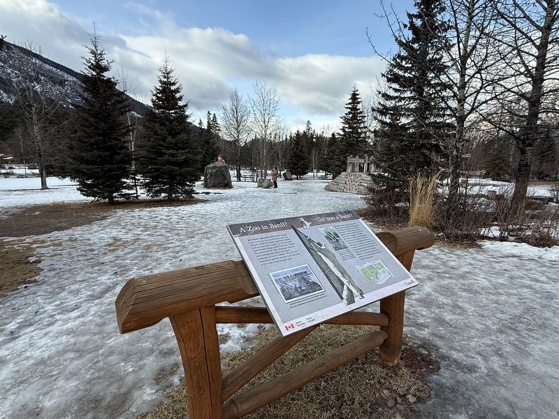
A Zoo in Banff?
Between 1904 and 1937, Banff Central Park was home to a world-renowned zoo.
Visitors could see locally captured wildlife, such as bears and cougars, as well as birds and animals foreign to the Park, like 'Buddy' . . . — — Map (db m294229) HM
Banff's first train station was actually located 1.5km east along the line from here. By 1888 it was deemed to be too far from the hot springs and a new log station was built at the site of today's station.
This new location for the train . . . — — Map (db m197062) HM
Opened in 1895, the Banff Park Museum was moved into this building in 1903. Its cross-log motif exemplifies an architectural style common in the town at the time. Norman Bethune Sanson, the museum’s curator from 1896 to 1932, . . . — — Map (db m8836) HM
Banff Springs Hotel
This hotel is among the largest and most renowned of the fashionable resort hotels established along railway and steamship routes in Canada during the late 19th and early 20th centuries. Constructed by the . . . — — Map (db m100084) HM
Born in Ceylon and educated in Scotland and Germany, Gibbon studied painting before turning to journalism. As publicity agent for the Canadian Pacific Railway from 1913 to 1945 he combined advertising with the promotion of a Canadian identity, . . . — — Map (db m108632) HM
The Man Behind the Collection
Norman Bethune Sanson was the museum's curator as well as Banff's meteorologist for more than 30 years. He energetically expanded the museum's original collection, gathering unique flora and fauna . . . — — Map (db m294230) HM
Located at the top of Sulfur Mountain, the cosmic ray station was completed by the National Research Council in 1956, in preparation for International Geophysical Year (1957–1958) an undertaking involving 66 countries and a dozen scientific . . . — — Map (db m109422) HM
The Cave and Basin Springs were brought to public attention after being located by CPR construction workers in 1883. These and the Upper Hot Springs soon drew private entrepreneurs and tourists. Growing support for public ownership prompted the . . . — — Map (db m108877) HM
Tunnel Mountain - What’s in a name?
The original survey for the railroad provided for a tunnel through this small mountain which appeared to obstruct the Bow Valley. A subsequent survey rerouted the railroad to the north, thus the . . . — — Map (db m293643) HM
End of the Road On the night of July 14, 1915 sixty prisoners were marshalled off a Canadian Pacific train just west of here and escorted to a barbed wire compound at the end of the unfinished Banff–Laggan (now Lake Louise) road. So . . . — — Map (db m109003) HM
During Canada’s first national internment operations in World War One, thousands of immigrants from the Austro-Hungarian Empire, the majority of Ukrainian origin, some citizens of Canada, were imprisoned as “enemy aliens”. Internment operations . . . — — Map (db m8827) HM
ENGLISH INSCRIPTION
Mountains create their own weather
As winds swirl around and rise above these massive barriers, clouds build up and bring the rain and snowstorms for which Storm Mountain was named.
Travellers . . . — — Map (db m82917)
Erected in honor of Sir James Hector K. C. M. C. Geologist and explorer to the Palliser Expedition of 1857 - 1860 by his friends in Canada, the United States & England. One of the earliest scientists to explore the Canadian Rocky Mountains. He . . . — — Map (db m70443) HM
Canadian Rocky Mountain Parks
World Heritage Site
The Canadian Rocky Mountain Parks were designated a site of outstanding universal value and placed on the World Heritage List on October 30, 1984.
Among the attributes that . . . — — Map (db m285692) HM
This renowned hotel had its origins in a simple log chalet built by the Canadian Pacific Railway in 1890. Early guests, including some pioneers of mountaineering in the northern Rockies, followed a packhorse trail from the station below. The advent . . . — — Map (db m109415) HM
Prior to 1913 the Alberta-British Columbia boundary was defined by the divide or watershed of the Rocky Mountains. The discovery of valuable coal deposits and the availability of marketable timber and the incursion of railroads and roads required a . . . — — Map (db m70445) HM
Imagine arriving here in the 1880s…the smell of pine forest, the sound of avalanches from the mountains above, and the wonder of vast unexplored country ahead. Today, the ice-capped peaks, hidden valleys and turquoise lakes are as spectacular as . . . — — Map (db m100116) HM
How many creeks do you know of that split, with each fork reaching a separate ocean, 4500 km apart. Here, Divide Creek forks on the boundary between Pacific and Atlantic watersheds, commonly called the Great Divide. Water in the left . . . — — Map (db m177899) HM
Rumbles of Excitement
Joyful arrivals, tearful departures, trains and telegrams coming and going. This Heritage Railway station was once a hub for locals and visitors alike.
The Station was built in 1910 by Canadian Pacific Railway to . . . — — Map (db m252885) HM
[English] The Bow Valley — Life flows through it The first car arrived in Banff in 1904 - on the railway tracks. The only other roads at the time were for horse-drawn carriages. But soon . . . — — Map (db m212533) HM
Coal mining in Canmore offered rare high quality coal and extremely dangerous mining conditions.
Anthracite coal, as found in Canmore, accounts for only one percent of the coal in the world. It is renowned for its purity and the heat it . . . — — Map (db m250743) HM
In 1884 Canmore was just a whistle-stop on the newly built Canadian Pacific Railway when two prospectors unearthed black coal on the west side of the Bow River. Two years later, Queen Victoria granted a Charter to mine coal in the Canmore area . . . — — Map (db m197082) HM
As a gateway to a major pass through the Rocky Mountains, the Bow Valley has been a transportation corridor since the time of the early Aboriginal groups, explorers, and fur traders. The arrival of the Canadian Pacific Railway in 1883 and the . . . — — Map (db m203491) HM
A Piece of Jasper's History
This rustic shelter was built in 1933 by workers involved in a federal relief project during the Great Depression. Since that time, the building has served generations of visitors and residents . . . — — Map (db m294220) HM
Strolling down the aisle, a conductor announces your destination. With steely squeals and a pish-sh-sh-sh of pent up steam, the locomotive glides to a halt. Descending the coach's stairs you step through the mist and arrive at Jasper Station. . . . — — Map (db m108634) HM
[English] Built by William Henry of the North West Company in 1811 to support David Thompson's exploration of the Athabasca Pass, Henry House stood at the head of navigation on the Athabasca River. When the pass became the principal . . . — — Map (db m202599) HM
[English] This building is one of the finest and most influential examples of rustic architecture in Canada’s national parks. Designed by A.M. Calderon and completed in 1914, it introduced a building tradition based on the use of local . . . — — Map (db m197059) HM
[English] In 1862, the Overlanders, numbering about 250, left their homes in Canada for the Cariboo gold fields. They journeyed via Fort Garry and Edmonton, and thence, guided by Indians to the mountains and westward by the . . . — — Map (db m203692) HM
[English] In 1813, the North West Company built Rocky Mountain House on Brûlé Lake as a provision depot for brigades crossing the Athabasca Pass to the Pacific. When Jasper Hawes took command of the post in 1817 it became known as . . . — — Map (db m203680) HM
A preeminent topographical surveyor, Wheeler represented British Columbia on the commission which located and marked the boundary with Alberta between 1913 and 1925. His party surveyed and mapped the 1000 km-long mountain section, using photographs . . . — — Map (db m108876) HM
[English] Born in London, Thompson served both the Hudson's Bay Company (1784-1797) and the North West Company (1797-1815) as trader, explorer and surveyor. One of the world’s great geographers, he accurately mapped the main travel . . . — — Map (db m203686) HM
This is a story about the history of this place from the Îyârhe [ee-YAH-hhay]. Îyârhe means “mountain people.” We are a branch of the Sioux/Dakota/Lakota/Nakoda people, who are now called the Stoney Nakoda Nation. When our grandfathers were . . . — — Map (db m203570) HM
In 1875 the Morleyville church was constructed entirely by hand from logs from surrounding timber. John McDougall, his father, his son and schoolmaster Andrew Sibbald labored to construct the church measuring 47' X 26' 7" wide and 21' 8" high. . . . — — Map (db m214299) HM
Chief Crowchild of the Tsuu T'ina people donated this cabin to be used by a caretaker for the church. The cabin was originally an Indian Agent's cabin on the Tsuu T'ina (Sarcee) Reserve west of Calgary. Workers dismantled it to be transported . . . — — Map (db m214301) HM
Robert Rundle introduced the Stoney people to Christian worship during his visit in 1842. Rundle promised to send missionaries to stay with the Stoney people. In 1873, Rev. George McDougall and his wife Elizabeth, along with sons John and . . . — — Map (db m214298) HM
[north tablet]To the Glory of God and in memory of Rev. George Millward McDougall and Rev. John Chantler McDougall, D.D. father and son and their devoted wives. Combined ministry 77 years. Pioneer missionaries of the . . . — — Map (db m214297) HM
The historic church at the end of this pathway was constructed in 1875. At that time native people were still hunting bison on the prairies. The young nation of Canada was only eight years old; the Canadian Pacific Railway still nine years in . . . — — Map (db m214300) HM
After it closed in 1921, the church was neglected until the early 1950s when a group of volunteers began restoration. A group of men from the United Church formed the Morley Church Restoration Society and began fund-raising to restore the . . . — — Map (db m214296) HM
Sacred to the memory of Rev. George MacDougall aged 54 years ——————————— The deceased was for 16 years Chairman of the Wesleyan Missions in the North-West. He lost his way on the prairie about 40 miles east of this place on January 24th . . . — — Map (db m214291) HM
Rev. George McDougall dedicated his life to frontier mission work. As a young man, George became interested in religion and while attending one of his first revival meetings he met a young Quaker girl, Elizabeth Chantler. They were married in . . . — — Map (db m214278) HM
The name "Stoney" is an English translation of their Assiniboine name which means "the people who cook with stones." The Stoney people are a branch of the Siouan Confederacy. They were comparative latecomers to the area and many of the local place . . . — — Map (db m214276) HM
In the early 1800s both the North West and Hudson's Bay companies recruited men from Iroquois settlements around Montreal, Quebec, and Cornwall, Ontario, to work as canoemen, hunters and trappers. Their skills in these occupations gave them an . . . — — Map (db m203626) HM