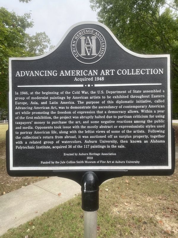
Auburn University's acquisition of paintings from the auction featured works by major artists of the day, including Arthur Dove, Lyonel Feininger, Jacob Lawrence, Georgia O’Keeffe, and Ben Shahn, together with significant examples by emerging . . . — — Map (db m183933) HM
Settled by Judge J. J. Harper and others from Harris County, Georgia, in 1836.
This region was opened to settlement
in 1836-37 by the removal of the
Creek Indians to lands west
of the Mississippi River.
Erected by
The Alabama . . . — — Map (db m39830) HM
Side 1
Auburn
1865~Present
Only one house was built in the village in the decade after the Civil War, and though the state took over the bankrupt college in 1872, the institution received no state appropriation until 1883. . . . — — Map (db m79947) HM
Auburn First Baptist Church's history dates to June 19, 1838. The first church
structure was a log building erected on the north side of West Glenn Avenue
on land donated by Judge John Harper, the Methodist founder of the town of
Auburn. Land for . . . — — Map (db m183941) HM
In 1836 Judge John Harper with 34 other Methodists from Harris County, Georgia settled here. They built a log structure on this site, the first church and school in Auburn. In 1856 church leaders inspired the Methodist Conference to open East . . . — — Map (db m74442) HM
Used popularly since the founding of East
Alabama Male College in 1856, the name Auburn
University was made official by the Legislature
in 1960, in recognition of the school's second
century of service to the state and nation.
Originally . . . — — Map (db m183914) HM
On January 31, 1921, farmers gathered on the campus of Alabama
Polytechnic Institute (API), now Auburn University, to form the
Alabama Farm Bureau, now known as the Alabama Farmers Federation.
Former Alabama Extension Service Director Luther . . . — — Map (db m194773) HM
Side A:
The University Chapel is the oldest public building in the city of Auburn. Built as a Presbyterian Church, the first service was held in the original Greek Revival-style building on September 13, 1851. Edwin Reese, spiritual leader . . . — — Map (db m39831) HM
Veterinary Science began at the Agricultural and Mechanical College, now Auburn University, in 1892 with the arrival of Dr. Charles Allen Cary. By 1907, Cary had built the program to a degree-granting school, and in 1922 the program began moving . . . — — Map (db m267369) HM
(Side 1)
Auburn's first separate black community cemetery offers a rich source of the city’s black heritage. Much of the history is oral but it is known that a white man gave most of the land in the early 1870’s. The four acre cemetery . . . — — Map (db m74453) HM
(Side 1)
Dr. Charles Cary, a native of Iowa and graduate of Iowa State in 1887, came to Auburn in 1892 and taught the first class of veterinary medicine at Alabama Polytechnic Institute. He has been called the Father of Veterinary . . . — — Map (db m74436) HM
Side 1
Under President Franklin D. Roosevelt's New Deal (1933-1942), the Civilian Conservation Corps (CCC) was established to provide work for single young men. The CCC's Company 4448, Camp Alabama SP-12, began work in September 1935 to . . . — — Map (db m85164) HM
Side 1
In 1846, Auburn's founder, Judge John J. Harper deeded the property on this corner to Simeon Perry, as town agent for two of the earliest public schools in Auburn. A member of the settlement party, Perry laid out the original . . . — — Map (db m79948) HM
The first African American student entered the library to register at Auburn University at this site. Acting on a court order, Auburn president Ralph Brown Draughon accepted the application of Harold Franklin as the first African American student in . . . — — Map (db m90861) HM
Built by Auburn merchant A.L. Dillard in 1894, the home was once part of the old Scott Plantation. It was one of the first homes in Auburn to have an indoor bath and electricity. An unusual feature of the house is the gray stone, for which Dillard . . . — — Map (db m74445) HM
Centennial Garden
commentates the granting of a state charter to the
East Alabama Male College
February 1, 1856
Established by Alabama Methodists
to foster Christian education.
Formally opened on October 1, 1859
Used as a . . . — — Map (db m183916) HM
(Side 1)
This simple frame structure was built by newly freed black men and women before 1870. The property on which the building stands was given to a member of the Ebenezer congregation in 1865, the year the War Between the States . . . — — Map (db m74450) HM
This post oak started growth in 1850 and was 6 years old when East Alabama Male College was established. It was 33 years old when the Alabama Agricultural Station was established, 91 when the nation entered World War II, and over 100 when this site . . . — — Map (db m74430) HM
The Lane House, built in 1853 at the corner of Thach and College Street, was home to several Auburn University notables, E. T. Glenn, Treasurer, leased it in 1873. Gen. James H. Lane, Aide to Gen. Stonewall Jackson and Head of Engineering, purchased . . . — — Map (db m85165) HM
J. F. Drake High School
J.F. Drake High School, formerly Lee County Training School, educated Black children of the community from 1958 to 1970. It bears the name of Dr. Joseph Fanning Drake. Drake consisted of 12 classrooms, gymnasium, . . . — — Map (db m74457) HM
Luckie Meagher's Kindergarten
Mrs. Luckie Meagher established a private kindergarten just east of this site and served as its premier teacher for more than 30 years, caring for delicate young minds from both Auburn and Lee County. Red Meagher . . . — — Map (db m184029) HM
(Side 1)
Max Adams Morris
Max Adams Morris b. December 7, 1918, of Blountsville, Alabama, entered Alabama Polytechnic Institute (API) in 1938, was a varsity football player and became a member of "A" club, Scabbard & Blade, and . . . — — Map (db m85166) HM
Marker Front:
The Greek Revival rock and mortar house was built by Addison Frazer (1809-1873) between 1852 and 1854 and served as the center for a 2,000 acre cotton plantation. Frazer owned 100 slaves and was on the Board of Trustees of . . . — — Map (db m25988) HM
With the creation of the seven-member Historic
Preservation Commission by the Auburn City
Council in 1999, the City took its first step
in establishing historic districts to preserve
its architectural heritage. The first work of
the Commission . . . — — Map (db m184196) HM
(Side 1)
Pine Hill was established in 1837 and is the oldest cemetery in Auburn. Judge John J. Harper, Auburn's founder, donated almost six acres to the new town to be used as a community burying ground for white settlers and their . . . — — Map (db m74474) HM
(Side 1)
Near this site once stood "Four-Story Cottage," the home of Robert Wilton Burton. A one-story house with wide porch and bay window, Burton built it in 1885 with proceeds from the sale of four stories to children's magazines. Born . . . — — Map (db m74440) HM
(Side 1)
Colonel Nathaniel J. Scott, from Harris County Georgia, built this house, which he called Pebble Hill, on 100 acres in 1847. With its pyramidal roof and symmetrical lines, the frame house reflects the Greek Revival . . . — — Map (db m74446) HM
The Alpha Mu chapter of Sigma Alpha Epsilon was founded on June 15, 1878 at the Agricultural & Mechanical College of Alabama (now Auburn University). John E.D. Shipp came to Auburn as a student determined to organize a chapter at a time when . . . — — Map (db m66726) HM
Front
The Crescent was an exclusive train of Southern Railway (SR) and Alabama affiliates Western Railway of Alabama (WRA), Atlanta & West Point Railway (AWPR), and Louisville & Nashville Railway (LNR). Excepting SR, these . . . — — Map (db m98305) HM
At the Auburn train depot on February 16, 1861, Jefferson Davis reviewed the Auburn Guards, the first Confederate military company thus honored. Davis was en route to his inauguration as President of the Confederacy. The Auburn Guards were comprised . . . — — Map (db m74455) HM
Designed by William Dryden Baughman and built by Fred Burk in 1929, the house was not finished due to the Great Depression. Because of its two-story turret and French Norman Style, it became known as "The Castle." In 1949, the home was sold to . . . — — Map (db m74443) HM
Built in 1924 and billed as "the world's largest bottle", The Bottle (also know as the "Twist Inn") was built by John F. Williams, owner of the Nehi Bottling Company in Opelika, Alabama. A wooden replica of a bright orange Nehi soda bottle, it stood . . . — — Map (db m85167) HM
The Cullars Rotation
(Established 1911)
The Cullars Rotation is the oldest, continuous soil fertility study in the South and the second oldest cotton study in the world. It was started in 1911 by the Alabama Agricultural . . . — — Map (db m74463) HM
The East Alabama Methodist College occupying this site was used as a Confederate hospital
1864 • 1865
1888
Alabama Polytechnic Institute
Agricultural & Mechanical College
Burned June 24, 1887. — — Map (db m183920) HM
Built in Selma, Alabama, during the early part of the Civil War for the manufacture of military supplies for the Confederate Army. During the war an attempt was made to move it to Columbus, Georgia to prevent its being seized by Federal troops. En . . . — — Map (db m39815) HM
Established in 1896 by Professor J.F. Duggar, the Old Rotation at Auburn University is: (1) the oldest, continuous cotton experiment in the U.S.; and (2) the 3rd oldest continuous field crop experiment in the U.S.; and (3) the 1st experiment to . . . — — Map (db m74429) HM
Facing relentless pressure to dissolve their sovereign status as the Creek Nation, Creeks ceded large tracts of their ancestral homeland to the United States of America in 1832, retaining individual allotments, believing that was the best way to . . . — — Map (db m278236) HM
This famous intersection, now known as Toomers Corner was named for businessman and State Senator Sheldon Toomer who founded the Bank of Auburn here in 1907. He served 45 years as bank President and 25 years on the Auburn City Council. Toomers . . . — — Map (db m183930) HM
Wittel Dormitory has long been admired as one of Auburn’s most significant examples of classic nineteenth-century design. Built in the early 1900’s by Samuel S. Wittel to house professional women, it also served as a home for three generations of . . . — — Map (db m66725) HM
Side 1
A popular recreation area for more than 100 years. Original dam located a short distance below Chewacla Lake Dam. Mill located on the west bank and ground both corn and wheat. Earlier mill owners from 1840's were Echols, Hiram . . . — — Map (db m85168) HM
The Botsford family came to the Farmville area,
then Chambers County, in 1839. Later, Robert and
Ida Botsford donated land for a new school. In
1923, the white wood frame structure with white
siding was built. It had three classrooms . . . — — Map (db m289589) HM
On this site in 1939, the Regional Laboratory for
Animal Disease Research (RLADR) was established at
Alabama Polytechnic Institute (API) during Dr. Luther
Duncan's presidency. The US Congressional Act of 1935
(PL 74-182) called for the . . . — — Map (db m294768) HM
Coming of the railroad from Montgomery in 1845 started a new era, with Loachapoka's name revived. It became the trade center for Waverly, Roxana, Rome, Camp Hill, Dudleyville, and Dadeville.
Rousseau's Raiders hit Loachapoka at sun down, . . . — — Map (db m31356) HM
Dr. Alexander Nunn
Dr. Nunn was born in Loachapoka on September 17, 1904. Beginning in 1924 he contributed to and edited the Progressive Farmer Magazine for 43 years. He helped to start Southern Living Magazine, retiring in . . . — — Map (db m73537) HM
Side 1
On this site once stood the first of over 5,300 Rosenwald schools for black children built between 1913 and 1932. The schools were started in a collaboration between Julius Rosenwald, CEO of Sears, Roebuck, and Company and Booker . . . — — Map (db m73539) HM
One of the larger settlements of the Upper Creeks at the time of Indian removal to the west, 1835-1837. Their last council fire was held here before their forced migration to Oklahoma. Pioneer families began pouring in after 1836. Today's cemetery . . . — — Map (db m85169) HM
Beulah No. 1 Missionary Baptist Church, formerly
Second Baptist Church of Notasulga, founded in 1865,
owns and cares for this sacred ground. Here rest
known and unknown souls whose faith and sacrifice
laid the foundation for generations to . . . — — Map (db m304055) HM
Side 1
On February 9, 1876, the City of Opelika paid D.B. Preston $80 for two acres of land to establish an African-American section of Rosemere Cemetery. This rectangular area of the cemetery contains 176 blocks, with 16 being partial . . . — — Map (db m75139) HM
Barbara H. Patton was elected Opelika's first female mayor in 1996, serving two terms, with her second term ending in 2004. During her tenure as mayor, Opelika saw significant economic growth and development, marked by the planning and development . . . — — Map (db m286067) HM
Side 1
Here in 1897 the first iron bridge in Lee County was built. In 1903 George W. Bean bought the mill, operating it until his death in 1952. About 1910 Bean installed an iron overshot wheel to replace the old turbine. Later, the dam . . . — — Map (db m73533) HM
Organized in 1868 under the leadership of Reverend Father Glenn. Formed only five years after the Emancipation Proclamation was Signed, Bethesda became the first Black church in the city of Opelika. Bethesda, which means “House of Mercy,” was . . . — — Map (db m296495) HM
Mayor Bobby James Freeman Remembered for Transforming Opelika's Historic Core Mayor Bobby James Freeman served as a Lee County Commissioner for 10 years and as Mayor of the City of Opelika for eight years. During his tenure as Mayor, the . . . — — Map (db m296636) HM
Located on this 800 acre site was an enemy prisoner of war camp. Construction of Camp Opelika began in September 1942. The first prisoners, captured by the British, were part of General Erwin Rommel’s Africa Corps. The camp prisoner population was . . . — — Map (db m85170) HM
Dr. John Wesley Darden, was the first African American physician to treat patients within a 30-mile radius of Opelika. He built the Darden House in 1904, and later married Maude Jean Logan of Montgomery. Dr. and Mrs. Darden shaped many lives through . . . — — Map (db m75131) HM
Organized in 1858, Trinity Mission was admitted to the Episcopal Diocese of Alabama on May 5, 1860. When the first church was consecrated on this site in 1862, it was renamed Emmanuel, meaning "God With Us." That building was destroyed by a tornado . . . — — Map (db m75132) HM
On this site in October 1859, the Opelika Baptist
Church was organized. In 1861, a "little white framed
church" was erected. After a fire consumed this
original building, a new structure was built in 1885.
This building was referred to as the . . . — — Map (db m176382) HM
Established as the first religious organization in the area in 1837 with 22 members as Lebanon Methodist Episcopal Church, around which the village of Opelika developed. Moved to present location in 1879 as Opelika Station, Montgomery District, . . . — — Map (db m68097) HM
In honor of Dr. J. W. Darden “A dedicated humanitarian, a builder of men, a physician, a Christian and a socially conscious citizen.” This marker honors Dr. Darden, his wife, Mrs. Jean Darden, the many teachers who gave so much of themselves to . . . — — Map (db m286106) HM
Entered on the National Register of Historic Places November 18, 1976 George W. Andrews Federal Building U. S. Courthouse Opelika, Alabama James A. Wetmore Architect 1915 This property significantly contributes to the nation’s . . . — — Map (db m296572) HM
Founded in 1951, J.W. Darden served as Opelika's African American high school until integration in 1972. The school's namesake, Dr. John Wesley Darden, was the first African American doctor in Lee County. The school fostered pride and served as the . . . — — Map (db m285898) HM
Side 1
Killgore Scholarships
Here James A. Killgore (1888-1966) and his wife, Ophelia Parker, operated a grocery store from 1916 to 1944. The Killgores worked hard, practiced frugality, and invested money wisely, desiring to help . . . — — Map (db m75123) HM
North side
To Our Confederate Dead
and Lee County Veterans
West side
"Nor Shall Your Glory
Be Forgot, While Fame
Her Record Keeps,
Or Honor Points
The Hallowed Spot,
Where Valor
Proudly Sleeps!
Easts . . . — — Map (db m176385) WM
Lee County Courthouse
Lee County was created from portions of Russell, Macon, Chambers and Tallapoosa by act of the Alabama Legislature, approved December 5, 1866. The County’s first election was held January 21, 1867.
An early . . . — — Map (db m85171) HM
Lee County Courthouse
Lee County was created from portions of Russell,
Macon, Chambers and Tallapoosa Counties by act of
the Alabama Legislature approved December 5, 1866.
Lee County's first election was held January 21, 1867.
An . . . — — Map (db m297059) HM
In grateful memory of the rich courage and
sacrifice of the men and women who served
with the Armed Forces in World War II
This tribute is erected by their friends in Pepperell
{List of Names} — — Map (db m176392) WM
Dallas “Dal” Smith was a veteran of the First World War. During his time of service, he was awarded the Distinguished Service Cross, Purple Heart and a Regimental Citation. He commanded the 3rd Battalion of the 167th Regiment. After the . . . — — Map (db m75133) HM
Lynching in America
After the Civil War, the ideology of white supremacy led to violent
resistance to equal rights for Black people. Lynching emerged to enforce
racial hierarchy through arbitrary and deadly violence that terrorized
all . . . — — Map (db m176380) HM
Opelika's Board of Parks and Recreation hired W.J. "Bill" Calhoun as its first director in 1951. His top priority was to develop a wooded area behind Northside School. Two adjacent parcels of land were donated by I.J. Scott, Sr. and Winston Smith . . . — — Map (db m210764) HM
Side 1
The City of Opelika purchased 19.6 acres of land to expand Rosemere Cemetery. This rectangular area is the newest portion. There are 193 blocks with varying numbers of sections and spaces in each. 467 grave markers have death dates . . . — — Map (db m75140) HM
Side 1
On July 23, 1869, the City of Opelika purchased ten acres of land for a cemetery from Dr. A.B. Bennett for $100 an acre. On November 23, 1869, he accepted his choice of a lot in exchange for the debt. The earliest marked grave is . . . — — Map (db m85335) HM
Opelika A Railroad Town. Opelika's original name was Opelikan when the town was founded in the 1830s. In 1850, the name was respelled as Opelika. In 1851, the Montgomery & West Point Railroad Company extended its Montgomery to Opelika rail . . . — — Map (db m184077) HM
Dragon/Griffin – The Pepperell trademark
symbol of world-wide excellence
This memorial is dedicated to the memory of the pioneer men and
women who came to Pepperell to begin a new way of life.
Russell Leonard, Treasurer of Pepperell . . . — — Map (db m176391) HM
obverse
The Railroad Avenue Historic District was the downtown nucleus of Opelika when the city was incorporated as part of Russell County, Alabama in February, 1854. The city limits extended a mile in every direction from the Montgomery . . . — — Map (db m85336) HM
With orders from Gen. Sherman, Gen. Lovell Rousseau left Decatur with 2,700 cavalry, beginning his raid into East-Central Alabama. That raid ended successfully in Opelika July 19, 1864, after miles of track were destroyed along with other railroad . . . — — Map (db m75126) HM
obverse
This is the last surviving covered bridge in Lee County. It was constructed about 1900 by Otto Puls over Wacoochee Creek in the Town's lattice truss design. Materials used in the 75 foot long bridge included longleaf heart pine, . . . — — Map (db m85337) HM
Organized November 15, 1846, as the Church of Christ at Shady Grove, under the New Covenant of 2nd Corinthians, 3rd chapter, agreeing to believe all the New Testament teaches, and to obey all its injunctions to the best of their capacity and submit . . . — — Map (db m85338) HM
The earliest buildings in the South Rail Road Avenue block between 9th and 10th Street were constructed by William O. Harwell around 1900 and were occupied by his agricultural supply store. His daughter, Alice Inez Harwell married Lum Duke who . . . — — Map (db m84735) HM
On September 10, 1929, Southside Elementary School and its Northside counterpart opened to serve the children of Opelika. Designed by noted Montgomery architect Frank Lockwood, these model educational facilities were built of colonial brick, and . . . — — Map (db m285897) HM
Organized c. 1872 by Rev. John Ford, Tom Isaiah, Julius Crockrum, Daniel Billingslea, Fannie Bryant, Charity Harris, Sarah Chambers and others, and named for presiding Bishop J. P. Thompson. This congregation first met in a house near the oil mill . . . — — Map (db m75157) HM
This "Top Rock" Millstone
was in a grist mill
owned and operated by W.S.A. Bence
on Sweetwater Creek in Clay County, AL
1919-1947
Donated by H.S. Bence — — Map (db m75160) HM
Union Grove Baptist Church was founded on
August 25, 1856, as Friendship Meeting House.
Henry S. Oliver and Nancy F. Oliver gave the
land to the church. The earliest marked grave
is April 10, 1869, for Nancy Oliver. General
Rousseau's Raid on . . . — — Map (db m304112) HM
Among the earliest settlers were the families of Henry Crowder, Dr. D. W. Floyd, Charles Nelms, W. W. Burt, George Heard, John Askew, Moses Pruitt, and Dr. McCoy. Rev. F. L. Cherry, leading historian of East Alabama’s first 50 years, wrote that . . . — — Map (db m39832) HM
Northern Boundary of:
British W. Florida 1764-83
Spanish W. Florida 1783-95
Mississippi Territory: 1798-1804
Washington County 1800-12
Clarke County 1812-15
Southern Boundary of:
British Illinois 1764-83
United States . . . — — Map (db m73532) HM
George Wyatt Jones Built the Jones Store around 1910. He and his wife Maggie Huguley Jones operated the store in the Smiths Station area for decades. The couple settled in the area in the late 1800s and opened their store on Old Opelika Road on the . . . — — Map (db m186337) HM
The community of Crockettsville was settled at about the time Russell County was formed in 1832. Among the first settlers were Jerry Segar and Green Sewell. It was named in honor of David "Davy" Crockett who served as a scout in Andrew Jackson's . . . — — Map (db m33541) HM
The Shiloh Baptist Church was constituted on March 27, 1852. Shortly thereafter, a house of worship was erected on what is now the present church site. The earliest marked grave in the church cemetery bears the date of 1854. A new building was . . . — — Map (db m154410) HM
This historic building was erected in 1848 to serve as the
Tuckabatchee Masonic Lodge No. 96. At the time, this community
of Crawford, Alabama (formerly known as Crockettsville from 1832 -
1843, named after Davy Crockett) was the county seat of . . . — — Map (db m111586) HM
Four score and seven years ago our fathers brought forth on this continent, a new nation, conceived in liberty, and dedicated to the proposition that all men are created equal.
Now we are engaged in a great civil war, testing whether that nation, . . . — — Map (db m120002) WM
While several written historical accounts of life among the Creeks inform our understanding of their culture, many details of daily life can only be corroborated or verify through archaeology.
Foodways
One of the most important aspects . . . — — Map (db m309619) HM
Archaeology is the scientific study of the past through analysis of physical traces of daily life discovered through excavation. It enables us to extend our knowledge of human history beyond the limits of written records and to learn details about . . . — — Map (db m101816) HM
In September 1821 Rev. William Capers was sent to Fort Mitchell, by the South Carolina Conference of the Methodist Episcopal Church, to negotiate with the chiefs of the Creek Indian Nations for a mission which would teach their children reading, . . . — — Map (db m26121) HM
William Bartram, American's first native born artist - naturalist, passed through Russell County during the Revolutionary era, making the first scientific notations of its flora, fauna and inhabitants. As the appointed botanist of Britain's King . . . — — Map (db m164144) HM
Creek Towns At its height, the Creek Nation consisted of about 20,000 people living in more
than seventy townships, or talwas (tvlwv), scattered throughout modern-day Alabama and Georgia. Creek townships commonly consisted of a primary . . . — — Map (db m120007) HM
Emma Crowell and James Whitaker were married near Fort Mitchell on
April 23, 1840. Colonel John Crowell, Indian Agent, gave the Log Cabin to
his niece for a wedding gift. Emma was the daughter of Captain Henry Crowell, brother of Colonel John . . . — — Map (db m241216) HM
Cultural Exchange and Cooperation Though significant cultural conflict characterized Creek-American relations in the Chattahoochee Valley, and Creeks faced numerous forms of exploitation, not all relationships between Creeks and settlers were . . . — — Map (db m120019) HM
418 entries matched your criteria. The first 100 are listed above. Next 100 ⊳