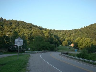
Site of Camp McDonald, set up, 1862, occupied by the 11th W. Va. Inf., U.S.V. Scene of engagement, May 6, 1862, when Federals under Maj. George C. Trimble beat off an attack by Confederate Moccasin Rangers under Capt. Geo. Downs. — — Map (db m14153) HM
Early in 1862, the 11th West Virginia Infantry in Spencer established an outpost here in Arnoldsburg to suppress Confederate guerilla activity. Union Maj. George C. Trimble commanded four companies here at Camp McDonald, named for former county . . . — — Map (db m73440) HM
Gilmer CountyFormed, 1845, from Kanawha and Lewis. Named for Thomas Walker Gilmer, Secretary of the Navy in President Tyler's Cabinet, who was killed by the explosion of a gun on board the United States battleship, Princeton, February 28, 1844. . . . — — Map (db m73437) HM
One of several partisan groups in western VA during the Civil War, the Moccasin Rangers were Southern sympathizers who operated in the central counties of present-day West Virginia, conducting raids and terrorizing local Unionists. After they looted . . . — — Map (db m137948) HM
Perry Hays & George Silcott. Peregrine Hays and George Silcott were prominent businessmen before the Civil War. Hays was sheriff of Calhoun County and Silcott county clerk. In 1861, they helped form the Moccasin Rangers. After truce they . . . — — Map (db m137949) HM
Site of first Calhoun Co. Court which met at home of Joseph Burson, April 14, 1856. Justices were Wm. Brannon, Dan. Duskey, H.R. Ferrell, Geo. Lynch, Joshua Knight, Absalom Knotts and Hiram Ferrell. — — Map (db m73462) HM
Dedicated to all veterans of Calhoun County, to the honor and glory of those who bravely served to keep our country a land of freedom. — — Map (db m174390) WM
Town was laid out in 1866
on farm of Simon P. Stump
and named for Gen. Grant.
Became permanent county
seat of Calhoun in 1869,
after 13 years of moving
county seat from place to
place. Incorporated 1896. — — Map (db m174389) HM
In Memoriam
CSM Clovis Drexell Ice
1933 - 1991
United States Army
1950 thru 1977
Military Intelligence Hall of Fame
Airborne - Special Forces
Distinguished Soldier and Citizen
Duty, Honor, and Country
Erected by . . . — — Map (db m190015) WM
• In 1883, A. H. "Dick" Stump (who would later become Grantsville's first Mayor)
and his wife, Druscilla Ball Stump, built a house, a block from the Courthouse,
on Main Street.
• The Stumps tuned their home into a hotel by 1885, and in . . . — — Map (db m190017) HM
One mile west in the low gap are the graves of Mike Fink and an Indian, slain in 1780, and buried where they fell. While hunting, Fink and Adam O’Brien were fired on by two Indians; Fink shot one and was killed by the other. — — Map (db m137950) HM
This privately owned covered bridge was completed in 1890 as ordered by the county court. Stone masons T. C. Ancell and E. Underwood prepared all abutments at a cost of $976.54, and carpenters John Ash and S. H. Smith built frame superstructure for . . . — — Map (db m142404) HM
In 1915, a two-span reinforced concrete arch bridge was built over Arnold Creek near Central Station by the Clarksburg-based Concrete Steel Bridge Company. Constructed during the Good Roads Movement and the state's first major effort to address poor . . . — — Map (db m142409) HM
Crossing rivers and mountains from New Jersey, Seventh Day Baptists came in 1789-90 to Virginia and established their church at New Salem. In 1870 a daughter church was organized on Greenbrier Run, Rev. Jacob Davis first pastor; Rev. Walter B. . . . — — Map (db m228822) HM
Here lived Joseph H. Diss Debar, artist, designer of the State seal and coat of arms. He lived here many years and helped establish Saint Clara Colony nearby, about 1845. Author of first "Handbook of West Virginia". — — Map (db m142421) HM
21st governor of W. Va. (1941-1945), born at Grove, 1874, spent boyhood here in former town of Market. He served in Spanish American War and graduated from W. Va. Univ. before opening law practice in Fairmont. His public career included terms as . . . — — Map (db m142423) HM
Doddridge County
Formed in 1845 from Ritchie, Harrison, Tyler, and Lewis. Named for Philip Doddridge, lawyer-statesman of western Virginia. Many of the Indians who once came to this State got war and hunting weapons from flint quarries near . . . — — Map (db m301178) HM
Site of Greenbrier Seventh Day Baptist Church, organized Aug. 1870 by members of New Salem church, est. 1792 in Salem. Met in log building; new church dedicated, 1880; razed, 1975. Rev. Peter Davis (1783-1885), original settler & Rev. Jacob Davis . . . — — Map (db m142418) HM
Gilmer County. Formed, 1845, from Kanawha, Lewis and named for Thomas Walker Gilmer, Secretary of the Navy in Tyler's cabinet, who was killed in an accident on a war vessel. Farming is important, particularly sheep and cattle raising.
. . . — — Map (db m246892) HM
Ephraim Bee and his wife Catherine's inn served
stages from the Northwest Turnpike. J.H. Diss Debar,
W.V. State Seal designer said seeing all the children
playing about, he had never dined in a Bee Hive before. Thereafter it was the Bee Hive Inn. . . . — — Map (db m31748) HM
Born January 8, 1820, Stuart was prosecuting attorney of Doddridge County, 1852-1861. After voting against secession at the Richmond Convention, he was elected senator of the Restored Government of VA. He also served as a delegate to the . . . — — Map (db m142415) HM
In honor of those who gave all
World War I
Wayne C. Adams •
Benjamin H. Ash •
Delbert Bailey •
Harper Bailey •
Cecil O. Britton •
Roy D. Cole •
Marion C. Davis •
John W. Droppleman •
Linden L. Gain •
John W. Guthrie . . . — — Map (db m225739) WM
Blacksmith, innkeeper, an operator of the "Underground Railroad". A
Captain of the Doddridge County Militia,
a member of the first West Virginia
State Legislature in 1863, serving
3 terms. The Founder and Grand Royal
Gyascutis of the Most . . . — — Map (db m31822) HM
The West Virginia
Division of Culture and History
State Historic Preservation Office
announces that in recognition of its significance
and to encourage its preservation
Lathrop Russell Charter House
Doddridge . . . — — Map (db m190103) HM
Skirmish at West Union. Early on May 5, 1863, six companies of the 2nd WV Infantry under Col. George Latham arrived in West Union to protect area railroad bridges during the Jones-Imboden raid. Two regiments of Confederate cavalry advanced to . . . — — Map (db m253592) HM
Tyler County
Formed in 1814 from Ohio. Named for John Tyler, governor of Virginia and father of President Tyler. Here in 1894 was drilled "Big Moses", the greatest gas well in the world, producing one hundred million cubic feet per day. . . . — — Map (db m301213) HM
West Union, incorporated in 1881, was formerly called Lewisport in honor of Lewis Maxwell. It is the county seat of Doddridge, named for Philip Doddridge. In it lived J. H. Diss Debar and Sen. and Gov. M. M. Neely. — — Map (db m42429) HM
Begun, 1860; finished after the Civil War; handhewn log church is oldest in Gilmer Co. Job's Temple Class of M.E. Church, South was organized in 1866 by the Rev. G.S. McCutchen, first pastor. First trustees were Levi Snider, Salathiel, Wm. & N.W. . . . — — Map (db m190018) HM
Confederate Gen. Albert G. Jenkins led 550 cavalrymen on a 500-mile raid from Salt Sulphur Springs, Aug. 22-Sept. 12, 1862, attacking Federal forces and destroying military stores. He captured and paroled 300 Union soldiers, killed or . . . — — Map (db m73427) HM
The clock tower, affectionately known as the "light house on the hill", was constructed in 1899 where the bell had rung from the top of the Administration building. Several years later in 1953, Roy Clemons was hired by President Harry Heflin to work . . . — — Map (db m190034) HM
Nearby is the homestead
of Henry Everett Engle
(1849-1933) where in 1885
he composed the melody
for "The West Virginia
Hills,” the most popular
of the official state
songs of West Virginia. — — Map (db m174399) HM
This post oak was an original corner to the four cemetery lots and the property that originally belonged to Robert Linn. Much of the restoration work has been done by Mr. Hunter Armentrout. — — Map (db m190036) HM
At the top of the hill is the site of a log fort 30x30 feet in size, built in spring, 1864, for Capt. W.T. Wiant's Gilmer County Home Guards. Occupied until December, 1864. Burned days later by Confederates under Capt. Sida Campbell. — — Map (db m73428) HM
Care of its needy citizens dates to
the county's creation in 1845. By
1907, an infirmary was needed on
the local poor farm. With a $6,000
levy, the county court hired Albert
N. West to design and W.D. Whiting
to build the structure. After . . . — — Map (db m174482) HM
Gratefully dedicated to the lasting memory of all the men and women who have honorably served in the armed forces of the United States of America in time of war — — Map (db m190021) WM
Here was written “The West Virginia Hills,” State song. This was the home of William Perry Brown, author of three score books for children, and for many years one of the most popular writer for the old “Youth’s Companion.” — — Map (db m189578) HM
Here was written "The West Virginia Hills," State song. This was the home of William
Perry Brown, author of three score books for children, and for many years one of the most popular writers for the old "Youth's Companion." — — Map (db m190020) HM
A college that offers both professional and general education with emphasis on teacher education was established by the Legislature in 1872 as the Glenville Branch of the West Virginia Normal School. Became Glenville State Normal School in 1898. . . . — — Map (db m73429) HM
Thomas Marcellus Marshall, Glenville State Normal, Acting Principal - January 1873-June 1873; Principal - 1875-1881 •
Louis Bennett, Glenville State Normal, Principal - 1873-1875 •
Robert Franklin Kidd, Glenville State Normal, Principal . . . — — Map (db m190029) HM
Over 292,000 Americans died in defense of their country
during World War II. Glenville State College lost 23 students
whose names are engraved on this memorial.
1st. LT. Elmer R. Cawthon, Jr. De Ridder, Louisiana April, 1943 •
Lt. (jg) . . . — — Map (db m190025) WM
A central West Virginia college maintained for the training of grade and high school teachers. Established as a normal school in 1872 by the Legislature. Given college status in 1930. — — Map (db m73430) HM
Begun. 1860; finished after the
Civil War; handhewn log church
is oldest in Gilmer County. Job’s Temple Class of Methodist Evangelical Church South was organized in 1866 by the Rev. G.S. McCutchen, first pastor. First trustees were Levi Snider, . . . — — Map (db m174391) HM
Scattered here around us are the tombstones of past Gilmer County residents that have all shared in their experiences with their participation among the community. The history here ranges from the eldest head stone date of December 18, 1794, (birth . . . — — Map (db m190035) HM
Built this home in 1837 on a 1000-acre tract, and laid out the town of Glenville in 1845. As a member of the Virginia Assembly, he urged the building of the Parkersburg-Staunton Turnpike. As a Congressman, in 1842, Hays appointed Thomas Jonathan . . . — — Map (db m17557) HM
On 24 March 1845, Commissioners met here in Salathiel Stalnaker's brick home to organize Gilmer County from parts of Lewis and Kanawha. Members were: Bennett, Conrad, Hayes, Stump, Riddle, Arnold, Huffman, Cook, Maze, Benson, Knotts, Holt, . . . — — Map (db m304203) HM
Stalnaker Plantation. Major William Stalnaker moved here
with his family from Randolph County
in 1817 to claim a land grant for
services rendered in the War of 1812.
Tobacco was among the crops grown
on the plantation. A post office . . . — — Map (db m174395) HM
A Confederate company organized at
Glenville in May 1861 by Rev. John
E. Mitchell, the group only had 45
hunting rifles and no uniforms.
Mitchell was replaced by J.S. Kerr
McCutcheon just before the formal
mustering of the company into . . . — — Map (db m174483) HM
Dedicated to the women of West Virginia who left their homes to work in defense plants throughout America and help win WWII.
Honoring: Ada England, Alpha Coberly Miles Osborn, Anna Hess, Ann Carpenter Stalnaker, Arlene Snyder, Bobbie . . . — — Map (db m190019) HM WM
Finished in 1848, the Farnsworth House sits on a 300-acre farm with family cemetery. The house was built for James Farnsworth, brother of Daniel D.T. Farnsworth, second governor of West Virginia.
A tavern was built to feed and house travelers, . . . — — Map (db m214703) HM
On September 18, 1863, a band of 30 Confederate guerillas raided the town of Troy. They robbed stores of about $1,000 worth of goods and pillaged private homes. They also took captive three residents and three 6th WV Infantry soldiers. In response, . . . — — Map (db m174486) HM
This memorial is dedicated to the men and women of our community who have proudly and bravely defended the precious rights and freedoms of our country — — Map (db m197530) WM
Commemorating those from Anmoore who served in World War II
Adams, John •
Allen, William •
Alonso, Raymond •
Alvarez, Sabrino •
Amato, Nicholas •
Ayers, Lyle •
Bailey, George •
Ball, Ashbury •
Balough, John . . . — — Map (db m197795) WM
The first building known as the Baptist Meeting House stood on this site. The church was organized about 1770 by Rev. John Sutton and five constituent members. Rev. James Sutton served as pastor for a short period. Rev. John Corbly served as pastor . . . — — Map (db m177155) HM
Enlarged replica on site of original Michael L. Benedum family home, Benedum, born here 16 July 1869, died 30 July 1959. Known as the “Great Wildcatter” for success in oil exploration, he became as well known for philanthropy. Benedum . . . — — Map (db m125816) HM
On April 20, 1863, Confederate Gens. William E. “Grumble” Jones and John D. Imboden began a raid from Virginia through present-day West Virginia against the Baltimore and Ohio Railroad. Taking separate routes, they later reported that they . . . — — Map (db m253235) HM
Combat Wounded
Dear friend, beware as you stand by
As you are now, so once was I
As I am now, so you will be,
So get prepared to follow me.
“To follow you I am not content
Until I know which way you went."
We are such things . . . — — Map (db m108674) WM
Combat Wounded
Dear friend, beware as you stand by
As you are now, so once was I
As I am now, so you will be,
So get prepared to follow me.
“To follow you I am not content
Until I know which way you went."
We are such . . . — — Map (db m184834) WM
1975
12 Year Old
Mike Applegate •
Mario Blount •
Joey Belcastro •
John Hartzell •
Steve Hitt •
Kyle Johnson •
Jeff Larosa •
Pat Oliverio •
Gregg Perris •
Jon Pinti •
Bub Renzelli •
Tommy Steele •
Bobby Tomasik •
Tommy . . . — — Map (db m249116) HM
Who made the first settlement on Lower Simpson Creek in April 1772. He obtained a patent on 400 acres of land and built his cabin near this site. Later in the same year he returned to the South Branch and married Sarah Allen. They reared a family of . . . — — Map (db m229645) HM
On Simpson Creek is the site of fort built by John Powers, 1771. Nearby is grave of Col. Benjamin Wilson, soldier and settler. Here lived Joseph Johnson, only Virginia governor from west of Alleghenies; first elected by popular vote. — — Map (db m4545) HM
Original site of the Simpson Creek Baptist Church (organized in 1770). Buried here are James "Peg" Clemens, Pony Express rider and cousin of Mark Twain; Joseph Johnson, the only man west of the Alleghenies to serve as governor of Virginia, and . . . — — Map (db m181303) HM
(Front):
Federal Bureau of Investigation
Criminal Justice Information Services Division
On the morning of Tuesday September 11, 2001, at 8:46 a.m. hijackers intentionally crashed the American Airlines Flight 11 passenger . . . — — Map (db m256479) HM
A. S. Hugill built 75' long by 14' wide multiple king-post truss bridge in 1881 for $1483 on land of John Lowe. Survived great flood of 1888 but was washed away from original site 1/2 miles upstream in 1899. — — Map (db m8541) HM
A Historic
Bowstring Concrete Arch Bridge
Built in 1924
By Frank Duff McEnteer's Concrete Steel Bridge Co. for The Bridgeport Lamp Chimney Co. to move handcarts with glassware from the factory across Simpson Creek to their warehouse. . . . — — Map (db m287870) HM
Birthplace of General Thomas J. “Stonewall” Jackson. After a brilliant Mexican War record, he joined the Confederacy in 1861, earned his nickname and advancement in rank in first Battle of Bull Run, and was killed at Chancellorsville. — — Map (db m73406) HM
This cannon captured in May 1898 from Spanish forces by U. S. Navy, under command of Admiral George Dewey near Manila, Philippine Islands. Unveiled in Clarksburg on July 4, 1899 by Custer Post No. 8 G.A.R., placed here in 1932. Cast in Seville, . . . — — Map (db m257252) HM
Seeded from the
9-11 Survivor Tree
Given to the
City of Clarksburg
from the
National September 11 Memorial & Museum
at the World Trade Center — — Map (db m257179) HM
Built in 1853 on land donated by Burton Despard and modeled after a church near Dublin, Ireland, that he attended as a child. The Reverend R. A. Castleman arrived as a deacon in 1853 and supervised the construction of the sanctuary. Black walnut . . . — — Map (db m257153) HM
(side 1)
Established 1785. Named for Gen. George Rogers Clark. John Simpson camped here in 1764. Early permanent settlements were made by the Davissons, Cottrills, Sotha Hickman, Nicholas Carpenter, and others.
(side 2) . . . — — Map (db m73413) HM
This church was organized and began serving a congregation in 1848. The present building, with its unusual round sanctuary, was completed in 1896 on land purchased from Colonel Alexander Moore. Colonel Moore served with gallant and highly . . . — — Map (db m257247) HM
The former Clarksburg Municipal Building was designed by Charles L. Hickman and was built in 1888. The building was an example of the late 19th Century Victorian Eclecticism. It served as the Post Office from 1888-1932; the Federal Building from . . . — — Map (db m257217) HM
On April 22, 1861, in Clarksburg, about 1,200 citizens of Harrison County met to oppose Virginia's proposed ordinance of secession. They supported John Carlile's call for delegates to meet on May 13 in Wheeling to determine a course of action for . . . — — Map (db m184744) HM
On April 20, 1863, Confederate Gens. William E. “Grumble” Jones and John D. Imboden began a raid from Virginia through present-day West Virginia against the Baltimore and Ohio Railroad. Taking separate routes, they later reported that they . . . — — Map (db m253236) HM
Combat Wounded. Dear friend, beware as you stand by. As you are now, so once was I. As I am now, so you will be. So get prepared to follow me. “To follow you I am not content. Until I know which way you went.”
We are such things as dreams . . . — — Map (db m104605) WM
Born along Devils Crk. in the Millstone Valley of New Jersey. Married
Prudence Izzard of Phil. in 1772. Came to Harrison Co. Va. in 1773 with wife
father, Obadiah, uncles John, Andrew, Amaziah and families. His survey
listed 400 acres in 1773 . . . — — Map (db m184966) HM
Site of Hopewell Baptist Church and burial place of Daniel Davisson. Major in Revolution. Commander of Nutter Fort and High Sheriff of Harrison County, he donated land for county buildings and this cemetery in the year of 1790. — — Map (db m184812) HM
Derek William Hotsinpiller
Deputy United States Marshal
Northern District of West Virginia
July 13, 2009 - February 16, 2011
Early in the morning hours on February 16, 2011, deputies assigned to the United States Marshals Service for . . . — — Map (db m257230) HM
This seven-story steel structure of brownstone and brick was built in 1907 by Virgil Highland. The first-floor portal is flanked by Corinthian columns. The embellished, bracketed cornice on the top floor gives it a Renaissance Revival theme. It . . . — — Map (db m256533) HM
The present church structure was built in 1893 at a cost of $15,500. It was constructed in the Gothic Revival style with Gothic gables located on each elevation and twin louvered lancet windows. Additions to the building were added in 1913 and . . . — — Map (db m256592) HM
This mural project was led and commissioned by the Clarksburg History Museum as part of the West Virginia Mural Trail for America 250, an initiative of the West Virginia Department of Tourism for America’s Semiquincentennial, with concept and . . . — — Map (db m309175)
This structure was first built as a four-story hotel in 1910. Then a fifth story was added in 1913. The hotel was owned by Dr. Truman. E. Gore, physician, and brother of Howard M. Gore. Howard Gore served as governor of West Virginia from . . . — — Map (db m257207) HM
Born February 9, 1947, in Clarksburg, West Virginia, Richard proudly served as an Armor Crewman with Company M, 3rd Squadron, 11th Armored Cavalry Regiment — the legendary Blackhorse Troopers.
On September 7, 1969, at the age of 22, he was . . . — — Map (db m309115) HM WM
Born February 9, 1947, in Clarksburg, West Virginia, Richard proudly served as an Armor Crewman with Company M, 3rd Squadron, 11th Armored Cavalry Regiment — the legendary Blackhorse Troopers.
On September 7, 1969, at the age of 22, he was . . . — — Map (db m309116) HM WM
On March 25, 1808, George Jackson, son of John and Elizabeth Jackson, deeded his orchard place to his son John George as a cemetery for family and friends. The George Jackson farm was an outpost of pioneer Clarksburg and the scene of Indian . . . — — Map (db m256447) HM
(Panel 1):
John George Jackson (1777-1825) - also known as John G. Jackson - of Clarksburg, Harrison County, Va. (now W.Va.). Born in Hardy County, Va. (now W.Va.), September 22, 1777. Son of George and Elizabeth Brake Jackson; . . . — — Map (db m256467) HM
Born in 1817, he practiced law and served in the Virginia Senate and US Congress. At the 1861 Richmond Convention, he opposed secession. Although he led efforts to create a new state and wrote "A Declaration of the People of Virginia" calling for a . . . — — Map (db m184802) HM
In 1764, John Simpson, hunter and trapper, established a camp here on the bank of the West Fork River opposite the mouth of Elk Creek. He was the first white man in the area. Simpson Creek and the town of Simpson are named for him. — — Map (db m174580) HM
John William Davis was born in Clarksburg on April 13, 1873. Davis served in the United States House of Representatives from West Virginia's First District, was the United States Solicitor General under President Woodrow Wilson, and was the . . . — — Map (db m257195) HM
Kelly Miller School (1st to 12th grade), located on EB Saunders Way (formerly Water St.), was a black school operated from 1903 until school desegregation in 1956. The school was named in honor of Kelly Miller, an African American mathematician, . . . — — Map (db m288087) HM
The original structure was established in 1860 as a branch of the Merchants & Mechanics Bank of Wheeling. The current structure was built in 1894. Its first president was Nathan Goff, Sr., followed by his nephew, Nathan Goff, Jr., then R.T. . . . — — Map (db m256641) HM
186 entries matched your criteria. The first 100 are listed above. The final 86 ⊳