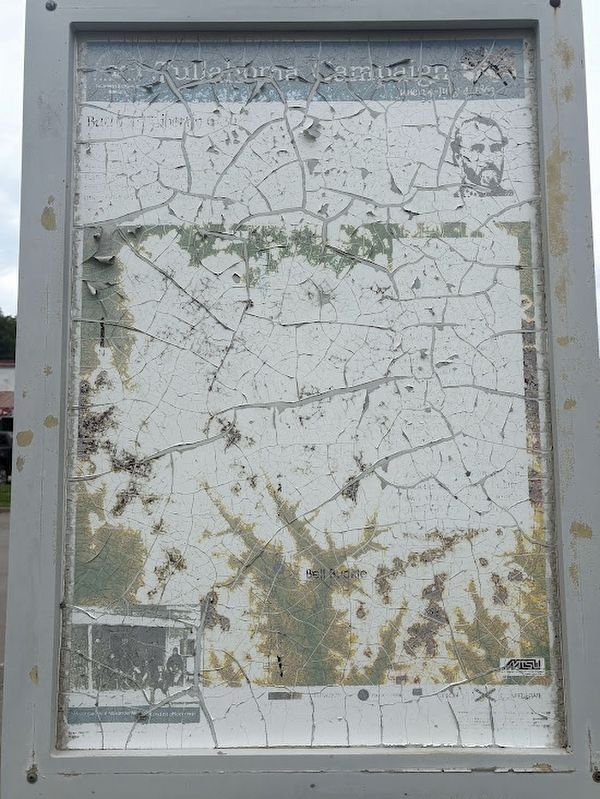
In late June of 1863, Union Major General William S. Rosecrans launched a massive offensive from his base in Murfreesboro in an attempt to drive Confederate General Braxton Bragg's 43,000-man Army of Tennessee from its entrenchments at Shelbyville . . . — — Map (db m277761) HM
Webb gratefully acknowledges the gift from Mr. and Mrs. William Ransom Jones, Sr., William Ransom Jones, Jr. '88, and Jennings H. Jones '90, making possible the purchase of the bell in 2013.
First rung in Bell Buckle by the Class of 2014 on . . . — — Map (db m278251) HM
Z.T. Crouch, Webb School employee, built this house in 1913 on a plat deeded from W. R. (Sawney) Webb. The home of H. Pearl and Virginia Wright Sain from 1959 till 1995, it was also the site of Sain Stables from 1960 to 1973. Shaker's Shocker was . . . — — Map (db m277759) HM
This building is dedicated in honor of Eugene F. Strobel (1927-2016) for his tireless service to the town of Bell Buckle as its mayor from 1978-1986. Mr. Strobel was a professor at Middle Tennessee State University and an ardent naturalist.
Mayor . . . — — Map (db m277760) HM
The Webb School was founded in 1870 in Culleoka by William Robert Webb, known affectionately to thousands as "Sawney." It was relocated to Bell Buckle in 1886. Sawney was active in educational, political, religious, social, and community affairs, . . . — — Map (db m278249) HM
Founded 1870, at Culleoka, by William R. ("Sawney") Webb, whose brother John M. ("Old Jack") Webb joined him in 1874. It moved here in 1886. Its curriculum, embracing chiefly Latin, Greek and Mathematics, was designed to give a sound preparatory . . . — — Map (db m24169) HM
On this knoll, members of the Federal party which attempted to destroy the Western & Atlantic R.R. in 1862, assembled before starting their foray. It started with seizure of the engine "General" and ended with recapture of the engine at the Georgia . . . — — Map (db m80317) HM
The Reserve Corps (Granger) moved south along this road, screened by the Army's Cavalry (D.S. Stanley). Taking Guy's Gap, against minor resistance, they pushed rapidly into Shelbyville, evacuated the same morning by the Corps of Maj. Gen. Leonidas . . . — — Map (db m26075) HM
Born on March 3, 1916 and raised in his father’s ancestral home of Bedford County, Tennessee, Austin C. Shofner forever changed World War II.
When World War II commenced for the United States in 1941, Capt. Shofner fought as a company . . . — — Map (db m214902) HM
The Veterans Memorial Plaza is conceived and designed to honor, commemorate and forever remember the veterans of Bedford County Tennessee who have served in the armed forces throughout the world. It is to recognize the sacrifices these brave men . . . — — Map (db m85709) WM
This was Lot 44 of the original town plan. A log church was built here in 1815. The Presbyterians used it, and built the present church in 1817. In 1856, a Catholic congregation bought the building, selling to the Northern Methodists in 1894. These . . . — — Map (db m25049) HM
Born in NC, 1783; veteran of the War of 1812; early Bedford County manufacturer; Whig political leader. In 1810 Cannon provided 100 acres of land for the site of the "Town of Shelbyville" and in 1817 donated 5 acres to Dickson Academy and a lot to a . . . — — Map (db m26807) HM
In the cemetery north of the road are buried Confederate soldiers of the Army of Tennessee, who fell while opposing the advance of Rosecrans' Army of the Cumberland through Liberty Gap and Guy's Gap, in late June, 1863. Also buried here are soldiers . . . — — Map (db m25864) HM
Preface
After the Battle of Stones River ended on January 2, 1863, Union Gen. William S. Rosecrans occupied Murfreesboro. Confederate Gen. Braxton Bragg withdrew south to the Highland Rim to protect the rail junction at Tullahoma, Bragg's . . . — — Map (db m85714) HM
Born in a house which stood here. Enlisted in the 1st Tenn. Volunteers for the Mexican War; on graduation from US Military Academy in 1853, commissioned in Dragoons. Resigning for the Confederacy and rapidly promoted to colonel, he was captured at . . . — — Map (db m207913) HM
In memory of the
"Shelbyville Rebels" Co. F.
41st Tenn. Reg't. C.S.A. and
all soldiers from Bedford
County who fought for the
Confederacy in the War
Between the States 1861-1865
Erected and affectionately dedicated
by the Agnes L. . . . — — Map (db m85555) WM
Born on November 15, 1858, James S. Gilliland, an African American native of Shelbyville and self-taught stone mason, work extensively with limestone. He envisioned turning his log house into a stone home with fifteen-inch thick walls quarried over . . . — — Map (db m282004) HM
The first Bedford County public school for African-Americans was known as 'Slip up'. Between 1889 and 1894, 27 schools for African American (mostly one-teacher) were established in various Bedford County communities. Organized in 1895, McAdams was . . . — — Map (db m263119) HM
Son of Michael, an immigrant from Frankfurt on Main, Germany in 1760. Migrated by covered wagon, horseback and afoot from North Carolina in 1808 with his family and settled this tract of land on Thompson's creek. The land was granted to him by the . . . — — Map (db m80313) HM
Mary Shirley, who was born on 17 February 1762, married William McGuire on 23 February 1778 in Virginia. During the Revolutionary War William and Mary McGuire with son Michael were taken prisoner on 26 June 1780 and moved from Virginia to Montreal, . . . — — Map (db m262420) HM
Dedicated to the Memory of the Thirteen Free and Accepted Masons Who Were Among the First Signers of the Constitution of the United States.
A.D. 1787 - A.D. 1987
Donated by Normandy Lodge No. 617 Shelbyville Lodge No. 122 of Free and . . . — — Map (db m207988) HM
Captain Charles Davis of the 7th Pennsylvania Volunteer Cavalry received the Medal of Honor for leading a cavalry charge on June 27, 1863 to the south, directly up Main Street, in the face of Confederate artillery and troops defending the . . . — — Map (db m263407) HM
Governor of Tennessee for three successive terms 1939-1945. A native of Bedford County and graduate of Webb School, Princeton and Harvard Law School, he was Attorney General of the 8th Judicial Circuit, a member of the 63rd and 70th General . . . — — Map (db m25868) HM
Shelbyville Central High was a public, 4~year high school that served students across Bedford County. This building was completed in 1939, opened for classes in 1940, and was occupied by the school until 1977. The facilities expanded in 1955 with . . . — — Map (db m297577) HM
Shelbyville was established in 1810 on 100 acres of land donated by Clement Cannon (1783-1860), local manufacturer and veteran of the War of 1812. The city was named in honor of General Isaac Shelby (1750-1826), statesman and noted Revolutionary War . . . — — Map (db m85443) HM
This 90-acre tract is home of the Tennessee Walking Horse National Celebration - "The World's Largest Walking Horse Show". On July 17, 1939, a non-profit association was chartered to conduct a national celebration to honor and exhibit the Tennessee . . . — — Map (db m25869) HM
The Tribute of the South to S.A. Cunningham, founder and editor of the "Confederate Veteran",
January, 1893 - December, 1913.
He gathered the history of his people written in tears but radiant with glory.
(On left side of . . . — — Map (db m263522) HM WM
[Side A]
Shelbyville — “Little Boston”
Shelbyville, Tennessee, better known as “Little Boston,” was a hotbed of Unionist sentiment throughout the war. When William Rosecrans' Union army captured the town, they were welcomed as . . . — — Map (db m191662) HM
Moore County Established 1871; named in honor of
Major Gen. William Moore
He settled in Tennessee in 1808, coming from Kentucky. Commanded a company in the Creek War; finished the War of 1812 as a Major General. Member of the State House . . . — — Map (db m61915) HM
U.S. Army 79th Infantry
Feb 19, 1925
Lost his life in the
Normandy Invasion
July 12, 1944
Erected by his buddies, friends, and relatives
Sponsored by Rover Community Club — — Map (db m263520) WM
By
Sergeant Major Larry E. & Mrs. Sheila M. Williams, US Army / Retired
Commander Camp #72 (Manchester), Starnes DBE., TN Div., SCV
10 December 2011 — — Map (db m152097) WM
Wartrace is located on a 5000-acre North Carolina grant acquired by General Andrew
Jackson at an 1802 marshal's sale in Nashville. In 1805, Jackson came to the area to establish his boundaries for the opening of the lands for settlement by the . . . — — Map (db m152096) HM
Hardee's Corps retired to the Wartrace-Fairfield defensive line, January, 1863. Here they remained until late June, when Rosecrans, moving the bulk of the Federal Army of the Cumberland around the right flank to Manchester, made Bragg withdraw from . . . — — Map (db m152093) HM
In 1909, the merchants of Wartrace constructed a wooden platform on this site. The platform was used as a stage for performances by the merchants' band and as the judges' reviewing stand for horse shows that were then held on Front Street. The . . . — — Map (db m267842) HM
The Beechwood Plantation house, which formerly stood at this site, was an important Confederate headquarters during the Tullahoma Campaign. It was built for Col. Andrew Erwin, Jr. and family in 1826. The Erwins, who were southern sympathizers, . . . — — Map (db m25862) HM
Jazz trombonist Jimmy Cleveland was a versatile musician whose work was largely confined to other artists' sessions, pit orchestras and broadcasting. Among the artists he backed were Quincy Jones, Miles Davis, James Brown, Billie Holiday, Cannonball . . . — — Map (db m267849) HM
In April 1862, Major James M. Shanklin with 197 men of the 42nd Indiana Infantry campedon the west bank of Wartrace Creek, near the end of Bridgeview Street, to secure the supply line of the Nashville & Chattanooga Railroad by guarding two bridges . . . — — Map (db m152103) HM
Strolling Jim, the first World's Champion Tennessee Walking Horse, is buried in a pasture directly behind the Walking Horse Hotel. Foaled in 1936, this former work horse was ridden to the championship by Floyd Carothers at the first Walking Horse . . . — — Map (db m24165) HM
(side 1)
Anatomy of a Campaign
In late June of 1863, Union Major General William S. Rosecrans launched a massive offensive from his base in Murfreesboro in an attempt to drive Confederate General Braxton Bragg’s 43,000-man Army of . . . — — Map (db m152889) HM
In 1850, Rice Coffey gave eight acres to the Nashville and Chattanooga Railroad on which the main line would run with a depot and freight house at the junction of the branch line to Shelbyville. In 1851, town lots were laid off. The following year, . . . — — Map (db m88407) HM
Born in Cannon County in 1890, James Harvey Cummings, known as "Mr. Jim," was a farmer, attorney, politician, and statesman. Having served in the Tennessee General Assembly from 1928 to 1972, except for 1949 – 1953 when he was Secretary of . . . — — Map (db m60422) HM
(North side)
To honor the memory, the
patriotism, the deeds of valor
and sacrifices of Cannon County's
Confederate soldiers of the period
of 1861-1865
Erected by Cannon County Chap-
ter United Daughters of the
Confederacy . . . — — Map (db m177931) WM
Cannon County
Established 1836; named in honor of Newton Cannon Governor of Tennessee, 1835–39; Member of Congress, 1814–17 and 1821–27; Served in Creek War and War of 1812.
Warren County
Established . . . — — Map (db m60421) HM
On Short Mountain, 7.1 mi., Henry Hoover & John Beeson established a millstone and grindstone factory in 1806. An inscription on a bluff of the mountain, and discarded fragments of stone mark the spot. — — Map (db m60423) HM
The East Fork Stone's River originates approximately 7 miles to the east, at a spring on
Short Mountain. Stone's River is named after
Uriah Stone, a member of a party of longhunters
who explored a section of the river in 1767.
Beginning in the . . . — — Map (db m150447) HM
Here Forrest, with his newly organized brigade of about 1400 cavalrymen, halted for a short rest before making his successful raid on Federal forces at Murfreesboro under Gen. T.L. Crittenden. He freed a number of hostages from this locality and . . . — — Map (db m76173) HM
This stone was erected and used as a mile marker during the 1800's for what is now U. S. Highway 70S. Before the settlement of Europeans to this area, the route was known as the Black Fox Trail by Native Americans. During the 1800's the road was . . . — — Map (db m150448) HM
In the valley to the south, that part of the Cherokee nation which took part in the enforced overland migration to Indian Territory rested for about three weeks in 1839. About 15,000 persons of various ages took part in the march. Several who died . . . — — Map (db m254349) HM
Woodbury, located on the Murfreesboro-McMinnville Turnpike, experienced two significant Civil War actions in 1862–1863.
On July 12–13, 1862, when Confederate Col. Nathan Bedford Forrest marched through Cannon County to raid . . . — — Map (db m150449) HM
A tribute of love to the memory of those we must not forget-World War I-Army-
World War II-Navy
Eternal rest grant unto them oh Lord and let light shine upon them.
World War I-II erected by Veterans of Foreign Wars, American Legion, American . . . — — Map (db m107685) WM
On this site in 1796, Braxton Lee and family settled on 640 acres of land along the Cumberland River. In 1807 Lee was commissioned captain of the 20th Tennessee Regiment, Davidson Militia and served as Justice of the Peace for many years. Many early . . . — — Map (db m165440) HM
Located on this three-acre site, the original
42' x 48' brick structure was completed in 1869
at a cost of $12,000. The first-floor offices
and the courtroom on the second floor of the
original structure are still in use today. The . . . — — Map (db m165958) HM
Edwin Clifton and his wife, the former Nancy Folks are buried in the old cemetery on a hillside above Hwy.12, opposite the spring used by the early members when their meeting house stood nearby. Many graves there are not marked; however, Edwin's . . . — — Map (db m165457) HM
(Side A)
The church stood on a hill across Hwy. 12 on Neptune Rd. from 1888 until it was struck by lightning 5/16/1984 and burned to the ground. A grove of trees marks the historic spot. The church was named for Edwin Clifton who built first a . . . — — Map (db m165453) HM
As Chairman of the Parks and Recreation Commission,
Mr. Johns began recreational baseball for the youth of
Ashland City. He organized the Dixie Youth Program
and Dixie Boys Program. J. W. served as State Director
for Dixie Boys, and Vice . . . — — Map (db m192590) HM
Pioneer settlers arrived in the area from No. & So. Carolina as early as 1808. Civil War soldiers camped here on their way to Clarksville & Nashville. The community was named when a post office opened in 1882. In 1883 the village had blacksmith . . . — — Map (db m151790) HM
In 1885 J.T. Mosely deeded this property for use as a school or church for African Americans in the Neptune Community. To enhance the quality of public education for African Americans in rural Cheatham County, school officials built Neptune School . . . — — Map (db m151795) HM
Richard and Hazel Head moved their family to Cheatham County in 1966 so their daughter,
Pat, could play basketball. A 1970 graduate of Cheatham County Central High School and a
1975 graduate of the University of Tennessee-Martin, Pat played in the . . . — — Map (db m165476) HM
In the year 1790, Benjamin Darrow began operating a cotton gin and grist mill along
Sycamore Creek, In 1835, on the site of the old Darrow Mill, Robert and Edward Cheatham
along with Samuel Watson erected a powder mill which operated until the . . . — — Map (db m151807) HM
The son of C. Hyde and Vina (Hale) Stump, Thomas Jefferson Stump was born in Cheatham County on February 18, 1870 and was educated in Cheatham and Dickson Counties. On October 27, 1895, he married Henrietta Dozier. They had two sons. Stump engaged . . . — — Map (db m151786) HM
In November 1863, Federal troops occupied Kingston Springs to serve as headquarters for the supervisors of the U.S. Military Railroad Construction Corps. They oversaw the construction of this section of the Nashville and Northwestern Railroad. . . . — — Map (db m69365) HM
Across the river are the remains of an 800-year old town built by ancient Native American Indians. Almost surrounded by the river, it was also guarded by a high palisade wall. A large temple mound and several smaller mounds surrounded an open plaza. . . . — — Map (db m143825) HM
The Narrows of the Harpeth is rich in natural and cultural features. The most beautiful and unusual natural feature is the long narrow wall of limestone surrounded by a five mile loop of the river that returns to within 200 feet of itself . . . — — Map (db m248944) HM
4.1 mi. northwest, at The Narrows, Montgomery Bell, pioneer industrialist, ironmaster, philanthropist and turfman, built a forge in 1818. Power was obtained by tunneling water through the hill at the top of the Narrows to a point below it where the . . . — — Map (db m143827) HM
Prior to the Civil War, a rail line ran from Nashville to
Kingston Springs. After the federal seizure of Nashville
in 1862, work began to extend the line westward from
Kingston Springs to Johnsonville, providing another
supply line for the . . . — — Map (db m205515) HM
This tribute honors all the brave men and women of South Cheatham County who have served in our armed forces during times of war and peace, preserving the freedom we enjoy today. — — Map (db m205521) WM
Located on the Daniel Young 2,059 acre Land Grant No. 2419 of June 29, 1784 and the Robert Weakley North Carolina 640 acre Grant No.342 of September 24, 1787 where John Turnbull of Natchez, MS corralled his herds adjoining the headwaters of Spring . . . — — Map (db m151810) HM
Butler's Landing Daniel Boone, on his trip to the Western Territory in 1773, followed the old game and Indian trail to where two creeks flowed into the Cumberland River. He referred to them as the Twin or Double Creeks in his journal. On this . . . — — Map (db m74336) HM WM
During the Civil War, the residents of the eastern and Cumberland River sections of present-day Clay County (then part of Jackson and Overton Counties) were usually Confederate sympathizers, while those in the western section supported the Union. . . . — — Map (db m74297) HM
Honoring those who gave
the supreme sacrifice
from
Clay County
Reverse:
Spanish American War
Stanley G. Wright
World War I
Bedford Sherman Bean • Ezra A. Brown • John S. Bean • John E. Cherry • Stone F. Cherry • . . . — — Map (db m157355) WM
Constructed and operated by Corps of Engineers Department of the Army.
This is one of a series of dams in the Cumberland River Basin for flood control, power, navigation and water conservation.
Height of dam - 185 ft. Length of dam - 1,717 . . . — — Map (db m91771) HM
Dale Hollow Dam 1942-1943
Congress authorized the construction of Dale Hollow Dam in 1938 to reduce flood damages in the Cumberland, Ohio, and Mississippi River Valleys. Designed by the U. S. Army Corp of Engineers and built by private . . . — — Map (db m235590) HM
Capt. Jacob C. “Jake” Bennett, a native Kentuckian and noted Confederate partisan ranger, is buried in Donaldson Cemetery (four miles north of here). During the war, bushwhackers and guerrillas on both sides raided the sparsely populated borderlands . . . — — Map (db m112197) HM
Free Hill(s), a historic Black community, was established northeast of Celina before the Civil War by former slaves of Virginia Hill. Hill brought her slaves from North Carolina to then Overton County, purchased 2,000 hilly and rough acres, settled . . . — — Map (db m74274) HM
On September 25, 1830, Mary Ann (Hudspeth) Webb (ca 1772-1842) used the proceeds from the sale of her land holdings in North Carolina to buy 200 acres of land in Overton County, located on the east side of the Obed River, about 1 ½ miles . . . — — Map (db m112216) HM
On the knoll 400 yards to the east is the house, built between 1780 and 1782 by this Pennsylvania Quaker, who reportedly migrated here to avoid military service. At the time of its building, this territory was part of Washington District of North . . . — — Map (db m157353) HM
The Clay County Courthouse, 1873, has been listed in the National Register of Historic Places by the United States Department of the Interior. — — Map (db m183687) HM
The William Hull building — constructed in 1898, (photograph taken in 1913)
William Hull, 1840 - 1923, a small man with flashing black eyes, was a pioneer lumberman in Clay County, the #1 lumber producer in the USA 1880-1920. Wm. Hull . . . — — Map (db m157359) HM
Hermitage Springs was first called Trace because of its location in Big Trace Creek valley. The community existed of only a few scattered residences and a small log church that became known as the Hermitage Springs Church of Christ. Established . . . — — Map (db m177398) HM
[Top side]
The access highway to AEDC is renamed
Wattendorf Memorial Highway
19 June 1987
in honor of
Dr. Frank L. Wattendorf
a distinguished engineer and scientist and a pioneer in the development of aeronautical . . . — — Map (db m184057) HM
This F-14-D Tomcat is dedicated in memory of LT Kara Hultgreen United States Navy. On 25 October, 1994 the Black Lions of Fighter Squad 213 were conducting training operations in preparation for deployment to the Persian Gulf aboard the aircraft . . . — — Map (db m184032) HM WM
This F-105 Thunderchief is dedicated in memory of Lt. Gen. Robert M. Bond, who died in service to his country. General Bond flew the F-105 both as a test pilot and combat pilot. As vice-commander of Air Force Systems Command, he was ever mindful of . . . — — Map (db m184049) WM
This F-15C Eagle is dedicated in memory of Major James Duricy United States Air Force. On 30 April 2002 his F-15C was conducting flight tests of the AIM-9X Sidewinder Missile when a large section of the F-15's tail broke off at Mach 2. The aircraft . . . — — Map (db m184042) HM WM
Hoover's Gap, TN. June 24, 1863. The 18th Indiana Battery, commanded by Capt. Eli Lilly, dislodged one Confederate artillery piece and forced the Confederate batteries to change position. The battery, along with Wilder's Brigade, did considerable . . . — — Map (db m81374) HM
On June 24, 1863, Union forces under Rosecrans overpowered Confederate defenders on Hoover's Gap, commanded by Stewart, Bate, and Bushrod Johnson. This was the beginning of Bragg's withdrawal to Chattanooga. Unknown soldiers who fell in the battle . . . — — Map (db m26052) HM
Originally the site of a pioneer cemetery, many early residents are buried here. In 1866, returned Confederate soldiers, under the leadership of Maj. William Hume and David Lawrence, collected and reinterred here the bodies of soldiers who fell at . . . — — Map (db m286486) HM
3899 entries matched your criteria. The first 100 are listed above. Next 100 ⊳