Near Kumeyaay Highway (Interstate 8) 3 miles west of Forester Road (County Road S30), on the right when traveling east.
"California is one of the richest repositories of Native American rock art in North America.
Rock art - is an inclusive term for symbols created on natural rock surface.
pictograph - painted rock art.
petroglyph - . . . — — Map (db m205837) HM
On D Street (Business Interstate 15) east of 5th Street, on the right when traveling east.
Built in the late 1930s as "Red Rooster," later "Les Pyrenees Restaurant." Museum dedicated to those who lived, passed through and passed on here.
Recognized by Hampton Hotels Save-A-Landmark program as a site worth seeing — — Map (db m193155) HM
On Scott Mountain Road (Route 3 at milepost 83.3), on the right when traveling north.
About 60 feet above this marker a line of rocks marks the old Trappers and Emigrants Trail from Trinity River to Scott Valley. This route may have been used as early as 1829 by Hudson’s Bay trappers and others prior to the building of this road in . . . — — Map (db m57898) HM
Near South Hall Road north of Campanile Way, on the right when traveling south.
These landmarks form the historic core of the first University of California campus, opened in 1873: Founders’ Rock, University House, Faculty Club and Glade, Hearst Greek Theatre, Hearst Memorial Mining Building, Doe Library, Sather Tower and . . . — — Map (db m229323) HM
“Ukraina” is the site of the farm and burial place of the Ukrainian patriot and exiled orthodox priest Agapius Honcharenko (1832-1916) and his wife Albina. Honcharenko was the first nationally conscious Ukrainian to arrive in the United States. He . . . — — Map (db m146447) HM
In 1888, the State Board of Forestry established an experimental forestry station and nursery, a companion to the Santa Monica Station established in 1887. The two were the first such stations in the nation. Exotic and native trees were tested and . . . — — Map (db m100602) HM
On Highway 395 south of Bush Street, on the right when traveling south.
One hundred thirty feet west of this site, Charles Putnam built the first cabin of permanent habitation in what is now Inyo County in August 1861. The building served as a home, trading post, hospital, and “fort” for early settlers, as well as a . . . — — Map (db m2957) HM
Near California Route 136, 9.6 miles east of U.S. 395, on the right when traveling east.
The Owens Lake Silver-Lead Furnace and Mill was built here by Col. Sherman Stevens in 1869 and used until March 1874. James Brady assumed its operation in 1870 for the Silver-Lead Company and built the town of Swansea. During the next few years the . . . — — Map (db m72576) HM
On Potomac Avenue, on the right when traveling west.
Elisha Stephens was born in South Carolina in 1804 and moved to Georgia with his family at a young age.
However, he was to spend most of the first half of his life in the frontier lands bordering the Missouri River. Like many other Americans of his . . . — — Map (db m55187) HM
On North Main Street north of Temple Street, on the right when traveling north.
Southern California's first newspaper, The Los Angeles Star, was founded in this block on May 17, 1851 and for many years exerted a major influence upon this part of the state. Suspended temporarily from 1864 to 1868, it continued later as an . . . — — Map (db m125413) HM
On Latimer Road at Hilltree Road, on the left when traveling north on Latimer Road.
In 1887, the State Board of Forestry established the nation's first experimental forestry station. Located in Rustic Canyon, the station tested exotic trees for planting in California, established plantations for management studies, and produced . . . — — Map (db m119875) HM
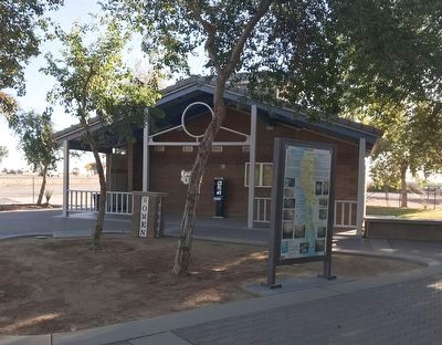
Near Culver Boulevard at Pershing Drive, on the right when traveling west.
The varied habitats of Guashna, which includes the Ballona Wetlands, nurtures the Gabrielino-Tongva people
of the past, present, and future. Discover how this biodiversity contributes to their rich culture and survival.
Ti'at (Plank . . . — — Map (db m216623) HM
Near Roscoe Boulevard, 0.4 miles east of Valley Circle Blvd.
These venerable oak trees were topped by the Franciscan friars to furnish fuel for the nearby lime kilns that provided mortar for the building of the Mission San Fernando Rey de Espana. These fused rocks were taken for their preservation, from the . . . — — Map (db m144163) HM
Near Cary Avenue north of East Opp Street, on the left when traveling north.
Established at Wilmington in 1862, Drum Barracks became the United States military headquarters for Southern California, Arizona, and New Mexico. A garrison and base for supplies, it was a terminus for camel pack trains operated by the army until . . . — — Map (db m85152) HM
On Montrobles Place east of Los Robles Avenue, on the left when traveling east.
This was the site of ‘Los Robles’, the 400 acre estate of Governor George Stoneman. Here in 1880 President Rutherford B. Hayes was entertained. The first schoolhouse in the San Gabriel Valley, California's first tennis club, and the first municipal . . . — — Map (db m127644) HM
On Lang Station Road, 0.2 miles south of Soledad Canyon Road, on the right when traveling south.
On September 5, 1876, Charles Crocker, President of the Southern Pacific Company, drove a gold spike here to complete his company's San Joaquin Valley Line, the first rail connection of Los Angeles with San Francisco and Transcontinental lines. — — Map (db m122365) HM
On June 30, 1864 the United States granted the Yosemite Valley and the Mariposa Big Tree Grove to the State of California to "be held for public use, resort and recreation...inalienable for all time." This act, signed by President Abraham Lincoln, . . . — — Map (db m81941) HM
Near St. Helena Highway (State Highway 29/128) south of Deer Park Road.
Founded in 1861 by Charles Krug (1825 – 1892). This is the oldest operating winery in Napa Valley. The pioneer wine maker of this world famous wine region, Krug made the first commercial wine in Napa County in 1858, at Napa. — — Map (db m18693) HM
Built in 1862 by David J. Wood with lumber from his mill in Sierra County, the covered bridge was part of the Virginia Turnpike Company toll road that served the northern mines and the Nevada Comstock Lode. The associated ranch and resources for . . . — — Map (db m78339) HM
On West Road, 0.5 miles west of Hacienda Road, on the left when traveling west.
Through its progeny, this tree, planted in 1926 by Rudolph Hass, has played an important role in the development of the California avocado industry. — — Map (db m117267) HM
On Squaw Valley Road, 3 miles west of California Route 89.
One thousand competitors from 34 nations came to Squaw Valley to compete in the VIII Olympic Winter Games of 1960. The Games, brought here by Alexander C. Cushing, commemorated a century of sport skiing in America. By 1860 mining towns in the Sierra . . . — — Map (db m23504) HM
Near Johnsville - McCrea Road, on the left when traveling north.
The first sport ski area in the western hemisphere was in the Sierra Nevada. By 1860, races were held in the Plumas-Sierra region. The mining towns of Whiskey Diggings, Poker Flat, Port Wine, Onion Valley, La Porte, Jamison City, and Johnsville . . . — — Map (db m143423) HM
On 10th Street at Capitol Mall, on the right when traveling north on 10th Street.
The historic Capitol was designed by architects M.F. Butler and Reuben Clark. Its style is an adaption of Roman Corinthian architecture. Work began in 1860 and by late 1869 the Capitol was partly occupied. In 1874, construction ended at a cost of . . . — — Map (db m154357) HM
On Front Street at K Street, on the left when traveling north on Front Street. Reported permanently removed.
At this location on January 8, 1863, Governor Stanford surrounded by politicians and locals, announced the start of the United States’ first transcontinental railroad. You are standing at Mile Marker 0, the origin of the Central Pacific Railroad . . . — — Map (db m149177) HM
On Front Street at K Street, on the left when traveling north on Front Street. Reported permanently removed.
You are standing where the First Transcontinental Railroad in America had its western origin, at Front and K Streets in Sacramento.
On January 8, 1863, prominent citizens and railroad founders gathered here for a groundbreaking ceremony to . . . — — Map (db m201267) HM
Near an un-named desert road, 0.5 miles east of Great Overland Stage Route (County Route S2).
This pass, Puerta, between the desert and the cooler valleys to the north, was used by the Mormon Battalion, Kearny's Army of the West, the Butterfield Overland Mail Stages, and emigrants who eventually settled the west. The eroded scar on the left . . . — — Map (db m145313) HM
On Valencia Street at Cesar Chavez, on the right when traveling south on Valencia Street.
Here from 1881-1906 stood the library of Hubert Howe Bancroft who in 1860 began to collect the wealth of material which was to subsequently result in the writing of his monumental history of western North America. In 1905, the library was . . . — — Map (db m162984) HM
Apostle of liberty, humanitarian, Unitarian minister, who in the Civil War bound California to the Union and led her to excel all other states in support of the United States Sanitary Commission, predecessor to the American Red Cross. His statue, . . . — — Map (db m91855) HM
On Kearny Street near Merchant Street, on the right when traveling south.
The third Jenny Lind Theatre was opened by Tom Maquire on October 4, 1851 on the same site as the two preceding it, which were destroyed in the fires of 1851. In 1852 the City of San Francisco purchased this theatre for use as the City Hall. — — Map (db m143439) HM
On Leidesdorff Street at Sacramento Street on Leidesdorff Street.
This is the site of the famous What Cheer House, a unique hotel opened in 1852 by R. B. Woodward and destroyed by the fire of 1906. The What Cheer House catered to men only, permitted no liquor on the premises, and housed San Francisco's first free . . . — — Map (db m33319) HM
Near Montgomery Street near Washington Street, on the left when traveling north.
This, San Francisco’s first fireproof building erected in 1853 by Henry Wager Helleck, was the headquarters for many outstanding lawyers, financiers, writers, actors and artists. James King of William, editor of the Bulletin, died here . . . — — Map (db m143443) HM
On Mission Street at 13th Street, on the right when traveling south on Mission Street.
Woodward's Gardens occupied the block bounded
by Mission, Duboce, Valencia and 14th Streets,
with the main entrance on Mission Street.
R.B. Woodward opened his gardens to the public
in 1866, as an amusement park catering to all
tastes. It was . . . — — Map (db m162992) HM
On Montgomery Street at Columbus Avenue on Montgomery Street.
In a second floor room in a store which stood on this location, forty pioneers of Jewish faith gathered on Yom Kippur (5610) September 26, 1849, and participated in the first Jewish religious services in San Francisco.
State Registered Landmark . . . — — Map (db m40514) HM
On Jackson Street at Montgomery Street on Jackson Street.
William Tecumseh Sherman established the branch bank of Lucas, Turner & Co. in San Francisco in 1853. He settled the firm in their own building on the northeast corner of Jackson and Montgomery Streets in the spring of 1854. Sherman successfully . . . — — Map (db m33402) HM
In August 1863, Archbishop Joseph Sadoc Alemany, O.P. opened St. Mary's College at this location with a faculty of two diocesan priests, four laymen, and two student teachers in August 1868. At the invitation of Archbishop, Brother Justin McMahon . . . — — Map (db m115443) HM
On Jackson Street near Gold Street, on the right when traveling west.
Here on November 29, 1858, was held the celebration in honor of the completion of the Columbia and Stanislaus River Water Company's ditch, which brought water from the north fork of the Stanislaus River to Columbia. James Wood Coffroth, attorney, . . . — — Map (db m25649) HM
Overview of History
California Nursery Historical Park is 20 acres of prime agricultural land. People who inhabited the area included the Muwekma Ohlone, Spanish (Mission San Jose), Mexicans (Rancho Arroyo de la Alameda), and “Californios.” . . . — — Map (db m208723) HM
On State Highway 58 at State Highway 33, on the left when traveling west on State Highway 58.
Located one-eighth mile west of here is an
ancient asphaltum seepage in which hundreds
of Pleistocene Age (15,000-50,000 years ago)
birds, insects, and animals were trapped.
The skeletal remains found in the pit include
giant condors, giant . . . — — Map (db m168958) HM
On Silverado Canyon Road, 1.2 miles east of Santiago Canyon Road, on the right when traveling east.
In 1881, after the Southern Pacific took over the Santa Clara Coal Mine northeast of here, a bustling mining camp complete with hotel, saloons, shacks, store, and post office sprang up on these flats. Three years later the mine played out and . . . — — Map (db m154585) HM
On Blossom Hill Road at Dartmouth Dr. (County Route G-10) on Blossom Hill Road.
On this site in 1852 Charles LeFranc made the first commercial planting of fine European wine grapes in Santa Clara County and founded Almadén Vineyards. LeFranc imported cuttings from vines in the celebrated wine districts of his native France, . . . — — Map (db m2580) HM
On Palos Verdes Drive, South, 0.2 miles east of Sea Cove Drive.
The Palos Verdes Peninsula supports a plant community called coastal bluff scrub that contains elements of coastal sage scrub. Coastal sage scrub communities are composed of soft, witty sub-shrubs. Coastal sage scrub seen at this site is dominated . . . — — Map (db m81923)
Constructed in 1827 by the Mexican government to collect custom duties from foreign shipping, a principal revenue source when Monterey was the capital of Alta California, Mexico's northernmost province. Thomas O. Larkin, US consul to Alta . . . — — Map (db m82186) HM
(This series of 35 (36) plaques, inlayed in the brick walkway, extends from Pacific Street to the Great Seal of the State of California in front of Colton hall, at which point the line of plaques turn left.)
The Ancient Ones . . . — — Map (db m63358) HM
On River Road at Mirabel Road, on the left when traveling west on River Road.
In 1834, Mariano G. Vallejo's brother-in-law, John B.R. Cooper, constructed California's first known power-operated commercial sawmill. In addition to sawing redwood lumber, the mill and settlement served as a barrier to Russian encroachment from . . . — — Map (db m102484) HM
Near East Spain Street west of First Street East, on the right when traveling west.
A surprising amount of California's history has taken place in these few blocks of Sonoma. In the early 1820s, Father Altimira, a Franciscan Missionary, commenced the building of the 21st California mission, utilizing Native American labor. General . . . — — Map (db m231021) HM
The Castro/Breen adobe is associated with the early development and settlement of Mexican California. The adobe is an excellent example of blended eastern and western building methods first produced in Monterey to form the Monterey Colonial . . . — — Map (db m82243) HM
Near Western Pacific Way, 0.2 miles west of Main Street.
The Western Pacific Railway was incorporated in 1903 to build from Salt Lake City, Utah and a connection with the Denver and Rio Grande Railway to Oakland, California. It was part of the Gould family of railroads that stretched from Utah to the . . . — — Map (db m163290) HM
On 4th Street at Lane Street, on the right when traveling south on 4th Street.
The citizens of Siskiyou County and California hereby honor Senator Randolph Collier, the “Father of the Freeway.” Born in Etna, educated in Yreka’s schools, Senator Collier began his long political career as a Police Judge in Yreka in . . . — — Map (db m70185) HM
Near 4a Avenida Norte just south of 4a Avenida Norte and 4a Calle Poniente.
Presentada por La Sociedad Aguacatera De California
en el 1946
En reconocimiento y aprecio por la gran contribución
de Antigua y toda Guatemala por el desarrollo de la
industria de aguacates en California.
Un jóven saludable, . . . — — Map (db m71194) HM
Lieut. James Barrett – Co. A.
Private George Johnson – Co. A.
Private William S. Leonard - Co. D
1st California Cavalry Volunteers
killed April 15, 1862 at Picacho Pass.
In only battle of the Civil War
fought in Arizona . . . — — Map (db m73897) HM WM
On Ave 64E near Interstate 8, on the left when traveling south.
Camps Hyder & Horn were established 10 miles north of Dateland in the fall of 1943. They were 2 of 15 desert camps built to harden and train United States Troops for service in World War II. The Desert Training Center was a simulated theater of . . . — — Map (db m78546) HM
Near Rogers Avenue east of 6th Street (Arkansas Highway 255), on the right when traveling east.
The emigrant train of Forty-Niners, 5,000 strong, set out from Fort Smith in April, 1849, with an escort of United States [Army] Regulars under the command of Captain R. B. Marcy. — — Map (db m92353) HM
Gilman Hall was built in 1916-17 to accommodate an expanded College of Chemistry under the leadership of Gilbert Newton Lewis. This building provided research laboratories and teaching facilities for faculty and students specializing in physical, . . . — — Map (db m15870) HM
On Oxford Street at Allston Way, on the right when traveling north on Oxford Street.
From 1885 to the end of his life his home stood about fifty yards east of this spot
"He who is a blessing for his time is a blessing for all time" — — Map (db m174416) HM
On Iron Horse Parkway near Martinelli Way, on the right when traveling east.
During World War II 3,396 acres were purchased for the largest naval installation in the U.S. Three navy bases sat adjacent to each other in an area known as Fleet City. Camp Parks located along Dougherty Road, The U.S. Naval Hospital among . . . — — Map (db m94022) HM
Near Horton Street near 59th Street, on the left when traveling north.
A 3 foot narrow gauge railroad starting on land owned by Joseph E. Emery, later president and founder of the City of Emeryville.
The line started at 40th and San Pablo, extended through Berkeley and up San Pablo Creek to Bryant (Orinda) 23 . . . — — Map (db m72398) HM
The primary purpose of the California Nursery Historical Park Master Plan is to tell the story of the California Nursery Company to current and future generations through the sharing of the site’s remaining historic buildings, majestic . . . — — Map (db m208557) HM
One warm summer morning some four score years ago a young Spaniard
and his señora rode into Señor Castro's old hacienda, situated near the present
Pinedale Court tract in Hayward; and as many travelers asked for food and
lodging here, it was . . . — — Map (db m152981) HM
On Boston Road near Hampton Road, on the left when traveling north.
Built in 1869 by William Meek, a pioneer of commercial agriculture, the mansion is characteristic of the affluent agricultural society of the Victorian era in California.
The estate is on the site of the former Rancho San Lorenzo. This area . . . — — Map (db m149204) HM
“May God continue the unity of our country as this railroad unites the two great oceans of the world.” The gold spike ceremony at Promontory, Utah in May of 1869 united the tracks of the Central Pacific and Union Pacific Railroads. . . . — — Map (db m143737) HM
On Franklin Street at 14th Street, on the right when traveling north on Franklin Street.
University of California, chartered March 23, 1868. Located between Franklin and Harrison, 12th and 14th Streets, from 1869 to 1873, using buildings of former College of California, successor to Contra Costa Academy founded by Henry Durant, June . . . — — Map (db m100544) HM
On Calcot Place, on the left when traveling north.
The California Cotton Mill was one of Oakland’s earliest and largest industries.
Jingletown was named for the mill workers’ habit of jingling coins in their pockets on payday.
At its height, the mill had 600 to 700 employees and 20 to 30 . . . — — Map (db m71211) HM
On Harrison Street at 3rd Street, on the right when traveling north on Harrison Street.
Designer: H.C. Baumann
Construction Date: 1929
Architectural Style: Early 20th century utilitarian with Art Deco elements
1926 was a profitable year for the Poultry Producers. Pooled resources created “orderly marketing” to . . . — — Map (db m228121) HM
In 1848, Mexican Settlers from Sonora, Mexico established a camp on the north back of the Mokelumne River and called it Sonora Bar. At the start of the California Gold Rush miners flocked to the Mokelumne River and set up camps and towns along its . . . — — Map (db m126094) HM
Near State Highway 49, on the right when traveling south.
The Foothill Station became the first University of California qualifying outlying station funded jointly by federal, state and local county sources in March 1888. The station was developed under the patronage of Senator A. Caminetti of Jackson. . . . — — Map (db m72065) HM
On Humboldt Road at Butte Creek Flat (Summit) Road on Humboldt Road.
On this site the remains of Katie Thompson, Mattie Thompson, and Josie Campbell were laid to rest. The children, were the grandchildren of Joseph Campbell, and all died of Scarlett Fever in 1877. Joseph Campbell was a prominent pioneer in this area . . . — — Map (db m61767) HM
On Myers Street (Business California Route 70) at Kitrick Avenue, on the right when traveling south on Myers Street.
To Commemorate completion of 4th Railroad in California – Marysville to Oroville, by California Northern Railroad, later the Southern Pacific Co. 1st passenger train February 9 – 1864. Also marks site of Middletown 1854 – 1856. — — Map (db m190381) HM
Imported from Mazatlan, Mexico, the Mother Orange Tree was purchased on the streets of Sacramento when it was only a 2 to 3 year-old seedling in a tub. She was planted in 1856 and quickly grew into a California legend. The leafy greens of her robust . . . — — Map (db m62787) HM
Near South Main Street/Golden Chain Highway (State Highway 49), on the right when traveling north.
Hydraulic Mining was the largest and most destructive form of mining. Water, brought through flumes and ditches from high up in the mountains, was redirected into an ever-narrowing channel and out through a giant iron nozzle, called a . . . — — Map (db m56649) HM
Near Big Trees Parkway near Ebbetts Pass Scenic Byway (California Highway 4).
In the spring of 1852, Augustus T. Dowd, while hunting, discovered a grove of truly immense trees, now known as the Calaveras North Grove. Several stockholders of the Union Water Company (who employed Augustus as a hunter) developed a plan to . . . — — Map (db m34120) HM
[Left Column]
Mr. and Mrs. Calhoun
Elva Lucy Drennan
Mr. Hussky
[Right Column]
John Laplasse
Christian Kientz
Henry Christian Kientz
---Were known to have been buried at Poverty Bar Cemetery now covered by . . . — — Map (db m13020) HM
Near San Pablo Avenue, 0.1 miles west of Merchant Street.
Alfred 'Al' Zampa was the first born son of Emilio and Maria Zampa, Italian immigrants who migrated to the USA from Abruzzi, Italy. Al was born on March 12, 1905 in Selby, California down river from where this plaque sits. He was the eldest of three . . . — — Map (db m91658) HM
Here, following the base of San Pablo Ridge, ran the tracks of the California & Nevada Railroad. Incorporated in 1881, its founders had grand plans to run from Emeryville to Nevada. The line never got farther than Orinda. Until ending service in . . . — — Map (db m94300) HM
These eucalyptus trees mark the route of the narrow gauge California and Nevada railroad chartered in 1884 to connect California to the Nevada mines.
Only 23 miles of track were completed by 1891 from Emeryville to Bryant now Orinda. In addition . . . — — Map (db m133653) HM
In 1919, Colonel Robert Bradford Marshall
of the United States Geological Survey
proposed an unprecedented project
of dams, canals, and pumps to
move Delta-bound water from
California's wet north and snowy
Sierra Nevada mountains to its
arid . . . — — Map (db m190979) HM
Just east of this monument is the last
remaining original post from the C&N
Railroad trestle structure. The C&N
was incorporated on March 25, 1884.
J.S. Emery was listed as the railroad's
president, for which present day
Emeryville is named. . . . — — Map (db m144979) HM
On Railroad Avenue near East 3rd Street, on the right when traveling north.
Since opening its doors on May 4, 1920, this theatre has been a cornerstone to the New York Landing Historic District in Old Town Pittsburg. Like many Bay Area theaters of the 1920's, the California Theatre was designed by A.W. Cornelius in a . . . — — Map (db m146532) HM
On Civic Drive near North California Boulevard, on the left when traveling east.
Electric rail service came to Walnut Creek in 1911. The railway (later called Sacramento Northern) provided passengers and freight service from Sacramento through Walnut Creek and on to Oakland and the San Ramon Valley. The tracks run along today's . . . — — Map (db m93754) HM
Near Trinity Avenue near Oakland Boulevard, on the right when traveling west.
Oldest church building
in Walnut Creek Originally
located on Locust Street
Erected 1888 -1889
Consecrated, April 26, 1891
by
Bishop William Ford Nichols — — Map (db m93978) HM
Near Coloma Road (California Route 49) north of Mt Murphy Road.
Soon after miners discovered gold in underground quartz veins, mills were brought in to process ore. Dating back to at least the 1500’s, the mills used heavy iron pounders called stamps to crush the rock. Each mill had a series of stamps equipped . . . — — Map (db m215022) HM
Near Coloma Road (California Route 49) north of Mt Murphy Road.
If you had stood on this spot in 1769, 1823, and 1848, you would have been in three different countries! Each time California switched hands, life changed for its people.
Spanish Province
“California” was a Spanish province in 1769. For the . . . — — Map (db m214606) HM
On PG&E-Clarksville Sub-Station Road, on the right when traveling west.
At this site on the old Clarksville-White Rock Emigrant Road was Mormon Tavern. Constructed in 1849, this popular stage stop was enlarged and operated by Franklin Winchell in 1851. It became a remount station of the Central Overland Pony Express and . . . — — Map (db m12056) HM
On State Highway 49, on the left when traveling north.
Original Marker - Missing
First Replacement Marker - See Photo #2
Pilot Hill Grange No.1, of 29 charter members: Master, F. D. Brown; Secretary, A. J. Bayley; was organized August 10, 1870. The Grange Hall, dedicated at this site . . . — — Map (db m11607) HM
On Pony Express Trail (Lincoln Highway) at Forebay Road, on the right when traveling east on Pony Express Trail (Lincoln Highway).
The California gold rush followed Captain John Sutter’s logging effort in the Coloma valley. On January 24, 1848, James W. Marshall found gold in the tail-race at Sutter’s Mill. This discovery incited the greatest migration of mankind in history to . . . — — Map (db m94635) HM
On West Pelco Way at West Pontiac Way on West Pelco Way.
In Memory of the victims of September 11, 2001 and in honor of our fallen heroes
America's bravest - New York City Firefighters
Port Authority of NY and NY Police Officers
America's Finest - New York City Police Officers
The Passengers . . . — — Map (db m114526) WM
Historical landmark
commemorating
Fresno Technical School,
constructed 1895.
Known as the Fresno High School
from 1895 - 1921.
Established as the First Junior College
of California, 1910.
Normal School - forerunner to
Fresno . . . — — Map (db m241689) HM
On State Highway 99W at Jacqueline Drive on State Highway 99W.
The first house in Glenn County, built about 1848 by Granville P. Swift, a member of the Bear Flag Party, who came to California from Oregon in 1844. The site is 150 yards east on the banks of Hambright Creek. The house was built of clay by . . . — — Map (db m143522) HM
This site, originally R.A. Simpson's Ferndale Mechanical Shop, and shared by A. Monroe Cider and Vinegar Company, was chosen in 1904 by Aage Jensen as the founding location of the Central Creamery with first production of butter in September, . . . — — Map (db m65235) HM
On Front Street east of Sherman Avenue, on the right when traveling west.
California's first drilled oil wells producing crude to be refined and sold commercially were located on the north fork of the Mattole River approximately three miles east of here. The old Union Mattole Oil Company made its first shipment of oil . . . — — Map (db m51955) HM
Near Center of The World Plaza, 0.1 miles north of Frontage Road, on the left when traveling north.
A 1533 expedition sent by Hernan Cortes discovered Baja California,
leading to the name "California" and the belief that it was the famed
Island of California which then appeared on maps of the era.
Exploration and Cartography
. . . — — Map (db m165827) HM
On China Grade Loop, on the right when traveling south.
Gordon’s Ferry was an overhead cable type of ferry operated during the 1850’s by Major Gordon. An adobe station house was located on the south bank of Kern River, just a few yards to the west of this marker. It was also a station on the Butterfield . . . — — Map (db m25149) HM
On Kern Canyon Road (State Highway 178), on the left when traveling east.
One mile north of here on May 1, 1776, Francisco Garces of the Franciscan Order, crossed Kern River in his search for a shorter route from Sonora, Mexico to Monterey, California. He was the first known explorer to describe this river, which he . . . — — Map (db m24984) HM
On Buttonwillow Drive, 0.5 miles north of California Highway 58, on the left when traveling north.
A lone tree landmark on an old trans-valley trail. It was an ancient Yokuts Indian meeting place, later a location for white stock rodeos. Miller and Lux established their headquarters and store here about 1885. The town of Buttonwillow takes its . . . — — Map (db m50251) HM
Near Station Road, 0.2 miles west of Morris Road, on the left when traveling west.
Back From the Brink of Extinction
Half a million tule elk once roamed
the marshes and grasslands of
California. The Gold Rush began an
era of commercial hunting and
agricultural practices that decimated
the elk and their . . . — — Map (db m184928) HM
Near Randsburg Mojave Road near 20 Mule Team Parkway, on the right when traveling east.
Dedicated to all American war veterans
who have made the supreme sacrifice.
American Legion Post No. 476,
California City, California - 1979.
"Lest we forget" — — Map (db m243245) WM
6347 entries matched your criteria. The first 100 are listed above. Next 100 ⊳
* Inflectional forms of words are their plurals, singulars, and possessives as well as gramatical tenses and similar variations.