Gold deposits at Havilah were discovered in 1864. Havilah was the county seat between 1866, when Kern County was organized, and 1872, when the government was moved to Bakersfield. Havilah was an active mining center for more than 20 years, and . . . — — Map (db m51821) HM
Kernville called Whiskey Flat until 1864, was founded in 1860 when Adam Hamilton, whiskey dealer, moved shop here from more temperate Quartzburg, founded earlier that year. Both camps resulted from the discovery of the Big Blue Ledge by “Lovely” . . . — — Map (db m25169) HM
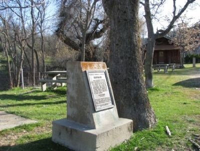
From 1853 until 1870 Keyesville was a center of both placer and quartz gold mining. On the knoll just below the townsite may still be seen the outlines of an earth-work fort, built to meet a possible Indian attack in 1863. The original Keys Mine is . . . — — Map (db m143331) HM
America's most spectacular gusher blew in here on March 14, 1910. Initially 18,000 barrels per day, the flow later reached an uncontrolled peak of 100,000 barrels per day, completely destroying the derrick. This Union Oil Company well produced nine . . . — — Map (db m54267) HM
Eight miles due west of this marker stood one of California's first commercial oil refineries. Between August 1864 and April 1867, approximately 4,000 gallons of illuminating oil produced there was shipped to San Francisco by the Buena Vista . . . — — Map (db m78295) HM
In 1772, Don Pedro Fages, first recorded non-Indian to visit the southern San Joaquin Valley, crossed this spot on his way from San Diego to San Luis Obispo. Near this point crossed Father José María de Zalvidea in 1806, while accompanying the Ruiz . . . — — Map (db m54266) HM
In dedication to the pilots, air crews and personnel of Mojave, who trained, served and gave their lives in the service of this country, especially to those who valiantly fought for freedom in the great battles of World War II and Korea.
Semper . . . — — Map (db m53280) HM
Gold was discovered on the slope of Rand Mountain in 1895. From this discovery, the town of Randsburg sprang up almost overnight. By 1899, the town had over 3500 residents. Randsburg boasted a 100-stamp mill and conservative estimates are that . . . — — Map (db m78578) HM
Visited by Padre Garces (1776) while following Old Horse Thief Trace later known as Joe Walker Trail. Fremont stopped here (1844). The famished Jayhawk Party (1850) found water here while struggling from Death Valley to Los Angeles. Still later was . . . — — Map (db m156684) HM
Willow Springs was a stage station on the Los Angeles-Havilah Stage Lines, 1864-1874. From here light traffic went through Oak Creek Pass via Tehachapi to Havilah and Kernville; heavy traffic went northwest to the Inyo mines, or via Jawbone Canyon . . . — — Map (db m156685) HM
1906-1914: City of Los Angeles builds and operates plant to make cement for Los Angeles Aqueduct and also constructs town named Aqueduct to house workers and families.
1910: Aqueduct train station and post office are renamed Monolith. . . . — — Map (db m52988) HM
Father Francisco Garces used the Oak Creek Pass in 1776 to return to the Mojave after exploring the San Joaquin Valley, as did Fremont in 1844-45. Until the building of the railroad through the Tehachapi Pass in 1876, Oak Creek Pass was the only . . . — — Map (db m50250) HM
In 1933 California’s first women’s prison was established in Tehachapi to provide an environment more conductive to rehabilitation than San Quentin State Prison. Two-story buildings were constructed of reinforced concrete in the French Normandy . . . — — Map (db m134503) HM
“In Camponit Peter Lassen and his party had been waiting for the winter to be over. Instead of crossing the mountain ranges on their way south, he and six other persons decided to go by ship from Fort Vancouver. A small steamship, . . . — — Map (db m31740) HM
This is the oldest existing McDonald's hamburger stand in the world. Its neon arches and red and white tile have become an icon of the California car culture of the 1950s. The towering neon chef, "Speedee," was McDonald's first mascot and . . . — — Map (db m51959) HM
In front of you in the hills, high above freeway Interstate 5, is a portion of the historic 1915 two-lane “Ridge Route”. The power lines follow it.
The original Ridge Route was constructed in 1914-1915 by pick, shovel and mule drawn Fresno . . . — — Map (db m152085) HM
Henry L. Kuns was son
of David Kuns, one of four
men who established
Lordsburg College. Henry
Kuns was a rancher, realtor,
banker, and first mayor of
Lordsburg. He founded an
orphanage named for his
parents, David and Margaret,
and created . . . — — Map (db m190950) HM
This Craftsman home, built
in 1912 by Mace and Adele
Doutt, was purchased in 1918
by Isaac Eikenberry and
remained in the Eikenberry
family until 1974, a total of
56 years. The large bur oak
tree grew from an acorn
which Eikenberry . . . — — Map (db m190938) HM
This residence was built at the
same time as Henry L. Kuns’
home at the north end of the
block. James M. Johnson was
married to Kuns' daughter,
Ora Lamb Kuns.
Johnson
owned the Lordsburg Garage
& Machine Shop.
He also
maintained streets . . . — — Map (db m190953) HM
In the 1940s Jane S. Pinheiro, a local resident and self-taught wildflower artist, became concerned that rapid growth in the Antelope Valley was
endangering wildflower fields. Jane's dream was to have a "Poppy Park" to protect the official . . . — — Map (db m189239) HM
Commemorating the 100th anniversary of the founding in the Plaza area of the first gas service in Southern California June 28, 1867. — — Map (db m162929) HM
The Founders of the City of Los Angeles Lara · Mesa · Moreno · Rosas · Camero · Rosas · Navarro · Villavicencio · Rodriguez · Quintero · Vanegas
In 1542, Captain Juan Rodríguez Cabrillo “discovered” California while . . . — — Map (db m162879) HM
This plaque and garden are dedicated to the memory of the first peoples who lived in what is now the County of Los Angeles. Some of the earliest Indians were members of the Uto Aztecan linguistic family or were descended from the Shoshone Tribe. . . . — — Map (db m54552) HM
On this site of Birmingham Hospital,
1943-1950, Veterans returning from
World War II were given renewed
confidence and hope by the dedicated
personnel who cared for them. Their legacy of pride and courage
remains here as an incentive for
all . . . — — Map (db m192055) HM
Originally planted in 1959 with California natives, the 1.5-acre
garden and greenhouse complex is now a collection of some 1,200
plant species representing many regions and climates from around
the world. In addition to exotic plants, it contains . . . — — Map (db m220283) HM
Built in 2009, Chaparral Hall is named after the most dominant
natural vegetation type in Southern California, and is home to the
Biology Department in the College of Science and Mathematics.
Chaparral Hall's 13 "smart" lecture rooms can seat a . . . — — Map (db m220300) HM
On this site the flag of our country
was raised on September 24, 1956, signaling the
beginning of classes for the Valley campus
of Los Angeles State College, which became
San Fernando Valley State College July 1, 1958,
and California State . . . — — Map (db m208634) HM
The grove's more than 400 orange trees serve as one of the
last vestiges of the San Fernando Valley's agricultural history.
Harvested fruit is regularly donated to local food banks.
The grove has been transformed into a welcoming retreat
with . . . — — Map (db m208641) HM
The 166,000 sq. ft. state-of-the-art performing arts center opened
in 2011 and features an acoustically tunable 1,700 seat
performance hall, 180 seat flexible theatre, and academic lab and
lecture spaces. The building incorporates reflective . . . — — Map (db m220284) HM
Because a superior faculty is at the heart of
any university's stature, USC has long been
committed to attracting the best and the
brightest men and women to teach its students. During
its early years, the university's growing . . . — — Map (db m234141) HM
Command Post For Southern California's Car Culture
The headquarters of the Automobile Club of Southern California has sometimes been mistaken for the ornate Roman Catholic St. Vincent de Paul church. The two, along with the imposing . . . — — Map (db m208552) HM
Black Americans In The Golden State
Africans have had a presence and stake in California since before there was a California. Some 300 Africans accompanied the Spanish conquistador Hernan Cortes to the New World in 1519. And more than two . . . — — Map (db m216966) HM
From Owl to Eagle
Starting in 1827, African American-owned
newspapers began popping up throughout the
United States, giving a voice to people who had
been largely voiceless. From the late 1800s until
1964, the California
Eagle . . . — — Map (db m229278) HM
From Inner Spaces To Outer Space
The nation was celebrating
the tenth anniversary of the
Wright Brothers' powered
flight when the State Exposition Building first opened
in Exposition Park in 1913 — a place that
would become an . . . — — Map (db m233940) HM
When USC was founded in 1880, there were few avenues open to ambitious young Angelenos, who sought training in the different professions. Aspiring physicians were forced to leave the region to attend medical school in other cities, and future . . . — — Map (db m234144) HM
Douglas Fairbanks founded the USC Cinema program when president of the Academy of Motion Picture Arts and Sciences, 1929.
The Academy of Motion Picture Arts & Sciences Courtyard. — — Map (db m229400) HM
When Orro Childs, John G. Downey and
Isaias Hellman deeded 308 lots to the trustees of the
University of Southern California in 1879, they were
not only providing a new campus and a source of
funding for the new institution; they were laying . . . — — Map (db m235269) HM
Established here July 29, 1879, to the Glory of GOD and to the Preservation of the Republic.
An institution of higher learning dedicated to the search for and the dissemination of the truth to freedom of thought and discussion. To intelligent, . . . — — Map (db m130534) HM
Allan Hancock Foundation,
the University of Southern California, 1940.
Rufus B. Von KleinSmid, president of the university.
Allan Hancock, director of the foundation.
Building committee: Frank F. Barham, Henry W. Bruce, Addison B. Day, Elizabeth . . . — — Map (db m229921) HM
Physical Education Building,
University of Southern California,
erected 1930.
Rufus B. Von Kleinsmid,
president of the university.
William Ralph La Porte,
director of the Division of Physical Education.
Building committee:
Charles E. . . . — — Map (db m230110) HM
No event in track and field is more challenging, physically or mentally, than the decathlon.
1955 · UCLA freshman Rafer won the Pan American Games decathlon in Mexico City.
1954-58 · He competed under UCLA coaches Craig Dixon and . . . — — Map (db m238101) HM
Dedicated on September 4, 1880, this original building of the University of Southern California has been continuously in use for educational purposes since its doors were first opened to students on October 6, 1880, by the university's first . . . — — Map (db m126924) HM
The First Trojan—Before There Was A University Amid the ivy-covered brick buildings and towering palm trees of the University of Southern California, there survives a two-story white clapboard
building, a relic and a link not only to the . . . — — Map (db m128578) HM
Trojan Cardinal And Olympic Gold
Among the scholars who have passed
through the University of Southern California have been thousands of star athletes:
All-American football players, Hall of Fame
standouts, a future Oscar winning . . . — — Map (db m238532) HM
Early Life
As a young man, Theodore Payne (1872-1963) immigrated to Southern California from England to pursue a career in horticulture. He fell in love with the local flora, especially our wild flowers, which were threatened by . . . — — Map (db m118536) HM
The 72 foot mural depicts life in early California with scenes of Native Americans, Francisan Padres and Senoritas. It was painted over a period of three months. Images projected against the wall at night provided the basic outline necessary to . . . — — Map (db m67295) HM
This building, built in 1951, was purchased by Ramona Parlor No.109
Native Sons of the Golden West in 1998 and renovated as a meeting
hall and a place to display their early California artifacts in their efforts to preserve the “Spirit of . . . — — Map (db m124459) HM
'California' is believed to be the oldest camellia plant on record in Southern California. It arrived in 1888 as an unnamed seedling and was purchased for 25 cents off a Japanese tramp steamer in Redondo Beach harbor. For nearly 70 years the plant, . . . — — Map (db m124471) HM
California's first oil refinery operated on a commercial scale, erected 1876. Restored by the Standard Oil Company of California in 1930 as a memorial to D. G. Scofield and his pioneer associates of the California Star Oil Works company, a . . . — — Map (db m165742) HM
On this site stands CSO-4 (Pico #4), California's first commerically productive well. It was spudded in early 1876, under the direction of Demetrius G. Scofield, later to become first president of Standard Oil Company of California, and was . . . — — Map (db m157684) HM
The mill was constructed in the 1830's by John Reed and was one of the first saw mills in Northern California.
The mill site was utilized in May 1890 to conduct a public land auction of land parcels that signaled the founding of the City of Mill . . . — — Map (db m143523) HM
The Novato Bank (828 Grant Avenue) was built in 1913 by property owner, Frank Silva. The bank served ranchers, merchants, home builders, and the Novato area.
The adjoining section of the building (826 Grant Avenue)first served as a drugstore when . . . — — Map (db m102561) HM
In honor of the sesquincentennial of the Mariposa County Courthouse and recognition of its continuous use since 1855.
In June 1857 Biddle Boggs vs. Merced Mining Company made legal mining history and the 1861 cases of Moore vs. Smaw and Fremont . . . — — Map (db m46739) HM
The California State Geological Society started collecting mineral specimens in 1865. In 1880, the California State Mining Bureau was founded. This plaque is dedicated to the miners and founders for their foresight. Todays collection displays . . . — — Map (db m46845) HM
This mining town became the seat of justice of Mariposa County when on February 18,1850, the State Legislature divided the state into 27 counties. Mariposa County the comprised one-fifth of the entire state and included what are Mariposa, Tulare, . . . — — Map (db m46411) HM
Confusion Hill was officially listed by the California Office of Historic Preservation as a State Point of Historical Interest 1/29/10
Confusion Hill was opened in 1949 by George Hudson. It consisted of a Gift
Shop, Snack Bar . . . — — Map (db m120663) HM
To the 2,495 men from California who during the Korean War, 25 June 1950 to 27 July 1953, gave their last measure of valor to their country. On this wall are men killed in action, mission in action, or who died prisoners of war. May this memorial . . . — — Map (db m213834) WM
The first building erected in Deep Creek settlement, now Cedarville, was built in 1865 as a trading post by James Townsend, who was killed in an indian fight it 1866.
Purchased by William T. Cressler and John H. Bonner in 1867, the building . . . — — Map (db m10245) HM
This trail was blazed by Peter Burnett in 1848 from Oregon City, Oregon Territory to the California gold fields. The route followed the Applegate Trail south and eastward to Tule Lake. It then struck southward probably following an earlier trail . . . — — Map (db m147839) HM
In October of 1863, rich silver discoveries led to the formation of Montgomery Mining District and Montgomery City which, although short lived, supported a newspaper, The Pioneer. There were no continuous veins found and mining operations . . . — — Map (db m3492) HM
Honoring
Four Early Americans in California
They came to this coast as seamen and remained as settlers
Baptized in this Mission
George Mayo, of Plymouth, Mass., on 3 August, 1816
Thomas W. Doak, of Boston, Mass., on 22 November, 1816 . . . — — Map (db m63684) HM
Junípero Serra
Serra played a decisive role in the European settlement of the New World. He was born Miquel José Serra in Petra on the Mediterranean island of Mallorca on November 24, 1713. Though not an assuming figure and plagued by ill . . . — — Map (db m143467) HM
First Marriage in California took place at this Mission between Juan Maria Ruiz of El Fuerte, Sonora, Mexico, 25 years of age, and Margarita de Cortona, 22, a Salinan woman of Mission San Antonio, on the sixteenth of May in the year of Our Lord 1773 — — Map (db m51561) HM
Forty-eight men of diverse education and cultural backgrounds from throughout California converged upon Monterey in September in 1849 to frame a constitutional government for California. Working together as Californians, they created this . . . — — Map (db m63348) HM
California's First Theatre.
Monterey State Historic Park,
a California State Park.
For more information, go to our website: www.parks.ca.gov/mshp — — Map (db m239972) HM
From 1901 to 1941, much of the eastern portion of Cannery Row’s coastline was occupied by a single estate, Casa de Las Olas, which stretched 1,000 feet along Monterey Bay (top). San Francisco financier Hugh Tevis had it built in 1901 as a wedding . . . — — Map (db m55212) HM
The Great Seal of the State of California
designed by
Major Robert Selden Garnett,
U.S. Army,
and adopted by the Constitutional
Convention of 1849 at Monterey.
Commissioned a Brigadier General
in the Confederate States Army
He . . . — — Map (db m33659) HM
In 1870, the year in which the Groezinger Winery (now Vintage 1870) was built, these flags: the California Bear flag (note how much more primitive in design it is in contrast with the present day version) and the American flag (then with 37 stars) . . . — — Map (db m103540) HM
On Oct. 25, 1882, the Veterans Home of California Association purchased 910 Acres in
Yountville for $17,750. On this site the first
building was erected.
Opened April 1, 1884 for Civil and Mexican
War veterans. By July 1, 1889, the Home . . . — — Map (db m144263) HM
Established in 1884 by Mexican War Veterans and members of the Grand Army of the Republic who recognized the need for a home for California’s aged and disabled veterans. In January 1897 the Veterans Home Association deeded the home and its 910 acres . . . — — Map (db m18743) HM
Downhill ski racing history in the Western Hemisphere first began in California circa 1857, and in this famous Donner Pass of the Sierra Nevada the Auburn Ski Club presents a full exhibition of pioneered manpower transportation and skisport history . . . — — Map (db m60888) HM
The Most Beautiful Drive in America California's fabled road begins here in Dana Point and winds north along the scenic California coast linking waterside destinations, secluded stretches, and California's biggest cities. The road ends near . . . — — Map (db m183015) HM
In January 1857, a group of outlaws were terrorizing the citizens of
San Juan Capistrano committing robbery and murder. Los Angeles
County Sheriff James R. Barton formed a posse of five men and rode south.
On January 23, 1857, near this mound, a . . . — — Map (db m244100) HM
In 1769 Gasper de Portolá led a group of Spanish soldiers on a thousand-mile march from Baja California to San Francisco. His purpose was to locate the ports of San Diego and Monterey and to establish a series of churches and military posts. The . . . — — Map (db m188706) HM
The eloquent artwork, Spirit, creates a landmark corner for the 38-acre Mission Hospital campus as well as the City of Mission Viejo. Grand, curved arches in soft brown, oxidized steel act as a frame for the artwork with clear reflection . . . — — Map (db m196038)
The Santa Ana Mountains, which encompass the canyons of Silverado, Modjeska and Trabuco, provided one of the last refuges for the state symbol, the Grizzly Bear.
At the turn of the century, beekeeping was an important local industry, providing . . . — — Map (db m78516) HM
Richard M. Nixon, the only native Californian elected to the Presidency of the United States of America, strongly believed in serving his community. His membership in the Native Sons of the Golden West reflected a lifelong devotion to public . . . — — Map (db m170611) HM
This building first constructed in 1852, opened on September 22, 1855 as the first Placer County Hospital. In 1890 the building was badly damaged by fire. At the time, the upstairs was the residence and gallery of photographer J.M. Jacobs and the . . . — — Map (db m93966) HM
CCT 24 was originally built for the famous Santa Fe Railway as part of its first order of all steel cabooses. Built in St. Charles, Missouri by American Car and Foundry, the 24 was part of the same class of cars as ATSF 999197, another caboose that . . . — — Map (db m163302) HM
This unit, affectionately called a "covered wagon" was purchased to power Western Pacific's California Zephyr less than one year after the train began on March 20, 1949. This cab unit, typically joined by two cabless "B" units, hauled the train . . . — — Map (db m163295) HM
Training troops in desert warfare in preparation for Operation "Torch." The invasion of German held North Africa. The world's largest military installation, training 60 divisions and more than one million soldiers. — — Map (db m99284) HM
This monument is dedicated to the men and women of the United States Army who were trained here at the Desert Training Center during World War II. — — Map (db m78559) HM
The D.T.C was established by Major General George S. Patton Jr. in response to a need to train American combat troops for battle in North Africa during World War II. The camp, which began operation in 1942 covered 18,000 square miles. It was the . . . — — Map (db m50700) HM
The Hoxie-Vance cabin is officially
listed as a Prairie style resort cabin
of u-shaped configuration and a
hipped roof, constructed in 1923 for
Charles A. Vance and Wyckoff Hoxie
of Tustin, California. This is an
excellent example of . . . — — Map (db m232827) HM
On January 1, 1776, the first party of colonists to come overland to the Pacific Coast crossed the Santa Ana River south of this marker and camped between here and the river. Recruited in the presidios of Sonora, Mexico, and led by Lt. Col. Juan . . . — — Map (db m50995) HM
To Commemorate the introduction of the first Marsh Grapefruit Trees into California, brought to Riverside from Lakeland, Florida in 1890 by Twogood and Cutter, pioneer nurserymen, and to honor J.E. Cutter who planted here one of those first trees. — — Map (db m82144) HM
In 1908 Elk Grove acquired through the efforts of Miss Harriet G. Eddy, then principal of Elk Grove Union High School, the first county free library branch in California. Subsequently, California's county free library branch system has become one of . . . — — Map (db m11868) HM
Completion of the Sacramento Valley Railroad from Sacramento to Folsom was completed here February 22, 1856, by enthusiastic residents of both cities. The new line, 22 miles in length was commenced February 12, 1855, and was built by Theodore . . . — — Map (db m15613) HM
Natomas Company activities started in this area in 1857 with the acquisition of 9,000 acres from the Joseph L. Folsom estate.
Early partners engaged in water, granite quarrying, agriculture, vineyards, gold mining, hydro-electric power and . . . — — Map (db m705) HM
George Hack settled in the Sacramento River delta in 1855, seven years before the town of Freeport was established, and was a true pioneer farmer of the area. Hack operated a small dairy and grew a variety of crops on his ranch. His apricots, once . . . — — Map (db m91789) HM
Researched by Martha Esch, copyright 2016. '17 Citations verified by J'aime Rubio
For hundreds of years when the Sacramento Delta was a swamp, nearly the size of Rhode Island, Native Americans inhabited this area. Burial mounds of the . . . — — Map (db m151239) HM
In memory of the American Servicemen of Hispanic descent and all others who sacrificed their lives to protect the freedoms we enjoy. — — Map (db m15474) HM
History When Spanish governors ruled the California territory, its capital was moved from town to town between San Diego and Monterey. San Jose had already been designated the capital by the time California was granted statehood in 1850. In . . . — — Map (db m137646) HM
HISTORY
When Spanish governors ruled the California territory, its capitol was moved from town to town between San Diego and Monterey.
San Jose had already been designated the capitol by the time California was granted statehood in 1850. . . . — — Map (db m15017) HM
Dedication The people of the State of California dedicate this Monument to the memory of those Californians who died, or remain
missing, in the Vietnam War 1959-1975 and in doing so, Honor all the men and women who served during that war. . . . — — Map (db m137482) WM
6347 entries matched your criteria. Entries 101 through 200 are listed above. ⊲ Previous 100 — Next 100 ⊳
* Inflectional forms of words are their plurals, singulars, and possessives as well as gramatical tenses and similar variations.