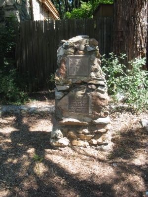
Near this spot the “E.C.V. Saloon” stood in 1853. Believed to be the only E. Clampus Vitus (miners’ fun fraternal order) saloon officially recorded. — — Map (db m32875) HM
Following the incorporation of E Clampus Vitus in 1940, the corporate officers met in different cities and towns, did not meet annually, and first met in Sonora in 1947. By
1962, the Grand Council and Board of Proctors had been created and these . . . — — Map (db m272748) HM
Want it known that in the State of Nevada....
This site is dedicated not for it’s historical significance, but for the significance of the genuine gold diggers of Western history… the working girls who made a man forget the back . . . — — Map (db m90814) HM
During the Gold Rush Days of California the organization known as E Clampus Vitas flourished throughout the gold diggings. It was sort of a parody of the solemn and mysterious fraternal orders then so popular in the states. Every member held an . . . — — Map (db m115597) HM
On this site the remains of Katie Thompson, Mattie Thompson, and Josie Campbell were laid to rest. The children, were the grandchildren of Joseph Campbell, and all died of Scarlett Fever in 1877. Joseph Campbell was a prominent pioneer in this area . . . — — Map (db m61767) HM
In 1863 Jacob Snively, founder of Gila City, and right hand to Sam Houston, avenger of the Alamo, following blazes left on the saguaros by Mexican and Conquistador predecessors, came to Castle Dome, and within 15 years, Castle Dome City’s population . . . — — Map (db m48924) HM
William Gordon Huff
1903 ~ 1993
Sublime Nobel Grand Patriarch
Grand Clamp Artist
Visionary • Artist • Sculpture
Bill conceived, named, and created
E Clampus Vitus Wall of Comparative Ovations
as a memorial to portray early . . . — — Map (db m31195) HM
Welcome to one of the most famous ghost towns of the 1800's. Hornitos is Spanish for "Little Ovens". It got its name from the above ground graves that were shaped like little cooking ovens used in Mexico. During this time, population was about . . . — — Map (db m163538) HM
These plaques featuring little known and forgotten facts about Mono Lake. Dedicated September 13, 2013, E Clampus Vitus Bodie Chapter No. 64.
Mono Lake - Land of Many Uses
Except for fishing, this "inland sea" has been a lake of many . . . — — Map (db m72569) HM
Downieville is historically one of the most important & colorful towns of the Northern Mines. Gold deposits were discovered in 1848-1849. The spot where the town later developed was known as Jim Crow Diggins, Washingtonville, Missouri Town, or . . . — — Map (db m43922) HM
Young love to the sea. Intense and critical love for place
and people … Editor of the Territorial Enterprise where he reigned intense and critical … "High" Commodore of the Virginia City Yacht Club … To those who loved him, "A touch of Twain . . . — — Map (db m174098) HM
On this Hundredth year of the Wilkeson Eagles Building we dedicate this plaque to all the Fraternal Orders that have called it home. We also want to recognize the past and present members of these groups that have helped preserve it in posterity. . . . — — Map (db m48994) HM
E Clampus Vitus laid the corner stone July 4, 1871. August C. Busch, partner in the Young America Mine, entrepreneur extraordinaire built the structure using Sierra City bricks. The three story building housed the Wells Fargo Express, Western Union, . . . — — Map (db m61190) HM
Pioneers, miners & cowboys along with ranching and farming have
all been important parts of Clayton's history. Founded by Joel
Clayton in 1857, he laid out the downtown, established his cattle
ranch and planted 28 acres of vineyards.
When . . . — — Map (db m190219) HM
Within these walls, on Jan. 22, 1896, Lord Sholto Douglas, theatrical entrepreneur, and son of the Marquis of Queensbury of Pugilistic fame, was initiated into the mysteries of ECV. Though Douglas went on to riches, subsequent publicity of his . . . — — Map (db m40152) HM
He was our drinking buddy
While on duty
He drank our beer
He was
Full of good cheer
And went to the nurses' quarters around the bend
And came to an untimely end,
Of the Colonel, he was unaware
That it would be the crime of all time . . . — — Map (db m78536) HM
We bring to a close
We tried to find
We must now impose
Units not found
748th Tank Battalion
150th Station Hospital
538th Ordnance Company
166th Quartermaster
629th Quartermaster — — Map (db m29161) HM
Built at the crossroads in 1862 by James Witt Dougherty where it served travelers going by stagecoach from Oakland to Stockton and from San Jose to Martinez and Sacramento. This area was named Dougherty Station from 1862 until 1878, and the hotel . . . — — Map (db m69726) HM
The brothers John Murphy (1824-1892) and Daniel Murphy (1826-1882) reportedly pitched their trading tent near this site late in 1848. — — Map (db m51558) HM
This was the site of the original county courthouse in Bakersfield (1874). In 1913 it was purchased by the city for use as a city hall and was occupied until the earthquakes of 1952. The present city hall was dedicated in 1954. — — Map (db m116962) HM
Site of the first 3 story team & stage stop on the Henness Pass route to the Northern Mines & Comstock Lode. Built & operated by George & Veronica Schmidt served miners, travelers & teamsters. — — Map (db m45153) HM
Schuyler Colfax, Speaker of the House of Representatives, was asked by President Abraham Lincoln on April 14 to take a message to the miners of the west, that their prosperity is the prosperity of the Nation. These may have been Lincoln’s last words . . . — — Map (db m10976) HM
A.P. Wiley, storekeeper and postmaster at Palo Verde, financed miners to prospect this area early in the1900s. He also financed the first well, approximately 9 miles southerly of here, it was used and maintained for years by prospectors and . . . — — Map (db m50671) HM
The opera house was constructed by Richard Ryland, Joseph Winzell, and M.D. Foley in October through December of 1880. They used the foundation of the Odd Fellows Hall. The building had been destroyed earlier in the year during a disastrous fire. . . . — — Map (db m69601) HM
This monument built to
perpetuate the memory of
the pioneers, trailblazers,
and adventurers that rest
in these unmarked graves.
(Arizona Highway Department, 1934)
Rededicated: April 27, 2003 (CY 6008)
By the Ancient and . . . — — Map (db m31188) HM
The River Bluff Ranch is on the north bank of the Mojave River near the historic locations of Calico Ghost Town, Newberry Springs, Yermo, and abandoned relics of U.S. Army outpost Camp Cady. To the east are the Mojave Road, the Old Spanish Trail, . . . — — Map (db m159411) HM
At first, the town of Cordelia served mainly as a stagecoach stop between Benicia and Sacramento. Its fertile land, easy access for ships, and railroad
connection soon made Cordelia and the neighboring valleys one of California's most important . . . — — Map (db m155133) HM
Browns Valley was an early stage stop and mining town sporting 5 hotels and 24 saloons. Freight wagons and mule trains loaded with supplies came up from Marysville with enormous loads of supplies destined for the mines and lumber camps in the high . . . — — Map (db m40153) HM
Maidu Indians had made this valley their home for generations until gold was discovered on the Yuba River, June 2, 1848, by Jonas Spect disrupting their way of life forever. Miners flocked to the area, mining up and down the banks of the Yuba. In . . . — — Map (db m40159) HM
7 miles southeast of here was a favorite pioneer crossing of the Humboldt River, Gravely Ford. Campsite of the Donner Party, here occurred the Snyder-Reed fight, as Snyder lashed at Reed he missed and hit Reed's wife. Reed then killed Snyder. Reed . . . — — Map (db m67443) HM
In the early 1850's, before it became a town, Reedley was in Mariposa County. The only way to cross the Kings River was doing so at your own risk or to find a ferry and pay a fee to cross. The Reedley area could claim two operating ferries. . . . — — Map (db m77752) HM
Three miles east of Niland are the remains of Camp Dunlap, established 15 October 1942 as a training base of the 12th Marines, the Artillery Regiment of the 3rd Marine Division. The camp was named in honor of Brigadier General Robert H. Dunlap, . . . — — Map (db m172159) HM
Near this spot, situated on the west bank of the Colorado River, about 45 miles north of Fort Yuma, Camp Gaston was established in 1859 by Captain Henry S. Burton, Company F 3rd Artillery. The camp served as a supply post for the Hoffman Expedition . . . — — Map (db m138177) HM
This valley, Walker Basin, was originally named "The Park" before being named for Joseph R. Walker, an early day scout.
The founder of Rankin Ranch, Walker Rankin was 22 when he left Pennsylvania in 1854 for the California "Gold Rush." He . . . — — Map (db m71073) HM
Constructed by the Southern Pacific, Santa Fe and Union Pacific Railroads, opened on May 7, 1939. It was considered to be the most impressive railroad station of its type in the entire west.
In it's heyday the terminal covered 52 acres, . . . — — Map (db m171705) HM
On November 3, 1954, Toho Studios in Japan released a monster movie that was an allegory of the atomic bombings and fire raids visited upon the Japanese during the closing months of the Second World War. Produced by Tomoyuki Tanaka, directed by . . . — — Map (db m171972) HM
Built after the town was removed from the U.S. Forest by a 1911 Presidential proclamation it replaced the constable's home or Forest Service cabin to restrain rowdy miners and hold suspects for arrival of a sheriff's deputy. A colorful story tells . . . — — Map (db m171835) HM
In 1842, gold was first found in the Wind River Mountains of Wyoming by a fur trapper, Georgia Tom Mckeever of the American Fur Company. Mckeever passed before he could get his gold to an assayer, leaving location unknown. Given the hostile . . . — — Map (db m152989) HM
Eviglia's Place operated by Frank & Henrietta Eviglia for 40 years. Operated as 19th Hole by John Eviglia & Jean Mouret for 17 years.
Operated by Buck (ECV) & Stoffer (ECV) for 13 years. Operated 1 year by Welch & Galleri. Currently operated by . . . — — Map (db m229348) HM
The first chapter of ECV in Weaverville began in 1855. After a rocky start in the Sierra Nevada Gold County, the organization got a foothold in Mokelumne Hill, in 1851. The first Noble Grand Humbug for the Weaverville Chapter was John C. Burch, a . . . — — Map (db m70304) HM
In the summer of 1857 former Navy Lt. Edward F. Beale was chosen by the Buchanan Administration to develop a wagon road from Fort Defiance, New Mexico Territory (now Arizona) to the Colorado River along the 35th parallel. Secretary of War John B. . . . — — Map (db m48347) HM
Kernville, called Whiskey Flat until 1864, was founded in 1860 when Adam Hamilton, whiskey dealer, moved shop here from more temperate Quartzburg, founded earlier that year. Both camps resulted from the discovery of the Big Blue Ledge by . . . — — Map (db m25169) HM
California’s oldest existing theater building. The Nevada opened September 9, 1865. Celebrities such as Mark Twain, Jack London and Emma Nevada have appeared on its stage. Closed in 1957. The theater was later purchased through public donations and . . . — — Map (db m10828) HM
Also known as the Luna-Otero home, it was built for Don Antonio Jose Luna by the Santa Fe Railroad in 1880 in return for a right of way through the family hacienda. Numerous trips through the south inspired the design and style of architecture, . . . — — Map (db m49030) HM
Beneath this spot in 1851, Joe H. Zumwalt established the first chapter of the Ancient and Honorable Order of E Clampus Vitus. On his way West, Zumwalt discovered an amusing ritual in the newspaper office at Bowling Green, Mo. Arriving in Moke Hill . . . — — Map (db m45976) HM
Furnace Creek is a spring-fed stream flowing into Death Valley. Native Americans lived here centuries prior to its discovery by lost Forty Niners. In 1881, Aaron Winters found borax nearby, and sold his claims and water rights to William Tell . . . — — Map (db m159457) HM
Built in 1862 by David Isaac John Wood with lumber from his mill in Sierra County, this bridge was part of the Virginia Turnpike Company toll road which served the northern mines and the busy Nevada Comstock Lode. Utilizing a combination truss . . . — — Map (db m8540) HM
In 1863, Joseph Gray built Truckee’s first structure on this site for use as the Dutch Flat–Donner Lake Wagon Road’s Toll Station. The old log structure was moved in 1907 to the Englehart property on Church Street, one block east of this site, . . . — — Map (db m23545) HM
Built in 1911 by Judge Gay, it was the first grocery store between Susanville and Red Bluff. On May 27, 1932 Gordon Purdy turned it into a bar named the Mt. Lassen Club. Margaret and Lee Baker became the club’s owners in August of 1963. Now the . . . — — Map (db m56736) HM
Built in 1876, it is one of the first permanent structures in the Quincy Business District. Businesses of this site included Cohn Bros. Dry Goods, U.S. Post Office, I.O.O.F. Lodge, E.C.V. Hall, National Forest Supervisors office, Quincy Hardware and . . . — — Map (db m56386) HM
Built in 1914 as “Harvey’s Place” by Harvey Egbert. During Prohibition Ed Dory ran the Quincy Dairy Store & some slot machines here. Zola & Plumas “Plumie” Stokes bought the saloon from Egbert in 1947. In 1989 Plumie sold the building to Melody and . . . — — Map (db m56529) HM
In1852 the Cameron Bros. built a 2 story building. Madam La Batcheler purchased it in 1853 and operated the Golden Gate Saloon. Later known as the Polka Saloon, by 1855, the town lodges of ECV, Masons and Son of Temperance met in the upper story . . . — — Map (db m56024) HM
The inspiration to revive the Ancient and Honorable Order of E Clampus Vitus, a benevolent society prominent in Gold Rush days, occurred fifty years ago to Carl I. Wheat as he traveled from Columbia down to Parrots Ferry on the Stanislaus River. ECV . . . — — Map (db m53303) HM
This 1854 A.J. Downing designed "Carpenters Gothic" is among the earliest such wood frame structures in the state. Built by Josiah Prentiss Brown, miner, 49er, local banker, multi-term state legislator and Commander of the Yuba Light Infantry, Co. . . . — — Map (db m39811) HM
During the 1800's this site was used as a bivouack-camp area for the "Sagebrush Clippers." These wagons served the mining districts of the area almost exclusively. The name of this colorful area was derived from the Missouri Mule, a cousin of the . . . — — Map (db m105208) HM
Ferries of various size and design once provided transportation across the lower Colorado River linking Arizona with California, Nevada and Utah.
Ferrymen plied their trade from Yuma to Pearce Ferry. The first ferry on the river was started . . . — — Map (db m78553) HM
On October 28, 1846 the six covered wagons brought west by George and Jacob Donner and their families halted here for repairs. By March of 1847 one half of the party of 22 adults and children had died of starvation and cold. They came west seeking a . . . — — Map (db m60507) HM
In March 1928, the Federal Government established the first and only experimental station in the United States devoted solely to research on the breeding and raising of rabbits on a five-acre property donated by A. B. Miller of Fontana. The station . . . — — Map (db m50670) HM
Captain Stephens brought the first wagons
over the snow covered Sierra Nevada
Truckee Pass with no casualties in the
Stephens-Murphy-Townsend party of 1844,
arriving at Sutter's Fort with 11 wagons
and 51 people plus 2 infants born on the
way. . . . — — Map (db m24125) HM
In commemoration of the motion picture research conducted in 1878 and 1879 by Eadweard Muybridge, at the Palo Alto Stock Farm, now the site of Stanford University. This extensive photographic experiment portraying the attitudes of animals in motion . . . — — Map (db m2716) HM
Blythe Army Air Base was constructed during 1942 to train heavy bomber crews.
127 officers and men recevied orders in February 1943, to form 4 squadrons of the 390th Bombardment Group (H).
The 390th B-17s joined the 8th Air Force in England . . . — — Map (db m78572) HM
Constructed the year following the great 1875 conflagration, the building had deteriorated in latter-days until all that remained was the front brick façade in 1969. During this year the site was purchased by the Virginia City Chapter of E Clampus . . . — — Map (db m21986) HM
Charles August Fey began inventing and manufacturing slot machines in 1894. Fey pioneered many innovations of coin operated gaming devices in his San Francisco workshop at 406 Market Street, including the original three-reel bell slot machine in . . . — — Map (db m29118) HM
Shiloh Cemetery has long been a place of rest. The first recorded burial took place in the shadow of the area’s Methodist Church in October 1850. The church burned in 1867 and was relocated to Windsor, leaving the cemetery uncared for. In 1885 a . . . — — Map (db m54778) HM
Purchased in 1897 for the princely sum of $22.90 from the Sears Roebuck Co., this 425 lb. bell adorned the first school in Hotchkiss. It was located where the Town Hall is located today. Later it was moved to the next school built in 1910, . . . — — Map (db m283686) HM
Prospecting began in 1860 with additional claims being staked in 1864. The greatest activity took place between 1901 and 1903 and continued until 1921. Subsequently, mining has been sporadic over the years, but again is being done today. Total . . . — — Map (db m167370) HM
Previous to the building of Stoddard Wells Road, the primary route of travel between the Fish Ponds (present-day Daggett) and Little Meadows (present-day Victorville) was by way of the Mojave River and Lane's Crossing. Although it later became known . . . — — Map (db m92810) HM
The U. S. Army maintained a camp at Goffs 1942-1944. Goffs was an important railhead, supply point, hospital, and for three months in 1942 Headquarters of the 7th Infantry Division. That unit went on to distinguish itself in combat in the Aleutians . . . — — Map (db m304893) HM
Club Arrowhead Villas was constructed and dedicated in 1926 by The Atkins Corporation as seen on the pillared entrance to Arrowhead Villas. It was to be a luxury resort catering to wealthy patrons from across the country seeking adventure and . . . — — Map (db m94403) HM
Lytle Creek Canyon in the San Gabriel Mountains has a long and interesting history. It is named for Andrew Lytle, who served as a company commander in the famed Mormon Battalion during the Mexican War. Lytle was among the earliest settlers of the . . . — — Map (db m78514) HM
For centuries the Cajon Pass has been an important thoroughfare for travelers and traders between the Mojave Desert and Southern California. Following the route of the Old Spanish Trail, most travelers transited the pass on its east side. This . . . — — Map (db m80751) HM
In 1917 a deposit of Epsom salts was discovered near the old Wingate Wash Borax Road at the southern end of Death Valley. In 1919 the claims were acquired by Los Angeles florist Thomas Wright. Although close to an existing road, Wright devised other . . . — — Map (db m78525) HM
Calico’s most distinguished and long time resident was Lucy Bell Lane (1874-1967). Known at one time as the “Queen of Calico”, Lucy lived at Calico for nearly 67 years. Of her many gifts, she is most remembered for her warm hospitality . . . — — Map (db m78579) HM
Jay Orley and Everis A. Hayes built this Mission Revival Style mansion, designed by George W. Page in 1904. The Hayes Brothers were early San Jose Mercury publishers, prominent valley politicians, and were actively involved in establishing the . . . — — Map (db m18496) HM
Originally known as Stage Field, this was an outlying airfield of Camp Ibis, one of the eleven camps established within the Desert Training Center, California-Arizonan Maneuver Area during World War II. Developed by General George S. Patton, Jr., . . . — — Map (db m78522) HM
Beginning in the 1840s, the dock at Alviso served as Santa Clara County’s access to the San Francisco Bay. From this port, passengers boarded steamboats loaded with goods and produce bound for San Francisco and points beyond. In the early days of . . . — — Map (db m64389) HM
Constructed in the late 1878s, by the early argonaut, J.F. Bovee, to house a clothing store and tavern. In 1928 David H. Casey, the 1918 Marine Corps Light Weight Boxing Champion, acquired the building. He ran a meat market with a “speak . . . — — Map (db m65934) HM
Across the road and down about 300 feet was the original Unionville School. Built in 1862, this adobe building was the first public structure in Humboldt County. Used by such organizations as the Union League, Knights of the Golden Circle, the Free . . . — — Map (db m166846) HM
Blacksmith, innkeeper, an operator of the "Underground Railroad". A
Captain of the Doddridge County Militia,
a member of the first West Virginia
State Legislature in 1863, serving
3 terms. The Founder and Grand Royal
Gyascutis of the Most . . . — — Map (db m31822) HM
Original Marker:
North San Juan Fire Department
In Commemoration of the establishment of this fire station in 1864
George S. Murphy
First Fire Chief
Replacement Marker:
N. S. J. F. D.
To the memory of the . . . — — Map (db m39826) HM
Built in 1892 as one of the three depots along the line of the San Joaquin Valley Railroad, this structure was originally located on the Tarpey Ranch just southeast of what is now the intersection of Ashlan and Clovis Avenues. In the span of its . . . — — Map (db m101992) HM
Built in 1876 at the height of the quicksilver mining boom, the Lower Lake stone jail was a response to rapid town growth and the urgent need for civil order. Stephen Nicolai, one of the first stone masons in Lower Lake, built the jail from local . . . — — Map (db m8509) HM
During the California gold rush, E Clampus Vitus was a fraternal order and benevolence society for miners. It was rumored to be one of the secret societies in the town of Bodie during its heyday.
Today, ECV is dedicated to the preservation of . . . — — Map (db m8493) HM
Somewhere near this spot is located the famous Lost Cement Mine. First discovered in 1857, the find was described as a ledge, "wide as a curb stone" of rusty, reddish cement, two thirds of it pure gold. Various circumstances prevented the original . . . — — Map (db m759) HM
West of this site was the eastern end of the Old French Trail (Fresno Flats Trail)/ Built by J.S. French, it was 54 miles long and a vital east-west route for supplies, mail, equipment and pioneers through the Sierra mountains.
It connected the . . . — — Map (db m50056) HM
E Clampus Vitus was conceived in the mountains of West Virginia by Ephraim Bee and brought to the mother lode of California by Joe Zumwalt who was seeking fortune. Once established it spread through the diggin like wildfire and has grown from its . . . — — Map (db m272741) HM
Lower Marker:
Chinatown
Napa’s China Town was situated on both sides of First Street from this point west to Napa Creek. It occupied the area south of First to the Napa River where the Joss House stood near the juncture of Napa . . . — — Map (db m54550) HM
Founder of Murphys, 1848.
John and brother Daniel set up trading post; hired Miwok Indians to mine gravel – paid them in merchandise
Murphys was first known as Murphys Diggings; then Murphys Camp – later Murphys
John Murphy . . . — — Map (db m34335) HM
Member of Fremont’s Battalion during Mexican War. Established Indian trading posts throughout Central San Joaquin Valley. Leader of the first expedition of the Mariposa Battalion into Yosemite Valley, 1851
Dr. Lewis Leach described Savage as . . . — — Map (db m34057) HM
From the crest of the ridge of a few hundred feet behind this point members of the Mariposa Battalion under the leadership of Major James D. Savage looked into Yosemite Valley on March 27, 1851.
Alarmed by the encroaching tide of California Gold . . . — — Map (db m47417) HM
The old Levitt House which became The Bridgeport Hotel and is now the Bridgeport Inn was built in 1877 by Sam Hopkins for Hiram L. Leavitt. Weary travelers in the old west used this historic hotel as a stage and buggy stop to and from the Bodie gold . . . — — Map (db m211809) HM
107 entries matched your criteria. The first 100 are listed above. The final 7 ⊳
Thin black lines indicate changes in relevance. Between each pair of lines entries are ordered geographically but all have the same relevance.
* Inflectional forms of words are their plurals, singulars, and possessives as well as gramatical tenses and similar variations.