The Dakota and Ojibwa people believed that the confluence of two great rivers was a sacred place.
The Point was used as an encampment and gathering place for several tribes. It was also a meeting place to form hunting parties going north . . . — — Map (db m70897) HM
The Rum and the Mississippi were highways for the earliest recorded European explorers of Minnesota. Many explorers traveled past The Point and some may have camped here including Radission, Hennepin, Du Luth, Pike, Faribault and Nicollet.
. . . — — Map (db m70569) HM
Three stone houses were built during the 1920's by Thaddeus P. Giddings (1969-1954). Giddings was the Supervisor of Music for the Minneapolis Schools and founder of the National Music Camp in Interlachen, Michigan. The stone houses were part . . . — — Map (db m70825) HM
Why Settle Here? Looking for Work
Timber was a resource that drew many west and in 1847, surveyor Daniel Stanchfield noted, "Seventy mills in seventy years couldn't exhaust the white pine I have seen on the Rum River". The rivers . . . — — Map (db m70982) HM
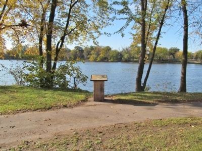
Itasca grew up around an Indian trading post which was established 800 feet east of here in 1849 by Thomas A. Holmes and James Beatty. At the suggestion of Territorial Governor Alexander Ramsey, the settlement was named in honor of Lake Itasca, the . . . — — Map (db m69908) HM
Minnesota Territory 1849-1858On March 3, 1849, during his last hours in office. President James K. Polk signed a bill adding a new name to the American political landscape — Minnesota Territory. A vast land, it stretched from the St. . . . — — Map (db m205213) HM
The last act of the Minnesota Dakota (Sioux) War took place here in Mankato on December 26, 1862 when thirty-eight Dakota Indians died in a mass execution on this site.
The Dakota War was a culmination of years of friction between Dakota and . . . — — Map (db m14195) HM
When the Second Battle of New Ulm ended on the morning of August 24, 1862, the city lay nearly in ruins. Fearing that it would surely fall if attacked again, Colonel Charles Flandrau ordered the entire city to evacuate. The next day . . . — — Map (db m73792) HM
In the summer of 1862, after years of broken treaty promises and late payments that fueled growing tensions and conflict, some Dakota began an attempt to forcibly reclaim their homeland. After attacking the Redwood (Lower Sioux) Agency . . . — — Map (db m67915) HM WM
The Sioux Indians called this lake "minne hanska," meaning "long water." The basin of the lake was formed 11,000 to 15,000 years ago by the Wisconsin glacier; the original hard clay bottom is now about 50 feet below the present surface of the . . . — — Map (db m66454) HM
By the end of the fighting in New Ulm, the U.S.—Dakota War of 1862 had taken a heavy toll on the town. More than 50 settlers had been killed and 36 wounded, along with an unknown number of Dakota. In addition, at least 190 of the . . . — — Map (db m74136) HM
West Newton in 1870 was a thriving town, serving riverboat travel on the Minnesota River. It consisted of a hotel, a livery stable, a brewery, a sawmill, a wagon works, two blacksmith shops, three saloons, and many dwellings that made the town an . . . — — Map (db m66238) HM
Sleepy Eyes, or Drooping Eyelids, was born about 1780 in a Sisseton Sioux Indian village at Swan Lake in Nicollet County. The Bureau of Indian Affairs commissioned him a chief in 1824. His fame was achieved not as a warrior or hunter but as a friend . . . — — Map (db m67658) HM
One hundred miles north and west of Duluth lies the Iron Range. North America's largest iron ore region consists of three major iron ranges: the Vermillion, the Mesabi, and the Cuyuna. The Vermillion was the first to ship iron ore from Minnesota . . . — — Map (db m44038) HM
By 1804 Jean B. Faribault was trading in furs for the Northwest Company near the "Little Rapids" of the Minnesota River, 5 miles south of this point, and in this vicinity. His fur post of 1824 on the site of Chaska became the nucleus for the first . . . — — Map (db m41051) HM
When a federal marshal with about 100 troops of the 3rd Infantry tried to arrest the Chippewa Chief Bugonaygeshig at Sugar Point opposite here on the northeast shore of the lake, a sharp fight occurred October 5, 1898. The whites lost 7 killed and . . . — — Map (db m124726) HM
"The North Country is a siren Who can resist her song of intricate and rich counterpoint?"
(Grace Lee Nute, The Voyageur's Highway, 1941)
Lured by America's premier wilderness canoe region, Lake Superior's rugged shoreline and . . . — — Map (db m222163) HM
William Henry Carmen Folsom, St. Croix River Valley lumberman and land speculator, chose this imposing site for his home in 1854. He, his wife Mary Jane, and their two small sons lived in an open barn on this property to prove up the claim while . . . — — Map (db m44027) HM
Red River Transportation The Red River Trails were a set of overland routes linking the cities of Winnipeg and St. Paul and the small forts and settlements between them.From 1820 to the 1870s, the trails were used by Metis freight drivers who . . . — — Map (db m100838) HM
St. John's Episcopal Church was designed on an Elizabethan model by the noted architect, Cass Gilbert, among whose other significant buildings is the present Minnesota State Capitol. Construction of St. John's began on August 1, 1898.On February 12, . . . — — Map (db m43829) HM
The name "Itasca" was coined specifically from the Latin words "Veritas caput" -- literally meaning "true head" -- by Henry Rowe Schoolcraft in 1832. Led by Ozawindib, an Ojibwe guide who knew the upper reaches of the Mississippi River and its . . . — — Map (db m71470) HM
When Newton H. Winchell, Minnesota's state geologist, and, Ulysses S. Grant II (the president’s son) surveyed this area in the 1890s, they concluded that a peak in the Misquah Hills was the state's highest point. Using an aneroid barometer, they . . . — — Map (db m151362) HM
Named for entrepreneur Cuyler Adams and his faithful dog Una, the Cuyuna Ranges lies at the westernmost edge of a ring of iron ore that circles Lake Superior. The smallest of Minnesota’s three northern iron ranges, the Cuyuna was also the last to be . . . — — Map (db m43934) HM
The establishment of Fort Ripley in 1848 represents the U.S. government’s effort to establish control on the northern frontier. Construction began on the west bank of the Mississippi River across from this point a year before Minnesota became a . . . — — Map (db m43935) HM
As Hastings quickly grew and settlement in the area increased, this port city soon became the commercial center for Dakota County farmers.
Farmers brought wagons full of crops to the Hastings market, and then returned home driving wagons full . . . — — Map (db m47843) HM
The Mississippi River has been a source of recreation for many generations. People have long enjoyed its beauty and marveled at its power.
This is more true than ever today. Boating, hiking, and bird watching all draw people to the river. In . . . — — Map (db m48510) HM
Just northwest of here, at the bottom of the hill, stood the home of Ignatius Donnelly, author, orator, politician, reformer, and prophet who was easily the best known Minnesotan of his time, both in the state and throughout the world.
. . . — — Map (db m65584) HM
For more than 10,000 years, people have lived near the Mississippi River. The first cultures relied on hunting, fishing, and gathering for survival. As early as 1,000 years ago, however, Indian peoples were farming portions of the river valley near . . . — — Map (db m49801) HM
The natural river above Hastings was treacherous for steamboats, with a depth that reached only three and one-half feet in some places. The first efforts of the federal government to improve navigation of the river were wing dams (piles of . . . — — Map (db m48475) HM
The Mississippi River has long been a major artery for trade and transportation.
For thousands of years, Indians traveled on the river by canoe. By the 1850s, rivertowns like Hastings boomed as steamboats brought settlers into the region. The . . . — — Map (db m48589) HM
Called M'Dote or "the place where waters meet" by the Dakota, this area is central to many Dakota creation stories and is significant to Dakota people today. Just west of this site is Pilot Knob, which was used extensively for burials by the Dakota . . . — — Map (db m37659) HM
In front of you stands the Faribault House, built by long-time fur trader Jean-Baptiste in 1839. Faribault was originally from the Montreal area, and had been associated with the British and American fur traders since the late 1790s. He built . . . — — Map (db m37618) HM
The Sibley House was built in 1836 for Henry Hastings Sibley, regional manager for the American Fur Company. The first floor was designed for business operations, and the second floor was his bachelor's residence. Two additions were made to the . . . — — Map (db m242009) HM
Mendota
This wide valley intersection between the two rivers known today as the Minnesota and Mississippi has been a meeting place for people for thousands of years.
The Dakota people lived on these prairielands by the 1700s. . . . — — Map (db m229001) HM
Welcome to the Sibley House Historic Site! This area had long been the center of travel and trade for the Dakota when it became the center for American Fur Company operations on the Upper Mississippi. It was also home to Minnesota's first governor, . . . — — Map (db m41238) HM
Here at Mendota (where the rivers meet) missionaries ministered to both Indians and settlers, enduring the hardships of a sprawling wilderness that was the Minnesota country. In 1842, Father Lucien Galtier built a small, log chapel with only two . . . — — Map (db m37714) HM
The "New Deal"
During the Great Depression of the early 1930's, more than 25 percent of the nations' workforce was unemployed. One of President Franklin Roosevelt's New Deal programs was the Works Progress Administration (WPA). The WPA . . . — — Map (db m178002) HM
Here on the Mendota Trail from 1839 to 1852 stood the Sioux village of the Little Crow family. An attempted Chippewa attack in 1842 precipitated the Battle of Kaposia across the river. After the Treaty of Mendota in 1851 the band moved up the . . . — — Map (db m31186) HM
The First National Soil Conservation District Field Day and Plow Matches were held here on September 6, 1952. Over 125,000 spectators saw demonstrations of new methods and new techniques for soil conservation during the event. The presidential . . . — — Map (db m114960) HM
When the Civil War began in 1861, Minnesota was the first state to offer and send troops to aid the Union cause. In April 1861, this building was converted to use as a recruiting station. Recruits from the Wasioja station, numbering over 200, formed . . . — — Map (db m114961) HM
The role of buildings in the development of a community and their significance in history is amply pointed out by the history of this structure. Anxious to promote the growth of the newly formed town, the citizens agreed to provide the Free Will . . . — — Map (db m115028) HM
Osakis was one of the stops on the Burbank Minnesota Stage Company Line to the Red River, established in the spring of 1859 upon the opening of the Fort Abercrombie Military Road. During the Sioux outbreak of 1862 the maintenance of this line of . . . — — Map (db m157797) HM
A Golden Dedication for I-90
The nation celebrated completion of Interstate 90 after contractors paved the last four-miles of freeway near Blue Earth in 1978. Reminiscent of the "Golden Spike" that symbolized completion of the nation's first . . . — — Map (db m96915) HM
With the Louisiana Purchase in 1803, the United States acquired a vast area west of the Mississippi River. Eager for information about its new territory, the government dispatched a series of explorers to learn more about the land and the native . . . — — Map (db m178486) HM
Like immigrants from many European nations in the mid-19th century, Norwegians left their homeland to escape overpopulation, food shortages, and farm foreclosures. They began arriving in Minnesota in the 1850s, drawn by rich farmland and job . . . — — Map (db m31323) HM
Horse medicine, school slates, eyeglasses, flour - all might have been for sale or trade in the log cabin store opened in 1853 by Felix Meighen and Robert Foster, boyhood friends from Pennsylvania. As the only store in Fillmore County, it did a . . . — — Map (db m205151) HM
Today more than one hundred parks, waysides, monuments, historic sites, and trails are operated by the State of Minnesota. They fulfill the plea of Newton H. Winchell, state geologist and archaeologist, who in 1889 stressed the value of a system . . . — — Map (db m185580) HM
Minnesota's Roads. "A perfect highway is a thing of beauty and joy forever," enthused a speaker at Minnesota's first "Good Roads" convention in 1893. "It blesses every home by which it passes."
Early in the 1890s, even before the automobile . . . — — Map (db m9911) HM
On the shore of Lake Pepin just north of here a French expedition commanded by LaPerriere and accompanied by two Jesuits in September 1727 built a substantial log fort and the mission of St. Michael the Archangel. The post was occupied periodically . . . — — Map (db m45242) HM
"The most beautiful prospect that imagination can form," wrote 18th century explorer Jonathan Carver about the view from Barn Bluff. "Verdant plains, fruitful meadows, and numerous islands abound with the most varied trees.... But above all, . . . — — Map (db m24816) HM
Founded in 1853 and called “Mattson’s Settlement” after its first resident, Hans Mattson, the community was renamed Vasa in 1856 in honor of Swedish King Gustav Vasa. Once called “the most Swedish colony in America,” . . . — — Map (db m45380) HM
†
This property has been placed on the
National Register
of
Historic Places
by the United States
Department of the Interior
In memory of Laura Schlasner — — Map (db m49215) HM
Although this site is known today as the Earl Brown farm, it originally belonged to Captain John Martin, who was involved in steamboating, lumbering, banking, flour milling and railroading. In the mid-1880s, he purchased 420 acres of rich Hennepin . . . — — Map (db m69931) HM
In 1853, Peter Miller Gideon and his wife, Wealthy, arrived in Minnesota from Ohio and settled on the shores of Lake Minnetonka. Long interested in fruitgrowing, Peter Gideon determined to satisfy the craving of pioneer families for apples and . . . — — Map (db m59213) HM
This historical ground was a pivotal place in the development of the Northwest. With the outbreak of the Civil War in 1861, Fort Snelling expanded its limestone walls into this area, formerly a part of the U.S. Indian Agency and the location of the . . . — — Map (db m211174) HM
A Sea of Grass
In its early days Fort Snelling was surrounded by a sea of head-high grass. The vast Minnesota prairie was broken only by small groves of trees—willows, cottonwoods, and oaks that grew near creeks, lakes, and marshes. . . . — — Map (db m229951) HM
Built in 1904-05 by the U.S. Army, Buildings 17 and 18 were constructed as double barracks to house cavalry troops. By 1911 the cavalry had left Fort Snelling, but the buildings continued to house troops through the early 1940s as the post grew in . . . — — Map (db m229952) HM
This memorial honors the sixteen hundred Dakota people, many of them women and children, who were imprisoned here at Fort Snelling in the aftermath of the 1862 U.S.-Dakota Conflict. Frightened, uprooted, and uncertain of the fate of their missing . . . — — Map (db m227845) HM
This aerial view shows the gatehouse, water power canal and adjacent mills as they appeared in 1945. They, together with similar structures on the east bank, made Minneapolis the milling capital of the nation from 1880-1930. Changes in marketing and . . . — — Map (db m27169) HM
"This viaduct...is the only one of its kind that spans the Father of Waters, and is one of the largest and most noteworthy in the United States.
Firmer than the earth which supports it, it is constructed to stand the test of time."
. . . — — Map (db m27042) HM
Milwaukee Road station agents affectionately referred to the quaint little Minnehaha Depot as "the Princess." Its delicate gingerbread architecture is reminiscent of the Victorian era when ladies in bustles and gentlemen in high collars traveled . . . — — Map (db m17233) HM
Built in 1848, the Ard Godfrey House is the earliest frame house still standing in Minneapolis. An example of Greek Revival architecture, it originally occupied a site in the vicinity of Main and Second Streets Southeast.
Ard Godfrey, a . . . — — Map (db m37774) HM
For 74 years this transit railway carried passengers to downtown jobs, to University of Minnesota classes, and to picnics and concerts on the shores of Lake Harriet.
Steam passenger trains of the Minneapolis, Lyndale & Minnetonka Railway first . . . — — Map (db m38850) HM
In May, 1822, a Fort Snelling drummer boy named Joseph R. Brown and his friend, William Snelling, son of the fort's commander, canoed up what is now called Minnehaha Creek to "discover" a lake long sacred to the Indian people who built burial mounds . . . — — Map (db m59258) HM
Named for Charles W. Christmas, first county surveyor of Hennepin County, elected in 1852, who platted the original town site of Minneapolis for John H. Stevens and Franklin Steele. This lake and Lake Minnetonka now occupy what in pre-glacial times . . . — — Map (db m71571) HM
Minnesota Territory 1849-1858 (marker side 1) On March 3, 1849, during his last hours in office. President James K. Polk signed a bill adding a new name to the American political landscape — Minnesota Territory. A vast . . . — — Map (db m126662) HM
At the start of the U.S.-Dakota War of 1862 settlers around Columbia (now Spencer) hastily formed an oxcart train and started for the stockade at Forest City. On the way to Diamond Lake, the refugees ran into other settlers fleeing from the Eagle . . . — — Map (db m77228) HM
The Red River Trail was the nineteenth-century answer to communication over the frontier between the early settlements on the Mississippi and Minnesota Rivers and Lord Selkirk's settlements (Winnipeg) in Canada. Trails, such as this, were not . . . — — Map (db m77016) HM
After fighting a running battle with the Dakota on August 20, 1862 at Diamond Lake, two groups of refugees from Spicer and Eagle Lake camped here at Wheeler's Lake. The Dakota camped across the lake from them. There were no disturbances during . . . — — Map (db m77273) HM
Kandiyohi Town Site Corporation was organized in 1856, with John Swainson as president. By October of that year, the town site had been surveyed. David Charlton's plat indicates a large central area reserved for the State Capitol with a much . . . — — Map (db m78239) HM
John Other Day, a Dakota who disagreed with the decision to go to war with the Whites, led a party of sixty-two white men, women and children out of danger when the Dakota attacked the Upper Sioux Agency near Granite Falls. The party left the Agency . . . — — Map (db m76656) HM
Joshua H. Gates arrived at Diamond Lake in 1857 where he claimed land in Sections 17 and 20 of Harrison Township. Gates may have been the first farmer in what is now Kandiyohi County. This is the site of the Joshua and Lucinda Gates family . . . — — Map (db m77102) HM
In May 1859, Olof Olson Haugen, his wife Bergeret, and son Frederick homesteaded here in section 32, Dovre Township. Over the next three years, the Haugen family diligently worked to establish their new life; building shelter, raising crops and . . . — — Map (db m77770) HM
Ojibwe and Dakota nations had a long history of conflict in what would become Minnesota. Both Dakota and Ojibwe people contended for the control of the abundant natural resources in the future Kandiyohi County area that played an economic role in . . . — — Map (db m78028) HM
Following the Civil War, immigrants flowed into the Norway Lake area with the majority from Norway and Sweden. On October 10, 1868, Norwegian Evangelical Lutheran Church of Norway Lake incorporated and built a log cabin worship facility at this . . . — — Map (db m76700) HM
In May 1859, Olof Olson Haugen, his wife Bergeret, and son Frederick homesteaded here in section 32, Dovre Township. Over the next three years, the Haugen family diligently worked to establish their new life; building shelter, raising crops and . . . — — Map (db m77735) HM
From the late 1600s to about 1820 the chain of waterways of which Minnesota's border lakes form a segment was the thoroughfare of a vast fur trading empire. As its longest, this water route stretched from Montreal to Lake Athabasca, and over it a . . . — — Map (db m8363) HM
On September 26, 1862, 91 whites and about 150 mixed-blood captives, some of whom had been prisoners of the Dakota Indians for more than a month, were returned to Colonel Henry H. Sibley's military camp, later joyfully known as Camp Release. In the . . . — — Map (db m69118) HM
On September 26, 1862, the 270 men, women and children taken captive by the Dakota during the war were released to military commander Henry H. Sibley at this site, known from that time on as Camp Release.
Years later at the . . . — — Map (db m71384) HM
Experience showed Dakota Chief Maza śa (Red Iron) that it did little good to stand in the way of the U.S. government. He had opposed the 1851 Treaty of Traverse des Sioux but, in the end, had little choice when he and other Dakota . . . — — Map (db m164642) HM
Just two days after the captives were turned over, the brief military trials of the Dakota who had taken part in the fighting began here at Camp Release on September 28, 1862. The trials moved to the Redwood (Lower Sioux) Agency on . . . — — Map (db m71437) HM
This town site, named after President Buchanan, was laid out in October 1856. From September 1857 until May 1859 the place though little less than wilderness, was the seat of the U.S. Land Office for the Northeastern District of Minnesota. After the . . . — — Map (db m43806) HM
Rising from the waves of Lake Superior, this cliff face serves as an awesome reminder of Minnesota's geological past. Eruptions of molten lava over a billion years ago, followed by eons of weathering and glacier scouring, created the spectacular . . . — — Map (db m203280) HM
This anchor was salvaged from the shipwreck of the 5000-ton steel barge, Madeira, which was tossed up against Gold Rock Point, about a quarter mile northeast of here, during the fierce storm of November 27-28, 1905. As the ship broke . . . — — Map (db m78751) HM
This concrete platform is all that remains of the building that housed the steam hoist engine that was used in constructing Split Rock Lighthouse.
Everything needed for building the light station in 1909-10 came by boat. The hoist engine . . . — — Map (db m78717) HM
It's the early morning hours of November 28, 1905.
Imagine yourself standing right here in the middle of one of the worst storms in Great Lakes history—65-mile-per-hour winds, blinding snow, 30-foot waves crashing into the cliff.
The . . . — — Map (db m78716) HM
The accomplishments of the Mayo family in the field of medicine have brought fame to both its members and to Minnesota, for it was Dr. William W. Mayo and his two sons, William J. and Charles H., who founded the Mayo Clinic in Rochester, . . . — — Map (db m65417) HM
Named for Pierre Charles Le Sueur, French explorer who passed the site in 1700. This town on the old Red River trail includes two towns, Le Sueur and Le Sueur City which were laid out in 1852-53 on Prairie Le Fleche about a mile apart. Consolidation . . . — — Map (db m65509) HM
Le Sueur Tigers No. 1, William Dellaughter, commander
I. Allen,
E. Bacon,
A. Bangs,
H. Bridenthall,
B. Birdsall,
J. Birdsall,
P. Burch,
N. Burgers,
L. Butman,
F. Butteauz,
S. Carpenter,
W. Case, J. Coggswell, G. Cook, B. Cosly, . . . — — Map (db m65705) HM WM
In 1903, fourteen of Le Sueur's leading businessmen met in the back of the Cosgrove Harness Shop to start a canning factory. They called it the Minnesota Valley Canning Company. Sixty-seven shares of stock at one hundred dollars per share were sold . . . — — Map (db m65416) HM
Geologically young when compared with ancient rivers such as the Nile or the Amazon, the Minnesota River is only about 12,000 years old. It occupies a channel that was cut by the Glacial River Warren, when it drained Glacial Lake Agassiz, the . . . — — Map (db m65411) HM
Symbolic of agriculture, Dassel's lifeline, the West End Elevator is commonly known to its users as the Dassel Farmers' Elevator. Since its construction in 1885, the area's farmers have brought their corn, oats, wheat, beans, flax, rye, and . . . — — Map (db m76500) HM
On August 17, 1862, four young Dakota hunters, returning to their hungry families from an unsuccessful hunt, argued about stealing food from white settlers. Sungigidan, Kaomdeiyeyedan, Nagiwicakte, and Pazoiyopa dared each other this: who among . . . — — Map (db m70357) HM
The Grand Army of the Republic was an organization established in 1866 by Union veterans of the Civil War to preserve friendships, honor fallen comrades, and aid widows and the handicapped. It was wielded great political influence in the years . . . — — Map (db m70427) HM
The first pioneers to settle in this area arrived by July, 1856, three months after their oxen-drawn prairie schooners left Rock County, Wisconsin. They were the families of Henrik H. Thoen, Ole H. Ness, Nels H. Colberg and bachelors Ole H. . . . — — Map (db m92468) HM
In this vicinity stood the grand Sioux village of Izatys where Duluth planted the French arms on July 2, 1679.
The settlement was visited by Father Hennepin in 1680. About 1750 the Chippewa moving westward from Lake Superior, captured the . . . — — Map (db m19760) HM
The center of Charles Lindbergh's grand boyhood adventures was the Mississippi River. Here he fished and swam, built and 'sailed" a raft, skipped across logjams, and looked across the water's wide expanse, dreaming about the future. It was in . . . — — Map (db m78225) HM
White pines once dominated northern Minnesota. Even in Lindbergh's time these scattered reminders of earlier eras dotted the pasture.
The trunk in front of you is the remains of one of these forest giants. This white pine stood 100-feet . . . — — Map (db m78229) HM
"I never deserted the farm as the ultimate goal of my return - and there is my home when I am home, for the farm unquestionably is the best of all places to live, and it affords the most independence." Thus wrote Congressman Charles A. Lindbergh, . . . — — Map (db m78194) HM
After Charles Lindbergh took off on his motorcycle in 1920, headed for the University of Wisconsin, he rarely came back to Little Falls. He made one visit by airplane in 1923, landing his "Jenny" - the first plane he owned - in a field near here. . . . — — Map (db m78196) HM
224 entries matched your criteria. The first 100 are listed above. Next 100 ⊳