131 entries match your criteria. The first 100 are listed. ⊳
Francis Asbury, Traveling Methodist Preacher Historical Markers
Francis Asbury (1745-1816) was one of the first two bishops of the Methodist Episcopal Church in the United States. Beginning in 1771 he devoted his life to ministry, traveling on horseback and by carriage thousands of miles to those living on the frontier.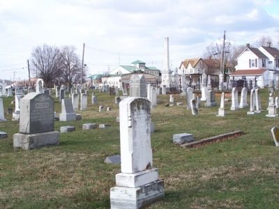
By Bill Pfingsten, December 15, 2010
Site of Dover's First Methodist Church Cemetery
| 1 ► Delaware, Kent County, Dover — K-70 — Site of Dover's First Methodist Church — |
| On W. North Street at South Queen Street on W. North Street. | |||
| 2 ► Delaware, Kent County, Dover — KC-79 — Wesley United Methodist Church — |
| On South State Street, on the left when traveling south. | |||
| 3 ► Delaware, Kent County, Greenwood — K-61 — Todd's Chapel United Methodist Church — |
| On Todds Chapel Road (County Road 114) near Hickman Road (State Route 16), on the right when traveling north. | |||
| 4 ► Delaware, Kent County, Harrington — KC-46 — Home of Judge Thomas White — Refuge of Francis Asbury — |
| On Whiteleysburg Road. | |||
| 5 ► Delaware, Kent County, Milford — KC-65 — Site of Milford's First Methodist Church — |
| On North Street at NW 3rd Street, on the right when traveling north on North Street. | |||
| 6 ► Delaware, Kent County, Smyrna — KC-56 — Site of Old Asbury Methodist Church — |
| On Delaware Street, on the right when traveling south. | |||
| 7 ► Delaware, New Castle County, Townsend — NC-117 — Old Union Methodist Church — |
| On Union Church Road, 0.1 miles east of US 13, on the right when traveling west. | |||
| 8 ► Delaware, New Castle County, Wilmington — NC-A10 — Asbury Methodist Episcopal Church — |
| On North Walnut Street at East 3rd Street on North Walnut Street. | |||
| 9 ► Delaware, New Castle County, Wilmington — Ezion Methodist Episcopal Church — 1805 - 1971 — |
| On North French Street at East 9th Street, on the left when traveling south on North French Street. | |||
| 10 ► Delaware, Sussex County, Bridgeville — Sudler House |
| On North Main Street (Alternate U.S. 13) near Church Street, on the right when traveling north. Reported permanently removed. | |||
| 11 ► Delaware, Sussex County, Delmar — SC-104 — Line United Methodist Church — |
| On Line Church Road, on the right when traveling west. | |||
| 12 ► Delaware, Sussex County, Georgetown — SC-117 — Wesley United Methodist — |
| On North Race Street, on the right when traveling north. | |||
| 13 ► Delaware, Sussex County, Laurel — SC-150 — Mount Pleasant Methodist Church — |
| On Mount Pleasant Road (County Road 493) near Sharptown Road (State Route 24), on the left when traveling north. | |||
| 14 ► Delaware, Sussex County, Lewes, Lewes Historic District — Old Bethel Church — |
| On Mulberry Street near 3rd Street, on the right when traveling west. | |||
| 15 ► Delaware, Sussex County, Milford, Cedar Creek — SC-115 — Slaughter Neck United Methodist Church — |
| On Church Road close to Argos Corner Road. | |||
| 16 ► Delaware, Sussex County, Seaford — S-64 — Bethel Church — |
| On Neals School Road (County Road 553) near Harper Road / Oak Grove Road (County Road 549), on the right when traveling west. | |||
| 17 ► District of Columbia, Washington, Northwest Washington, Mount Pleasant — 1 — Fashionable 16th Street — Village in the City — Mount Pleasant Heritage Trail — |
| On 16th Street Northwest just north of Harvard Street Northwest, on the left when traveling north. | |||
| 18 ► District of Columbia, Washington, Northwest Washington, Mount Pleasant — Francis Asbury — 1745-1816 — Pioneer Methodist Bishop in America — |
| On 16th Street Northwest north of Harvard Street Northwest, on the right when traveling south. | |||
| 19 ► Georgia, Bibb County, Macon — 011-23 — Mulberry Street Methodist Church — |
| On Mulberry Street at 1st Street, on the right when traveling west on Mulberry Street. | |||
| 20 ► Georgia, Bulloch County, Donegal — 016-1 — Union Meeting House — (Organized 1790) — |
| On Old River Road North (County Route 474) at Jones Ln Memorial Highway (U.S. 301), on the right when traveling west on Old River Road North. | |||
| 21 ► Georgia, Chatham County, Savannah, Historic District - North — 1812 Wesley Chapel — |
| On Oglethorpe Avenue at Lincoln Street, on the left when traveling east on Oglethorpe Avenue. | |||
| 22 ► Georgia, Chatham County, Savannah, Historic District - North — Barnard House — |
| On Lincoln Street near East York Street, on the left when traveling south. | |||
| 23 ► Georgia, Chatham County, Savannah, Historic District - North — 025-67 — Trinity Methodist Church — |
| On Barnard Street near Presidents Street, on the right when traveling south. | |||
| 24 ► Georgia, Chatham County, Savannah, Historic District - North — Wesley Chapel Trinity / John Wesley's American Parish — United Methodist Church Registered Historic Site No. 50 / No. 23 — |
| On Abercorn Street at East Saint Julian Street, on the left when traveling south on Abercorn Street. | |||
| 25 ► Georgia, Elbert County, Elberton — 052--10 — Coldwater Methodist Church — |
| On Coldwater Creek Road, 0.5 miles west of Double Bridges Road, on the left when traveling west. | |||
| 26 ► Georgia, Franklin County, Carnesville — 059-4 — Carroll’s Methodist Church — < ---- 2 mi. ---- <<< — |
| On New Franklin Church Road (Georgia Route 327) at Jackson Bridge Road, on the right on New Franklin Church Road. | |||
| 27 ► Georgia, Greene County, White Plains — 066-11 — Liberty Chapel — |
| On Liberty Church Road, 0.1 miles south of Lanier Road, on the right when traveling south. | |||
| 28 ► Georgia, Hancock County, Sparta — 070-10 — Pierce Memorial Methodist Church — |
| On East Hamilton Street at Boland Street, on the right when traveling east on East Hamilton Street. | |||
| 29 ► Georgia, Richmond County, Augusta — 121-45 — Two Early Augusta Churches — |
| On Greene Street. | |||
| 30 ► Georgia, Screven County, Girard — Bethel United Methodist Church — 1827 (Brick Church) — United Methodist Church Registered Historic Site No. 49 — |
| On Oglethorpe Trail at an unnamed plantation road, on the left when traveling north on Oglethorpe Trail. | |||
| 31 ► Georgia, Taliaferro County, Sharon — 131-19 — Raytown Methodist Church — |
| On Lower Mill Road (County Route 16) 0 miles west of Sheehan Road NE (County Route 17), on the left when traveling east. | |||
| 32 ► Georgia, Wilkes County, Washington — 157-20 — First Methodist Church — |
| On Spring Street (Georgia Route 47) at West Liberty Street when traveling north on Spring Street. | |||
| 33 ► Georgia, Wilkes County, Washington — 157-25 — Grant's Meeting House — |
| On Wrightsboro Road (Georgia Route 80) 1.2 miles south of Thomson Road (U.S. 78), on the left when traveling south. | |||
| 34 ► Kentucky, Fayette County, Lexington — 10 — Masterson's Station — |
| On Leestown Road (U.S. 421) at Ruffian Way, on the right when traveling north on Leestown Road. | |||
| 35 ► Kentucky, Jessamine County, Wilmore — 1830 — Bethel Academy / Asbury College — |
| On North Lexington Avenue (Kentucky Route 29) 0.1 miles south of West College Street, on the right when traveling south. | |||
| 36 ► Maryland, Anne Arundel County, Annapolis — Site of the Methodist Church — 1789–1817 — |
| Near State Circle at North Street, in the median. | |||
| 37 ► Maryland, Anne Arundel County, Millersville — Baldwin Memorial United Methodist Church — |
| On Generals Highway (Maryland Route 178) at Indian Landing Road, on the left when traveling south on Generals Highway. | |||
| 38 ► Maryland, Anne Arundel County, Pasadena — Magothy Methodist Church — |
| On Mountain Road (Maryland Route 177) 0.2 miles west of Magothy Bridge Road (Maryland Route 607), on the left when traveling west. | |||
| 39 ► Maryland, Baltimore, Carroll-South Hilton — Mt. Olivet Cemetery — |
| On Frederick Avenue (Maryland Route 144) at Font Hill Avenue, on the right when traveling west on Frederick Avenue. | |||
| 40 ► Maryland, Baltimore County, Fork — Fork United Methodist Church — |
| On Fork Road at Brinton Road, on the left when traveling west on Fork Road. | |||
| 41 ► Maryland, Baltimore County, Perry Hall — Camp Chapel — |
| On Joppa Road, 0.1 miles east of Honeygo Boulevard, on the right when traveling west. | |||
| 42 ► Maryland, Baltimore County, Perry Hall — Harry Dorsey Gough — 1745-1808 — Maryland History — |
| On Belair Road (U.S. 1) 2.4 miles north of Forge Road, on the right when traveling north. | |||
| 43 ► Maryland, Baltimore County, Perry Hall — Harry Dorsey Gough — |
| On Honeygo Boulevard at East Joppa Road, on the right when traveling west on Honeygo Boulevard. | |||
| 44 ► Maryland, Caroline County, Preston — Site of Frazier’s Chapel — Preston, Maryland, 1785 — |
| On Main Street (Maryland Route 331) at Harmony Road (Maryland Route 16), on the left when traveling south on Main Street. | |||
| 45 ► Maryland, Carroll County, New Windsor — John Evans House, 1764 — Methodist Land Mark — |
| Near Wilt Road. | |||
| 46 ► Maryland, Dorchester County, Cambridge — Zion United Methodist Church — |
| On Locust Street just east of Mill Street, on the left when traveling west. | |||
| 47 ► Maryland, Dorchester County, Taylors Island — Bethlehem Methodist Episcopal Church — Built 1787 - Rebuilt 1857 — |
| On Hoopers Neck Road, 1.5 miles north of Taylors Island Road (Maryland Route 16), on the left when traveling north. | |||
| 48 ► Maryland, Harford County, Abingdon — Cokesbury College — Old Post Road — Established 1666 |
| On Philadelphia Road (Maryland Route 7) 0.2 miles south of Abingdon Road, on the right when traveling north. Reported missing. | |||
| 49 ► Maryland, Prince George's County, Greenbelt — Methodist Preaching Place — 1776-1803 |
| On Kenilworth Avenue (Maryland Route 201) north of Crescent Road, on the right when traveling south. Reported missing. | |||
| 50 ► Maryland, Prince George's County, Horsehead — Immanuel Church — Horsehead, Maryland — 1879 Centennial 1979 (Built 1879 - Burned, Rebuilt 1896) — |
| On Aquasco Road (Maryland Route 381) 0.1 miles north of Horsehead Road, on the right when traveling north. | |||
| 51 ► Maryland, Queen Anne's County, Sudlersville — Dudley's Chapel — |
| On Benton Corners Road, 0.1 miles south of Sudlersville Road (Maryland Route 300), on the left when traveling south. | |||
| 52 ► Maryland, Queen Anne's County, Sudlersville — Dudley's Chapel — Built in 1783 on land donated by Joshua Dudley — |
| On Benton Corner Road, 0.3 miles south of Sudlersville Road (Maryland Route 300), on the left when traveling south. | |||
| 53 ► New Hampshire, Cheshire County, Chesterfield, West Chesterfield — 060 — First Methodist Meeting Place In New Hampshire — |
| On Franklin Pierce Highway (New Hampshire Route 9) at Pond Brook Road, on the right when traveling west on Franklin Pierce Highway. | |||
| 54 ► New Jersey, Burlington County, Burlington — Bishop Francis Asbury — Broad Street United Methodist Church — |
| On East Broad Street just west of Lawrence Street, on the right when traveling north. | |||
| 55 ► New Jersey, Morris County, Madison — Francis Asbury — |
| Near Madison Avenue, on the right when traveling east. | |||
| 56 ► New Jersey, Warren County, Asbury — Methodist Church of Asbury — Methodist Historic Site — |
| On Main Street north of Maple Avenue, on the right when traveling north. | |||
| 57 ► New Jersey, Warren County, Mt. Bethel — Pioneer Methodist Bishop Francis Asbury — |
| On Mt. Bethel Road at Snyder Road, on the right when traveling north on Mt. Bethel Road. | |||
| 58 ► North Carolina, Buncombe County, Asheville — P-33 — Francis Asbury — |
| On Beaverdam Road (State Highway 2230) at Merrimon Avenue (U.S. 25), on the left when traveling east on Beaverdam Road. | |||
| 59 ► North Carolina, Camden County, South Mills — A-63 — McBride Church — |
| On State Highway 343 at Main Street (U.S. 17), on the right when traveling north on State Highway 343. | |||
| 60 ► North Carolina, Forsyth County, Clemmons — J-66 — McKnight's Meeting House — |
| On U.S. 158, on the right when traveling east. | |||
| 61 ► North Carolina, Haywood County, Clyde — The Shook House — |
| On Carolina Boulevard (U.S. 23) at Morgan Street on Carolina Boulevard. | |||
| 62 ► North Carolina, Haywood County, Cove Creek — P-51 — "Cataloochee Trail" — |
| On Jonathan Creek Road (U.S. 276) at Cove Creek Road (North Carolina Highway 1395), on the right when traveling north on Jonathan Creek Road. | |||
| 63 ► North Carolina, Haywood County, Lake Junaluska — P-50 — "Cataloochee Trail" — |
| On Dellwood Road (U.S. 19) 0 miles south of N. Lakeshore Drive, on the right when traveling west. | |||
| 64 ► North Carolina, Haywood County, Maggie Valley — Bishop Francis Asbury — 1745 - 1816 — |
| On N. Lakeshore Drive. | |||
| 65 ► North Carolina, Haywood County, Waterville — Francis Asbury Trail — |
| On Big Creek Park Road at Mount Sterling Road (County Route 1397), on the left when traveling south on Big Creek Park Road. | |||
| 66 ► North Carolina, New Hanover County, Wilmington, Historic District — Grace Methodist Church — Organized December 24, 1797 — |
| On Grace Street at North 4th Street, on the left when traveling east on Grace Street. | |||
| 67 ► North Carolina, Stanly County, Norwood — L-83 — Randall's United Methodist Church — |
| On Indian Mound Road (County Road 1740) at Randalls Church Road, on the right when traveling north on Indian Mound Road. | |||
| 68 ► Pennsylvania, Lancaster County, Gordonville, East Lampeter Township — Soudersburg Methodist Church — |
| On East Lincoln Highway (U.S. 30) 0.2 miles west of Leven Road, on the left when traveling west. | |||
| 69 ► Pennsylvania, Lancaster County, Lancaster — Francis Asbury — 1745 - 1816 — |
| On North Mulberry Street at West Orange Street, on the right when traveling south on North Mulberry Street. | |||
| 70 ► Pennsylvania, Lancaster County, Willow Street, Pequea Township — Boehms Chapel — Founded 1791 — United Methodist Church Historic Shrine — |
| Near West Boehms Road, 0.2 miles west of PA 272. | |||
| 71 ► Pennsylvania, Lancaster County, Willow Street, Pequea Township — Boehm's Chapel — |
| On West Boehms Road, 0.2 miles north of E. Boehm's Rd., on the right when traveling south. | |||
| 72 ► Pennsylvania, Philadelphia County, Philadelphia, Old City — Old St. George's — Old Philadelphia Congregations — |
| On North 4th Street at North Marginal Road, on the left when traveling south on North 4th Street. | |||
| 73 ► Pennsylvania, Philadelphia County, Philadelphia, Society Hill — Mother Bethel — 1791 — Old Philadelphia Congregations — |
| On South 6th Street at Addison Street, on the left when traveling south on South 6th Street. | |||
| 74 ► South Carolina, Calhoun County, Cameron — 9-3 — Jericho Methodist Church — Mile And A Half East — |
| On Old State Road (U.S. 176) at Jericho Road (State Highway 9-26), on the right when traveling north on Old State Road. | |||
| 75 ► South Carolina, Charleston County, Charleston, French Quarter — Site of the First Methodist Church In Charleston — 1785 — United Methodist Church Registered Historic Site No. 295 — |
| On Cumberland Street, on the right when traveling west. | |||
| 76 ► South Carolina, Charleston County, Charleston, Harleston Village — Bethel Methodist Church — United Methodist Church Registered Historic Site No. 220 — |
| On Pitt Street near Calhoun Street, on the right when traveling south. | |||
| 77 ► South Carolina, Charleston County, Charleston, Radcliffeborough — 10-72 — Old Bethel Methodist Church — United Methodist Church Registered Historic Site No. 563 — |
| On Calhoun Street near Pitt Street, on the right when traveling west. | |||
| 78 ► South Carolina, Chesterfield County, Cheraw — 13-11 — Francis Asbury's First Visit to S.C. — |
| On Church Street at Front Street, on the left when traveling west on Church Street. | |||
| 79 ► South Carolina, Clarendon County, Summerton — 14-9 — Andrews Chapel Church — |
| On H.T. Everetts Road (State Highway 14-306) near Pulitzer Road , Richbourg Lane (State Highway 14-258), on the right when traveling east. | |||
| 80 ► South Carolina, Colleton County, Springtown — Green Pond United Methodist Church — Formerly Chapel and Camp Ground — |
| On Augusta Highway (State Highway 61), on the right when traveling west. | |||
| 81 ► South Carolina, Dorchester County, Ridgeville — 18-14 — Cypress Methodist Camp Ground — |
| On Cypress Campground Road near Myers Mayo Road (South Carolina Highway 18-182). | |||
| 82 ► South Carolina, Fairfield County, Winnsboro — 20-18 — First Methodist Church — |
| On Congress Street at College Street, on the left when traveling south on Congress Street. | |||
| 83 ► South Carolina, Florence County, Johnsonville — 21-4 — Marion at Port’s Ferry / Asbury at Port’s Ferry — |
| On Kingsburg Highway (State Highway 51) at East Trinity Road (County Road 21-909), on the left when traveling south on Kingsburg Highway. | |||
| 84 ► South Carolina, Georgetown County, Georgetown — 22-15 — Methodists — |
| On Orange Street south of Highmarket Street, on the right when traveling south. | |||
| 85 ► South Carolina, Georgetown County, Georgetown — 22-62 — Oak Grove Methodist Church — |
| On Kent Road at Porter Road, on the right when traveling west on Kent Road. | |||
| 86 ► South Carolina, Greenville County, Fork Shoals — 23-16 — Lebanon Church — |
| On Dunklin Bridge Road (State Highway S-23-68) west of Lebanon Church Road. | |||
| 87 ► South Carolina, Greenville County, Simpsonville — Bethel Church — |
| On Holland Road at Balcome Boulevard, on the right when traveling south on Holland Road. | |||
| 88 ► South Carolina, Horry County, Conway — 26-6 — First Methodist Church — United Methodist Church Registered Historic Site No. 136 — |
| On 5th Avenue at Main Street (Business U.S. 701), on the left when traveling west on 5th Avenue. | |||
| 89 ► South Carolina, Lancaster County, Great Falls — 29-21 — Camp Creek Methodist Church — |
| On Great Falls Highway (State Highway 200) 0.2 miles north of Green Road, on the right when traveling north. | |||
| 90 ► South Carolina, Lee County, near Woodrow — Rembert Cemetery — |
| Near Rembert Church Road (State Highway 31-37), on the left when traveling west. | |||
| 91 ► South Carolina, Lee County, near Woodrow — 31-13 — Rembert Church — |
| On Rembert Church Road (State Highway 31-37). | |||
| 92 ► South Carolina, Marlboro County, Breeden — 35-20 — Old Beauty Spot — |
| On Beauty Spot Road at Wallace Road on Beauty Spot Road. | |||
| 93 ► South Carolina, Newberry County, Pomaria — 36-11 — Mount Bethel Academy — United Methodist Church Registered Historic Site No. 419 — |
| On US Highway 176, on the left when traveling south. | |||
| 94 ► South Carolina, Orangeburg County, Holly Hill — Holly Hill — |
| On State Street (U.S. 176) at Depot Street, on the left when traveling east on State Street. | |||
| 95 ► South Carolina, Orangeburg County, Orangeburg — 38-18 — White House Church — |
| On Five Chop Road (U.S. 301), on the right when traveling west. | |||
| 96 ► South Carolina, Saluda County, Ward — 41-9 — Spann Methodist Church / Captain Clinton Ward — |
| On Church Street (State Highway 23) at Church Street, on the left when traveling west on Church Street. | |||
| 97 ► South Carolina, Williamsburg County, Andrews — 45-9 — Early Settlers / Potatoe Ferry — |
| On Thurgood Marshall Highway (State Highway 527) at County Line Road (State Highway 41) on Thurgood Marshall Highway. | |||
| 98 ► Tennessee, Hawkins County, Rogersville — 1B 6 — Amis House — |
| On East Main Street at Burem Pike, on the right when traveling east on East Main Street. | |||
| 99 ► Tennessee, Sevier County, Pigeon Forge — 1C 4 — Shiloh Church — |
| On Henderson Chapel Drive. | |||
| 100 ► Tennessee, Sevier County, Pigeon Forge — 1C 4 — Shiloh Church — |
| On The Great Smoky Mountains Highway (Route 441) at Henderson Chapel Drive, on the right when traveling south on The Great Smoky Mountains Highway. | |||
131 entries matched your criteria. The first 100 are listed above. The final 31 ⊳