Nicholas County. Formed in 1818 from Greenbrier, Kanawha and Randolph. Named for Wilson C. Nicholas, governor, Virginia, 1814-1817. In this countý in 1861 sharp engagements were fought at Kessler's Cross Lanes and at Carnifex Ferry. . . . — — Map (db m238104) HM
Meadow River Lumber CompanyEstablished as Raine-Andrew Lumber Co. concern with purchase of 32,000 ac. (1906-08) by John & Tom Raine, namesake of Rainelle, founded 1908. Used logging railroad from woods to mill & Sewell Valley RR (NF&G) to C&O. . . . — — Map (db m50391) HM
In this cave, whose beautiful natural formations have long been known, salt petre was manufactured before 1835. When war broke out between the states in 1861, it was a source of powder supply for General Lee's army. — — Map (db m76509) HM
From the French word meaning “Greenbrier”. Thomas Edgar settled in Greenbrier County before 1780. His son built first grist mill on Greenbrier River. Three successive mills were destroyed but the fourth plant operates today. — — Map (db m76513) HM
A post office was established here in 1889 and the village was incorporated in 1945. Named for Dr. Cyrus A. Rupert (1812-1891), a prominent local physician. The first settler here was William McClung (1738-1833) who came in 1766. A soldier in the . . . — — Map (db m50390) HM
Built in 1901, church building was dedicated in memory of the Rev. Sam Black (1813 - 1899). He preached here in the 1880s - 90s. Born in Rupert & licensed in 1840, Black was a Methodist circuit rider almost fifty years. Sam Black Church, a spiritual . . . — — Map (db m55766) HM
Interred in nearby cemetery is Zona Heaster Shue. Her death in 1897 was presumed natural until her spirit appeared to her mother to describe how she was killed by her husband Edward. Autopsy on the exhumed body verified the apparition's account. . . . — — Map (db m50356) HM
On November 26, 1862, 20 members of Company G, 2nd WV Cavalry, led by Maj. William H. Powell and Lt. Jeremiah Davidson, surprised and routed 500 Confederate soldiers of the 14th VA Cavalry at the base of Cold Knob. Union forces captured more than . . . — — Map (db m144217) HM WM
Site of the first organized golf club in United States. It was formed, 1884, on the "Oakhurst estate of owner, Russell W. Montague, a New Englander and Scotchmen" George Grant, Alexander m. and Roderick McLeod and Lionel Torrin. — — Map (db m21752) HM
A two-day encounter, Aug. 26-27, 1863, between Gen. Sam Jones' Confederates and Gen. W. W. Averell's Federals. Action is also known as Howard's Creek, White Sulphur Springs and Rocky Gap. Losses: 350. — — Map (db m76721) HM
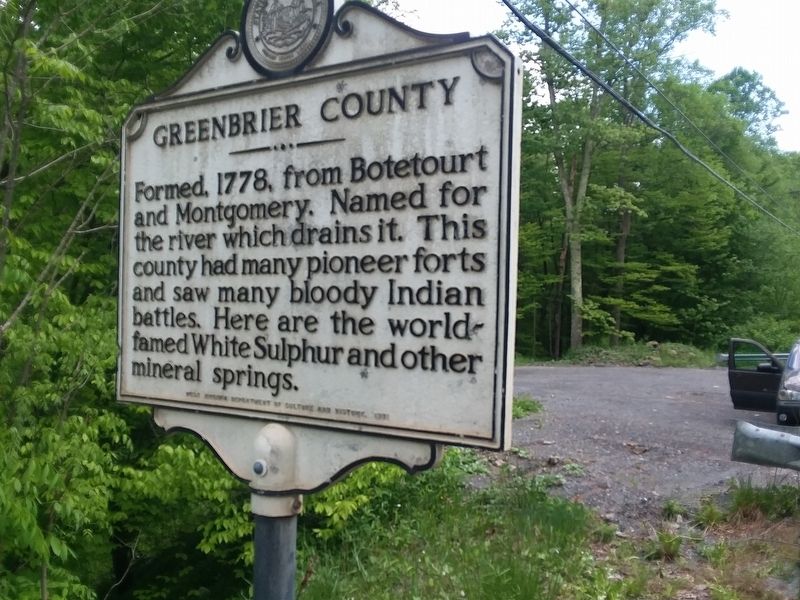
Greenbrier County. Formed, 1778, from Botetourt and Montgomery. Named for the river which drains it. This county had many pioneer forts and saw many bloody Indian battles. Here are the world-famed White Sulphur and other mineral springs.
. . . — — Map (db m84054) HM
Named for Kate Carpenter, whose husband, Nathan, was killed by the Indians. Fine scenic view. Home of Kate's Mountain Clover and other rare plants, such as the Box Huckleberry, 6000 years old - the oldest living thing. — — Map (db m19363) HM
Large Federal fish hatcheries are located here. A mile east on Howard's Creek the armies of North and South fought in 1863. At "Oakhurst" three miles north the first golf club in America was organized in 1884.
Twelve Presidents, from "Old . . . — — Map (db m19361) HM
The pure massive sandstone forming Hanging Rock is the Oriskany of the driller and geologist. The "Oriskany Sand," an important gas Sand, has produced in excess of a trillion cubic feet of gas in West Virginia. — — Map (db m150664) HM
Troops from this fort under Captain Mercer were ambushed in 1756 and many were killed. The French and Indians later attacked the fort but the garrison, aided by Daniel Morgan and other frontiersmen, repulsed the assault. — — Map (db m4556) HM
In 1784, Washington proposed the Northwestern Turnpike as an all-Virginia route to the Ohio. Authorized in 1827 and started in 1831, it remains a monument to the skill of its engineers, Charles Shaw and Colonel Claudius Crozet. — — Map (db m4623) HM
First erected in 1874 as a two span bridge on US Route 50 near Romney, one span was moved here in 1938 and re-erected on a new foundation. the 17' wide by 176' long bridge is a Whipple-Murphy Truss. The state’s oldest extant metal truss, the bridge . . . — — Map (db m92752) HM
Capon Springs bears Indian name meaning the "Medicine Waters." Discovered in 1765. Famous resort of early days. President Franklin Pierce, Daniel Webster, and his guest, Sir Henry Bulwer, the British Minister, were among guests. — — Map (db m50808) HM
Named for James Caudy, pioneer and Indian fighter, who took refuge from the Indians on a mass of rocks overlooking Cacapon River during the French and Indian War (1754–1763). From his position on the Castle of Rocks, he defended himself by . . . — — Map (db m20850) HM
Bloomery Iron Furnace
The furnace was built, 1833, by Thomas Pastly and later was owned by Lewis Passmor. He placed a Mr. Cornwell in charge who operated it until 1848 when it was sold to S. A. Pancost. He and his heirs operated it until 1875 . . . — — Map (db m11019) HM
Hampshire County
Oldest county; established by the Virginia Assembly, 1754. Formed from Frederick and Augusta. Lord Fairfax, owner, named it for the English shire of the same name. Ice Mountain and Hanging Rocks are among its natural . . . — — Map (db m159337) HM
Confederate troops under Captain George F. Sheets were defeated by Colonel S. H. Dunning's 5th Ohio Infantry here, Jan. 7, 1862. North River Bridge and a number of buildings were burned by the Federals. — — Map (db m203986) HM
Huge natural refrigerator, five miles north along North River, where ice is found for several hundred yards on the hottest summer days. Raven Rock, on North Mountain, overs one of the finest views in West Virginia. — — Map (db m25085) HM
Constructed in Spring 1863 by the 54th Pennsylvania under Col. Jacob Campbell, the fortifications took advantage of the natural defenses overlooking Mechanicsburg Gap and the South Branch of the Potomac. The site was occupied March-June and . . . — — Map (db m150658) HM
Mechanicsburg Gap
Scenic canyon cut through Mill Creek Mountain by Mill creek. Here an old Indian trail was the pathway from the Valley of Virginia to the Alleghenies, then the Northwestern Turnpike, now the George Washington Highway
Col. . . . — — Map (db m19355) HM
This peak on Hampshire-Hardy line rises a thousand feet above the surrounding hills to a height of more than half a mile. From it can be seen points in three counties. It overlooks "The Trough," famed for its history and scenery. — — Map (db m152775) HM
Built by State Road Comm. and local artisans in 1932; land given by H.R. Edeburn. Crystal quartz quarried from behind nearby Bloomery iron furnace, and stone from hillside behind the fountain. Spring water, gravity fed from hill above, supplied . . . — — Map (db m391) HM
The Indian Mound Cemetery, which is 7 feet high and about 15 feet in diameter, is one of the largest remaining mounds in the Eastern Panhandle of West Virginia. This mound has never been excavated but similar mounds of area dug by Smithsonian . . . — — Map (db m155358) HM
On June 13, 1861, Col. Lew Wallace (11th Indiana Infantry) led a raid against Southern forces occupying Romney. Wallace passed through the Mechanicsburg Gap and took South Branch Bridge. The Rebel retreat from Romney forced Gen. Johnston to abandon . . . — — Map (db m150660) HM
The massive sandstone forming the top of the exposure and the great arch is the Oriskany, and the limestone below it is the Helderberg of the driller and geologist. The "Oriskany Sand", an important gas Sand, has produced in excess of a trillion . . . — — Map (db m150659) HM
Romney. Incorporated as a town, 1762. Owned and laid off as a town by Lord Fairfax. Named for one of the five English Channel ports. Not far away was Fort Pearsall, built, 1756, as Indian defense. Town changed military control 56 times, . . . — — Map (db m159299) HM
Romney in 1861–1865. Sitting astride the natural invasion route from the Shenandoah Valley to the Potomac and the B. & O. Railroad, Romney was scourged by both armies. No great battles were fought here, but during the War the town . . . — — Map (db m159297) HM
Established, 1870. The Classical Institute was donated by the Romney Literary Society as the initial building unit. Co-educational school giving academic and vocational training to the State's deaf and blind youth. — — Map (db m459) HM
The Presbyterians established a church near here in 1792. At first called the Mountain Church in 1808, it became the nucleus of Presbyterian work in Hampshire County under the auspices of the Rev. John Lyle. The Rev. James Black reorganized the . . . — — Map (db m19356) HM
Frontier outpost, Capt. William Forman (Foreman), in 1777, led a company from this county to the relief of Fort Henry at Wheeling. He, two sons, and others were killed in an ambush by Native Americans at the "Narrows" near Moundsville. — — Map (db m19357) HM
Named for natural springs reputedly used by George Washington. Donated in 1857 for picnics and prize fights. Developed in 1897 as amusement park served by streetcar and boat attracting 15-20 thousand daily. Included dance pavilions, shooting . . . — — Map (db m49697) HM
Site of Nesselroad's powder mill which operated from 1795 to 1801. To the south on King's Creek stood Hartford's grist mill which served local settlers in early 1800's. In 1823, Swearingen's grist mill and Eaton's saw mill were built near the same . . . — — Map (db m39654) HM
Named by boat captains for many brick works shipping from area. John Gamble first mined clay in 1839; James Porter had first brick works in 1832. By 1844, five works produced 1.5 million bricks. Later, some 20 plants: including Captain John Porter, . . . — — Map (db m44118) HM
Named by boat captains for many brick works shipping from area. John Gamble first mined clay in 1830; James Porter had first brick works in 1832; five works in 1844 produced 1.5 million bricks. Later, over 20 plants, using local clay, gas and coal, . . . — — Map (db m44120) HM
Side A:Captain John Porter(August 7, 1838 - February 7, 1893) Early developer of New Cumberland, he operated line of steamboats and barges on Ohio River, Chelsea China Company and glass plants. Known as "brick king" he owned Sligo, . . . — — Map (db m44121) HM
Hancock County, formed in 1848 in home of Sam C. Allison in Fairview, also known as Pughtown and New Manchester. In election for county seat, New Cumberland won by 13; refusal to move led to another vote and majority of 46 in 1850 to move. In May . . . — — Map (db m44124) HM
Located beside courthouse, original building of four rooms built in 1869, opened in 1870 with town hall on 2nd floor. In 1888 two wings were added. By 20 January 1939, when destroyed by fire, had 14 rooms with 500 students. Rebuilt on same site, it . . . — — Map (db m44126) HM
Near New Cumberland, George Chapman settled, about 1783, and built an Indian fort. Here are graves of the Chapmans, Gregorys, Graftons, and other pioneer families. Pughtown, settled about 1810, was the first county seat. — — Map (db m39685) HM
Near New Cumberland, George Chapman settled, about 1783, and built an Indian fort. Here are graves of the Chapmans, Gregorys, Graftons, and other pioneer families. Pughtown, settled about 1810, was the first county seat. — — Map (db m44130) HM
The river flowing past New Cumberland contributed significantly to the political, economic and social development of the town. Early settlers to New Cumberland came by river and then depended on the river as means of receiving supplies and . . . — — Map (db m44133) HM
In 1839 John Cuppy laid out 42 lots on his farm between Ohio River and hill; added 50 lots in 1850. Named Vernon but called Cuppy Town. In 1840 John Chapman built the first house. Industry based on rich clay deposits, brick plants and river . . . — — Map (db m39743) HM
In 1839 John Cuppy laid out 42 lots on his farm between Ohio River and hill; added 50 lots in 1850. Named Vernon but called Cuppy Town. In 1840 John Chapman built the first house. Industry based on rich clay deposits, brick plants and river . . . — — Map (db m44135) HM
On Tomlinson Run, Nesselroad's powder mill began operation about 1795. Near by occurred the famous fight between Andrew and Adam Poe, border scouts, and Chief Big Foot and another Indian in 1782. The Poes won. Two Indians died. — — Map (db m66535) HM
One of the events which led up to Dunmore's War was the killing at this point of the family of Chief Logan, eloquent leader of the Mingo Indians, April, 1774, opposite their village at the mouth of Yellow Creek in Ohio. — — Map (db m44727) HM
In July 1863, Confederate Gen. John H. Morgan raided through Kentucky. Indiana, and Ohio seeking to bring the war to the North. Defeated at Buffington Island, he fled up the Ohio River and tried to cross into West Virginia. Members of the state . . . — — Map (db m189407) HM
Developed by subsidiaries of the Homer Laughlin China Company, the town has been home to the world's largest single pottery unit. A key industry in the county and state, fine wares made here have sold around the world. — — Map (db m44730) HM
Side A:Hancock CountyFormed in 1848 from Brooke. Named for John Hancock, first signer of the Declaration of Independence. Iron furnaces established in this county as early as 1794 made the cannon balls that Commodore Perry used in . . . — — Map (db m44127) HM
Hancock County
Formed in 1848 from Brooke. Named for John Hancock, first signer of the Declaration of Independence. Iron furnaces established in this county as early as 1794 made the cannon balls that Commodore Perry used in Battle of Lake . . . — — Map (db m80381) HM
East was Fort Holliday, built in 1776. During the Revolution it was a supply depot for the Continental Army. From it Col. Swearingen led troops with ammunition to relieve Fort Henry at Wheeling when attacked by Indians in 1777. — — Map (db m80384) HM
Born in Hollidays Cove ca. 1829. Moved to Kentucky and served as Union civilian scout during the Civil War. Seized locomotive, The General, in northern Georgia, and attempted to move within Union lines, but train lost power and raiders were . . . — — Map (db m155989) HM
Two miles east is the site of first blast furnace west of the Alleghenies. Built in 1794, it was the forerunner of the steel industry which flourished in this area. Here Peter Tarr cast cannon balls used by Perry on Lake Erie. — — Map (db m44138) HM
100 yards south is site of original log Three Springs Church. Built 1790 on land donated by James Campbell. Elisha Macurdy, first pastor, called Nov., 1799. The mother church of Cove and Paris United Presbyterian churches. — — Map (db m80385) HM
Names for the river flowing through it, the valley runs from Pendleton to Hampshire County and has some of the state's most productive farm land. During the French and Indian War, Fort Buttermilk protected area settlers. The valley was again the . . . — — Map (db m178372) HM
300 yards east is the first Lost River Valley Church. Built of logs, prior to 1797, on land deeded by Anthony Miller, 1831, to the Baptists and Presbyterians “to hold in common for a meetinghouse and graveyard.” — — Map (db m48935) HM
Settled before 1750. Nearby was Riddle’s Fort, frontier outpost. Here Battle of Lost River was fought in 1756 between company of Virginia frontiersmen under Captain Jeremiah Smith and band of 50 French and Indians. — — Map (db m155201) HM
Howard's Lick
Howard's Lick, or Lee White Sulphur Springs, was once owned by Gen. Henry "Light Horse Harry" Lee of Revolutionary War fame. It was owned later by Charles Carter Lee, brother of the beloved Gen. Robert E. Lee.
Jackson Home . . . — — Map (db m50470) HM
After a failed raid on New Creek on August 4, 1864, the Confederate cavalry of Gens. McCausland and Johnson made camp near Moorefield on the South Branch of the Potomac. Hoping to smash the Rebel raiders, Union Gen. Averell led his smaller force in . . . — — Map (db m153025) HM
(Front): Near here, grave of Gen. Joseph Neville; officer in Revolution; member of conventions of 1775 and 1776. With Alexander McLean of Pennsylvania, he completed survey of the Mason and Dixon line in 1782. His son, Joseph, was a general in . . . — — Map (db m23213) HM
Chartered, 1777, and named for Conrad Moore, early settler. During Indian wars, Town Fort, north, and Fort Buttermilk, south, gave protection. Here, 1794, Gen. Biggs brought part of the troops recruited to suppress Whisky Rebellion. — — Map (db m9233) HM
During the Civil War this church was used by both the North and South as a hospital. Union soldiers stabled horses here and burned pews for firewood. Federal government paid $800 indemnity in 1914. — — Map (db m9236) HM
Built on lands of Issac Van Meter who took up claim near Old Fields, 1735, and settled there, 1744. In chain of forts which Washington established. For a time it was garrisoned by British regulars. Near it was Battle of the Trough, 1756. — — Map (db m155454) HM
This U-shaped Georgian-Tidewater house, built 1811-12, was the home of the McNeill family. During the Civil War, McNeill's Rangers, a Southern band of guerillas, used it as a home base. Confederate Gen. Bradley Johnson headquartered here before the . . . — — Map (db m152773) HM
Last of the Lutheran horseback circuit rides, who was known as a dynamic pastor, theologian, professor of history, philologist and a Christian gentleman.
Died 1952 A.D. — — Map (db m49580) HM
Here the Lost River disappears under Sandy Ridge. Two miles away on the other side of the mountain the stream is “found” again as the headwaters of the Cacapon River. This stream has the Indian name for “Medicine Waters.” — — Map (db m74493) HM
The massive sandstone forming the cliff is the Oriskany of the driller, and the geologist. The "Oriskany Sand", an important gas sand, has produced in excess of a trillion cubic feet of gas in West Virginia. — — Map (db m34572) HM
The population center of the United State was in present West Virginia four times as it moved westward across the nation: near Wardensville in 1820; at Smoke Hole in 1830; west of Buckhannon in 1840; near Burning Springs in 1850. — — Map (db m23212) HM
George Washington laid off land here for William Wallace Warden, Nov. 11, 1749. Warden built a stockade fort, near which members of his family were killed by Indians, 1758, and the fort burned. Scene of skirmishes in 1862-1863. — — Map (db m237969) HM
West Virginia. (Hardy County) “The Mountain State”—western part of the Commonwealth of Virginia until June 20, 1863. Settled by the Germans and Scotch-Irish. It became a line of defense between the English and French during . . . — — Map (db m74496) HM
Enlarged replica on site of original Michael L. Benedum family home, Benedum, born here 16 July 1869, died 30 July 1959. Known as the “Great Wildcatter” for success in oil exploration, he became as well known for philanthropy. Benedum . . . — — Map (db m125816) HM
On Simpson Creek is the site of fort built by John Powers, 1771. Nearby is grave of Col. Benjamin Wilson, soldier and settler. Here lived Joseph Johnson, only Virginia governor from west of Alleghenies; first elected by popular vote. — — Map (db m4545) HM
A. S. Hugill built 75' long by 14' wide multiple king-post truss bridge in 1881 for $1483 on land of John Lowe. Survived great flood of 1888 but was washed away from original site 1/2 miles upstream in 1899. — — Map (db m8541) HM
Birthplace of General Thomas J. “Stonewall” Jackson. After a brilliant Mexican War record, he joined the Confederacy in 1861, earned his nickname and advancement in rank in first Battle of Bull Run, and was killed at Chancellorsville. — — Map (db m73406) HM
(side 1)
Established 1785. Named for Gen. George Rogers Clark. John Simpson camped here in 1764. Early permanent settlements were made by the Davissons, Cottrills, Sotha Hickman, Nicholas Carpenter, and others.
(side 2) . . . — — Map (db m73413) HM
On April 22, 1861, in Clarksburg, about 1,200 citizens of Harrison County met to oppose Virginia's proposed ordinance of secession. They supported John Carlile's call for delegates to meet on May 13 in Wheeling to determine a course of action for . . . — — Map (db m184744) HM
Born in 1817, he practiced law and served in the Virginia Senate and US Congress. At the 1861 Richmond Convention, he opposed secession. Although he led efforts to create a new state and wrote "A Declaration of the People of Virginia" calling for a . . . — — Map (db m184802) HM
In this cemetery lie buried members of the Stonewall Jackson family: his father Jonathan, a sister Elizabeth, his great grandparents John Jackson and wife Elizabeth Cummings. Buried here also are Mrs. Mary Payne Jackson and Mrs. Mary Coles Payne, . . . — — Map (db m175548) HM
Built in 1894 and named in honor of Reverend George Towers, graduate of Oxford, England who was a teacher at Randolph Academy. The Academy, authorized by the Virginia Assembly in 1787, stood just to the east and was the principal regional school . . . — — Map (db m73405) HM
Bathsheba Bigler Smith, born May 3, 1822, one mile upstream, was baptized in The Church of Jesus Christ of Latter - day Saints in 1837. Moved to Nauvoo, IL, where she was a founding member of the Relief Society, the LDS Church charitable women's . . . — — Map (db m177224) HM
Nearby is the Mclntire blockhouse, built in 1773, another of the outposts established as protection against the Indians. Here are the graves of many
early settlers, including those of John McIntire and wife, both victims of the Indians. — — Map (db m176882) HM
Built 1892, following the completion of railroad in 1887. Lost Creek grew to become largest shipping point for cattle in West Virginia in 1915 and on entire B & O system, east of Mississippi in 1923. — — Map (db m35331) HM
Side A
Site of “Big Elm,” tree awarded “largest of its kind in US” in 1876. Measured over 30 feet in circumference at its base. The tree began dying by 1905, with the cause attributed to disease, the building of a streetcar line, and hogs . . . — — Map (db m125818) HM
Born in 1837, Hall worked at the Wheeling Intelligencer during the Civil War. His reporting during the creation of WV served as the basis for his publication, The Rending of Virginia. Hall also recorded the proceedings of the . . . — — Map (db m125819) HM
From 1922 to 1933, WV State Police training facilities and Company A headquarters were located at a camp in Haywood Junction. Not only were troopers trained, but horses were broken using proven methods of the U.S. Cavalry. In the late 1920s, . . . — — Map (db m176749) HM
Built, 1778, by Levi Shinn who came from New Jersey, 1773, and claimed tomahawk rights. Returned with family and brothers, Clement and Jonathan and settled. Sold part of land to Jonathan whose son, Levi, deeded it for site of Shinnston. — — Map (db m125817) HM
Village so named because of well drilled here in 1835 by Abraham and Peter Righter. The well reached a depth of 745 feet releasing natural gas. Often attributed to be first deep well drilled in United States. Water from such wells was reputed to . . . — — Map (db m177528) HM
At 8:30 p.m. on June 23, 1944, a large tornado struck this area without warning because weather news was banned during WWII. The violent tornado lifted the West Fork River from its bed and left path of destruction up to 1,000' wide. Storm claimed . . . — — Map (db m125820) HM
Spelter Community Company town built for immigrant, primarily Spanish, zinc plant workers, 1910-11: housed 1,500 residents in 175 homes, renting for $11 per month by 1915. First known as Ziesing, for a company official; named Spelter for post . . . — — Map (db m125821) HM
Michael Coleman, member of a hunting party from frontier fort at Belleville, was killed and scalped by the Indians at this point about 1793. Near by at Mill Creek Falls, Benjamin Wright build an early power flour mill. — — Map (db m124884) HM
Post Office established here July 1, 1880, with Grandville P. Morrison as first postmaster. Named in honor of John Edward Kenna (1848-1893), member of the U.S. House of Representatives (1879-1883), and later elected to the U.S. Senate (1883-93). . . . — — Map (db m73672) HM
Jackson County
Formed in 1831 from Mason, Kanawha and Wood. Named
for General Andrew Jackson,
the seventh President of the
United States. Jesse Hughes,
noted Indian fighter, spent
declining years in this county where he is buried.
. . . — — Map (db m189747) HM
Born in 1819, Frost was editor of Jackson County’s first newspaper, The Virginia Chronicle, which was burned in 1862 during Jenkins Raid for its pro-Union stance. He served as Speaker of the House for the Restored Government of Virginia, . . . — — Map (db m124351) HM
Ravenswood. These lands were surveyed, 1771, for George Washington by Colonel William Crawford, who later was taken captive by the Indians and burned at the stake. Washington camped here in 1770. Here is grave of Jesse Hughes, noted scout. . . . — — Map (db m39625) HM
Westward lies the Millwood Tract of 4,395 acres patented by George Washington on December 15, 1772, based on a survey made in June 1771. It bordered on the Ohio River above the Great Bend for “file miles and 700 poles.” — — Map (db m124517) HM
On November 3, 1897, John Morgan
murdered Chloe Greene and two of
her three children, James Greene
and Matilda Pfost. Daughter Alice
Pfost managed to escape despite
being wounded during the attack.
G.W. Shamblen captured Morgan who
was tried . . . — — Map (db m124858) HM
At around 9 p.m. on December 19, 1861, a party of armed Confederate guerillas known as the Moccasin Rangers captured Ripley and broke into the post office, seizing its contents. The Rangers also robbed a store, stole private possessions, and took . . . — — Map (db m178585) HM
980 entries matched your criteria. Entries 201 through 300 are listed above. ⊲ Previous 100 — Next 100 ⊳