By Mark Hilton, August 26, 2013
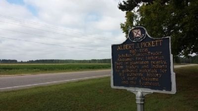
Albert J. Pickett Marker
GEOGRAPHIC SORT Title Sort Marker Number Sort Marker Number Sort N Marker Number Sort T Publication Order Sort Publication Order Sort A Erected Year Sort Most Viewed Sort Most Recent-Interest Sort Most Recently Changed Sort SEE FAQ #33 FOR DESCRIPTIONS
On Alabama Route 14 at County Road 133, on the right when traveling west on State Route 14.
On South Autauga Street at Academy Street, on the right when traveling south on South Autauga Street.
On East 4th Street west of North Court Street, on the right when traveling west.
On County Road 4, 0.1 miles west of Buena Vista Boulevard, on the right when traveling west.
On Doster Road at Mobile Drive, on the right when traveling south on Doster Road.
On East Sixth Street, 0.4 miles east of North Northington Street, on the right when traveling west.
On Dosterville Road, 1.5 miles west of South Memorial Drive (U.S. 31), on the left when traveling west.
On Main Steet at South Chestnut Sreet, on the right when traveling east on Main Steet.
On South Court Street at West 3rd Street, on the left when traveling south on South Court Street.
On Maple Street at Pletcher Street, on the right when traveling west on Maple Street.
On East Main Street at South Memorial Drive (U.S. 31), on the right when traveling east on East Main Street.
On Bridge Street at Gin Shop Hill Road, on the right when traveling west on Bridge Street.
On Wetumpka Street (County Route 2) at South Washington Street, on the right when traveling east on Wetumpka Street.
On South Chestnut Street at 1st Street, on the right when traveling south on South Chestnut Street.
Paid Advertisement
On Pine Grove Drive near Confederate Rest Road, on the right when traveling west.
Near Dixie Graves Parkway (State Highway 180) when traveling west.
Near West Fort Morgan Road (Alabama Route 180) at Island Club Drive, on the right when traveling west.
On Battleship Parkway (U.S. 98) near Interstate 10, on the right when traveling east.
On Alabama Route 225, 4.7 miles north of Spanish Fort Blvd (U.S. 31), on the right when traveling north.
On Alabama Route 225, 1.2 miles north of Interstate 65, on the right when traveling north.
On Alabama Route 59 north of Hodgson Road, on the right when traveling north.
On Boatyard Road (County Road 80) at Fort Mims Road, on the left when traveling west on Boatyard Road.
On East Broad Street, 0.1 miles north of North Livingston Ave, in the median.
On Montevallo Road (State Highway 25) at County Road 62, on the left when traveling west on Montevallo Road.
On U.S. 31 at County Road 7, on the right when traveling north on U.S. 31.
On Local Road 26 at Dunn Lane, on the right when traveling east on Local Road 26.
On Main Street (U.S. 231) at Lee Street West, on the left when traveling north on Main Street.
On College Street at Church Street, on the right when traveling north on College Street.
On Local Road 26 at Dunn Lane, on the right when traveling east on Local Road 26.
On Main Street (U.S. 231), on the right when traveling south.
Paid Advertisement
On County Road 36, 0.1 miles north of New Home Church Road, on the right when traveling north.
On Second Avenue East (US Highway 231) at 4th Street North, on the right when traveling west on Second Avenue East (US Highway 231).
On 6th Street South (U.S. 231) at Champion Road, on the right on 6th Street South.
On U.S. 29 just north of Twin Trail, on the right when traveling south.
On County Route 19, on the right when traveling south.
On U.S. 29 at County Road 19, on the right when traveling south on U.S. 29.
On Fitzpatrick Road, 0.5 miles north of Alabama Route 110, on the right when traveling north.
On Old Troy Road, on the left when traveling west.
On Main Street, on the right when traveling south.
On Old Troy Road, on the left when traveling west.
On Railroad Street, on the right when traveling west.
On U.S. 15/29, on the right when traveling north.
On U.S. 82 at County Road 35, on the right when traveling west on U.S. 82.
On U.S. 29, on the right when traveling north.
On U.S. 82 at Greenwood Avenue, on the right when traveling west on U.S. 82. Reported damaged.
On U.S. 82 west of Prairie Street, on the right when traveling east.
Paid Advertisement
On State Highway 223 at County Road 22, on the left when traveling south on State Highway 223.
On Blackmon Street (U.S. 82) at Prairie Street, on the right when traveling west on Blackmon Street.
On East Commerce Street (Alabama Route 10) at South Conecuh Street (County Route 45), on the left when traveling east on East Commerce Street.
On East Commerce Street (Alabama Route 10) at South Park Street, on the left when traveling west on East Commerce Street.
On Sherling Lake Road (Road 44) 0.4 miles north of Ridge Road (County Road 54), on the right when traveling north.
On West Commerce Street (Alabama Route 10) at Bolling Street, on the left when traveling west on West Commerce Street.
On U.S. 431, 2 miles north of State Route 144, on the right when traveling south.
On Albert P. Brewer Highway (State Highway 202) west of Old Birmingham Highway, on the right when traveling east.
On East 10th Street west of Kirkwood Avenue, on the left when traveling east.
On East 10th Street west of Leighton Avenue, on the left when traveling east.
On U.S. 431, on the right when traveling north.
On Quintard Avenue (U.S. 431), on the right when traveling north.
On Public Square West (State Highway 21) south of Clinton Street Southwest, on the left when traveling south.
On Public Square East (State Highway 21) west of Ladiga Street Southeast, on the left when traveling north.
On Public Square West (State Highway 21) near Clinton Street Southwest, on the left when traveling south.
On University Circle west of North Pelham Road (State Highway 21), on the right.
Paid Advertisement
On Pelham Road (State Highway 21) at James Street SE, on the right when traveling north on Pelham Road.
On Lafayette Street North (U.S. 431) just south of Alabama Avenue, on the right when traveling north.
On South LaFayette Street (U.S. 431) at East Alabama Avenue, on the right when traveling north on South LaFayette Street.
On 1st Street Southeast at 2nd Avenue Southeast, on the right when traveling north on 1st Street Southeast.
On 20th Avenue (U.S. 29) 0.1 miles north of 61st Street West, on the right when traveling east.
Near County Route 587 at Troy Lane, on the right when traveling south.
On 2nd Avenue North west of 5th Street South, on the right when traveling west.
On 2nd Avenue North west of 5th Avenue South, on the right when traveling west.
On County Route 458, on the right when traveling north.
On Alabama 22 at County Road 45, on the right when traveling south on Alabama 22.
Near County Road 45, 0.3 miles west of State Route 22, on the right when traveling north.
On Paragon Road (County Road 16) 2 miles west of State Route 17, on the left when traveling west.
On Mayton Drive, on the left when traveling south.
On U.S. 84 at County Road 22, on the right when traveling west on U.S. 84.
On Shady Grove Road (Alabama Route 9) at Alabama Route 63, on the right when traveling north on Shady Grove Road.
On Cheaha Road (Alabama Route 49) at Nichols Street, on the right when traveling north on Cheaha Road.
Paid Advertisement
On County Route 639 at County Route 640, on the right when traveling west on County Route 639.
On Claxton Avenue at East Davis Street (U.S. 84), on the left when traveling south on Claxton Avenue.
On Davis Street, on the left when traveling west.
On U.S. 84, on the right when traveling west.
On County Route 544, 0.3 miles north of County Route 552, on the left when traveling north.
On Main Street (U.S. 84) at College Street, on the right when traveling north on Main Street.
On Alabama Route 27, on the right when traveling south.
On South Main Street (U.S. 84) 0 miles south of College Street, on the left when traveling north.
On Old Lee Highway (County Road 20) at Garner Lane, on the right when traveling west on Old Lee Highway.
On Middle School Road north of Old Lee Highway (County Road 20), on the left when traveling north.
On Mulberry Lane, 0.4 miles east of Moody Lane, on the left when traveling east.
On Mt. Pleasant Road (County Road 66) 0.3 miles east of County Line Road (County Road 48), on the right when traveling east.
On Main Street at 1st Street, on the left when traveling south on Main Street.
On Main Street, 0.1 miles south of 1st Street, on the right when traveling south.
On County Line Road (Alabama Route 99) 0.2 miles north of Bethel Cemetery Road, on the left when traveling north.
On Old Hwy 20 east of Morgan Drive, on the right when traveling east.
Paid Advertisement
On Bainbridge Road (County Road 83) 0.3 miles north of River Road (County Route 40), on the right when traveling north.
On South Wilson Dam Road, on the right when traveling south.
On S. Wilson Dam Highway, 1 mile Kimberley Drive.
Near Ashe Boulevard, 0.4 miles north of NE 16th Street.
717 entries matched your criteria. The first 100 are listed above.
Next 100 ⊳