6996 entries match your criteria. Entries 101 through 200 are listed.⊲ Previous 100 — Next 100 ⊳
Historical Markers and War Memorials in Georgia
By Darren Jefferson Clay, May 26, 2022
Petroglyphic Boulders Marker
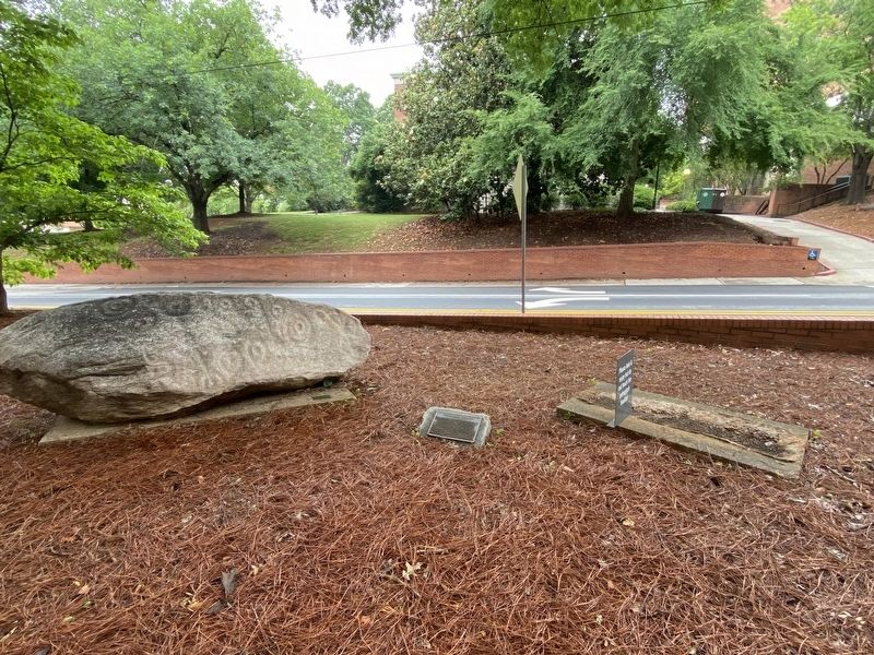
| 101 ► Georgia, Athens-Clarke County, Athens — Petroglyphic Boulders — |
| Near South Jackson Street north of Baldwin Street, on the right when traveling north. | |||
| 102 ► Georgia, Athens-Clarke County, Athens — Phi Beta Sigma — |
| Near South Lumpkin Street at Baxter Street, on the left when traveling south. | |||
| 103 ► Georgia, Athens-Clarke County, Athens — Prominent Facilities — |
| Near Pinecrest Drive. | |||
| 104 ► Georgia, Athens-Clarke County, Athens — Purple Heart Memorial — |
| On Gran Ellen Drive, on the left when traveling west. | |||
| 105 ► Georgia, Athens-Clarke County, Athens — R. Chappelle Matthews — |
| Near South Lumpkin Street. | |||
| 106 ► Georgia, Athens-Clarke County, Athens — Railroad Heritage — Georgia Railroad — |
| Near East Broad Street east of Mulberry Street, on the left when traveling east. | |||
| 107 ► Georgia, Athens-Clarke County, Athens — Railroad Heritage — Seaboard Air Line Railway — |
| Near East Broad Street west of Mulberry Street, on the left when traveling west. | |||
| 108 ► Georgia, Athens-Clarke County, Athens — Railroad Heritage — Central of Georgia Railway — |
| Near East Broad Street east of Mulberry Street, on the left when traveling east. | |||
| 109 ► Georgia, Athens-Clarke County, Athens — Railroad Heritage — Gainesville Midland Railway — |
| Near East Broad Street east of Mulberry Street, on the left when traveling east. | |||
| 110 ► Georgia, Athens-Clarke County, Athens — Railroad Heritage — Southern Railway — |
| Near East Broad Street east of Mulberry Street, on the left when traveling east. | |||
| 111 ► Georgia, Athens-Clarke County, Athens — Railroad Heritage — Trains Create a District — |
| Near East Broad Street west of Mulberry Street, on the left when traveling west. | |||
| 112 ► Georgia, Athens-Clarke County, Athens — Railroad Heritage — King Cotton — |
| Near East Broad Street west of Mulberry Street, on the left when traveling west. | |||
| 113 ► Georgia, Athens-Clarke County, Athens — Railroad Heritage — Culture and Entertainment — |
| Near Oconee Street (Business U.S. 78) 0.4 miles west of South Poplar Street, on the right when traveling west. | |||
| 114 ► Georgia, Athens-Clarke County, Athens — Railroad Heritage — Business and Industry Diversify — |
| Near East Broad Street west of Mulberry Street, on the left when traveling west. | |||
| 115 ► Georgia, Athens-Clarke County, Athens — River Overview — The Mill Bridge — |
| Near East Broad Street east of Wilkerson Street, on the right. | |||
| 116 ► Georgia, Athens-Clarke County, Athens — River Overview — Mill Location — |
| Near East Broad Street east of Wilkerson Street, on the right when traveling east. | |||
| 117 ► Georgia, Athens-Clarke County, Athens — River Overview — Taking Care of the River — |
| Near East Broad Street east of Wilkerson Street, on the right when traveling east. | |||
| 118 ► Georgia, Athens-Clarke County, Athens — 029-15 — Robert Toombs Oak — |
| Near East Broad Street (State Road 10 / 78) at Herty Street, on the left when traveling south. | |||
| 119 ► Georgia, Athens-Clarke County, Athens — Ross Crane House — |
| On Pulaski Street at West Washington Street, on the right when traveling south on Pulaski Street. | |||
| 120 ► Georgia, Athens-Clarke County, Athens — Sigma Gamma Rho — |
| Near South Lumpkin Street at Baxter Street, on the left when traveling south. | |||
| 121 ► Georgia, Athens-Clarke County, Athens — Significant Achievements — |
| Near Pinecrest Drive. | |||
| 122 ► Georgia, Athens-Clarke County, Athens — Significant Achievements — |
| Near Pinecrest Drive. | |||
| 123 ► Georgia, Athens-Clarke County, Athens — Site of First Classes — |
| Near S Jackson Street, 0 miles south of E Broad Street, on the left when traveling north. | |||
| 124 ► Georgia, Athens-Clarke County, Athens — Student-Athlete Awards — |
| Near Pinecrest Drive. | |||
| 125 ► Georgia, Athens-Clarke County, Athens — 029-5 — The Athens Double-Barrelled Cannon — |
| On East Hancock Avenue at College Avenue, on the right when traveling east on East Hancock Avenue. | |||
| 126 ► Georgia, Athens-Clarke County, Athens — The Life and Times of Two Athens Families — |
| Near Hoyt Street at North Jackson Street, on the left when traveling east. | |||
| 127 ► Georgia, Athens-Clarke County, Athens — The Millstone — Grist Mills: Cornmeal and Flour — |
| Near East Broad Street east of First Street, on the right when traveling east. | |||
| 128 ► Georgia, Athens-Clarke County, Athens — The Olympic Flame — |
| Near Sanford Drive. | |||
| 129 ► Georgia, Athens-Clarke County, Athens — The Parterre Gardens of Athens — |
| Near State Street at Hoyt Street, on the right when traveling north. | |||
| 130 ► Georgia, Athens-Clarke County, Athens — 029-18 — The Red and Black — |
| On Herty Drive, 0 miles south of Broad Street, on the left when traveling south. | |||
| 131 ► Georgia, Athens-Clarke County, Athens — 029-6 — The Stoneman Raid — |
| On West Broad Street (U.S. 78) at South Lumpkin Street, on the right when traveling east on West Broad Street. | |||
| 132 ► Georgia, Athens-Clarke County, Athens — 029-13 — The Taylor-Grady House — |
| On Prince Avenue, 0 miles west of Grady Avenue (U.S. 129), on the right when traveling west. | |||
| 133 ► Georgia, Athens-Clarke County, Athens — The University of Georgia — Dedicated to and in memory of the student-athletes of The University of Georgia who made the supreme — sacrifice for their country — |
| On East Rutherford Street, on the left when traveling east. | |||
| 134 ► Georgia, Athens-Clarke County, Athens — Tradition of Service — |
| Near Pinecrest Drive. | |||
| 135 ► Georgia, Athens-Clarke County, Athens — U.S. Navy Supply Corps School / Former Site of Georgia State Normal School — |
| On Prince Avenue (U.S. 129) 0.1 miles north of Oglethorpe Avenue, on the left when traveling north. | |||
| 136 ► Georgia, Athens-Clarke County, Athens — 1965 — UGA vs Alabama — 1965 — 18 - 17 — |
| Near South Lumpkin Street. | |||
| 137 ► Georgia, Athens-Clarke County, Athens — UGA vs Auburn — 2016 — 13 - 7 — |
| Near Sanford Drive. | |||
| 138 ► Georgia, Athens-Clarke County, Athens — UGA vs Auburn — 2007 — 45 - 20 — |
| Near Sanford Drive. | |||
| 139 ► Georgia, Athens-Clarke County, Athens — UGA vs Auburn — 1959 — 14 - 13 — |
| Near Sanford Drive. | |||
| 140 ► Georgia, Athens-Clarke County, Athens — UGA vs Clemson — 1984 — 26 - 23 — |
| Near South Lumpkin Street. | |||
| 141 ► Georgia, Athens-Clarke County, Athens — UGA vs Georgia Tech — 1968 — 47 - 8 — |
| Near Baxter Street. | |||
| 142 ► Georgia, Athens-Clarke County, Athens — UGA vs LSU — 2013 — 44 - 41 — |
| Near South Lumpkin Street. | |||
| 143 ► Georgia, Athens-Clarke County, Athens — UGA vs Mississippi State — 2017 — 31 - 3 — |
| Near Sanford Drive. | |||
| 144 ► Georgia, Athens-Clarke County, Athens — UGA vs South Carolina — 1980 — 13 - 10 — |
| Near Sanford Drive. | |||
| 145 ► Georgia, Athens-Clarke County, Athens — UGA vs Tennessee — 2002 — 18 - 13 — |
| Near South Lumpkin Street. | |||
| 146 ► Georgia, Athens-Clarke County, Athens — 29-1 — United States Navy Pre-Flight School — |
| On South Jackson Street, 0 miles north of Baldwin Street, on the right when traveling north. | |||
| 147 ► Georgia, Athens-Clarke County, Athens — 029-1 — University of Georgia — |
| On East Broad Street at College Avenue, on the right when traveling east on East Broad Street. | |||
| 148 ► Georgia, Athens-Clarke County, Athens — 29-7 — University of Georgia Botanical Garden — 1833-1856 — |
| On North Pope Street, 0.1 miles north of West Broad Street (Business U.S. 78), on the right when traveling north. | |||
| 149 ► Georgia, Athens-Clarke County, Athens — Vince Dooley Athletic Complex — |
| Near Pinecrest Drive. | |||
| 150 ► Georgia, Athens-Clarke County, Athens — Vincent J. Dooley — The University of Georgia Head Football Coach — 1964-1988 — |
| Near Pinecrest Drive. | |||
| 151 ► Georgia, Athens-Clarke County, Athens — Vincent J. Dooley — |
| Near Pinecrest Drive. | |||
| 152 ► Georgia, Athens-Clarke County, Athens — Vincent J. Dooley — Director of Athletics — 1979-2004 — |
| Near Pinecrest Drive. | |||
| 153 ► Georgia, Athens-Clarke County, Athens — Vincent J. Dooley — Director of Athletics — 1979-2004 — |
| Near Pinecrest Drive. | |||
| 154 ► Georgia, Athens-Clarke County, Athens — Ware-Lyndon House Garden Features — |
| Near State Street at Hoyt Street, on the right when traveling north. | |||
| 155 ► Georgia, Athens-Clarke County, Athens — Ware-Lyndon House Through the Years — |
| Near Hoyt Street east of State Street, on the left when traveling east. | |||
| 156 ► Georgia, Athens-Clarke County, Athens — Water Power — Water and Gravity — |
| Near East Broad Street east of First Street, on the right when traveling east. | |||
| 157 ► Georgia, Athens-Clarke County, Athens — Water Power — Waterwheels — |
| Near East Broad Street east of First Street, on the right when traveling east. | |||
| 158 ► Georgia, Athens-Clarke County, Athens — Water Power — The Headrace and Tailrace — |
| Near East Broad Street east of First Street, on the right when traveling east. | |||
| 159 ► Georgia, Athens-Clarke County, Athens — William Bartram — Artist, Naturalist, Explorer — |
| Near East Broad Street west of Mulberry Street, on the left when traveling west. | |||
| 160 ► Georgia, Athens-Clarke County, Athens — William Bartram Trail — Traced 1773-1777 — Deep South Region — |
| On the State Botannical Garden entrance road, 0.2 miles west of S. Milledge Avenue, on the right when traveling west. | |||
| 161 ► Georgia, Athens-Clarke County, Athens — Zeta Phi Beta — |
| Near South Lumpkin Street at Baxter Street, on the left when traveling south. | |||
| 162 ► Georgia, Atkinson County, Pearson — 002-1 — Atkinson Court House — >>>----- > — |
| On South Main Street (U.S. 441) at West Smith Avenue, on the right when traveling south on South Main Street. | |||
| 163 ► Georgia, Atkinson County, Pearson — Confederate Soldier Memorial — |
| On South Main Street (U.S. 221/441) just south of West Roberts Avenue, on the right when traveling south. | |||
| 164 ► Georgia, Atkinson County, Pearson — 002-2 — Kinnaird Trail — |
| On U.S. 221 at Kinnaird Trail (County Road 29), on the right when traveling south on U.S. 221. | |||
| 165 ► Georgia, Atkinson County, Pearson — 002-3 — Minnie F. Corbitt Memorial Museum — >>>----- > — |
| On East Carter Avenue at North Church Street, on the left when traveling east on East Carter Avenue. | |||
| 166 ► Georgia, Atkinson County, Pearson — Salem Church — |
| On Salem Church Road (County Route 29) 0.5 miles east of U.S. 221, on the left when traveling east. | |||
| 167 ► Georgia, Bacon County, Alma — 003-1 — Bacon County — |
| On Dixon Street (State Highway 4) at East 12th Street, on the right when traveling south on Dixon Street. | |||
| 168 ► Georgia, Baker County, Leary — 004-2 — Battle of Chickasawachee Swamp — |
| On Georgia Route 37 at Clear Lake Road (County Route 121), on the right when traveling north on State Route 37. | |||
| 169 ► Georgia, Baker County, Milford — Milford Baptist Church Memorial — |
| Near Millford Church Road, 0.3 miles north of Georgia Route 216, on the left when traveling north. | |||
| 170 ► Georgia, Baker County, Newton — 004-1 — Baker County — |
| On Main Street at Court Avenue, on the right when traveling north on Main Street. | |||
| 171 ► Georgia, Baldwin County, Midway-Hardwick — John Rutherford House — |
| On Allen Memorial Drive Southwest west of Harrisburg Road Southwest, on the right when traveling east. | |||
| 172 ► Georgia, Baldwin County, Midway-Hardwick — Summer Home (of) Governor Herschel V. Johnson — |
| On Allen Memorial Drive west of Irwinton Road (U.S. 441), on the right when traveling west. | |||
| 173 ► Georgia, Baldwin County, Milledgeville — Alexis de Tocqueville — |
| On East Greene Street at North Jefferson Street, on the right when traveling east on East Greene Street. | |||
| 174 ► Georgia, Baldwin County, Milledgeville — Baldwin County Veterans Memorial — |
| On West Hancock Street at North Wilkinson Street, on the right when traveling west on West Hancock Street. | |||
| 175 ► Georgia, Baldwin County, Milledgeville — 005-10 — Birthplace of Charles Holmes Herty — (1867-1938) — |
| On West Hancock Street, 0 miles North Wilkinson Street, on the right when traveling west. | |||
| 176 ► Georgia, Baldwin County, Milledgeville — 005-1 — Brown-Stetson-Sanford House — |
| On West Hancock Street (Georgia Route 49) at Jackson Street, on the right when traveling west on West Hancock Street. | |||
| 177 ► Georgia, Baldwin County, Milledgeville — 005-14 — Campsite of Union Army — <------<<<< — |
| On Georgia Route 22/24 at Old River Bridge Road, on the right when traveling east on State Route 22/24. | |||
| 178 ► Georgia, Baldwin County, Milledgeville — Carl Vinson • Mary Green Vinson — Nov.18, 1883 - June 1, 1981 Sept. 19, 1887 - Nov. 16, 1950 — |
| Near S. Liberty Street continued, on the left when traveling south. | |||
| 179 ► Georgia, Baldwin County, Milledgeville — Cedar Lane Cemetery — |
| On Lawrence Road at Central Shop Road, on the right when traveling south on Lawrence Road. | |||
| 180 ► Georgia, Baldwin County, Milledgeville — 005-28 — Cemetery Square |
| On Franklin Street (Bypass Route 441), on the right when traveling east. Reported missing. | |||
| 181 ► Georgia, Baldwin County, Milledgeville — 005-12 — Cobb's Quarter, Sherman's Campsite — |
| On Old Monticello Road NW at Nelson Road, on the right when traveling west on Old Monticello Road NW. | |||
| 182 ► Georgia, Baldwin County, Milledgeville — Cornerstone/Auditorium Building — |
| On Jones Drive at Broad Street, on the left when traveling north on Jones Drive. | |||
| 183 ► Georgia, Baldwin County, Milledgeville — 005-30 — De Soto in Georgia — |
| On West Hancock Street (Georgia Route 24) at S. Wilkinson Street, on the right when traveling east on West Hancock Street. | |||
| 184 ► Georgia, Baldwin County, Milledgeville — Dr. Charles Holmes Herty — Statesman - Chemist — |
| On West Handcock Street (Georgia Route 49) just west of Wilkinson Street, on the right when traveling west. | |||
| 185 ► Georgia, Baldwin County, Milledgeville — 005-3 — Flannery O'Connor's Andalusia Farm — |
| On North Columbia Street (U.S. 441) 0 miles south of Pearl Street, on the right when traveling north. | |||
| 186 ► Georgia, Baldwin County, Milledgeville — 005-23 — Fort Wilkinson — |
| On Carl Vinson Highway (Georgia Route 112) at Fort Wilkinson Road, on the left when traveling south on Carl Vinson Highway. | |||
| 187 ► Georgia, Baldwin County, Milledgeville — L15 — Georgia State Penitentiary — From Prisoners to Soldiers — March to the Sea Heritage Trail — |
| On West Hancock Street (Georgia Route 49) west of North Wilkinson Street, on the right when traveling west. | |||
| 188 ► Georgia, Baldwin County, Milledgeville — 005-4 — Georgia's Secession Convention — |
| On East Green Street near South Jefferson Street, on the right when traveling east. | |||
| 189 ► Georgia, Baldwin County, Milledgeville — Great Seal of Georgia and the Unfinished Acts of the Legislature, 1864 — |
| On North Wilkinson Street at West Hancock Street (Georgia Route 49), on the left when traveling north on North Wilkinson Street. | |||
| 190 ► Georgia, Baldwin County, Milledgeville — 005-17 — Howell Cobb Plantation — |
| On Old Monticello Road NW at Nelson Road, on the right when traveling west on Old Monticello Road NW. | |||
| 191 ► Georgia, Baldwin County, Milledgeville — In Commemoration of Marquis De Lafayette — |
| On East Greene Street west of South Jefferson Street, on the right when traveling east. | |||
| 192 ► Georgia, Baldwin County, Milledgeville — Jarrett Springs — |
| On North Wayne St. near West Thomas St. when traveling north. | |||
| 193 ► Georgia, Baldwin County, Milledgeville — 005-13 — Junction of 20th and 14th Corps — |
| On Kinderhook Road (Georgia Route 212) at Glynn Street (Georgia Route 22), on the right when traveling south on Kinderhook Road. | |||
| 194 ► Georgia, Baldwin County, Milledgeville — 24 — Lafayette's Tour — Mapping the Farewell Tour™ — The Lafayette Trail — |
| On West Greene Street at South Clarke Street, on the right when traveling west on West Greene Street. | |||
| 195 ► Georgia, Baldwin County, Milledgeville — Masonic Temple of Benevolent Lodge No 3, F. & A. M. — |
| On East Hancock Street (Georgia Route 22/24) at North Wayne Street, on the right when traveling west on East Hancock Street. | |||
| 196 ► Georgia, Baldwin County, Milledgeville — Memory Hill Cemetery — |
| On W. Franklin Street (U.S. 441) near S. Liberty Street, on the left when traveling west. | |||
| 197 ► Georgia, Baldwin County, Milledgeville — Milledgeville Confederate Monument — |
| On South Jefferson Street near East Greene Street, in the median. | |||
| 198 ► Georgia, Baldwin County, Milledgeville — 005-24 — Milledgeville State Hospital — |
| On Broad Street at the unnamed hospitalentrance drive, on the right when traveling east on Broad Street. | |||
| 199 ► Georgia, Baldwin County, Milledgeville — 005-7 — Montpelier — <------<<<< — |
| On Sparta Highway (Georgia Route 22) at Montpelier Church Road, on the right when traveling east on Sparta Highway. | |||
| 200 ► Georgia, Baldwin County, Milledgeville — 005-5 — Old Fort Fidius — >>>-- 1793-1797 --> — |
| On Kings Road at Hancock Street (Georgia Route 22/24), on the right when traveling north on Kings Road. | |||
6996 entries matched your criteria. Entries 101 through 200 are listed above. ⊲ Previous 100 — Next 100 ⊳