By David Seibert, September 5, 2010
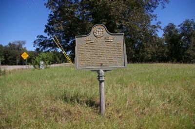
Old Fort Fidius Marker
| On Kings Road at Hancock Street (Georgia Route 22/24), on the right when traveling north on Kings Road. |
| Near Rock Hill Road east of Vinson Highway (County Route 112) when traveling south. |
| On South Clark Street (U.S. 441) 0 miles north of West Greene Street, on the right when traveling north. |
| On Allen Memorial Drive at Ivey Drive, on the right when traveling west on Allen Memorial Drive. |
| On South Jefferson Street at East Hancock Street (Georgia Route 22/24), in the median on South Jefferson Street. |
| On Broad Street west of Swint Avenue Southeast, on the left when traveling west. |
| On East Greene Street at North Jefferson Street, on the right when traveling east on East Greene Street. Reported missing. |
| On West Greene Street at South Jackson Street, on the left when traveling east on West Greene Street. |
| On North Jefferson Street at East Hancock Street (Georgia Route 22/24), on the right when traveling south on North Jefferson Street. |
| On South Jefferson Street at East Hancock Street (Georgia Route 22/24), in the median on South Jefferson Street. |
| On South Wayne Street at West Washington Street, on the right when traveling north on South Wayne Street. |
| On North Clark Street (Business U.S. 441) 0 miles West Hancock Street (Georgia Route 49), on the right when traveling north. |
| On East Greene Street at South Jefferson Street, on the right when traveling east on East Greene Street. |
| On South Wayne Street at East Greene Street, on the right when traveling north on South Wayne Street. |
| Near West Hancock Street at North Wilkinson Street. |
| On North Wilkinson Street at West Hancock Street (Georgia Route 49), on the right when traveling south on North Wilkinson Street. |
| On Swint Avenue Southeast, 0.1 miles north of Broad Street, on the right when traveling north. |
| On Clark Street (Georgia Route 243) 0 miles south of West Montgomery Street (U.S. 441), on the right when traveling south. Reported missing. |
| Near W. Franklin Street (U.S. 441). |
| On South Wayne Street at East Greene Street, on the right when traveling north on South Wayne Street. |
| On South Clarke Street (Business U.S. 441) south of East Hancock Street, on the left when traveling south. |
| On Kings Road at Hancock Street (Georgia Route 22/24), on the right when traveling north on Kings Road. |
| Near S. Liberty Street continued. |
| On Swint Avenue Southeast north of Broad Street, on the right when traveling north. |
| On West Greene Street at South Liberty Street, on the right when traveling west on West Greene Street. |
| On East Greene Street at South Jefferson Street, on the left when traveling east on East Greene Street. |
| On Gordon Highway (Georgia Route 243) at Colony Farm Road, on the right when traveling south on Gordon Highway. |
| On Irwinton Road (Ga 29) (U.S. 441) at Georgia Route 243, on the right when traveling north on Irwinton Road (Ga 29). |
| On Old U.S. 441 at Line Church Road, on the right when traveling south on U.S. 441. |
| On Homer Road (U.S. 441) 0 miles north of Womack Drive, on the right when traveling north. |
| On Homer Road (U.S. 441) 0.1 miles north of Womack Drive, on the right when traveling north. |
| On Georgia Route 105, 0.3 miles east of Andrews Road, on the right when traveling east. |
| On Georgia Route 105 at Carnes Circle, on the right when traveling east on State Route 105. |
| On Main Street (Georgia Route 51) at Yonah Homer Road, on the left when traveling east on Main Street. |
| On U.S. 441 at Old U.S. 441, on the right when traveling south on U.S. 441. |
| On Georgia Route 51, 0.1 miles west of Damascus Road (Old Georgia Route 184), on the right when traveling east. |
| On Georgia Route 51, 0.1 miles west of Martin Bridge Road (Georgia Route 63), on the right when traveling west. |
| Near Hurricane Shoals Road, 0.2 miles south of Georgia Route 82. |
| On Hurricane Shoals Park Road, 0.1 miles south of Wheeler Cemetery Road, on the right when traveling south. |
| On 6th Avenue at 7th Street, on the right when traveling east on 6th Avenue. |
| Near Christmas Avenue (Georgia Route 11) at Manger Avenue, on the right when traveling south. |
| On Old Thompson Mill Road, 0.1 miles south of Farm Market Road, on the right when traveling south. |
| On Winder Highway (State Highway 11). |
| On Atlanta Highway Southeast, 0.3 miles east of Jefferson Street, on the right when traveling east. |
| Near Broad Street at Elizabeth Street, on the right when traveling west. |
| On Broad Street, 0 miles east of Elizabeth Street, on the left when traveling east. |
| On Broad Street at Wise Court, on the right when traveling east on Broad Street. |
| On Georgia Route 82 at milepost 4,, 0.1 miles east of Steed Road, on the right when traveling east. |
| On North Broad Street (Georgia Route 11) at West Athens Street (Georgia Route 211), on the right when traveling south on North Broad Street. |
| Near North Broad Street (Georgia Route 11) just south of West Athens Street (Georgia Route 211), on the right when traveling south. |
| Near West Athens Street (Georgia Route 211) at North Broad Street (Georgia Route 11), on the right when traveling east. |
| On Thompson Mill Road (Georgia Route 211) 0.1 miles north of Will Maynard Road, on the right when traveling north. |
| On Porter Street, 0 miles west of North Broad Street (Georgia Route 53), on the right when traveling east. |
| On Fort Yargo Road, 1 mile south of Loganville Highway (Georgia Highway 81), on the right when traveling south. |
| On West Athens Street (Georgia Route 211) 0 miles east of Church Street, on the left when traveling east. |
| On Fort Yargo Road, 0.2 miles east of South Broad Street (State Highway 81), on the left when traveling south. |
| On Broad Street, 0.4 miles south of South Broad Street (Georgia Route 81), on the left when traveling south. |
| Near Fort Yargo Road east of South Broad Street (Georgia Highway 81), on the left when traveling south. |
| Near Fort Yargo Road east of South Broad Street (Georgia Highway 81), on the left when traveling south. |
| Near Fort Yargo Road east of South Broad Street (Georgia Highway 81), on the left when traveling south. |
| Near Fort Yargo Road east of South Broad Street (Georgia Highway 81), on the left when traveling south. |
| Near Fort Yargo Road east of South Broad Street (Georgia Highway 81), on the left when traveling south. |
| Near Fort Yargo Road east of South Broad Street (Georgia Highway 81), on the left when traveling south. |
| Near Fort Yargo Road east of South Broad Street (Georgia Highway 81), on the left when traveling south. |
| On King Street at Wood Street, on the right when traveling north on King Street. |
| Near Park Avenue at East Athens Street, on the right when traveling south. |
| Near West Athens Street (Georgia Route 211) just east of Woodlawn Avenue, on the right when traveling east. |
| On West Athens Street (Georgia Route 211) at North Broad Street (Georgia Route 11), on the right when traveling east on West Athens Street. |
| On Fort Yargo Road, 1 mile south of Loganville Highway (Georgia Highway 81), on the right when traveling south. |
| On Gainesville Highway (Georgia Route 53) at Rockwell Church Road, on the right when traveling north on Gainesville Highway. |
| On Atlanta Highway SE (U.S. 29) 0 miles east of Russell Cemetery Road, on the right when traveling east. |
| On North Broad Street (Georgia Route 11) at Laura Street, on the right when traveling south on North Broad Street. |
| On North Broad Street (Georgia Route 53) just west of East Stephens Street, on the left when traveling west. |
| On Porter Street just west of North Broad Street (Georgia Route 53), on the left when traveling west. |
| On West Athens Street (Georgia Route 211) at Church Street, on the left when traveling east on West Athens Street. |
| On Cottage Lane east of Fort Yargo Road, in the median. |
| On Main Street North at Cherry Street, on the left when traveling north on Main Street North. |
| On Barnsley Gardens Road, 0.1 miles east of Rock Fence Road, on the right when traveling east. |
| On Poplar Springs Road at South Cass Street, on the right when traveling east on Poplar Springs Road. |
| On Adairsville Highway (Georgia Route 140) at Poplar Springs Road, on the right when traveling east on Adairsville Highway. |
| On Public Square at Wood Street, on the right when traveling south on Public Square. |
| On Poplar Springs Road at South Cass Street, on the right when traveling east on Poplar Springs Road. |
| On Woody Road, 0.1 miles west of Old U.S. 41. |
| On Hall Station Road at Rock Fence Road, on the right when traveling south on Hall Station Road. |
| On Poplar Springs Road at South Cass Street, on the right when traveling east on Poplar Springs Road. |
| On Joe Frank Harris Parkway (U.S. 41 at milepost 0), 0 miles south of Miller Ferry Road, on the right when traveling south. |
| On Public Square south of Wood Street, on the right when traveling south. |
| Near Old Alltatoona Road SE, 0.4 miles north of Allatoona Landing Road SE, on the right when traveling north. |
| Near Old Allatoona Road SE, 0.4 miles Allatoona Landing Road SE, on the right when traveling north. |
| On Old Allatoona Road, 0.2 miles north of Allatoona Landing Road, on the left when traveling east. |
| On Old Allatoona Road SE, 2.9 miles east of Interstate 75. |
| Near Old Alltatoona Road SE, 0.4 miles north of Allatoona Landing Road SE, on the right when traveling north. |
| On Old Allatoona Road, 0.2 miles north of Allatoona Landing Road, on the left when traveling east. |
| Near Old Alltatoona Road SE, 0.4 miles north of Allatoona Landing Road SE when traveling north. |
| Near Old Alltatoona Road SE, 0.4 miles north of Allatoona Landing Road SE, on the right when traveling north. |
| Near Old Alltatoona Road SE, 0.4 miles north of Allatoona Landing Road SE, on the right when traveling north. |
| Near Old Allatoona Road, 0.2 miles north of Allatoona Landing Road. |
| Near Old Alltatoona Road SE, 0.4 miles north of Allatoona Landing Road SE, on the right when traveling north. |
| Near Old Allatoona Road SE, 2.9 miles east of Interstate 75. |
7015 entries matched your criteria. Entries 201 through 300 are listed above.
⊲ Previous 100 —
Next 100 ⊳