1164 entries match your criteria. The first 100 are listed. ⊳
Historical Markers and War Memorials in Iowa
By Juris Bets, August 10, 2010
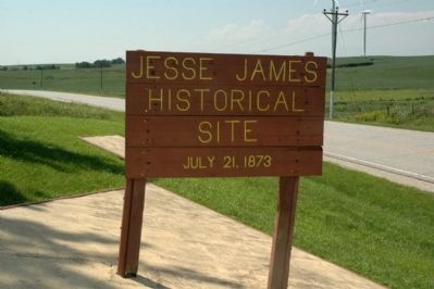
First Train Robbery in The West Marker
| 1 ► Iowa, Adair County, Adair — First Train Robbery in the West — Jesse James Robberies — |
| On County Road G30, on the left when traveling west. | |||
| 2 ► Iowa, Adair County, Adair — Roll of Honor — Melvin Memorial Park — |
| On 5th Street at Broad Street, on the right when traveling north on 5th Street. | |||
| 3 ► Iowa, Adair County, Adair — Site of the First Train Robbery in the West — |
| On Broad Street at 5th Street, on the right when traveling east on Broad Street. | |||
| 4 ► Iowa, Adair County, Greenfield — Carnegie Library — 1916 — |
| On South 1st Street just north of Southeast Kent Street (State Route 92), on the right when traveling north. | |||
| 5 ► Iowa, Adair County, Greenfield — Howe & Olesen Building — Site of Adair County Bank — |
| On North 1st Street at Public Square, on the right when traveling north on North 1st Street. | |||
| 6 ► Iowa, Adair County, Greenfield — Light Plant — 1940 — |
| On South 1st Street north of Southeast Kent Street (State Route 92), on the right when traveling north. | |||
| 7 ► Iowa, Adair County, Greenfield — The Heaton Block — Circa 1893-1899 — |
| On Public Square just east of North 1st Street, on the right when traveling west. | |||
| 8 ► Iowa, Adair County, Greenfield — Veterans Memorial — "Lest We Forget" — |
| On the Public Square at East Iowa Street, on the left when traveling north on the Public Square. | |||
| 9 ► Iowa, Adair County, Greenfield — Veterans Memorial — |
| On the Public Square at 1st Street, on the left when traveling east on the Public Square. | |||
| 10 ► Iowa, Adair County, Greenfield — Warren Opera House Block and Hetherington Block — National Register of Historic Places — |
| On Public Square just south of East Iowa Street, on the right when traveling north. | |||
| 11 ► Iowa, Adair County, Menlo — Adair County Freedom Rock Veterans Memorial — Life, Liberty, Pursuit of Happiness — Ray "Bubba" Sorensen II — |
| On State Highway 25 at 120th Street, on the left when traveling south on State Highway 25. | |||
| 12 ► Iowa, Adair County, Orient — Grasses / Voices — Artist - Susan Gardels — |
| 13 ► Iowa, Adair County, Orient — Henry A. Wallace Birthplace — 1888 — |
| On 290th Street west of Henry A. Wallace Road, on the right when traveling west. | |||
| 14 ► Iowa, Adair County, Orient — Jasper James And His Family — |
| 15 ► Iowa, Adair County, Orient — Native Prairie Planting — |
| 16 ► Iowa, Adair County, Orient — The Mormon Trail — |
| On School Street (State Highway 25) south of Division Street, on the right when traveling north. | |||
| 17 ► Iowa, Adair County, Orient — Veterans Memorial — |
| On Broad Street south of 1st Street, on the right when traveling south. | |||
| 18 ► Iowa, Adams County, Corning — Adams County Jail — House of History — |
| On Benton Avenue at 10th Street, on the right when traveling north on Benton Avenue. | |||
| 19 ► Iowa, Adams County, Corning — City of Corning Fire Bell — |
| On Benton Avenue at 10th Street, on the right when traveling north on Benton Avenue. | |||
| 20 ► Iowa, Adams County, Corning — Corning Freedom Rock Veterans Memorial — Honoring Adams County Veterans — Ray "Bubba" Sorensen II — |
| On 6th Street west of Adams Street, on the right when traveling west. | |||
| 21 ► Iowa, Adams County, Corning — Fairview Church — 1892 - 2008 — |
| On Benton Avenue at 10th Street on Benton Avenue. | |||
| 22 ► Iowa, Adams County, Corning — First Adams County Mill — |
| On Benton Avenue at 10th Street, on the right when traveling north on Benton Avenue. | |||
| 23 ► Iowa, Adams County, Corning — Icarian Colony — |
| On U.S. 34 at Mulberry Avenue, on the left when traveling east on U.S. 34. | |||
| 24 ► Iowa, Adams County, Corning — Mt. Etna United Methodist Church — 1852 - 1987 — |
| On Benton Avenue at 10th Street, on the right when traveling north on Benton Avenue. | |||
| 25 ► Iowa, Adams County, Corning — The Bell — |
| On Grove Avenue at 10th Street, on the left when traveling north on Grove Avenue. | |||
| 26 ► Iowa, Adams County, Corning — Veterans Memorial — |
| On Davis Avenue north of 8th Street, on the left when traveling north. | |||
| 27 ► Iowa, Allamakee County, Harper Ferry — The Mystery of the Mounds — Effigy Mounds National Monument — National Park Service, U.S. Department of the Interior |
| On State Highway 76. Reported permanently removed. | |||
| 28 ► Iowa, Allamakee County, Waukon — Allamakee County Court House Museum — |
| On Allamakee Street, on the right when traveling north. | |||
| 29 ► Iowa, Allamakee County, Waukon — Norwegian House — |
| On Allamakee Street, 0.1 miles north of 1st Ave. NW, on the right when traveling north. | |||
| 30 ► Iowa, Allamakee County, Waukon — Waukon Freedom Rock Veterans Memorial — Honoring Allamakee County Veterans — Ray "Bubba" Sorensen II — |
| Near Rossville Road (State Highway 9) just north of 13th Avenue Southeast (Park Road), on the left when traveling north. | |||
| 31 ► Iowa, Appanoose County, Centerville — Around the World in 91 Hours — Howard Hughes Around the World Flight of 1938 — Albert I. Lodwick — |
| On 12th Street at State Street, on the right when traveling south on 12th Street. | |||
| 32 ► Iowa, Appanoose County, Centerville — Centerville Freedom Rock Veterans Memorial — Ray "Bubba" Sorensen II — |
| On 13th Street south of State Street, on the right when traveling south. | |||
| 33 ► Iowa, Appanoose County, Centerville — Union Soldiers Monument — |
| On Jackson Street west of 13th Street, on the right when traveling west. | |||
| 34 ► Iowa, Appanoose County, Walnut City — The Real Village of Griffinsville — Appanoose Historical Marker — |
| On Southfork Place. | |||
| 35 ► Iowa, Audubon County, Audubon — Albert — the World's Largest Bull — |
| On East Division Street just north of Southside Street, on the right when traveling north. | |||
| 36 ► Iowa, Audubon County, Audubon — Audubon — |
| On Market Street (U.S. 71) just south of Southside Street, on the left when traveling south. | |||
| 37 ► Iowa, Audubon County, Audubon — Audubon County Courthouse — National Register of Historic Places — Built 1939 — |
| On Leroy Street at South Park Place, on the right when traveling north on Leroy Street. | |||
| 38 ► Iowa, Audubon County, Audubon — Audubon County Tourism — |
| On Leroy Street just north of Broadway Street, on the left when traveling north. | |||
| 39 ► Iowa, Audubon County, Audubon — Audubon County Veterans Memorial — |
| On Leroy Street at Broadway Street, on the right when traveling north on Leroy Street. | |||
| 40 ► Iowa, Audubon County, Audubon — Audubon Public Library — |
| Near Tracy Street just south of North Park Place, on the left when traveling south. | |||
| 41 ► Iowa, Audubon County, Audubon — T-Bone Trail — |
| On Market Street (U.S. 71) just south of Southside Street, on the left when traveling south. | |||
| 42 ► Iowa, Audubon County, Audubon — We Honor Our Veterans — |
| Near Leroy Street at Broadway Street, on the left when traveling north. | |||
| 43 ► Iowa, Audubon County, Kimballton — Kimballton Freedom Rock Veterans Memorial — Honoring Audubon County Veterans — Ray "Bubba" Sorensen II — |
| On Esbeck Street east of North Main Street (State Route 173), on the right when traveling east. | |||
| 44 ► Iowa, Benton County, Vinton — Benton County Courthouse — |
| On East 4th Street just east of 1st Avenue, on the left when traveling east. | |||
| 45 ► Iowa, Benton County, Vinton — Benton County World War II Veterans Memorial — |
| On East 4th Street just east of 1st Avenue, on the left when traveling east. | |||
| 46 ► Iowa, Benton County, Vinton — Flooding of the Cedar River — |
| Near A Avenue at West 1st Street, on the right when traveling north. | |||
| 47 ► Iowa, Benton County, Vinton — Iowa Canning Co. Seed House — “First canning plant west of the Mississippi” — |
| On 1st Avenue (State Highway 150) at West 2nd Street, on the left when traveling north on 1st Avenue. | |||
| 48 ► Iowa, Benton County, Vinton — Minne Estema Park — The "Sleeping Waters" of the Cedar River — |
| Near A Avenue at West 1st Street, on the right when traveling north. | |||
| 49 ► Iowa, Benton County, Vinton — Moments in Time on the Cedar — |
| Near A Avenue at West 1st Street, on the right when traveling north. | |||
| 50 ► Iowa, Benton County, Vinton — Red Cedar River — Celebrating the History & Tradition — |
| Near A Avenue at West 1st Street, on the right when traveling north. | |||
| 51 ► Iowa, Benton County, Vinton — Sweet Corn Day Festival — Vinton, Iowa — 1929 - 1959 — |
| On A Avenue just north of West 4th Street, on the right when traveling north. | |||
| 52 ► Iowa, Benton County, Vinton — The Many Bridges Built to Cross the Cedar River — |
| Near A Avenue at West 1st Street, on the right when traveling north. | |||
| 53 ► Iowa, Benton County, Vinton — Watson's Opera House — |
| On A Avenue just south of West 3rd Street (State Highway 150), on the right when traveling south. | |||
| 54 ► Iowa, Black Hawk County, Cedar Falls — Cedar Falls Freedom Rock Veterans Memorial — Black Hawk County Freedom Rock — -- Ray "Bubba" Sorensen II -- — |
| On Bluff St at E 14th St on Bluff St. | |||
| 55 ► Iowa, Black Hawk County, Cedar Falls — 40 — Historic Cedar Falls — |
| 56 ► Iowa, Black Hawk County, Hudson — 27 — Historic Black Hawk County — |
| Near U.S. 63, 0.7 miles north of East Eldora. | |||
| 57 ► Iowa, Black Hawk County, La Porte City — Chestnut Firestation — |
| On Chestnut Street at 1st Street, on the left when traveling north on Chestnut Street. | |||
| 58 ► Iowa, Black Hawk County, La Porte City — City Hall — La Porte City, Iowa — |
| On Main Street west of Commercial Street (U.S. 218), on the right when traveling west. | |||
| 59 ► Iowa, Black Hawk County, La Porte City — Rural Iowa Heritage Center — |
| On Chestnut Street just north of 1st Street, on the left when traveling north. | |||
| 60 ► Iowa, Black Hawk County, La Porte City — The Jesse Wasson Society — |
| On Chestnut Street just north of 1st Street, on the left when traveling north. | |||
| 61 ► Iowa, Black Hawk County, La Porte City — The Pioneer Spirit — |
| On Chestnut Street just north of 1st Street, on the left when traveling north. | |||
| 62 ► Iowa, Boone County, Boone — Boone Freedom Rock Veterans Memorial — Boone County — Ray “Bubba” Sorensen II — |
| On Mamie Eisenhower Avenue at Main Street, on the right when traveling east on Mamie Eisenhower Avenue. | |||
| 63 ► Iowa, Boone County, Boone — Co. D. 32nd Iowa Infantry — |
| On Mamie Eisenhower Avenue at State Street, on the right when traveling east on Mamie Eisenhower Avenue. | |||
| 64 ► Iowa, Boone County, Boone — Dragoon Trail Historical Site Marker No. 8 — |
| On Mamie Eisenhower Avenue at Division Street, on the right when traveling west on Mamie Eisenhower Avenue. | |||
| 65 ► Iowa, Bremer County, Readlyn — Readlyn Freedom Rock Veterans Memorial — Bremer County Freedom Rock — -- Ray "Bubba" Sorensen II -- — |
| On Reed Ave, 0.1 miles north of 6th St. | |||
| 66 ► Iowa, Bremer County, Waverly — Bremer County Civil War Memorial — |
| On East Bremer Avenue (Iowa Route 3) just west of 5th Street Northeast, on the right when traveling west. | |||
| 67 ► Iowa, Bremer County, Waverly — Bremer County Courthouse — Dedicated June 1937 — 415 East Bremer Avenue — |
| On East Bremer Avenue (State Road 3) just west of 5th Street Northeast, on the right when traveling west. | |||
| 68 ► Iowa, Bremer County, Waverly — Bremer County Korean & Vietnam War Memorial — |
| On East Bremer Avenue (Iowa Route 3) just west of 5th Street Northeast, on the right when traveling west. | |||
| 69 ► Iowa, Bremer County, Waverly — Bremer County World War Memorial — |
| On East Bremer Avenue (Iowa Route 3) just west of 5th Street Northeast, on the right when traveling west. | |||
| 70 ► Iowa, Bremer County, Waverly — Replica of the Statue of Liberty — |
| On East Bremer Avenue (Iowa Route 3) just west of 5th Street Northeast, on the right when traveling west. | |||
| 71 ► Iowa, Bremer County, Waverly — Rock Island Depot — |
| On 1st Street Southwest at East Bremer Avenue (State Route 3), on the right when traveling north on 1st Street Southwest. | |||
| 72 ► Iowa, Bremer County, Waverly — The Bremer Avenue Bridge over the Cedar River — |
| On East Bremer Avenue (Iowa Route 3) just east of 1st Street Northwest, on the right when traveling west. | |||
| 73 ► Iowa, Bremer County, Waverly — Waverly Cedar River Dam — Waverly's Cedar River Dam, 1853-1914 — |
| On 1st Street Northwest just north of East Bremer Avenue (Iowa Route 3), on the right when traveling north. | |||
| 74 ► Iowa, Bremer County, Waverly — Waverly Cedar River Dam — Waverly's Cedar River Dam, 1915-2010 — |
| On 1st Street Northwest just north of East Bremer Avenue (State Route 3), on the right when traveling north. | |||
| 75 ► Iowa, Bremer County, Waverly — Waverly Cedar River Dam — Flooding on the Cedar River, 1853-2008 — |
| On 1st Street Northwest just north of East Bremer Avenue (State Route 3), on the right when traveling north. | |||
| 76 ► Iowa, Bremer County, Waverly — Waverly Cedar River Dam — Protecting and Preserving Waverly's Heritage — |
| On 1st Street Northwest just north of East Bremer Avenue (State Route 3), on the right when traveling north. | |||
| 77 ► Iowa, Buchanan County, Independence — Wapsipinicon Mill — 1867 — |
| On 2nd Avenue Northwest just north of 1st Street West (County Highway D22), on the right when traveling north. | |||
| 78 ► Iowa, Buena Vista County, Albert City — Albert City Freedom Rock Veterans Memorial — Buena Vista County Freedom Rock — -- Ray "Bubba" Sorensen II -- — |
| On Main Street, 0.1 miles east of 230 Ave, on the right when traveling east. | |||
| 79 ► Iowa, Buena Vista County, Storm Lake — Harker House — Iowa Historic Site — |
| On Lake Avenue North at West 3rd Street, on the left when traveling north on Lake Avenue North. | |||
| 80 ► Iowa, Buena Vista County, Storm Lake — Hayes Memorial Field — |
| On Flindt Drive (State Highway 7) at East 4th Street, on the right when traveling south on Flindt Drive. | |||
| 81 ► Iowa, Buena Vista County, Storm Lake — Storm Lake Public Library — |
| On East 5th Street just east of Erie Street, on the right when traveling east. | |||
| 82 ► Iowa, Butler County, Greene — Greene Freedom Rock Veterans Memorial — Honoring Butler County Veterans — Ray "Bubba" Sorensen II — |
| On West Traer Street just east of Water Street, on the right when traveling east. | |||
| 83 ► Iowa, Calhoun County, Rockwell City — Rockwell City Freedom Rock Veterans Memorial — Calhoun County Freedom Rock — -- Ray "Bubba" Sorensen II -- — |
| On Main St at 5th Street on Main St. | |||
| 84 ► Iowa, Calhoun County, Rockwell City — Rockwell City, Iowa Civil War Memorial — |
| On 4th Street at Main Street, on the left when traveling north on 4th Street. | |||
| 85 ► Iowa, Carroll County, Arcadia — Influence of Railroads and Elevation — |
| On Lincoln Highway (U.S. 30) 0.3 miles east of Delta Avenue (County Road M68), on the left when traveling east. | |||
| 86 ► Iowa, Carroll County, Carroll — The Miracle Cornfield Landing of 1960 — |
| On Ashwood Drive, 0.1 miles south of Lakewood Drive. | |||
| 87 ► Iowa, Carroll County, Manning — Manning Freedom Rock Veterans Memorial — Carroll County — Ray “Bubba” Sorensen II — |
| On East Street. | |||
| 88 ► Iowa, Carroll County, Manning — Veterans Memorial Wall Manning, Iowa — |
| On Main Street at 5th Street, on the right when traveling south on Main Street. | |||
| 89 ► Iowa, Cass County, Atlantic — American Legion Memorial Building — |
| On Poplar Street at 2nd Street, on the left when traveling north on Poplar Street. | |||
| 90 ► Iowa, Cass County, Atlantic — Cass County Veterans Memorial — |
| On Chestnut Street north of White Pole Road (U.S. 6), on the left when traveling north. | |||
| 91 ► Iowa, Cass County, Atlantic — Chicago, Rock Island & Pacific Railroad Depot — Iowa Historic Site — |
| On Chestnut Street at 1st Street when traveling north on Chestnut Street. | |||
| 92 ► Iowa, Cass County, Atlantic — Civil War and Spanish-American War Soldiers Monument — |
| On Chestnut Street north of White Pole Road (U.S. 6), on the left when traveling north. | |||
| 93 ► Iowa, Cass County, Atlantic — John Gingery Cabin — A Link With The Past — |
| On Poplar Street (State Highway 83) at 6th Street, on the right when traveling north on Poplar Street. | |||
| 94 ► Iowa, Cass County, Griswold — Veterans Memorial — |
| On Cass Street at Main Street (Iowa Highway 92), on the right when traveling north on Cass Street. | |||
| 95 ► Iowa, Cass County, Lewis — Fighting Slavery – Aiding Runaways — John Brown Freedom Trail — December 20, 1858 - March 12, 1859 — |
| 96 ► Iowa, Cass County, Lewis — Lewis Freedom Rock Veterans Memorial — Ray "Bubba" Sorensen II — |
| On Main Street at 5th Street, on the right when traveling east on Main Street. | |||
| 97 ► Iowa, Cass County, Lewis — Memorial Building — Lewis, Iowa — Remodeled 1993 — |
| On Main Street at Webster Street, on the left when traveling west on Main Street. | |||
| 98 ► Iowa, Cass County, Lewis — Rev. George B. Hitchcock House — |
| 99 ► Iowa, Cass County, Lewis — The Mormon Pioneer Trail / A Road and River, Well Traveled — |
| On Minnesota Street / Nishna Valley Road, 0.8 miles west of Lewis Road / 1st Street, on the right when traveling west. | |||
| 100 ► Iowa, Cass County, Lewis — The Mormon Pioneer Trail / A Warm Welcome on the Nishnabotna — |
1164 entries matched your criteria. The first 100 are listed above. Next 100 ⊳