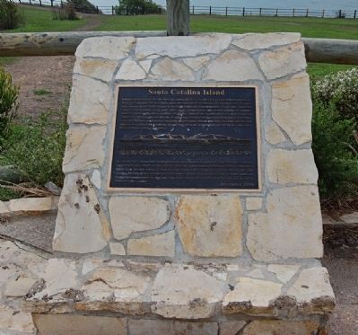
Located approximately 20 miles from the mainland, Santa Catalina Island rises 2000 feet above sea level, approximately 500 feet higher than the Palos Verdes Peninsula. The island is over 20 miles long, making it the longest of the eight California . . . — — Map (db m157646) HM
This herd traces its roots to 1962, when Walt Disney donated a herd of American Bison to
William S. Hart Regional Park. To discourage inbreeding, the County of Los Angeles has exchanged some of its animals with other facilities over the years; . . . — — Map (db m129211) HM
One of several art bears that grace sites around Santa Clarita, "The Santa
Clarita History Bear" is part of the California Bear Project, a series of
life-sized representations of the "Monarch" grizzly, the bear that appears
on the California . . . — — Map (db m245537) HM
In 1885, Edwin Cawston chartered a ship for the purpose of transporting from South Africa to America some of the best ostriches obtainable in the world. Of the original 50 fine birds only 18 survived the five week voyage to Galveston and hazardous . . . — — Map (db m130144) HM
Greek George, born in Smyrna as George Caralambo, came to this country as a camel driver for the United States Government in 1857. Naturalized -- George Allen in 1867.
Died Sept. 2, 1913 at Old Mission.
Historical marker . . . — — Map (db m157793) HM
In the year 1912 a Mr. William King Heiskell built an aviary with its first inhabitants being a green parrot and several species of birds from around the world. The zoo also had several ponds and water fountains and a bandstand. Although the Madera . . . — — Map (db m34946) HM
On the rocks and ledges just below here you can often spot common murres. For a good view from this height, binoculars are helpful. If conditions are right you may hear the colony “moaning” as they huddle penguin-like on the rocks. . . . — — Map (db m63383) HM
Some of the world’s richest waters exist right off California’s coast. An explosion of life occurs here due to a combination of the sun’s energy, wind, ocean currents, and contours of the sea floor. Microscopic phytoplankton form the base of the . . . — — Map (db m63362) HM
Center Panel
Shaped by People
Humans changed Angel Island in many ways. We cut trees, brought animals, and plants, dug into the mountain, paved roads, and erected buildings. Yet nature persists, creating habitat for countless plants . . . — — Map (db m203632) HM
In 1931 the Army built this rock crusher to sort and crush serpentine rock from the nearby quarry.
The crushed rock was used to pave the roads on Angel Island.
The roads were not paved until the 1930s because the Army was still using mules and . . . — — Map (db m203634) HM
This picture, circa 1930, show remnants of oysters beds used by the Morgan Oyster Company. For an unknown reason, oyster spawn (eggs) would not thrive in the bay so oysters were brought in from Washington State and from the East Coast to be fattened . . . — — Map (db m204079) HM
Horse- and mule-drawn wagons moved supplies throughout the immigration station until the 1930s. When cars were brought to the island, these stables were converted to garages. During World War II, the building was used to store linens. — — Map (db m203563) HM
The Army used “mule power” on the island until the 1930s to haul supplies and quarried rock. They pulled graders, mowing equipment, and garbage wagons. Soldiers stabled and cared for the mules in this barn. — — Map (db m203683) HM
The view ahead could have looked quite different had the Reeds Port Project, a proposed development of several thousand homes, been built over Richardson Bay in the 1950s. Fortunately, this vital habitat was saved by concerned local residents who . . . — — Map (db m203902) HM
(Left photo caption:)
The trestle, which crossed Tiburon Boulevard, was a landmark for 84 years until it was torn down in 1968, a year after the last train rumbled over its sturdy wooden framework. This picture is from the 1930s. The berm . . . — — Map (db m154670) HM
Creating an Experience to Match the Dignity of the Trees People have revered this Grove and its mighty trees for thousands of years. Through ecological restoration, the health and resilience of these giants will be protected and all visitors . . . — — Map (db m160409) HM
Mirror Lake was once regarded by park scientists as a stream-fed lake slowly filling in to become a meadow. As hydrologists have developed a more complex understanding of the water's dynamics, they now theorize that the "lake" is a pool in a . . . — — Map (db m81952)
Left panel:
The Pinches Stable was located here during the late eighteen-hundreds. During that time horses were the key element for travel and people passing through town boarded them here.
Right panel:
Laytonville's . . . — — Map (db m91801) HM
There is one description of Henry Miller, California's cattle king, that sums up his contributions to this community: Henry Miller - Founding Father of Los Banos.
Born 1827 in Brackenheim, Kingdom of Wurtemberg, Germany, Miller left the family . . . — — Map (db m41164) HM
This steep cliff of nestholes and crevices overlooks the Tule Lake National Wildlife Refuge and Lava Beds National Monument — fruitful hunting ranges for hawks, falcons, owls, and other birds of prey.
A favorable environment here is . . . — — Map (db m151904) HM
Established by the Nevada
Territorial Legislature
February 20, 1864
Rates of Toll
Wagon with two animals $1.00
Carriage and one animal $.75
Each additional animal $.25
Empty teams returning half price
Saddle animals each $.25 . . . — — Map (db m20732) HM
The Magnificant Condor
The California Condor (Gymnogyps californianus) is an ancient species that once soared from Mexico to Canada. In 1805 Lewis and Clark were the first explorers to record condors for western science. When they . . . — — Map (db m196817) HM
Monterey's world-famous sardine industry depended on the courage and skill of cannery divers. Sardines were pumped ashore from floating hoppers through underwater pipes that had to be installed, repaired, replaced, realigned and maintained in order . . . — — Map (db m30004) HM
Marine biologist, philosopher, writer, ecologist, and friend to many. Immortalized as “Doc” of John Steimbeck’s Cannery Row, the real man had a profound influence on the thinking of writers, artists, and scientists through his . . . — — Map (db m54904) HM
The Monterey Bay Aquarium stands on the site of the old Hovden Cannery. In its heyday, the cannery processed tons of sardines every day. But by the 1960s the sardines had disappeared, and the cannery closed its doors in 1972.
Now you can see . . . — — Map (db m41620) HM
Recurring winter storms wreaked havoc on the Monterey fishing fleet every few years (top). On April 29, 1915, such a storm, with 60-mile-per-hour winds, destroyed or damaged nearly 50 boats. On Thanksgiving morning 1919, more than 93 vessels were . . . — — Map (db m55214) HM
Since the early 1900's the Monterey Bay has been one of the principal fishing centers along the Pacific Coast. Today, Monterey's fishermen continue to be major contributors to the nation's supply of squid (calamari).
In the early 50's Abalonetti . . . — — Map (db m30162) HM
This Monument pays tribute to the many diverse characters vital to the evolution of Cannery Row. Perched atop the rocky outcropping sits Nobel Prize winning author John Steinbeck, who immortalized Cannery Row with his novel of the same name. He is . . . — — Map (db m81813) HM
The building across the cove is Hopkins Marine Station. It was the first marine laboratory on the West Coast, founded in 1892. Part of Stanford University, its facilities are dedicated to the study of marine life.
What biologists at Hopkins . . . — — Map (db m41618) HM
Nevada Hose Co. No. 1 occupied this firehouse from May 30, 1861 to 1938. Hand pulled hose carts, horse drawn engines and motorized pumpers all rolled out of this building to save life and property. — — Map (db m40266) HM
Dedicated August 10, 1986 in honor of
Charles Fayette McGlashan
1847-1931
Truckee’s patriarch, historian, author, editor, attorney, legislator, inventor, entomologist and astronomer.
His last public address was given in 1926 at . . . — — Map (db m81893) HM
History
"The sound of the bells when it was quiet (no trains), was magical to hear."
The tinkle of bells on the lead sheep was once a common sound in Summit Valley late in the summer and fall.
Lake Van Norden filled with water with . . . — — Map (db m129645) HM
This skull of Mixocetus baleen whale was discovered during grading of this plaza. It is the second example of the species known to science. The first was found in Los Angles in 1931.
Mixocetus was one of the largest marine animals to inhabit . . . — — Map (db m188542) HM
The Santa Ana River stretches over a distance of 110 miles before reaching the Pacific Ocean at Huntington Beach. It is the largest river entirely within Southern California.
From Dollar Lake and Dry Lake on to Big Bear Lake in the San . . . — — Map (db m224296) HM
In dedication to Don Hansen and Dana Wharf Sportfishing, the first business operating out of Dana Point Harbor. Dana Wharf Sportfishing originated Whale Watching for Orange County and founded the Dana Point Festival of Whales and Dana Point Boat . . . — — Map (db m60798) HM
From 1970 to 1984, Lion Country Safari made it possible for children of all ages to experience the sights and sounds of an African safari - entirely from the safety and comfort of their cars. It was Southern California's first ever wild animal . . . — — Map (db m148301) HM
William Pereira's Master Plan envisioned for Irvine an entirely
different approach to living a series of self-contained villages
providing a wide diversity of housing types along with parks,
trails, schools and retail centers. The City's . . . — — Map (db m244148) HM
Lewis and Nellie Gail Moulton's daughters, Charlotte and Louise, circa 1918 in a wicker buggy at the Moulton Ranch House. Both the guggy and the Girls' beloved horse "Dicky" were purchased from the Pasadena Rose Parade. The hand-drawn, illustrated . . . — — Map (db m226414) HM
Nellie Gail Moulton with Charlotte in a buggy on Moulton Ranch with Saddleback Mountain in the distance, circa 1915.
A Moulton Ranch Roundup with teams roping and branding cattle near the corral with foreman "SI" Salustiano Sansinena on the . . . — — Map (db m226423) HM
1769 - Portola Expedition enters what is now Orange County.
1821 - California under Mexican Rule.
1842 - Rancho Canada de los Alisos granted to Don Jose Serrano; future site of Heritage Hill Historical Park.
1850 - California . . . — — Map (db m195046) HM
An ancient spring near the railroad tracks played an important role in California's transportation history. A portion of California's Highway 101 and El Camino Real passed by the Aguaje del Cuate.
In the late 1860's the Seeley and Wright Stage . . . — — Map (db m225959) HM
The main exhibit displays a fossil right whale skull in profile. It was recovered from the marine siltstone member of the Capistrano Formation (3.5 to 5 million years old) in the 1970's right here in Mission Viejo. It is a fossil skull from the . . . — — Map (db m72036) HM
Originally dedicated on June 4, 1977 by the Mission Viejo Cultural and Heritage Association.
The Fossil was unearthed in the southern part of the city in 1976, and is a partial skull of a Baleen whale belonging to the Bowhead or right whale . . . — — Map (db m72035) HM
The first inhabitants of San Juan Capistrano were the Acjachemen. These Native Americans lived in what we know today as Orange County. Some of the tribe's descendants work here at Zoomars.
In 1776, the Historic District was part of the . . . — — Map (db m188924) HM
The Santa Ana Mountains, which encompass the canyons of Silverado, Modjeska and Trabuco, provided one of the last refuges for the state symbol, the Grizzly Bear.
At the turn of the century, beekeeping was an important local industry, providing . . . — — Map (db m78516) HM
On the day of July 3, 1901 a stagecoach, driven by Henry Crockett, was on its way to the town of Foresthill when a hooded man appeared with a shotgun and ordered Crockett to stop, to which he replied, “You are only foolin.” At that the . . . — — Map (db m667) HM
Just as you may have come to fish these waters today, so have native people for thousands of years. Natives of the Tahoe Sierra fished the waters from Lake Tahoe and the Truckee River and Pyramid Lake for food. Depending on the season, they pulled . . . — — Map (db m112970) HM
This water trough was constructed on the Southern Pacific Railroad property along Cantaloup Avenue for watering teams of horses hauling cantaloupes and onions. It replaced a wooden trough on Front Street used in the early industry of shipping . . . — — Map (db m113032) HM
During the equestrian games of the 10th Olympiad,
Lt Col Shunzo Kido turned aside from the prize to save his horse.
He heard the low voice of mercy, not the loud acclaim of glory.
情
は
武
士
の . . . — — Map (db m147984) HM
During The Mission Inn's early days,
Frank Miller, Master of the Inn, had two
macaws that lived at the hotel for many years,
Napoleon arrived to The Mission Inn in 1907
and welcomed guests for 49 years. His name
comes from the fact that his . . . — — Map (db m233204) HM
FISHER is a very popular American Black Bear
who resides at the Folsom City Zoo Sanctuary.
He's been a resident since 1995 and during his
years at the z0o sanctuary, he's contributed his
awesome bear skills!
Fisher was born in December, . . . — — Map (db m192705) HM
The river before you is not the same river that flowed through here 200 years ago when the Nisenan Indians caught salmon and collected acorns along its bank. The river has been mined, dammed and surrounded by our cities, yet it still supports . . . — — Map (db m15836) HM
From Prairie to Park
Prior to the arrival of Europeans in the late 1700’s, this area was an open prairie, where roaming herds of elk and deer grazed on perennial grasses. By the late1800’s, nearly all of the grasslands had been divided up . . . — — Map (db m90234) HM
This Tree Stump Hitching Post was blasted
loose with dynamite, quarried out, then cut
and shaped into Horse Head Hitching
Post by prisoners working in the quarry in
the early years of Folsom Prison. The Horse
Head Hitching Post was moved to its . . . — — Map (db m192796) HM
Even though California and the Sacramento Valley were remote to the rest of the world, the area was a focus of exploration in the first half of the 19th century by the Spanish, Americans, British, French, Germans, Russians, and many others. Gabriel . . . — — Map (db m229800) HM
This complex of hoofed animal exhibits is dedicated in memory of Anthony A. “Hank” Spencer
Zoo Superintendent – 1942 – 1972
“Hank’s” dedication to the Sacramento Zoo provided numerous . . . — — Map (db m113463) HM
These millstones were brought from Mexico by water and oxcart in 1846 and were used by Jared D. Sheldon one of the earliest settlers in this valley in his grist mill near here, his Rancho Omochumne was granted him in payment for his work on . . . — — Map (db m28312) HM
The rocky spires of Condor Crags are seen rising above you, named by those who once saw California condors soaring over these lofty formations. In 2003, Pinnacles National Monument became part of a cooperative program to restore these endangered . . . — — Map (db m41123) HM
In 1857, under orders to survey a wagon road from New Mexico to California, General Edward Beale followed the 35th parallel to paths opened by Francis Aubry and Lt. A.W. Whipple. Beale’s orders required importation of camels and drivers to . . . — — Map (db m50561) HM
In January 1996: A family of "Three Strikes" Grizzly Bears were captured outside of
Yellowstone National Park. US Fish and Wildlife Bear Management guidelines directed the
rangers to either find them a permanent home in a zoological facility . . . — — Map (db m197752) HM
Elliot Ranch is just south of this
point, in Little Horse Thief Canyon.
It is the thirty acre homestead of
William and Lena Elliot built in 1927. The family with eight children truly lived frontier lives in wilderness
surroundings. . . . — — Map (db m166295) HM
Today, Valley Wells is part of the Great Mojave Desert,
but as recently as 15,000 years ago, this area was home
to grasslands and temperate forests. As the environment
of an area changes, so must its inhabitants either adapt
or perish. How . . . — — Map (db m221111) HM
For almost 30 years, people have visited the Whispering Pines Nature Trail. The trail was originally developed for a special episode of the television program “Lassie.” Filmed in 1969, the episode depicts the journey of a 13-year-old blind girl . . . — — Map (db m219499) HM
Pelican Brown was in search of a home
where he could have fun and relax
he looked for a beach that was pretty
and a sea that was swimming with snacks.
He flew up and down the long coastline
looking both far and quite near
then one . . . — — Map (db m84187) HM
Bum
San Diego’s Official Town Dog
Died November 10, 1898 – Aged 12 Years
Loved by everyone – owned by no one. His name suited him because he arrived as a town stowaway, befriended everyone and “bummed” quality food . . . — — Map (db m52910) HM
Transformed from an army parade ground to a playground for the children of federal prison guards, the expanse of concrete straight ahead is now a nesting ground for Alcatraz's vast colony of western gulls. Each winter, up to 1,100 pairs of . . . — — Map (db m133765) HM
Wentworth Place was
well known as a
street of commerce
where hawkers
would come to sell
preserved fish and
seafood, earning it
the moniker 'Salty
Fish Alley'. As
homage to this
legacy, students from
the Mandarin Institute have . . . — — Map (db m175279) HM
Bummer and Lazarus were two stray dogs who roamed this part of San Francisco in the 1860s. Their devotion to each other endeared them to the citizenry, and the newspapers reported their joint adventures, whether stealing a bone from another dog, . . . — — Map (db m58394) HM
California’s first state fair was held on this site on October 4, 1854. Sponsored by the California State Agricultural Society, the exhibition of “horses, cattle, mules and other stock, and agricultural, mechanical and domestic manufacture and . . . — — Map (db m637) HM
Near this site occurred
the incident which led to the formation of
The San Francisco
Society for the Prevention
of Cruelty to Animals
on April 8, 1868
———————————
James Sloan Hutchinson, a pioneer banker witnessing nearby an act . . . — — Map (db m33538) HM
Lands End is the wildest, rockiest corner of San Francisco – a corner strewn with shipwrecks and a history of landslides. At the tip of Lands End is Point Lobos. Named by the Spanish for its many lobos marinos (sea wolves), otherwise known as . . . — — Map (db m211359) HM
Natural & Cultural Resources
The National Park Service (NPS) assumed responsibility for managing Alcatraz Island in 1972 when it was added to the newly created Golden Gate National Recreation Area. The NPS’ continuing policy of protecting the . . . — — Map (db m228684) HM
In 1849 chickens were scarce in San Francisco. The Pacific Egg Company was formed and sailed to the farallon "Devil's Teeth" Islands, just 30 miles outside the Golden Gate, with the dangerous job of collecting sea bird eggs. These eggs would be . . . — — Map (db m241705) HM
Within the ocean swells, beyond the Golden Gate, is an underwater world of astoundingly rich and diverse marine life. Few regions on earth host the multitude of marine species found in the sanctuary’s open waters an estuaries, within its sea floor, . . . — — Map (db m63424) HM
Monarch is thought to have been the last living grizzly bear in captivity in California. He was wild-caught in 1889 as a result of a search requested by San Francisco Examiner media magnate, William Randolph Hearst. A crowd of 20,000 gathered at the . . . — — Map (db m225940) HM
Twin Peaks is the last San Francisco Habitat for the Mission Blue Butterfly (icaricia Icariodes Missionensis), an endangered species that was once commonly found throughout the City. On sunny spring days a few small iridescent blue butterflies may . . . — — Map (db m210552) HM
It was 1938 ranchers Lee Bluck, Jack Granlees and Art Burger (manager of the George R. Clements merchandising store) came up with a plan for a pleasure riding club. The three men held a meeting at the Clement's schoolhouse to see if others were . . . — — Map (db m220248) HM
Frank Vaz Borba was born near Visalia in Goshen, California on February 17, 1927. He was a son of Portuguese immigrants from Terceira Island Azores
that cave him the passion for brave bulls. In Frank's blood was the instincts of a true fighting . . . — — Map (db m183454) HM
Here was the terminus of the Oregon-California Trail used by the French-Canadian trappers employed by the Hudson’s Bay Company from about 1832 to 1845. Michel La Framboise, among others, met fur trappers here annually where they camped with their . . . — — Map (db m15957) HM
Pioneer Hill
It was on this hill that Dr. Dean Jewett Locke and his brother Elmer H. Locke built the first cabin of this section in 1851. Disturbed by grizzly bears, they spent their first nights in the oak trees. Dr. Locke, physician for the . . . — — Map (db m143490) HM
Almost Lost Forever
In the late 1800s whalers discovered elephant seal blubber yielded extremely high quality oil. Hunted by the thousands for several decades, these animals were thought to be extinct until a small group was found on Guadalupe . . . — — Map (db m81694) HM
Few and Far Between
By the 1860s most land along California’s central coast was privately owned, but large territories farther inland were still unclaimed. A few hardy cowboys and stockmen began moving herds of cattle and sheep onto the rolling . . . — — Map (db m225432) HM
The beginning
In 1969, James V. Fitzgerald and the San Mateo County Board of Supervisors passed a bill officially designating Fitzgerald Marine Reserve. That same year, Bob Breen was hired as its first Ranger. Within one year of parks . . . — — Map (db m229654) HM
Fossilized bones were discovered on this site in 2017 during earthwork grading operations for the Stanford Redwood City campus. The bones were found at substantial depth below the ground surface. They were determined to be from the Pleistocene . . . — — Map (db m206827) HM
Seabiscuit
Born 1933
Sired by Hard Tack – Out of Swing On
Owner – Charles S. Howard
Jockeys
Red Pollard – George Woolf
World’s Champion Money Winner to 1938 — — Map (db m18406) HM
Erected by coffee magnate James A Folger II, and designed by Arthur Brown Jr., who designed the San Francisco Opera House and City Hall, the stable is an example of the so-called "Victorian Gothic Style". Famed for it's decorative elements, it had . . . — — Map (db m56579) HM
Arroyo Hondo creek has the best habitat on the south coast of Santa Barbara County for the endangered Southern California Steelhead (Oncorhynchus mykiss). This native fish spends part of its life in freshwater streams like this one, and part . . . — — Map (db m71951)
Discovery
This skeleton is from a Blue
Whale found beached on the
coast of Vandenberg AFB.
The cause of death was
blunt force trauma from
a ship strike.
Recovery
Museum scientists lifted the
bones up a . . . — — Map (db m236055) HM
This park was once the summer home of "the cattle king" Henry Miller. Mr. Miller was the dominant partner in the firm Miller & Lux. The large foundation on your left was Mrs. Miller's home, and the other two foundations were a dining hall and . . . — — Map (db m54057) HM
Uvas Creek's streamside habitat provided important resources for the inhabitants of Chitactac. Year-round fresh running water was a major factor in the establishment of a permanent village here. The creek was important for food . . . — — Map (db m198395) HM
Long before nearby Coyote Creek was dammed to form the reservoir in 1950, people were drawn to its cool shade and clear flowing water. In 2006 an ancient burial site
was unearthed during construction of homes across the street from this park. First . . . — — Map (db m54034) HM
In commemoration of the motion picture research conducted in 1878 and 1879 at the Palo Alto Farm now the site of Stanford University
This extensive photographic experiment portraying the attitudes of men and animals in motion was conceived by . . . — — Map (db m113015) HM
This parcel, known as the Bernal Adobe Site, is part of the Rancho Santa Teresa Historic District of Santa Clara County. Ancestors of Mowekma Ohlone Indians used this area as a large permanent cemetery and village site as long ago as 3,000 years due . . . — — Map (db m52767) HM
Before electric and gas-powered machinery, strong animals such as draft horses and oxen were used to clear and plow fields, pull wagons and turn mills. Ranchers kept a variety of other animals to provide the family with food, leather, wool and fat. . . . — — Map (db m219205) HM
This sketch depicts what the Bernal Hacienda may have looked like in the late 1820s. Visible are several adobe buildings, pens and corrals located in the area below the Santa Teresa Spring.
With an economy based on hides and tallow, a rancho . . . — — Map (db m219701) HM
The industrious Leland Stanford wore many hats over his lifetime-lawyer, merchant, chief railroad builder, governor of California, horse breeder, vintner, university founder and U.S.-senator. His lifelong passion, however, was horses. The son of a . . . — — Map (db m231687) HM
Native People
Arana Gulch’s oak forest, coastal prairie, nearby lagoon, and coastline were a rich source for the Ohlone. These semi-nomadic natives lived in the region for thousands of years, moving with the seasons to harvest acorns, hunt . . . — — Map (db m212638) HM
3964 entries matched your criteria. Entries 201 through 300 are listed above. ⊲ Previous 100 — Next 100 ⊳