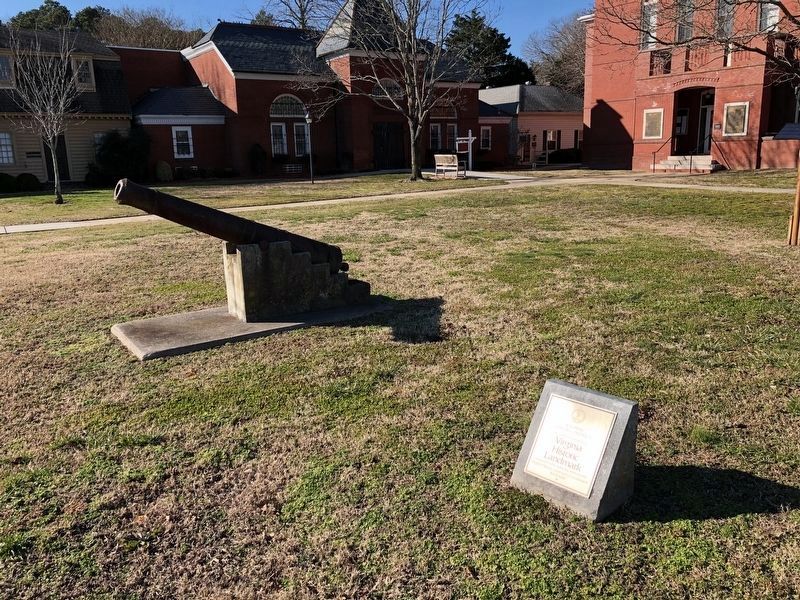
Accomac Historic District has been registered as a Virginia Historic Landmark pursuant to the authority vested in the Virginia Historic Landmarks Commission Act of 1966. — — Map (db m7827) HM
Fifty yards north on the hilltop stood Assawaman Church of the Anglican Accomack Parish, formed in 1663. The brick sanctuary was built after 1680 on land donated by Willam Taylor, a native of England who had settled on the Eastern Shore by 1637. . . . — — Map (db m205005) HM
Captain Timothy Hill House
Built circa 1800 is registered as a Virginia Historic Landmark and placed on the National Register of Historic Places by the United States Department of the Interior 2011 — — Map (db m59833) HM
1671
First land purchase from Gingo-Teague Indians recorded on April 1. Oral tradition says the Gingo-Teague called Chincoteague Island "the beautiful land across the water."
1680
Tenant farmer Robert Scott moves to Chincoteague . . . — — Map (db m165061) HM
Hardy, compact, and spirited—the horses on Assateague Island run freely over a range bounded by ocean and bay. Bands of mares and young led by protective stallions graze on marsh grasses, drink at freshwater ponds, and retreat into island . . . — — Map (db m98826) HM
Since Colonial times, residents of Assateague and Chincoteague Islands have depended on fish and shellfish for food. By the time of the Civil War, islanders were exporting seafood to Northern cities. Toms Cove, or Chincoteaque, oysters . . . — — Map (db m205182) HM
In the 1800s, after the lighthouse was built, a small community grew up not far from here. By the early 1900s, about 225 lived in the village, which included a school, dry goods store, and a church. The residents harvested resources from the sea, . . . — — Map (db m98825) HM
Five miles west is "Hedra Cottage", site of the home of Colonel Edmund Scarborough (Scarburgh), surveyor general of the colony. Beyond, at the end of Scarborough's Neck, was the village of the Occahannock Indians, the seat of Debedeavon, the . . . — — Map (db m7608) HM
An eighteenth century mansion acquired in 1950 by the Eastern Shore of Virginia Historical Society as headquarters for the society. — — Map (db m7682) HM
Two miles west is Onancock, founded in 1680. A courthouse was then built and used for a few years. Militia barracks were there in the Revolution. From Onancock, Colonel John Cropper went to the aid of Commodore Whaley in the last naval action of the . . . — — Map (db m7673) HM
Accomack County. Area 502 Square Miles. The Eastern Shore was first known as the Kingdom of Accomack, for an Indian tribe. Accomac was one of the original shires formed in 1634. The name was changed to Northampton in 1643. In . . . — — Map (db m7609) HM
The Doctor's Bungalow was built in 1961 by Grover Charmock. In 1964, Oscar Watson, Jr., MD moved in. It is thought to be the first house on Tangier to have two bathrooms. — — Map (db m106990) HM
The former Noble Dise Store was replaced with the island's first mobile home in 1959.
Manufactured homes remain popular today, but require a community-wide effort to move one into place after being delivered to the island by barge. — — Map (db m39950) HM
The Doctor's House was owned consecutively by doctors Samuel Oglesby, William Daisey, Bache Gill, and Charles Gladstone. Dr. Gladstone never lived there, but boarded next door in the Sidney Crockett House.
Dr. Gladstone's former office still . . . — — Map (db m39951) HM
The John Thomas House marks the dividing line between the old Thomas and Wallace family lands.
At the end of the 19th century, these two families owned almost all of the land on the western side of the island. — — Map (db m106991) HM
Patrick Benson, a ship's captain from Dublin, Ireland, purchased this land in 1879. The middle section of house was completed in 1889. The front section with porch and back section with kitchen and outbuilding were added over the years, but . . . — — Map (db m106977) HM
The Peter Dise House is one of the oldest on the island and was moved from the "Uppards," the now unoccupied marsh north of the harbor.
There were originally four fresh water wells on the island, two on Maine Ridge, one on Canton Ridge and one on . . . — — Map (db m39953) HM
The Rothwell Family of Albemarle County Virginia.
Claiborne one of the first of the Rothwells to live in this county, was born about 1741 as reported in The Virginia Advocate, Saturday Oct. 11, 1828 and “died on Oct. 6 in his 87th . . . — — Map (db m3996) HM
The original house was built in 1765 by Thomas Walker, explorer and pioneer. Tarleton, raiding Charlottesville to capture Jefferson and the legislature, stopped here for breakfast, June 4, 1781. This delay aided the patriots to escape. Castle Hill . . . — — Map (db m22439) HM
Ash Lawn - Highland
Home of James Monroe from 1799-1823
Dedicated on July 20, 1985
by
Virginia Daughters of the American Revolution
State Regent
Mrs. G.E. Honts, Jr. — — Map (db m63671) HM
In 1814 a ditch 500 yards long was dug to keep grazing animals off the west lawn.
The rails that were laid across the banks reminded a visitor in 1823 of "a common post and rail fence, blown down across a ditch." — — Map (db m100002) HM
Wood charcoal fueled the forges in the nailery on Mulberry Row and heated the stoves in the kitchen. Charcoal was stored under lock and key in wooden sheds that once stood here. Built about 1794, these "coal sheds" likely resembled temporary . . . — — Map (db m100442) HM
Historic Michie Tavern, established in 1784 by Scotsman William Michie, served as a social center of its community and accommodated travelers with food, drink and lodging.
◇ Highlights of the Tavern Tour
◇ . . . — — Map (db m170646) HM
The Eagle. Peacemaker. Tecumseh. Bremo. Wellington. Diomede. These were the six carriage and saddle horses, plus one mule, stabled here in 1821. As many as 30 riding and carriage horses, workhorses, and mules were stabled at various locations on . . . — — Map (db m100157) HM
Master carpenter James Dinsmore oversaw construction of this Ice House to Jefferson's design in 1802. Enslaved and hired workers filled it each year between November and February with ice cut from the nearby Rivanna River, shallow ponds, or snow . . . — — Map (db m68174) HM
This was the general site of the "old nursery," where Jefferson grafted and sowed the seed of special garden plants. He propagated thirteen kinds of shrubs, forty—one species of ornamental trees, twenty—six vegetable varieties, six kinds . . . — — Map (db m100003) HM
Virginia's virgin forest provided materials for the settlers' most basic shelter. Centuries ago, first growth trees were felled and the wood hewn to form this single-room log cabin in Piney River, Virginia, 45 minutes south of here. The structure is . . . — — Map (db m53613) HM
Over 200 years ago, four log dwellings stood here. The first, constructed in the 1770s and destroyed by fire ca. 1790. was the "Negro quarter," a large 17 x 34 foot structure intended for multiple enslaved individuals or families. Three identical, . . . — — Map (db m100176) HM
In the long, three-celled wooden structure that stood here between ca. 1790 and 1809, Jefferson combined two of what he considered "indispensable" elements of a Virginia plantation, the "smoke house" and "dairy." His unusual design placed "two . . . — — Map (db m100440) HM
Not far from the Tavern, the Michie family owned and operated a mill and general store. At the turn of the century the mill fell from decay. In order to recreate the Michie's Tavern-plantation (which stretched for several miles) Historic Michie . . . — — Map (db m53611) HM
At the age of 23, Pleasant Sowell began building his house on a 100-acre tract six miles south from here. This structure became his family's home for 173 years. For six generations, the Sowells' choice of materials, craftsmanship and alterations . . . — — Map (db m170650) HM
[The marker features floor plans of the house at different points of its history:]
1822 - This is how the house appeared when Pleasant and Sarah moved in towards the end of 1822. We do not know if at this time a staircase led to the . . . — — Map (db m170653) HM
Charlottesville wool also outfitted the US Postal Service and most railroad workers from coast to coast. In the early 1900s, the Mill employed some 130 people and had established a national reputation, supplying uniform cloths worn by police . . . — — Map (db m172977) HM
Villages such as Advance Mills were once common features of rural Virginia, serving as economic and social centers. Advance Mills grew around a single mill that John Fray constructed in 1833 on the north fork of the Rivanna River. By the twentieth . . . — — Map (db m55785) HM
This is a spring that was used by the Carr family when they lived here in 1870. The spring provided a source of clean drinking water and was also used as a storage location to keep perishable foods cool — — Map (db m170175) HM
Legacy of Hugh Carr
The Ivy Creek Natural Area was once the home of Hugh Carr, born into slavery around 1840 in Albemarle County. The end of the Civil War in 1865 was for Hugh the start of a new life founded in freedom.
In 1870, Hugh . . . — — Map (db m170172) HM
A network of more than six miles of walking trails leaves large areas of natural habitat undisturbed. The 1.5 mile Central Red Trail leads back to the parking lot and barn. All other trails stem from the Red Trail.
A 0.75-mile paved trail . . . — — Map (db m170174) HM
1975: Red Flags
For years, Elizabeth (Babs) Conant had canoed the relatively new South Fork Rivanna Reservoir and enjoyed its abundant wildlife. Then one autumn day in 1975, she rounded a bend and saw something ominous. Survey stakes . . . — — Map (db m170170) HM
Bounded by the James River to the south and the Rivanna River to the north, this nationally significant district encompasses 83,627 acres. Listed on the National Register of Historic Places in 2007, it includes buildings influenced by Jefferson’s . . . — — Map (db m23240) HM
Albemarle County. Albemarle County was formed in 1744 from Goochland County and named for William Anne Keppel, the second Earl of Albemarle, titular governor of Virginia from 1737 to 1754. A portion of Louisa County was later added to . . . — — Map (db m22780) HM
This was the girlhood home of Viscountess Nancy Astor, first woman member of the British Parliament. She was a daughter of Chiswell Dabney Langhorne, who bought “Mirador” in 1892. The house was built sometime after 1832 for James M. . . . — — Map (db m1536) HM
Half a mile north was born, 1774, Meriwether Lewis, of the Lewis and Clark Expedition, sent by Jefferson to explore the far west, 1804–1806. The expedition reached the mouth of the Columbia River, November 15, 1805. — — Map (db m1795) HM
Free State, a community of free African Americans, stood here. Its nucleus was a 224-acre tract that Amy Farrow, a free black woman, purchased in 1788. Her son Zachariah Bowles lived here and married Critta Hemings of Monticello, an older sister of . . . — — Map (db m170663) HM
Here stands the Barclay House, built about 1830, later the home of Dr. James Turner Barclay, inventor for the U. S. Mint and missionary to Jerusalem. He founded the adjacent Diciples Church in 1846 and served as its first preacher. It is now the . . . — — Map (db m17995) HM
Thomas Jefferson—author of the Declaration of Independence, third president of the United States, and founder of the University of Virginia—was born near this site on 13 April 1743. His father, Peter Jefferson (1708–1757), a surveyor, planter, and . . . — — Map (db m17306) HM
This estate was the home of James Monroe, fifth president of the United States. In 1793, James and Elizabeth Kortright Monroe purchased 1,000 acres adjoining Jefferson’s Monticello. Called Highland, the plantation, eventually totaling 3,500 acres, . . . — — Map (db m23437) HM
The house was built about 1770 by workmen engaged in building Monticello. Mazzei, an Italian, lived here for some years adapting grape culture to Virginia. Baron de Riedesel, captured at Saratoga in 1777, lived here with his family, 1779–1780. . . . — — Map (db m21952) HM
Philip Mazzei, a Tuscan merchant and horticulturalist, arrived in Virginia in 1775 and was persuaded by Thomas Jefferson to settle here. Jefferson gave him 193 acres of land, and Mazzei named his property Colle (meaning "hill"). He built a house ca. . . . — — Map (db m170655) HM
This land was once part of more than 1,100 acres acquired by the Terrett family by the mid-19th century. Within Fairfax County until annexed by the City of Alexandria in 1952, the area was primarily agricultural fieldsd and woodlands here before . . . — — Map (db m214230) HM
[Plaque on the left side of the entrance:]
From the establishment of Alexandria in 1749 to the present time, African Americans have been a vibrant part of this city's history. The City of Alexandria would not exist in its present form were . . . — — Map (db m131547) HM
Josiah Watson, a wealthy merchant and postmaster of Alexandria, established his 272-acre plantation, “Bush Hill”, in 1791. Richard Marshall Scott purchased the plantation in 1791; his family stayed here for 200 years. Scott was an . . . — — Map (db m2610) HM
Three roads formed this Fairfax County intersection by the early 19th century. Braddock Road, Middle Turnpike (later called Leesburg Pike/King Street/Route 7) and Quaker Lane were the wagon routes for trade between the port town of Alexandria and . . . — — Map (db m150816) HM
Did you know that you traverse the District of Columbia, Maryland, and Virginia when you cross this bridge? The brass lines in the walkway mark the boundaries. They also commemorate the cooperation required to build this bridge.
Follow the . . . — — Map (db m140997) HM
Alexandria's Changing Shoreline
In 1749 the town of Alexandria was laid out on 10 to 15 foot bluffs around a crescent of shallow water. The back edge of John Carlyle's property, where you are standing now, was about 15 feet above the Potomac . . . — — Map (db m129171) HM
During the Civil War, thousands of formerly enslaved individuals came to Union-controlled Alexandria to seek refuge and freedom. As a result, several new African American neighborhoods developed during and after the Civil War, including four in . . . — — Map (db m239750) HM
The African American Heritage Trail along the waterfront consists of two interconnecting routes. Both begin at Waterfront Park. Together, these trails illuminate the history of the African American community in Alexandria over a span of several . . . — — Map (db m239718) HM
Alexandrians created waterfront land by banking out the shoreline using timber cribbing and old ships including three discovered on this site.
For over two centuries this land embodied Alexandria's working waterfront with an evolving mix of . . . — — Map (db m204474) HM
Wording on stone tablet to left:
Alexandria, Virginia
County seat of Fairfax 1742-1800
Organized 13th July, 1749
Incorporated by the Assembly of Virginia 1779
Ceded to the Federal Government 1789
First boundary . . . — — Map (db m167068) HM WM
This house was built between 1784-1786 by Colonel Michael Swope, a Revolutionary War Battalion Commander, and his wife, Eva Kuhn Swope. Originally from York, PA, Colonel Swope was taken prisoner by the British at the beginning of the war and was . . . — — Map (db m149717) HM
During the 17th century, settlers began to establish small plantations near landing places on the Potomac River. Oceangoing ships could load tobacco and other goods to export to Great Britain. The area that was to become Alexandria was still . . . — — Map (db m127772) HM
As Virginia's population grew, so did its reliance on fish from the Potomac River as a dietary staple. In 1813, the city authorities passed a law designating the county wharf at the foot of Oronoco Street as the official place for landing fish. . . . — — Map (db m239715) HM
The Alexandria waterfront has changed dramatically since the City's founding in 1749. The Potomac River once flowed along the high banks about two blocks west of here near Water (now Lee) Street. Two hundred and fifty years ago, the area where . . . — — Map (db m182672) HM
When Alexandria was founded in 1749, this corner was planned as the main intersection in the new town, with the streets named in honor of Thomas Fairfax, 6th Lord Fairfax of Cameron, a major land-owner in Northern Virginia. From Cameron Street, . . . — — Map (db m167213) HM
In 1804, Francois-Dominique Toussaint L'Ouverture, a formerly enslaved Haitian Black military leader, led the only successful uprising of enslaved people in the Western Hemisphere. As a result of the rebellion, the Caribbean island of Haiti . . . — — Map (db m239747) HM
American Indians first frequented Jones Point to hunt and fish. The point is likely named for an early English settler. By the 1790's, military installations were established at Jones point due to its strategic location on the Potomac River. The . . . — — Map (db m79997) HM
■ a living public art sculpture encompassing the entire park ■ a combination of three garden types: a hanging garden, topiary garden and rain garden ■ the result of an international design competition an important example of . . . — — Map (db m243158) HM
On September 6, 1654, this site was included in a patent of 700 acres granted by the Colony of Virginia to Mistress Margaret Brent (c1601–c1671). An extraordinary woman, she spent most of her adult life fighting discrimination of her sex, she was . . . — — Map (db m62020) HM
Theodore Roosevelt Island
This wooded island is a tribute to the vision of our 26th president. Explore, on foot, 2.5 miles of trails and the memorial plaza.
Lady Bird Johnson Park
Take time to visit the Lyndon Baines Johnson . . . — — Map (db m233790) HM
Living history
Discover the spirit of Alexandria that has been making history for centuries.
Alexandria has had a role in our nation's history since its founding in 1749. George Washington called Alexandria home in his . . . — — Map (db m236052) HM
[Marker is a series of photos:]
Washington, Alexandria and Mt. Vernon electric railway train at King and Pitt Streets, circa 1915.
Courtesy of Alexandria Library, Special Collections
North side of the 300 . . . — — Map (db m156844) HM
Jones Point was once a wooded wilderness, ringed by marshes and periodically cut off from the mainland during high tide. American Indians made use of both woodland and wetland for food, tools and supplies. By the 17th century, Europeans had . . . — — Map (db m62028) HM
Early Uses
The West End was a rough and rowdy area just outside Alexandria's city limits. Stockyards, rail tracks, a tavern, and small shops catered to the farmers and drovers supplying the city's markets in the years before the Civil War. . . . — — Map (db m236050) HM
A private residence listed in the National Register of Historic Places by the United States Department of the Interior. Registered as a Virginia Historic Landmark by the Virginia Board of Historic Resources.
Thomas Swann House, 1802-1833. . . . — — Map (db m145963) HM
The Carlyle House, completed in 1753, was the residence of one of the 18th-century Alexandria's leading citizens—John Carlyle—a prosperous merchant and landowner.
1. Although the earliest known engraving of the Carlyle House appeared . . . — — Map (db m129174) HM
The Patton-Fowle House - attributed by some to renowned early American architect Charles Bulfinch of Boston - is one of America's finest examples of Federal high-style architecture. Sharing many of the same features as the historic Octagon House, . . . — — Map (db m134973) HM
From this point, King Street slopes gently down to the Potomac. But when Alexandria was founded in 1749, the new town was perched on a high bluff some 20 feet above the river. The town was established on a shore of a crescent-shaped bay that . . . — — Map (db m115766) HM
Owned by William Ramsay, a founder of Alexandria in July, 1749, and first Mayor. Restored by the City of Alexandria in 1956 and dedicated to the memory of Mrs. Robert Miller Reese (Rebecca Ramsay) (1870–1955), great-great-granddaughter of . . . — — Map (db m144) HM
Oldest house in Alexandria owned by William Ramsay, a Founder, Trustee, and the first Mayor of Alexandria in 1749. Later occupied by his son Dennis Ramsay and his descendants. Interest in preserving the house was initiated by Edward . . . — — Map (db m115763) HM
Despite occasional conflicts between European settlers and local Indians, Mistress Margaret Brent of Saint Mary’s City, Maryland, was granted the first land patent on Piper’s Island (later known as Jones Point) in 1654. An extraordinary woman for . . . — — Map (db m62026) HM
Replica of Washington's Town House.
Lot purchased by George Washington 1763. House completed 1769 – torn down 1855. Rebuilt by Gov. and Mrs. Richard Barrett Lowe 1960. Bricks & stones from excavation used in construction. Worth . . . — — Map (db m147) HM
Archaeological Evidence of a Working Seaport
The archaeologists tasked with researching this property on the 200 block of South Union Street used a host of sources such as historic photographs, lithographs, deeds, court cases, newspapers, . . . — — Map (db m195635) HM
(Panel 1)
The Alexandria waterfront reflects the perpetual relationship between people and the Potomac River. The Old Town shore documents a history rich in individual and collective maritime, commercial, and cultural concerns. Waterfront . . . — — Map (db m81244) HM
This area, called "Cross Canal," was a neighborhood of black residents who settled across from the canal shortly after the Civil War. The canal, located just north of this marker, extended from the Potomac River to Washington Street, thence north to . . . — — Map (db m129476) HM
During the Civil War, thousands of African Americans fled to the Union-controlled city, either moving into government-run freedmen camps; settling into historically black neighborhoods such as the Bottoms, or seeking out affordable housing on the . . . — — Map (db m237644) HM
Populated almost exclusively by Black residents, the racially segregated neighborhood of The Berg evolved by necessity to have its own set of dwellings, amenities, and social institutions. Houses like the "five frame shanties" that stood on this . . . — — Map (db m204836) HM
Neighborhoods function as support networks and knit people together. For Alexandria's Black residents in the late-19th and early-20th centuries, establishing neighborly bonds was essential for survival within a racist, segregated society.
In . . . — — Map (db m204833) HM
During the Civil War, an influx of self-emancipated slaves (often referred to as "contrabands") arrived in Alexandria. For several decades thereafter, this population, along with other free Black migrants, changed the racial character of both the . . . — — Map (db m204837) HM
Funded by the U.S. Public Housing Administration and built by the Alexandria Housing and Redevelopment Authority (ARHA) between 1954 and 1959, the James Bland Homes was Alexandria's fourth public housing project, and it more than doubled the . . . — — Map (db m72374) HM
Built by Philip Richard Fendall in 1785 on land purchased from Henry (Light Horse Harry) Lee. Lee was a brilliant cavalry officer in the Revolution, close friend of George Washington, Virginia Assemblyman, member of Congress and Governor of . . . — — Map (db m128768) HM
“Light Horse Harry” Lee, Revolutionary War officer, owned this land in 1784. The house was built in 1785 by Phillip Fendall, a Lee relative. Renovated in 1850 in the Greek Revival style, the house remained in the Lee family until 1903. . . . — — Map (db m8567) HM
Built 1797 by John Wise, tavern keeper, and his residence, until 1799. Rental property when sold to Major Jacob Hoffman 1810–1825, included outbuildings, gardens, small sugar refinery. Next owner Elizabeth Thacker Hooe leased house to Benjamin . . . — — Map (db m8613) HM
In 1941, the United States Housing Authority (USHA), under the Federal Works Agency, began to plan for the construction of permanent housing for Black defense workers in the Uptown neighborhood. Then known as the Lanham Act Alexandria Defense . . . — — Map (db m182231) HM
About 100 years before Ramsey Homes was built, prominent Alexandrian Henry Daingerfield purchased this parcel of land. In 1849, prominent Alexandrian Henry Daingerfield purchased a parcel of land upon which the Ramsey Homes would eventually be . . . — — Map (db m188811) HM
The racially integrated working-class neighborhood known as the Hump, named for the high ground at its northern boundary, once spanned three blocks, centering on the 800 block of Montgomery Street. The Hump was first settled in the decade . . . — — Map (db m72500) HM
This city block became part of the Alexandria town grid in 1798. Near the rural outskirts of the developing town, the block remained vacant throughout the nineteenth century. Colross, a country estate, was established in the vicinity, and outside . . . — — Map (db m70671) HM
Charles W. Hill was born on February 22, 1949, in Suffolk County, New York. Charlie, as he was known to his friends, grew up on Long Island where he met his wife, Virginia. They married in 1971. Charlie was hired as a New York City Police Officer . . . — — Map (db m115684) HM
Four Mile Run and the course of its namesake waterway have changed dramatically over the centuries, partly due to natural events and partly to modern human engineering. Although a setting for a rich abundance of plant and animal . . . — — Map (db m130987) HM
Charles A. Watson, an African-American, purchased this land in 1870. In 1905, three years after the passing of the "Jim Crow" Laws in Virginia, his wife Laura and sons Frank and Attorney Thomas M. Watson dedicated and subdivided the land to . . . — — Map (db m211888) HM
1637 entries matched your criteria. The first 100 are listed above. Next 100 ⊳