By Devry Becker Jones (CC0), January 17, 2021
Accomac Historic District Marker
GEOGRAPHIC SORT Title Sort Marker Number Sort Marker Number Sort N Marker Number Sort T Publication Order Sort Publication Order Sort A Erected Year Sort Most Viewed Sort Most Recent-Interest Sort Most Recently Changed Sort SEE FAQ #33 FOR DESCRIPTIONS
On Courthouse Avenue at Courthouse Ave., on the left when traveling north on Courthouse Avenue.
On Atlantic Road (Virginia Route 679) 0.1 miles west of Arbuckle Neck Road, on the left when traveling north.
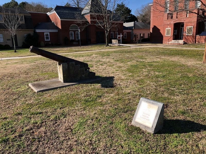
On Main Street just west of Post Office Street, on the right when traveling west.
On Beach Access Road, 0.5 miles south of Wildlife Drive, on the right when traveling south.
On National Seashore Lane at Stephen Decatur Hwy (Virginia Route 611), on the right when traveling west on National Seashore Lane.
Near Beach Access Road north of Boat Ramp Access Road, on the right when traveling south.
On U.S. 13 at County Line Road, on the right when traveling north on U.S. 13.
On Market Street near Crockett Ave., on the right when traveling west.
On US 13 at W. Main Street, on the left when traveling north on US 13.
On County Line Road at County Line Road, on the right when traveling north on County Line Road.
On West Ridge Road south of Wallace Road, on the left when traveling north.
On Main Ridge Road at Wallace Road on Main Ridge Road.
On Main Ridge Road just south of Hilda Crockett Road.
On West Ridge Road at Wallace Road, on the left when traveling north on West Ridge Road.
Paid Advertisement
On Main Ridge Road south of Dise Lane, on the left when traveling south.
On Main Ridge Road just south of Wallace Road.
On Rockfish Gap Turnpike (U.S. 250) west of Crozet Avenue / Miller School Road (Virginia Route 240), on the right when traveling east.
On Gordonsville Road (Virginia Route 231) 1.5 miles Virginia Route 640, on the left when traveling north.
Near Ashlawn-Highland Drive.
Near Thomas Jefferson Parkway.
Near Thomas Jefferson Parkway.
Near Thomas Jefferson Parkway (Virginia Route 53) at Jefferson Lake Drive, on the right when traveling east.
Near Thomas Jefferson Parkway.
Near Thomas Jefferson Parkway.
Near Thomas Jefferson Parkway.
Near Thomas Jefferson Parkway (Virginia Route 53) at Mitchie Tavern Lane (County Road 1102), on the right when traveling east. Reported permanently removed.
Near Thomas Jefferson Parkway.
Near Thomas Jefferson Parkway.
On Thomas Jefferson Parkway (Virginia Route 53) at Michie Tavern Lane (County Road 1102), on the right when traveling east on Thomas Jefferson Parkway. Reported permanently removed.
Near Thomas Jefferson Parkway (Virginia Route 53) 0.1 miles east of Michie Tavern Lane (Virginia Route 1102), on the right when traveling east.
Paid Advertisement
Near Thomas Jefferson Parkway (Virginia Route 53) 0.1 miles east of Michie Tavern Lane (Virginia Route 1102), on the right when traveling east.
On East Market Street (County Road 1105) 0.3 miles south of Riverside Drive, on the right when traveling east.
On Advance Mills Road (County Route 743) at Frays Mill Road (County Route 641), on the left when traveling west on Advance Mills Road.
Near Earlysville Road at Woodlands Road, on the right when traveling south.
On Earlysville Road, 0.2 miles south of Woodlands Road, on the right when traveling south.
Near Earlysville Road (County Road 743) 0.3 miles south of Woodlands Road, on the right when traveling south.
Near Earlysville Road, 0.3 miles south of Woodlands Road, on the right when traveling south.
On Scottsville Road (Virginia Route 20) just south of Carters Mountain Road (Route 627), on the left when traveling south.
On Louisa Road (Virginia Route 22) 0.1 miles west of Whitlock Road (Virginia Route 616), on the left when traveling west.
On Rockfish Gap Turnpike (U.S. 250), on the right when traveling west.
On Ivy Road (U.S. 250) at Owensville Road (County Route 678) on Ivy Road.
On Belvedere Boulevard, 0.1 miles east of Belvedere Place, on the right when traveling east.
On East Main Street (Virginia Route 6) east of Valley Street (Virginia Route 20), on the left when traveling east.
On Richmond Road (U.S. 250) east of Exit 124 (Interstate 64), on the right when traveling east.
On James Monroe Parkway (County Route 795) 0.8 miles south of Thomas Jefferson Parkway (Virginia Route 53), on the left when traveling south.
On Thomas Jefferson Highway (Virginia Route 53) just east of Milton Road (County Route 732), on the right when traveling east. Reported permanently removed.
Paid Advertisement
On Thomas Jefferson Parkway (Virginia Route 53) just south of Colle Lane, on the right when traveling south.
On Mark Center Avenue at Mark Center Drive, on the left when traveling west on Mark Center Avenue.
On Holland Lane at Jamieson Avenue, on the right when traveling north on Holland Lane.
On Eisenhower Avenue, 0.8 miles east of Metro Road, on the right when traveling east.
On King Street (Virginia Route 7) 0.1 miles east of Marlee Way, on the right when traveling east.
Near Capital Beltway (Interstate 95/495) 0.8 miles east of Richmond Highway (U.S. 1), on the left when traveling north.
Near North Lee Street south of Cameron Street, on the left when traveling north.
On South Lee Street just south of Wilkes Street, on the left when traveling south.
Near Thompsons Alley east of North Union Street, on the right when traveling east.
On Pioneer Mill Way just east of The Strand, in the median.
On Cameron Street east of North Royal Street, on the right when traveling east.
On Prince Street just east of South Fairfax Street, on the right when traveling east.
Near Wharf Street east of Ford's Landing Way, on the right when traveling west. Reported unreadable.
On North Union Street at Princess Street, on the right when traveling north on North Union Street.
On King Street east of Strand Street.
On Cameron Street just west of North Fairfax Street, on the left when traveling west.
Paid Advertisement
On Wilkes Street east of South Royal Street, in the median.
On South Royal Street at Jones Point Drive, on the left when traveling south on South Royal Street.
On Diagonal Road at King Street (Virginia Route 7), on the left when traveling east on Diagonal Road.
On Cameron Street west of North St. Asaph, on the right when traveling west.
Near South Street near South Washington Street (Virginia Route 400).
Near Jones Point Drive, 0.2 miles east of South Lee Street, on the right when traveling east.
On Cameron Street east of North Union Street, on the right when traveling east.
On King Street just west of North Pitt Street, on the right when traveling west.
Near Jones Point Drive, 0.2 miles east of South Royal Street, on the right when traveling east.
On Diagonal Road west of Daingerfield Road, on the right when traveling west.
On Prince Street east of South Columbus Street, on the right when traveling east.
Near North Fairfax Street north of King Street, on the right when traveling north. Reported permanently removed.
On Prince Street east of South Columbus Street, on the left when traveling east.
On King Street at North Lee Street, on the left when traveling east on King Street.
On King Street at Fairfax Street, on the left when traveling east on King Street.
On King Street east of North Fairfax Street, on the right when traveling west.
Paid Advertisement
Near Jones Point Drive, 0.2 miles east of South Royal Street, on the right when traveling east.
On Cameron Street near North St. Asaph Street, on the left when traveling west.
Near Strand Street just south of Prince Street, on the right when traveling south.
Near The Strand at King Street, on the right when traveling north.
Near Madison Street east of Mt. Vernon Trail, on the right when traveling east.
On Montgomery Street at North Fairfax Street, on the right when traveling west on Montgomery Street.
On Mt. Vernon Trail at Canal Center Plaza (First Street), on the right when traveling south on Mt. Vernon Trail.
On Wythe Street just east of North Pitt Street, on the right when traveling east.
On Wythe Street just east of North Pitt Street, on the right when traveling east.
On Wythe Street just east of North Pitt Street, on the right when traveling east.
Near North Alfred Street at Montgomery Street, on the left when traveling north.
On Oronoco Street at North Washington Street (Virginia Route 400), on the right when traveling east on Oronoco Street.
On Oronoco Street at North Washington Street (Virginia Route 400), on the right when traveling east on Oronoco Street.
On North Washington Street (Virginia Route 400) at Queen Street, on the right when traveling south on North Washington Street.
On Wythe Street at North Patrick Street (U.S. 1), on the left when traveling west on Wythe Street.
On North Patrick Street (U.S. 1) just north of Pendleton Street, on the right when traveling north.
Paid Advertisement
Near North Alfred Street at Montgomery Street, on the left when traveling north.
On Pendleton Street west of North Fayette St., on the right when traveling west.
On East Oxford Avenue east of Dewitt Avenue.
Near Commonwealth Avenue north of Luna Park Drive, on the left when traveling north.
On Charles Avenue at Shorter Lane, on the right when traveling north on Charles Avenue.
1636 entries matched your criteria. The first 100 are listed above.
Next 100 ⊳