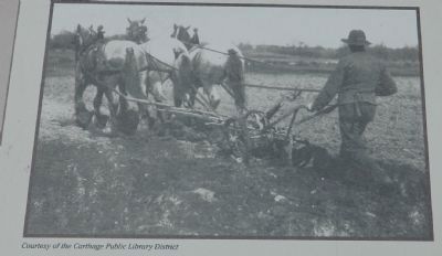
Agricultural life has defined the very essence of Hancock County from the earliest days of its Anglo-American settlement. Lincoln, however, seemed indifferent to agriculture. Once he left his father's home, Lincoln never farmed again. . . . — — Map (db m57876) HM
Forty acres of land were acquired by the Catholic church in the early 1830's from land in the Military Tract, which had been set aside for the veteran survivors of the War of 1812. Title to this land on the Southeast Quarter of the Northeast . . . — — Map (db m181443) HM
Abraham Lincoln came into LaHarpe from the west, riding in a phaeton borrowed from Daniel Bainter. There were some dissenters along his parade route. He spoke at the Methodist Episcopal Church, the so-called "Little Church Around the Corner," . . . — — Map (db m181448) HM
In 1846, about 13,500 Mormon pioneers fled Nauvoo, Illinois, in search of religious freedom. They departed in phases to prepare the way for those who would follow. Their journey started by crossing the Mississippi River. They traveled about 1,300 . . . — — Map (db m244071) HM
Lewis Bidamon, second husband of Emma Smith, built this structure during the 1860s from the foundation stone of the Nauvoo House. Bidamon owned a carriage “manufactory.” He, and his brothers John and Christian had conducted a number of . . . — — Map (db m55436) HM
Edward and Anne Hunter moved into this home in 1842. They added a kitchen sometime after 1843, after Edward became a bishop in Nauvoo's 5th Ward. Here in the Hunter home, Joseph Smith dictated to a scribe instructions on proxy baptism and keeping . . . — — Map (db m244380) HM
Near here, the Mormon exodus to the Rocky Mountains began on February 4, 1846 in seven years, members of The Church of Jesus Christ of Latter-day Saints, commonly called the Mormons, had built Nauvoo to a size comparable to Chicago, with . . . — — Map (db m55440) HM
On the anniversary of the 200th year celebration of the Prophet Joseph Smith, and the 175th anniversary of the establishment of the Church of Jesus Christ of Latter Day Saints, this monument of His prophets Joseph Smith and Brigham Young has been . . . — — Map (db m55439) HM
In 1839 the Mormons, or Latter Day Saints, settled at Nauvoo and made it their chief city. During their residence its population reached 15,000. After long friction with non-Mormons the Mormons were expelled in 1846. Three years later French . . . — — Map (db m55444) HM
In 1839 the Mormons, or Latter Day Saints, settled at Nauvoo and made it their chief city. During their residence its population reached 15,000. After long friction with non-Mormons the Mormons were expelled in 1846. Three years later French . . . — — Map (db m244018) HM
Site of Quashquema Indian Village
—
First White Settlement
By Captain James White 1824
—
Venus
First Post Office
In Hancock County established 1830
—
Town of Commerce
1834
—
Nauvoo 1839
City . . . — — Map (db m244017) HM
Nauvoo was the Latter-day Saints' home for seven years. But they faced increasing conflict with their neighbors. Church leaders planned to leave Nauvoo in the spring of 1846. Latter-day Saints gathered supplies, built wagons, and organized into . . . — — Map (db m244060) HM
Joseph and Emma Smith and their children moved into this home in August 1843. They moved from the home just behind you and to your right.
A hotel wing was added to this home soon after they moved in, allowing them to provide lodging for their . . . — — Map (db m243983) HM
Joseph, Sr., and Lucy Mack Smith, parents of the prophet Joseph and the patriarch Hyrum. Descended from industrious and religious New England families. From the beginning of the restoration, they consistently filled supportive roles in establishing . . . — — Map (db m244533) HM
This is a reconstruction of Joseph Smith's red brick store, built on the site of the original structure. Joseph opened the store to the public on January 5, 1842. At the time, this area was one of Nauvoo's main business districts.
Joseph and . . . — — Map (db m243980) HM
(left panel:)
Lincoln was in the Illinois House of Representatives when the controversial Nauvoo City Charter was granted in 1840.
Although Lincoln did not have the opportunity to view Nauvoo's panoramic vista in person, as a former . . . — — Map (db m244027) HM
Completed in 1843, the Mansion House was the second Nauvoo residence of Joseph Smith and his wife Emma. A hotel wing was added and opened in late 1843. The hotel was leased to Ebenezer Robinson in January 1844. As part of the lease agreement, the . . . — — Map (db m55435) HM
In 1841 church members were commanded to build two “houses,” a house for the Lord (the Nauvoo Temple) and a house for man to be known as the Nauvoo House. It was to be “a delightful habitation for man, and a resting-place for the weary traveler.” . . . — — Map (db m55433) HM
(Remodeled as the Riverside Mansion)
In a revelation to the Prophet Joseph Smith, Jesus Christ commanded the Latter-day Saints to build two houses in Nauvoo. One was a temple - the house of the Lord. The other was the Nauvoo House - " a resting . . . — — Map (db m244527) HM
This is the site of the original survey stone for Nauvoo, the "city beautiful," founded by church members in 1839 after they were forced to leave Missouri. All streets of the city were platted from this point. The two widest streets in Nauvoo at the . . . — — Map (db m68890) HM
Nauvoo was once the site of a Sauk and Fox village. After the Indians moved west of the Mississippi, promoters attempted to develop town sites here but the marshy bottom lands attracted few settlers.
In 1839, the Mormon Prophet Joseph Smith . . . — — Map (db m55432) HM
Like other Illinois cities, Nauvoo was divided into administrative units called wards. Latter-day Saints today still use the term to describe the physical and ecclesiastical boundaries of congregations.
(captions:)
·Knight Street . . . — — Map (db m244382) HM
The original Red Brick Store opened for business on January 5, 1842, with Joseph Smith as owner and proprietor. The main floor was a general store. At the back on this floor, Bishop Newell K. Whitney had an office where people could pay their bills . . . — — Map (db m55437) HM
The Smith Family Cemetery is the final resting place of Joseph Smith, his wife Emma, and brother Hyrum, Lucy Mack and Joseph Smith Sr., and many other family members and friends.
After Joseph and Hyrum were assassinated at the Carthage jail on . . . — — Map (db m244536) HM
When the Latter-day Saints came to this area, this home was one of the only structures here. It was smaller then, only a two-story log building with a summer kitchen, also made of logs.
The property was purchased in May 1839. Emma and Joseph . . . — — Map (db m244470) HM
This two-story, two-room log block house was located on the original 135 acres purchased from local farmer Hugh White and may date to 1803. Joseph Smith moved here in the spring of 1839 with his wife Emma; sons Joseph III, Frederick Granger . . . — — Map (db m55434) HM
On June 24, 1844, Joseph and Hyrum Smith set out for Carthage accompanied by John Taylor, Williard Richards and others to answer false charges. They left Nauvoo traveling a road that ran directly from Nauvoo to Carthage, a distance of 16 miles. It . . . — — Map (db m244074) HM
On the morning of June 24, 1844, Joseph Smith and his brother Hyrum left their families, homes, and fellow Saints for the last time. Traveling on horseback, they paused on this bluff. Joseph looked admiringly at the unfinished temple and the city of . . . — — Map (db m55443) HM
1846 began the Mormon exodus from Nauvoo. Leaving behind their homes, beautiful city, family and friends who they quite possibly would never see again in this life. As they journeyed west, they recorded their feelings and experiences in personal . . . — — Map (db m243986) HM
Regeneration began in 2015
In the 1840s, this hill was home to a small group of trees called the West Grove. Latter-day Saints gathered in the grove to learn gospel truths from the Prophet Joseph Smith and other Church leaders. After the . . . — — Map (db m244378) HM
William and Caroline Allen Weeks met in Quincy, Illinois, and were married June 17, 1839. They moved to this home and partial lot in Nauvoo in the spring of 1841. Joseph Smith selected William's designs for the Nauvoo Temple. Under inspired . . . — — Map (db m244075) HM
William Gheen bought this acre lot before moving with his family from their large farm in Pennsylvania. While in Nauvoo, Esther Gheen joined the Female Relief Society, and William was ordained a high priest. He died in 1845 shortly after returning . . . — — Map (db m243984) HM
Here once stood the thriving community of Green Plains. Established in the early 1830s, the settlement straddled four Hancock County townships and included log homes, a store, a blacksmith shop, a post office, and several cemeteries. Levi Williams, . . . — — Map (db m243818) HM
As the Big Creek Baptist Church is the oldest Baptist church in Illinois with continuous services, the site of the Big Creek Church is two miles west of this location. Elders Stephen Stilley and William Jones led in constituting the Big Creek Church — — Map (db m155007) HM
The first house of worship of the Swedish Evangelical Lutheran congregation of Andover Illinois. An evidence of pioneering faith and devotion this church, begun in 1851 under the leadership of Pastor Lars Paul Esbjorn, was dedicated on Advent . . . — — Map (db m202278) HM
Swedish Lutheran immigrants established here in 1850 their first congregation in America under Pastor L. P. Esbjorn and dedicated this house of worship in 1854.
A National Historic Site
604 Oak Street — — Map (db m202269) HM
Two miles north of here, religious dissident immigrants from Sweden founded the communal society of Bishop Hill in 1846. The charismatic Erik Jansson lead the society spiritually and temporally until 1850 when he was murdered. By 1854, a total of . . . — — Map (db m177481) HM
Bishop Hill Colony Historic District has been designated a National Historic Landmark This site possesses national significance in commemorating the history of the United States of America 1984 National Park . . . — — Map (db m177484) HM
The Geneseo Collegiate Institute was founded in 1884 by the
Presbyterian church of the United States and the citizens of
Geneseo "for the promotion of higher Christian education"
the academic building was on the corner to the east the . . . — — Map (db m160070) HM
This bronze sculpture of a pioneer family is lovingly dedicated to the memory of Nell, Elizabeth (Newton) Henningsen (1917 - 2002). She excelled as a daughter, student, dietician, World War II army dietician, wife, mother, homemaker, grandmother . . . — — Map (db m160103) HM
"If I have helped someone along life's way then my living has not been in vain"
Born in Brookport, Illinois Rev. Turley was a man interested in all facets of life. He always liked to build, loved the positive approach to problems, glorified in . . . — — Map (db m167726) HM
In continuous use since 1872. Moved from north Grand Tower to this site in 1896. It's Gothic architecture is primarily of solid walnut. A Civil War veteran was the first minister. — — Map (db m196141) HM
Elizabeth Jenkins, born in 1803 in North Carolina, married Dr. John Logan in 1825. When her son, John A. Logan, joined the Union Army in 1861, Elizabeth refused to speak to him. In this, she reflected the strong Southern feelings held across Egypt, . . . — — Map (db m161007) HM
In appearance, the Piasa Bird was a combination of bird, animal, reptile and fish. It preyed on local Indian tribes until it was killed by Illini Chieftan Owatoga, whose village was near Elsah. The original Bluff Picture was painted so Indians, . . . — — Map (db m142762) HM
The Union Forest Church was built in 1920 about eight miles southwest of Jerseyville. Its creation was a community effort: Leslie Stamps donated 1/2 acre of land, local farmers donated and milled the lumber, the Jerseyville Baptist Church donated . . . — — Map (db m142824) HM
Evangelist William "Billy" Sunday and his wife Helen "Ma" Sunday owned this farm, 1899-1913, and spent their summers here. Ma was born on the farm. Billy was born in Ames, Iowa, in 1862. He played outfield for Chicago and other National League . . . — — Map (db m55486) HM
This tablet is made to preserve the memory of pioneers, God fearing people from Scotland and Ireland who organized this church in 1841, as a place to meet together and worship
Andrew McCornack • Robert Shedden •
William Fraser •
George . . . — — Map (db m59171) HM
These 32 acres and buildings were purchased by the Kane County Board and the Forest Preserve Commission in October 1972 A.D. from The Society of the Missionaries of the Sacred Heart. — — Map (db m94262) HM
The Plano congregation of the church was organized on April 21, 1861, and met at the home of Elder James Horton. In May 1868, church members passed a resolution to build a church. In a show of support and encouragement, townspeople contributed . . . — — Map (db m68229) HM
Site of Beecher Chapel, first brick church in Galesburg, built in 1858 and named after its first minister, Edward Beecher. Often used as a stop on the Underground Railroad. Razed 1966. — — Map (db m230127) HM
Founded in 1837 by George Washington Gale, who led a group from upper New York State here to establish a Christian manual labor college and a community.
Knox College and the City of Galesburg stand as testimony to the efforts of these . . . — — Map (db m150559) HM
The original bell from St. Andrew Episcopal church heralded many events in the life of the church and community. Usually an altar boy would be assigned the task of pulling the long rope. It was rung before regular services. It was rung for weddings . . . — — Map (db m55555) HM
Dr. Paul Carus
Born July 18, 1852, Ilsenburg in Harz, Germany
Died February 11, 1919, LaSalle, Illinois
Dr. Paul Carus, who lived and worked at 1307 7th St, LaSalle, Illinois, was editor of the Open Court Publishing Company & The Open . . . — — Map (db m65300) HM
William Seeley, who came to LaSalle County in 1828, platted the town of Lowell. A church was built in 1851 serving Anglicans, Baptists, Congregationalists and Methodists. In 1856, in fulfillment of their having built a place of worship, he deeded . . . — — Map (db m197821) HM
[Front]
Born at Laon France June 1 1637 he died near
Ludington Michigan May 18 1675
Devoted missioner and heroic priest-explorer
he offered the Holy Sacrifice of the Mass near
this spot Maundy Thursday and Easter Sunday 1675
and . . . — — Map (db m185190) HM
Christ Episcopal Church
has been placed on the
National Register
of Historic Places
by the United States
Department of Interior
c. 1871 — — Map (db m198803) HM
In memory of the early French missionaries and settlers who came to this area in the late 18th century and the Catholic faith that they rooted in the lives of the people on the banks of the Wabash River
1818-1819 The establishment and . . . — — Map (db m178126) HM
On June 21, 1922, Ronald Reagan, with his brother Neil, was baptized at this church. Ronald and Mother Nelle were active members of the church from 1921 - 1937. Ronald Reagan taught a Sunday school class here. Mother Nelle taught Sunday school, snag . . . — — Map (db m78273) HM
Hennepin Avenue was often walked by a young Ronald Reagan from home to downtown and back. The street has four landmark institutions that played a vital role in the development of his character. They include the boyhood home, the grade school, now . . . — — Map (db m78280) HM
(front:)
Route 66, the Mother Road, is an American icon that symbolizes romance and freedom of the open road. Born in 1926, Route 66 was one of the first numbered U.S. highways, journeying 2,500 miles from Chicago to Los Angeles. Today, . . . — — Map (db m158308) HM
The Pioneer Gothic Church was built in 1857. The Architecture is called Carpenter Gothic Architecture. One of Dwight's founders Richard P. Morgan, Jr. donated the land for the church. The Historical Society raised $29,000 to completely renovate the . . . — — Map (db m158331) HM
The Niebuhr family, called “The Trapp Family of Theology” by Time magazine, produced four distinguished professors of Christian studies. In 1902, the Rev. Gustav and Lydia Niebuhr came to Lincoln, where he became pastor of St. John’s . . . — — Map (db m105975) HM
College Avenue Presbyterian Church, established 1837, formerly Upper Alton Presbyterian Church, heralds Elijah Parish Lovejoy, editor and martyr to freedom, as its first pastor.
Emerson wrote, "The brave Lovejoy gave his breast to the bullets . . . — — Map (db m142158) HM
This is the third church to be built here since 1836.
The first church was made of stone and was built late in 1836 on the present site. The land and church's bell were donated by Enoch Long.
Elijah Parish Lovejoy was the first pastor . . . — — Map (db m144833) HM
Elijah Parish Lovejoy (Nov. 9, 1802 - Nov. 7, 1837) was a newspaper editor, social reformer, and Presbyterian minister whose death at the hands of an angry mob at Alton, Illinois, made him an enduring symbol of the fight for human liberty and . . . — — Map (db m133297) HM
[South side]
Editor Alton Observer
Albion, Me.,
Nov. 8. 1802.
Alton, Ill.,
Nov. 7, 1837.
A Martyr to Liberty
"I have sworn eternal opposition to slavery,
and by the blessing of God I will never turn back." . . . — — Map (db m133298) HM
Elijah Parish Lovejoy was the first pastor of Upper Alton Presbyterian Church, now College Avenue Presbyterian Church. A minister, teacher, newspaper editor, and martyr to free speech and the abolition of slavery, he was fatally shot on Nov. 7, . . . — — Map (db m142159) HM
On this site in 1831, John Mason Peck (1789-1858), pioneer Baptist preacher, author, and educator, established the school which became Shurtleff College. In 1817, Peck had left his home in New England with a vision "to bring the lamp of learning and . . . — — Map (db m139658) HM
The warehouse of Godfrey, Gilman & Co. was situated at the foot of William Street near where the flour mill is located today. Broadway was a one lane street at that time called Short Street. The building was stone, three stories on the street . . . — — Map (db m211806) HM
Robert Pershing Wadlow, Alton's gentleman giant, was born February 22, 1918. He lived most of his life in Alton, where he attended Alton High School and Shurtleff College, now the campus of S.I.U.E. Dental School. At age five, Robert was 5'6" tall . . . — — Map (db m140133) HM
"He had been in Alton scarcely a year when he began the building with his own funds, of a neat stone church on the corner of Third and Market Street and offered the building for use of all organized religious bodies in the town. From that time . . . — — Map (db m144835) HM
Erected about 1873 by Conrad H. Flick of Bethalto, and enlarged in 1885.
Long the center of government and community activity, it has housed the police, fire and water departments, and today contains the public library. Lodge No. 406 A.F. & . . . — — Map (db m242306) HM
Erected near this site in 1805 by the frontier citizens of the Goshen Settlement was the first Methodist church in Illinois
These grounds surrounding it were the scene of many early camp meetings and frontier revivals. In later years the church . . . — — Map (db m147890) HM
Bethel Meeting House 1805
The Bethel Meeting House was erected near the site of the historical marker on the Glen Carbon Road at the entrance to Lakewood, in 1805 by the frontier citizens of the Goshen settlement. This was first Methodist . . . — — Map (db m169618) HM
[Marker features a set of historic photos:]
Greetings from Glen Carbon, Ill.
View of Glen Carbon from the west before 1910 (no Village Hall). Street in center is Sunset with First Methodist Church.
1918 World War I - Left to . . . — — Map (db m169595) HM
"Compared to other surviving Greek Revival churches in Illinois, the building stands on its own. There is nothing like it in the state." - Illinois Department of Conservation, 1977
Completed in 1854, the Benjamin Godfrey Memorial . . . — — Map (db m144922) HM
Scenic vistas, blossoming fields, soaring eagles and a rich history lure visitors off the main stretch of the Meeting of the Great Rivers National Scenic Byway to discover Godfrey during every season of the year. The beauty of the bluff region can . . . — — Map (db m220776) HM
"My years at Monticello formed such an epoch, and it is no flattery to say that to you I owe much of the richness and beauty of the landscape over which I now exult. For your teaching gave me intellectually a broader scope and firmer footing . . . — — Map (db m144920) HM
On this site religious services have been held since 1802 - Methodist Church organized 1809 - Fort Chouteau 7/8 mile south built for protection from indians 1811 - Salem Camp meetings held 1813-1861 - Wanda carried name of Salem until 1875 — — Map (db m77724) HM
Excavations on the southwest corner found that several large ceremonial buildings had burned around AD 1150. Next, a small mound and a new building on top were erected above this and rebuilt
eight times over the next 100 years. . . . — — Map (db m161392) HM
Erected in 1853, 500 yards west of this location. The church moved to this location in 1920. In the late 1960's it changed to:
Upper Salem Independent Baptist Church
On May 12, 2012 the building was destroyed by a fire.
The bell . . . — — Map (db m179300) HM
Civil rights activist Rev. Dr. C.T. Vivian (1924-2020) was raised in a home on this property from 1930 to 1945. He graduated from Macomb High School and Western Illinois State Teachers College (now WIU). His civil rights activism - helping black . . . — — Map (db m181704) HM
609/11 E. Grove St.
Phillip & Sophia
Young House
West Half Built c. 1855
Greek Revival Architectural Style
East side addition by architect Arthur Pillsbury was built
in 1904 to provide income for widow Anna Perrigo.
Phillip . . . — — Map (db m183823) HM
In 1913, Bloomington native Sigmund Livingston founded the Anti-Defamation League (ADL) in Chicago. Livingston came to Bloomington in 1881 at the age of nine with his parents from Germany. After attending public schools, he graduated from law school . . . — — Map (db m162812) HM
(left plaque:)
The following inscription was engraved on one of the original bells that hung in the Broadview Mansion Bell Tower:
"Dedicated to the glory of God
and in loving memory of
Bird Colladay Van Leer, 1867-1933 . . . — — Map (db m162820) HM
Immaculate Conception Church was built in 1866 on land purchased for $600 from Henry Schumacher in 1863. The church was dedicated December 12, 1867by Bishop Juncker. The building was remodeled in 1904, and the improvement included the installation . . . — — Map (db m172805) HM
The oldest known log structure in Illinois on it's original site in continuous use for religious purposes since 1859. First worship service of St. John's congregation held here 1859-67. — — Map (db m143416) HM
The Village of Maeystown, originally known as Maeysville was founded in 1852 by Jacob Maeys, a German immigrant from Bavaria. Maeys purchased 100 acres and had the land surveyed and subdivided into streets and lots with the intention of attracting . . . — — Map (db m144864) HM
Early Community History
St. Joe is located in what was originally the New Design Precinct. The name New Design originated with James Lemen, Sr., who observed that he had a "new design” to make a settlement south of Bellefontaine (Waterloo). . . . — — Map (db m198039) HM
This small community is located in the southern part of New Design Precinct. It was settled in the late 1830's by immigrants from Tipperary, Ireland. The press of economic and political circumstances caused many Irish to immigrate to Monroe . . . — — Map (db m207126) HM
Monroe City School was a rural Country School District located on KK Road west of Monroe City. This building was constructed in 1918 on land purchased from Gustav Hirsch. An increase of students later required adding a second building and another . . . — — Map (db m182052) HM
The church was organized in 1841 by pastor G. A. Schieferdecker and settlers from Saxony, Thuringia, and Westfalia, Germany. The site was donated in 1849 by Johann Christian and Katherine Just. The present church was erected in 1863, and the tower . . . — — Map (db m140384) HM