On 1st Avenue at East Main Street, on the right when traveling south on 1st Avenue.
Father Louis Hennepin, Belgian Recollect missionary accompanying Sieur de la Salle's expedition to the Mississippi River region, left Fort Crevecoeur, Illinois, on February 29, 1680, for an exploration of the upper Mississippi River. On April 11, he . . . — — Map (db m225175) HM
On Swedish Drive NE, on the right when traveling east.
This church, the Swedish Evangelical Lutheran Church of Ham Lake as it is called on the National Register of Historic Places, has a rich history. Founded in 1872, the building was constructed on land donated by Johan and Fredrika Magnuson shortly . . . — — Map (db m207320) HM
Near 370th Street, on the left when traveling east.
The first Minnesota mission to be named for Saint Columba was built by James Lloyd Breck in 1852 at Gull Lake near the present-day Brainerd. It was the fourth Episcopal church established in Minnesota.
The initial group of Chippewa Indians . . . — — Map (db m207531) HM
Near U.S. 75 at County Road 60, on the right when traveling north.
Placed on the National Register of Historic Places on Oct. 14, 2010. Built in 1896 at a cost of $3,300 on land given by Sevrin & Lisbet Huselid. — — Map (db m130999) HM
On St Marys Avenue (Minnesota Route 28 at milepost 22), 0.9 miles west of U.S. 75, on the right when traveling west.
About 1866 a trading post on the Fort Wadsworth Trail was established on
Tokua Lakes a mile west of town. Early in 1878 Archbishop Ireland, after erecting a church on the present town site, located several hundred families in the vicinity through . . . — — Map (db m156662) HM
On State Highway 68 at 227th Lane, on the right when traveling east on State Highway 68.
The above locations of Welsh Churches were established in Blue Earth County after the first Welsh settlers expanded from this farm site, which was claimed by Humphrey Jones and Thomas Y. Davis on April 26, 1855.
In the wooded area . . . — — Map (db m203325) HM
On South Minnesota Street at 6th South Street on South Minnesota Street.
The Church of St. Mary was incorporated on September 26, 1911 by Archbishop John Ireland of St. Paul. The Parish included Catholics living south of Center Street in New Ulm, plus Cottonwood and Courtland Townships. Because of difficult economic . . . — — Map (db m74048) HM
On County Highway 25 west of 140th Avenue, on the right when traveling west.
Valentine Sommereisen was the first resident Catholic priest in three large areas of the American West: southwestern Minnesota, the Dakota Territory, and western Kansas. Born 28 May 1829 in Rouffach, Alsace, a German–speaking part of eastern . . . — — Map (db m74222) HM
Near 190th Street, 0.2 miles west of Minnesota Highway 15, on the right when traveling west.
In 1857, Rev. August Huelster held the first Evangelical church service at the home of Charles Lauer in Cottonwood Township. In 1865, two acres of land were purchased in Cottonwood Township by John Mohr, Philip Pfisterer & Carl Schreyer, . . . — — Map (db m78463) HM
On Main Street East east of Broadway Street, on the right when traveling east.
Carver Historic District
has been placed on the
National Register
of Historic Places
by the United States
Department of the Interior
Church by-the River,
Presbyterian Church
1913 — — Map (db m79234) HM
On Oak Street North north of 4th Street East (County Highway 40), on the right when traveling north.
Carver Historic District
has been placed on the
National Register
of Historic Places
by the United States
Department of the Interior
Trinity Lutheran Church
1914 — — Map (db m79158) HM
On North Walnut Street south of East 4th Street, on the right when traveling south.
City Square Park
City Square in Chaska has always been a gathering place and the heart of this community. The land was set aside for public purpose in 1852 in the original plat. Early settlers in Chaska found six earthen mounds on this . . . — — Map (db m63707) HM
On Chaska Boulevard (County Highway 61) 0.3 miles west of North Hickory Street (County Road 140), on the right when traveling west.
By 1804 Jean B. Faribault was trading in furs for the Northwest Company near the "Little Rapids" of the Minnesota River, 5 miles south of this point, and in this vicinity. His fur post of 1824 on the site of Chaska became the nucleus for the first . . . — — Map (db m41051) HM
On Minnesota Avenue West (State Highway 200/371) at 3rd Street, on the right when traveling east on Minnesota Avenue West.
Missionaries were among the first to arrive in the Leech Lake Area and their work had a lasting impact on those who had settled there. Although their primary purpose was to spread the good news of salvation in Jesus Christ, they also served as . . . — — Map (db m235755) HM
Near 140th Avenue Northwest (County Road 32) near 1st Street West (County Road 13).
"What is old is not good.
What is new is good.
Think only on the new.
In that way, by degrees
you will be able to attain
something. That is the way.
Among other peoples beyond
ours, men consider that alone....
The Dakotas are getting . . . — — Map (db m176416) HM
Near 140th Avenue Northwest (County Road 32) near 1st Street West (County Road 13).
Tokanne (Mary Little Crow Renville) (1789-1840) was born a Kaposia
Bdewakantuŋwan toward the end of the 18th century when tribes
throughout the Midwest were actively developing kinship alliances via
marriage into the Canadian fur trade . . . — — Map (db m176989) HM WM
On 140th Avenue Northwest (County Road 32) near 1st Street West (County Road 13), on the right when traveling north.
“Considering how different all their thoughts are from ours and how unlike
to everything which they have ever seen or heard would be the whole way
of salvation, it is not to be expected that we could make them understand
or believe much of what . . . — — Map (db m176400) HM
On 140th Avenue Northwest (County Road 32) north of 1st Street West (County Road 13), on the right when traveling north.
Lac qui Parle Mission was
established in 1835. Here Christian
missionaries founded one of the
earliest churches and schools in
Minnesota. You can visit a replica
of the chapel built with the help
of Dakota people in 1841, and
you can see the . . . — — Map (db m176311) HM
Near 140th Avenue Northwest (County Road 32) near 1st Street West (County Road 13).
Thomas S. Williamson (1800-1879) and Margaret Poage Williamson
(1804-1872), the founding couple of the ABCFM mission to the Dakotas. With their
young daughter, Elizabeth, they arrived at Lac qui Parle on July 9,1835 from Ripley,
Ohio, . . . — — Map (db m176978) HM
Near 140th Avenue Northwest (County Road 32) near 1st Street West (County Road 13).
Stephen R. and Mary Riggs built a new home for their
family here in 1848. The one-story frame house contained
a living room, small kitchen and two bedrooms.
Mission farmers Jonas and Fanny Pettijohn built their
cabin nearby. Both cabins were . . . — — Map (db m176401) HM
Near 140th Avenue Northwest (County Road 32) near 1st Avenue West (County Road 13).
And Jesus came and said to them,
“All authority in heaven and on
earth has been given to me.
Go therefore and make disciples
of all nations, baptizing them in
the name of the Father and of
the Son and of the Holy Spirit,
teaching them to . . . — — Map (db m176633) HM
Near 140th Avenue Northwest (County Road 32) 0.1 miles north of 1st Street West (County Road 13), on the right when traveling north.
Thomas S. and Margaret Williamson's 1½-story log
cabin was completed near this location in December, 1836.
One of the first two rooms also served as a church and
school until 1841. Missionaries Stephen and Mary Riggs
lived in one of the upstairs . . . — — Map (db m176310) HM
On Park Trail (County Route 12) at Maple Lane, on the right when traveling north on Park Trail.
The village of Almelund and the Immanual Lutheran Church were established in 1887
Reverse
By Gods grace, the people of Amador Township and with the assistance of the Almelund Lions Club, this Triangle Park was developed in 1987. . . . — — Map (db m232288) HM
On West Government Street at Basil Street, on the right when traveling west on West Government Street.
This is the oldest Methodist Church building in continuous use in Minnesota. Methodist circuit riders of the Sunrise Mission served the Taylors Falls area 1852-59. On March 27, 1859, the Rev. Sias Bolles organized the Taylors Falls Methodist . . . — — Map (db m44571) HM
On 8th Street South at S. Second Avenue, on the right when traveling north on 8th Street South.
St. John's Episcopal Church was designed on an Elizabethan model by the noted architect, Cass Gilbert, among whose other significant buildings is the present Minnesota State Capitol. Construction of St. John's began on August 1, 1898.On February 12, . . . — — Map (db m43829) HM
On State Highway 61 east of Old Shore Road, on the right when traveling east.
From the 1700s until the early 1900s, itinerant missionaries braved extreme hardships to minister sporadically to North Shore settlers. In 1855, Jesuit missionaries from Fort Williams, Ontario, served Chippewa City, an Ojibwe community of about 100 . . . — — Map (db m200626) HM
Near State Highway 61, on the right when traveling north.
Father Frederic Baraga, learning of a possible
epidemic afflicting the Indians at Grand Portage in 1846, set out in a small boat from Madeline Island in Wisconsin with an Indian guide.
An unexpected storm threatened them, but their lives were . . . — — Map (db m98448) HM
Near State Park Road north of Voyageur Highway, on the right when traveling west.
Here stood the mission of that great servant of God, Father Francis X. Pierz, his log chapel of 1852, and his frame church of 1867 (demolished 1915). Stones that supported the original structures now support this stone, laid on Columbus Day in . . . — — Map (db m189779) HM
On Upper 55th Street East (County Highway 18) at Annette Avenue East, on the left when traveling east on Upper 55th Street East.
The first congregation in Minnesota of the Evangelical Association of North America was organized here on March 2, 1857 by the Reverend Andrew Tarnutzer. The first small frame building was replaced in 1875 by a church measuring 20 by 32 feet and . . . — — Map (db m67319) HM
On D Street, 0.2 miles north of 1st Street / Sibley Memorial Highway.
In front of you stands the Faribault House, built by long-time fur trader Jean-Baptiste in 1839. Faribault was originally from the Montreal area, and had been associated with the British and American fur traders since the late 1790s. He built . . . — — Map (db m37618) HM
On 1st Street / Sibley Memorial Highway (State Highway 13) west of D Street, on the right when traveling west.
To the glory of God and in memory of General Henry Hastings Sibley. Born February 20, 1811, died February 18, 1891. A great patriot - soldier - statesman. This historic marker is built
of the only remaining stone from the pioneer . . . — — Map (db m37573) HM
Near 1st Street / Sibley Memorial Highway (State Highway 13) 0.5 miles north of State Highway 110, on the left when traveling north.
Here at Mendota (where the rivers meet) missionaries ministered to both Indians and settlers, enduring the hardships of a sprawling wilderness that was the Minnesota country. In 1842, Father Lucien Galtier built a small, log chapel with only two . . . — — Map (db m37714) HM
On 585th Street (County Highway 20) 0.1 miles west of 105th Avenue, on the left when traveling west.
Rice Lake and its surrounding area were popular among early Indians for the abundance of good hunting and the wild rice that grew in the shallow lake waters. Women of the Winnebago tribe harvested the rice even after the first white settlers . . . — — Map (db m196833) HM
On 212th Avenue south of 605th Street, on the left when traveling south.
The role of buildings in the development of a community and their significance in history is amply pointed out by the history of this structure. Anxious to promote the growth of the newly formed town, the citizens agreed to provide the Free Will . . . — — Map (db m115028) HM
On County 2 Boulevard (County Road 2) east of Westervelt Way, on the right when traveling east.
Built to the Glory of God
1868
by Gen. Nathaniel C. McLean
and Consecrated October 27th
by Bishop Henry Whipple.
This church has been placed on the
National Register of Historic Places
by the United States
Department of the . . . — — Map (db m45602) HM
Near Great River Road (State Highway 61 / 63) at County 2 Boulevard (County Road 2), on the right when traveling north.
On the shore of Lake Pepin just north of here a French expedition commanded by LaPerriere and accompanied by two Jesuits in September 1727 built a substantial log fort and the mission of St. Michael the Archangel. The post was occupied periodically . . . — — Map (db m45242) HM
On Norelius Road (County 7 Boulevard), 0.2 miles east of Old Childrens Home Road, on the left when traveling east.
Founded in 1853 and called “Mattson’s Settlement” after its first resident, Hans Mattson, the community was renamed Vasa in 1856 in honor of Swedish King Gustav Vasa. Once called “the most Swedish colony in America,” . . . — — Map (db m45380) HM
On East Avenue north of East 5th Street, on the right when traveling north.
†
This property has been placed on the
National Register
of
Historic Places
by the United States
Department of the Interior
In memory of Laura Schlasner — — Map (db m49215) HM
On Main Street, 0.1 miles south of Jefferson Drive, on the right when traveling north.
Settled by a colony that moved from Lowell, Mass. in 1856, this community takes its name from the Zumbro River which flows through it. This stream, called Riviere des Embarras by the French because of a raft of driftwood at its mouth, became . . . — — Map (db m203002) HM
On East 104th Street, on the left when traveling south.
In the 1830s and 1840s Christian Missionaries came into Indian Country, which included Bloomington, with the purpose of converting Dakota Indians to Christian beliefs and white person's ways. This included farming, owning property, receiving a . . . — — Map (db m117572) HM
Welcome to the 19th century dwelling of Gideon and Agnes Hopkins Pond, missionaries to the Dakota Indians, farmers, and ministers to the community of Bloomington, Minnesota, during the mid- to late-1800s.
Following a move from the Lake . . . — — Map (db m117722) HM
Listed below are some of the most prominent missionaries to the Dakota Indians. These missionaries were sponsored by the American Board of Commissioners of Foreign Missions, a joint venture of the Presbyterian and Congregational Churches of America. . . . — — Map (db m117630) HM
After several years at Lake Calhoun and a series of battles with the Ojibwe (Anishinabe), Chief Cloud Man (Marpiyawicasta) moved to the banks of the Minnesota River. In 1843 Gideon and Samuel Pond followed Cloud Man to this river bluff location. . . . — — Map (db m117498) HM
On East 104th Street, on the right when traveling east.
Welcome to Pond Dakota Mission Park, the site of the historic Oak Grove Mission and the 1856 Gideon and Agnes Pond House. The Ponds served as missionaries to the Dakota Indians and as farmers and ministers to the community of Bloomington, Minnesota. . . . — — Map (db m117549) HM
Samuel Pond (1808-1891) and Gideon Pond (1810-1878) were born into a mostly rural United States comprised of 17 states with a population of slightly over 7 million. These brothers from Connecticut were two of the most influential persons interacting . . . — — Map (db m117720) HM
Near East 104th Street east of Clinton Avenue South, on the right when traveling east.
1834 – 1934
To honor Samuel W. and Gideon H. Pond
Volunteer missionaries to the Dakotas who arrived at Ft. Snelling May 6, 1834.
This tablet is placed on the house built in 1856 by Gideon H. Pond. Near-by is the site of . . . — — Map (db m4894) HM
The Bloomington Town Hall was built twenty feet from this site in 1892 on land given to the Township by the Baillif family. The building was moved to the current location in the 1930's in the first of a number of remodelings the building has . . . — — Map (db m15357) HM
On East Bde Maka Ska Parkway north of W. 36th Street, on the left when traveling north.
On the hill above was
erected the
first dwelling
in Minneapolis by
Samuel W. and Gideon H. Pond
missionaries to the Indians
June, 1834.
Dedicated by the Native Sons of Minnesota, May 30th, 1908. — — Map (db m205658) HM
On West Lake Street (County Road 3) at East Bde Maka Ska Parkway, on the right when traveling east on West Lake Street.
Missionaries Samuel and Gideon Pond arrived at Fort Snelling in 1834 and were immediately dispatched to work with Cloudman, Chief of the Dakota people, who had established an agricultural settlement on the eastern shores of Lake Calhoun near the . . . — — Map (db m212037) HM
On E. 31st Street at S. 28th Avenue, on the right when traveling west on E. 31st Street.
Holy Trinity Lutheran Church began in 1904 when a group of younger members of St. Peder's Lutheran Church, a Danish-speaking congregation, split from St. Peder's over the issue of English in Sunday school and services. The new church . . . — — Map (db m135064) HM
Christ Church Lutheran was founded on 1911. This building, designed by world famous Finnish architect, Eliel Saarinen, was completed in 1949. Immediately the building received international acclaim as one of the earliest examples of modernist . . . — — Map (db m50066) HM
On 12th Street / 4th Avenue at 3rd Avenue, on the right when traveling east on 12th Street / 4th Avenue.
John H. Field · O.L. Loberg · Dr. F. Moody
S.A. Nelson · Oliver Prestholdt
Dr. Ivar Sivertsen · Dr. C.O. Solberg
J.S. Strate · E. H. Sund · Dr. A.C. Tingdale
R. T. Tingdale · Christian Wangaard
Founders
————————
Central Lutheran . . . — — Map (db m91375) HM
On Grant Street west of Nicollet Mall, on the right when traveling west.
Construction on the Basilica of Saint Mary, 88 North 17th Avenue, began in 1907. It is the country's first Basilica and acts as an anchoring landmark on the north side of Loring Park.
The church was planned by French architect Emmanuel . . . — — Map (db m91409) HM
On Grant Street west of Nicollet Mall, on the right when traveling west.
Loring Park has 14 historically designated buildings as well as the Harmon Place Historic Auto District. Some of the designated buildings include the Minneapolis Woman's Club, the Basilica of St. Mary, the Loring Theater, the Wesley Methodist . . . — — Map (db m91408) HM
On Grant Street at Marquette Avenue / 1st Avenue, on the right when traveling east on Grant Street.
This church stands as the first Minneapolis Methodist Church founded west of the Mississippi River. It has been the site of several Annual Conference sessions and twice Methodist bishops have been consecrated at its altar. Having brought scores . . . — — Map (db m122510) HM
On Broadway Street NE east of New Brighton Boulevard, on the left when traveling east.
Northeast Homes Have Distinct Differences
Northeast Minneapolis housing is distinctly different from that in other parts of the city. The upper-middle class and business owners built the older houses in much of Minneapolis. But in old St. . . . — — Map (db m232206) HM
On 10th Avenue S. north of E. Lake Street, on the left when traveling north.
Upon their arrival in the United States, many rural Greek immigrants demonstrated a preference for the city and its promise of a better life. Like other newcomers, they quickly established culturally supportive organizations. In 1909 a . . . — — Map (db m213679) HM
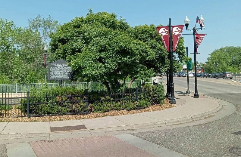
Near 6th Avenue SE just south of SE Main Street, on the right when traveling east.
This was the site from which Father Louis Hennepin, the Franciscan Priest, first viewed the Falls of St. Anthony in June of 1680. He named the falls after his patron saint St. Anthony of Padua.
The famous waterfall was responsible for the birth . . . — — Map (db m225467) HM
On Lourdes Place west of Southeast 2nd Street, on the right when traveling west. Reported missing.
Near this spot in 1630 Father Louis Hennepin first sighted and named the Falls of Saint Anthony.
This is the oldest standing church in the city of Minneapolis. The front rectangular nave, built of native limestone, was opened by the First . . . — — Map (db m238143) HM
On T-33, 0.2 miles south of Cabbage Ridge Road, on the right when traveling north.
This church was established in 1855 by settlers from Rhode Island and Massachusetts. The small but vigorous congregation met in private homes and at the local school house until this building was built in 1877 from plans brought from St. Paul by . . . — — Map (db m137032) HM
On 5th Street (County Highway 13) at Maple Street (County Highway 13), on the right when traveling west on 5th Street.
When the St. Paul, Sioux City & Omaha Railroad came to southwest Minnesota in the early1870s, it established stations along the way. A siding was established at a place called Timber Lake (Sec. 7-Delafield Township) which eventually became known as . . . — — Map (db m233117) HM
On County Highway 8 north of 154th Avenue Southeast, on the right when traveling north.
On August 16, 1885 thirty people met at the home of Erik and Anette Larsen located in Section 26 of Fahlun Township and under the direction of Rev. A.N. Kleven, a new Lutheran congregation was organized by the name of "Tromso Lutheran Church," . . . — — Map (db m78263) HM
On Main Street South (State Highway 9) at 1st Avenue Southwest, on the right when traveling south on Main Street South.
1865 Louis Larson filed homestead rights and named the site New London.
1867 Merchants W.W. Pinney and Samuel Adams each built and opened stores. Postal service began.
1868 New London became county seat of Monongalia County.
. . . — — Map (db m79619) HM
On North Shore Drive (County Highway 30) 1.5 miles west of County Road 4 Northeast, on the right when traveling west.
American Indians lived in Kandiyohi County for thousands of years before settlers first arrived in the 1850s. Among the earliest Euro-Americans to visit this area were traders and missionaries as far back as the mid-1700s. The Missionaries came to . . . — — Map (db m231752) HM
On 150th Avenue Northwest (County Road 29) 0.5 miles east of County Highway 5, on the right when traveling west.
First Church in Minnesota Organized by Mission Friend Immigrants from Sweden
1870-Organized on J.A. Skoglund Farm
1873-Built 1910-Enlarged
1870-1955 Served this Rural Parish
1961-Perpetual Care Fund Raised . . . — — Map (db m77844) HM
On 140th Street Northwest (County Highway 7) 1.6 miles south of 225th Avenue Northwest (County Road 112), on the right when traveling south.
On August 20, 1862, Andrew Jackson, a circuit-rider minister, was conducting services for members of the New Sweden Church (Lebanon Lutheran) at the Lundborg family cabin at this site. Young Peter Broberg interrupted to tell his parents that . . . — — Map (db m77823) HM
On 99th Street Northwest at 195th Avenue Northwest, on the right when traveling north on 99th Street Northwest.
Following the Civil War, immigrants flowed into the Norway Lake area with the majority from Norway and Sweden. On October 10, 1868, Norwegian Evangelical Lutheran Church of Norway Lake incorporated and built a log cabin worship facility at this . . . — — Map (db m76700) HM
Near 99th Street Northwest at 195th Avenue Northwest, on the right when traveling north.
Until 1868 the rapidly growing Norway Lake settlement had no regular place of worship. In the fall of that year a church of logs was hastily constructed. It would serve as the Norway Lake church until 1875 with Rev. L.J. Markhus as the pastor.
. . . — — Map (db m78357) HM
On County Highway 5, 0.2 miles north of 60th Avenue Northwest (County Highway 25), on the left when traveling north.
This monument has been placed to honor Guri Endresen-Rosseland and other early settlers of the Solomon Lake community. The settlers were predominately immigrants from Hardanger, Norway. Among the special characteristics of these pioneers were . . . — — Map (db m75661) HM
On 15th Street Northeast at 60th Avenue Northeast (County Highway 25), on the right when traveling north on 15th Street Northeast.
A Congregation & the Conflict
Kandiyohi County's first church once stood near here. Housed in an abandoned log cabin, the first congregation gathered in 1859 to hold its services. The congregation was called New Sweden and later became . . . — — Map (db m231773) HM
Near 67th Avenue Northwest, 0.6 miles west of County Road 5 Northwest (County Highway 5), on the left when traveling west.
This log house is one of our state's Norwegian-American treasures. It was built about 1858 for the Endreson family, who had emigrated from Vikoy parish, Hardanger, Norway, in 1857.
Lars Endreson Rosseland, the builder of the house, had been a . . . — — Map (db m231777) HM
On Vine Avenue West just east of 3rd Street Southwest, on the right when traveling east.
To the memory of Reverend Emil Polášekwho for thirty-two years, from 1905 to 1937, served God as a pastor of The Church of the Holy Redeemer, rejoicing with us in our joys, comforting us in our sorrows, exhorting us by word of mouth . . . — — Map (db m212945) HM
On Whittier Street at Liberty Street, on the right when traveling south on Whittier Street.
Was organized in 1857 and the stone building was erected in 1859 by the Methodists of this community and has served for 90 years as a place of worship and education. This church building is one of the three oldest Methodist church buildings in . . . — — Map (db m212845) HM
Near East Johnson Avenue just east of Farm Avenue, on the right when traveling east.
Organized on Oct. 12, 1880, by 18 people as the Middle River Congregation, this church was built in 1893 and located in Alma Township. Name changed to Alma Lutheran on May 17, 1959, and the last service in this church before moving to the new one . . . — — Map (db m206299) HM
On 165th Avenue (County Highway 10) 0.2 miles north of 30th Street (County Highway 8), on the right when traveling north.
Established 1895 on land donated by Ed Hoffmeyer
1 ¼ acre Tenhassen Section 22, Martin County, MN
Founding members:
Henry Sr, & Jr. Fred & August Rosenberg,
Edward, Kossuth & Walter Hoffmeyer,
Gottfried Schmidt, Conrad Brutsch, Charles . . . — — Map (db m230851) HM
On 260th Avenue south of 80th Street, on the right when traveling south.
On January 22, 1899, 18 men met to establish a German Evangelical congregation in Pleasant Prairie Township. July 9, 1899 church was dedicated. 1934 the Evangelical and Reformed churches merged. 1957 the Evangelical and Reformed merged with . . . — — Map (db m230862) HM
Near State Highway 7, 0.6 miles west of Silver Avenue (County Highway 16), on the right when traveling west.
O God Our Help in Ages Past
Our Hope for Years to Come!
With thanksgiving to God we erect this monument in honor of our ancestors sleeping here. They predominantly came to Silver Lake from Southern and Eastern Bohemia and Western Moravia, . . . — — Map (db m79519) HM
Near County Road 18, 1.8 miles west of State Highway 22, on the right when traveling west.
This monument marks the site of St. Columban Church and Cemetery. Beginning in 1858, mass and sacraments were celebrated in the homes of the early settlers by Benedictine Monks from St. Cloud friory, who came periodically on horseback. . . . — — Map (db m70775) HM
On 230th Street, 0.2 miles west of Minnesota Highway 4, on the left when traveling west.
On November 26th, 1990 Arndahl Lutheran Church was destroyed by a fire. We are left with many memories of our church and its people.
We dedicate this monument to our church-going fore-fathers who did so much to build the kingdom of God in this . . . — — Map (db m70605) HM
On 580th Avenue, 0.5 miles north of County Highway 23, on the right when traveling north.
The first pioneers to settle in this area arrived by July, 1856, three months after their oxen-drawn prairie schooners left Rock County, Wisconsin. They were the families of Henrik H. Thoen, Ole H. Ness, Nels H. Colberg and bachelors Ole H. . . . — — Map (db m92468) HM
On Riverwood Drive, 0.1 miles west of Minnesota Highway 75, on the left when traveling west.
Belle Prairie, meaning, "beautiful prairie," was named by French fur traders and voyageurs. It was organized as a township on March 25, 1859. Belle Prairie was the home of the first school in Morrison County started in 1849 by Frederick Ayer. Belle . . . — — Map (db m78448) HM
On Riverwood Drive, 0.1 miles west of Minnesota Highway 75, on the right when traveling south.
The First Parish In The Diocese Of St. Cloud
Addition & Remodeling
Dedication - June 2000
————————
Built c.1877
This property recognized by
Heritage Preservation Commission . . . — — Map (db m78427) HM
On Riverwood Drive, 0.1 miles west of Minnesota Highway 75, on the left when traveling west.
This is a replica of the cabin, Mother Ignatius Hayes and her Sisters lived in, when they came to Belle Prairie in 1872. She purchased land from Daniel Mason in Belle Prairie on September 6, 1872 as a site for her convent. The Cabin was rebuilt . . . — — Map (db m78435) HM
On Riverwood Drive, 0.1 miles west of Minnesota Highway 75, on the left when traveling west.
Mother Mary Ignatius (Elizabeth) Hayes
1823 - 1894
Foundress
"My principle prayer has been to known the will of God and my only resolution to do it." — — Map (db m78436) HM
On Riverwood Drive, 0.1 miles west of Minnesota Highway 75, on the left when traveling south.
About the middle of January 1915, the convent bell was Blessed and placed in the Belfry of the Our Lady of the Angels Academy. Rev. Rather Barras preformed the ceremony. It was named, Michael, Ignatius, Francis, Anthony, Columba. — — Map (db m78429) HM
On Riverwood Drive, 0.1 miles west of Minnesota Highway 75, on the left when traveling south.
This monument which was built to memorialize the ground where the Body of Christ burnt, when the convent was destroyed by fire, on April 26, 1889. After the sale of the Academy building the Monument was moved from that location to the present . . . — — Map (db m78434) HM
On Riverwood Drive, 0.1 miles west of Minnesota Highway 75, on the left when traveling south.
These Stations of the Cross were preserved from the chapel of Our Lady of the Angels which closed in 1969. The former Academy is now the River Pines Apartments Complex, located across the road. The original Chapel was blessed on December 7, 1911. . . . — — Map (db m78433) HM
Evidence found by archaeologists shows that tribal peoples frequented this low riverside ridge at least 5,000 years ago, perhaps using the area as a portage around rapids that existed on the Mississippi River here prior to the construction of the . . . — — Map (db m224235) HM
On Main Street North (Minnesota Route 27) just north of 1st Avenue East, on the right when traveling north.
[left panel] The first white settler, Herman J. Billig came to this area in the fall of 1865. In the spring of 1866 a mission was opened at Pierz and cared for by the pastor of Belle Prairie, Father Joseph Buh. [center panel]Pierz is . . . — — Map (db m158940) HM
On Main Street South (State Highway 25/27) 0.1 miles south of Park Avenue Southeast (County Road 252), on the left when traveling south.
Erected in 1952 to the Memory of Reverend Francis Xavier Pierz "Father of the Diocese of St. Cloud" 1785-1880 By assignment of Bishop Joseph Crétin of St. Paul he came to the Upper Mississippi and its tributaries in 1852 to convert the Indians and . . . — — Map (db m213533) HM
On Main Street North just south of 7th Place Northwest, on the right when traveling north.
Dr. O. H. Hegge, a native of Biri Parish, Norway, enrolled at the University of Minnesota Medical School in 1890, just two days after arriving in the United States. He later graduated from the University of Illinois School of Medicine in Chicago and . . . — — Map (db m235431) HM
On Main Street North just south of 7th Place Northwest, on the right when traveling north.
Pat Piper arrived in Austin in the 1960's as a Franciscan Sister. She taught primary grades at St. Augustine's School and later taught courses at Austin Community College. She eventually left the religious order and founded the Christian Education . . . — — Map (db m235455) HM
On Main Street North just south of 7th Place Northwest, on the right when traveling north.
A native of Mower County, Robert Enright graduated from St. Augustine High School, served 4 years in the U.S. Air Force, was a founding member of Queen of Angels Catholic Church, and worked at the Hormel Plant for 47 years as proud member of the . . . — — Map (db m235477) HM
156 entries matched your criteria. The first 100 are listed above. The final 56 ⊳