On West Superior Street near Maple Avenue, on the right when traveling west.
Originally known as the Administration Building, Old Main and an adjacent structure, Pioneer Hall, were actually older than Alma College. Completed early in 1886, the buildings were to constitute the Central Michigan Normal School and Business . . . — — Map (db m91763) HM
On West Center Street at North Maple Street, on the right when traveling west on West Center Street.
Side 1
Henry R. Pattengill (1852-1918) was Michigan superintendent of public instruction from 1893 to 1897. As a textbook author, an orator and editor of Moderator-Topics, a journal for educators, he shaped Michigan's . . . — — Map (db m91669) HM
On West Center Street near North Maple Street, on the right when traveling west.
Superintendent of Ithaca public schools from 1876 to 1884.
He devoted the best years of his young manhood to the lasting benefit of Gratiot's girls and boys who passed under his instruction.
This monument is erected on the site of the old . . . — — Map (db m91670) HM
Near East College Street, on the left when traveling east.
This amphitheater is dedicated to the memory of
Dorothy and Joseph Moller, whose service to our country
in peace and war is exemplary, and whose kindness
and generosity to this College are unsurpassed.
Dorothy was a member of the Board of . . . — — Map (db m199767) HM WM
In 1844 a group of Freewill Baptists organized Michigan Central College at Spring Arbor. This college was the first in Michigan to grant degrees to women. Moved to Hillsdale in 1853 and chartered by the legislature in 1855, the school was renamed . . . — — Map (db m34216) HM
On East College Street, on the left when traveling east.
Hillsdale College is an independent,
nonsectarian institution of higher
learning founded in 1844 by men and
women "grateful to God for the
inestimable blessings” resulting from
civil and religious liberty and
"believing that the diffusion of . . . — — Map (db m199766) HM
On East College Street at North Manning Street, on the left when traveling east on East College Street.
Where there is much desire to learn, there of necessity will be arguing, much writing, many opinions;
for opinion in good men is but knowledge in the making. John Milton
In 1975, The Kresge Foundation recognized Hillsdale College for . . . — — Map (db m199757) HM
On U.S. 12, 2 miles east of State Highway 99, on the left when traveling east.
Priest
Educator-Statesman
Secured funds in 1825 through the United States Congress for the survey of the Great Sauk Trail
now U.S. Highway 112 thus opening this artery of civilization into the west — — Map (db m32219) HM
On North Street at Winfield Road, on the right when traveling west on North Street.
(Obverse Side)
Mosherville Church
The Mosherville Church was built in 1861-62 on land donated by Joseph and Mary Riggs. Originally part of the Litchfield circuit of the Methodist Episcopal Church, it became the home church of a . . . — — Map (db m66790) HM
On Quincy Street (U.S. 41) at Dakota Street, on the right when traveling west on Quincy Street.
Old Main
Suomi College was founded in 1896 by the Finnish Evangelical Lutheran Church of America. The cornerstone of Old Main, the first building erected at Suomi College, was laid on May 30, 1898. Jacobsville sandstone, quarried at the . . . — — Map (db m122387) HM
On Shelden Avenue (U.S. 41) at Quincy Street, on the right when traveling west on Shelden Avenue.
Houghton has grown dramatically since 1861, when its two thousand residents, wood frame commercial district and few industrial buildings were incorporated as a village. By the time of the copper district's peak production, 1900-1920, the population . . . — — Map (db m153994) HM
On East Montezuma Avenue (U.S. 41) at Huron Street, on the left when traveling east on East Montezuma Avenue.
By the 1890s, Houghton had developed from a small lakeside village into a bustling regional hub for transportation and commerce. Its municipal services were designed to provide structure for the growing town, not only through ordinances and . . . — — Map (db m226704) HM
On Grant Street south of White Rock Road, on the right when traveling south.
Named after a boulder in Lake Huron that was used as a landmark in the Indian Treaty of 1807, the village was settled about 1860. Destroyed in the Great Fire of 1871, the town was soon rebuilt, including a schoolhouse. The present building was . . . — — Map (db m154098) HM
On State Road near West Huron Street, on the right when traveling east.
In 1872, the citizens
of Port Hope
constructed a new
two storied school
building on the
corner of School and
Second Streets. In
1927, the school
building was torn
down, saving the bell
tower roof.
For many years
the old tower . . . — — Map (db m225986) HM
On West Circle Drive, on the right when traveling west.
Side 1
The first women at the Michigan Agricultural College enrolled in 1896 in the "women's course," taught by Edith F. McDermott, Professor of Domestic Economy and Household Science. In 1899, the Michigan Legislature . . . — — Map (db m106835) HM
On West Circle Drive west of Abbott Road, on the left when traveling west.
The Alice B. Cowles House, built in 1857, is the oldest building on the Michigan State University campus. Built as a "Farm Cottage" on Faculty Row from bricks made of clay from the banks of the Red Cedar River, it was originally the official . . . — — Map (db m106907) HM
On West Circle Drive at Abbot Road, on the left when traveling west on West Circle Drive.
The central portion of this house was constructed in 1857 as a home for the first president of the college. It was occupied by President Williams and President Abbot until 1874. When a new president's house was built on the site now occupied by . . . — — Map (db m210805) HM
On North Hagadorn Rd at Ann Street, on the right when traveling north on North Hagadorn Rd.
By 1986 this Greek Revival house was the only privately-owned pre-Civil War house still used as a residence in East Lansing. Horace Bigelow (c. 1822-1891) built it in 1849. According to the 1874 Atlas of Ingham County, Bigelow was "a farmer, . . . — — Map (db m106962) HM
On West Circle Drive, 0.1 miles east of Kalamazoo Street, on the right when traveling east.
At this location, near the W.J. Beal Botanical Garden (1873), the Botanical Laboratory stood from 1879 until it burned on March 20, 1890. Watson and Arnold of Lansing designed this Gothic-inspired, wooden structure as the first botanical . . . — — Map (db m106817) HM
On Abbot Road at Linden Street, on the right when traveling north on Abbot Road.
Collegeville
In 1849 when D. Robert Burcham settled in this vicinity, Chippewa and Ottawa Indians lived along the Red Cedar River. Burcham journeyed here on the Indian trail that became the Grand River Road, also known as the Lansing-Howell . . . — — Map (db m102977) HM
On East Circle Drive at West Circle Drive, on the right when traveling east on East Circle Drive.
Famous horticulturist and educator, Liberty Hyde Bailey, designed this building as the first separate horticulture laboratory in America. Completed in 1888, the structure contained rooms for classes and botanical experiments. It exemplified Bailey's . . . — — Map (db m106911) HM
On West Circle Drive at Auditorium Road, on the right when traveling east on West Circle Drive.
Side 1
When completed in 1909, Agriculture Hall was the grandest structure at what that year officially became known as Michigan Agricultural College. Invoking antiquity with its massive concrete Tuscan columns and neoclassical . . . — — Map (db m106832) HM
Near West Circle Drive, 0.2 miles east of Kalamazoo Street, on the left when traveling east.
On this site stood College Hall, first building in the United States erected for the teaching of scientific agriculture. Here began the first college of its kind in America, and the model for Land-Grant colleges established under the Morrill Act . . . — — Map (db m106921) HM
Monsignor Jerome V. MacEachin
Affectionately known as Father Mac, the Reverend Monsignor Jerome V. MacEachin (1904-1987) was associated with Lansing area Catholics for nearly 45 years. A native of Ubly, he was ordained in 1932. Father Mac . . . — — Map (db m102974) HM
Here, on December 9. 1876, the first dormitory of the new Agricultural College of the State of Michigan burned. The college was founded in 1855 and Saints' Rest - as the building was later called in reference to a popular nineteenth century . . . — — Map (db m210812) HM
On West Circle Drive, 0.2 miles east of Kalamazoo Street, on the left when traveling east.
Side 1
The small depression between Beaumont Tower and the Music Practice Building, known today as Sleepy Hollow, is the last vestige of a small, spring-fed brook entering the campus from the north and draining into the Red . . . — — Map (db m106834) HM
Near North Shaw Lane, 0.1 miles west of Farm Lane.
On this site stood
The Livestock Judging Pavilion
For six decades, from 1938 to 1997, the Livestock Judging Pavilion served as a focal point for many activities within the College of Agriculture and Natural Resources. At this site, . . . — — Map (db m133817) HM
On West Circle Drive north of East Circle Drive, on the right when traveling west.
Left Panel
The Agricultural College of the State of Michigan was founded on February 12, 1855, as a bold experiment in higher education. The College opened the doors of higher education to the common man - and, later, woman - . . . — — Map (db m106820) HM
Near West Circle Drive, 0.2 miles east of Kalamazoo Street, on the left when traveling east.
On May 3, 1996, the bells of Beaumont Tower rang again after having been silenced by wear and tear since 1987. Spartans everywhere rejoiced. In July 1995, the MSU Board of Trustees approved a renovation plan for the tower and carillon.
A . . . — — Map (db m106923) HM
Walter Adams (1922-1998), master teacher and one of the foremost antitrust economists of his generation, served from April 1, 1969, until January 1, 1970, as 13th President of Michigan State University. Prolific author and frequent witness before . . . — — Map (db m107335) HM
Left Panel
In 1870, what was then called State Agricultural College admitted its first 10 women, offering them the same physically and academically demanding courses offered to men.
The Women's Building was completed on . . . — — Map (db m106818) HM
On Washington Road at Holt Road, on the right when traveling south on Washington Road.
Gunn School, Delhi District No. 7, Hold Public Schools, 1886-1957. This present structure replaced a log school house built in 1867. — — Map (db m182167) HM
On W. Shiawassee Street, on the right when traveling west.
Side A Andrew Carnegie credited libraries with opening the "treasures of knowledge and imagination through which youth may ascend." This belief led him to provide funding for more than 1,600 libraries across the United States. Designed by . . . — — Map (db m103324) HM
On Cherry Street near East Hillsdale Street, on the right when traveling south.
Built 1894 - From 1873 to 1894 The 3rd Ward School was held on this site. Since 1958 the building has been occupied by Manson, Jackson & Kane, Inc. — — Map (db m210813) HM
On E. Michigan Avenue, on the right when traveling west.
Church of the Resurrection On June 15 1922, the Most Reverend Michael J. Gallagher, bishop of Detroit, sent Father John A. Gabriels to Lansing to establish a Catholic parish east of the Pere Marquette railroad tracks that would include East . . . — — Map (db m103656) HM
Near North Washington Square, on the right when traveling south.
Fannie Richards helped initiate the fight for educational equality that led to a landmark 1869 Michigan Supreme Court decision abolishing segregation in the Detroit public schools. She began her 50-year teaching career as a Detroit teacher in . . . — — Map (db m103984) HM
On N. Grand Avenue at E. Michigan Avenue., on the right when traveling north on N. Grand Avenue.
George E. Palmer George E. Palmer (1862 - 1944) served Lansing as a truant officer, police officer and superintendent of buildings for the Lansing Public Schools. Beginning in 1900 as a truant officer, Palmer worked with students who were not . . . — — Map (db m103930) HM
Near South Washington Square, on the right when traveling south.
Considered “The First Lady of the Press,” former White House Bureau Chief Helen Thomas is a trailblazer who broke through barriers for women reporters. Thomas worked for United Press International for more than 55 years covering every president . . . — — Map (db m104168) HM
On N. Capitol Ave., on the left when traveling south.
Lansing Community College was established on April 8, 1957, by the Lansing Public Schools. It opened that fall with 425 students and sixteen faculty members. It offered civil mechanical and electronics technologies as well as practical nursing and . . . — — Map (db m103351) HM
Near North Washington Square, on the right when traveling north.
Educated first in Odawa (Ottawa) skills and traditions, Andrew J. Blackbird struggled to find the resources to Euro-American schools. He eventually studied at Ypsilanti State Normal School. His command of English enabled him to work as an . . . — — Map (db m103710) HM
On N. Washington Avenue at W. Kilborn Street on N. Washington Avenue.
Michigan Education Association When completed in 1928, this building marked the Michigan Education Association's seventy-fifth anniversary. The Lansing architectural firm of Warren Holmes-Powers Company designed the Neo-Georgian structure. The . . . — — Map (db m105077) HM
On N. Pine Street, on the right when traveling south.
Michigan School for the Blind
Michigan began educating the blind in 1859 at Flint's Michigan Asylum. In 1879 the legislature established the Michigan School for the Blind, which opened here on September 29, 1880, with 35 students. The next . . . — — Map (db m103504) HM
Near West Miller Rd., on the left when traveling west.
Roswell Everett
Roswell Everett, a native of New York State, came to Michigan in 1834. In 1841 he moved to Ingham County and immediately involved himself in public affairs. Everett (1790 - 1871) is credited with naming Delhi Township, which . . . — — Map (db m103501) HM
On North Verlinden Ave. at Inverness Ave,, on the right when traveling north on North Verlinden Ave..
Wolverine Boys' State: The American Legion
On November 28, 1937, the board of directors of The American Legion established Wolverine Boys' State. American Legion departments in other states, including Ohio and Indiana, had existing programs. . . . — — Map (db m104318) HM
On West Ash Street at Kiwanis Drive, on the right when traveling east on West Ash Street.
The Pink School Fractional Dist. 5, Vevay & Aurelius Twps. was organized on July 3, 1853. Built on N.E. corner of College & Columbia Roads. Opened June 27, 1854.
Serving our community for 111 Years. — — Map (db m171650) HM
On Marsh Road, 0.3 miles north of Central Park Drive, on the left when traveling north.
Basic education
For children
“Readin’, (w)ritin’, and (a)rithmetic” were the “3 R’s” of pioneer learning. Pioneers rarely had time for more advanced or specialized subjects, such as history or literature. With one teacher for all eight . . . — — Map (db m174994) HM
The Michigan Dental Association was organized on January 8, 1856, by fourteen dentists who met in Detroit at the office of Hiram Benedict and Lorain Christopher Whiting. According to the American Dental Association, it was the first state dental . . . — — Map (db m174750) HM
Near Marsh Road, 0.3 miles north of Central Park Drive, on the left when traveling north.
Perkins-Copland Log Cabin
The first dwelling for most pioneers was a log cabin, usually built from trees that had been cut down to clear the land. In the mid 1800s Jim and Alice Perkins started a farm in Williamstown Township, and built their . . . — — Map (db m174979) HM
On North Main Street at Cherry Street, on the right when traveling north on North Main Street.
In 1856 Webberville’s first school was built on the Lansing and Howell plank road, present-day Grand River Avenue. In 1872 the William McPherson family recorded the first plat for the village, originally named LeRoy. Four years later a three-room . . . — — Map (db m174719) HM
On East Main Street at Hanover Street, on the right when traveling west on East Main Street.
Alvah N. Belding
Memorial Library
has been placed on the
National Register of
Historic Places
by the United States
Department of Interior
May 21, 1993 — — Map (db m216061) HM
On East Main Street at Hanover Street, on the left when traveling east on East Main Street.
Alvah N. Belding erected this library in 1917/18 as a memorial to his parents, Hiram and Mary Wilson Belding. Alvah and his brother Hiram began peddling silk around Belding (then Patterson's Mills) in 1858. With the help of their brother Milo they . . . — — Map (db m216178) HM
On East Main Street at Library Court, on the right when traveling west on East Main Street.
Captain Lucius Mills, a local builder, constructed this house for Frederick and Ann Hall in 1869-70. Built of variegated Ionia sandstone, the house is an outstanding example of the Italian Villa style. Frederick Hall came to Ionia County in 1837 . . . — — Map (db m215970) HM
Near West Main Street west of South Depot Street, on the right when traveling east.
• Julia Wheelock
(top center)
- One of the area's early school teachers
- Pioneering nurse during the Civil War
- Early advocate for nursing education
• Bertha Brock
(lower left)
- Ionia's premier historian
- Namesake of . . . — — Map (db m216323) HM
On West Main Street, on the right when traveling east.
• Samuel & Anna Dexter
(top center)
- Leader of the Dexter Colony that first
settled the village of Ionia in 1833
- A leading businessman in Ionia
• Erastus & Phoebe Yeomans
(lower left)
- Original settlers of the village
- . . . — — Map (db m216320) HM
On West Riverside Drive, on the right when traveling east.
Doubtless the oldest
cobble-stone school house
now standing in Michigan
Restored by
the board of supervisors
of Ionia County
in 1918 — — Map (db m216328) HM
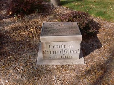
On East Campus Drive, 0.3 miles south of East Broomfield Street, on the left when traveling south.
Privately organized by citizens of Mt. Pleasant in 1892, Central became Michigan's second state-supported normal school in 1895. This met a long-felt need for a state school in this region. At first the college was designed to prepare rural and . . . — — Map (db m45876) HM
On South Main Street at East Michigan Street, on the right when traveling north on South Main Street.
Founded in 1892 as a private institution, Central Michigan Normal School and Business Institute held its first classes on this site. The institution became a state normal school in 1895. After several changes in name, the school became Central . . . — — Map (db m206063) HM
On Chippewa Street at Franklin Street, on the right when traveling west on Chippewa Street.
Built about 1865 this oldest remaining house in Mt. Pleasant was purchased by Wilkinson Doughty in 1869. An early hardware and dry goods merchant, Doughty was a town trustee, and a founder of Central Michigan Normal School, now Central Michigan . . . — — Map (db m91750) HM
On East Michigan Street near South Franklin Street, on the left when traveling west.
In 1889, Sacred Heart Academy was organized as a school for St. Charles Church, which was established in 1872. That year a new church was built here and the parish was renamed Most Sacred Heart of Jesus. Father John J. Crowley moved the old church . . . — — Map (db m91751) HM
On Homer Road (State Highway 60) at Mann Road, on the right when traveling east on Homer Road.
This property has been placed on the National Register of Historic Places by the United States Department of the Interior. As early as 1840 school has been held at this location when fifty-seven students attended the log store turn. By 1849 . . . — — Map (db m226151) HM
On West Michigan Avenue, on the left when traveling east.
1908 School Photograph (High School & Lower Grades) The Grass Lake Union School was built in 1863-64, the cast addition was added in 1867. The 1959-60 school year was the final time that it was used, and it was torn down in June & July 1960. . . . — — Map (db m226823) HM
On Fairview Street, on the right when traveling north.
Hanover High School
Located on one of Hanover's most
prominent sites, this former school
was erected in 1911. Built in the
Georgian Revival style, this town
landmark exemplifies a school design
popular during the early . . . — — Map (db m165368) HM
The Dibble schoolhouse
was built in 1885 and was
first located at the corner of
Kibby and Robinson Roads.
This one-room schoolhouse
was donated to the Museum
by the Union School District
of Jackson and moved to its
current site in 1968. — — Map (db m211733) HM
On McCain Rd at Ganton Dr, on the right when traveling west on McCain Rd.
This typical one-room schoolhouse was built for School District No. 2 of Summit Township in the 1880s. Named for a school board member, McCain School is the second schoolhouse erected on this site. The first was built in the early 1850s shortly . . . — — Map (db m88676) HM
On Hammond Road west of Cross Road, on the right when traveling east.
From here, view both sides of Hammond
Road that in 1835 boasted a village with
a storekeeper, a tailor, a shoemaker, a
blacksmith, and many others who carried
on a busy community life. To the northeast,
observe the 210 acres that Deacon . . . — — Map (db m165356) HM
On E.P. Hart Circle north of Spring Arbor Road, in the median.
Named in honor of Edward Payson Hart (1835-1919)
Founder of Spring Arbor University
1873
Born in Vermont, Edward Payson Hart with his wife, Martha (1838-1924), came to Michigan
as a Free Methodist Evangelist in 1864. In 1873, Hart . . . — — Map (db m206857) HM
On Hammond Road west of Cross Road, on the right when traveling east.
December 4, 1844, Michigan Central College, under
the auspices of the Free-Will Baptists, enrolled five
students and started classes near this location.
Earlier, the newly-chosen president, David M. Graham,
a graduate of Oberlin College, had . . . — — Map (db m165360) HM
On Hammond Road west of Cross Road, on the right when traveling east.
A charter for a seminary under the auspices of
the Methodist Episcopal Church was approved on
March 23, 1835, by the Michigan Legislative Council,
Michigan Territory, Detroit, Michigan. In 1837, a
mile south of this site, a foundation for a . . . — — Map (db m165353) HM
On State Highway 60 at Teft Road, on the left when traveling west on State Highway 60.
This building, constructed in 1845 and pictured here in 1903, served as a residence hall of Michigan Central College. The connecting living quarters t the right were built in 1873 by Moses L. Hart, father of Rev. E.P. Hart. Moses Hart, the . . . — — Map (db m86569) HM
On E.P.Hart Circle (State Highway M60), on the right when traveling west.
Three Michigan institutions of higher education have had their roots here. The predecessor of Albion College, the Spring Arbor Seminary was chartered in 1835. Michigan Central College, founded in 1844, was located here until its removal in 1855 when . . . — — Map (db m212365) HM
On College Street, on the left when traveling north.
The Wesleyan Quadrilateral is named for John Wesley (1703-1981),
founder of Methodism and one of the great theologians and critical thinkers in
the history of Christianity. The basic structure of the Quadrilateral begins with
Scripture and . . . — — Map (db m206884) HM
On Cottage Street near Spring Arbor Road (Michigan Highway 60), on the right when traveling south.
Free Methodist Movement Pursues Educational Freedom
In 1872, Free Methodist leaders bought and developed 10 acres of land that housed two vacant buildings for the purpose of founding Spring Arbor Seminary (see image below left). They hoped . . . — — Map (db m239288) HM
On East Michigan Avenue near Wayne Terberg Drive, on the left when traveling west.
Honor thy father and thy
mother that thy days may
be long upon the land which
the Lord thy god giveth thee.
—Exodus 20:12
In Memoriam.
Pioneer Casey McKay, great grandfather
of George C. McKay, settled here with
his family in . . . — — Map (db m190185) HM
Near S. Park Street (State Highway 331) north of W. Lovell Street, on the right when traveling north.
This building, completed in 1879, is the first in the nation erected for the use of a women’s club. The Ladies’ Library Association, organized in January, 1852, grew out of a reading club started in 1844. It was the first women’s club in Michigan . . . — — Map (db m74487) HM
On West Water Street at North Kalamazoo Mall, on the right when traveling west on West Water Street.
Michigan State Grange Organized in 1873, the Michigan State Grange of the Order of Patrons of Husbandry held its first annual meeting in January 1874 at Allen’s Hall, which once stood on this site. The Michigan Grange grew rapidly with over six . . . — — Map (db m190215) HM
On South Rose Street, on the left when traveling north.
In recognition of
the work and effort of
Molly Barker,
founder of "Girls On The Run,"
and visionary of girls
with self-respect and
healthy living everywhere. — — Map (db m216578) HM
On West Michigan Avenue (Business Highway 94) at South Rose Street, on the right when traveling east on West Michigan Avenue.
In 1858, the citizens of Kalamazoo extended free public education
beyond the elementary level when they used tax money to construct
Kalamazoo Union High School and to fund both elementary and
secondary studies.
In i873, several . . . — — Map (db m192982) HM
On South Burdick Street near W. Cedar Street, on the right when traveling north.
The only resident of Kalamazoo to be elected governor of Michigan during its first 150 years, Epaphroditus Ransom lived and farmed on this site. Born in Massachusetts in 1796, Ransom came to Michigan in 1834. An attorney, he soon became the area’s . . . — — Map (db m74527) HM
On S. Westnedge Avenue (State Highway 331) at W. Walnut Street, on the left when traveling south on S. Westnedge Avenue.
The first classroom building for the Michigan and Huron Institute, now Kalamazoo College, was erected on this site between June and September of 1836. The charter bill for the school had been introduced in the Michigan Territorial Legislative . . . — — Map (db m74525) HM
On South Westnedge Avenue (State Highway 331) at West Vine Street, on the right when traveling south on South Westnedge Avenue.
Near here, in 1858, Kalamazoo's first high school was opened. Fifteen years later the right of the school board to levy taxes to support a high school was challenged. A unanimous decision of the Michigan Supreme Court, rendered by Justice Thomas M. . . . — — Map (db m193020) HM
On West Michigan Avenue at Archer Drive, on the right when traveling west on West Michigan Avenue.
Established by legislative act in 1903 as Western State Normal School, the first classes were held in 1904. The first permanent building, completed in 1905, overlooked the city from Prospect Hill. By the 1920's Western had become one of America’s . . . — — Map (db m191505) HM
Near Garden Lane near Kingston Drive, on the left when traveling west.
Built in 1856, this one-room schoolhouse was formerly located on Oakland Drive south of Shaver Road on land donated by Mr. & Mrs. Harvey booth. The schoolhouse remained in use until 1947.
A fine example of Greek revival architecture, the . . . — — Map (db m190204) HM
On Park Street west of N. 32nd Street (Michigan Highway 43), on the right when traveling west.
The Ladies Library Association raised the funds to build this Classical Revival style building, which was completed in 1910. After serving as a private library for thirty-eight years, it was sold first to the Richland Rural Agricultural School . . . — — Map (db m68821) HM
On W. Maple Street west of S. Main Street, on the right when traveling west.
Fanny M. Bair, a member of one of Vicksburg's pioneer families, built this library and presented it to the Ladies Library Association on November 21, 1902. Charles A. Fairchild of Kalamazoo designed the building with "modern conveniences" like . . . — — Map (db m68793) HM
On Sigma Road Southeast (County Highway 571) at Wagonschutz Road, on the left when traveling north on Sigma Road Southeast.
Twenty-five years after the township's organization in 1875, Excelsior's
citizens decided to build a town hall. In 1901 they
purchased this site from Edwin Wagenschutz for
$100, and with plans costing only $7, erected this
structure for $1085. . . . — — Map (db m190642) HM
On Maple Street near Sheldon Boulevard, on the left when traveling west.
Father Frederic Baraga established the Mission of the Blessed Virgin Mary on the west side of the Grand River in 1833 and began Catholic education in Grand Rapids. During his seventeen months there, some thirty Odawa children and about a . . . — — Map (db m240460) HM
Near Bridge Street at Scribner Avenue, on the right when traveling east.
On this site for 114 years stood the historic German-English schoolhouse. Built in 1868 by the German-English School Association, the structure was used as a school and meeting house for the pioneer German families of Grand Rapids. In 1880 it was . . . — — Map (db m240641) HM
On Maple Street near Sheldon Boulevard, on the left when traveling west.
In the fall of 1872, ground was broken on the corner of Sheldon and Maple for a new three-story brick school building in the Second Empire style. In September of 1873, the Sisters of Mercy, a community founded in Ireland, left their convent in . . . — — Map (db m240463) HM
On White Pine Lane east of Honeysuckle Lane, on the left when traveling west.
Aquinas had its beginning in 1887 as the Novitiate Normal School of the Dominican Sisters of Marywood. In 1922 it became Marywood College of the Sacred Heart. When the college was moved downtown in 1931, it became the coeducational Catholic Junior . . . — — Map (db m199193) HM
Side A The first Central High School opened in a stone building three blocks to the west. The state legislature instituted high school grading in 1859, and the first Central High School graduation was held in 1862. Two successively larger . . . — — Map (db m99990) HM
Built between 1865 and 1870 by James and Hannah Gallup, this Victorian style villa is one of the oldest homes in the Heritage Hill Historic District. Gallup and his family lived here until 1896. The house was later owned by several prominent Grand . . . — — Map (db m99991) HM
On State Highway 26 at North Street, on the right when traveling north on State Highway 26.
Horace Greeley landed on June 15, 1847. He came on the Independence, the first propeller boat on Lake Superior. It had a maximum speed of 5 miles per hour. That night, Greeley reported, the harbor was frozen over for some distance from shore. There . . . — — Map (db m76313) HM
On 4th Street at Sand Dunes Drive (State Route 26), on the right when traveling west on 4th Street.
Douglass Houghton, Michigan’s first State Geologist, was born in Troy, New York, on September 21, 1809. He studied under Amos Eaton at the Van Renssaeler Polytechnic School in Troy. In 1828 he graduated and became a professor of chemistry and . . . — — Map (db m181726) HM
On 2nd Street (Gay Lac La Belle Road) east of Lake Street, on the left when traveling east.
A Part of Local History A few workers from Hebbard Lumber and Stone Company established a small lumbering community in the early 1880s. Nestled into the protected east shore of Keweenaw Peninsula, its population remained low, and by 1898, the . . . — — Map (db m153270) HM
462 entries matched your criteria. Entries 101 through 200 are listed above. ⊲ Previous 100 — Next 100 ⊳