Near Hutchins Landing Road, 0.2 miles east of Hillside Plantation Road, on the right when traveling east.
[Top plaque] United Methodist Historic Site No. 80
[Bottom plaque] This property has been placed on the National Register of Historic Places by the United States Department of the Interior — — Map (db m243643) HM
Near Duncan Avenue west of Duncan Park Road, on the left when traveling west.
has been designated a National Historic Landmark
This site possesses national significance in commemorating the history of the United States of America
1975
National Park Service
United States Department of the Interior
[Second . . . — — Map (db m243744) HM
On Main Street at South Canal Street, on the left when traveling west on Main Street.
Built ca. 1836, this structure, a National Historic Landmark, is a fine example of the Greek Revival style. A Banker’s House attached to the rear insured security & gives the structure an unusual and practical plan. — — Map (db m79346) HM
On High Street at North Rankin Street, on the right when traveling east on High Street.
This 1866 view of High Street shows two houses, but one is no longer standing. The surviving house in the foreground has porches with the kind of sawn wooden railing that is called “gingerbread,” because it looks like the . . . — — Map (db m127099) HM
On North Wall Street at High Street, on the left when traveling south on North Wall Street.
Joseph Neibert built Choctaw in 1836 as his mansion townhouse. Neibert was a cotton planter. In the 1830s he and his partner Peter Gemmel, operated the city's most successful building firm, which employed both white and enslaved . . . — — Map (db m104476) HM
On Main Street at Canal Street, on the left when traveling north on Main Street.
The Protection Steam Fire Company No. 3 built a grand firehouse in 1902 at the corner of Main and Canal streets (no longer standing). During the 1800s and early 1900s, volunteers provided fire protection in Natchez as in most American . . . — — Map (db m127086) HM
On Franklin Street at North Pearl Street, on the left when traveling east on Franklin Street.
The dramatic looking Natchez Hotel (no longer standing) was built in 1891. Within a few years, parts of the building began to disappear in stages. The tent-like dome went first in a storm, and a 1926 fire destroyed most of the structure. . . . — — Map (db m127090) HM
On South BroadwayStreet near Washington Street, on the right when traveling south.
Edelweiss is a Swiss Chalet-style building which dates to 1883. The house offered both a great view of the Mississippi River and a convenient location for the family of its first owner, Joseph O'Brien, a coal-dealer at Natchez . . . — — Map (db m108807) HM
On Washington Street at South Wall Street, on the right when traveling west on Washington Street.
Known as the Spanish Quarter in the early 1800s, this neighborhood is one of the oldest in Natchez. Each corner house dates to before the Civil War.
A Spaniard, Manuel Texada, built the house called Texada . . . — — Map (db m127092) HM
Near Gloucester Court, 0.4 miles west of Lower Woodville Road when traveling west.
[Top plaque]
Presented to
the Pilgrimage Garden Club
Natchez Mississippi
by the Kelly E. McAdams Foundation
Austin, Texas
1970
[Bottom plaque] Longwood has been designated a Registered National Historic Landmark under . . . — — Map (db m243661) HM
Near John A Quitman Boulevard west of Melrose Avenue, on the left when traveling west.
Natchez postmaster John Hankinson built Monmouth on two adjacent, 15-acre tracts, in 1818. He named his estate after his place of origin in Monmouth County, New Jersey. Monmouth was sold in 1826, to John A. Quitman. Quitman, born in New York, lived . . . — — Map (db m243751) HM
On South Union Street near Ravenna Lane, on the left when traveling west.
An outstanding example of Colonial Revival architecture, Ravennaside, built 1902, was the home of Roane Fleming Byrnes (1890-1970) and headquarters for her efforts in the creation and development of the Natchez Trace Parkway, the 444-mile National . . . — — Map (db m103821) HM
On St. Catherine Street near McCabe Street, on the right when traveling west.
Ida McGuire Gillespie (left) and Odille Angelety grew up across the street from each other on St. Catherine Street and were lifelong friends. Odille never married and had a long distinguished career as a teacher at nearby Brumfield High School. An . . . — — Map (db m114291) HM
On State Street at Pearl Street, on the left when traveling east on State Street.
Congregation organized in 1817. The Sanctuary was built in 1828-29 and enlarged in 1851. The Romanesque Revival rear addition was built in 1900 in honor of Joseph Stratton, Pastor, 1843-1903. The church and its companion manse on South Rankin Street . . . — — Map (db m19027) HM
On South Pearl Street north of Main Street, on the right when traveling north.
This building, completed in July of 1853 and known as Institute Hall, was re-christened Memorial Hall in 1921 in honor of veterans of World War I. Re-dedicated in 2007, the structure was extensively renovated and now houses the United States . . . — — Map (db m106223) HM
On Old N Street at Court Street, on the left when traveling east on Old N Street.
Originally the home of Washington physician John C. Inge, the school purchased this frame building in 1842 for $1,350 to house the college president. — — Map (db m105846) HM
On Polk Street at East Linden Street, on the right when traveling north on Polk Street.
William Lane Duncan moved his dry goods operation to Corinth in 1858. Already a local leader, the South Carolina native had twice won elections as Tishomingo County sheriff.
To accommodate his growing family, Duncan built this house at the . . . — — Map (db m155261) HM
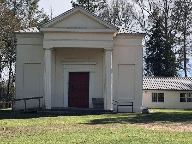
On Perry Road north of Ewell Road, on the left when traveling north.
[Top plaque] This property has been placed on the National Register of Historic Places by the United States Department of the Interior
[Bottom plaque]
Bethany Presbyterian Church
Organized in 1808, Bethany . . . — — Map (db m243301) HM
On Main Street (State Highway 1) north of Vorhees Street, on the right when traveling north.
Built in 1879, this vernacular Carpenter Gothic structure is the oldest extant church in Bolivar County. Congregation organized by 1875 under Bishop Wm. M. Green. Listed in Register of Historic Places. — — Map (db m154854) HM
On South Starkville Road north of East Harrington Street, on the right when traveling north.
Light Columns are architectural features that flank the main entrance steps of many public and government buildings. It is rare to find them on public buildings in small communities, but Houston High School, constructed in 1927, possessed two of the . . . — — Map (db m155310) HM
On State Highway 552 at Russum Westside Road, on the left when traveling south on State Highway 552.
The original congregation of the Bethel Presbyterian Church organized in 1826 under the direction of Dr. Jeremiah Chamberlain, constructed this building in the mid 1840s. On the interior, ornamentation is completely lacking. The use of pilasters on . . . — — Map (db m105784) HM
On State Highway 552 at Canemount Plantation, on the right when traveling north on State Highway 552.
This house is considered the finest example of the Italianate Revival influence in Claiborne County. The house is located on the site of an earlier house built about 1826. — — Map (db m105845) HM
During 1890, the priest's house was constructed and the mission received a Christmas gift from the Society at Brussels for "Poor Churches" as one of the most destitute churches of the diocese. This gift probably contained the vestments and altar . . . — — Map (db m104105) HM
On ASU Drive east of Alcorn Avenue, on the right when traveling east.
Ca. 1851. Neoclassic Revival. The origin of this structure is uncertain. It is generally assumed to be one of two buildings completed in 1851 for use by a campus literary society. Its architecture is more properly called Neoclassic Revival. It does . . . — — Map (db m117988) HM
On ASU Drive east of Alcorn Avenue, on the right when traveling east.
1840-51. Greek Revival. This structure, listed in the National Register of Historic Places, is one of the finest Greek Revival style remaining in Mississippi. The Chapel is in the familiar Greek temple form. Its two principal floors are raised . . . — — Map (db m119851) HM
On Walnut Street at Farmer Street, on the right when traveling east on Walnut Street.
Built by Samuel and Jacob, prominent Jewish businessmen, this complex forms an unusual group of consecutively constructed buildings of various architectural styles. This house, built in 1901, replaced an earlier one used by Gen. U.S. Grant as his . . . — — Map (db m103796) HM
On Walnut Street west of College Street, on the right when traveling west.
407 Walnut. 1857 Greek Revival. Erected as a school for young ladies. Brashear Academy became Chamberlain-Hunt Academy after the Civil War. Thereafter, used as a public school until purchased by the First Presbyterian Church. — — Map (db m139489) HM
On Carrol Street east of Main Street, on the right when traveling east.
212-14 Carrol. Ca. 1840 Greek Revival. One of the finest commercial/residential buildings from this era in Mississippi today. The center doorway opens to a stairhall which leads to the residence area upstairs. — — Map (db m139356) HM
On Market Street south of Fair Street, on the left when traveling south.
600 Block of Market. Ca. 1828-40. Federal/Greek Revival. This grouping of buildings had commercial space on the ground floor and either storage or living space above. Washington Hall at 601-09 Market was formerly a hotel. — — Map (db m139468) HM
Near Church Street (U.S. 61) near Horton Drive, on the right when traveling north.
An outbuilding in size and architectural detail to this one was constructed by Samuel Gibson, apparently at the same time as his residence circa 1805. The original dependency was probably used as a plantation office, school or weaving room. Since . . . — — Map (db m137981) HM
On Church Street (U.S. 61) south of Coffee Street, on the right when traveling south.
1006 Church. Ca. 1900 Queen Anne. A stained glass transom over the large window of the protruding bay and decorative woodwork in the gable are characteristic of this architectural style. — — Map (db m139171) HM
On Church Street (U.S. 61) at Walnut Street, on the right when traveling south on Church Street.
702 Church. Ca. 1817 Federal. The birthplace of Constance Cary who was one of the young ladies involved in making the first Confederate battleflag. The small formal garden is the only one of its type remaining in Port Gibson. — — Map (db m104374) HM
On Church Street (U.S. 61) at Walnut Street on Church Street.
Second oldest Presbyterian Church in Old Southwest. Org. April, 1807, as Bayou Pierre Church. Moved to Port Gibson 1827. Zebulon Butler first resident pastor, 1827-60. Present structure built 1859. — — Map (db m103807) HM
On Church Street (U.S. 61) at Walnut Street, on the right when traveling north on Church Street.
609 Church. 1859-60 Romanesque Revival. This church with the hand pointing to heaven is the most famous building in Claiborne County. The original hand of gilded wood was carved by young Daniel Foley. — — Map (db m104345) HM
On Church Street (U.S. 61) at Fair Street, on the right when traveling south on Church Street.
602 Church. Ca. 1830-50 Federal/Greek Revival. One of the two remaining examples of this architectural style in Claiborne County. Double galleries have modified Tuscan colonnettes. The brick dependency possibly predated the home. — — Map (db m104368) HM
On Church Street (U.S. 61) north of Carroll Street, on the right when traveling north.
703 Church. Ca. 1840 Greek Revival/Italianate. Italianate long windows and protruding bay windows are typical of many houses built just before the Civil War. The interesting and unusual etched glass panel in the front door depicts a pelican. — — Map (db m104344) HM
On College Street south of Oak Street, on the left when traveling south.
1301 College. 1840's Queen Anne. The oldest portion of this house is a three room, one story wing at the south east corner.The Queen Anne addition, constructed in 1890, became the main living area. — — Map (db m139172) HM
On Church Street north of Jackson Street, on the right when traveling north.
805 Church. Ca. 1845, Greek Revival. Reportedly constructed of flat boats in Grand Gulf in 1845 and moved to Port Gibson Ca. 1872. This Greek Revival cottage has typical square columns. Dormer windows have been added to the original structure. — — Map (db m139182) HM
On Church Street (U.S. 61) north of Coffee Street, on the right when traveling north.
907 Church. Ca. 1825 Greek Revival. Home of Henry Hughes, author of the first textbook on sociology, who gave this science its name. Dr. Irwin Russell, the first writer to use Negro dialect in poetry, also lived here as a boy. — — Map (db m139173) HM
On Idlewild Drive west of Church Street (U.S. 61), on the left when traveling west.
Ca. 1833 Greek Revival. Idlewild's interior is noted for its twelve foot doors and windows. Henry Clay made a speech from the front porch during his presidential campaign in the 1840's. — — Map (db m137984) HM
On Church Street (U.S. 61) south of Chinquepin Street, on the right when traveling south.
1108 Church. Ca. 1830 Greek Revival. This home built by Judge Coleman was the site of a large political rally held for Henry Clay, during one of his early visits to Port Gibson. — — Map (db m139459) HM
On Jackson Street at Farmer Street, on the left when traveling west on Jackson Street.
302 Jackson. Ca. 1827-1840, Greek Revival. Henry Clay often visited in Port Gibson and stayed in this house as guest of his friend, Judge James H. Maury. Descendents of Judge Maury still live here (1979). — — Map (db m139354) HM
On Church Street (U.S. 61) south of China Street, on the right when traveling south.
1202 Church. Ca. 1890 Stick Style. This house with its tall proportions, irregular silhouette, projecting eaves and exposed framing in the gables is an interesting example of the Stick Style. — — Map (db m138753) HM
On Church Street (U.S. 61) north of Fair Street, on the right when traveling north.
509 Church. Ca. 1820 Greek Revival. The portico treatment featuring two round columns between two square columns is called distyle-in-antis. This arrangement is modeled after the Tower of the Winds in Athens. The Corinthian columns are carved from . . . — — Map (db m139490) HM
On McComb Avenue (Mississippi Route 547) at Burlington Place, on the right when traveling south on McComb Avenue.
Miss. 547. Ca. 1845 Greek Revival. Peter A. Van Dorn built this planter house which has the typical front and rear galleries, the latter now enclosed. The basic plan features two pairs of rooms flanking a center hall. — — Map (db m138725) HM
On Church Street (U.S. 61) at Jackson Street, on the right when traveling north on Church Street.
901 Church. 1858-60 Romanesque Revival. The original building was constructed in 1826, but was destroyed by fire in 1858. The new church built on the same site, was dedicated July 8, 1860. — — Map (db m104399) HM
On Church Strery (U.S. 61) north of Oak Street, on the right when traveling north.
1207 Church Street. Port Gibson's largest mansion. This neoclassic house exemplifies the grandeur of antebellum days. The house with gardens and dependencies originally occupied the entire block. Named Oak Square because of the massive Oak trees . . . — — Map (db m139025) HM
On Farmer Street south of Jackson Street, on the right when traveling south.
902 Farmer. Ca. 1850 Greek Revival. The original floor plan of this cottage consisted of one large room to either side of an entrance hall with front and rear galleries. A detached kitchen extended off the rear gallery. — — Map (db m139474) HM
On Church Street (U.S. 61) north of Chinquepin Street, on the right when traveling north.
1009 Church Street,Ca. 1880's Queen Anne. The house is noteworthy for the lavish display of stained glass on the front facade. The builder used a strange, free classic Corinthian order for his columns. — — Map (db m139028) HM
On Main /Market Street north of Orange Street, on the right when traveling north.
405 Market. 1810-20 Federal. This large brick structure was one of the well known inns along the Natchez Trace. The famous actor Joseph Jefferson was a guest here. This is one of the oldest buildings in Claiborne County. — — Map (db m139471) HM
On Market Street south of Walnut Street, on the right when traveling south.
702 Market. 1840 Greek Revival. This bank closed its doors during the Civil War but reopened afterwards as a hotel. Since 1890 it has been used for its original purpose. The hexastyle portico features unfluted Doric columns. — — Map (db m139458) HM
On Church Street (U.S. 61) north of China Street, on the right when traveling north.
1103 Church Street. 1830-31 Greek Revival. This house was constructed the year following erection of the first building to house the First Presbyterian Church during the early ministry of Dr. Zebulon Butler. — — Map (db m139026) HM
On College Street north of China Street, on the right when traveling north.
1101 College Street. 1896 Queen Anne. This house is one of the finest examples of Queen Anne architecture in Claiborne County. The style is indicative of a number of houses built in Port Gibson near the turn of the century. — — Map (db m139027) HM
On Church Street (Highway 61) at Walnut Street, on the right when traveling north on Church Street.
701 Church. Ca. 1825 Federal. The original floor plan consisted of four rooms, no center hall, front and back galleries. The designer and builder was Horatio Nelson Spencer, a prominent local attorney. — — Map (db m104354) HM
On Church Street (U.S. 61) south of Oak Street, on the right when traveling south.
1302 Church. Ca. 1840. Greek Revival. The front part of this house is pegged together with wooden pegs rather than being nailed. The kitchen was in a separate building to the rear. — — Map (db m138751) HM
On Church Street (U.S. 61) at Carroll Street, on the right when traveling south on Church Street.
808 Church. 1884-85. Ca. 1897 High Victorian Gothic. The architect was W.P. Wentworth from Boston. The entire structure reflects contemporary architectural developments in Massachusetts rather than in Mississippi. — — Map (db m104400) HM
On Church Street (U.S. 61) north of Orange Street, on the right when traveling north.
409 Church. Ca. 1885 High Victorian Gothic. This church was founded in 1870. The building is a simplified version of the High Victorian Gothic style popular in the United States in the latter half of the nineteenth century. — — Map (db m139491) HM
On Church Street (U.S. 61) at Carroll Street, on the right when traveling south on Church Street.
706 Church. 1891-92 Victorian Moro-Byzantine Revival. The architects of Temple Gemiluth Chassed, which means gift of the righteous, combined Moorish, Byzantine and Romanesque styles to produce a building unique in Mississippi. — — Map (db m104343) HM
Originally named "The Hill," this house was built by Peter Aaron Van Dorn, ca. 1828. Located on one of Port Gibson's highest hills, the brick and cypress house was constructed from the resources presumed to be local. Distinctive features of the . . . — — Map (db m137977) HM
Near Rodney Road (State Highway 552) 1.3 miles north of Rodney Westside Road, on the right when traveling north.
Smith Coffee Daniell II, a successful cotton planter, completed construction of Windsor in 1861. Daniell owned 21,000 acres of plantation land in Louisiana and Mississippi. Ironically, he died in April 1861, only weeks after completing his . . . — — Map (db m70541) HM
On State Highway 45, on the right when traveling north.
E. 10 mi. Plantation home built c. 1852 by Geo. H. Young. Octagonal cupola. Gen. N.B. Forrest visited here during the Civil War. National Fox Hunters Assn. organized here. — — Map (db m50160) HM
On Delta Avenue at 1st Street, on the right when traveling north on Delta Avenue.
In 1909 steel magnate Andrew Carnegie was contacted by local women's club member Liliian Waddell about sponsoring a public library. In 1911 the Carnegie Foundation gave $10,000 to the city of Clarksdale to build and equip a public library, with the . . . — — Map (db m89927) HM
On Eigth Street north of Cemetery Street, on the right when traveling north.
According to its cornerstone, this structure was "ereted 1889; destroyed by fire 1890; rebuilt 1893." Built in the Romanesque style of Wesson's Miss. Mills, it is now the Oswalt Youth & Com. Center. — — Map (db m122520) HM
On North Beach Boulevard north of Boardman Avenue, on the left when traveling north.
Located here was a two-story, French Creole house, with two-tiered galleries. Although construction may have begun prior to the War of 1812, the house was not completed until 1828. Situated on a large plantation, with Sea Island cotton its . . . — — Map (db m108380) HM
On South Beach Boulevard at Main Street, on the right when traveling south on South Beach Boulevard.
Hancock County Bank opened on October 9, 1899. Weeks later the bank's board of directors purchased this property at the corner of Main Street and South Beach as the site of a new headquarters. Bay St. Louis's first two-story brick building, the . . . — — Map (db m108455) HM
On this site stood the "Spanish Customs House," perhaps the oldest structure in Bay St. Louis. The house is believed to have been built by French colonist Hyacinth Caron in 1787. The date of construction is based on an inscription in the . . . — — Map (db m108576) HM
The home of Andrew Jackson, Jr., a nephew and the adopted son of President Jackson, was located here. Jackson and his wife Sarah, who named the plantation, lived here just before the Civil War. The Jacksons sold the property in 1861. The house, . . . — — Map (db m108577) HM
On North Beach Boulevard, 0.2 miles south of Whispering Pines Drive, on the right when traveling south.
According to local tradition, the "Pirate House," located here, was built as early as 1802 and was frequented by famed pirate Jean Lafitte and his associates. Later remodeled as a Greek Revival structure, the house is believed to have a secret . . . — — Map (db m108459) HM
On Beach Boulevard (U.S. 90) at Bellman Street, on the right when traveling west on Beach Boulevard.
The Carpenter Gothic style Episcopal Church of the Redeemer, built 1873-74 was located here. Among the church's parishioners was former Confederate President Jefferson Davis. In 1892, a new church, designed by architect Thomas Sully, was constructed . . . — — Map (db m102182) HM
On Cadet Street at East 1st Street on Cadet Street.
Built here in 1934 as part of a U.S. Coast Guard base, the barracks was an E-shaped, Spanish Colonial Revival style building made of reinforced concrete. Arcaded porches lined the building's
wings and central pavilion, which had an octagonal . . . — — Map (db m102175) HM
On Beach Boulevard (U.S. 90) at Bellman Street, on the right when traveling west on Beach Boulevard.
The Greek Revival mansion once located here was a "raised cottage" (meaning it was composed of a frame upper story set upon an above-ground brick basement to
protect the wooden portion from moisture and insects.) Probably built ca. 1850 for Peter . . . — — Map (db m68423) HM
On Beach Boulevard (U.S. 90) at Caldwell Avenue, on the right when traveling west on Beach Boulevard.
Known as the Father Ryan House, the Greek Revival house once located here was built ca. 1840 by Judge W.C. Wade of Natchez. Among the area's first vacation villas, it was sold to New Orleans architect T.W. Carter in 1885, and was altered. It may be . . . — — Map (db m115365) HM
On Beach Boulevard (U.S. 90) at Main Street, on the right when traveling west on Beach Boulevard.
Historic downtown Biloxi has seen many changes over the decades caused by disasters both natural and man-made including fires, hurricanes, and urban renewal. Today visitors will find an eclectic blend of old and new architecture. Downtown includes . . . — — Map (db m107244) HM
On Beach Boulevard (U.S. 90) at Bellman Street, on the right when traveling west on Beach Boulevard.
Built in the 1830s, the French Creole house once located here incorporated Federal and Greek Revival decorative influences in its design. The gallery completely encircled the house, and its
slender, colonnettes supported a broad hipped roof with . . . — — Map (db m102173) HM
On Friendship Oak Circle north of Avenue of the Oaks.
Designed in the Mission Revival style by New Orleans
Architect, Rathbone Emile DeBuys and built by Chevally &
Fursden Contractors of Gulfport, the Administration
Building was one of the first buildings constructed for the
Gulf Park College . . . — — Map (db m122568) HM
On West Second Street east of Church Avenue, on the left when traveling east.
Built in 1936, the Old Pass Christian High School was located here. Designed by the local architectural firm of Shaw and Woleben, the main school building was a one-story, U-shaped brick building with a columned Federalesque entrance portico and a . . . — — Map (db m243131) HM
On East Scenic Drive, 0.1 miles west of Davis Avenue, on the right when traveling west.
Built ca. 1855 by Pierre Saucier, whose son was later mayor of Pass Christian, the two-story Greek Revival House located here had a central temple-like portico and square-columned galleries spanning its facade, and an octagonal Gothic Revival . . . — — Map (db m81033) HM
On East Scenic Drive at St Paul Avenue, on the right when traveling west on East Scenic Drive.
Due to the large number of 19th and early 20th century mansions once located here, Pass Christian's Scenic Drive was heralded as "The Newport of the South." Composed of architecturally significant vacation villas set among live oaks, this National . . . — — Map (db m81042) HM
277 entries matched your criteria. The first 100 are listed above. Next 100 ⊳