Rivers were the transportation and power for Maine's logging industry from the first sawmill in 1630 in Berwick until 1974. Lewiston's first sawmills were located near the Great Falls. Throughout the year, hardy loggers cut the trees . . . — — Map (db m186026) HM
Leon Leonwood Bean, founder of the Maine company L.L. Bean, began his career in Freeport. In 1902, he moved to W.H. Moody's shoe store at 74 Main Street in Auburn. Soon, with Moody's permission, Bean began to sell pants over the . . . — — Map (db m186027) HM
Welcome to Auburn's Museum in the Streets® Historic Walking Tour.
Auburn's history is a manifold tale of Native Americans and settlers; entrepreneurs and visionaries; industrialization and the American . . . — — Map (db m185956) HM
Welcome to Auburn's Museum in the Streets® Historic Walking Tour.
Auburn's history is a manifold tale of Native Americans and settlers; entrepreneurs and visionaries; industrialization and the American . . . — — Map (db m186022) HM
The Barker Mill, at 143 Mill Street, was a catalyst for the residential development of what became known as "New Auburn." Auburn had recently annexed Danville in 1867. The Little Androscoggin Water Power Company was formed in 1870 . . . — — Map (db m186001) HM
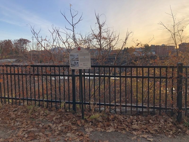
Squire Edward Little is called the "father" of Auburn and Lewiston. He inherited vast tracts of land from his father. In 1826, at the age of 53, he moved to Danville (now Auburn) and built what his father called an "extravagant" . . . — — Map (db m185965) HM
Festival Plaza was created as part of the 1997 Auburn Downtown Action Plan for Tomorrow (ADAPT) visioning and revitalization initiative. As designed by Boston's ICON Architecture, Festival plaza establishes a vibrant . . . — — Map (db m185953) HM
The Androscoggin River's great power has played a tremendous role in the development of the Lewiston-Auburn communities. The river drops more than 1,500 feet along its journey from the Rangeley Lakes, one of the steepest gradients of . . . — — Map (db m186023) HM
Named for the Knight family, the building's longest occupants, the "Knight House" stands as the oldest frame house in downtown Auburn. It is a typical example of houses built in the late 1700s. Nathaniel Knight was a butcher and meat . . . — — Map (db m186025) HM
As with many American rivers that fueled the Industrial Revolution, the Androscoggin has a complex history. It was once considered one of the "Top Ten" most polluted rivers in the country. The paper mills along the river accounted . . . — — Map (db m185995) HM
A growing demand for shoes and boots during the Civil War established Auburn as a shoe manufacturing center. Jacob Roak, Ara Cushman, Jeremiah Dingley and others strived to build "a first-rate shoe manufacturing center." Roak Block, . . . — — Map (db m186028) HM
If you've ever seen a working factory, you know they require a lot of power. In Lewiston in the 1800s, the best source was the Androscoggin River. Canals extended that power beyond the riverbanks, making it possible to develop . . . — — Map (db m185983) HM
The Lewiston-Auburn Railroad Bridge was erected in 1909 and served as a vital link to the downtown. It also provided the connection for thousands of Canadian, Irish, Polish and other immigrants to the area. Recognizing the bridge's historic . . . — — Map (db m185981) HM
Lewiston's industry began with the Harris sawmill beside the falls. In 1809, Josiah Little's family built a large wooden building for saw, grist, and fulling mills under one roof. When the mill burned in 1829, the Littles built a . . . — — Map (db m186038) HM
Where could latter 19th century city residents buy hay for their horses or wood for their stoves? Farmers brought hay, wood, and other produce to Haymarket Square in this wide-open space on Main Street. However, by 1898, the city . . . — — Map (db m186050) HM
After a fire destroyed several stores in 1877, leading citizens, among them Congressman William P. Frye, decided to construct "the best opera house east of Boston." The offerings featured travelling stock companies, minstrels, drama, . . . — — Map (db m186045) HM
Bradford Peck prospered in his Lisbon Street stores. In 1899, he opened the largest department store east of Boston on Main Street. Naysayers predicted bankruptcy, for they believed that customers would not cross Main Street from . . . — — Map (db m186047) HM
Once a fishing spot for indigenous peoples and then the origin of Lewiston industry, Veterans Memorial Park was dedicated in September 2004. This park is the culmination of efforts from the L/A Veterans Council to garner donations . . . — — Map (db m186044) HM
English:
1902: The arrival of the Bangor and Aroostook in Fort Kent marked a time of rapid economic growth. Potatoes, hay, lumber, and people were able to move efficiently south. Now, this remote French-speaking Valley with . . . — — Map (db m148188) HM
English: —Local storytellers continue, “it was a crime but not a sin.” Of course, since lying is a sin, “Do not get caught!” Some priests may not have believed that your grandmother taking . . . — — Map (db m148075) HM
English: Acadian settlers claimed fertile lands along the river first, raising oats, wheat, and buckwheat, then potatoes. Savvy farmers fertilized with manure and rotated crops with pastureland. By 1905 railroads make it . . . — — Map (db m148074) HM
English:
Did you know? Water towers were once a common sight along rail tracks. Frenchville’s 55,000 gallon 1910 water tower is one of the last remaining in the U.S. Coal heat kept it from freezing. When diesel engines . . . — — Map (db m148076) HM
Originally designed and built 1892 by John A. Roebling's Sons Co. for mill workers to cross the river from new housing in Topsham to the Cabot Mill in Brunswick. The bridge has served generations of citizens of all ages between Brunswick and . . . — — Map (db m51968) HM
One of Franklin Delano Roosevelt's New Deal programs, the Civilian Conservation Corps hired unemployed young men during the Great Depression. The CCC provided training to men between the ages of 18 and 25 for work on conservation projects including . . . — — Map (db m25390) HM
The Goddard Manson was completed in 1858 for John Goddard (1811-1870) to an Italianate villa design prepared by Portland architect Charles Alexander, who planned other prominent buildings in the area. It was built of native stone and was one of the . . . — — Map (db m161828) HM
Derosier's Market, the oldest continually run in Freeport, opened in 1904 as a grocery store. The same family has operated it ever since then. In 1890, Augustus Derosier, his wife Delia, and their first born son, Philip, emigrated from the Gaspe . . . — — Map (db m233300) HM
You have landed on one of the fourteen Main Coastal Island which have year-round communities with public schools. Once there were three hundred such communities.
Cliff Island lies at a Latitude of 43° 42' North and a Longitude of 70° 8' . . . — — Map (db m186394) HM
In memory of
Asa Clapp
A seaman of the American Revolution
Merchant, an upbuilder of Portland
1762 ✠ 1848
Asa William Henry Clapp
Citizen of Portland
A conservator of its interests
Member of
the Congress of . . . — — Map (db m185934) HM WM
Publisher Guy P. Gannett commissioned this building to serve as the headquarters for the media empire he founded in 1922.
For its time, it was a state-of-the-art production facility where reporters, photographers and editors put together . . . — — Map (db m185936) HM
Landing spot for many passengers on the Underground Railroad and embarkation point for their transit to Canada and England.
Anti-slavery sympathizers were well-organized to greet stowaways from Southern cargo vessels, find them safe housing . . . — — Map (db m20614) HM
Hack stand of Charles H.L. Pierre, 29 Middle Street. Charles H.L. Pierre led the African American men, who rescued the stowaway aboard HMS Albion Cooper in the Fall of 1857.
In the mid-1800s, professional opportunities for freed Blacks were . . . — — Map (db m185939) HM
Home of Charles Frederick Eastman, Harriet Stephenson Eastman, and her father, Alexander Stephenson, 211 Sumner Street, now Newbury Street. They are buried at Evergreen Cemetery.
The Eastmans and Stephensons were conductors on the . . . — — Map (db m186150) HM
In recognition of
Portland's role in Canada's history
India Street Terminal
at Milepost 0.0.
on the
Atlantic & St. Lawrence /
St. Lawrence & Atlantic RRs.
Grand Trunk Railway of Canada
Canadian National Railways
July . . . — — Map (db m50445) HM
Portland Observatory
has been designated a
National Historic Landmark
This site possesses national significance
in commemorating the history of the
United States of America.
The Observatory is the nation's only remaining . . . — — Map (db m50418) HM
One of the earliest marine signal stations in the United States, this tower is unique in its engineering design and construction and contributed to the prosperity of Portland Harbor as a vital center of maritime commerce during the "Golden Age of . . . — — Map (db m186397) HM
An early supporter of the Temperance cause and one of the first to "espouse the cause of the slave."
Thurston (1814-1900) helped freedom seekers in their flight from slavery, "at one time having the care of 30 fugitives, who were dispatched . . . — — Map (db m186462) HM
By the summer of 1866, Portland was the largest commercial shipping port in the nation. Industries sprouted up everywhere. Much of their was simply dumpted into rivers, streams, and directly into the Bay.
Few realized that we were . . . — — Map (db m186353) HM
"Whe Ed Muskie laid out the nation's framework for proection of the human environment, it was the political equivalent of splitting the atom."
Leon G. Billings, . . . — — Map (db m186352) HM
This arch is all that remains of a Scarborough landmark business called The Danish Village. It was a first-class motel and restaurant built by Portland businessman Henry Rines. The 100-unit complex was probably the finest set of buildings ever . . . — — Map (db m186450) HM
In December, 1940, William Newell, president of Todd-Bath Iron, won a British contract to construct a seven-berth shipyard at Cushing Point and to build thirty 10,000-ton cargo vessels. On the mudflat site, Newell had constructed a cofferdam to . . . — — Map (db m186132) HM
This scenic point of land overlooking Portland Harbor, where Bug Light Park stands today, was once home to a sprawling World War II Shipyard that covered 140 acres of land, including over 60 buildings, and had the capacity to build up to 13 ships . . . — — Map (db m50474) HM
Shipbuilding has been an important part of South Portland’s economy since colonial times. Small vessels built prior to the Revolutionary War were used for fishing and the coasting trade which ranged from the Kennebec River to Virginia. During the . . . — — Map (db m55678) HM
A major revival of shipbuilding took place here in the four years just prior to and during World War II. Cargo ships, the British Ocean series and the United States Liberty ships, were produced by the Todd-Bath Iron Shipbuilding . . . — — Map (db m186129) HM
In the mid-1800s, when South Portland was still a part of Cape Elizabeth, its waterfront appeared to be a continuous line of bustling yards building and repairing ships. From Butler on Turner's Island to Knight and Blanchard in Knightville to . . . — — Map (db m50413) HM
Todd-Bath Iron Shipbuilding Corp., 1940-1942
South Portland Shipbuilding Corp., 1941-1943
New England Shipbuilding Corp., 1943-1945
This is a complete list of the ships built by the emergency shipyards at South Portland, Maine, between . . . — — Map (db m50396) HM
When Rear Admiral Land, U.S. Maritime Commission Chairman showed President Roosevelt the Liberty ship plans, he remarked, "She'll carry a good load. She isn't much to look at though? A real ugly duckling." However, these simple but seaworthy ships . . . — — Map (db m50508) HM
This park memorial is dedicated to all families whose homes and heritages were destroyed in 1942 so a shipyard could be built during World War II
This area, known as Cushing’s Point at Ferry Village, consisted of many homes, some built by their . . . — — Map (db m84835) HM WM
We welcome you to our yard. You are now a member of our army of 25,000 men and women building the ships so urgently needed to carry war supplies to the fighting front.
New England Shipbuilding Corporation, Employee Handbook
With the . . . — — Map (db m55925) HM
We were all working there for one purpose: to get this country out of trouble. Everyone had one thing in mind: to produce and to win.
Bill Walton
Worker at New England Shipbuilding Corp.
Before there could be any British Ocean class or . . . — — Map (db m55737) HM
Each new ship strikes a blow at the menace to the Nation and for the Liberty of the Free People of the World…
President Franklin Delano Roosevelt
September 27, 1941
At the launching of the first Liberty ship, Patrick Henry from . . . — — Map (db m55922) HM
The U.S. Maritime Commission in the spring of 1941, called for the emergency construction of shipyards. William Newell received an order to develop another shipyard to the west of Cushing Point. Known as the West Yard, this facility had six . . . — — Map (db m186130) HM
During the war we all did our part to contribute. At first I worked at the shipyard as a welder. Then I served on board the Francis Retka, a Liberty ship we launched from the East Yard.
Frank Emery
Welder, 1941-1944, New England . . . — — Map (db m55765) HM
English: Farm, tavern, dance hall, boarding house, post office, or library? First explored by Europeans in 1760, settlers came to Rangeley in the early 1800s to farm and to harvest the abundant timber in the mountains. Early . . . — — Map (db m148395) HM
Agamont Park is named after the Agamont House, built by Tobias Roberts in 1857 as Bar Harbor's first hotel. It burned down in 1888. The unusual name was supposedly given by his granddaughter who called this hill on the water "Aqua . . . — — Map (db m78293) HM
Established before 1790 holds in many unmarked and unknown graves the remains of those courageous men and women pioneers on the frontier of downeast Maine. Sea captains, fishermen and farmers, shipwrights and hotelmen, selectmen and legislators, . . . — — Map (db m54389) HM
To take advantage of electricity supplied from the Wyman Dam in Bingham construction began on the Bucksport Mill in 1928 on the site of a former tannery along the banks of the Penobscot River. In its early days, the mill produced newsprint that was . . . — — Map (db m148398) HM
To the Top of the World
The beginnings of an historic journey to the
North Pole took place across the bay at the
McKay and Dix Shipyard on Verona Island
when the keel for a 185-foot, 650 ton wooden
sail-steamer named the . . . — — Map (db m183886) HM
The Penobscot River is a vital resource. In the 1700's it spawned numerous riverside communities, while the 1800's saw Bangor become the "lumber capital of the world", and Bucksport an international port renowned for shipbuilding. Crafted along . . . — — Map (db m55115) HM
At this site and adjacent to Mill Stream is the location of the first sawmill built in 1764 by Jonathan Buck. The mill provided boards, staves, shingles and clapboards needed by the settlers as well as for sale in Boston and more distant ports. The . . . — — Map (db m148399) HM
In 1763 Jonathan Buck settled the area, which was subesequently burned during the Revolutionary War. First incorporated as "Buckstown", the name was changed to "Bucksport" in 1817. In the 1800's Bucksport thrived as an international port. Later . . . — — Map (db m55112) HM
In Hancock County, the granite industry was
most significant between the years 1870 to
1910. Franklin and Sullivan became the main
source of paving and curbing stones for the
major US cities: Boston Philadelphia,
Providence, Washington, DC . . . — — Map (db m233950) HM
The Granite Industry of Franklin and Sullivan
Quarrying granite in eastern Hancock County was centered in the towns of Franklin and Sullivan. The quality of granite found around Tranton and Hog Bay was high. The Bays provided an easy way to . . . — — Map (db m234536) HM
This
historic galamander (granite lifter) was
used in the local quarries for nearly a hundred
years. As far as we know, it is the only
surviving complete machine and stands as a
memorial to the granite industry that flourished
from 1820-1940. . . . — — Map (db m234315) HM
Established in 2017 for the citizens of Gouldsboro through the generosity of one of its own.
Gouldsboro peninsula is thirty thousand acres of granite, heath and shallow soil, two mountains and two ponds. On a point in West Gouldsboro, . . . — — Map (db m184603) HM
Dorcas Library
In 1932 the Dorcas Society,
a Christian women’s group in Prospect Harbor that did good works for the community with
money raised from sewing projects, erected a small building here with two rooms. One room was for sewing and the . . . — — Map (db m183938) HM
A Part of History
Both Native Americans and early settlers enjoyed abundant harvests along this coastal shore. Each spring, thousands of adult alewives made an upstream pilgrimage, moving from salt water into the Mill Pond and up Somes Brook . . . — — Map (db m54520) HM
This stone cutter proudly stands as a tribute to the many workers whose labor and dedication have made this region known internationally as the home of Deer Isle Granite.
The sculpture by William Muir was given to the Town of Stonington by . . . — — Map (db m145043) HM
In the 1800s when ship building, quarrying and mining thrived, enterprising businessmen built boarding houses and hotels to house the many laborers. Blacksmith shops, livery stables, grocery and feed stores, and a meat shop flourished as well. . . . — — Map (db m54711) HM
With the help of steamship & train travel in the late 1800s, summer tourism peaked. But within a few short decades, the age of the auto and better roads to Bar Harbor - plus closing mines and quarries - led to decades of gradual economic . . . — — Map (db m54709) HM
All the mountains that you see are part of Acadia National Park
The Age of Sail lingered into the 1900s as sailing ships proved more economical than steamships for carrying heavy cargos such as granite.
Generations of watercraft ply . . . — — Map (db m54707) HM
In July 1895, the first color issue of Comfort rolled off the presses to be sent nationwide to over a million subscribers. W. H. Gannett established his phenomenally successful magazine (1888-1942) to promote Giant Oxien, his . . . — — Map (db m111271) HM
Welcome to Augusta
Indigenous people occupied the Augusta area for thousands of years before European explorers arrived. Little evidence remains of their time here, but patches of forested land along the Kennebec give us a glimpse . . . — — Map (db m186068) HM
These buildings were built to house the E. C. Allen Publishing Company. Allen has been called the forerunner of the advertising agency business, the pioneer of low-priced mail order periodicals, and the creator of the premium idea . . . — — Map (db m111073) HM
In commemoration of the first trading voyage of the Pilgrims of Plymouth to the ancient Indian village at Cushnoc on the Kennebec River, 1625, and on this site the establishment of their fur trading post with the Indians, 1628, Jown Howland in . . . — — Map (db m110858) HM
An endless quest for riches brought Europeans to the Kennebec River by 1607 and to Augusta by 1625. In 1628, the Plymouth (Massachusetts) Colony constructed Cushnoc Trading Post on the Kennebec riverbank at the head of navigation, . . . — — Map (db m110861) HM
In 1910, Delbert W. Adams opened a store on Water Street offering "strictly first-class goods at a fair margin of profit." In 1920, Adams moved across the street to 190 Water Street, where the store operated until it closed in 1982. . . . — — Map (db m111248) HM
The embargoes leading to war caused economic hardship in Augusta, and news of war generated disdain in this Federalist Town. Citizens mounted a protest by hanging an effigy of President Madison from the public wharf and flying an . . . — — Map (db m153146) HM
The Pilgrims' trading post at Cushnoc had enjoyed a monopoly of fur trade with local Abenaki since 1628. In the spring of 1634 a vessel commanded by John Hocking of Portsmouth challenged that monopoly. Arriving at Cushnoc, Hocking . . . — — Map (db m110824) HM
Market Square was an early civic and commercial center for the community. Bordering the Square were Pollard's Tavern and the first Meeting House, built in 1782. In 1816, hard times prompted "Ohio Fever" and the square was a . . . — — Map (db m111082) HM
As part of the strategy to expand and strengthen Massachusetts' territorial claims along the Kennebec River, a Boston-based land company, the Kennebec Proprietors, built Fort Western in 1754. Commanded by James Howard, the Fort . . . — — Map (db m110822) HM
In the golden years of wooden shipbuilding, Maine-built ships carried American goods worldwide-and Augusta was no exception! Master William Jones' shipyard was located here in the 1840s & 1850s. From 1837 to 1856, 37 vessels were . . . — — Map (db m153160) HM
Steamboats debuted on the Kennebec in 1818. By 1823, the Kennebec Steam Navigation Company operated the Waterville between Bath and Augusta. A nationwide economic decline later forced them out of business, but the organization . . . — — Map (db m111161) HM
By 1858 Water Street had been transformed from a wilderness into a bustling business district featuring many fine commercial brick and wooden buildings. That year a pioneer photographer, Simon Wing of Waterville, took two stereo . . . — — Map (db m111238) HM
Looking down the river from where you are, the building foundation remanents you see are those of an electric power generation station which began operation in the late 1890's and is pictured on this display.
Water power was used to drive belts . . . — — Map (db m147321) HM
The Kennebec River is the largest river in Maine. Originating from Moosehead Lake, the river flows 190 miles through Somerset, Kennebec and Sagadahoc Counties to the Gulf of Maine at Popham Beach. The Kennebec was a primary travel route for . . . — — Map (db m125013) HM
The Kennebec River is the largest river in Maine. Originating from Moosehead Lake, the river flows 190 miles through Somerset, Kennebec and Sagadahoc Counties to the Gulf of Maine at Popham Beach. The Kennebec was a primary travel route for Native . . . — — Map (db m125019) HM
The Franco-Americans who settled in the Central Maine area in the 19th and early 20th centuries came for the most part from Quebec counties bordering Maine, such as Beauce and Frontenac.
Eventually, other immigrants from Prince Edward . . . — — Map (db m116152) HM
[Historical Excerpt Transcribed]
General Information
The Rockland Harbor Trail is easy to follow. Allow you and your imagination enjoy the Harbor sights along the way. The trail is approximately 5.5. mile[s] from beginning to end, . . . — — Map (db m55360) HM
[Historical Excerpt Transcribed]
General Information
The Rockland Harbor Trail is easy to follow. Allow you and your imagination enjoy the Harbor sights along the way. The trail is approximately 5.5. mile[s] from beginning to end, . . . — — Map (db m55393) HM
During the 19th Century, Rockport was a major supplier of lime to East Coast markets. These kilns converted limestone rock supplied by 15 local quarries into lime used to make mortar & finish plaster. The burned lime was packed into wooden casks and . . . — — Map (db m124348) HM
Near the Old Prison
The Georges Hotel stood at the intersection of Main and Georges Street where there now is an empty lot. It burned to the ground leaving the three chimneys standing. On a very windy day several years after the . . . — — Map (db m54671) HM
This flagpole was erected as a memorial to the Builders, the Captains and the Seamen of Thomaston Ships by those who take pride in their accomplishments — — Map (db m55529) HM
Welcome to Thomaston, Maine, the town that went to sea
Thomaston is known for its historic white houses. Both Main and Knox Streets are on the National Historic Register. Of the slightly more than 700 homes in town, approximately . . . — — Map (db m55531) HM
( left panel ) For about a century and a half the upper Damariscotta River enjoyed an exciting period of its history in the construction of wooden sailing vessels. Nearby forests provided ideal timber resources, such as ash, pine, spruce . . . — — Map (db m205102) HM
19th-early 20th century downtown Wiscasset provided for all your basic needs and more. In 1898, there were 11 grocers, 3 doctors, 2 apothecaries, 3 fancy and dry goods stores, 2 hardware stores, 4 dressmakers, 2 hair . . . — — Map (db m116046) HM
200 entries matched your criteria. The first 100 are listed above. Next 100 ⊳