Near Battlefield Road, 0.3 miles east of Green Street, on the right when traveling east.
Fort Blakeley, named for the town which it surrounded, was one of two major Confederate defensive positions protecting eastern approaches to Mobile during the Civil War. The fort consisted of a nearly three mile long series of entrenchments anchored . . . — — Map (db m131891) HM
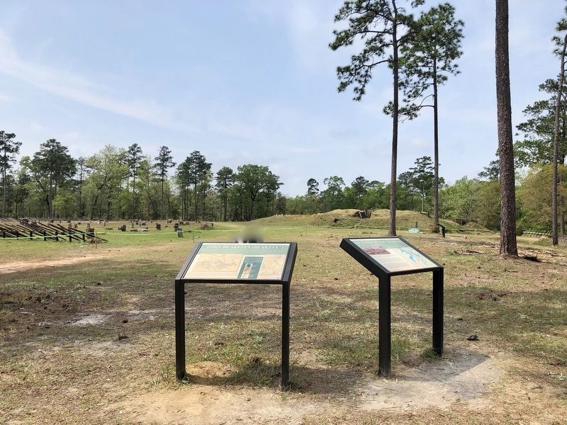
On Battlefield Road, 0.3 miles east of Green Street.
You are standing on the site of the last grand charge of the Civil War, made during the Battle of Fort Blakeley on April 9. 1865. The battle was the climax of a months-long campaign that led ultimately to the capture of the city of Mobile by Union . . . — — Map (db m131890) HM
Near Fort Morgan Road (Alabama Route 180) 2 miles west of Dune Drive, on the left when traveling west.
Traditionally referred to as "colors", flags have long been used to identify nations, loyalties, and movements. As the sands have shifted through the ages, so too have the colors and loyalties of the Gulf Coast. Displayed here are a small section of . . . — — Map (db m187336) HM
Near Fort Morgan Road (Alabama Route 180) 2 miles west of Dune Drive, on the right when traveling west.
American Forces
158 Men
20 Cannons
Casualties
3 Killed; 5 Wounded
British Forces
852 Men
130 Creek Indians
4 Ships; 80 Cannon
23 Killed; 47 Wounded
On September 11, 1814, HMS Hermes, HMS . . . — — Map (db m187342) HM
On Fort Morgan Road (Alabama Route 180) 2 miles west of Dune Drive, on the right when traveling west.
Drawn by A. Laccarriere Latour to accompany his book Historical Memoir of the War in West Florida and Louisiana, the above image depicts Fort Bowyer on the right as it appeared during the first battle in 1814. The drawing on the left; . . . — — Map (db m225072) HM
On Fort Morgan Road (Alabama Route 180) 2 miles west of Dune Drive, on the left when traveling west.
American Forces
370 Men
28 Cannon
Casualties
1 Killed; 18 Wounded
British Forces
3000 Men
38 Ships
28 Cannon (not including those on ships)
13 Killed; 18 Wounded
A map of the Second Battle of Fort . . . — — Map (db m118334) HM
Near Fort Morgan Road (Alabama Route 180) 2 miles west of Dune Drive, on the right when traveling west.
Construction began on August 19th on two artillery positions that were emplaced only 200 yards from the southeast bastion of Fort Morgan. These positions, which were part of Battery Bailey, anchored the southern flank of the Federal siege lines. . . . — — Map (db m118336) HM WM
(East Face):
Tribute dedicated to the memory of the soldiers who gave their lives in the defense of our country here at Fort Morgan.
Here lies the pride of seven flags entombed in our ancestor’s worth, who heard the thunder of the fray . . . — — Map (db m4649) HM
On Fort Morgan Road (Alabama Route 180) 1.2 miles west of Dune Road, on the right when traveling west.
(preface)
"Damn the Torpedoes!" is a familiar battle cry, but there's more to the story! The Mobile Civil War Trail is your guide to military movements and the way of life on and around Mobile Bay in the closing two years of the Civil . . . — — Map (db m87247) HM
Near Fort Morgan Road, 1.4 miles Dune Road, on the left when traveling west.
After the surrender of Fort Gaines, U.S. General Gordon Granger prepared to besiege Fort Morgan. On August 9, 1864, he moved by transport to Navy Cove and debarked 2,000 men and his siege equipment at the Pilot Town wharf. By 2:00 p.m. he had . . . — — Map (db m87246) HM
Near Fort Morgan Road (Alabama Route 180) 1.6 miles west of Dune Road, on the right when traveling west.
This smoothbore, muzzle-loading cannon was one of the
main coast defense weapons in the United States' arsenal when Fort Morgan was completed in 1834. With an eight pound charge of powder the gun could fire a 32 pound solid iron shot about one . . . — — Map (db m87245) HM
On Fort Morgan Road (Road 180) 1.7 miles west of Dune Drive, on the right when traveling west.
6.4” (100 pounder) Parrott Rifle
Designed by Robert Parker Parrott at the outbreak of the Civil War, the Parrott Rifle became one of the most used rifled artillery pieces during the war. With shells that exploded on impact, rifled . . . — — Map (db m69898) HM
Near Fort Morgan Road (State Road 180) 1 mile west of Dune Drive, on the left when traveling west.
Constructed between 1899 and 1900, the battery was named in honor of Major General Henry Dearborn, a Revolutionary War hero. The battery mounted eight 12” breech-loading mortars. Each mortar weighed 13 tons and was 11’ 9” long. The . . . — — Map (db m69919) HM
On Fort Morgan Road (State Road 180) 1.7 miles west of Dune Drive, on the right when traveling west.
Battery Schenck, named for First Lieutenant William Schenck who was killed in action during the Philippine Insurrection, was the second rapid fire battery constructed at Fort Morgan. Completed on June 4, 1900, the battery would sit without guns for . . . — — Map (db m70058) HM
Near Fort Morgan Road (State Road 180) 1.7 miles west of Dune Drive.
The first of two rapid fire gun batteries, Battery Thomas was named in honor of Captain Evan Thomas, 4th U.S. Artillery, who was killed in action with the Modoc Indians at Lava Beds, California in 1873.
In March 1898, as the nation moved . . . — — Map (db m69826) HM
Near Fort Morgan Road (Alabama Route 180) 1.7 miles west of Dune Drive when traveling west.
The Citadel, a large ten sided brick and wood structure, once dominated the Fort’s parade ground. Completed in 1825 as a defensive barracks, it was capable of housing 400 soldiers.
During the Union bombardment on August 22, 1864, the pine . . . — — Map (db m68751) HM
On Dixie Graves Highway, on the right when traveling south.
At, or near, this site, the United States, after seizing this point of land from the Spanish in 1813, built Fort Bowyer, a structure of wood and sand.
A small garrison of men courageously fought to defend the fort against two British attacks, one . . . — — Map (db m187339) HM
On Fort Morgan Road (Alabama Route 180) west of Pontoon Lane, on the right when traveling west.
Navy Cove
The Mobile Bay shoreline just inside Mobile Point, close to Fort
Morgan, is known as Navy Cove. This was the site of Native
American villages for over two thousand years. The name
came after the British Navy anchored here . . . — — Map (db m122441) HM
Near Fort Morgan Road (State Road 180) 1 mile west of Dune Drive, on the left when traveling west.
When Fort Morgan was modified between the 1890’s and early 1900’s, an allocation of $7,000.00 was made to build a “Peace” magazine. This building was the central storage area for the powder used by the fort’s guns. If war was expected, . . . — — Map (db m69917) HM
Near Fort Morgan Road (Alabama Route 180) 1.2 miles west of Dune Road, on the right when traveling west.
On February 28, 1899, the U.S. Army completed construction of the post Hospital for the garrison of Fort Morgan. At a cost of $7,500.00, the original structure consisted of a two story modern medical facility that was heated by mineral oil. Due . . . — — Map (db m116935) HM
Near Fort Morgan Road (State Highway 180) 1.7 miles west of Dune Drive.
Eager to attack Mobile Bay since 1862, U. S. Admiral David Farragut knew he could not capture control of the lower bay without the support of the army and without a flotilla of ironclad monitors to confront the Confederate ironclad CSS . . . — — Map (db m68815) HM
Near Fort Morgan Road (Alabama Route 180) 1.7 miles west of Dune Drive when traveling west.
The Citadel, a large ten sided brick and wood structure, once dominated the Fort’s parade ground. Capable of housing 400 soldiers, it served as a defensive barracks for the Fort’s garrison.
During the Union bombardment of Fort Morgan on August . . . — — Map (db m92994) HM
On Fort Morgan Road (State Road 180) 1.7 miles west of Dune Drive, on the left when traveling west.
To Wait and Watch
In late August 1864 the Federals controlled Mobile Bay but could not attack Mobile. Admiral Farragut could not reach the city even with his light draft vessels, because the channels in the upper Bay had been obstructed. . . . — — Map (db m187338) HM
On Fort Morgan Road (State Road 180) 1.7 miles west of Dune Drive, on the right when traveling west.
The U.S. Model 1918M1 155mm Gun, more commonly known as the “G.P.F.”, was a French heavy artillery piece manufactured in the U.S. for use by the U.S. Army during World War I. Due to the gun’s mobility and hitting power, it was used . . . — — Map (db m69910) HM
On Speckle Trout Route, 0.1 miles north of General Canby Drive, in the median.
This earthen mound was part of a redoubt constructed by the 1st Division, U.S. Colored Troops in April, 1865. The regiment saw considerable action against Confederate warships protecting the Blakely River. These earthworks have been preserved as a . . . — — Map (db m100853) HM
On General Gibson Road, 0.1 miles west of Lancers Lane, on the right when traveling east.
Confederate Redoubt No. 3
Capt. Cuthbert Slocomb of the 5th Company, Washington Artillery of New Orleans, commanded Redoubt No. 3, also known as Battery Blair,
consisted of one 8-inch Columbiad, two 12-pound Napoleons, one 3-inch ordinance . . . — — Map (db m168270) HM
On Artillery Range Street north of Yankee Trove, on the right when traveling north.
Confederate Redoubt No. 5
Also called the Sandbag Battery, Redoubt No. 5 was originally commanded by Lt. Andrew Hargrove of Lumsden's Tuscaloosa Battery, Company F, 2nd Alabama Light Artillery Battalion. During the early stages of the . . . — — Map (db m168290) HM
On Confederate Drive, on the right when traveling north.
From this Confederate Fort 15 heavy artillery guns, repelled elements of 2 Union Army Corps, routed 5 ironclad monitors attacking up the Blakely River and for 13 days helped prevent the capture of Mobile until after General Lee's Surrender at . . . — — Map (db m100911) HM
On Spanish Main Street south of Cannonade Boulevard, on the right when traveling south.
Highest point along 2 miles of Confederate battle lines extending east and north. Here 200 soldiers from Georgia, Louisiana & Arkansas, held off a numerically superior Union Force for thirteen days and nights in the last battle of the War Between . . . — — Map (db m100913) HM
On Spanish Main Street south of Cannonade Boulevard, on the right when traveling south.
Dedicated to the men of the Confederate States of America who valiantly fought for our American liberties, "Governments are instituted among men, deriving their just powers from the consent of the governed... whenever any form of government becomes . . . — — Map (db m100936) HM
On Lancers Lane east of Spanish Main Street, on the left when traveling west.
Built of red clay, armed with 12 heavy guns and served by 307 crack
Confederate Artilleryman from Batteries Perry (Tenn.) Phillips (Tenn.) Lumsden (Ala.) and Garrity (Mobile, Ala.). It was the keystone in the defense of Spanish Fort, 1865. — — Map (db m100868) HM
On Larry Dee Cawyer Drive at Old Spanish Trail (U.S. 98), on the left when traveling north on Larry Dee Cawyer Drive.
During the Revolutionary War, France, Spain, Britain, and the United States were interested in the fate of this region. In March 1780, Spanish forces captured Mobile. They established a palisaded fort with trenches (one mile north of here) to . . . — — Map (db m61451) HM
On Spanish Main Street north of Spanish Fort Boulevard (U.S. 31), on the right when traveling north.
Rendezvous for Indians, Spanish, French and English Explorers. In 1865, Three Confederate Brigades, outnumbered 10 to 1, engaged the Army of West Mississippi (Union Forces) in the last battle of the War Between the States. March 26~April 9, 1865. — — Map (db m100844) HM
On Patrician Drive South west of Patrician Drive East, on the right when traveling south.
Near this site was the location of the first of twenty-two artillery positions the Union army set up to bombard the Confederate fortifications of Spanish Fort. The Confederate forces were under the command of Brig Gen. Randall Gibson. Battery Tracy, . . . — — Map (db m120331) HM
On Fort Mims Road north of Boatyard Road (County Route 80), on the right.
Front:
In 1813, people on the United State’s southwestern frontier were fearful. The Redstick faction of the Creek Indian Nation opposed growing American influence in the area and had voted for war. However, Creeks living in the Tensaw . . . — — Map (db m116678) HM
Near Alabama Route 225, on the left when traveling north.
The American Revolution gave the United States its independence but the War of 1812 gave it status among the nations and established permanent peace with Great Britain.
Alabama had a significant role during the War of 1812. The Creek Indian . . . — — Map (db m122670) HM
On Boatyard Road (County Road 80) at Fort Mims Road, on the left when traveling west on Boatyard Road.
Here in Creek Indian War 1813-14 took place most brutal massacre in American history.
Indians took fort with heavy loss, then killed all but about 36 of some 550 in the fort.
Creeks had been armed by British at Pensacola in this phase . . . — — Map (db m86293) HM
On Woody Johnson Road, 0.1 miles east of County Route 79, on the left when traveling east.
Fort Browder
Approximately one mile south-southwest of here stood Fort Browder, a small wooden fortification built in 1836 for protection in the last war with the Creek Indians and named for Isham Browder, a prominent local planter. In 1861, . . . — — Map (db m188679) HM
On U.S. 82 close to County Road 79, on the left when traveling west.
Fort Browder
Approximately one mile south-southwest of here stood Fort Browder, a small wooden fortification built in 1836 for protection in the last war with the Creek Indians and named for Isham Browder, a prominent local planter. In 1861, . . . — — Map (db m208018) HM
On Pineapple Highway (Alabama Route 10) 0.8 miles west of Bibb Road (County Road 5), on the right when traveling west.
(obverse)
The Butler Massacre
On March 20, 1818, Capt. William Butler, Capt. James Saffold, William Gardener, Daniel Shaw and John Hinson left Fort Bibb to meet Col. Sam Dale. They were attacked near Pine Barren Creek by Savannah . . . — — Map (db m83259) HM
On Sherling Lake Road (Road 44) 0.4 miles north of Ridge Road (County Road 54), on the right when traveling north.
Ogly-Stroud Massacre
William Ogly built his cabin near this site at Poplar Springs along the Federal Road, and was killed here with most of his family on March 13, 1818. His friend Eli Stroud's wife was fatally wounded and their infant . . . — — Map (db m120933) HM
On Fort Dale Road (Alabama Route 185) 0.3 miles north of Sherling Lake Road, on the right when traveling south.
The Federal Road and the Palings
The Federal Road was built in 1806 as a shorter route from Washington to New Orleans and the new Louisiana Territory. The road entered Alabama at Fort Mitchell, Georgia and passed through Butler County near this . . . — — Map (db m130050) HM
On County Route 99 at County Route 95, on the right when traveling north on County Route 99.
One hundred feet east was one site where "The Trail of Tears" began. On May 23, 1838 the Indians of this general area, who had been held in a chestnut log stockade after being gathered by the U.S. Army, began their long trek to Oklahoma.
The . . . — — Map (db m114398) HM
On Rockville Road (County Road 15) at Suel Road, on the right when traveling south on Rockville Road.
Near this site, is the gravesite of Maj. Jeremiah Austill, folk hero & prominent figure in the early settlement of Clarke County. Born in 1794 in S. C., he lived, along with his parents, Capt. Evan and Sara Austill, among the Cherokee in Ga. . . . — — Map (db m101588) HM
On Bird Jackson Road (County Road 35) 5.9 miles south of Simmons Creek Road, on the left when traveling south.
This marks the site of pioneer stockade
commanded by Captains Sam Dale and
Evan Austill. Choctaw Chieftain
Pushmattaha often here. Expedition
terminating in noted Canoe Fight on
Alabama River immediately east of
this site, was . . . — — Map (db m101566) HM
Fort Sinquefield
Kimbell - James Massacre
Creek War 1812-13
Erected by Clarke County School Children 1931
Lest we forget Hayden and his dogs. — — Map (db m115627) HM
On Berrys Chapel Road, 0.7 miles north of Winn Road (Route 3), on the right when traveling north.
Built around the home of John Landrum
Used during the Creek War of 1813
First Clarke County Court met here in 1813
Succeeding courts were held here until 1819 — — Map (db m101584) HM
On Old Federal Road (County Road 5) south of County Road 42, on the left when traveling south.
Site of Fort Warren, built in 1816 by Colonel Richard Warren, who owned considerable land in this vicinity. This facility was used as a refuge for settlers who feared for their lives in the early days of the aftermath of the Creek Indian Wars of . . . — — Map (db m47689) HM
On Painter Avenue, on the right when traveling south.
To all military and civilian personnel who have served at Fort Rucker since 1942 with special recognition of those who paid the supreme sacrifice in fighting for freedom throughout the world. The citizens of Ozark are deeply grateful for the . . . — — Map (db m184131) HM WM
On Lapsley Road at Buckeye Avenue, on the right when traveling south on Lapsley Road. Reported permanently removed.
By 6pm General James H. Wilson had moved the 4th U.S. Cavalry, down Summerfield Road through the outer works and had ordered Captain Robinson of the Chicago Board of Trade Battery to do the same. After the main assault most of the regiments of . . . — — Map (db m81930) HM
On Summerfield Road at Battery Avenue, on the right when traveling south on Summerfield Road.
Redoubt No. 15 located just to the west of Summerfield Road was defended by Colonel Pinson's 1st Mississippi Cavalry Regiment of Anderson's Brigade. Their 400 men held positions on the west side of the road and the rest of Armstrong's present; . . . — — Map (db m81925) HM
On Summerfield Road at Highland Avenue (U.S. 80), on the right when traveling south on Summerfield Road. Reported missing.
The Lightening Brigade of the 2nd Division would spearhead the attack between Redoubts No. 13 - No. 16. Artillery covered all the approaches. At 5 p.m. General Long ordered the Second Division forward. "As Long's Second Division charged . . . — — Map (db m83682) HM
Near 4th Street near Gault Avenue South (Alabama Route 35) when traveling east.
In 1837 Federal Troops arrived in this area to select a fort location for the collection, holding and removal of the Cherokee. Part of a much larger compound, this site contained a cabin seized by the troops for use as part of the fort. Today a . . . — — Map (db m100286) HM
On Gault Avenue North (U.S. 11) east of 4th Street, on the right when traveling east.
The fort, consisting of a log house and large stockade, was built in 1838 by order of General Winfield Scott, commander of military forces responsible for the removal of Cherokee Indians.
Soldiers occupying the fort were commanded by Captain . . . — — Map (db m28030) HM
Near Interstate 59, 1 mile north of County Road 140, on the right when traveling south.
A Cherokee town founded 1770. Situated on Big Wills Creek, named for a half-breed chief, Red-Headed Will. A place of importance in the Cherokee Territory, it was the home of Sequoyah, inventor of the Cherokee Alphabet; John Ross, the last chief of . . . — — Map (db m213367) HM
On West Fort Toulouse Road, 0.3 miles south of Jackson Park Road, on the right when traveling south.
At this site stood Fort Toulouse,
later Fort Jackson, named in honor of
Gen. Andrew Jackson
who on
March 27, 1814,
defeated the Creek Indians in a
decisive battle at Horseshoe Bend.
Erected
by
Peter Forney Chapter D.A.R. . . . — — Map (db m69705) HM
Near West Fort Toulouse Road, 0.3 miles west of Jackson Park Road, on the right when traveling west.
Here stood
Fort Toulouse
A defense against
the Indians
Built by
Bienville
1714
The Alabama Society
of Colonial Dames
preserves the memory
of faithful service
1912 — — Map (db m69567) HM
On Shoffner Street (County Road 22) at Weaver Street, on the right when traveling east on Shoffner Street.
Fort Crawford was established in 1816 by elements of the 7th U.S. Infantry under orders from Major General Andrew Jackson. Purpose was to monitor Spanish activities in West Florida and curtail hostile Creek Indian activities.
Named after . . . — — Map (db m84373) HM
On Hartford Road (Alabama Route 10) 0.6 miles east of County Road 46, on the left when traveling east.
The frontier village of Franklin was established here by Colonel Robert Irwin in 1814 on the site of the Indian town of Cheeska Talofa. It was the first colonial village in east Alabama. Fort Gaines, Georgia, was constructed in 1816 to protect the . . . — — Map (db m71844) HM
On City Park Road south of Kentucky Avenue (Alabama Route 17), on the left when traveling south.
Alabama’s Winter Waterfowl
The Tennessee River Valley is the winter home for thousands of waterfowl. These birds migrate from across the northern US and Canada down through the center of the continent to the Tennessee River.
Careful . . . — — Map (db m106298) HM
On East Mobile Street south of North Royal Avenue, on the left when traveling south.
At this site where once stood Fort Willingham (Armory) the 115th Signal Battalion was organized December 1, 1940. Originally the 2nd Battalion, 151st Engineers, it was organized a number of times from 1940 to 1959 as its mission was changed to meet . . . — — Map (db m208808) HM
On East Mobile Street at North Royal Avenue, on the left when traveling south on East Mobile Street.
The United States flag that flies at the base of this hill stands as a sentry over the site that was the home of Fort Willingham Armory from 1937-1979. The Armory was named after Dr. Henry J. Willingham, president of Florence State Normal School, . . . — — Map (db m83987) HM
On Veterans Drive at South Magnolia Street, on the right when traveling east on Veterans Drive.
This high elevation was used by both armies during the Civil War. Large earthworks were
constructed in February 1862 by Confederate Brigadier General Daniel Ruggles. At the time, more than 500 sick and wounded soldiers were being treated in . . . — — Map (db m156920) HM
On Martin Luther King Drive (County Road 83) at County Road 82, on the right when traveling south on Martin Luther King Drive.
Following the signing of the Creek Treaty in 1832, the early white settlers constructed a 16 by 30 foot hand hewn log fort for protection against a possible Indian uprising from Cussetaw Indian Village on Osanippa Creek just north of here. Walls of . . . — — Map (db m71643) HM
On Lee Highway (U.S. 72) 0.2 miles west of Wright Road, on the right when traveling west.
Approx. ¼ mile North is the site of Ft. Hampton, built in 1810 and named in honor of
Brig. General Wade Hampton of Revolutionary War fame. Two Companies of soldiers were
stationed here in log buildings. The purpose of the fort, and its garrison . . . — — Map (db m154231) HM
On Browns Ferry Street (County Road 29) west of Allyn Street, on the right when traveling west.
Fort Henderson Built on this site in 1863 by federal forces occupying Athens. It was a five-sided earthen fort with some frame buildings and underground bomb-proofs. Abatis lined the fifteen-foot deep perimeter ditch, a small portion of which . . . — — Map (db m41787) HM
Near East Market Street west of South Clinton Street, on the right when traveling east.
This cistern is the last remnant of Trinity School located here 1865-1907. The cistern was used to store rainwater collected from the roof. No physical evidence remains of the Ross Hotel, the Chapman Quarters, and other buildings on this block, . . . — — Map (db m72219) HM
On Elkmont Road/North Jefferson Street (Alabama Route 127) 1.2 miles south of Morris Road, on the right when traveling south.
On Sept. 25, 1864 Gen. N.B. Forrest's Confederate cavalry, with Morton's battery of 4 guns, attacked and captured the Union fort near here. The fort consisted of a square redoubt, rifle pits, two blockhouses, and some frame buildings. It protected a . . . — — Map (db m60870) HM
On Easter Ferry Road south of Morris Road (County Road 49), on the right when traveling south. Reported missing.
Side A (North side) In the fall of 1806 a group of settlers led by William and James Sims, traveled from east Tennessee on flatboats down the Tennessee River and up the Elk River to this area. They landed near Buck Island and spread out . . . — — Map (db m85454) HM
On U.S. 43, 0.2 miles north of Richie Road, on the right when traveling north.
(English)
Site of
Old Mobile
Fort Louis de la Louisiane
Founded 1702 by
Pierre Le Moyne d’Iberville
Under orders of Louis XIV
First Capital of French Louisiana
1702-1711
(French)
Site de
Vieux Mobile
Fort . . . — — Map (db m70588) HM
Near Bienville Boulevard east of Albatross Street, on the right when traveling east.
The Confederates built Fort Powell on Tower Island, an oyster shell bank fifty feet north of Grant's Pass. The Pass provided an easy route from Mobile Bay to New Orleans through Mississippi Sound. C.S. Lieutenant Colonel James M. Williams, only . . . — — Map (db m87239) HM
Near Bienville Boulevard east of Albatross Street, on the right when traveling east.
Once Farragut was in the Bay, capture of Fort Gaines and Powell would prevent his isolation there. So at 4:00 pm, August 3, 1864, 1,500 soldiers commanded by U.S. General Edward Canby (but under the operational direction of General Gordon . . . — — Map (db m87219) HM
Near Bienville Boulevard east of Albatross Street, on the right when traveling east.
At 7:25 a.m., August 5, 1864, Admiral Farragut’s lead monitor Tecumseh steered into the torpedo field at the mouth of Mobile Bay. The admiral had ordered Commander Tunis Craven, the Tecumseh’s captain, to engage the ram . . . — — Map (db m87234) HM
Near Bienville Boulevard east of Albatross Street, on the right when traveling east.
This anchor came from the U.S.S. Hartford, Admiral Farragut's flagship during the Civil War "Battle of Mobile Bay" in August of 1864. It was there that he uttered the now famous words, "Damn the Torpedoes—Full Speed Ahead!" — — Map (db m87244) HM
Near Bienville Boulevard east of Albatross Street, on the right when traveling east.
To Wait and Watch
In late August 1864 the Federals controlled Mobile Bay but could not attack Mobile. Admiral Farragut could not reach the City even with his light draft vessels, because the channels in the upper Bay had been obstructed. . . . — — Map (db m87243) HM
On Government Street, 0.1 miles east of South Royal Street, in the median.
Manufactured at Tredegar Iron Works
Richmond, Virginia
CSA
This cannon was used by Alabama Confederate Forces in the
defense of Mobile during the War for Southern Independence
from 1861-1865.
It was mounted at Ft. Powell, guarding . . . — — Map (db m86727) HM
Near Virginia Street, 0.1 miles east of South Ann Street.
Ill. 76th Vol. Inf.
In Memory
of our Heroes
Who Fell at
Fort Blakely, Ala.
April 9, 1865
——
2nd Brig. 2nd Div.
13th Army Corps.
William T. Duke • Micajah S. Moore • William Crimes • George H. Hopkins • George . . . — — Map (db m86870) WM
On South Royal Street at Church Street, on the right when traveling south on South Royal Street.
Since colonial rulers were unable to attract large numbers of settlers to Mobile, the Port City’s population remained small and never grew above 500. Because the majority of Mobile’s population was military personnel, the city was built around the . . . — — Map (db m87207) HM
On Church Street west of South Royal Street, on the right when traveling west.
This ruin is a vestige of the second Fort Conde. Built by the French in 1723 and later occupied by the British, Spanish, and the Americans, these foundations are the only architectural remains of Colonial Mobile. — — Map (db m117253) HM
On South Royal Street at Theatre Street, on the right when traveling south on South Royal Street.
Spain, America's ally, declared war on Great Britain in June 1779. Bernardo de Galvez, governor of Spanish Louisiana at New Orleans, led the attack against the British along the lower Mississippi River and Gulf Coast. In February 1780, Galvez laid . . . — — Map (db m86355) HM
Near South Royal Street just south of Church Street, on the right when traveling south.
Patterned after forts designed by French military engineer Sebastian Le Pestre de Vauban, Fort Condé protected Mobile and its citizens for nearly 100 years from 1723-1820. Built by the French as a defense against British and Spanish attack, the . . . — — Map (db m160801) HM
On Military Road (County Road 96) at Old Highway 43, on the left when traveling east on Military Road.
Site three miles east. Border fort and port of entry into the United States while the 31st parallel was the southern border. Aaron Burr was held prisoner here after capture near McIntosh in 1807. — — Map (db m70592) HM
On Old Military Road East (Alabama Route 96) 0.1 miles Old Military Road South (Alabama Route 96), on the right when traveling north.
Early in 1799 a joint U.S.-Spanish survey commission had
determined the international boundary to be a few miles south
of this spot, at 31° N Longitude. (A marker known as the
Ellicott Stone still stands on the old boundary line, just east of
US . . . — — Map (db m149312) HM
On Superintendents Drive at Coy Smith Highway (Alabama Route 96), on the right when traveling west on Superintendents Drive.
The cannon in front of you, buried muzzle-down during an
1873 land survey to mark a corner of the Mount Vernon
Military Reservation, is just one of many reminders that Mount
Vernon hosted important U.S. Army posts throughout the 19th
century. . . . — — Map (db m149304) HM
On Old Highway 43 at Military Road (County Road 96), on the left when traveling south on Old Highway 43.
In 1811, the Mount Vernon Cantonment, located on a hill about three miles west of the Mobile River, was laid out by Col. Thomas H. Cushing. The cantonment was on the site of a spring called Mount Vernon Springs. In 1814, the garrison at Mt. Vernon . . . — — Map (db m85911) HM
On U.S. 84 at Grain Elevator Road and Lena Landegger Highway, on the left when traveling west on U.S. 84.
Built by Gen. Ferdinand L. Claiborne as a base for his invasion of the Alabama country with U.S. Regulars, Lower Tombigbee Militia, and friendly Choctaws. Claiborne’s campaign culminated in the American victory over the Creeks at the Holy Ground. — — Map (db m47641) HM
On U.S. 84 at Old Fort Claiborne Road, on the right when traveling west on U.S. 84.
Piache, an Indian town visited by DeSoto in 1540 was near here.
DeLuna made a settlement here, Nanipacna in 1560.
Fort Claiborne was erected on the south bluff, in 1813.
LaFayette was entertained here, 1825.
. . . — — Map (db m47639) HM
On Bank Street at Vine Street Northwest, on the right when traveling south on Bank Street.
Decatur played a key role in the Federal defenses of the vital rail lines in North Alabama. These defenses were configured in a three-tiered system. First, a number of lightly armored gunboats, constructed on the Tennessee River and nicknamed . . . — — Map (db m86476) HM
On Lafayette Street Northwest at Railroad Street, on the right when traveling west on Lafayette Street Northwest.
As Hood’s Army of Tennessee encircled Decatur, sharpshooters advanced upon the Union defenses. Colonel Doolittle’s men responded with heavy artillery and musket fire. During the early afternoon of October 27, the Confederates approached the Federal . . . — — Map (db m28241) HM
Built during Creek War 1813 by Georgia Militia on main Indian trade route to Tombigbee River
U.S. Troops stationed here until 1837 1836 Lower Creeks corralled here for forced removal to the West — — Map (db m26069) HM
On Unnamed road, 0.2 miles east of Alabama Route 165, on the right when traveling east.
Fort Mitchell
Fort Mitchell is located on the Federal Road on the West bank overlooking the Chattahoochee River.
General John Floyd received orders from Governor David B. Mitchell to pick up supplies, cross the Chattahoochee River and . . . — — Map (db m120003) HM
Near Old Federal Road east of Alabama Route 165, on the left when traveling east.
Originally a major path Creek Indians and indigenous tribes who preceded
them, the Federal Road became a postal route as a result of a treaty between
the Creeks and the United States government in 1805. The widening of the
Federal Road occurred . . . — — Map (db m241205) HM
On Alabama Route 165, on the right when traveling north.
Fort Mitchell
Has Been Designated A
National Historic Landmark
This site possesses National significance in commemorating the history of the United States of America — — Map (db m241212) HM
This military graveyard was established soon after Fort Mitchell was built by General John Floyd of the Georgia Militia. Located just south of the stockade, the cemetery was used between 1813 and 1840 during the fort's occupation by Georgia and . . . — — Map (db m26122) HM
Approximately one mile due east of this marker, back down the Old Federal Road, called by frontiersmen and Indians the Three Notched Trail or the Three Chopped Way, stood Fort Mitchell, an early 19th century American fort that in 1836 was one of the . . . — — Map (db m26100) HM
On Alabama Route 165 at Terminal Road (Route 54), on the right when traveling north on State Route 165.
East of here, on the Chattahoochee River, was the "fort among the Apalachicolas," most northern of the Spanish settlements in eastern North America. A palisaded "strong house" built by Captain Enrique Primo de Rivera to check activities of English . . . — — Map (db m101252) HM
On South Railroad Street west of Holland Court, on the right when traveling west.
Built in 1950, Fort Jabe Brassell has served as a hub for military training and arms storage for the local community by the Alabama Army National Guard and the Armory Commission of Alabama. Between July 1954 and January 1955, the Alabama Army . . . — — Map (db m165538) HM
6450 entries matched your criteria. The first 100 are listed above. Next 100 ⊳