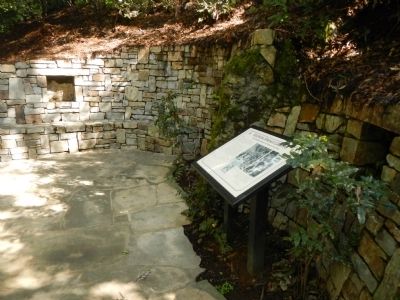
The first recorded visitor to the sulphur springs grotto is Isaac Holmes, a retired U.S. Senator from South Carolina, who reportedly installed a bathtub in Bushy Dell canyon in the early 1860s in order to take alfresco baths for his rheumatism. . . . — — Map (db m72378) HM
In 1849 Dr. James Caples passed through here on his way to California’s gold country.
After a brief stay in Old Hangtown (Placerville) Caples remembered the lake and returned here with his family to establish a way station that served weary . . . — — Map (db m11048) HM
In 1849 Mary Jane Walker Caples, along with her brother, husband James, and baby daughter Isabella, traveled overland by wagon to the gold fields of California. The Caples went to “Hangtown,” (Placerville,CA) to seek their fortune. James . . . — — Map (db m44987) HM
Telltale signs of geologic activity surround Grover Hot Springs State Park. Bold granite peaks to the northwest are the work of immense mountain building forces. Old lava flows cover hundreds of square miles to the east, giving the Markleeville area . . . — — Map (db m13239) HM
In Memory of the Bryant Brothers
Clemens E. Bryant, Thomas L. Bryant,
Roy Bryant and Walter F. Bryant
Whose surviving relatives deeded this property
to Volcano Lodge No. 56 F. & A. M. on June 20, 1962.
Our pioneer . . . — — Map (db m15824) HM
Bald Rock Dome was formed from a large body of melted rocks (called the Bald Rock Pluton) deep in the earth's crust. The Bald Rock Pluton is two miles wide, and was formed approximately 140 million years ago. As the pluton cooled, parts of its . . . — — Map (db m146208) HM
This natural formation came from a cavern on the property of the Calaveras Cement Co., located near Calaveritas in Calaveras County. It was donated to the museum by the Flintkote Co. in 1957. Collectively known as speleothems, these ancient . . . — — Map (db m101618) HM
Discovered September 1, 1885, by Walter J. Mercer. Resting at this site and noticing movement of grass near a small hole. Enlarging the opening, he ascended into extensive caverns containing varieties of fantastic crystalline formations. The public . . . — — Map (db m16017) HM
Founded in 1927 by Gerald (Jerry) Gill and family, the park consisted of four picnic sections, over forty acres, four baseball diamonds, two swimming pools, a wading pool for children, large dance hall and two snack bars.
At one time the grounds . . . — — Map (db m94663) HM
This area in the mid 1850s, was a known hideout for legendary bandit Joaquin Murrieta, who worked as a vaquero for John Marsh on his rancho just east of here. It was also frequented by John "Grizzly" Adams, famed California mountain man.
In 1927 . . . — — Map (db m94657) HM
Cerrito Creek and its branches carry
rain and spring water from the East Bay Hills
to San Francisco Bay. Native Americans lived along
its banks. It became the boundary between vast
Spanish land grants and, later, the county line.
The City . . . — — Map (db m155139) HM
El Cerrito, Spanish for "the little hill", is named for the hill to the southwest - now called Albany Hill. Like Brooks Island, the hills north Port Richmond, and the hills at China Camp across the bay, Albany Hill is a part of a range older than . . . — — Map (db m94105) HM
Its waters made possible the irrigation of a million fertile acres, despite a 39 year battle over water rights. From 1882 forward, 150 lawsuits were filed and early irrigators often used armed force to open headgates to water their crops. L. A. . . . — — Map (db m27996) HM
The Eel, California’s third largest river, flows 800 miles before emptying into the Pacific Ocean. Through ongoing monitoring, public and private entities are working to preserve the integrity of this designated “Wild and Scenic River.”
(The . . . — — Map (db m71985) HM
People have been drawn to the beauty and serenity of Northern Californias's majestic redwood forests for millennia
In the 1910s and 1920s, improved roads and services drew tourists from every walk of life, and the redwoods became a . . . — — Map (db m139843) HM
Seeking to capitalize on the mystique of Death
Valley, early promoters attached dubious names
like "Devils Cornfield" to its strange and unusual
features. Thought to resemble bundled corn left
to dry in rows at harvest time, the root system . . . — — Map (db m195412) HM
Crystallized salts compose the jagged
formations of this forbidding landscape.
Deposited by ancient salt lakes and shaped
by winds and rain, the crystals are forever
changing.
Listen carefully. On a warm day you may hear
a metallic . . . — — Map (db m302747) HM
For years, these moving rocks were a mystery. The tracks prove to
everyone that rocks slide, and all believed that high desert winds
must surely play a role. Many theories were proposed, but no one
had ever seen a boulder slide across dirt or . . . — — Map (db m270309) HM
Prehistoric Shores
Prehistoric Lake Manly, fed by melting
Sierra Nevada glaciers and surrounded by
trees, would have looked very different
from what you now see. With no exit from
the valley, the lake grew to a depth of 500 . . . — — Map (db m160793) HM
Before
you is part of one of the largest military aircraft
training areas in the U.S. It has been used continuously since
the 1930s. Much of what is now the western portion of
Death Valley National Park was added under the condition
that . . . — — Map (db m194626) HM
In front of you is a dry lake bed - a playa - the
flattest of all natural surfaces.
Fine mud and silt, eroded from the surrounding
mountain, compose the playa. Water washes across the
playa, suspending the sediments in a
shallow, . . . — — Map (db m235586) HM
"...a curious dry lake, almost a perfect oval in shape, and
resembling a racetrack. The illusion is heightened by the
fact that an extraordinary rock formation near it appears
to be a grandstand for spectators." -Phil Townsend Hanna,
"Some . . . — — Map (db m270302) HM
The beauty, silence, and solitude of Racetrack
Valley and its dry lakebed, or playa, are almost
unworldly. Adding to its appearance is the mystery
of the moving stones, which leave furrows in the
dried mud of the lakebed as a record of . . . — — Map (db m270316) HM
Before you is vivid evidence of one of the geologic forces that shapes Death Valley. Unlike most geologic features, the age of Ubehebe Crater (u-bee hee-bee) is measured in thousands rather than millions of years; it is about 2,000 years old. . . . — — Map (db m167511) HM
Early People at Fossil Falls - Life at the Edge of Volcanoes and Glaciers
An Oasis in the Past
Imagine this spot twelve thousand years ago. The
climate was much wetter than it is now. Large lakes
filled many of today's . . . — — Map (db m194960) HM
Back From the Brink of Extinction
Half a million tule elk once roamed
the marshes and grasslands of
California. The Gold Rush began an
era of commercial hunting and
agricultural practices that decimated
the elk and their . . . — — Map (db m184928) HM
Honey Lake is a remnant of the once huge Lake Lahontan. Fed by melting snow and ice at the end of the most recent ice age, Lake Lahontan covered nearly 8,000 spquare miles of land. The lake reached its highest level about 13,000 years ago when it . . . — — Map (db m308302) HM
Ladyface Mountain climbs to 2,031 feet above sea level and is visible for many miles.
Legend has it that the Chumash Indians, who used the mountain as a perch to view the
entire Conejo Valley, gave the mountain the name "Ladyface."
The . . . — — Map (db m200712) HM
After a century as privately-held land, Vasquez Rocks entered the mid-1960s as a public park for the first time. While many
years of interest were delayed with budget shortfalls, support from the local, state, and federal levels finally led to . . . — — Map (db m262617) HM
Known to the Mission Padres, Crystal Lake is the only natural lake in the San Gabriel Mountains. R.W. Dawson visited the lake in 1876, and later built a cabin nearby. Pasadena Judge Benjamin Eaton wrote in 1887 that "The water is clear as a . . . — — Map (db m172024) HM
Once common across the globe, cycads are now
threatened or endangered in the wild. Explore our
diverse collection and learn about these impressive plants.
Age of Cycads
The Jurassic Period is famous for its fantastically large . . . — — Map (db m198164) HM
On this site, bubbling springs once flowed from their source in a deep water basin which has existed continuously since the Pleistocene Era. Prehistoric animals, Indians, and early Inglewood settlers were attracted here by the pure artesian water. . . . — — Map (db m126337) HM
In 1984 a Red Oak tree in front of La Verne Heights Elementary School became diseased. Tree limbs began to fall off onto Baseline Road, creating hazards for drivers as well as students of the elementary school. Recognizing the potential danger, . . . — — Map (db m190868) HM
In the 1940s Jane S. Pinheiro, a local resident and self-taught wildflower artist, became concerned that rapid growth in the Antelope Valley was
endangering wildflower fields. Jane's dream was to have a "Poppy Park" to protect the official . . . — — Map (db m189239) HM
In the early 1990s, Long Beach was world-famous as a visitor destination. Hotels and dance halls, trolleys and roller coasters lured tourist to the city. The mild climate and pristine beaches beckoned people to the water's edge. With daily train . . . — — Map (db m71543) HM
Garden of the Gods was part of the Iverson Movie Ranch which flourished from 1912 until the late 1960s, the golden era of the "B" Western movies. This site was known as the "most shot up location in movie history."
Hollywood cowboys Rex . . . — — Map (db m127037) HM
A sandstone rock hill with the natural formation of an eagle in flight.
Declared 1962, Historic-Cultural Monument No. 10, City of Los Angeles, Cultural Heritage Commission, Cultural Affairs Department. — — Map (db m266330) HM
Declared Historic Cultural Monument No. 24 by the Cultural Heritage Board, Municipal Arts Department, City of Los Angeles.
newer plaque, now missing:
Lang Oak
Encino's 1000-year-old oak,
trunk diameter 24 . . . — — Map (db m165309) HM
Presented to the citizens of Los Angeles County in December 1916 by Captain Allan Hancock with a request that the scientific
features be preserved.
First historic reference to the tar pools recorded in the diary of Gaspar de Portolá on August . . . — — Map (db m126874) HM
This site possesses exceptional value as an illustration of the nation's natural heritage and contributes to a better understanding of man's environment.
1963, National Park Service - United States Department of the Interior — — Map (db m291250) HM
Today, Ballona Lagoon is a 16-acre remnant of a formerly extensive coastal wetland. Like other southern California wetlands, urbanization has reduced its size and degraded its habitat over the last century. Historically, Ballona was much larger . . . — — Map (db m128456) HM
One of the most outstanding geological features in California, extending for over 650 miles from Point Arena, north of San Francisco, to south of San Gorgonio Pass, between twenty and thirty miles deep and more than a mile wide in some . . . — — Map (db m149749) HM
The Palos Verdes Peninsula is an up lifted block of land forced out of the sea at a rate of about 0.4 millimeters per year over the last 2 million years. Once an island, the peninsula is encircled by thirteen wave cut terraces. These broad "benches" . . . — — Map (db m42124) HM
Today's San Dimas Canyon Community
Regional Park and Nature Center was
the first nature center facility owned by
the County of Los Angeles. The park lands
were first purchased as a gravel quarry in
1909, known then as the San Dimas . . . — — Map (db m260041) HM
Devils Postpile stands not only as an unusual geologic wonder but as a monument to the visionary efforts of a dedicated conservationist. In 1910, under U.S. Forest Service management, engineer Walter L. Huber received an application from mining . . . — — Map (db m63616) HM
Some of the world’s richest waters exist right off California’s coast. An explosion of life occurs here due to a combination of the sun’s energy, wind, ocean currents, and contours of the sea floor. Microscopic phytoplankton form the base of the . . . — — Map (db m63362) HM
For thousands of years Native Americans lived in the Bay Area harvesting animals, salt, and acorns. The changes they made to the landscape were limited. They used fire to shape oak woodlands and grasslands. cultivated plants, and collected salt . . . — — Map (db m102474) HM
Providing a narrow entrance to the west coast's most defensible harbor, the strategic value of the Golden Gate is readily apparent. Between 1776 and 1846, Spanish, then Mexican, guns defended the harbor entrance. Starting in 1846, American soldiers . . . — — Map (db m102777) HM
“If California ever becomes a prosperous country, this bay will be the center of its prosperity.”
Richard Henry Dana
Two Years Before the Mast, 1835
Thirteen years after Dana’s visit, the discovery of gold in the Sierra . . . — — Map (db m256281) HM
Originally named Tower Rock, May Rock is the largest outcropping of quartz along the Mother Lode. This 82 foot high formation contains no gold ore. Most gold ore within quartz is at greater depths in the earth.
It was part of Colonel John C. . . . — — Map (db m301007) HM
From the crest of the ridge of a few hundred feet behind this point members of the Mariposa Battalion under the leadership of Major James D. Savage looked into Yosemite Valley on March 27, 1851.
Alarmed by the encroaching tide of California Gold . . . — — Map (db m47417) HM
Ever-Changing Scene
In Yosemite, you may never witness the same scene twice.
This grand show is eternal. It is always sunrise, somewhere; the dew is never all dried at once; a shower is forever falling; vapor ever rising. Eternal . . . — — Map (db m63596) HM
A Burning Tradition
Miwok people, who called themselves Ahwahneechee, lived in Yosemite Valley for thousands of years. Their traditional practice of regularly burning the meadows and oak woodlands of the Valley contributed to the open . . . — — Map (db m63597) HM
At certain times of the year some of the Valley’s waterfalls disappear. Bridalveil keeps flowing even in late summer, when Yosemite Falls begins to dry up.
Above Yosemite Falls the terrain is largely bare granite; runoff is rapid. Bridalveil . . . — — Map (db m63589) HM
You are standing on the site of two famous Yosemite landmarks: McCauley’s Mountain House (1872-1969) and the Glacier Point Hotel (1917-1969). Both structures were built from trees cut down near this site. They both burned to the ground on the . . . — — Map (db m100858) HM
Where the Old Village once stood, little evidence remains. In its heyday, thousands of tourists arrived on horseback, in wagons, and in early Model T Fords. They danced, bathed, and slept here. Today this is hard to imagine, as the meadow seems so . . . — — Map (db m65527) HM
People have been coming to Glacier Point for generations to see one of the most spectacular views on earth. For a panoramic vista of Yosemite Valley, walk along the trail to Glacier Point, located ¼ mile from where you’re now standing. Along the . . . — — Map (db m63610) HM
A distinctive geological feature along the Mono Trail, for many years provided the shortest route between Mono Basin and Yosemite Valley.
Lt. S. Treadwell Moore (Co. B, 2nd Infantry-USA) and his detachment are credited as being the first white . . . — — Map (db m252389) HM
Convict Lake and Creek are so named as the result of an encounter here September 17, 1871, between Robert Morrison, Benton Merchant and member of a posse of citizens, and three convicts who had escaped from the Carson City, Nevada, State . . . — — Map (db m19879) HM
Crowley Lake, widely known for its trout fishing, has yielded more than 40 tons of fish the first week of fishing season. It was named for Father Crowley, a beloved Catholic priest. who traveled this area extensively.
The White Mountain Range, . . . — — Map (db m72570) HM
Even though Monterey cypress trees prefer this area's rugged bare granite headlands, the Lone Cypress is a testament to the hardiness of these trees. It has withstood Pacific storms and winds for roughly 250 years. Fences and cables now offer added . . . — — Map (db m8476) HM
Soldiers once guarded this shoreline against sea-borne attack, but one force proved too powerful to stop. Coastal erosion, the wearing away of these bluffs and beaches by ocean waves, has been steadily moving the coastline inland here since sea . . . — — Map (db m157374) HM
Soldiers once guarded this shoreline against sea-borne attack, but one force proved too powerful to stop. Coastal erosion, the wearing away of these bluffs and beaches by ocean waves, has been steadily moving the coastline inland here since sea . . . — — Map (db m157375) HM
Decades of logging, grazing, recreation, and foot traffic brought Asilomar's dune ecosystem to the brink of extinction. When the Young Women's Christian Association (YWCA) established the Asilomar summer camp grounds in 1913, the dunes became a . . . — — Map (db m63773) HM
The hot mineral therapy pool was constructed back in the 1930s. Much like the native Wappo Indians, guests considered the hot mineral therapy pool to have spiritual, healing and rejuvenating properties. Guests would sooth what ailed them by enjoying . . . — — Map (db m251280) HM
You are now standing in front of the Old Faithful Capped Geyser, which was capped in 1916, the same year it was drilled. In the mid-1900s, this geyser was put back into service, providing nutrient- rich mineral water to the Old Faithful Hot Mineral . . . — — Map (db m251282) HM
Water for the Old Faithful Geyser of California comes from an underground river that is 350°F (177°C) and lives 2 miles below the earth's surface. When it flows over the hot molten magma deep in the earth, it boils, expands and is collected in . . . — — Map (db m251278) HM
History
“I don’t believe I have adequate words to describe the real beauty of Donner Pass. As we stood looking down I had a floating sensation… I lost all fear as I looked at one of the most beautiful blue lakes (Donner Lake) I have . . . — — Map (db m81894) HM
America's Largest Nordic Ski Resort Opens
When Royal Gorge opened in the 70's, Nordic skiing in the U.S. was in its infancy. Since then, the sport has grown to near European popularity and Royal Gorge became renowned the world over, boasting . . . — — Map (db m129654) HM
This section weighs five tons and measures 7½ feet in diameter. The original tree, estimated to have been 200 feet tall, was part of a sub-tropical forest 55 to 70 million years ago in what is now Colorado. Scientists believe it to be of the Redwood . . . — — Map (db m155279) HM
In early descriptions it was known as Cerrito De Las Ranas, meaning the Hill of the Frogs. In the 1890s this hill became the scene of mining excitement. Its soil composition, very red in color, had caused early American settlers to name it Red Hill. . . . — — Map (db m51966) HM
History
Fire! Fire at Cascade! Call Cisco
Snowsheds solved one problem and opened up an industry of snow shovelers, maintenance workers, carpenters, line walkers and fire lookouts. 24 hours a day, high on Red Mountain, lookouts scanned . . . — — Map (db m129442) HM
Dedicated to Susan Cooley-Gilliom
This was Susan's favorite spot for photographing and painting the South Yuba River, which she cherished in all season. When Placer Legacy first began negotiations to preserve this land, Susan was a key . . . — — Map (db m105153) HM
A historic section of the Western States Trail through the Sierra Nevada.
Michigan Bluff–Last Chance Trail.
The Michigan Bluff to Last Change section of the Western States Trail was built in 1850 and later became a maintained . . . — — Map (db m692) HM
At 10,834 feet, San Jacinto Peak is the second highest peak in southern California. Its north face rises over the desert floor, creating one of the steepest escarpments in the United States. The peak also helps create a landscape of extremes. Mount . . . — — Map (db m210759) HM
Earthquake Faults Crisscross this land and shape its restless landscape.
The San Andreas fault cuts along the eastern side of the Coachella Valley. From where you are standing it runs parallel to Interstate 10 toward the base of . . . — — Map (db m212019) HM
When rain falls on a vernal pool grassland, some water sinks into the ground and the rest flows into streams or into depressions in the landscape. The water cannot move deeper into the ground in a vernal pool grassland because a hardpan blocks its . . . — — Map (db m52708) HM
Was discovered on February 22, 1907 by James Marshall Couch while prospecting for quicksilver on a fifty dollar grubstake for shares from R.W. Dallas and Tom Sanders. On July 30, 1907 mineralogy Professor George D. Louderback identified it as a new . . . — — Map (db m63910) HM
Ecology is all about how all things around us interact and affect each other, from rocks to plants to animals. Here is a place rich with different ecological interactions. How many can you see?
Millions of years ago, most of California was under . . . — — Map (db m71565) HM
Amboy Crater, formed of ash and cinders, is 250 feet high and 15,000 feet in diameter. It is situated in one of the youngest volcanic fields in the United States. It is located in the Barstow-Bristol trough, a conspicuous west-northwest trending . . . — — Map (db m249852) HM
Amboy Crater, formed of ash and cinders, is 250 feet high and 1500 feet in diameter. The crater is in one of the youngest volcanic fields in the United States. Six distinct periods of eruptions created the resulting nested group of volcanic cinder . . . — — Map (db m78561) HM
Panel 1:
The Story of Route 66
Commissioned in 1926 and soon dubbed "The Mother Road," Route 66 was a great asphalt river linking Chicago and Los Angeles – a highway of hope that led thousands of people to a new life. . . . — — Map (db m33446) HM
Over 400 years ago, as the Spanish adventurer Cabrillo was
exploring what is now Southern California, the mighty pine
above you had just peeked through the soil. By the time
Benjamin Davis Wilson discovered our valley in 1845, this tree
had . . . — — Map (db m197487) HM
Hole-in-the-Wall is a common place-name in the West, the most famous
being the Wyoming hideout of such outlaws as Jesse James. Legends
describing the origin of the local name abound. The most credible is that
gunslinger-turned-homesteader Bob . . . — — Map (db m263510) HM
While crossing the slope of Cima Dome in its first mile, Teutonia Peak
Trail passes through the densest concentration of Joshua trees in the
world. After passing the remnants of the old Teutonia Mine, the trail
gains 750 feet ascending the . . . — — Map (db m258676) HM
Mitchell Cavern
and Winding Stair Cave
has been designated a
National
Natural Landmark.
This site possesses exceptional value
as an illustration of the nation's natural
heritage and contributes to a better
understanding of man's . . . — — Map (db m263524) HM
Located on the hills above San Bernardino, the Arrowhead has been an important landmark for centuries. It is believed to be a natural feature but its true origin is unknown. The distinctive arrowhead shape is visible because the white sage, . . . — — Map (db m126067) HM
Do you recognize the Trona Pinnacles
from more than a dozen hit movies?
Over thirty film projects a year
are shot among the tufa
pinnacles, including backdrops for
car commercials and sci-fi movies such
as Star Trek V, The Gate II, . . . — — Map (db m212574) HM
Rising from the bottom of what was once an ancient lakebed, the Trona Pinnacles represent one of the most unique geologic landscapes in the California Desert. Over 500 of these tufa or calcium carbonate spires are spread out over a 14 square mile . . . — — Map (db m50221) HM
San Francisco was an ancient river valley were creatures who grazed and browsed and stalked their prey, left their bones. (text on the horizontal surface)
20,000 years ago you could have walked to the Farallon Islands... . . . — — Map (db m92829) HM
This tablet marks the shore line of San Francisco Bay at the time of the discovery of gold in California, January 24, 1848. Map reproduced above delineates old shore line. — — Map (db m638) HM
The shore line of San Francisco Bay reached a point twenty-five feet northeasterly from this spot at the time gold was discovered by James W. Marshall at Coloma, California, January 24, 1848.
Map of old water line shown on tablet on opposite . . . — — Map (db m71806) HM
Imagine how the Glen Canyon Park used to be part of the open rolling hills far south of San Francisco and how you might feel if you came across this 70 acre, 500 foot deep canyon for the first time, protected by the winds down with its own . . . — — Map (db m143531) HM
Swift tides, treacherous rocks, dense fog, and a narrow harbor entrance have always made San Francisco’s coast and port difficult to navigate. Over 300 known vessels have failed to make the passage and sank in the cold, treacherous waters.
One . . . — — Map (db m48638) HM
The Channel Watershed was originally comprised of
sand dunes, marshes, and a large bay called Mission
Bay. The waterfront edges of Mission Bay were marked
by Potrero Point, near Pier 70, and Steamboat Point,
which today is the launch point for . . . — — Map (db m191949) HM
2186 entries matched your criteria. Entries 101 through 200 are listed above. ⊲ Previous 100 — Next 100 ⊳